- Home
- About
- Map
- Trips
- Bringing Boat West
- Migration West
- Solo Motorcycle Ride
- Final Family XC Trip
- Colorado Rockies
- Graduates' XC Trip
- Yosemite & Nevada
- Colorado & Utah
- Best of Utah
- Southern Loop
- Pacific Northwest
- Northern Loop
- Los Angeles to NYC
- East Coast Trips
- Martha's Vineyard
- 1 Week in Quebec
- Southeast Coast
- NH Backpacking
- Martha's Vineyard
- Canadian Maritimes
- Ocracoke Island
- Edisto Island
- First Landing '02
- Hunting Island '02
- Stowe in Winter
- Hunting Island '01
- Lake Placid
- Chesapeake
- Provincetown
- Hunting Island '00
- Acadia in Winter
- Boston Suburbs
- Niagara Falls
- First Landing '99
- Cape Hatteras
- West Coast Trips
- Burning Man
- Utah Off-Roading
- Maui
- Mojave 4WD Course
- Colorado River Rafting
- Bishop & Death Valley
- Kauai
- Yosemite Fall
- Utah Off-Road
- Lost Coast
- Yosemite Valley
- Arizona and New Mexico
- Pescadero & Capitola
- Bishop & Death Valley
- San Diego, Anza Borrego, Joshua Tree
- Carmel
- Death Valley in Fall
- Yosemite in the Fall
- Pacific Northwest
- Utah Off-Roading
- Southern CA Deserts
- Yosemite & Covid
- Lake Powell Covid
- Eastern Sierra & Covid
- Bishop & Death Valley
- Central & SE Oregon
- Mojave Road
- Eastern Sierra
- Trinity Alps
- Tuolumne Meadows
- Lake Powell Boating
- Eastern Sierra
- Yosemite Winter
- Hawaii
- 4WD Eastern Sierra
- 4WD Death Valley +
- Southern CA Deserts
- Christmas in Tahoe
- Yosemite & Pinnacles
- Totality
- Yosemite & Sierra
- Yosemite Christmas
- Yosemite, San Diego
- Yosemite & North CA
- Seattle to Sierra
- Southwest Deserts
- Yosemite & Sierra
- Pacific Northwest
- Yosemite & South CA
- Pacific Northwest
- Northern California
- Southern Alaska
- Vancouver Island
- International Trips
- Index
- Tips
- Books
- Photos/Videos
- Search
- Contact
Monument Valley Navajo Tribal Park, AZ
Sunday, May 1, 2022 - 4:00pm by Lolo
37 miles and 1 hour from our last stop - 1 night stay
Travelogue
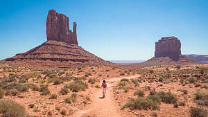 Lolo setting off on the Wildcat TrailAfter leaving Valley of the Gods, we drove an hour back down Highway 163 to the Monument Valley Navajo Tribal Park, stopping once again along the way at Forrest Gump Point to take in the view of Monument Valley at the end of a straight line of highway. As always, there were people lined up to take their turn to position themselves on the centerline of the road.
We weren’t quite sure what our plans were for the day. There are really only two things you are allowed to do in the park without paying for a Navajo Guide to accompany you, and that was the 17-mile Scenic Drive and the 3.2-mile Wildcat hiking trail around the West Mitten. So, our plans were kind of made for us.
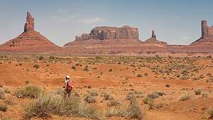 Herb on the Wildcat TrailThere were still two big uncertainties for the day: when would the big winds forecasted for today start and where would we sleep tonight. Camping in big winds is very unpleasant.
Unknown to us before coming here today, there is a hotel right next to the Visitor Center called The View, aptly named because of its fabulous views of the Mittens. We went in to inquire about availability, but unfortunately they were completely booked that night. She mentioned something about cabins, but I thought she was referring to the rather undesirable looking structures near the hotel, so I really didn’t listen.
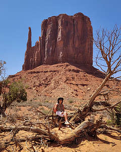 Taking a break on the backside of West MittenOh well. We decided to do the Wildcat Trail hike first and then the scenic drive, because the wind was going to pick up as the day went on, and when that did happen we would rather be in the car than out on the trail.
The trailhead was near the two striated rocks that we had posed on yesterday. As we walked on the path that paralleled the road back towards the entrance kiosk, we saw a small building that said “The View Cabin registration.” To the right of that building were several rows of cabins on a bluff overlooking the same view that the hotel had. Oh my god I thought, if I had known this, I would have listened more carefully when inquiring about availability.
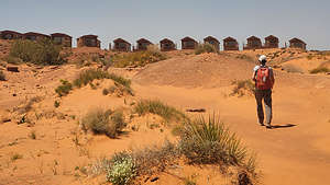 Wind starting to pickup as we complete the Wildcat TrailDesperate to stay in one of these cabins, we went into the registration office and found out that there was in fact availability for a premium cabin along the first row where the views were unobstructed. We were so excited that we immediately grabbed it.
However, check in time wasn’t until 3:00, so we had lots of time to kill. We were also a little nervous because when booking our reservation, her computer went down, so we really hoped that this cabin was in fact ours for tonight. She assured us it was and said we could come back around 2:00 to see if it was ready for us.
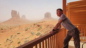 Sanctuary from the sandstorm in our cabinI was so relieved that we had a place to stay with four walls around us tonight because the forecast was calling for 50 to 60 mph wind gusts.
The weather was still calm, so we set out along the Wildcat Trail. The trail started from right near the cabins and led down a fairly steep, very sandy trail to a wash. From there it was a mostly level hike around the iconic West Mitten Butte across sand dunes and more washes, with good views of the neighboring cliffs and pinnacles.
I think most people spend their time in Monument Valley driving the scenic drive, so we pretty much had this traill to ourselves, which was nice.
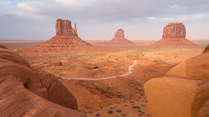 Looking out over the scenic driveAs I mentioned in the previous stop, the buttes of Monument Valley are created by erosion and weathering, sometimes separating a piece of rock from the main part, forming what looks like a thumb. When this happens, they are appropriately called “mittens.”
The other thing that makes them so stunning is their bright red color, due to the presence of iron oxides.
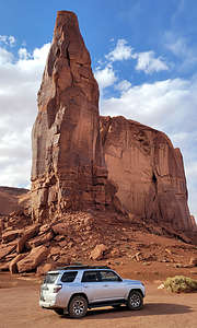 Rain MesaWe made our ways counterclockwise around the West Mitten Butte, which looked so different when we got to the side where its thumb is hidden from view. Without its distinctive thumb, It looked just like any old butte.
When we were about three quarters of the way done with our hike and back into the deep sandy area where we would have to start climbing back up towards the cabins, the wind started with a vengeance, pelting us with sand. I had expected some kind of warning, but it had come on so suddenly.
 The "Totem Poles"To avoid getting sand in my eyes, I put my head down, pulled the brim of my hat over my eyes, and tried to follow Herb’s feet along the trail.
It was only about 1:00 when we made it up to the cabins, but we decided to stop in the office anyway, in the hopes that our cabin was ready. Unfortunately, it wasn’t, but she said she would text us when it was, so we continued on back to our car and sheltered there.
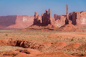
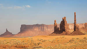 The "Totem Poles"Finally, around 2:30 we got our cabin keys, and fought our way through the sandstorm with our luggage to the comfort and coziness of what turned out to be a really lovely cabin. There was even a separate bedroom with two bunk beds. I couldn’t help feeling nostalgic for the last time we had been to Monument Valley 20 years ago when our boys were just 11 and 13, and how much they would have loved this cabin.
The wind was now blowing so fiercely that the cabin was actually shaking. Plus our view of the Mittens was becoming more and more obscured by the blowing sand. However, the wilder it got outside, the cozier it felt inside.
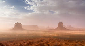 Sandstorm in Monument ValleyI began to wonder if we would be able to do the Scenic Drive, but around 5:00 we decided to give it a try. At least we would be protected from the elements.
As we drove through the gate down into the Valley, we couldn’t help but laugh when reminiscing about the last time we had traveled this scenic drive back in 2002. For some reason back then, I had gotten it in my head (I think from a Utah Mountain Biking Guide) that we should mountain bike this loop rather than drive it.
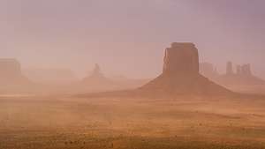 Sandstorm in Monument ValleyThe Navajo woman at the entrance kiosk, as well as my 11- and 13-year old sons, were quite skeptical of using this mode of transportation along a 17-mile sandy road, but I was determined. Ever since our boys were little, we had always tried to encourage them to push themselves and go the extra mile so to speak.
So, off we went down the steep 500-foot descent onto a sandy washboard road, along which we spent the next few hours cycling the loop.
All the while we were pedaling, a constant flow of cars went by, kicking up clouds of the dry red sand. We must have been quite a spectacle because people were waving and cheering us on. I tried to let their cheering drown out the whining which was now coming from my younger son.
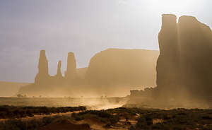 "Three Sisters" through the stormBy the time we finished the ride, we were totally covered in a thin coat of red sand, and probably could have passed for Navajos. I think it was a great ride, and the only way I would have wanted to see it. They wouldn't admit it at the time, but I think they thought so too.
I have no regrets, and to this day, our sons are two of the most adventurous young men you can find. Perhaps, it was because of that day - probably not, but I like to think so.
Today, we would have an adventure of a different sort - battling the elements from the comforts of the inside of our car, hoping that we could at least open the car doors to get out and take a photo or two. I think we were destined to not experience this drive the way the millions of other visitors do.
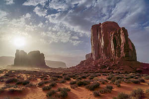 After the stormThere are eleven stops along the Scenic Drive:
- The Mittens and Merrick Butte (which we saw from the Visitor Center Overlook and our cabin)
- Elephant Butte
- Three Sisters
- John Ford’s Point
- Camel Butte
- The Hub
- Totem Pole and Yei be Chei
- Totem Pole and Sand Spring
- Artist’s Point
- North Window
- The Thumb
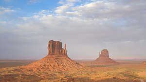 Sun peeks out along the end of our driveFortunately, we had gotten some photos of the red rock “mittens” yesterday, because today they were cloaked in a cloud of sand, barely visible at some points and at others, when the wind temporarily died down, set against a bright blue sky.
Rather than being disappointed, both Herb and I thought that seeing the buttes this way was even more interesting than seeing them in their normal iconic state. So rather than the classic shots of stunning red buttes, we photographed them under very different atmospherics - more eerie and mysterious.
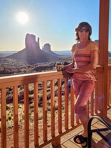 Back at our cozy cabinWe made it back to our cabin, happy that what could have been a wash out day had turned out to be a fantastic one.
The next morning it was still very windy, but it was going to pretty much be a driving day for us anyway as we made our way to Canyon de Chelly.
Before leaving we took advantage of our Free Breakfast at The View hotel, which was quite hearty and in fact did have a fabulous view.
- ‹ previous
- 4 of 9
- next ›
Monument Valley Navajo Tribal Park location map in "high definition"
Javascript is required to view this map.
