- Home
- About
- Map
- Trips
- Bringing Boat West
- Migration West
- Solo Motorcycle Ride
- Final Family XC Trip
- Colorado Rockies
- Graduates' XC Trip
- Yosemite & Nevada
- Colorado & Utah
- Best of Utah
- Southern Loop
- Pacific Northwest
- Northern Loop
- Los Angeles to NYC
- East Coast Trips
- Martha's Vineyard
- 1 Week in Quebec
- Southeast Coast
- NH Backpacking
- Martha's Vineyard
- Canadian Maritimes
- Ocracoke Island
- Edisto Island
- First Landing '02
- Hunting Island '02
- Stowe in Winter
- Hunting Island '01
- Lake Placid
- Chesapeake
- Provincetown
- Hunting Island '00
- Acadia in Winter
- Boston Suburbs
- Niagara Falls
- First Landing '99
- Cape Hatteras
- West Coast Trips
- Burning Man
- Utah Off-Roading
- Maui
- Mojave 4WD Course
- Colorado River Rafting
- Bishop & Death Valley
- Kauai
- Yosemite Fall
- Utah Off-Road
- Lost Coast
- Yosemite Valley
- Arizona and New Mexico
- Pescadero & Capitola
- Bishop & Death Valley
- San Diego, Anza Borrego, Joshua Tree
- Carmel
- Death Valley in Fall
- Yosemite in the Fall
- Pacific Northwest
- Utah Off-Roading
- Southern CA Deserts
- Yosemite & Covid
- Lake Powell Covid
- Eastern Sierra & Covid
- Bishop & Death Valley
- Central & SE Oregon
- Mojave Road
- Eastern Sierra
- Trinity Alps
- Tuolumne Meadows
- Lake Powell Boating
- Eastern Sierra
- Yosemite Winter
- Hawaii
- 4WD Eastern Sierra
- 4WD Death Valley +
- Southern CA Deserts
- Christmas in Tahoe
- Yosemite & Pinnacles
- Totality
- Yosemite & Sierra
- Yosemite Christmas
- Yosemite, San Diego
- Yosemite & North CA
- Seattle to Sierra
- Southwest Deserts
- Yosemite & Sierra
- Pacific Northwest
- Yosemite & South CA
- Pacific Northwest
- Northern California
- Southern Alaska
- Vancouver Island
- International Trips
- Index
- Tips
- Books
- Photos/Videos
- Search
- Contact
Gooseneck State Park, Muley Point, and Valley of the Gods , UT
Saturday, April 30, 2022 - 11:00am by Lolo
250 miles and 6 hours from our last stop - 1 night stay
Travelogue
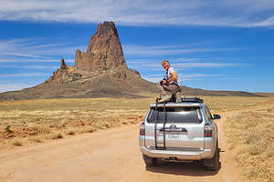 Algatha Peak near KayentaAfter leaving the Grand Canyon, we headed east along Desert View Drive and then northeast on 160 towards Monument Valley. However, today we would pass right by Monument Valley to explore some less famous destinations: Goosenecks State Park and the Valley of the Gods.
When we got to the town of Kayenta, we were hungry so we searched google for a place to eat. After being sent on a wild goose chase to a non-existent BBQ place in a Navajo housing development, we looked on Trip Advisor and found the Amigo Cafe, near the junction of 160 and 163, which we would be taking north towards Monument Valley.
 Quick stop in Monument Valley - more tomorrowThe cuisine was both Mexican and Navajo, but we both chose the Navajo Tacos which were absolutely delicious. Much better choice than the non-existent BBQ place.
After lunch, we took a little side trip on a dirt road off of Highway 163 towards a large rock formation that Herb had spotted back when we were driving up Highway 160. Herb insisted it was Shiprock, but I had to break it to him that we were in Arizona and Shiprock 100 miles to the east in New Mexico. That’s why I do the trip planning and documenting.
 Forrest Gump Point - Run Lolo RunThe rock was actually called Agathla Peak (also known as El Capitan), and to Herb’s credit, like Shiprock it was a volcanic plug with jagged edges, created by a powerful gaseous explosion. However, Shiprock is much larger - but not large enough to see from 100 miles away. It was pretty darn cool just hanging out there on the side of the Highway.
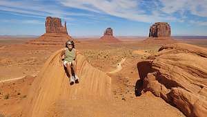
We were driving right by Monument Valley, so we decided to make a quick stop to find out a little more about where we could stay the following night. The man at the kiosk told us that the pass, which was $20 per carload, was good for two days. In that case, we would buy it now and take a quick drive to the Visitor Center Overlook.
 Goosenecks OverlookI’ll talk more about Monument Valley tomorrow, but for now we drove to the Visitor Center where there is an iconic view of three landmark buttes: West Mitten, East Mitten, and Merrick.
Without getting too technical, these and the other buttes in Monument Valley are made of three principal rock layers. The hard protective layer on top is Moenkopi Formation, the middle is softer de Chelly Sandstone and the base is Organ Rock Shale.
They are created by erosion and weathering, sometimes separating a piece into what looks like a thumb. When this happens, they are appropriately called “mittens.” Their and the valley floors' red color is due to the presence of iron oxides.
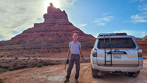 Valley of the Gods Scenic DriveBetween the Visitor Center and the gates for the scenic drive, there are two round boulders with vertical striations that serve as an excellent foreground for a photo of the Mittens. It’s a little corny and cliche, but that didn’t stop me from posing atop one of them.
Time to move on now. We had other things to see today, but we would be back tomorrow to drive the 17-mile scenic drive.
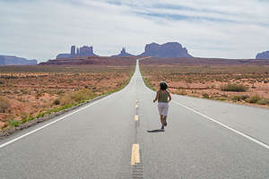
About 12 miles north of Monument Valley along Highway 163 (now in Utah), the speed limit is reduced, cars come to a stop alongside the highway, and people wander out to the center of the road. Fortunately, we had done our homework and knew that this was Forrest Gump Point.
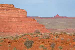 Evening in Valley of the GodsIt was in this very spot along a long straight road that leads to a majestic view of Monument Valley where Forrest Gump decided after running for 3 years, 2 months, 14 days, and 16 hours to just suddenly stop and sit down in the road.
In honor of that fabulous scene, today people express their own awe with the beauty at the end of that road by sitting, jumping, doing handstands, or whatever floats their boat on the yellow dotted line in the middle of the road. Of course, we had to stop as well. How could we not?
Our next stop was in the town of Mexican Hat, obviously named for a rock formation shaped amazingly like a Mexican Hat.
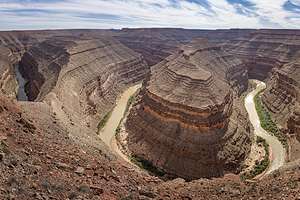
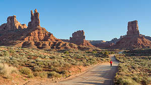 Evening stroll in Valley of the GodsAt the junction of 261 and 316, we took a 3.5-mile side trip to Goosenecks State Park Overlook, paid our $10 entry, and gazed down 1,000 feet at several huge river bends meandering through a deep canyon formed by a series of stepped cliffs and terraces. It is so twisty that it takes 5 miles to progress westward just 1 mile on its way to Lake Powell.
We had thought about camping here, but the bluff was quite exposed and it was already getting windy, so we decided to move on.
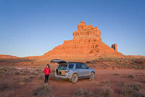 Getting ready to settle down for the nightContinuing north on 261, we passed the entrance to the Valley of the Gods (for now) and drove through a series of switchbacks to a place called Moki Dugway where there is an incredible view of Monument Valley towards the south and the Valley of the Gods about 1,000 feet below.
From there, we continued up the dirt road to Muley Point. After 3.7 miles we came to a view of the goosenecks of the San Juan River.
After another mile and a half we came to the end of the road at Muley Point from which there was a wonderful view of Monument Valley, as well as a 360 degree panorama of the Navajo Mountain, the Henrys, and Sleeping Ute Mountain.
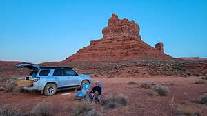 Herb the Happy CamperWe returned down the road from whence we came to head toward our final destination of the day, and hopefully a place to camp - Valley of the Gods.
The Valley of the Gods is a smaller and less visited version of Monument Valley in that it too has red rock, isolated sandstone buttes and pinnacles, and cliffs rising above the desert floor. And, it has something that Monument Valley doesn’t offer - overnight camping.
We set out on the 17-mile scenic drive through the Valley, keeping our eye out for a good spot to camp for the night. The road was a bit bumpy in places, but definitely okay for 2WD cars.
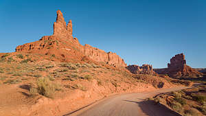 Valley of the Gods in morning lightThere were quite a few vehicles already tucked into camping spots for the night, so we kept our eyes out for a place with nice views to spend the night. About half-way around the drive, we pulled into a spot, but soon moved it when we realized that the high butte to the west of us was going to put us in shade much earlier than if we just moved another 100 yards down the road.
We spent a lovely evening wandering along the road photographing the red rock formations in the evening light.
The next morning, we drove the remainder of the scenic loop and then headed back towards Monument Valley to spend the day.
- ‹ previous
- 3 of 9
- next ›
Gooseneck State Park, Muley Point, and Valley of the Gods location map in "high definition"
Javascript is required to view this map.
