- Home
- About
- Map
- Trips
- Bringing Boat West
- Migration West
- Solo Motorcycle Ride
- Final Family XC Trip
- Colorado Rockies
- Graduates' XC Trip
- Yosemite & Nevada
- Colorado & Utah
- Best of Utah
- Southern Loop
- Pacific Northwest
- Northern Loop
- Los Angeles to NYC
- East Coast Trips
- Martha's Vineyard
- 1 Week in Quebec
- Southeast Coast
- NH Backpacking
- Martha's Vineyard
- Canadian Maritimes
- Ocracoke Island
- Edisto Island
- First Landing '02
- Hunting Island '02
- Stowe in Winter
- Hunting Island '01
- Lake Placid
- Chesapeake
- Provincetown
- Hunting Island '00
- Acadia in Winter
- Boston Suburbs
- Niagara Falls
- First Landing '99
- Cape Hatteras
- West Coast Trips
- Burning Man
- Utah Off-Roading
- Maui
- Mojave 4WD Course
- Colorado River Rafting
- Bishop & Death Valley
- Kauai
- Yosemite Fall
- Utah Off-Road
- Lost Coast
- Yosemite Valley
- Arizona and New Mexico
- Pescadero & Capitola
- Bishop & Death Valley
- San Diego, Anza Borrego, Joshua Tree
- Carmel
- Death Valley in Fall
- Yosemite in the Fall
- Pacific Northwest
- Utah Off-Roading
- Southern CA Deserts
- Yosemite & Covid
- Lake Powell Covid
- Eastern Sierra & Covid
- Bishop & Death Valley
- Central & SE Oregon
- Mojave Road
- Eastern Sierra
- Trinity Alps
- Tuolumne Meadows
- Lake Powell Boating
- Eastern Sierra
- Yosemite Winter
- Hawaii
- 4WD Eastern Sierra
- 4WD Death Valley +
- Southern CA Deserts
- Christmas in Tahoe
- Yosemite & Pinnacles
- Totality
- Yosemite & Sierra
- Yosemite Christmas
- Yosemite, San Diego
- Yosemite & North CA
- Seattle to Sierra
- Southwest Deserts
- Yosemite & Sierra
- Pacific Northwest
- Yosemite & South CA
- Pacific Northwest
- Northern California
- Southern Alaska
- Vancouver Island
- International Trips
- Index
- Tips
- Books
- Photos/Videos
- Search
- Contact
Lake Tahoe
Sunday, August 31, 2014 - 7:45am by Lolo100 miles and 2.5 hours from our last stop - 3 night stay
Travelogue
 Vikingholm Mansion Dining RoomOne thing we didn’t take into consideration when we were wandering along the Eastern Sierra, like two free spirits without a care in the world, was it was Labor Day Weekend, and we didn’t have camping reservations in the Lake Tahoe area, our next destination.
I got online and tried the state parks along the lake, but they were all booked. Finally, I was able to get a site at KOA South Lake Tahoe, about 5 miles south of the lake. This is one of the Catch 22 situations where you want to find a campsite, but wonder what’s wrong with any you find. I guess this one was still available because it was a few miles from the lake. Hopefully, it wouldn’t be too bad.
Our drive from Bridgeport to South Lake Tahoe took us north along US 395 and then northwest on the highly scenic and highly stressful US 89. This was the first really steep and windy road that we encountered since our nail biter out of Yosemite. We took advantage of every pullout there was, but still the brakes managed to overheat, so we spent a lot of time just sitting and letting them cool off to be safe. By the time we arrived in South Lake Tahoe, Herb was pretty much toast.
 Herb Lunching on Rubicon TrailThe campground was okay. It had a nice pool, but our campsite was pretty small and unlevel. Fortunately, once we got the motorhome situated and on leveling blocks, we wouldn’t have to move it for a few days.
The woman that checked us in at the campground office suggested that we not go anywhere near the lake that afternoon or evening because there was going to be fireworks over the lake and that always resulted in huge traffic jams, as early as 4:00 in the afternoon. We should have listened, but not having anything else to do, we ventured out anyway with our goal being the Emerald Bay Scenic Overlook. As soon as we got anywhere near the lake, traffic was completely stopped as people vied for roadside parking – any legitimate parking was already long gone. Finally, we gave up, made a U-turn and returned to the campsite.
Vikingsholm and the Rubicon Trail
 Cliff Diving on Rubicon TrailThe next morning, however, we set out again for the Emerald Bay Lookout, this time to hike down to the lake to the Vikingsholm Mansion and the Rubicon Trail. Although the parking lot was full, there was plenty of turnover, since most people were just walking out to the lookout and back. We found a car that was pulling out, and the gentleman in it was kind enough to not only give us his space, but also his $10 parking fee ticket.
From the parking lot, we hiked a very short distance to a lovely view of Lake Tahoe and its only island – Fannette Island, a stubborn block of sparsely timbered granite that refused to be pushed along by the glacial ice that gouged out this Bay more than 12,000 years ago. Its very existence is what makes Emerald Bay so picturesque.
 Boats in Calawee CoveFrom the lookout, we took a steep, one-mile trail down to the lakeshore to the Vikingsholm mansion, which is part of Emerald Bay State Park. There is no vehicle access to the lakeshore of Emerald Bay, so the only way to get here is on foot or by boat.
I love going on mansion tours and seeing how people lived in different times and places. We have been on our fair share of them over the years, our favorites being the grand “cottages” in Newport, Rhode Island and, of course, the Hearst Castle. When Tommy was little he used to hate these tours. He called them “butt tours,” because he was eye level with the rest of the tour groups’ butts.
Well, today we would go on a butt tour of the Vikingsholm Mansion, one of the finest examples of Scandinavian architecture in the world – or at least, outside of Scandinavia. It is a replica of a 1,200 year old Viking castle, built with materials native to the Tahoe Basin area.
 Lolo approaching Calawee Cove for a DipThe castle was built in 1929 by Mrs. Lora Josephone Knight, with the help of about 200 workers. Mrs. Knight furnished the house with Scandinavian antiques and hired artisans to build period reproductions.
As you might expect from a Viking-inspired designed, there are intricately-carved dragons throughout the house, especially along the roof ridges and beams. During the 11th century, when Christianity was first introduced to Scandinavia, they were a little skeptical that it would be entirely effective. So, to hedge their bets, they carved dragon heads in church entrances to provide a little extra protection against evil spirits.
Another interesting feature of the design is the sod roof, which covers both the north and south wings. It would be lovely to be here in spring, when the roof sprouts with colorful wildflowers.
Unlike other mansion tours we have been on, this one emphasized the architecture more than the person that lived in it. However, during the tour and afterwards, I did find out some interesting facts about Mrs. Knight:
• She was not Scandinavian, but English
• She also owned Fannette Island and built a “Tea House,” which looks like a miniature castle on its summit
• She was extremely kind and generous to her servants
• She and her husband were the primary financial backers of Lindbergh's non-stop solo flight across the Atlantic in 1927.
• She must have been a smart investor because she managed to hold onto the house and the servants, despite the Stock Market Crash and the Great Depression.
 Lake Tahoe Old 1916 LighthouseAfter the tour, we hiked along the shoreline of Emerald Bay on the scenic Rubicon trail, which goes all the way to Rubicon Point in D.L. Bliss State Park 4 ½ miles away. The trail pretty much traces the shoreline, sometimes at lake level and other times rising high above for sweeping views out over the lake and mountains.
From Rubicon Point, we hiked down to Calawee Cove Beach, which was pretty crowded – this was after all Labor Day. The water was a little chillier than we were used to, but we jumped in anyway, to cool off before our hike back.
The Rubicon Trail is really an out-and-back hike, but there is a spur trail from Calawee Cove to the old 1916 lighthouse, one of four navigational lights on Lake Tahoe. I love lighthouses, and I am not sure what I was expecting, but this one really cracked me up. I actually thought it was an outhouse. When I think lighthouse, the words tall, majestic, and visible come to mind, but this one was short, undignified, and hidden in the trees. Maybe I’m a New England lighthouse snob, but seriously.
Okay, enough picking on the lighthouse. We continued on eventually rejoining the main Rubicon Trail. On the way back we stopped at the boat-in campground in Emerald Bay State Park and took another swim near the campground dock.
Then it was back past the lovely Vikingsholm and up the steep trail to the parking lot. It was a very robust hike, 11.9 miles and a 600-foot elevation gain at the end, but thankfully tomorrow would be a rest day.
Secret Cove and MacDuff’s Pub
 Lolo on Rock in Secret CoveFor our final day in Tahoe, and really our final day of vacation – the rest was just driving back to Petaluma and storing the motorhome – we decided to drive along the eastern shores of Lake Tahoe to one of its most beautiful beaches, Secret Cove.
Secret Cove is one of a series of pristine beaches located along Highway 28 on the remote Nevada eastern shore, many of which, including this one, are clothing optional. It’s a little difficult to find, and even more difficult to find a parking space in the small and infrequent pullouts along the Highway.
Since the highway is quite high above the lakeshore, we had to lug our beach chairs, cooler, etc. down a steep ½-mile or so trail to get to the beach. I had suggested bringing the tubes along as well, but Herb looked at me like I was nuts.
 Sailboat in Secret CoveWhat we found when we finally reached the beach is that Secret Cove is not all that secret, and there were already dozens of sunbathers, most of them exercising their “option” to be au naturel. The rock-strewn beach and cove was absolutely stunning. We tucked ourselves behind one of the larger boulders, which provided us with some degree of privacy.
Knowing me all too well, Herb knew exactly what I was looking at – no not the naturists, but the plethora of tubes and floats that people had dragged down the trail to the beach. So, good husband that he is, he made the long trek back up the steep trail to the car, blew up the tubes, and carried them back down to his adoring and appreciative wife. They were very fun to float in and I very much appreciated Herb’s efforts at keeping me happy.
 Secret CoveA little after lunch, the conditions in the cove changed dramatically, without any noticeable change in the weather. The water, which had been like glass in the morning, was now quite rough and choppy. There were even white caps in the cove. We were told by other beachers that this usually happens in the afternoon. Tahoe is a very big lake, and as the day goes on, the seas build up and create these conditions, especially on the north end of the lake along the eastern shore. Almost like clockwork, every day from 2:00 to 8:00 pm, the Tahoe Zephyr (you know it’s not good when it has a name) blows from the west, reaching wind speeds of 10 to 15 mph, with 20+ gusts.
I have this tendency of not letting reality get in the way of my good time, so, much to Herb’s amusement, I floated about in my tube, desperately trying to appear relaxed, all the while being buffeted into the rocks by the waves. Finally, I gave up – just too rough.
 Lolo Tubing in Secret CoveOn the way back to South Lake Tahoe, I used the Yelp app on Herb’s phone to look at restaurant reviews. We really find this very helpful when in a place we know little about, and it has rarely steered us wrong. MacDuff’s Pub had by far the best reviews and even more importantly, the most reviews. Although not on the lake, the outdoor patio was lovely, and we very much enjoyed the food and the service.
It was a nice way to close a wonderful vacation – well, at least the fun part of it anyway. The rest was just driving back to Petaluma, dealing with more motorhome repair issues, putting it back in storage, and flying home – all stressful stuff.
For now though, we looked back rather than forward, reminiscing about the amazing places we had seen and the wonderful people we had shared them with.
Description
 Emerald Bay ShorelineI am not even going to attempt to give a full description of what Lake Tahoe has to offer, as we only spent a short time on its southern shore.
However, briefly, Lake Tahoe is one of the highest elevation lakes (6,255 feet high) in the U.S., as well as the second deepest (1,645 feet deep) – Crater Lake is the deepest. It is located along the border between California and Nevada. The four shores of the lake are each quite different. The north is quiet and upscale, the west and east are more rugged and less developed, and the south shore is busy and tacky with neon-lit hotels and casinos. The 72-mile drive around the lake is very scenic.
Lake Tahoe is known for its clear blue and green waters and the panorama of mountains that surround it on all sides. It is a year-round destination with swimming, boating, kayaking, and various other kinds of water sports during the summer; hiking, backpacking, and camping all year round; and tremendous skiing and snowboarding in the winter.
Eastern Sierra (North of Mono Lake)
Friday, August 29, 2014 - 2:00pm by Lolo91 miles and 2 hours from our last stop - 2 night stay
Travelogue
 Bodie State Historic ParkAfter a wonderful kayaking experience on Mono Lake, we headed north on US 395 for about 50 miles to set up base camp at the Willow Springs RV Park in the town of Bridgeport. As I mentioned in a previous post, setting up of a base camp, and then using our tow vehicle to get around was really working for us. It was very liberating not to have to drag the motorhome with us everywhere we went.
One of the reasons we chose Willow Springs RV Park was that it is close to the two places we were interested in visiting in the area: Bodie State Historic Park and the Travertine Hot Springs.
The next morning we set out for Bodie State Historic Park, the turnoff for which was just a mile south of our campground. From there it was 13 miles through what really looked like cowboy country. The last 3 miles were on a bumpy, dirt road, so once again we were grateful that we were driving a Subaru rather than a Lazy Daze.
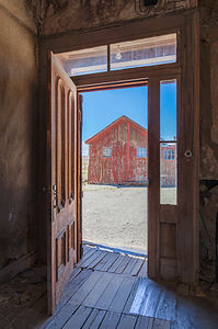 View from Doorway at BodieWe actually arrived before the park opened, so we got in line behind two other early birds at the entry booth. At 9:00 am sharp, a Park Ranger strolled over to the flagpole, raised the California flag, returned to the booth, and greeted us with a hardy, “Welcome to Bodie.”
Getting there early was a good idea, because ghost towns feel more ghostlike when you have them to yourselves rather than sharing them with a lot of other tourists, which did happen about an hour later.
Before coming here, I kind of expected one of those touristy manufactured cowboy towns that you encounter in the West, but this was the real deal, a genuine gold-mining boom town that had gone bust.
I always find visiting a place much more meaningful when I know its history, so I diligently read the informative brochure, and this is what I learned:
Gold was first discovered in the area (actually by Mono Lake) in1859 by W.S. Bodey, who unfortunately froze to death before he got a chance to enjoy his new-found wealth. The town, with a minor spelling change, was named for him. After a slowdown in the 1860s, in the mid-1970s an even richer strike was made by what became known as the Standard Mining Company, and thousands of prospectors hoping to make it rich rushed to Bodie. By 1879 the town had a population of about 10,000 people and more than 2,000 buildings, primarily general stores, dance halls, and saloons to keep the miners supplied and entertained. Bodie soon developed a reputation for wildness and lawlessness.
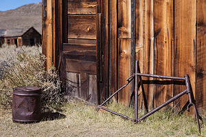 Bodie Rusted BicycleIn addition to the miners, hundreds of Chinese workers also flocked to Bodie and profited from the boom by providing for the needs of the miners with wood, charcoal, vegetables, laundries, and more. The Chinese created a town within a town so that they could maintain their own customs and traditions. There is an old Chinese residence still standing in old Chinatown at the end of King Street.
However, by 1881, the mines were depleted and miners and business people left Bodie to follow the next strike. By 1886, the town’s population had fallen to 1,500 people. In the 1890s, the use of electricity as a source of cheap power made mining here profitable again and temporarily boosted it. However, a fire in 1932 destroyed 90% of the town.
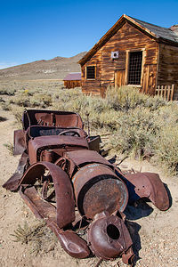 Bodie Rusted Car with CabinBodie faded into a ghost town in the 1940s. Fortunately, in 1962, the town was designated a National Historic Site and a State Historic Park. The town has been preserved in a state of “arrested decay.” The interiors of the buildings are maintained as they were left, still furnished and stocked with goods.
We spent an enjoyable two hours, especially the one before everyone else arrived, wandering the deserted streets, peeking in windows, and reading the informative brochure that explained each building. It really was a very poignant experience imagining the lives of those that lived, played, worked, and died here so many years ago.
After leaving Bodie, we headed north on US 395 towards the town of Bridgeport to soak in the Travertine Hot Springs. It wasn’t too hard to find – just a right onto Jack Sawyer Road and then left again on a marked, but somewhat rutted, dirt road.
Although Herb and I had soaked in pools fed by hot springs– Ouray, Banff, and Bend come to mind – we had never been to a “natural” hot spring, so we were pretty excited about adding a new experience to our list.
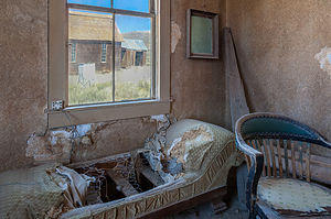 Bodie Interior Couch with Window ViewThe first hot spring we saw was adjacent to the parking lot. This one was partially developed with a man-made lining and rugs placed around it to cushion the hard surface. I had no intention of sitting at the edge of a parking lot, so we strolled down the trail a short distance to the lower pools, which are fed from water trickling over the ridge of a colorful rock formation. The rock was stained with beautiful tan, cream, and rust streaks from the “travertine” limestone that is continually being deposited by the mineral-laden hot springs above.
There were three pools below, with water flowing from one pool to the next, decreasing in temperature as it went along. The pool on the right had stone sides to sit on and was about 105 degrees, the pool in the middle also had stone sides and was about 100 degrees, and the pool on the left was mostly mud and only about 90 degrees. Each of the pools’ bottom were covered in soft, mushy mud, which felt rather soothing to the skin.
There were two couples already in the rightmost pool, so Herb and I tried each of the two on the left. I wasn’t crazy about sitting directly in the mud, so I chose the middle pool, which was also warmer than the muddy one. This one was “just right.”
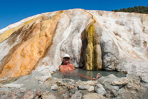 Travertine Hot Spring with HerbWe weren’t the only ones that thought about coming here today, and throughout the afternoon probably at least 30 people or so passed through – some just to look, but most to sit for awhile in the warm sulfuric waters.
When it got a bit too crowded, we walked a short distance to find a more private, primitive pool. The whole area around the springs is very active geothermally, so new springs are continuously erupting and new pools forming.
Although I liked the middle pool by the rock formation where I didn’t have to sit directly in the mud, Herb preferred having his own hot spring to himself, where he could also soak up the beautiful views of the Sierra in the distance.
It had been a lovely day, much more relaxing and less physically demanding than the prior two weeks had been. The slower pace felt good, at least for awhile.
Description
The Eastern Sierra Scenic Byway, officially known as Highway 395, runs the entire length of the Sierra Nevada Range, from south of Lone Pine to Lake Tahoe and beyond. The scenery along the way is breathtaking and full of variety – snow covered mountains, incredible lakes, ancient bristlecone forests, natural hot springs, and so much more.
I have broken up our journey along the Scenic Byway into three stops:
• South of Mono Lake
• Mono Lake
• North of Mono Lake
The following is a description of a few of the stops we enjoyed along the Eastern Sierra northern section:
Bodie State Historic Park
 Bodie Store InteriorBodie State Historic Park is a genuine California gold-mining ghost town. The town rose to prominence when mining along the western slope of the Sierra declined, and prospectors moved to the eastern side to search for gold. A huge strike in Virginia City, the Comstock Lode, brought a wild rush to the high desert country along the eastern Sierra.
In 1859, W.S. Bodey and E. S. “Black” Taylor stumbled upon gold in the hills north of Mono Lake, amounting to millions of dollars in gold and silver. Unfortunately, Bodey froze to death in a blizzard while returning with supplies and never got to enjoy his new-found wealth. The town, with a slight spelling change, is named for him.
Things slowed down for a bit in the 1860s, but then in the mid-1870s a rich strike was made by the Standard Mining Company in the Bodie Hills. Word spread, sparking a rush of people to Bodie. By 1879 the town had a population of about 10,000 people and more than 2,000 buildings, primarily general stores, dance halls, and saloons to keep the miners supplied and entertained. Bodie soon developed a reputation for wildness and lawlessness.
 Bodie Buildings with Yellow FlowersHundreds of Chinese workers also flocked to Bodie and profited from the boom by providing for the needs of the miners with wood, charcoal, vegetables, laundries, and more. The Chinese created a town within a town so that they could maintain their own customs and traditions.
However, by 1881, the mines were depleted and miners and business people left Bodie to follow the next strike. By 1886, the town’s population had fallen to 1,500 people. In the 1890s, the use of electricity as a source of cheap power made mining here profitable again and temporarily boosted it. However, a fire in 1932 destroyed 90% of the town.
Bodie faded into a ghost town in the 1940s. Fortunately, in 1962, the town was designated a National Historic Site and a State Historic Park. Today visitors can walk the streets of this deserted town, which has been preserved in a state of “arrested decay.” The interiors of the buildings are maintained as they were left, still furnished and stocked with goods.
To get there, take U.S. Hwy. 395 to State Hwy. 270 and drive 10 miles east until the paved road ends, then continue for 3 miles of an unpaved dirt road.
Travertine Hot Springs
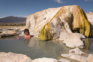 Travertine Hot Spring with LoloThere are many natural hot springs in the Sierra, but the Travertine Hot Springs are one of the prettiest and the easiest to get to. They are located just south of the town of Bridgeport along Route 395. To reach the springs, turn onto Jack Sawyer Road, then left again onto a marked, but somewhat rutted, dirt road.
There are several pools at Travertine. Right next to the parking area is a developed pool, which is the hottest of the pools in the area. There were even rugs placed around it to cushion the hard surface.
A short way down the trail are the lower three pools, which are fed from water trickling over the ridge of a colorful rock formation that rises above them. The beautiful tan, cream and rust colors of the rock are the result of a form of limestone, called “travertine” that is deposited by the mineral-laden hot springs. The water flows from one pool to the next decreasing in temperature as it goes along. The first pool is about 105 degrees, while the last, which is the largest and shallowest, is only about 90 degrees.
 Hot Spring PoolA little past the main pools there are a few more primitive pools that are much more private. The whole area around the springs is very active geothermally, and new springs are continuously erupting.
There are wonderful views of the Sierra while you bathe in one of its pools, sitting along a rocky ledge or in the mud that lines their bottoms. The mud is slightly sulfuric and soothing to the skin.
The area is designated “clothing optional,” but most people wear bathing suits.
Mono Lake
Friday, August 29, 2014 - 7:00am by Lolo51 miles and 1.5 hours from our last stop
Travelogue
 Lolo Kayaking among the Tufas of Mono LakeFor anyone traveling through the Eastern Sierras, a stop at the Mono Lake South Tufa Reserve to see the “tufa castles” is a must. It’s a place like no other.
Mono Lake is definitely not your typical lake. Besides being over a million years old, and probably the oldest continuously existing lake in North America, it is 2 ½ times saltier than the ocean and 80 times more alkaline. This is because the water that flows in from the Sierra streams, carrying trace amounts of salts and minerals with it, has no way to leave the lake other than evaporation. So, the concentration levels of these salts and minerals keeps building up year after year. I think it’s the same reason that the Great Salt Lake in Utah is so salty. However, although the Great Salt Lake might be more famous for its saltiness, Mono Lake does have one it doesn’t—“tufa castles.” Tufa, not to be mistaken with “tofu,” are calcium-carbonate deposits that form in lakes with high calcium contents. Normally they would just be hidden beneath the water, but as lake levels dropped, they became exposed, some of them rising as high as 30 feet above the surface—and they do look like castles.
 Lolo Exploring Paoha IslandOne of the best places to see the tufas is at the Mono Lake South Tufa State Reserve along the southern shoreline of the lake. Back in 2007, it was from this very shoreline that I was brave enough to swim with the tufas, allowing my body to be coated with salt and brine flies, while my wimpy family just looked on from the shore.
This time, however, our plan was to launch our kayaks and paddle through and around the tufas and out to Paoha Island. Herb and I had been dying to use our kayaks, which are now stored out on the West Coast with our motorhome, and this was our first real opportunity to do so this trip. We had thought about paddling around Tenaya Lake in Yosemite, but the day we were there was cloudy and cold, so we hiked to stay warm instead.
The best place to launch a kayak on Mono Lake is from Navy Beach, which is just ½ mile east of the South Tufa area by water, but a fairly longer drive along a bumpy dirt road to the launch parking lot. From there, you have to carry your kayak and gear about 30 yards down to the water.
 Paoha Island ShorelineBesides us, there was a group of about half dozen a kayakers that were part of a guided tour. We seemed to be the only ones venturing out on our own.
It was a perfect day, extremely calm and the water was like glass. Very fortunate for us, because often the winds on the lake are so strong that kayaking is strongly discouraged. Mornings are usually calmer, with winds picking up in the afternoon, so fortunately we had gotten an early start and would just keep an eye out for changing conditions in the afternoon.
We started out to the west towards the South Tufa Reserve. So did the guided group, as this is where the action is. It was surreal paddling amongst these extraordinary tufa castles, so very different from any kayaking experience we have had to date. Herb must have taken about 100 photos in the first 15 minutes.
 Paoha Island View of Lake mit LoloFrom there we headed out towards Paoha Island, which according to the Ranger was a little over 3 miles from Navy Beach. Herb has a much longer kayak than mine, which goes a lot faster, so he got quite a bit ahead of me. I didn’t mind though. It was so quiet and peaceful being alone. Sometimes I would just stop paddling, lean back, and just gaze at the mountains and the clouds.
There’s something very deceptive about distance on the water, especially when you are far from the shore. I kept paddling and paddling and the island just never seemed to get any closer. That’s when I started to get a little annoyed that Herb wasn’t by my side. I couldn’t even see him anymore.
Finally, the island cooperated and stopped moving away from me, and I paddled up onto a beach – fortunately, the same one Herb had paddled up on, probably a half hour ago. It felt like I was landing on the moon.
 Mono Lake SkyEverything was kind of a chalky white and crunched under your feet when you walked. Sometimes my feet broke through the crusty surface, which was primarily comprised of calcium carbonate, like the tufas.
Life so many features in this area of the country, this island had volcanic origins. Normally, I would classify volcanic eruptions as a bad thing, but they are responsible for so many beautiful wonders that they can’t be all bad. I just hope they do their work when I’m not around.
In the case of Paoho Island, the eruptions were quite recent – just 350 years ago. Before that this island did not exist. At that time, volcanic eruptions on the lakebed pushed sediments and volcanic material above the lake surface, forming this island, which rose 290 feet above the lake.
 Lolo with KayaksIt was so desolate that I felt a bit like Robinson Crusoe or Tom Hanks in Castaway, except that we had kayaks to leave whenever we wanted. However, we didn’t want to leave just yet, and I am not sure if Herb ever wanted to leave. Besides heat and sun, Herb’s favorite thing in the world (besides me) is solitude, and today he had an abundance of all three. He was in heaven and declared it a trip highlight, an honor sparingly bestowed.
We even went for a swim and discovered, as we had in the Great Salt Lake, that the higher salinity really does make it easier to float. I could even raise my hands above the water and still stay afloat. The only downside was that after we got out and dried off, we were completely covered in a white film of salt.
 Kayaking Back from Paoha IslandThe water was still calm, but I didn’t want to press my luck. The thought of paddling those endless three miles in windy conditions was not a pleasant one. So after about 2 hours of playing Castaway, we began our paddle back to Navy Beach. Once again, Herb got way ahead of me. At first, I struggled to keep up, but then I thought, what the heck, I am going to enjoy this at my own pace, so I went back to my routine – paddle for awhile, rest and gaze at mountains and clouds, paddle again, gaze again, and so on. It was wonderful.
What a great day and our timing had been perfect. By the time we got to the Visitor Center in Lee Vining, the winds had picked up and were gusting over 20 mph. That would not only have been strenuous, but unsafe as well. So far, with the exception of a few clouds and cooler temps in Tuolumne Meadows, the weather had really been cooperating beautifully.
Description
 Lolo and the TufasMono Lake is located just off Highway 395 near the town of Lee Vining, California, 13 miles east of Yosemite National Park. Mono Lake is extremely unique. First of all, at over 1 million years of age, it is one of the oldest continuously existing lakes in the continent. Secondly, it is about 2 ½ times as salty as the sea and about 80 times as alkaline. This is because Sierra streams flow into Mono Lake bringing trace amounts of salts and minerals, but the lake has no outlet other than evaporation. As a result, the concentration levels of salts and minerals keeps growing each year. Thirdly, and the main reason Mono Lake is so popular, are the hundreds of spectacular “tufa towers” that rise from the lake. These intriguing calcium-carbonate sculptures were formed beneath the water when carbonates in the water combined with calcium from freshwater springs feeding into the lake. As lake levels dropped, these extraordinary-looking knobs, spires, and minarets became exposed. Most of the towers visible in the lake are from 200 to 900 years old and rise as high as 30 feet above the water.
A good place to start your visit is at the Mono Basin Scenic Area Visitor Center, located just off Highway 395, north of Lee Vining, where you will find exhibits about both the natural and human history of the Mono Basin.
 Lazy Daze and Forester with Kayaks at Mono LakeOne of the best places to view the tufas is at the Mono Lake Tufa State Reserve along the southern shoreline of the lake. The trailhead for the south tufa castles and Navy Beach is at the edge of the parking lot. During the summer, rangers lead walking tours 3 times a day (10am, 1pm, and 6pm), but if your not lucky enough to catch one of these, there are plenty of informative signboards along the trail. A short walk along the mile-long trail brings you to the strange and fanciful tufa castles at Navy Beach. A swim in the buoyant waters of Mono Lake is a memorable experience, as long as you are willing to step through the millions of harmless alkali flies that line the water’s edge. It’s fun to watch what at first looks like black sand part before you.
Surrounded by volcanic hills, Mono Lake is also a geologist's paradise. The two major islands in the lake are actually volcanic domes. The large black island, which the Kuzedika Indians named Negit, meaning “blue-winged goose,” erupted about 1700 years ago. The white island, which the Native Americans named Paoha, meaning “spirits of the mist,” erupted 250 years ago.
Bird watching and photography are other popular activities at Mono Lake.
Eastern Sierra (South of Mono Lake)
Tuesday, August 26, 2014 - 1:00pm by Lolo260 miles and 6 hours from our last stop - 3 night stay
Travelogue
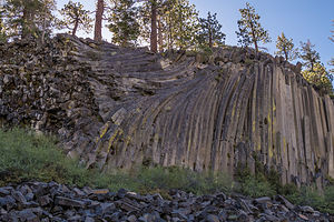 Devils PostpilesAlthough we had been to Mono Lake before, we had never explored the Eastern Sierra in any depth, so we decided it was definitely time to fill in this gap in our western travels.
Rather than drag the motorhome along for each of our stops, we decided to set up base camp at the Mammoth Mountain RV Park in Mammoth Lakes and set out on day trips in our Subaru. Towing a car has definitely been a very liberating experience.
The drive out through the very steep Tioga Pass had been a bit stressful, to say the least, with the uncertainty of the status of our brake calipers, so when we got to the campground, we decided to just relax there for the remainder of the day. Also, this was the first time that we had access to a laundry in two weeks, so hanging out in the hot tub in between wash loads was about all the physical activity we were up for today.
Devils Postpile National Monument and the Ancient Bristlecone Pine Forest
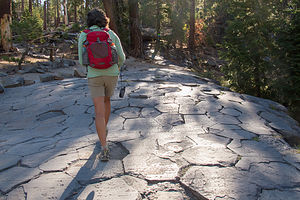 Lolo Hiking on Top of Devils PostpilesHowever, the next morning we were refreshed and ready to see new sights. Our first destination was the nearby Devils Postpile National Monument, an unusual rock formation comprised of hexagonal basalt columns. From mid-June through mid-September, cars are not allowed into the Monument after 7:00 am, and visitors must take a shuttle bus from the Mammoth Mountain Adventure Center. We briefly toyed with getting up early enough to drive into the park, but then we came to our senses and decided to take the shuttle instead. The tickets were only $7 and the bus driver gave an interesting talk and pointed out things to see along the way, such as the impressive Minarets.
The shuttle has about 10 stops in the park, but we got out at the Devils Postpile Ranger Station (Stop 6) near the trailhead for the Devils Postpile and Rainbow Falls.
From the trailhead, we walked along a very pleasant, level path that traced a section of the Middle Fork of the San Joaquin River. In less than a half mile, we came upon the Postpile, which definitely was different from any rock formation we had ever seen. Probably the closest thing to them that we have seen are the basalt cliffs along the Columbia River Gorge.
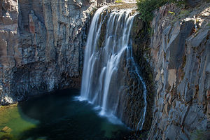 Rainbowless Falls at Devils Postpile National MonumentThe columns were so uniform that they really appeared to be man-made rather than by the forces of nature. But as we have learned over and over again in our travels, nature has created some pretty miraculous sights. These uniformly-shaped basalt columns were formed over 80,000 years ago when basalt lava erupted in the area, cooled, contracted, and split into symmetrical, hexagonal columns, one of mother nature’s favorite shapes.
The view from the top of the cliff, which you can reach by walking up a short, steep trail around the back, really accentuates their hexagonal shapes and made me even more amazed that they were created through a natural process. It looked like someone had laid down hexagonal floor tiling, with the occasional pentagonal tile thrown in here and there.
From there we hiked back down the formation and continued along the trail another 2 miles until we reached Rainbow Falls, where the San Joaquin River plunges 101 feet over a cliff of volcanic rock. The falls got its name from the rainbows that sparkle in the mist when the sun is overhead.
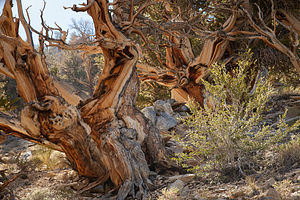 Bristlecone Pine TreesUnfortunately, we were here too early in the morning to have the proper lighting either on the falls or on the Devils Postpile. We thought about waiting around until the afternoon so that we could get better lighting for photographs, but decided that instead we would rive down to Big Pine to hike through the Ancient Bristlecone Pine Forest.
So, we hiked back to the Red Meadow Shuttle Stop and returned by shuttle to the Mammoth Mountain Adventure Center.
The drive to Big Pine took us along the Eastern Sierra Scenic Byway (US 395) through the quaint town of Bishop, where we had stopped back in 2007 to visit the very impressive Galen Rowell photography gallery. This time we would visit an equally impressive Bishop establishment, the Erick Schat’s Bakery, known for its delicious pastries and other baked goods. We were only three feet in the door before I picked up an Apple Pullover, the size of a football, to purchase. Funny, how when driving into town, I thought how quiet it was. Now I know why –everyone was in this bakery. It was absolutely bustling. We bought two sandwiches made with their famous sheepherder bread and ate them on the outside patio.
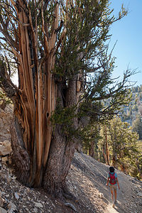 Lolo Hiking in Bristlecone Pine ForestFrom there, we continued on US 395 south to the town of Big Pine and turned east on State Highway 168. After 13 miles, we turned left onto White Mountain Road and followed that for another 10 miles to the Schulman Grove Visitor Center. We were very grateful we were in our Subaru rather than the motorhome, because the road was very steep and windy. We stopped at an incredible viewpoint just about a mile shy of the top.
From the Schulman Visitor Center, we took the Methuselah Trail, named for the oldest documented living tree in the world which lives along this trail. It is estimated to be over 4,750 years old. Unfortunately, although we would most likely see it, we wouldn’t know when, because its location is kept a secret, for fear that someone might cut it down or harm it in some way. How sad is that?
The trail was lovely, winding its way for 4 ½ miles through bristlecone pines, both ancient and new – some of the baby ones were probably only about a thousand years old. These trees were very photogenic, each of them individually sculpted by thousands of years of wind, ice, and extreme exposure to the elements. Their twisted and contorted shapes are evidence of their ability to not only survive, but to thrive in adverse living conditions. It’s funny how the harshest growing conditions produce trees that live the longest. There’s much to be said for tough love.
It had been quite a robust day, with hikes in two very interesting and unique areas.
Mammoth Mountain Bike Park and Inyo Craters
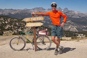 Herb with GoPro at Trail Juncture in Mammoth Mountain Bike ParkOur boot camp of a vacation continued the next day with plans to mountain bike down the trails of Mammoth Mountain. I was definitely going to need a vacation from this vacation.
We drove the short distance from our campground to the Mammoth Mountain Adventure Center and purchased our Bike Park tickets. Our choices were $41 for two rides down the mountain, or $49 for all day. Of course, the economically minded Herb went for the $49 value and planned to make the most of it.
There was nobody there, so we able to get on a Panorama Gondola right away. You could tell from the set up though that they were prepared to handle a crowd. The very courteous liftees took our bikes and loaded them on a gondola for us, and then we got in the one behind. The views from the gondola were awesome. Why couldn’t we just ride this thing up and down all day? – I didn’t say that aloud, but I did think it. At the top, the liftees politely removed our bikes from their gondola and set us on our way. Very civilized so far.
We were now atop the summit of Mammoth Mountain at an elevation of 11,053 feet, where the 360 degree views were incredible. I think I could see all of California from here. I took note of the Top of the Sierra Café where I intended to reward myself with lunch if I made it back up here again.
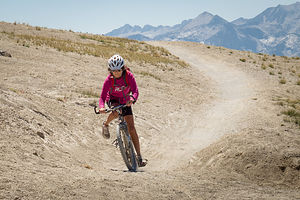 Lolo on Inadequate Hardtail BikeWe rolled our bikes down the staircase from the gondola – the cool kids ride them down, but I was just getting warmed up. The cool kids also wear full-body armor and ride full-suspension bikes. I was a 58-year-old woman in a running outfit wondering what the heck I was doing up here.
There were two choices of trails from the summit – Kamikaze and Off the Top. Little hint: If you are at a trail junction, and one of the trail names is Kamikaze, take the other one, which we smartly did. Off the Top was a blue, intermediate trail as opposed to a black diamond. Mountain bike parks rate the difficulty of their trails the same way ski slopes do.
Herb let me go first so he could keep an eye on me – actually not just an eye, but a camera. He GoPro’d my entire first descent – all 10 miles and 1 hour of it. I watched the entire thing afterwards, and am sure that I am the only one that ever will. I was both impressed and amused by my efforts.
The trail was quite steep, but not ridiculously so, and wound its way along dozens of switchbacks for most of the first five miles. We were above the tree-line, so we were on exposed mountainside with uninterrupted views, which I would have seen if I ever took my eyes off my front tire.
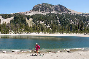 Lolo and Lake in Mammoth Mountain Bike ParkAt a trail junction, we continued on another blue trail called Beach Cruiser which flattened out for awhile and brought us to a pretty little lake, called Bud Lake. Afterwards, the trail led through a lovely forest of trees, where we even had to peddle uphill at times.
We made it back to the gondola after about an hour, with no cuts or bruises. Proudly, neither of us had taken a spill.
Still no crowds, so we were able to just hop back on the gondola again. The same guy loaded our bikes on the gondola. I think he was pretty surprised to see that the old lady was back for more.
At the top, I suggested lunch, but Herb, wanting to make sure that we got our money’s worth out of our All-Day pass, suggested that we eat after the next run, thereby guaranteeing that I would have to go for a third.
I reluctantly agreed, and we set off again, this time taking a different trail near the bottom, which brought us to wonderful views of the Minaret pinnacles. The second run was a bit easier, because I knew what to expect, but I was getting a little tired. You would think that going downhill isn’t tiring, but it actually is very tough on the arms and the hands, which in my case were desperately gripping the brakes. Also, even the legs get tired because you have to hold yourself up off the seat most of the way.
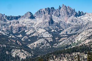 Minarets ViewpointSoon, we were on our way up for our third, and what I was suggesting, final run. As promised, Herb did take me to lunch at the Top of the Sierra Café first. By the time we finished lunch, the winds had picked up and were really gusting. I honestly was a bit concerned about being blown over. I didn’t need any more challenges getting through the switchbacks at the top.
I was really pretty tired now and on one of the early switchbacks, I almost did an “endo” – where I braked so hard that the back of my bike lifted up too high and almost sent me over my handlebars. Herb was way ahead. I had told him to go first, because I was much slower, but still I was mad at him now because I was scared and he wasn’t by my side.
From this point on I was totally psyched out, which is very bad, because you really have to ride with confidence to get through this stuff. While I hadn’t fallen at all the first two runs, I must have fallen about 4 or 5 times on this one. It was getting to a point where I would practically throw myself on the ground rather than wait for the bike to do that for me. I even landed in a very cute pine tree. Herb later said that I probably killed a thousand year old bristlecone pine, because they actually do grow on the mountainside. I didn’t care. It deserved it.
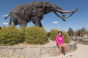 Lolo with MammothHerb knew he was in trouble when I caught up with him at the bottom, scratched, bloody, and tearful. Two runs would have been great, but three had really pushed me over the top. We had ridden over 30 miles of some very steep and rough terrain. I had every right to be cranky.
Before returning my weary body to the much-needed hot tub at the campground, we decided to make a quick stop at the nearby Inyo Craters, right off the Mammoth Scenic Loop .
Herb and I had definitely developed, rather late in our national park travels, a keen interest in geology. A few years back, Herb and I discovered TTC (The Teaching Company) videos of various college courses. Every morning after breakfast, we dutifully sit down with a cup of coffee and watch a ½-hour lecture on a particular subject. Last year we completed two entire courses on geology (18 hours each), and are always anxious to go out and apply what we have learned. Tommy’s move to the Pacific Northwest and its many volcanoes features definitely gives us plenty of opportunity to do just that.
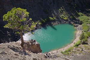 Inyo CraterOnce we found the Inyo Craters parking lot at the end of a dirt road off the Scenic Loop, it was just a 1/4-mile walk through a lovely forest to get to the rim of the first of the Inyo Craters. This crater is part of a 25- mile chain of craters that stretches from here all the way to Mono Lake.
This crater and the next one, which is only a short walk away, are about 660 feet across and contain small lakes. The water in them was a beautiful, deep turquoise. There was an observation area even closer to the rim, but because of erosion, access to it was blocked off.
In terms of geological time, these craters were very young – only 600 years old, babies compared to the bristlecone pines we saw the other day. They were formed when magma pushed up into the water table, heated it, and triggered a volcanic phreatic (fancy word for steam) explosion on the summit and south flank of Deer Mountain. The two craters we visited were the ones along the south flank.
We returned to the campground, got a cooler of cold beer, and went and sat it the campground hot tub. It was the right thing to do.
Description
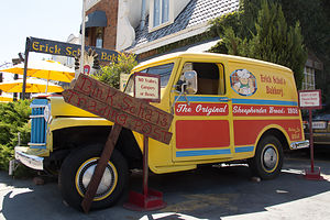 Erick Schat’s Bakery TruckThe Eastern Sierra Scenic Byway, officially known as Highway 395, runs the entire length of the Sierra Nevada Range, from south of Lone Pine to Carson City. The scenery along the way is breathtaking and full of variety – snow covered mountains, incredible lakes, ancient bristlecone forests, natural hot springs, and so much more.
I have broken up our journey along the Scenic Byway into three stops:
• South of Mono Lake
• Mono Lake
• North of Mono Lake
The following is a description of a few of the stops we enjoyed along the Eastern Sierra southern section:
Devils Postpile National Monument
Devils Postpile National Monument, located near Mammoth Mountain, was created in 1911 to protect a premier example of columnar basalt formations and the 101-foot Rainbow Falls. It was originally part of Yosemite National Park, but when gold was discovered near Mammoth Lakes in 1905, local mining interests pressured the government to make it public land so that they could build a hydroelectric dam. Their plans were to dynamite the postpile to make a rock dam. Thankfully, environmental activists, such as John Muir, were able to stop the demolition and bring the area back under federal protection as a National Monument.
The main attraction in the Monument is a dark 60-foot cliff of uniformly-shaped basalt columns. These columns were formed approximately 82,000 years ago when basalt lava erupted in the area. As the lava cooled, it contracted and split into symmetrical, hexagonal columns. Then, around 12,000 years ago, a glacier carved away one side of the postpile, polishing the top and exposing the sheer wall of columns that you see today.
A second attraction is Rainbow Falls, where the Middle Fork of the San Joaquin River plunges 101 feet over a cliff of volcanic rock. It received its name from the rainbows that sparkle in the mist when the sun is overhead.
Between June 15 and September 15, the park is closed to daytime traffic and requires visitors to travel by shuttle from the Mammoth Mountain Adventure Center.
Mammoth Mountain Bike Park
The Mammoth Mountain Bike Park boasts over 80 miles of single track trails for riders of every experience level. Beginners can start at the Discovery Zone where there are miles of forested intermediate Cross Country trails. The more experienced can take the Panorama Gondola to either the mid-station or the summit for intermediate to advanced terrain.
Mammoth Mountain was rated the #1 bike park in the U.S. by Outside Magazine.
Inyo Craters
The Inyo Craters are the southernmost part of a chain of craters and other volcanic features that stretches all the way to Mono Lake. The Inyo Craters were created 600 years ago (very recent in terms of geological time) when magma pushed up into the water table, heated it, and triggered a volcanic phreatic (steam) explosion on the summit and south flank of Deer Mountain.
The two southernmost craters are about 660 feet in diameter and 200 feet deep and contain small lakes. The crater on the summit of Deer Mountain is smaller and dry.
To reach Inyo Craters, take the Mammoth Scenic Loop from the town of Mammoth Lakes, until you reach a turnoff for Dry Creek Road. Follow this dirt road to a parking lot for the trailhead.
From the parking lot, there is a short ½-mile (RT) trail through a lovely forest of red fir and Jeffrey pine that leads to the two craters that have lakes in them.
Ancient Bristlecone Pine Forest
The Ancient Bristlecone Pine Forest, atop the White Mountains of the Inyo National Forest, is home to the oldest living trees on earth, some of which are over 4,000 years old. Although there are two groves, the Schulman Grove is the most accessible.
To get there from Bishop (about an hours drive), take US 395 south to Big Pine and turn east onto State Highway 168. After 13 miles, turn left onto White Mountain Road and follow that for 10 miles to the Schulman Grove Visitor Center. White Mountain Road is steep, winding, and highly scenic.
The most popular activity in the Forest, is to hike the Methuselah Trail, which begins at the Visitor Center (elevation 10,000 feet) and meanders on a 4 ½ mile loop through a forest of ancient and younger bristlecone pines, as well as pinyon and limber pines.
Each of these trees is unique, individually sculpted by thousands of years of wind, ice, and extreme exposure to the elements. Their contorted shapes are evidence of their ability to not only survive, but to thrive in adverse living conditions. Ironically, the harshest growing conditions produce trees that live the longest.
The trail gets its name because it is home to the Methuselah Tree, the oldest documented living tree in the world, at the ripe old age of 4,750 years old. Don’t expect to take your picture next to it, because rangers keep which one it is a secret, for fear someone will cut it down. However, you will pass it along the way – you just won’t know when.
The Patriarch Grove is located another 12 miles north on a dirt road. This grove is home to the Patriarch Tree, the world’s largest Bristlecone Pine.
Yosemite National Park
Thursday, August 14, 2014 - 5:45am by Lolo230 miles and 5.5 hours from our last stop - 12 night stay
Travelogue
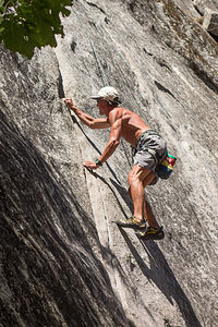 Herb ClimbingDespite our stressful arrival, it’s hard not to be relaxed and happy in Yosemite. It truly is, in my opinion, the most beautiful place in the U.S., and that’s saying a lot.
Also, with its tremendous rock climbing and hiking opportunities, it was the perfect place to meet up with our very adventurous and energetic sons. who had moved to the West Coast the previous summer. Rock climbing has become a bit of a family activity for us, and much of our vacations together are now centered around rock climbing destinations.
In preparation for their arrival later that night, Herb and I decided to use our “Yosemite Sport Climbs and Top Ropes” book, which we had bought here last Thanksgiving, to scout out potential rock climbing areas for the week. Herb and the boys have a preference for what is known as “sport” climbing, so it is a bit of a challenge finding these types of routes in what is really a “trad” climbing mecca.
Bikes are a great way to get around the valley, especially in August when the car traffic is awful, so we spent a really pleasant day riding the 12 miles around the Valley floor stopping at potential climbing areas and our favorite viewpoints along the way.
I spent a lot of time that day at the base of cliffs, straining to match the picture and description of climbs in the book with the sheer granite wall rising above me; and then visualizing my offspring scaling up it. As a mother, I was very highly motivated to find climbs that were “just right,” which meant “sport or top rope,” 5.9 to 5.11a range of difficulty, and some degree of shade during the day. The shade part is really important in August, because the mid-90 temps can heat up the rock in the sun, so much that you can practically fry an egg on it.
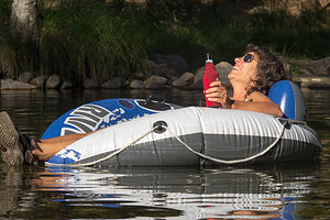 Lolo Demonstrating Proper Use of the TubeI think they were proud of me, because Herb and I pretty much came up with the same conclusions as they did from reading the climbing guides before their arrival. Our picks for the week included such interesting names as Swan Slab, Church Bowl, Manure Buttress Pile (my personal favorite – name that is), and Glacier Point Apron.
Even for those not scouting out climbing areas for their offspring, I highly recommend the bike ride around the Valley. You can cover a lot more ground than walking while at the same time avoiding sitting in traffic in your car.
That evening we just relaxed around the camp site talking to our neighbors, some of which were campground volunteers whose job it was to stroll the campground at night with bean bag guns to shoot at black bears that got a little too comfortable with spending time in the campground. They really did this, because sure enough, every night we were there we heard at least two or three gunshots go off during the night. It’s time like this that I am very grateful that I am sleeping in my hard-sided Lazy Daze rather than a tent. Actually, I think I am always grateful for that.
Herb fell asleep around 10:00, but I was too excited about the kids’ arrival to go to bed yet. They finally pulled in around 1:00 am, and after a few quick hugs and intense snacking, we all went to bed to rest up for what was to be a very active week.
Rock Climbing on Swan Slab and Tubing from Cathedral Beach
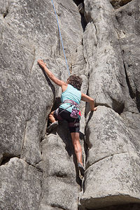 Lolo ClimbingHaving arrived well after midnight the night before after a full day of work, a flight from Seattle (for Tommy), and a long four and a half hour drive in the dark, I mistakenly thought that the boys and Celeste might want to sleep in. Silly me. I apparently have forgotten what it is like to be in your early 20s and on vacation from your first job. They were up at the crack of dawn, rearing and ready to go.
We decided to start that day at a climbing area called Swan Slab, mostly because we were familiar with it from climbing there last Thanksgiving. It had two of the three criteria we were looking for: ease of top-roping and difficulty ratings in the 5.9 – 511a range. There were even some easier climbs for me to attempt, although after the spectacle I made of myself the last time I climbed (and I use the term loosely) here, I wasn’t quite sure if I was ready to show my face there again.
The only problem with this wall was that it might be too hot, as it was in the sun for the majority of the day, which explains why we liked it so much in the cool days of November. However, because most climbers in August head to the higher elevation rock in Tuolumne Meadows or the shadier walls in the Valley, we pretty much had the whole place to ourselves. I definitely liked the idea of fewer spectators.
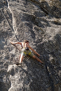 Tom ClimbingSince the climbs here were not “sport” climbs, Tommy, who is the most comfortable leading, would have to put in his own protective pieces on the way up. However, unlike “traditional” climbing where the leader sets up a belay station on the wall from which he belays the other climbers up to him, with top roping the leader climbs up to a secure anchor point, attaches the rope, and then rapels back down, so that both ends of the rope are on the ground, secured above at the anchor point. Then one person belays from the ground as the next climber goes up the route, removing the protective pieces along the way. The reason that it is safer is that the climber can’t fall very far at all, because the belayer has him tight on the other end.
So, here we were, sending out the youngest to set up a top rope by climbing a 5.9 called Grant’s Crack. From there, they were able to top rope a few other 5.9s and 5.10s as well.
To their credit, the boys and Herb are always very encouraging and nurturing to me regarding climbing. I had really put a lot of effort in over the last year to improve my climbing skills. I even joined a climbing gym and have been going three times a week. I was really starting to truly enjoy it for the first time in my life and could actually see myself progressing from week to week.
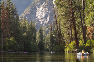 Tubing the MercedStill, applying what you learn in a gym to an actual rock wall is not necessarily that easy. However, with their patience and guidance, I actually did climb pretty well, and was able to complete two climbs fairly skillfully, if not necessarily gracefully. They were quite impressed, which made me very proud and happy.
However, my proudest moment of the trip would come later that day when I unveiled the five Intex River Tubes I had ordered from Amazon – complete with backrests and drink holders. I had remembered from our trip to Yosemite in August of 2007 just how hot the Valley can be, and just how good the Merced River can feel after a long day of physical activity.
Not everyone was initially as enthusiastic as me about my purchase. Due to the very severe drought conditions in California, there was much skepticism amongst the troops as to the feasibility of using these tubes in what would probably be a dried up river. I, however, had been tracking the USGS graphs of water levels and flow in the Valley, and although far from impressive, I knew there was at least a few inches of water in the river. I was not going to let these “Debbie Downers” get in the way of my good time.
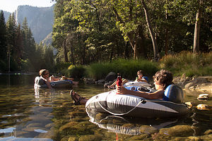 Family TubingSo, after everyone had tired themselves out on the rock (Celeste is always the last to give in), we drove around the Valley Loop to Cathedral Beach, where the views of El Cap are particularly spectacular, and where there seemed to be at least some water in the river.
Using our brand new car-powered electric pump (also from Amazon), we quickly and effortlessly inflated the tubes – although we did have to blow up the backrests by mouth. The pièce de résistance was my placement of ice cold refreshing beers in the drink holders. I could see by their now enthusiastic faces that I was reaching new heights in motherhood.
I dragged my tube to the river, plopped myself down in about 8 inches of water, and basked in the glow of my sons’ admiration and love for their crazy mother.
Seriously though, I highly recommend these tubes:
http://www.amazon.com/gp/product/B000PEOMC8/ref=oh_aui_detailpage_o03_s0...
Rock Climbing on Church Bowl Wall and the Bergs Arrival
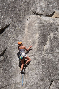 Celeste ClimbingUsually we don’t climb two days in a row, as a rest day in between makes for stronger climbing the next, but since Celeste’s parents were arriving that evening and we would be mostly hiking during their stay, we decided to squeeze in another day of climbing before their arrival.
This time we chose the Church Bowl Wall, located right behind a picnic area about halfway between Yosemite Village and the Ahwahnee Hotel. Often access to climbing walls involves a lengthy scramble up rocks to get to the base of a cliff, but this area, like Swan Slab was very accessible. Also, If I got bored, I could just take a short walk to the Village to buy a latte or stroll the other direction and hang out in the cozy Ahwahnee living room.
As with the previous day, Tommy led the first climb with the plan to set up a top rope from which to do some other climbs. Unfortunately, about halfway up, he pulled a muscle in his bicep and appeared to be in quite a bit of pain. We lowered him down and I volunteered Herb to set up the route instead. “Thanks dear,” he said and accused me of trying to preserve my gene pool by sending him up instead of our young. I just told him I had faith in him. He did just fine.
They did a few more 5.10s and I even did two climbs as well. Unfortunately, some of the easier graded climbs are what are known as chimneys, which basically means you have to ooch your entire body through very narrow, damp spaces – not quite the elegant and graceful movements I watch Herb, the boys, and Celeste do on the rock. There were times when I could have completely let go with my hands and still not fallen because my butt was wedged so tightly between two rocks that I could barely set it free.
It was kind of secure and cozy in the chimney though, so I chose to continue ooching my way up like a worm rather than go out on the open exposed face of the rock, which, although more intimidating, would probably have been a lot easier.
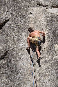 Andrew ClimbingI had pretty much had enough and was starting to picture my butt squeezed into a tube on the river instead of between two rocks. The others were pretty convinced that that sounded pretty good as well.
On the way back to the campground we stopped at the Village Store to pick up cans of Sierra Nevada Pale Ale, as we always enjoy drinking a beer appropriate to our location – except for the time we bought General Grant Ale in Sequoia National Park because we had visited the Grant Grove of Sequoia Trees. Big mistake – awesome trees, lousy beer.
Back in the campground, we dragged the tubes down to the river, which was only about 50 yards from our campsite, inserted Sierra Nevadas in the cup holders, and floated. Why is it that beer always tastes better after physical activity?
Just when I thought we were in the relaxation phase of the day, Andrew and Celeste decided that they should go bouldering. For those non-rock climbers, bouldering is climbing on small rock formations, or “boulders,” without using ropes. For safety, a bouldering pad is placed below the climber to cushion his fall, which is usually not from a great height. Herb and I had given Andrew and Celeste a bouldering pad for Christmas, so we were happy to see that they were using it. We are such cool parents!
Tommy was torn between a second Sierra Nevada and joining them, but peer pressure won out. So, the three of them took the bikes, with a bouldering pad strapped to Andrew’s back, and rode back to the Church Bowl area to boulder. Like climbs, bouldering routes are also rated based on their difficulty, with V0 being the easiest. Climbing in Yosemite can always be very humbling, so they soon discovered that even doing a Yosemite V0, which they renamed Vbaby, was challenging, especially after a full day of climbing and a Sierra Nevada.
While they were gone, Herb and I drove over to the Ahwahnee Meadow, our favorite place to sip wine and watch sunset in the Valley. There’s nothing like watching the colors change on Half Dome, especially the alpenglow that occurs a little while after sunset.
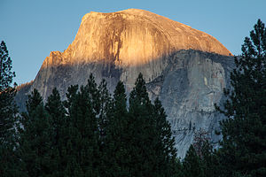 Half Dome SunsetHowever, this time it was not to be. For the first time in over a dozen nights spent partaking of this beautiful scene, over a period of close to 30 years, we were asked to leave the meadow by a pair of Park Rangers. Despite our question as to why we were not allowed to be on what was very obviously a well-established and highly-traveled path through the meadow, they told us that the meadow was now closed for restoration and that there were signs all around the meadow indicating that. We found that strange in that we parked, as always, in the small pullout which was located right by the start of the path that crossed the meadow, and there had been no signs indicating a meadow closure. In fact, this pullout’s only reason for being was for usage of this path. We later confirmed that there were no signs anywhere else around the meadow.
I am very much a proponent of preservation and conservation, but quite frankly, I thought this was just silly and not essential for accomplishing their worthy goal. There are paths crossing most of the meadows in the park, and people respect them by staying on them and off the meadows. Oh well. I guess I was just disappointed that this cherished tradition of ours was over.
That evening, Andrew cooked his delicious Penne Vodka recipe and we kept it warm until Celeste’s parents arrived sometime after 9:00 pm. Afterwards we helped them store their food in the bear box and set their tent up in the dark. We also warned them that they might hear shots during the night as our park volunteer neighbors shot bean bags at bears that were becoming a bit too campground friendly. Once again, I was glad I was in a hard-sided motorhome.
Hiking Taft Point and the Fissures, Sentinel Dome, and Glacier Point
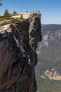 Taft PointDespite this being our 7th visit to Yosemite, there were still plenty of spectacular hikes that we hadn’t done, two of which were the hikes to Taft Point and the Fissures and Sentinel Dome. Their exclusion to date was simply due to the fact that there are so many fantastic hikes right from the Valley, and these two required a 30-mile drive to the trailhead along Glacier Point Road.
We obviously weren’t the only ones with this idea. The trailhead parking lot was full, so we joined the dozens of cars parked along the shoulder of the road.
From the trailhead, we chose to go left first through the woods towards Taft Point. I wouldn’t want to do this hike in the dark, because before you get to Taft Point itself, you have to step around the fissures, which are these immense vertical gashes in the granite that plunge hundreds of feet to the Valley—kind of like crevasses minus the snow. There were no guard rails around them, so we were free to get up close and gaze down and down. It still makes my palms sweat thinking about it.
A short distance ahead was Taft Point itself, where we stood at the edge of the cliff –this time with a metal railing – and gazed down at the Valley. From this vantage point, we were actually looking down on El Cap rather than craning our necks skyward to take in its immensity. The view would have been even more spectacular if Yosemite Falls wasn’t dry.
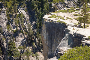 Herb at the FissuresRather than retrace our steps back to the car, we took the Pohono Trail, which eventually wrapped clockwise around the northern end of Sentinel Dome, bringing us to the backside where we scrambled up its smooth granite surface for about 100 yards to the summit.
All I can say is that there is an awful lot of bang for your buck on this hike. The hike up the backside of Half Dome is about a 17-mile roundtrip, and the hike to the top of Yosemite Falls is a strenuous 7.4-mile one, but getting to the top of Sentinel Dome takes about 2 miles of level walking and just a brief scramble to the top. And, the views are just as spectacular, if not even more so with El Cap and Yosemite Falls to the north (too bad it wasn’t flowing); Half Dome, Clouds Rest, and Nevada Fall to the east; and the most famous dead tree right there on top of the summit (the one Ansel Adams photographed when it looked a little livelier).
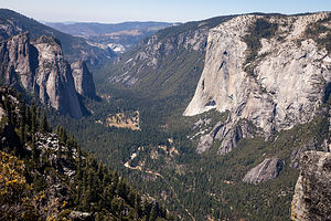 El Capitan View from Pohono TrailWe spent a good deal of our time on the summit photographing various combinations of our party with a spectacular backdrop, but the winning photo in my opinion was the auto-timed shot with the seven of us jumping with glee in the air. The boys were so embarrassed about doing this publicly that Herb only got one shot at it, but thankfully, it was a good one.
From Sentinel Dome, we could have just gone back to the car, but we decided to continue on to Glacier Point, which probably was a mistake, because after the relative solitude of the hiking so far, that place was an absolute zoo due to the fact that people could just drive up to it without that annoying hiking thing getting in the way. Plus there was ice cream and a gift shop.
The views at Glacier Point are spectacular as well, but are tainted by the need to elbow yourself into position so you don’t have a group of strangers in your photo.
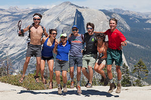 Sentinel Dome Jumping HikersFrom there, our party split. At least two of us had to hike back to the cars we had parked near the trailhead on Glacier Point Road, but the rest could take advantage of the opportunity to hike the Four-Mile Trail down to the Valley floor rather than drive. Andrew, Tommy, and Celeste decided to do the hike while their very gracious parents took it for the team and hiked back to the cars. All in all, we hiked 9.3 miles while the kids hiked 11.4 miles. Those steep downhill miles though are much tougher on the knees than the uphill ones.
Ironically, the hike back to the car and drive to the Valley took the same exact time as the kids’ hike on the misnamed Four-Mile Trail – it is actually closer to 4 ½ miles. They had just arrived at the bottom when we swung by and picked them up in our cars.
I think we all felt that sense of satisfaction from a great day of strenuous physical activity and awesome views. A very nice ending to the day included Paul cooking pasta and pork sausage that came from his very own pigs. There’s nothing like knowing the name of your dinner.
Hiking Inspiration Point, Tubing from Cathedral Beach, and Dinner at the Ahwahnee Bar
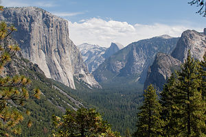 Yosemite Valley View from Inspiration PointWe wanted to pick another classic Yosemite hike to do with Celeste and her family. If the falls in the Valley had been running, we would definitely have chosen to hike the strenuous switchback trail to the top of Yosemite Falls. However, without the spectacular images of water cascading over the granite walls and tumbling down to the Valley, it was just too much work for too little reward.
Instead we chose another classic – the fairly short (2.6 miles RT), but steep hike to Inspiration Point. The trailhead is at the Wawona Tunnel overlook, where at any given moment you will encounter tour buses dispensing camera-clad tourists anxious to capture this iconic view of the Valley. Its masses rivaled the Glacier Point overlook.
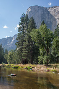 El Capitan View from Cathedral Beach with TuberHowever, as we have discovered in the past, all you need to do is hike a ½ mile to leave the crowds behind. And, if the trail is steep, as the first half mile of this one was, you will practically have it to yourselves within the first 100 yards.
At 1.3 miles we reached “Old Inspiration Point,” which is where the road to Yosemite Valley used to go in the days before the Wawona Tunnel was built. The views are now mostly obscured by trees, but as we discovered last Thanksgiving, if you just hike a short distance down to a lower granite shelf, the views of El Cap, Half Dome, and Yosemite Falls are unobstructed and breathtaking. In fact, this was the site of our 2013 Gaidus Family Christmas Photo.
It seemed like every hike we chose boasted that it had the best views of the Valley. Although they can’t all be the best, they all can be pretty damn spectacular.
The trail doesn’t end at Old Inspiration Point, but continues steeply uphill for another 1,000 foort elevation gain to what I guess is New Inspiration Point.
We debated for awhile as to whether to continue upward or go back to Cathedral Beach and tube in the river. Andrew and Celeste decided to go on and meet up with us at the beach, while the rest of us chose to go down.
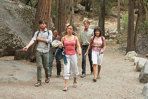 Hiking to the Ahwahnee BarWhile Andrew and Celeste hiked, we drove back to the campground, picked up the motorhome, filled it with water at Upper Pines campground so we could all shower later, made sandwiches, drove to Cathedral Beach, and blew up tubes. Just as all that was done, Andrew and Celeste showed up and joined us.
Although the water in the Merced was painfully low, we still were able to float a bit and soak up the views, this time from below looking up. I was still gloating about these tubes.
That evening, after some very quick, cold showers (something was wrong with the motorhome’s water heater), we walked from the campground to the Ahwahnee Hotel to have dinner on the outdoor patio of the Ahwahnee Bar. We had to wait a pretty long time for a table for 7, but eventually were seated just as it was getting dark. The bar menu is fairly limited compared to the Dining Room, but we were able to find something to our liking. I just love being anywhere in the Ahwahnee, especially with my favorite people in the world.
Hiking to Vernal and Nevada Falls, Berg’s Departure, and Yosemite Theater Live
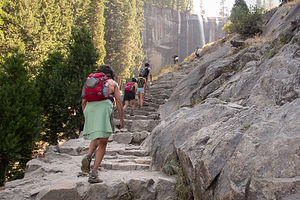 Hiking to Vernal FallsThis was Celeste and her parents’ last day in Yosemite, because Celeste had to get back to work. Mistakenly, I thought they would want to get going by late morning to make the 4 ½-hour drive back to San Francisco, but being as active (if not more so) a family as we are, I should have realized that they would want to squeeze out one more classic Yosemite hike.
The day began the way every day should, with Paul cooking fresh eggs from his very own chickens and bacon and sausage from his ex-pigs. Wonderful aromas like this normally don’t emanate from our campsite.
After a delicious and very filling start to our day, we packed a lunch and walked about a mile from the campground to Happy Isles, the trailhead for the Mist Trail to Vernal and Nevada Falls. This is one of the most popular climbs in the Valley, so we had no expectations of finding solitude on the trail, but even we were surprised by the steady stream of people of all ages, shapes, sizes, and foot gear. We even passed two people (in separate groups) carrying soccer balls and one with a football. I can’t even imagine any scenario where this would have made sense.
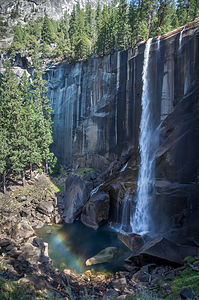 Vernal Falls with Rainbow at BaseThe trail is named the Mist Trail, because the mist from the falls normally sprays hikers and the trail itself, often making it quite slippery. However, due to the severe drought in California and the lateness of the summer, the falls were a mere shadow of their former selves. I am sorry to report that there was no mist on Mist Trail, but at least there was some water cascading over the falls, while the rest of the falls in the Valley were dry. This might also explain the hordes of hikers on this trail.
The first mile of the trail is partially paved and almost entirely uphill. After 0.8 miles and about a 500-foot elevation gain, we came to the Vernal Falls footbridge where there is a good view looking up at the falls. After crossing the bridge, in about 0.2 miles we came to a junction in the trail, with the Mist Trail continuing to the left and the John Muir Trail to the right. We planned to do a loop, so we followed the Mist Trail up a steep granite staircase with over 600 steps to the top of Vernal Falls. There’s nothing like strenuous physical activity to thin a crowd, so already we were finding ourselves with a bit more peace and solitude.
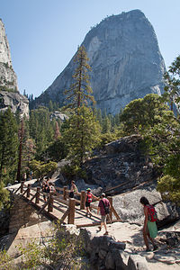 Hiking the Mist Trail to Nevada FallsThe staircase comes pretty close to the falls, so this is where you normally get soaked. From the top of Vernal Falls, you can stand behind metal railings, and look straight down the length of the 317-foot waterfall. Although it didn’t look terribly fierce today, far too many foolish tourists, trying to get the ultimate photo, have climbed over the railings and been swept away over the edge.
Just beyond the top of the falls, the Mist Trail led passed the Emerald Pool, where there were happy swimmers ignoring the Danger No Swimming signs. I have to admit that in 2007 on our way down from the strenuous hike up the Half Dome Cable Route, we did take a refreshing dip in this Pool, but far, far away from where the current was strong – still no excuse.
Right past the Emerald Pool, we crossed a bridge back over the Merced and began the 1 ½ mile climb up steep, rocky switchbacks, with Liberty Cap to our left and Nevada Falls slipping in and out of view ahead.
At 2.8 miles (and an elevation gain of 2,600 feet), the Mist Trail came to an end and joined with the John Muir Trail. Straight ahead was the trail to the Half Dome Cable Route, which we did back in 2007, but this time we took the John Muir Trail to the right and crossed a footbridge over Nevada Falls, with railings to hold onto while gazing down its 594-foot plunge.
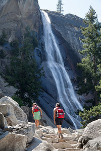 Nevada Falls with HikersFrom this point, we could either retrace our steps back down the Mist Trail for 2.8 miles, or continue on the John Muir Trail for 4 miles as an alternate route down to the Valley. We all preferred a loop-hike, so we unanimously decided to continue on the John Muir Trail.
But before doing so, we decided that this was a perfect stop for lunch. We pretty much had left about 90% of the hikers behind, so the only thing we had to contend with were the very aggressive squirrels anxious for a little bit of lunch themselves.
We also took this opportunity to perfect our group jumping shot. Herb dutifully set up his camera on a tripod, lined us up, and on the count of 3 we all leaped in the air as high as we could. This time the kids let us take several shots from which to pick the best. Some of them were hysterical. For some reason, Tommy got the idea that kicking his leg up in the air would be amusing, but unfortunately this required pushing the person next to him, which of course was me, downward to achieve his ultimate height. It made me look like a munchkin.
The hike down the John Muir Trail was a little less scenic and less crowded than the Mist Trail. There was, however, a particularly nice view of Nevada Falls with Liberty Cap in the background.
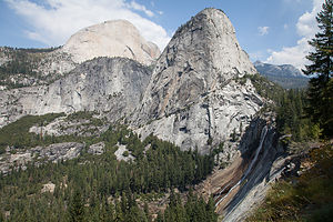 Liberty Cap, Nevada Falls, and Back of Half DomeOnce back at Happy Isles, we decided to take a more scenic route back to the campground, but we got a bit lost and wound up passing the Ahwahnee and having to go across the Ahwahnee Meadow to get back to the campground. This made our total hiking distance 9.9 miles, with over 2,600 feet of elevation gain.
Back at the campsite, Celeste and her parents packed up and left to drive back to San Francisco. They added so much to our trip, and we would certainly miss them, and not just because of Paul’s sausages and bacon.
That evening we did something I have wanted to do every visit to Yosemite, but somehow never managed to squeeze in – attend a performance at the Yosemite Theater Live. It seems like we were always too busy chasing sunsets, but this time I said that I should get to pick how an evening was spent.
It was such an unbelievably worthwhile experience. Every Wednesday night since 1983, the actor Lee Stetson has been playing the role of John Muir in a presentation entitled “Conversation with a Tramp: An Evening with John Muir.” Tickets for the live performance were only $8 and can be purchased at the Visitor Center.
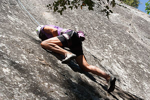 Lolo Attacking the Manure Buttress PileFor over an hour we were mesmerized and completely absorbed in the self-reflections of this great man who did so much to preserve Yosemite for all of us to enjoy. Stetson was incredibly convincing in his role as he rambled on about his childhood, his obsession with the beauty of Yosemite, and his efforts to save Hetch Hetchy, which sadly failed. The performance, which Stetson wrote entirely himself, included his reception and reaction to the news that more politically powerful men had won the battle for Hetch Hetchy.
At the end of the performance, Stetson spoke to the audience and mentioned that he was available to speak at schools, communities, or wherever people were interested in hearing his message. The boys tried to get me to hire him to have Thanksgiving dinner with us, which we are actually doing at the Ahwahnee this year. Wouldn’t that be something?
Rock Climbing on Manure Buttress Pile and Hanging out at the Ahwahnee
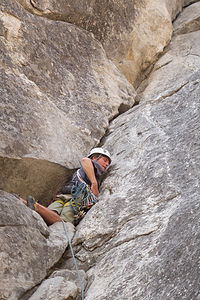 Tommy on Lead at the Manure ButtressThis was our first day back rock climbing after three rest days, if you can call strenuous hiking a rest.
For today’s adventures we chose the alluringly-named Manure Buttress Pile wall, just east of El Cap on the north side of the Valley. Like the other walls we had selected, this one had an easy approach, a selection of climbs in the 5.9 – 5.11a range, and the ability to set up a top rope.
Just to set the record straight, there was no hint or whiff of manure anywhere near this very nice 600-foot rock formation. Perhaps the name was a convenient way of keeping away the crowds.
Actually, I did a little digging (no pun intended) and found out that in the old days when horses were the only way to get to the park, the park service used to collect all the horse manure in the Valley and bring it to the base of this rock for disposal. Thankfully, Henry Ford’s Model T’s eventually eliminated manure production and disposal and replaced it with traffic jams. Progress isn’t always a good thing.
After a very satisfying day of climbing, even for me, we went back to the campground, barbecued pork chops, and then headed over to the Ahwahnee, with a deck of cards and kindles in hand, to settle in their comfortable sitting area. Hanging out in this sitting room is especially nice during our Thanksgiving visits, because the days are shorter and there isn’t much to do after nightfall, and this place is really, really cozy. Actually, it’s pretty cozy any time of year.
Hiking to North Dome
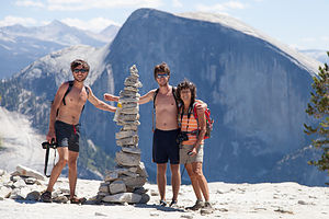 Family with Faux Dad Rock Cairn on route to North DomeOver the years, we had pretty much hiked all of the classic trails from the Valley, but had not spent much time up along the Tioga Pass Road. In fact, I don’t think the boys had even been up to Tuolumne and Tioga Pass, except to drive through went entering the park through the East Entrance.
When researching hikes before leaving on this trip, I originally selected Clouds Rest as a must do. However, after looking a little further, I found that the final summit ascent is only about 4 feet wide and has terrifying drop-offs on either side. I even tried to watch You-Tube videos that people posted of this section, and my palms sweated every time. Then I even googled deaths on Clouds Rest to reassure myself that it was perfectly safe and found that a 53 year old woman fell to her death—and I am a much more feeble 58. I told Herb that, call me a weenie if you will, but I just couldn’t do it.
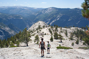 Boys on Final Approach to North DomeSo, that’s when I found the North Dome hike, a great alternative in that it had just as spectacular views, without the risk of death. I now had new criteria for selecting a hike. Plus, oddly enough, since the Tioga Pass road is so high, the final hike to the summit of North Dome is actually a descent.
The drive to the trailhead at Porcupine Creek was about 43 miles from our campground in the Valley and took us close to an hour and a half because of road construction. We were still pretty early though, so fortunately there were a few spots left in the parking area.
Unlike the other hikes we had done this week, the trail started down rather than up, which it continued to do for about a mile through a lovely, quiet pine forest. There was no one else around, so it was very, very peaceful – a much different experience than the crowded Mist Trail.
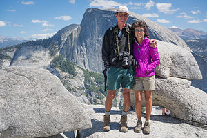 Lolo and Herb at North Dome with Half Dome and Boobs under RockAt about the mile and a half mark, we came to a trail junction – straight ahead to North Dome and a left to the Valley Floor via Tenaya Canyon. On the way back from North Dome, we would split up at this point, with Tommy and me going back to the car, and Andrew and Herb hiking down to the Valley.
However, for now, we all continued on together as the trail began to ascend Indian Ridge. At about 2.5 miles we came to another junction for the side trip to Indian Rock. We decided to skip that for now and hit it on the way back if we still had the energy.
As the trail made its way up the ridge, we came to a big flat granite area that I at first thought was North Dome, but realized we hadn’t gone far enough yet. I knew that because whenever we hike I clutch a GPS that tells me how far we’ve gone, what our elevation is, etc. I use it for reinforcement that I am actually making progress. This false North Dome was just a treeless portion of Indian Ridge.
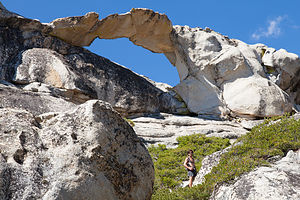 Indian Rock ArchNow that we were out of the trees, the views were getting really good, and as we continued on, they just kept getting better and better. Eventually, we saw the real North Dome, a huge smooth granite plateau jutting out before us.
At 4.5 miles, we took the left spur for the hike down (that’s right, down) to the summit of North Dome. The winds had really picked up, making our trek across this spectacular rock even more dramatic. It seemed like the whole world lay before us – Clouds Rest and Tenaya Canyon to the northeast, Yosemite Valley below, and our old favorite Half Dome just across the canyon.
This was a totally different perspective of Half Dome than we had ever seen. It looked much wider than usual. We finally figured out that this time we were looking at it head on, and all our other views of it, like from the Valley or Glacier Point, were from an oblique angle that shortened it. It was kind of like getting used to an old friend that you hadn’t seen in awhile that had gained weight.
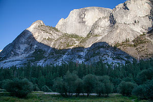 Half Dome view from Dry Mirror LakeFinally, we pried ourselves away and began our ascent off the Dome. On the way back, we took the steep ¼-mile spur trail to Indian Rock, the only natural arch in Yosemite.
When we got back to the junction to hike down to the Valley, I tried to convince them all to take it and I would drive the car back. Tommy sweetly said he would keep me company, and Herb and Andrew went off on their own adventure, adding another 5 or 6 miles to an already long 9-mile hike.
Tommy and I were back at the campsite for quite awhile, and it was almost dark before Herb and Andrew eventually wandered in, tired but happy. They said it was absolutely spectacular, but a very steep descent – after all they had to descend almost 4,000 feet in those 5 extra miles. In fact, it is the steepest trail to the Valley. However, what they will always remember most from this hike was the large rattlesnake that Andrew almost stepped on. No matter how old you are, in times like tha,t you’re always glad your dad is nearby.
Rock Climbing on Glacier Point Apron and Yosemite Theater Live
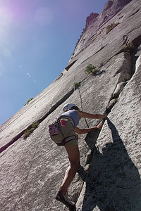 Lolo Climbing at Glacier Point ApronOur last full day in Yosemite with the boys—it was sad in a way, but I am so, so grateful that they still want to spend some of their vacation time with us.
Since yesterday was a hiking day, today must be a rock climbing one. The selection for the day’s activities was the Glacier Point Apron, a massive granite slab that slopes upward towards Glacier Point. Our only hesitancy at first was that the guide book listed this as having potential for rock falls. I was actually more worried about the throngs of tourists atop Glacier Point dropping a latte on my head. In either case, we decided we would where our helmets all day and keep a keen lookout.
The objective for the day was for Andrew to do his first multi-pitch climb, which was a lot more involved than sport climbing or top-roping and required a much more experience, which Tommy and Herb had, and Andrew very much wanted to gain.
Unlike top rope climbing, where a climber climbs up and sets the rope through an anchor and then comes down, in a multi pitch climb, the leader (in our case Tommy) climbs up to a belay station (usually a ledge), anchors himself in, and then belays the other climbers up from there. Then the process is repeated up to the next belay station and so one, for the number of pitches in the climb.
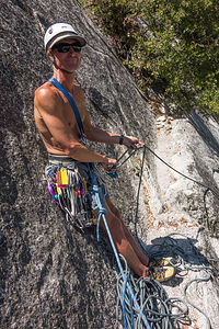 Herb Belaying at First Pitch of "Harry Daley"Before doing the multi-pitch climb, we warmed up on an area called the Goblet, which is known for its slab climbing. Slab climbing is done on rock walls that are not strictly vertical, but slope at angles less than 90 degrees. The holds tend to be really small, so it is a great place to practice balance and friction climbing. Tommy quickly set up a top rope and we were able to practice on different variations ranging from 5.6 to 5.9.
Now that I had gotten climbing out of my system for the day and they were warmed up, we moved right along the cliff base to the base of a classic Yosemite climb called Harry Daley, a 5-star climb that is considered one of the best two-pitch 5.8 climbs in Yosemite.
It’s a bit more time-consuming to do a multi-pitch climb, and all the climbers do disappear upwards, so I brought my Kindle along to entertain me while they were gone. I could also watch them for most of their climb.
At the end of the climb, they each had to rappel down to the belay station below them, and then again down to the ground. Ironically, many climbing accidents occur while belaying, so it is something that also requires knowledge and experience.
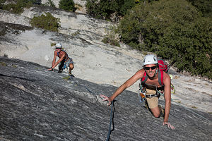 Andrew and Herb Simul Climbing "Harry Daley"They came back exhilarated. Andrew was absolutely ecstatic over his first multi-pitch climb.
That evening we went back to the Yosemite Live Theater, this time to see a presentation called “Return to Balance: A Climber’s Journey,” which gave a climber’s perspective of Yosemite. It was give by Ron Kauk, a renowned Yosemite climber. It seemed a very appropriate ending to our week of climbing in the Valley. .
Afterwards, we had pizza at Degnan’s Loft in nearby Yosemite Village and then headed back to the motorhome to call it a night
Ahwahnee Brunch, Andrew and Tommy’s Departure, and Crane Flat
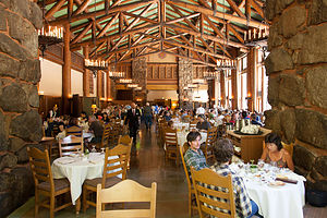 Brunch at the AhwahneeThe boys had to leave today, but not before we squeezed in one more classic Yosemite event—Sunday brunch in the Ahwahnee’s Great Dining Hall, an experience everyone should have at least once in their life. I was shooting for a dozen.
As usual, we requested a table in the alcove at the back of the dining room, where there were views of the granite walls through the floor-to-ceiling windows– you think we would have had enough of rock walls by now.
Once again we were seated next to the Queen’s Table, where Queen Elizabeth had dined during a visit here, but no matter where you sat, you felt like royalty. The food was ample and delicious, the service was impeccable, and the atmosphere was beyond compare. The company wasn’t too bad either.
Well, it was time for the boys to get back to work, so they said their good-bye’s and headed back to San Francisco, and then onto Seattle for Tommy.
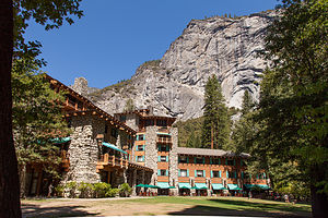 Ahwahnee HotelI had reserved a campsite in the Crane Flat Campground for that night, so we wouldn’t have to rush the boys off early or drive too far afterwards. It was only about a 20 mile drive.
Now, it was just the two of us on our own, with another two weeks to explore the Eastern Sierras. We hadn’t locked ourselves into any specific plans yet, but we had a pretty good idea of places we would like to see and things we wanted to do.
One thing we had never done in all of our trips to Yosemite was to camp in Tuolumne Meadows, so we decided to wake up early and try to nab one of the first-come,-first-served campsites.
It had been a pretty exhausting week trying to keep up with the boys, so going to bed early seemed like a very good idea.
Hiking May Lake – Mount Hoffman and Tuolumne Meadows
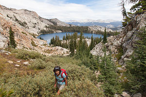 Lolo Hiking with May Lake in BackgroundThe next morning, as planned, we woke early, drove the 40 miles to the Tuolumne Meadows Campground, and were able to get a campsite.
After a brief nap, we looked out the motorhome windows and saw cloudy skies and people dressed in winter jackets and hats. I can’t even begin to tell you how much Herb hates cloudy, cold, damp weather. What a difference from the sunny skies and 90+ temperatures of the Valley. We were 4,600 feet higher than the Valley, but still, this seemed like we had entered a completely different season.
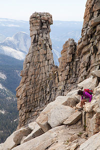 Lolo being "Extreme" on Mount HoffmanWe originally thought we would kayak in Tenaya Lake, but neither of us had any desire to do so in the cold, so we decided to do a hike instead. We chose another hike that was praised for its tremendous views – is there any other kind of hike in Yosemite? – the 6-mile May Lake and Mount Hoffman hike. Located at the geographical center of Yosemite, the promised 360 degree views from its summit sounded amazing.
We had done three 10-mile hikes last week, so 6 miles seemed relatively trivial, or so we thought. We had overlooked two factors. Firstly, we would be starting at 8,710 feet (just 100 feet shy of the summit of Half Dome), and secondly, we would be climbing 2,000 feet, 1,500 of which were in the last mile and a half.
The first part of the hike to May Lake was quite easy, with only a 500 foot elevation gain over 1.3 miles. The lake was very pretty, with the striking granite cliffs of Mt. Hoffman serving as a backdrop.
There was much activity here as this is the location of one of the five Yosemite High Sierra Camps. This would be fun to do sometime. The camps are spaced about 6 to 10 miles apart on a scenic loop through the High Sierras, and provide sleeping accommodations, as well as a full dinner and breakfast to its guests. As with most things that sound wonderful in Yosemite, reservations for these camps are in very high demand and available only on a lottery basis.
 Herb on Mount Hoffman HikeFrom the lake, we were a little confused as to which way to go around it, but another hiker confirmed that we should head left around the lake. Now the trail began to steadily climb in earnest. As we trudged on through a meadow and talus gardens, we were began to be treated to views of Half Dome to the south.
The trail became rockier as we approached the top, and we soon became more than a bit confused as to the proper route to the summit. We tried to follow the cairns, but often there were cairns pointing us in different directions. No matter which way we went, much rock scrambling was required for the last ¼ to summit. I found myself using both hands and even an occasional butt to make my way up to the top.
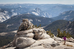 Half Dome from Mount Hoffman SummitThere are actually a couple of false summits, but we did manage to find our way to the true one, which had a radio antenna on top. The 360 degree panoramic view was as spectacular as promised, with every major peak and feature in the park visible.
We had lunch at the summit and a cute little marmot joined us, looking for a handout.
For some reason, navigating our way down through the talus field seemed easier than the way up. In fact, the whole hike seemed easier on the way down, except that it was a little tough on the knees.
I was so tired that by the time we got back to the car I could hardly complete full sentences and felt I only had the strength to grunt. I think it was the accumulation of so many consecutive days of long hikes and climbing. I definitely needed a rest day tomorrow.
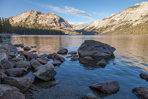 May LakeThe next morning we toyed with whether to spend another day in Tuolumne Meadows or continuing east out of the park to Mammoth Lakes. Since it was still a bit too cool to kayak, and I desperately needed a rest day from hiking, we decided to move on.
Up until now, Herb had put our motorhome brake problems to the back of his mind while we had fun with the boys, but now that we actually had to move the motorhome through mountain passes, the issues definitely came full front and center again. Not knowing whether the brake calipers would stick again, we stopped at every pullout on our drive along Tioga Road through the Pass towards the East entrance to the park to take a temperature reading of the brakes. Needless to say, although things seemed okay, the drive was very stressful and nerve-racking.
We headed south on Highway 395 towards Mammoth Lakes.
Description
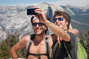 Tom's Sentinel Dome Summit SelfieYosemite National Park lies near the eastern border of California in the heart of the Sierra Nevada Mountains. Its spectacular waterfalls, soaring granite cliffs, and lush meadows are just a few of the reasons it is considered by many to be nature’s ultimate masterpiece. In the words of John Muir, “it is surely the brightest and the best of all the Lord has built.”
This description will focus on Yosemite Valley, which is the section of the park we visited. Although the Yosemite Valley is just a small portion of Yosemite’s 761,268 acres, it is part receives 95% of its visitors. In fact, an estimated 4.1 million people visit the Valley each year, making it extremely crowded.
Two one-way roads traverse Yosemite Valley: the east-bound Southside Drive and the west-bound Northside Drive, which wind through woodlands and meadows along the base of the 3,000-foot-high granite cliffs. As of today, cars are still allowed to enter and drive through the valley, but visitors are highly encouraged to park their vehicles and use the park’s free shuttle bus, which stops at the major attractions in the valley.
Virtual Tour of Yosemite Valley Highlights
- As you enter the valley, the first sight you’ll see is the 620-foot Bridalveil Falls flowing down from a hanging valley to the valley floor. From the parking area, a short paved path leads to the base of the falls. This is one of the few falls in Yosemite that does not completely dry up in the summer.
- Just past the Bridalveil Fall parking area, the Southside Drive begins to trace the Merced River. Soon El Capitan comes fully into view. This 3,000 foot high granite cliff is the largest single piece of exposed granite in the world and one of the most famous landmarks in Yosemite. If you look closely, you might see small dots that are actually rock climbers along its face.
- Continuing east on the Southside Drive are two riverside picnic areas and beaches: Cathedral Beach and Sentinel Beach.
- Right after the Sentinel Beach parking area is the trailhead for the 4-Mile trail, which ascends more than 3,200 feet from the valley floor to Glacier Point and one of the most spectacular views of the valley.
- A short distance further is Swinging Bridge, another picnic and swimming area. This area is also the westernmost point of the 8-mile bicycle loop that goes through the eastern part of the valley. From this point on, the bike path parallels the road.
- Next stop is the picturesque tiny Yosemite Chapel where many outdoor enthusiasts choose to exchange wedding vows.
- Now you enter the congested and developed portion of the valley.
- Right past the chapel, you can either take a left onto Sentinel Bridge towards Yosemite Village and the park exit, or you can continue straight towards Curry Village, the campgrounds, and Happy Isles Nature Center. For now, let’s stop at Sentinel Bridge for what is probably the most spectacular Half Dome viewpoint in the park. It’s a great spot for a photograph of Half Dome with the Merced River in the foreground.
- Continuing east on the Southside Drive, you pass Housekeeping Camp and Curry Village. Curry Village has lodging, restaurants, bicycle and raft rentals, a grocery store, and other shops. Curry Village is also one of the main parking areas in the valley.
- From Curry Village you can either take Northside Drive across the Ahwahnee Bridge back to Yosemite Village and the park exit, or continue east to the campgrounds. The Happy Isles Nature Center is also this way, but only shuttle buses are allowed on the road to it.
- The Happy Isles Nature Center features exhibits on the natural history of the park. It also serves as the trailhead for some of the best hikes in Yosemite. 1.5 mile trail leads to the top of Vernal Falls and then continues another 1.5 miles to the top of Nevada Falls (two waterfalls that flow even in the summer time). From there you can continue even further into the backcountry of Yosemite, including the cable route up the back of Half Dome.
- From Curry Village, the Northside Drive crosses the Ahwahnee Meadow, a wonderful spot to gaze at Half Dome during sunset, and enters Yosemite Village, the main center of visitor services in the park. Here you’ll find the park’s main Visitor Center, restaurants, lodging, shops, a grocery store, a post office, a medical clinic, the Ansel Adams Gallery, an Indian Cultural Exhibit and more. It’s also a good place to park your car and jump on the shuttle.
- A short dead end road from Yosemite Village leads to the majestic old Ahwahnee Hotel, which has played host to Queen Elizabeth, President John F. Kennedy, and Clint Eastwood, to name a few. This beautiful six-story rock structure offers tremendous views from every room. Within the hotel is the elegant and quite expensive Ahwahnee Dining Room (jackets required for dinner).
- Back on the Northside Drive heading west from Yosemite Village, the next stop is the Yosemite Falls parking area. At 2,425 feet, Yosemite Falls is the highest waterfall in North America. It is actually three waterfalls in one, with an upper, middle and lower section. A short walk from the parking lot along a paved walk leads to the base of Lower Yosemite Falls. This is the most visited landmark in the valley. Except in summer when the fall temporarily dries up, you’ll be sure to be covered in spray.
- A little further west on the Northside Drive is Yosemite Lodge, which marks the end of the developed area of the park going west.
- Right after Yosemite Lodge is Sunnyside Campground/Camp 4, a place where most rock climbers choose to congregate. From this campground begins the popular and strenuous Yosemite Falls hike, which ascends 2,600 feet from the valley floor to the top of the Upper Falls. The views from the top are incredible.
- Continuing west, there is nothing but woods and meadows from which to enjoy the views. Along the road there are several pullouts where you can stop and walk down to the Merced River for a swim. Just after the El Capitan Bridge, you’ll come to the El Capitan Meadow where you’re sure to find people looking through binoculars at the miniscule rock climbers clinging to the granite face.
- Just to the west of El Capitan, Ribbon Falls plunges over 1,600 feet down to the valley floor. It is the seventh highest waterfall in the world. However, it too dries up in the summer time.
- Finally the road nears the end of the Northside Drive at Valley View where El Capitan, on the left, and Cathedral Rocks, on the right, frame a magnificent valley view.
Several guided bus tours are also available. The 2-hour Valley Floor Tour is a great way to get acclimated. Visitors ride through the valley in an open tram while a guide leads a informative discussion of Yosemite’s history and geology. There are many photo stops along the way. In addition, there are bus tours out of the valley to Glacier Point, the Mariposa Grove of sequoia trees, and Tuolumne Meadows.
Although much of Yosemite can be enjoyed from the comforts of your car or a shuttle, the best way to truly experience Yosemite is do get out and experience it more directly.
Things to do in Yosemite
- Hike one of the many trails around the valley, ranging from an easy walk to the base of Lower Yosemite Falls to the strenuous 16-mile round trip hike up the back of Half Dome via cables
- Take an overnight backpacking trip
- Bike along the 12 miles of bicycle paths that loop through the Valley. Rentals are available at Curry Village and Yosemite Lodge.
- Rock climb in one of the premier climbing places in the world
- Raft down the calm waters of the Merced River through the valley. Rentals are available at Curry Village.
- Swim or tube in the Merced River. Besides the designated beaches, there are many pullouts along the road from which you can walk down to the river.
- Join one of the many ranger walks, which are offered daily
- Take a free art class at the Yosemite Art and Education Center
- Photograph the amazing scenery of the valley and surrounding granite cliffs
- Browse the Ansel Adams Gallery and see some of the photographs that first made Yosemite famous
- Relax in the meadow while gazing up at Half Dome or El Capitan
- Dine at the 5-star Ahwahnee Hotel, where presidents and royalty have stayed
Although many try to see Yosemite in a day, it is best to devote several days to seeing all the park has to offer. Besides the numerous hotels, lodges, and cabins in the Valley, there are three RV campgrounds: Upper Pines (238 sites), Lower Pines (60 sites), and North Pines (81 sites). That’s less than 400 campsites to accommodate all the people that want to camp here.
Since these campgrounds usually fill-up within the first hour they become available, it is essential to make your reservations as soon as possible. Campground reservations are available in blocks of one month at a time, up to five months in advance, on the 15th of each month at 7 am Pacific time. For example, if your arrival date is July 15 through August 14, the first day you can make reservations is March 15. The National Park Reservation System can be found at www.recreation.gov. Good luck!
San Francisco North / Petaluma KOA
Tuesday, August 12, 2014 - 5:30am by Lolo51 miles and 1.25 hours from our last stop - 2 night stay
Travelogue
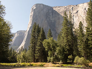 El CapitanThe first few days of our arrivals on the West Coast are always a bit tedious – taking the motorhome out of storage, unpacking, food shopping etc. However, this one was a bit rougher than most.
As a result of a Michelin tire recall, we had arranged to drop the motorhome off at a local truck repair shop to have all our tires replaced. We thought this was just great – all new tires (worth about $1,700) for free.
However, when changing the tires, the mechanic noticed that our front left rotor was cracked. Herb also found that the front ball joints were worn. After much deliberation, we decided to let them go ahead and redo our brake system and ball joints, and guess what…the bill was $1,700, the same as our free tires. We urged them to complete the job as soon as they could, because we were heading down to San Francisco that evening to see Andrew and Celeste’s new apartment and then leaving for Yosemite early the next morning.
This was a big step for Herb, because when the motorhome was stored in our backyard, he did all the work on it himself, and has always been hesitant to trust anyone else. I helped persuade him that he shouldn't have to do all these repairs himself, and that we should spend our time on the West Coast having fun, not rolling around in the dirt under an RV.
As promised, the motorhome was ready at 5:00. We tucked it back into our campsite and drove down to San Francisco for the evening. Andrew and Celeste’s new apartment was adorable – so cozy and neat. They were absolutely loving it. They cooked us a wonderful dinner and then afterwards we walked around their neighborhood, stopping at their favorite ice cream shop. San Francisco is a really great place to be young and in love – and I think Andrew and Celeste were enjoying it too.
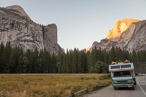 Lazy Daze with Half DomeThe next morning we set off for Yosemite, hoping to get there by mid-afternoon – enough time to maybe get in a run or bike ride around the Valley. However, that was not to be. It wasn’t too long into our drive that Herb realized that the motorhome was pulling really hard to the left, so bad that we started googling alignment places. We were lucky enough to find Hewitt Alinement Service in Stockton, that was able to take us immediately. After two hours, we were back on the road again and hoping to still make it before sunset. Herb said the motorhome was tracking better than it had in years.
Less than an hour later, as we approached the town of Oakdale, Herb thought he felt the motorhome pulling to the right a bit. “Do you smell anything?” he asked. I rolled down the window and was greeted with the dreaded smell of burning breaks. We quickly pulled over and Herb used his temperature sensor to confirm that indeed our front right brakes were off the charts hot.
After an angry phone call to the place that redid our brake system, and the offer of using a tow service to bring our vehicle somewhere, Herb decided to just do it himself. He jacked up the motorhome, took off the tire, and saw, as he expected, that the calipers were stuck, causing the brakes to overheat. The calipers were the only part that wasn’t replaced in our brake system repair job.
We continued on to Yosemite, hoping that the calipers would cooperate, and we could safely navigate the steep roads down into the Valley. What should have been a pleasant and scenic four and a half to five hour drive had turned into a 10 hour odyssey. We limped into the Valley near 10:00 pm, exhausted and stressed. The worst part was, we didn’t know what to do next to ensure that the motorhome would be safe for us to travel through mountain passes.
Since we had 10 days where we didn’t have to move the motorhome, we decided to put it out of our minds for now and just have a good time with the boys, who would be arriving tomorrow night.
If I remember correctly, Herb had a gin and tonic after we pulled into our campsite. Actually, I think he might have had two.
Description
The Petaluma KOA is an award winning camping resort located within an hour’s drive of San Francisco, Napa and Sonoma Valley Wineries, giant redwoods, and Sonoma County and California Coastal Beaches. It is considered to be the RV resort in the San Francisco Bay area.
On its 70 acres, there are 312 spacious RV sites, 32 camping cabins, and 10 Wine Country lodges.
Other amenities include:
• Guided tours of San Francisco (from May through October)
• Huge heated pool and spa
• Inflatable waterslide
• Rock climbing wall
• Huge playground
• Petting zoo
• Karaoke
• Hayrides and live weekend entertainment
The campground is open all year.
Flight Home
Friday, June 20, 2014 - 1:00pm by Lolo55 miles and 1.5 hours from our last stop - 1 night stay
Travelogue
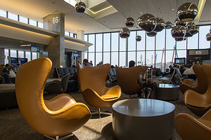 United Terminal at SFOAt the airport, I spoke again to Hospice to get an update on my Mom’s condition, and became more and more convinced that my Mom had decided that it was not yet her time. We have thought she was at death’s door at least a dozen times in the past two years she has been on Hospice – yes, that’s right, two years on Hospice – and each time, she bounces back. Originally when I got the call from Hospice a few days ago, I thought that this would be just another one of those times. In fact, when I called Andrew to tell him what was going on, he told me, “You know she’s going to rally. She always does.” However, Hospice and my sister-in-law who is a nursing home nurse assured me that this time was different and that there would be no rally.
Needless to say, when I arrived at the nursing home first thing the next morning, my mom was up in her wheelchair in the dining room being fed an entire bowl of oatmeal. She actually greeted me with, “Oh hi. What are you doing here? Did you come to see me?” I didn’t know whether to laugh or cry. I think the little drama queen just missed me.
San Francisco North / Petaluma KOA
Tuesday, June 3, 2014 - 10:15am by Lolo439 miles and 8 hours from our last stop - 2 night stay
Travelogue
By the time we reached Petaluma, reports from Hospice about my Mom’s condition were beginning to change in tone. “You know your Mom. She is going to do things in her own way and time.” Yep, she was rallying once again. That old Mark Twain quote came to mind: “Reports of my death have been greatly exaggerated.”
We briefly considered changing back to our original plan of celebrating my birthday in San Francisco this weekend with the boys -- Tommy was even going to fly down from Seattle – but too many things were already in motion, so we went forward on our plan to come home early. We spent the day prepping the RV for storage and packing up to go home.
That evening, Andrew drove up from the city for a visit and to say goodbye. We went out for dinner at Cucina Paradiso, a lovely Italian restaurant along Petaluma’s riverfront. Before finding this place, I didn’t even know that Petaluma had a riverfront. It was quite nice, with several restaurants and bars with outside dining along the river – definitely a place to explore more on future visits.
Description
The Petaluma KOA is an award winning camping resort located within an hour’s drive of San Francisco, Napa and Sonoma Valley Wineries, giant redwoods, and Sonoma County and California Coastal Beaches. It is considered to be the RV resort in the San Francisco Bay area.
On its 70 acres, there are 312 spacious RV sites, 32 camping cabins, and 10 Wine Country lodges.
Other amenities include:
• Guided tours of San Francisco (from May through October)
• Huge heated pool and spa
• Inflatable waterslide
• Rock climbing wall
• Huge playground
• Petting zoo
• Karaoke
• Hayrides and live weekend entertainment
The campground is open all year.
Stanton Park
Monday, June 2, 2014 - 8:45am by Lolo437 miles and 8 hours from our last stop - 1 night stay
Travelogue
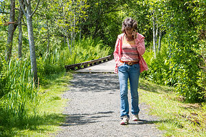 Lolo Talking with Hospice NurseTommy wasn’t gone 10 minutes before we got a call from the Hospice Nurse at my mom’s nursing home facility. At first I wasn’t too alarmed, because we do keep in close contact when I am away. However, I am the one that usually does the calling, so this time seemed different. She informed me that my mom had taken a serious turn for the worse. She was in a semi-comatose state, no longer eating or drinking, and had been put on oxygen. They didn’t think she would last through the weekend.
I didn’t know what to do. Our return flight was over a week away. The only reason I hesitated at all, was that my Mom has more lives than a cat, and we have gathered around her theoretical death bed many times, only to have her rally and come back to life. How was I to know whether this time was really different?
I called my sister-in-law, who is an ex-nursing home nurse and asked her if she could stop in to see my mome and assess the situation. She did and confirmed Hospice’s prognosis that she was truly near the end.
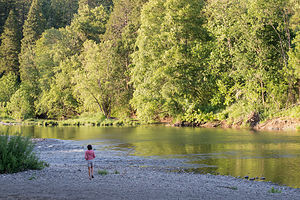 Lolo on South Umpqua River in Stanton ParkOkay, this was it -- time to start figuring out how to get home. First step, we called United Airlines to see what we could do about switching flights, especially in light of the fact that we didn’t have trip insurance. They were so incredibly nice, and allowed us to move up our flights to 3 days from now, without any charge.
Step two – start driving down I5 to get back to Petaluma to store the motorhome and fly back home.
We made a quick side trip to the Mount St. Helens Visitor Center near Silver Lake, just 5 miles off I5 on the Spirit Lake Highway, to get information for a possible future visit. Unlike other National Park System Visitor Centers, this one is run by the Washington State Park System and charges $5 to see the movie and the exhibits. I must admit I was a bit too distracted to really enjoy it much though and spent most of the time, hiding behind exhibits, talking on my phone to my sister-in-law and brothers about my mom.
Before leaving, we took a quick stroll along the Silver Lake Trail behind the Visitor Center, a lovely trail that includes boardwalks over marshlands. I pretty much missed that too, spending most of that walk on the phone with the Hospice nurse.
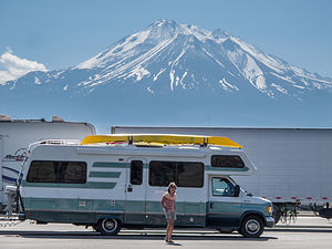 Lolo and Lazy Daze with Mount Shasta at I-5 Rest StopWe really did not give this place justice at all. I want to come back someday under better circumstances and take the ride out to the Johnston Ridge Observatory, about 50 miles further on, to actually see the 1980 blast zone. The visitor center here is the closest you can get to the mountain by car when driving in from the west. Also, when we come back I would like to stay at the Eco Park Resort, which I believe is the closest you can stay to the mountain. It’s located about halfway between I5 and the Johnston Observatory and has cabins, yurts, and camping.
Vowing to come back on a future trip, we continued our drive down I5 through Oregon. We had never been this way before, and I was quite surprised how scenic it was. Herb was also surprised how hilly it was, and was not really enjoying its many steep ups and downs.
After about another 5 hours of driving, we stopped for the night at Stanton Park, a 40-site campground on the South Umpqua River, just a short distance off I5 in the town of Canyonville, Oregon. It was actually quite nice. After dinner Herb and I took a short stroll down to a rocky beach on the river – very pretty.
Description
 Mount St. Helens Visitor Center Silver Lake TrailStanton Park is part of the Douglas County Park System. The 40-site campground is located on the South Umpqua River at Canyonville off I-5 Exit 99. The park has a picnic area, large pavilion, accessible restrooms with showers, fishing, and playground. Individual sites are available on a first come-first served basis.
Seattle
Thursday, May 29, 2014 - 6:15am by Lolo228 miles and 4.5 hours from our last stop - 4 night stay
Travelogue
 Approaching Gas Works Park via KayakVisiting a city with a motorhome is always a challenge, so finding the proper campground to use as a base camp for Seattle has been a work in progress for us. On our first visit, we stayed at Saltwater State Park, a lovely campground with a beach right on Puget Sound, about 23 miles south of the University District where Tommy lives. However, I5 can be a nightmare in terms of traffic, with a morning rush hour that lasts practically overlaps the afternoon one.
On our next visit we stayed at the Seattle Tacoma KOA, about 4 miles closer to Seattle. Although the setting is not as nice as Saltwater State Park, it does have the amenities that Saltwater does not, such as hookups, a pool, and laundry.
This year, thanks to the Moon West Coast RV Camping book that I have come to depend on, we found a new option: the Vasa Park Resort, right on lovely Lake Sammamish in Bellevue, Washington, just 7 miles from Tommy’s office in Redmond. It pretty much had it all – convenient location, beautiful setting, hookups, and a laundry. It’s really small though and fills up on weekends. There are 16 campsites, 6 full hookups and 10 partial. Fortunately, I had made a reservation in advance for one of the partial sites.
 Lake Union HouseboatThat night we just hung out at the campsite and barbecued salmon. It was really pleasant, with great views of the lake, which was only about a 100 yards from our campsite. It was hard to believe that this place was so close to the city. Tommy was considering moving here and living in a tent, so he wouldn’t have to contend with rush hour traffic from Seattle to Redmond every morning.
For the next day’s activities, I had really pushed for (and won) a kayak trip. Herb and my kayaks were spending far too much time just riding up and down the West Coast on the roof of the motorhome, so getting them out on the water was far overdue. Also, Seattle has so much beautiful water surrounding it that it would be the perfect place to exercise them.
Although Puget Sound would have been our first choice, the forecast was for strong winds, making the more protected Lake Union a better option.
 Andrew and Tommy in Synchronized Water Tube SlidesWe got a very good deal on kayak rentals for the boys at Moss Bay on Lake Union’s southeastern shore. On weekdays, if you rent for two hours, you get the next two hours free. The hourly rate was only $14, so each kayak was only $28 for 4 hours – not bad at all.
Lake Union is part of the Lake Washington Ship Canal System, so you can go west out through the locks to Puget Sound or east through Portage Bay and Union Bay into Lake Washington. However, those are really long trips, meant more for a powerboat or a multi-day kayak trip. We would content ourselves with exploring Lake Union.
We started off along the eastern shore of the lake, past the houseboats popularized in the movie Sleepless in Seattle. One of my favorite activities is peeking in windows of cozy homes, so this was a great opportunity for me, especially since most of these homes were mostly windows to take advantage of the great views of the city.
 Tommy Leading on World War I Wall at Exit 32After admiring the floating homes, we paddled over to Gas Works Park, the site of an old Seattle Gas Light Company gasification plant that has been transformed into a public park. Much of the old plant’s rusty towers, tanks, and pipes remain and make for a very interesting landmark on the lake – a sort of industrial still life. We had hoped to beach our kayaks and have lunch, but there were numerous signs forbidding it due to sediment toxicity surrounding the plant.
Undaunted, we continued on through Portage Bay and into the narrow Montlake Cut, which is the University of Washington’s crew team’s home course. The walls alongside the cut were covered with inspirational graffiti, extolling the superiority of the Huskies, and urging rowers to push harder to the finish line. It even got me to paddle a little faster.
 Andrew Leading on World War I Wall at Exit 32Our turnaround point and lunch spot was at the entrance to Union Bay at the Washington Park Arboretum, a 230-acre botanical garden that is managed jointly by the University of Washington and the City of Seattle. It would have been nice if we could have left the kayaks and explored the park a bit, but Tommy suggested that we come back by car on another day. Instead, we sat on a picnic table at the water’s edge and ate our lunch. It was a lovely spot.
The way back was a bit tougher – the winds were picking up as forecasted and the water was getting a bit choppy. As we got back into Lake Union, we were treated to wonderful views of the city and the Space Needle, which had been behind us on our way out.
I was falling a bit behind as we were finishing our paddle, so I missed most of the rescue operation that Herb and Andrew got themselves involved in. Tommy had stayed behind with me to make sure that I was okay and wouldn’t require my own personal rescue.
As Herb describes it, as they were approaching Moss Bay, they saw a kayaker struggling to get back into his capsized kayak. Often people like to get out of their own messes, especially if they are experienced, so they were unsure at first whether he wanted their help. As they approached him, they saw his hand rise above the kayak and the word “Help” coming from his direction. I guess that was about as clear as it gets.
 Hiking the Little Si TrailHerb came up alongside him and tried to hold his kayak in place while he climbed back in. After several failed attempts, they reverted to plan B. The capsized kayaker climbed onto the dock with his river bag, while Herb towed his kayak back to the rental dock, which was only about 100 yards away. That’s right, he had only gotten 100 yards before capsizing. Perhaps it was a good thing he did, because if he had gotten out onto the open water, he might have gotten in a lot more trouble. The poor guy. Andrew saw him empty his river bag on the dock, and water, along with his smartphone and wallet, poured out. Apparently, this was also his first time securely closing a river bag as well.
Our total trip, according to Strava, was about 7 miles, just about right on a day with conditions like this.
Back at the campsite that evening, we decided to try the water tube slides at the campground beach. The boys love nothing more than getting me to do stupid things. At first I questioned whether the slides were only meant for small children, but after a rather large father came shooting out of one of them, that excuse was gone.
 Lolo, Herb, and Andrew at West Point LighthouseThe boys went first, trying to synchronize their exit so that Herb could photo them shooting out at the same time – not a trivial matter, considering one tube was straight and the other J-shaped. Starting at the same time wouldn’t cut it. It took them only three attempts before they got a perfectly timed exit. Herb then photographed my less than graceful, sideways exit, while clutching my nose. It wasn’t pretty but it certainly was fun.
Saturday was rock climbing day. Tommy took us to one of his favorite weekend climbing spots at Exit 32 (on I90) in the town of North Bend. This is the town where the old TV series Twin Peaks was shot. We even saw the famous “Double R Diner” (now Twede’s Café), where you could get a great piece of cherry pie and a “damn fine cup of coffee.
The climbing area is actually halfway up the extremely popular hike to the summit of Little Si, so the parking lot fills up very quickly on weekends. Fortunately, we were early enough to nab the last parking spot. The climbing area is actually rather unoriginally named Exit 32 and there even is a guide book of its routes. There is also a climbing area called Exit 38 – also not very original, but it certainly does make driving directions easier.
 Pike Place Market Pig SculptureThe climbing here was very different from Smith Rock, both in terms of scenery and the type of rock. Rather than desert, this was a lush Pacific Northwest forest, beautiful in a different way. We set up on a wall, creatively called World Wall I, and Herb and the boys did about four climbs. There was nothing on this wall easy enough for me to do, so I was quite happy just being a spectator for the day .
After we finished climbing, we hiked the rest of the way to the summit of Little Si, along with about a hundred other people. The total hike is about 5 miles round trip, and very much worth it, as the views from its 1,576-foot summit of the Snoqualmie Valley are stunning.
Since we normally, don’t hike with a cooler – but had it along to hold our lunch while we were climbing – Herb can be forgiven for leaving it at the summit. We only discovered it was missing when we got back to the car. We even have a nice photo of Herb and I posing with it on the summit. I wonder if it is still up there.
 Lunch at Pike Place ChowderThat evening we just relaxed at the campground, taking turns with the kayaks out on Lake Sammamish. Andrew and I had a race between two buoys. He had me beat until he flipped his, and I cruised by for the victory.
Later, after much pestering, Tommy took Andrew out in his car to teach him how to drive stick shift. Andrew hates being the only one in the family that can’t. Tommy reported that some progress was made, and that hopefully his transmission was not any worse for wear.
Sunday was our last day together. Andrew had a flight back to San Francisco at 6:00 pm, giving us quite a bit of time to explore the city.
Our first stop, and one which had thwarted us on our visit here last year, was Discovery Park, Seattle’s largest park with 543 acres of tidal beaches, sand dunes, dramatic sea cliffs, meadows, and forests. We parked in the North Lot and set off to find the trail down to the beach and out to the lighthouse.
 Pike Place Market Mannequins with GuitarSince Tommy was our local expert and had run the trails here on several occasions, we let him lead the way. After walking to the Native American Tribal Center and enjoying the views of Puget Sound from the newly built viewing platform, he took us on a “shortcut” through a dense maple forest down along an overgrown, infrequently used trail. Despite our skepticism, we soon joined the main trail, which led us out onto a lovely beach on Puget Sound with wonderful views of the Olympic Mountains. I could have easily spent the entire day here. We strolled along the beach to the West Point Lighthouse, located on a piece of land that jutted out into the Sound. From there it was uphill on a real trail back to the car.
Our next stop was the famous Pike Place Market, and what better place to be at lunchtime? No one should come to Seattle without stopping at this iconic Seattle landmark.
I think Tommy and I were rather unoriginal in our selection of Pike Place Chowder, the same place we had eaten last year, but the chowder was just so darn good. Herb and Andrew were not as excited about our selection, because they both are allergic to shellfish and couldn’t partake in most of the menu selections.
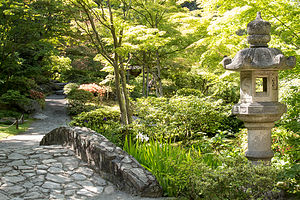 Seattle Japanese GardenAs always, there was a line out the door, but it moved pretty quickly, and Herb was able to secure us a table on the outside patio before we got our food.
Tommy and I very much enjoyed our Seafood Bisque and Dungeness Crab Roll sandwich Combo, while Herb grumbled a bit about his Alder Smoked Salmon sandwich having more bread than salmon. Andrew seemed pretty happy though with the Salmon Sandwich and a Southwest Chicken and Corn Chowder.
After lunch we strolled through the market and actually did see fish vendors tossing a salmon back and forth, as seen on TV. Then we went back through the infamous Post Alley to see the Gum Wall, where previously chewed gum of all shapes and colors covers the entire length of an alley, from street level to 6 feet above. There really is a fine line between litter and art, but I would have to go with art for this one, because it really is quite beautiful in its own way.
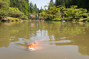 Seattle Japanese Garden KoiWe had time for one more stop before dropping Andrew off at the airport, so we drove over to the Seattle Japanese Garden, which is part of the larger Washington State Arboretum, where we briefly beached our kayaks two days back. We didn’t have much time before having to leave for the airport, so we hesitated for a moment at paying the $24 (for the four of us) admission fee for such a short visit. Feeling somewhat responsible as our tour guide, Tommy generously whipped out his credit card and paid for our entry. “I just don’t want to hear you guys grumbling,” was his official motivation. Whatever, works was fine with us.
The Garden was fairly small, just 3 ½ acres, but very, very lovely. I find Japanese gardens so peaceful and restful, which was probably what we all needed about now. The garden had a cherry orchard, babbling brooks, a teahouse, and my favorite – a beautiful pond filled with flowering lily pads and colorful koi. We noticed that the koi were coming to the surface with their mouths wide open. Herb said that this was a sign that there is not enough oxygen in the water, and they are doing that to get more air. I found it hard to believe that the koi weren’t properly managed in such a beautifully maintained park as this. I think they were just trained to look for handouts from people on the bridge over the pond.
I am so glad we stopped here. If this garden is representative of the rest of the Washington Park Arboretum, we definitely have to spend more time here on our next visit to Seattle.
Our time was up, so we drove down I5 and dropped Andrew off at the Seattle Tacoma Airport. Afterwards Tommy dropped us off at the campground and went back to his apartment to do laundry and get ready for the work week ahead. He came back though. Realizing that his commute to Microsoft was better from Vasa Park than his home, and knowing that Mom and Dad are always good for a free dinner, he returned to spend the night with us. I was happy, because I will take any time I can to spend with him.
The next morning, we said our goodbyes and he headed off to work. Now, once again after an active week with the boys, we were on our own slower paced schedule – or so we thought.
Description
Seattle
The following is in no way an attempt to give a thorough description of what to see and do in and around the city. However, the following sites are what we chose to do during our all too short visit.
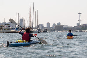 Boys Kayaking in Lake Union with Space NeedleKayaking Lake Union Lake Union is part of the Lake Washington Ship Canal System, which connects Lake Washington with Puget Sound. As far back as 1854, Thomas Mercer predicted that someday canals would join these two bodies of water in a “union of waters” -- hence the name Lake Union. Lake Union’s proximity to scenic views of Seattle makes it a popular recreational spot for power boaters, kayakers, and paddle boarders. Also of interest are the floating homes that line its shores, popularized by the movie Sleepless in Seattle. There are several parks on the shores of the lake, with Gas Works Park being the largest and most popular. There are several kayak rental shops on its shores, including Moss Bay and the NorthWest Outdoor Center.
Little Si is a very popular hiking and rock climbing destination for Seattleites. It is located about a ½ hour east of Seattle, just off Exit 32 of I90 in the town of North Bend. At 1,576 feet, it is smaller than its taller neighbor, 4167-foot Mount Si. Those planning to hike Little Si, especially on the weekends, should arrive early at the trailhead, as the parking lot often fills up early. The 5-mile hike to the summit and back leads through a lovely forest before scrambling over rocks near the top. The views of the Snoqualmie Valley from the summit are phenomenal. Little Si is also well known for its rock climbing and bouldering. The rock climbing area is located about halfway up the hike.
Discovery Park’s 534 acres makes it Seattle’s largest park. It is located in the Magnolia/Queen Anne district of Seattle. The park has a wide variety of terrain, including two miles of protected tidal beaches, active sand dunes, dramatic sea cliffs, meadows and forests, and a lighthouse. The more than 11 miles of trails includes routes along the beach and up and along the bluffs. From atop Magnolia Bluff, the views of Puget Sound and the surrounding Olympic and Cascade mountain ranges are spectacular. Maps and suggested walking/hiking routes are available at the Discovery Park Visitor Center.
Pike Place Market is one of the nation’s largest and oldest public markets. Founded in 1907, it has now become one of Seattle’s most famous and popular attractions, hosting over 10 million visitors each year. Perched atop Pike Hill overlooking Elliot Bay, the nine-acre market district consists of several levels, offering fresh produce, unique foods, handmade arts and crafts, restaurants, the first Starbucks, numerous talented street performers, and even one of the oldest head shops in the country. However, the most popular section is the upper level, pedestrian-friendly covered arcade, with its iconic huge red neon sign and fishmongers tossing salmon to the cheers of the expectant crowd.
The Seattle Japanese Garden is a 3 1/2 acre formal garden, located within the Washington Park Arboretum. It was designed and constructed under the supervision of world-renowned Japanese garden designer Juki Iida in 1960. The garden includes a cherry orchard, babbling brooks, a lake rimmed with Japanese irises and filled with flowering lily pads and colorful koi, and a teahouse. Admission is $6 for adults; $4 for ages 6-18, 65-plus, college students with ID and the disabled.

