- Home
- About
- Map
- Trips
- Bringing Boat West
- Migration West
- Solo Motorcycle Ride
- Final Family XC Trip
- Colorado Rockies
- Graduates' XC Trip
- Yosemite & Nevada
- Colorado & Utah
- Best of Utah
- Southern Loop
- Pacific Northwest
- Northern Loop
- Los Angeles to NYC
- East Coast Trips
- Martha's Vineyard
- 1 Week in Quebec
- Southeast Coast
- NH Backpacking
- Martha's Vineyard
- Canadian Maritimes
- Ocracoke Island
- Edisto Island
- First Landing '02
- Hunting Island '02
- Stowe in Winter
- Hunting Island '01
- Lake Placid
- Chesapeake
- Provincetown
- Hunting Island '00
- Acadia in Winter
- Boston Suburbs
- Niagara Falls
- First Landing '99
- Cape Hatteras
- West Coast Trips
- Burning Man
- Utah Off-Roading
- Maui
- Mojave 4WD Course
- Colorado River Rafting
- Bishop & Death Valley
- Kauai
- Yosemite Fall
- Utah Off-Road
- Lost Coast
- Yosemite Valley
- Arizona and New Mexico
- Pescadero & Capitola
- Bishop & Death Valley
- San Diego, Anza Borrego, Joshua Tree
- Carmel
- Death Valley in Fall
- Yosemite in the Fall
- Pacific Northwest
- Utah Off-Roading
- Southern CA Deserts
- Yosemite & Covid
- Lake Powell Covid
- Eastern Sierra & Covid
- Bishop & Death Valley
- Central & SE Oregon
- Mojave Road
- Eastern Sierra
- Trinity Alps
- Tuolumne Meadows
- Lake Powell Boating
- Eastern Sierra
- Yosemite Winter
- Hawaii
- 4WD Eastern Sierra
- 4WD Death Valley +
- Southern CA Deserts
- Christmas in Tahoe
- Yosemite & Pinnacles
- Totality
- Yosemite & Sierra
- Yosemite Christmas
- Yosemite, San Diego
- Yosemite & North CA
- Seattle to Sierra
- Southwest Deserts
- Yosemite & Sierra
- Pacific Northwest
- Yosemite & South CA
- Pacific Northwest
- Northern California
- Southern Alaska
- Vancouver Island
- International Trips
- Index
- Tips
- Books
- Photos/Videos
- Search
- Contact
Lake Tahoe, CA
Sunday, August 31, 2014 - 7:45am by Lolo
100 miles and 2.5 hours from our last stop - 3 night stay
Travelogue
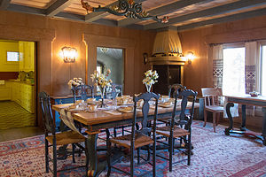
 Vikingholm Mansion Dining RoomOne thing we didn’t take into consideration when we were wandering along the Eastern Sierra, like two free spirits without a care in the world, was it was Labor Day Weekend, and we didn’t have camping reservations in the Lake Tahoe area, our next destination.
I got online and tried the state parks along the lake, but they were all booked. Finally, I was able to get a site at KOA South Lake Tahoe, about 5 miles south of the lake. This is one of the Catch 22 situations where you want to find a campsite, but wonder what’s wrong with any you find. I guess this one was still available because it was a few miles from the lake. Hopefully, it wouldn’t be too bad.
Our drive from Bridgeport to South Lake Tahoe took us north along US 395 and then northwest on the highly scenic and highly stressful US 89. This was the first really steep and windy road that we encountered since our nail biter out of Yosemite. We took advantage of every pullout there was, but still the brakes managed to overheat, so we spent a lot of time just sitting and letting them cool off to be safe. By the time we arrived in South Lake Tahoe, Herb was pretty much toast.
 Herb Lunching on Rubicon TrailThe campground was okay. It had a nice pool, but our campsite was pretty small and unlevel. Fortunately, once we got the motorhome situated and on leveling blocks, we wouldn’t have to move it for a few days.
The woman that checked us in at the campground office suggested that we not go anywhere near the lake that afternoon or evening because there was going to be fireworks over the lake and that always resulted in huge traffic jams, as early as 4:00 in the afternoon. We should have listened, but not having anything else to do, we ventured out anyway with our goal being the Emerald Bay Scenic Overlook. As soon as we got anywhere near the lake, traffic was completely stopped as people vied for roadside parking – any legitimate parking was already long gone. Finally, we gave up, made a U-turn and returned to the campsite.
Vikingsholm and the Rubicon Trail
 Cliff Diving on Rubicon TrailThe next morning, however, we set out again for the Emerald Bay Lookout, this time to hike down to the lake to the Vikingsholm Mansion and the Rubicon Trail. Although the parking lot was full, there was plenty of turnover, since most people were just walking out to the lookout and back. We found a car that was pulling out, and the gentleman in it was kind enough to not only give us his space, but also his $10 parking fee ticket.
From the parking lot, we hiked a very short distance to a lovely view of Lake Tahoe and its only island – Fannette Island, a stubborn block of sparsely timbered granite that refused to be pushed along by the glacial ice that gouged out this Bay more than 12,000 years ago. Its very existence is what makes Emerald Bay so picturesque.
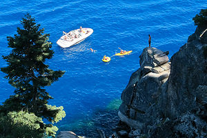
 Boats in Calawee CoveFrom the lookout, we took a steep, one-mile trail down to the lakeshore to the Vikingsholm mansion, which is part of Emerald Bay State Park. There is no vehicle access to the lakeshore of Emerald Bay, so the only way to get here is on foot or by boat.
I love going on mansion tours and seeing how people lived in different times and places. We have been on our fair share of them over the years, our favorites being the grand “cottages” in Newport, Rhode Island and, of course, the Hearst Castle. When Tommy was little he used to hate these tours. He called them “butt tours,” because he was eye level with the rest of the tour groups’ butts.
Well, today we would go on a butt tour of the Vikingsholm Mansion, one of the finest examples of Scandinavian architecture in the world – or at least, outside of Scandinavia. It is a replica of a 1,200 year old Viking castle, built with materials native to the Tahoe Basin area.
 Lolo approaching Calawee Cove for a DipThe castle was built in 1929 by Mrs. Lora Josephone Knight, with the help of about 200 workers. Mrs. Knight furnished the house with Scandinavian antiques and hired artisans to build period reproductions.
As you might expect from a Viking-inspired designed, there are intricately-carved dragons throughout the house, especially along the roof ridges and beams. During the 11th century, when Christianity was first introduced to Scandinavia, they were a little skeptical that it would be entirely effective. So, to hedge their bets, they carved dragon heads in church entrances to provide a little extra protection against evil spirits.
Another interesting feature of the design is the sod roof, which covers both the north and south wings. It would be lovely to be here in spring, when the roof sprouts with colorful wildflowers.
Unlike other mansion tours we have been on, this one emphasized the architecture more than the person that lived in it. However, during the tour and afterwards, I did find out some interesting facts about Mrs. Knight:
• She was not Scandinavian, but English
• She also owned Fannette Island and built a “Tea House,” which looks like a miniature castle on its summit
• She was extremely kind and generous to her servants
• She and her husband were the primary financial backers of Lindbergh's non-stop solo flight across the Atlantic in 1927.
• She must have been a smart investor because she managed to hold onto the house and the servants, despite the Stock Market Crash and the Great Depression.
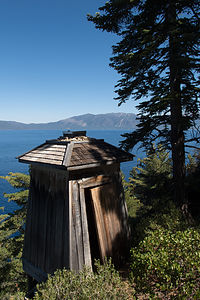
 Lake Tahoe Old 1916 LighthouseAfter the tour, we hiked along the shoreline of Emerald Bay on the scenic Rubicon trail, which goes all the way to Rubicon Point in D.L. Bliss State Park 4 ½ miles away. The trail pretty much traces the shoreline, sometimes at lake level and other times rising high above for sweeping views out over the lake and mountains.
From Rubicon Point, we hiked down to Calawee Cove Beach, which was pretty crowded – this was after all Labor Day. The water was a little chillier than we were used to, but we jumped in anyway, to cool off before our hike back.
The Rubicon Trail is really an out-and-back hike, but there is a spur trail from Calawee Cove to the old 1916 lighthouse, one of four navigational lights on Lake Tahoe. I love lighthouses, and I am not sure what I was expecting, but this one really cracked me up. I actually thought it was an outhouse. When I think lighthouse, the words tall, majestic, and visible come to mind, but this one was short, undignified, and hidden in the trees. Maybe I’m a New England lighthouse snob, but seriously.
Okay, enough picking on the lighthouse. We continued on eventually rejoining the main Rubicon Trail. On the way back we stopped at the boat-in campground in Emerald Bay State Park and took another swim near the campground dock.
Then it was back past the lovely Vikingsholm and up the steep trail to the parking lot. It was a very robust hike, 11.9 miles and a 600-foot elevation gain at the end, but thankfully tomorrow would be a rest day.
Secret Cove and MacDuff’s Pub
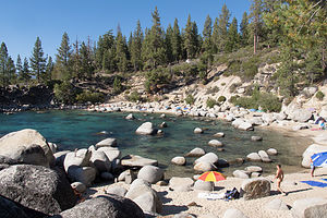
 Lolo on Rock in Secret CoveFor our final day in Tahoe, and really our final day of vacation – the rest was just driving back to Petaluma and storing the motorhome – we decided to drive along the eastern shores of Lake Tahoe to one of its most beautiful beaches, Secret Cove.
Secret Cove is one of a series of pristine beaches located along Highway 28 on the remote Nevada eastern shore, many of which, including this one, are clothing optional. It’s a little difficult to find, and even more difficult to find a parking space in the small and infrequent pullouts along the Highway.
Since the highway is quite high above the lakeshore, we had to lug our beach chairs, cooler, etc. down a steep ½-mile or so trail to get to the beach. I had suggested bringing the tubes along as well, but Herb looked at me like I was nuts.
 Sailboat in Secret CoveWhat we found when we finally reached the beach is that Secret Cove is not all that secret, and there were already dozens of sunbathers, most of them exercising their “option” to be au naturel. The rock-strewn beach and cove was absolutely stunning. We tucked ourselves behind one of the larger boulders, which provided us with some degree of privacy.
Knowing me all too well, Herb knew exactly what I was looking at – no not the naturists, but the plethora of tubes and floats that people had dragged down the trail to the beach. So, good husband that he is, he made the long trek back up the steep trail to the car, blew up the tubes, and carried them back down to his adoring and appreciative wife. They were very fun to float in and I very much appreciated Herb’s efforts at keeping me happy.
 Secret CoveA little after lunch, the conditions in the cove changed dramatically, without any noticeable change in the weather. The water, which had been like glass in the morning, was now quite rough and choppy. There were even white caps in the cove. We were told by other beachers that this usually happens in the afternoon. Tahoe is a very big lake, and as the day goes on, the seas build up and create these conditions, especially on the north end of the lake along the eastern shore. Almost like clockwork, every day from 2:00 to 8:00 pm, the Tahoe Zephyr (you know it’s not good when it has a name) blows from the west, reaching wind speeds of 10 to 15 mph, with 20+ gusts.
I have this tendency of not letting reality get in the way of my good time, so, much to Herb’s amusement, I floated about in my tube, desperately trying to appear relaxed, all the while being buffeted into the rocks by the waves. Finally, I gave up – just too rough.
 Lolo Tubing in Secret CoveOn the way back to South Lake Tahoe, I used the Yelp app on Herb’s phone to look at restaurant reviews. We really find this very helpful when in a place we know little about, and it has rarely steered us wrong. MacDuff’s Pub had by far the best reviews and even more importantly, the most reviews. Although not on the lake, the outdoor patio was lovely, and we very much enjoyed the food and the service.
It was a nice way to close a wonderful vacation – well, at least the fun part of it anyway. The rest was just driving back to Petaluma, dealing with more motorhome repair issues, putting it back in storage, and flying home – all stressful stuff.
For now though, we looked back rather than forward, reminiscing about the amazing places we had seen and the wonderful people we had shared them with.
Description
 Emerald Bay ShorelineI am not even going to attempt to give a full description of what Lake Tahoe has to offer, as we only spent a short time on its southern shore.
However, briefly, Lake Tahoe is one of the highest elevation lakes (6,255 feet high) in the U.S., as well as the second deepest (1,645 feet deep) – Crater Lake is the deepest. It is located along the border between California and Nevada. The four shores of the lake are each quite different. The north is quiet and upscale, the west and east are more rugged and less developed, and the south shore is busy and tacky with neon-lit hotels and casinos. The 72-mile drive around the lake is very scenic.
Lake Tahoe is known for its clear blue and green waters and the panorama of mountains that surround it on all sides. It is a year-round destination with swimming, boating, kayaking, and various other kinds of water sports during the summer; hiking, backpacking, and camping all year round; and tremendous skiing and snowboarding in the winter.
- ‹ previous
- 6 of 8
- next ›
Lake Tahoe location map in "high definition"
Javascript is required to view this map.
