- Home
- About
- Map
- Trips
- Bringing Boat West
- Migration West
- Solo Motorcycle Ride
- Final Family XC Trip
- Colorado Rockies
- Graduates' XC Trip
- Yosemite & Nevada
- Colorado & Utah
- Best of Utah
- Southern Loop
- Pacific Northwest
- Northern Loop
- Los Angeles to NYC
- East Coast Trips
- Martha's Vineyard
- 1 Week in Quebec
- Southeast Coast
- NH Backpacking
- Martha's Vineyard
- Canadian Maritimes
- Ocracoke Island
- Edisto Island
- First Landing '02
- Hunting Island '02
- Stowe in Winter
- Hunting Island '01
- Lake Placid
- Chesapeake
- Provincetown
- Hunting Island '00
- Acadia in Winter
- Boston Suburbs
- Niagara Falls
- First Landing '99
- Cape Hatteras
- West Coast Trips
- Burning Man
- Utah Off-Roading
- Maui
- Mojave 4WD Course
- Colorado River Rafting
- Bishop & Death Valley
- Kauai
- Yosemite Fall
- Utah Off-Road
- Lost Coast
- Yosemite Valley
- Arizona and New Mexico
- Pescadero & Capitola
- Bishop & Death Valley
- San Diego, Anza Borrego, Joshua Tree
- Carmel
- Death Valley in Fall
- Yosemite in the Fall
- Pacific Northwest
- Utah Off-Roading
- Southern CA Deserts
- Yosemite & Covid
- Lake Powell Covid
- Eastern Sierra & Covid
- Bishop & Death Valley
- Central & SE Oregon
- Mojave Road
- Eastern Sierra
- Trinity Alps
- Tuolumne Meadows
- Lake Powell Boating
- Eastern Sierra
- Yosemite Winter
- Hawaii
- 4WD Eastern Sierra
- 4WD Death Valley +
- Southern CA Deserts
- Christmas in Tahoe
- Yosemite & Pinnacles
- Totality
- Yosemite & Sierra
- Yosemite Christmas
- Yosemite, San Diego
- Yosemite & North CA
- Seattle to Sierra
- Southwest Deserts
- Yosemite & Sierra
- Pacific Northwest
- Yosemite & South CA
- Pacific Northwest
- Northern California
- Southern Alaska
- Vancouver Island
- International Trips
- Index
- Tips
- Books
- Photos/Videos
- Search
- Contact
Mono Lake , CA
Friday, August 29, 2014 - 7:00am by Lolo
51 miles and 1.5 hours from our last stop
Travelogue
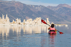 Lolo Kayaking among the Tufas of Mono LakeFor anyone traveling through the Eastern Sierras, a stop at the Mono Lake South Tufa Reserve to see the “tufa castles” is a must. It’s a place like no other.
Mono Lake is definitely not your typical lake. Besides being over a million years old, and probably the oldest continuously existing lake in North America, it is 2 ½ times saltier than the ocean and 80 times more alkaline. This is because the water that flows in from the Sierra streams, carrying trace amounts of salts and minerals with it, has no way to leave the lake other than evaporation. So, the concentration levels of these salts and minerals keeps building up year after year. I think it’s the same reason that the Great Salt Lake in Utah is so salty. However, although the Great Salt Lake might be more famous for its saltiness, Mono Lake does have one it doesn’t—“tufa castles.” Tufa, not to be mistaken with “tofu,” are calcium-carbonate deposits that form in lakes with high calcium contents. Normally they would just be hidden beneath the water, but as lake levels dropped, they became exposed, some of them rising as high as 30 feet above the surface—and they do look like castles.
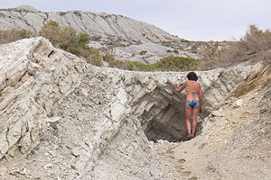 Lolo Exploring Paoha IslandOne of the best places to see the tufas is at the Mono Lake South Tufa State Reserve along the southern shoreline of the lake. Back in 2007, it was from this very shoreline that I was brave enough to swim with the tufas, allowing my body to be coated with salt and brine flies, while my wimpy family just looked on from the shore.
This time, however, our plan was to launch our kayaks and paddle through and around the tufas and out to Paoha Island. Herb and I had been dying to use our kayaks, which are now stored out on the West Coast with our motorhome, and this was our first real opportunity to do so this trip. We had thought about paddling around Tenaya Lake in Yosemite, but the day we were there was cloudy and cold, so we hiked to stay warm instead.
The best place to launch a kayak on Mono Lake is from Navy Beach, which is just ½ mile east of the South Tufa area by water, but a fairly longer drive along a bumpy dirt road to the launch parking lot. From there, you have to carry your kayak and gear about 30 yards down to the water.
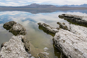 Paoha Island ShorelineBesides us, there was a group of about half dozen a kayakers that were part of a guided tour. We seemed to be the only ones venturing out on our own.
It was a perfect day, extremely calm and the water was like glass. Very fortunate for us, because often the winds on the lake are so strong that kayaking is strongly discouraged. Mornings are usually calmer, with winds picking up in the afternoon, so fortunately we had gotten an early start and would just keep an eye out for changing conditions in the afternoon.
We started out to the west towards the South Tufa Reserve. So did the guided group, as this is where the action is. It was surreal paddling amongst these extraordinary tufa castles, so very different from any kayaking experience we have had to date. Herb must have taken about 100 photos in the first 15 minutes.
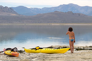 Paoha Island View of Lake mit LoloFrom there we headed out towards Paoha Island, which according to the Ranger was a little over 3 miles from Navy Beach. Herb has a much longer kayak than mine, which goes a lot faster, so he got quite a bit ahead of me. I didn’t mind though. It was so quiet and peaceful being alone. Sometimes I would just stop paddling, lean back, and just gaze at the mountains and the clouds.
There’s something very deceptive about distance on the water, especially when you are far from the shore. I kept paddling and paddling and the island just never seemed to get any closer. That’s when I started to get a little annoyed that Herb wasn’t by my side. I couldn’t even see him anymore.
Finally, the island cooperated and stopped moving away from me, and I paddled up onto a beach – fortunately, the same one Herb had paddled up on, probably a half hour ago. It felt like I was landing on the moon.
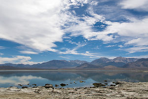 Mono Lake SkyEverything was kind of a chalky white and crunched under your feet when you walked. Sometimes my feet broke through the crusty surface, which was primarily comprised of calcium carbonate, like the tufas.
Life so many features in this area of the country, this island had volcanic origins. Normally, I would classify volcanic eruptions as a bad thing, but they are responsible for so many beautiful wonders that they can’t be all bad. I just hope they do their work when I’m not around.
In the case of Paoho Island, the eruptions were quite recent – just 350 years ago. Before that this island did not exist. At that time, volcanic eruptions on the lakebed pushed sediments and volcanic material above the lake surface, forming this island, which rose 290 feet above the lake.
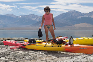 Lolo with KayaksIt was so desolate that I felt a bit like Robinson Crusoe or Tom Hanks in Castaway, except that we had kayaks to leave whenever we wanted. However, we didn’t want to leave just yet, and I am not sure if Herb ever wanted to leave. Besides heat and sun, Herb’s favorite thing in the world (besides me) is solitude, and today he had an abundance of all three. He was in heaven and declared it a trip highlight, an honor sparingly bestowed.
We even went for a swim and discovered, as we had in the Great Salt Lake, that the higher salinity really does make it easier to float. I could even raise my hands above the water and still stay afloat. The only downside was that after we got out and dried off, we were completely covered in a white film of salt.
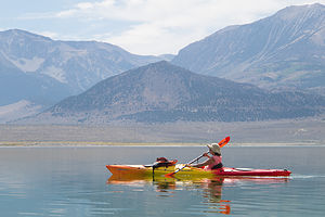 Kayaking Back from Paoha IslandThe water was still calm, but I didn’t want to press my luck. The thought of paddling those endless three miles in windy conditions was not a pleasant one. So after about 2 hours of playing Castaway, we began our paddle back to Navy Beach. Once again, Herb got way ahead of me. At first, I struggled to keep up, but then I thought, what the heck, I am going to enjoy this at my own pace, so I went back to my routine – paddle for awhile, rest and gaze at mountains and clouds, paddle again, gaze again, and so on. It was wonderful.
What a great day and our timing had been perfect. By the time we got to the Visitor Center in Lee Vining, the winds had picked up and were gusting over 20 mph. That would not only have been strenuous, but unsafe as well. So far, with the exception of a few clouds and cooler temps in Tuolumne Meadows, the weather had really been cooperating beautifully.
Description
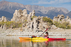 Lolo and the TufasMono Lake is located just off Highway 395 near the town of Lee Vining, California, 13 miles east of Yosemite National Park. Mono Lake is extremely unique. First of all, at over 1 million years of age, it is one of the oldest continuously existing lakes in the continent. Secondly, it is about 2 ½ times as salty as the sea and about 80 times as alkaline. This is because Sierra streams flow into Mono Lake bringing trace amounts of salts and minerals, but the lake has no outlet other than evaporation. As a result, the concentration levels of salts and minerals keeps growing each year. Thirdly, and the main reason Mono Lake is so popular, are the hundreds of spectacular “tufa towers” that rise from the lake. These intriguing calcium-carbonate sculptures were formed beneath the water when carbonates in the water combined with calcium from freshwater springs feeding into the lake. As lake levels dropped, these extraordinary-looking knobs, spires, and minarets became exposed. Most of the towers visible in the lake are from 200 to 900 years old and rise as high as 30 feet above the water.
A good place to start your visit is at the Mono Basin Scenic Area Visitor Center, located just off Highway 395, north of Lee Vining, where you will find exhibits about both the natural and human history of the Mono Basin.
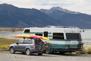 Lazy Daze and Forester with Kayaks at Mono LakeOne of the best places to view the tufas is at the Mono Lake Tufa State Reserve along the southern shoreline of the lake. The trailhead for the south tufa castles and Navy Beach is at the edge of the parking lot. During the summer, rangers lead walking tours 3 times a day (10am, 1pm, and 6pm), but if your not lucky enough to catch one of these, there are plenty of informative signboards along the trail. A short walk along the mile-long trail brings you to the strange and fanciful tufa castles at Navy Beach. A swim in the buoyant waters of Mono Lake is a memorable experience, as long as you are willing to step through the millions of harmless alkali flies that line the water’s edge. It’s fun to watch what at first looks like black sand part before you.
Surrounded by volcanic hills, Mono Lake is also a geologist's paradise. The two major islands in the lake are actually volcanic domes. The large black island, which the Kuzedika Indians named Negit, meaning “blue-winged goose,” erupted about 1700 years ago. The white island, which the Native Americans named Paoha, meaning “spirits of the mist,” erupted 250 years ago.
Bird watching and photography are other popular activities at Mono Lake.
- ‹ previous
- 4 of 8
- next ›
Mono Lake location map in "high definition"
Javascript is required to view this map.
