- Home
- About
- Map
- Trips
- Bringing Boat West
- Migration West
- Solo Motorcycle Ride
- Final Family XC Trip
- Colorado Rockies
- Graduates' XC Trip
- Yosemite & Nevada
- Colorado & Utah
- Best of Utah
- Southern Loop
- Pacific Northwest
- Northern Loop
- Los Angeles to NYC
- East Coast Trips
- Martha's Vineyard
- 1 Week in Quebec
- Southeast Coast
- NH Backpacking
- Martha's Vineyard
- Canadian Maritimes
- Ocracoke Island
- Edisto Island
- First Landing '02
- Hunting Island '02
- Stowe in Winter
- Hunting Island '01
- Lake Placid
- Chesapeake
- Provincetown
- Hunting Island '00
- Acadia in Winter
- Boston Suburbs
- Niagara Falls
- First Landing '99
- Cape Hatteras
- West Coast Trips
- Burning Man
- Utah Off-Roading
- Maui
- Mojave 4WD Course
- Colorado River Rafting
- Bishop & Death Valley
- Kauai
- Yosemite Fall
- Utah Off-Road
- Lost Coast
- Yosemite Valley
- Arizona and New Mexico
- Pescadero & Capitola
- Bishop & Death Valley
- San Diego, Anza Borrego, Joshua Tree
- Carmel
- Death Valley in Fall
- Yosemite in the Fall
- Pacific Northwest
- Utah Off-Roading
- Southern CA Deserts
- Yosemite & Covid
- Lake Powell Covid
- Eastern Sierra & Covid
- Bishop & Death Valley
- Central & SE Oregon
- Mojave Road
- Eastern Sierra
- Trinity Alps
- Tuolumne Meadows
- Lake Powell Boating
- Eastern Sierra
- Yosemite Winter
- Hawaii
- 4WD Eastern Sierra
- 4WD Death Valley +
- Southern CA Deserts
- Christmas in Tahoe
- Yosemite & Pinnacles
- Totality
- Yosemite & Sierra
- Yosemite Christmas
- Yosemite, San Diego
- Yosemite & North CA
- Seattle to Sierra
- Southwest Deserts
- Yosemite & Sierra
- Pacific Northwest
- Yosemite & South CA
- Pacific Northwest
- Northern California
- Southern Alaska
- Vancouver Island
- International Trips
- Index
- Tips
- Books
- Photos/Videos
- Search
- Contact
South Lake Tahoe
Sunday, December 25, 2016 - 11:15am by Lolo205 miles and 4 hours from our last stop - 2 night stay
Travelogue
 Alpenglow over Lake TahoeAlthough we were pretty much packed beforehand, the final loading of the car in the morning was once again a spectacle of excess – two snowboards, two pairs of downhill skis, three pairs of cross country skis, plus food, clothing, etc.
Since Herb’s Forester has the most storage capacity, we switched the Thule car-top box from Tommy’s car onto Herb’s, loaded it up, and hit the road. Even with that, Tommy and I were squooshed together on half of the backseat, shackled together by one seatbelt. Let’s just say that it was very cozy.
After decades of shoveling snow in New Jersey, I definitely like the Northern California concept of “driving to the snow.” As soon as we hit the tiny town of Kyburz (population 167) on Route 50, we were in a virtual winter wonderland. Cars were parked alongside the road for miles, with families pulled over to play in the snow. What a wonderful Christmas scene! Our already high spirits were soaring.
 Our cozy little cabin in Camp RichardsonI didn’t know what to expect in terms of our cabin at Camp Richardson, but when we checked in we were totally blown away. Everything about it exceeded expectations – the two bedrooms were roomy, the kitchen was well stocked, the gas stove was already lit to greet us, and our picture window looked out over Lake Tahoe. “I’ve done it,” I gloated, as I saw the pleased looks on the faces of my adoring family.
After unpacking, we took a walk along the snow-covered beach, admiring and photographing the colorful alpenglow over the lake and surrounding mountains. We also watched in awe as one brave (or perhaps crazy) young man, obviously put up to it by his friends, stripped down to swimming trunks and jumped in.
Back at our cozy little cabin, we cooked dinner and played Trivial Pursuits, before heading out once again for a walk – this time towards the nearby Tallac Historic Site, where there are three “Old Tahoe” style estates from the early 1900s, back when Tahoe was a summer retreat for the socially prominent families of San Francisco.
 Beach walkWhen we come to Camp Richardson in the summer, we love running on the paths that weave in and out of the estates, and even have returned in the evenings to sit in the rocking chairs on the porch of one, pretending that we were members of the "vieux riche."
Although we had headlamps, it was too dark to really get an appreciation for the homes, so we decided to walk back along the snowy beach and return to the Site another time when it was still light out.
As we were walking along the beach, we came across a large snowy ball, which looked like the bottom of a snowman. However, upon closer inspection, we realized that it was actually a snow-covered mooring ball.
It was while staring at this “ball” that the idea of a Gaidus “Feats of Strength” competition was born – inspired by the Seinfeld Festivus episode. However, rather than try to pin each other to the ground as the Costanzas did, we decided that our feat of strength would be lifting the large snow-covered mooring ball over our heads and throwing it as far as we could.
Herb immediately began whining that he didn’t want to throw his back out and ruin his chances of skiing the next day. However, he was taunted into participating by his sons.
 Feats of StrengthI reluctantly went first, but the damn thing was so heavy that I couldn’t even lift it over my head, and sort of just rolled it before removing myself from the competition and declaring myself the line judge for their throws.
I have probably never laughed so hard as I watched each of my loved ones take a turn at hoisting a ridiculous beach-ball sized object that weighed about 30 extremely awkward pounds over their heads, stepping up to a line drawn in the snow, and hurling it as far as they could. The “feat” was generally accompanied by a loud grunting sound, especially in Herb’s case.
I think that Tommy won by about three inches, but in reality we were all winners in that no one threw their backs out and the only pain we felt was from laughing so hard. Plus, a new Gaidus Christmas tradition had been born.
Cross Country Skiing and more Reindeer Games
 Trail to Fallen Leaf LakeThe next morning when I stumbled out of our bedroom, I found Herb ever so cozily sipping coffee in a chair by the stove, peacefully gazing out over the lake. It was so idyllic that I had to stop myself from further gloating as to delivering the family the perfect holiday experience.
It was difficult though, because everything was breaking my way this trip. First there was the fortuitous timing of my call to Camp Richardson to book a cabin an hour after someone had canceled the last available one.
Then there was the timing of the snowstorm on Christmas Eve - delivering a white Christmas and providing enough snow to cross country ski, while giving the road crews enough time to clear the roads before our arrival on Christmas day.
So, thanks to the storm, today we would cross country ski, right from our cabin through the forest to Fallen Leaf Lake, a few miles south of Lake Tahoe, and then back along the trails that wound through the Tallac Historic Site.
Herb, Tommy, and I had brought our own cross country skis, but Andrew needed to rent them. Fortunately, Camp Richardson has its own Mountain Sports Center, right on the premises next to the RV campground, so it was very convenient to just walk over and pick up a pair. At $19 for a full day, the price was very reasonable as well.
 Family by Fallen Leaf LakeThe staff was extremely helpful suggesting places to ski. They pointed us to a trail that started right behind their building that would bring us over to Fallen Leaf Lake.
About 8 inches of snow had fallen – not enough for them to machine groom the trails, but still plenty to ski on. The conditions were excellent, and since we were far from being the first skiers on them, no trail breaking was necessary.
After about 2 1/2 miles through the woods, we came to our first view of pristine Fallen Leaf Lake with snow-covered Mount Tallac across the way. We took off our skis and scampered down to lake level to better enjoy the view.
From there we skied to a beach on the northern end of the lake where there was a bench and a large rock about 100 feet from the shoreline, just begging to have snowballs thrown at it. Of course, we spent the next ½ hour taking turns trying to hit the rock with snowballs. What is it with this family and “Feats of Strength?”
From there, we skied back through the woods and across Route 89 to our cozy little cabin on the lake to have lunch.
 Herb XC skiing on Baldwin BeachAfter lunch we went out on the skis again, this time through the Tallac Historic Site, which we had been unable to appreciate in the dark the night before, and out to Baldwin Beach for more terrific views of Lake Tahoe and the surrounding mountains.
It was getting near 3:00 and the Mountain Outdoor Center closed at 4:00, so we skied back along the beach so that Andrew could return his skis in time. Not quite done yet, after the drop-off, we continued east along the southern shore of the lake to Pope Beach, three of us on skis and Andrew jogging with a pair of yaktrax attached to his sneakers.
All in all, we skied about 11 miles that day – not a bad day’s work.
Alpine Skiing at Heavenly Mountain Resort
 Heavenly GondolaHerb and I originally had no intention of downhill skiing during a busy holiday week, but Tommy convinced us that unlike east coast ski resorts, where you can wait as long as 30 minutes on a lift line, west coast ski resorts are much larger and can move people a lot more quickly.
There are several ski resorts in the South Lake Tahoe area to choose from – Heavenly, Sierra, Kirkwood, to name a few – but Tommy was pretty sure that I would like Heavenly best, because besides the fantastic views, it was a gentler mountain meant more for intermediate skiers.
Okay, we were convinced, so rather than pay the same-day $145 lift ticket price, we bought our discounted ones online the night before for $131 – still a bit pricey as far as I’m concerned. But as the boys said, “This is probably the last time we will ski together as a family.” I’m not sure where I was going? Did they know something I didn’t?
Since we had to drive back to San Francisco today, we got up bright and early so that we could get a lot of skiing in early and hit the road before it got too late. Fortunately Tommy had been to Heavenly many times and, as a result, knew the logistics – park behind Harrah’s Casino and walk with your ski boots right onto the gondola in Heavenly Village.
 Heavenly Mountain ResortWe were one of the first ones on the gondola, which scooted us up almost 3,000 feet over 2.4 spectacular miles to Tamarack Lodge, where we could catch another lift to the top of the mountain. The gondola ride was an event in itself, and many people do just that to get to the observation deck, which has wonderful views of Lake Tahoe and the surrounding mountains.
I recorded our skiing that day on Strava, so I know that over a 5-hour period we did 15 runs for a distance of 37.8 miles (counting up and down) and a total elevation gain of 18,534 feet.
With the exception of skiing at Badger Pass in Yosemite last Christmas, which is really a pretty small mountain even by east coast standards, this was Herb’s and my first real west coast skiing experience. I would have to say that it was pretty incredible.
Description
 Winter SailingI am not even going to attempt to give a full description of what Lake Tahoe has to offer, as we only spent a short time on its southern shore.
However, briefly, Lake Tahoe is one of the highest elevation lakes (6,255 feet high) in the U.S., as well as the second deepest (1,645 feet deep) – Crater Lake is the deepest. It is located along the border between California and Nevada. The four shores of the lake are each quite different. The north is quiet and upscale, the west and east are more rugged and less developed, and the south shore is busy and tacky with neon-lit hotels and casinos. The 72-mile drive around the lake is very scenic.
Lake Tahoe is known for its clear blue and green waters and the panorama of mountains that surround it on all sides. It is a year-round destination with swimming, boating, kayaking, and various other kinds of water sports during the summer; hiking, backpacking, and camping all year round; and tremendous skiing and snowboarding in the winter.
Two interesting nearby sites we did enjoy, include:
Tallac Historic Site
The Tallac Historic Site is comprised of three private estates dating back to the early 1900s, which served as summer retreats for three very socially prominent families from the San Francisco Bay area. In an effort to preserve “Old Tahoe,” the U.S. Forest Service acquired 74 acres, which included the three estates and a quarter mile of lakefront between Emerald Bay and Camp Richardson.
Today the remains of the restored estates attract thousands of visitors interested in recapturing this bygone and significant era in Tahoe’s history. Although the architecture of each is unique from its neighbors, each captures some aspect of the “Old Tahoe” style.
A list of activities and tours is available at the Visitor Center and the Baldwin museum.
Fallen Leaf Lake
 Fallen Leaf LakeIf the thought of kayaking in a lake as large as Tahoe is a bit intimidating, as it was for me, there is a wonderful alternative just a mile south of Camp Richardson. Fallen Leaf Lake, which was created by glaciers, is approximately 3 miles long and 1 mile wide. If the glacier had continued, Fallen Leaf Lake would have been just another bay in Lake Tahoe.
The land surrounding the lake is privately owned, leased from the U.S. Forest Service, and part of the Lake Tahoe Basin Management Unit. Except for a marina and store at the southern end of the lake, there is very little commercial development. As a result, the water quality is extremely good.
Home Sweet Home
Saturday, October 1, 2016 - 1:30pm by Lolo460 miles and 8 hours from our last stop - 1 night stay
Travelogue
 Home Sweet Home8 hours to go. I can’t believe our odyssey was almost over.
I also couldn’t believe that now that we were no longer the length of a semi-trailer, we didn’t have to stop at truck stops for lunch anymore.
So, instead of our daily fare of Subway heroes, we stopped at In-N-Out Burger in Livermore – we were going to have to wean ourselves gradually off fast food to avoid an adverse reaction.
Finally, the Suburban and our new home met for the first time.
Description
The final drive north on I5 to our home in Sonoma County
Boulder City, Nevada to Barstow
Friday, September 30, 2016 - 1:30pm by Lolo133 miles and 2 hours from our last stop - 1 night stay
Travelogue
 Last motel breakfastAs we traveled southwest along I15, I had this aching feeling that we had forgotten something. I just couldn’t look in the rear view mirror without being surprised each time that the boat was no longer behind us. We missed it already, although I didn’t miss having to go to Truck Stops for lunch.
Tired from all the work prepping and storing the boat, we only drove a few hours, stopping at a Super 8 in Barstow, California.
We used the Yelp App to look for restaurants and chose the #3 choice in Barstow - Jenny’s Grill and Mariscos, even though we had no idea what a marisco was. Luckily we didn’t know, because I later learned it means “shellfish,” and Herb is highly allergic.
This was it – our last dinner on the road. I did kind of like not having to cook, but it sure would be good to get back home.
Description
Drive southwest along I15 from Boulder City, Nevada, into California with a stop for the night in Barstow
Lake Mead National Recreation Area
Monday, September 26, 2016 - 6:30pm by Lolo325 miles and 4 hours from our last stop - 4 night stay
Travelogue
 Sunset over Lake MeadThe last day of dragging the boat around the country was upon us, for today we would reach Lake Mead, the boat’s intended home -- at least for awhile.
We had decided before embarking on this trip that rather than bringing the boat all the way back to California, we would let it live for awhile in the desert. Although we had first thought of storing it at one of our favorite places on Earth, Lake Powell in Utah, we settled instead on the more easily accessible, and still very stunningly beautiful, Lake Mead, just 30 miles outside of Las Vegas.
Before leaving home, we had reserved a storage site at the nearby Boulder City Boat Storage facility. However, before tucking it away, we thought it (and we) deserved a few days playing and camping on this beautiful lake.
Day 1 – Lake Mead Marina and short sunset cruise across Boulder Basin
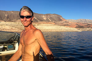 Happy Herb finally on Lake MeadOur original intention for our first night by Lake Mead was to stay at a motel, so that I could watch the second Presidential Debate – I am a bit of a political junkie. However, as we got our first view of this gorgeous lake from the Visitor Center, we figured it was stupid to pay a lot of money just to watch something that we could read about the next morning. It would be much more fun to sleep out under the stars and forget that the presidential election was even going on.
So, we continued down the hill from the National Recreation Area Visitor Center to the Lake Mead Marina, situated on the southern shore of Boulder Basin, on the southwestern end of the lake, about 2 miles (as the crow flies) from the Hoover Dam and only about 4 miles by boat.
We got a transient slip for the night. It was only $20 – what a deal! For now, we only booked one night, because we weren’t sure yet whether we wanted to spend the next few nights at a marina dock or anchored in a remote cove. There were plusses and minuses to both, but we would put that decision off until later.
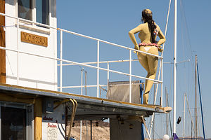 Young lady ready to party at Lake Mead MarinaWe launched the boat at a rather dubious launch area – not knowing at the time that the real launch ramp was located about a mile west by the Las Vegas Bay Marina. However, things went smoothly, and we were soon established in our new home for the night at the end of the transient dock.
You could tell we were near Las Vegas, just by the general party feel there was to the marina. It was quiet now, being a Monday night in late September, but I could just imagine what this place was like on a summer weekend. Most of the boats in the marina were houseboats – perfect for large groups of people celebrating the end of a work week. One right nearby left one of their revelers behind – a scantily clad, mannequin atop the upper deck gazing out over the lake, probably wondering where her party friends had gone.
We didn’t stay settled at the dock for long. The evening light was getting so good that we decided to take the boat out for a short spin across Boulder Basin to get an unobstructed view of the sun setting on the colorful sandstone cliffs surrounding the lake. It was absolutely stunning.
 The hills surrounding Boulder BasinWhen we got back to the dock at around 7:00 that evening, I walked over to the Boat House Restaurant at the end of the dock to check out the menu for later. It seemed pretty quiet, but the door was open, so I entered only to find empty tables and two people sitting at the bar, one of which was screaming at the TV set, which happened to have the presidential debate on. She stopped dead in her tracks, collected herself, and in her best restaurant hostess voice informed me that the kitchen had just closed.
So, it was Mountain House freeze-dried beef stroganoff on the camping stove for our first meal on Lake Mead.
I could deal with this.
Day 2 – Indian Canyon Cove
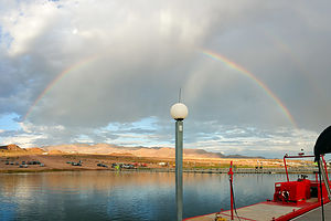 Rainbow (with no rain) by marinaSleeping in the Grady’s cozy littler cuddy cabin hadn’t been so bad – perhaps the gentle rocking and the sleep aid helped. It was quite nice to open the cuddy door and be greeted by the sun rising over the colorful cliffs. Since our boat is not exactly a yacht, it was nice to be able to just walk down the dock for the amenities we normally take for granted, like a restroom and shower.
Before heading off for breakfast at the marina restaurant, Herb and I had a mature discussion as to whether we should stay in the marina tonight or anchor in a cove. I know how much Herb loves remoteness and solitude, so I give him a lot of credit for letting me win for tonight with my desire for the creature comforts that the marina could provide. I promised him that tomorrow night we would venture out into the wild.
 Herb hanging out in Indian Canyon CoveWhen we walked into the Boat House Restaurant, I immediately recognized our waitress as being the politically impassioned one from the night before. I didn’t want to embarrass her so I pretended it never happened. However, when Herb made a comment about having never been here before, meaning Lake Mead Marina, she pointed at me and said, “She has!” which made me feel a bit as if I had been an intruder on her private moment of rage.
We quickly changed the subject and asked her if she could recommend some nice, remote coves to anchor in. She called over another gentleman that worked at the marina to join the conversation. Either none of the employees ever get out on the lake, or they’re keeping their favorite coves secret, because neither of them had any suggestions to offer.
After breakfast we went into the marine store to book another night at the dock and ask them about good places to go on the lake - still, nothing. They suggested we buy a detailed map of the coves, which of course they didn’t have, but suggested their nearby sister marina, Las Vegas Boat Harbor, might. I have never seen a marina so unable – or perhaps unwilling – to provide information to its guests.
 Lolo demonstrating use of float in Indian Canyon CoveSince we had to go to the food store in Boulder City anyway to stock up on supplies, we drove over to the other marina to see if they could perhaps be more helpful. I have a feeling that this is the main marina, because not only did they have the necessary maps and employees that were actually well informed and willing to share their knowledge, but there also was a top-notch concrete launch ramp – nothing like the sandy, undeveloped one we had used the night before.
Armed with navigational maps, local knowledge, and provisions from the food store, we headed out on the boat for a day of relaxation and fun.
The girl at Las Vegas Boat Harbor had given us the name of several coves to explore that would be scenic as well as possible to anchor in. Anchoring is a challenge in many of them, because the bottom tends to be rocky, making it difficult for the anchor to take hold, or, even worse, get stuck on a rock you finally do get hold of.
The water was smooth as glass and we cruised up the Boulder Basin Arm for about 10 miles into Sandy Cove on our left (excuse me, “port”). There were already a few boats anchored there, so we continued on looking for a cove to have to ourselves.
 Desert Bighorn Sheep in Indian Canyon CoveJust across from Sandy Cove, on the south side of the Arm, we discovered lovely and deserted Indian Canyon Cove. As expected, we (and by we, I mean Herb) had to spend a bit of time making sure we wouldn’t drift into the cliff walls. Not trusting solely that an anchor dropped to the bottom would keep us secure, Herb swam to the canyon walls – there really was no shoreline – to hook an anchor behind a rock.
Once secure, we set about the business of reading, swimming, gazing at the canyon walls, etc. It was as if we were the only inhabitants for miles – at least, the only ones on two feet. We were only there a short time before we heard what we thought was a minor rockslide along the canyon. For the next half hour, we quietly watched five desert bighorn sheep delicately make their way down the steep canyon wall to drink from the lake. They were absolutely beautiful!
It was quite hot out – probably close to 90 degrees -- but frequent dips in the 80 degree water made it very comfortable. We even managed to use our yellow float, which over the 10 years we have owned it, has never failed to wash away all our stress and cares.
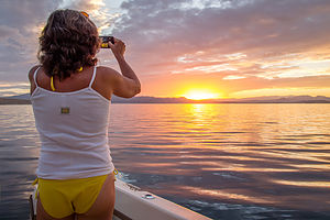 Lolo admiring the sunsetOn our way back, we stopped briefly in Fishfinder Cove to watch another incredible sunset.
Afterwards, my trusty captain safely navigated us in the dark back to the marina. That evening, after showering in the marina showers, we sipped wine, watched the stars, and ate the delicious salads we had bought at the Boulder City Vons today.
It had been a great day! Everyone needs some pristine wilderness to replenish the soul. A good marina shower after that replenishing isn’t so bad either.
Day 3 –the Narrows and Sidewinder Canyon
This was the day I promised Herb that I would enthusiastically leave the comforts and conveniences of the marina to camp out in the wild in a cove of his choice.
 View from our runI tend to be a bit restless when confined to small spaces, so knowing me as well as he does, Herb suggested we go for a run before departing on our journey - to get it out of my system. He calls it “running the spouse.”
As the lake is set in a basin, there was nowhere to go but up. So, we ran up the steep road from the marina back towards the Visitor Center atop the hill. Fortunately, we didn’t have to run along Highway 93, as there was a paved trail that paralleled it. It was already getting hot, so we stopped at the Visitor Center for a drink of water and then headed back down. It felt great to stretch the legs, and the views were fabulous along the way. I was now ready to sit still for awhile.
Back on the boat, we set out across Boulder Basin, which thankfully, once again, was as smooth as glass. In about 10 miles we passed the entrance to Indian Cove Canyon, where we had spent a delightful day yesterday, and continued on towards The Narrows, which connected Boulder Basin to Virgin Basin.
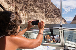 Approaching the NarrowsThe waterway connecting the two basins is about 5 miles long and significantly narrower (hence, the name), with beautiful cliffs, colored in layers of beiges and browns, rising steeply from the water’s edge. I am not sure, but I think the beige-colored rock used to be underwater when the lake was at full capacity, but is exposed now because the lake is down over 100 feet. That is about how far from the lake surface that the color distinctly changes from beige to brown.
Along the way, we cruised into a few coves to scout out possible anchoring spots for the night. The cove map we had bought back at the Last Vegas Bay Marina yesterday underlined in red all the coves that were good for houseboat mooring. These were the only ones we would consider.
Our first contender was Sidewinder Cove on the southern side. It definitely had potential – very private and pretty, with a narrow part at the end where we could place an anchor on the canyon walls on either side.
 Cruising through the NarrowsWe also checked out James Bay, also on the southern side, and Coyote Cove, on the northern side. Both of us liked Sidewinder Cove best.
However, before heading back to settle in for the night, we decided to continue out to the entrance to the Virgin Basin, just to see it. This last mile or so of the connecting waterway between the two basins is the official “Narrows.” At its narrowest point, I would have to guess that the canyon walls on either side are less than 100 yards apart.
Tomorrow we would explore out further into the Virgin Basin and up into the Overton Arm. For now though, we would cruise back to our home for the night at the end of Sidewinder Canyon.
Boating in Paradise is not all fun and glamour, so before settling into relax mode, there was the little issue of anchoring to deal with – and this was an important one, because we would be relying on it to keep us secure while sleeping.
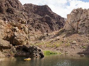 Sidewinder CoveUsing our yellow float to straddle and paddle to the sides of the canyon, Herb affixed an anchor on each side of the canyon so that we would stay put and not swing around and possibly into the rocks during the night.
I then took control of the yellow float and showed him how it should be used.
The sun was scheduled to set around 6:30, and since we were positioned between two canyon walls, it would get dark soon after that. Since wine and sunsets go so well together, Captain Herb declared an early start to cocktail hour, especially considering we would probably be in bed by 8:00.
Tonight was a new moon, and Lake Mead is a dark sky area, so needless to say, the number and brightness of the stars we saw that night was incredible.
Day 4 – the Narrows, Overton Arm, and Cathedral Cove
 Captain Herb in Cathedral CoveThe sun rose around 6:30 am, and as a result, so did we. We probably had gotten about 9 hours of sleep anyway. The boat was still securely anchored to the sides of the canyon. In fact, it had stayed so still during the night that I forgot I was even sleeping on the boat.
The canyon that morning was so quiet and serene. I must say I do like the way camping eliminates the clutter and noise of life and makes you focus on the simple things. Breakfast was just that – simple. Just bagels and cream cheese and coffee, and I would have to say they tasted better surrounded by pristine wilderness.
Our plan for the day was to take a cruise back out through the Narrows into the Virgin Basin, and then north up the Overton Arm. During a previous visit to the Lake with the boys back in 2007, we had rented a ski boat from the Echo Bay Marina up in the Overton Arm.
 Cathedral CoveHowever, now due to the low lake levels from the multi-year drought, that marina was closed. In fact, it was probably more than a half a mile from the lake now. A sign back at the launch ramp by our marina had warned boaters that there were no services north of The Narrows. That meant that only boats that could carry a lot of gas could make a trip up here and back. The good news was that there was no one up here, which meant that we had this whole section of the lake to ourselves. The bad news was there was no one up here, so we better not get in trouble.
Before departing, we took a quick dip, as it was already getting hot. Also, Herb had to retrieve the anchors from both side of the canyon first, or we weren’t going anywhere.
Back in the boat again, we cruised out of the cove and turned right into the Narrows, which in my opinion is the most stunning part of the lake. In comparison to the closeness of its canyon walls, the openness and vastness of the Virgin Basin felt more like an ocean.
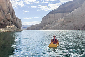 Herb relaxing in Cathedral CoveWe cruised up the Overton Arm looking for coves underlined in red on our map, meaning that they were good for houseboat mooring. Anchoring even in these recommended coves is tough, so we weren’t about to try one that wasn’t.
After 10 miles of nothing but non-underlined coves, we finally pulled into Cathedral Cove and immediately knew we had found our spot for the day. It was unbelievable, and there even was a little piece of sandy shore at its end where we could disembark and hike into a slot canyon.
If this cove was recommended for houseboat mooring, I would hate to see what one that wasn’t looked like. As we slowly inched our way towards the canyon’s end, I sat at the bow scanning the water for rocks, of which there were many, just enough below the surface to make them difficult to see, but close enough to do damage to a motor.
Anchor setting here was really challenging, because we had to not only ensure that the boat didn’t swing into the sides of the canyon or drift to shore, but also that it didn’t swing into any of the submerged boulders. It took quite a bit of maneuvering before we felt comfortable enough to relax.
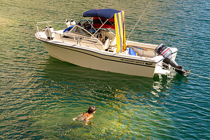 Refreshing dip in Cathedral CoveWe spent an absolutely incredible afternoon swimming, floating on our yellow float, and hiking into the slot canyon. It was like we were the only people on earth. I can see why boaters are hesitant to share information about their favorite coves. I might regret sharing the name of this one myself.
The wind began to pick up later in the afternoon, so we figured we better get out of here while we still could.
Releasing the anchors was going to be difficult. We would have to keep the motor running during the process, because we had to keep the boat from moving into the rocks once it was free. That meant that I, rather than Herb, would have to do the swimming and retrieval of the anchors, because he would need to be driving the boat.
It did take a bit of time, but I was able to free the anchors and get back onto the boat without calamity. Whew!
 Slot Canyon by Cathedral CoveJust as we eased out of the cove into the Overton Arm, the high temperature alarm went off on the boat. Herb turned the engine off and restarted it, but the alarm went off again.
I quickly switched into panic mode. We were 40 miles from anywhere. All that solitude that we had been gloating about all day was now going to come back to bite us on the bottom.
Meanwhile, Herb calmly surveyed the situation. He took the motor cover off to let it cool off for a bit and checked to see that nothing was blocking the water intake. The best theory he had was that all that sitting in the hot desert sun plus having to idle it for a long time while I struggled with the anchor – figured it was my fault – had caused the engine to overheat. If we just let it sit for awhile and cool down a bit, everything would be fine. God, I certainly hoped so.
After about 20 minutes, he tried the engine again. I braced myself for the screechy alarm, but the only sound was the roar of our trusty motor.
The 36 mile cruise back to the Lake Mead Marina was wonderful – and thankfully, smooth. We even made a quick side trip to see the Hoover Dam.
Day 5 – Prep and Store the Boat
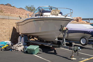 Tucking the boat away for awhileBoating and camping on Lake Mead had been a blast, but it was time to tuck it away and head home.
Before leaving on this trip, Herb had reserved a 27-foot outdoor spot in the Boulder City Boat Storage facility, about 10 minutes from the lake. We love our boat, so we felt bad about leaving it behind and a little worried that it would be well-cared for – kind of the way we felt when leaving the kids with a babysitter for the first time.
However, we couldn’t have been more pleased with the facility. It was so clean and organized, and the manager was great. We knew the boat would be in good hands.
We had always stored the boat in our back yard (and for the past year in Herb’s brother’s yard), so I had not been as involved in the prepping for storage process. I usually helped Herb back it in the driveway and then went in the house. Apparently, a lot more happened after that, and today I was privy to it. I was exhausted just watching him – just kidding, I helped whenever I could.
Over about a 4 hour period, we (mostly Herb) washed and cleaned the boat, raised it up on jack stands, preserved the gas, removed the batteries, built a frame for a cover and installed the cover and another plastic tarp on top of that, opened the storage lockers for ventilation, emptied its contents into the Suburban, and on and on.
We didn’t get done until 4 o’clock in the afternoon, so any hopes of getting home tonight were pretty dashed. That’s okay. Another night on the road would give us time to reflect on the highs (of which there were many) and lows (of which there were a bit more than we would have liked) of our odyssey, before getting back to the realities of home.
Description
 Sunset in Boulder BasinLake Mead National Recreation Area on the Nevada/Arizona border encompasses 1.5 million acres surrounding the Colorado River as it flows from the Grand Canyon through the desert to Lake Mojave. The centerpiece of the recreation area is 110-mile-long Lake Mead, the largest man-made lake in the country and a mecca for swimmers, boaters, anglers, windsurfers, and sightseers.
The lake was formed back in the 1930s by the construction of the Hoover Dam, which rises 726 feet above the bedrock and stretches 1,244 feet across the Black Canyon, making it the highest concrete dam in the Western Hemisphere. Because of the dam, Lake Mead can store up to 2 years of Colorado River flow. The water is then released in a regulated flow as needed. Today the reservoir irrigates over 2 million acres of land and supplies water for more than 14 million people.
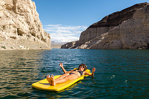 Lolo demonstrating use of floatIn addition to its practical usage, Lake Mead attracts more than 9 million visitors each year who come to enjoy its many recreational opportunities. One of the big draws is the weather, which is usually sunny and hot, up to 110 °F in summer with water temperatures in the mid 80's.
For those that are just driving through, the Lakeshore Scenic Drive along the western end of the lake and the Northshore Scenic Drive along the entire northern portion of the lake wind through desert basins and canyons, providing striking panoramic views of the crystal blue lake set against a background of colorful mountains.
There are 5 major access points to the lake along the way (clockwise from the Hoover Dam):
- Boulder Beach, on the Lakeshore Scenic Drive just a few miles north of the Alan Bible Visitor Center, is the most popular swimming beach on the lake. It is also the only one that you don’t need a boat to get to. Nearby is the Lake Mead Marina, which rents boats, and the shady 154-site Boulder Beach Campground.
- Las Vegas Bay lies seven miles north of Boulder Beach. The 89-site Las Vegas Bay Campground sits on a bluff overlooking the lake. There is also a marina with boat rentals.
- Callville Bay is located at the end of a 4-mile hilly spur road off the Northshore Scenic Drive. There is an 80-site campground and a marina for boat rentals.
- Echo Bay is located at the end of a 5-mile hilly spur road off the Northshore Scenic Drive, about 24 miles east of the turnoff for Callville Bay. The Echo Bay Campground has 166 sites and there is a marina with boat rentals.
- Overton Beach is another 10 miles east on the Northshore Scenic Drive. Its marina and campground have been closed due to lowering lake levels.
- The best way by far to explore the beauty of the lake and the surrounding canyons is by boat. Either rent one on your own at one of the many marinas or take a cruise on a paddlewheeler to and from the Hoover Dam with Lake Mead Cruises.
Petrified Forest National Park
Sunday, September 25, 2016 - 6:30pm by Lolo157 miles and 3 hours from our last stop
Travelogue
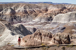 Lolo on the Blue Mesa TrailThis was a big day, one to which I had been looking forward to for many miles and miles – a day of pure fun, with a tiny bit of driving wrapped around it.
We hadn’t been to a new National Park in many years. Actually, technically this was not a new park for us, but I am counting it as such, because we did not give it justice when we passed through here back in 2002 on the way home from one of our aggressive cross country trips. After about 4,500 miles in 2 ½ weeks, trip fatigue had set in, and all I could get the family to do when we got here was to drive to the Kachina Point Lookout and have their picture taken with the colorful badlands of the Painted Desert behind them – cranky faces and forced smiles and all.
Today would be different. We had a whole day to devote to the Park and I was planning on exploring every nook and cranny.
The park is actually divided into 2 sections, divided by I40. The section south of I40 contains one of the world's largest concentrations of petrified wood. North of I40 are the colorful rocks and buttes that make up the badlands of the Painted Desert.
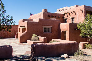 Painted Desert InnThe best way to see the park is to drive the 27-mile park road, stopping at various viewpoints and hikes along the way. We began our tour at the Painted Desert Visitor Center, just a short distance north of I40.
While at the Visitor Center I took note of the Painted Desert Diner behind the gift shop and suggested strongly that we should consider getting lunch there later. But first, we had some exploring to do.
We drove north on the park road, stopping first at the historic Painted Desert Inn, which overlooks the painted desert from Kachina Point – the site of our 2002 family photo. As much as I love pristine, untouched natural beauty, I also love learning about how people interacted with it. The Painted Desert Inn was the perfect place to do just that.
Wandering around inside, we learned a bit of its history from the informative exhibits. Back in 1924, a gentleman named Herbert Lore hired Native Americans to build the original Inn, as a place for travelers along the old Route 66 to stop in for a meal and to shop for Native American crafts. The building was originally constructed using petrified wood, which was abundant in the area.
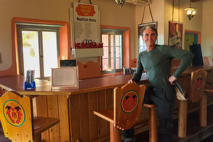 Old Diner in the Painted Desert InnIn 1936, the National Park Service purchased the Inn from Lore and enlarged and renovated it in the pueblo style, covering the petrified-wood walls with stucco. The building was closed during the final years of World War II, but reopened afterwards by the Fred Harvey Company, which hired famed Hopi artist Fred Kabotie to paint several murals inside.
The Inn closed in 1962 when the Painted Desert Visitor Center opened, and plans were made to demolish it because of structural problems. However, forward-thinking people that recognized its unique mixture of Spanish and Native American pueblo styles, as well as the value of Kabotie’s beautiful murals, argued for its preservation.
Today it is a National Historic Landmark restored to its 1940s appearance. It houses the Painted Desert Inn Museum, which celebrates the area’s cultural heritage. The old lunch counter and bar room downstairs are nostalgic to look at, but unfortunately they are just that – historical artifacts. As a hungry traveler, I sure would have liked to sit on a stool at the counter and order lunch for 35 cents, just like back in the 1940s.
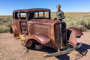 Herb shopping for a new vehicleAfter the Inn, we strolled the short distance out to Kachina Point before getting back in the car to continue along our drive. Right before we got to the overpass over I40, we pulled over to look at an old rusted out car alongside the road, a tribute to old Route 66, which used to travel through the park. It reminded me a bit too much of our Suburban.
It was at this point that I realized that I had made a boo-boo. The only place to eat in the Park was back at the Visitor Center, and the only way to get to the southern section of the park was from where we were right now. There was no way we were going to happily spend a day of hiking and exploring the rest of the park on empty stomachs, so we drove back the 5 ½ miles to the diner in the Visitor Center that I had scouted out earlier in the day.
Being the only game in town, I kind of expected the diner to be a rip-off, but it was unbelievably reasonable and delicious. I had a lamb stew with cornbread for less than $5 and Herb had a meat Navajo taco for about the same.
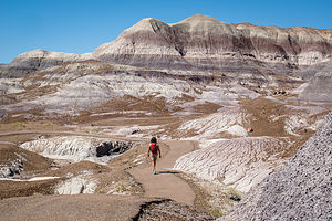 More Blue MesaTummies full, we were ready to set out for a day of exploring the Park. The best way to see it is to drive the 27-mile park road from one entrance to the other. We had already covered the 6 miles of the northern section (twice in, fact), so we retraced our steps, waved hello again to the Suburban’s rusty brethren, and crossed over I40 into the southern part of the park.
About 12 miles south of I40, we turned left off the scenic drive and continued on the Blue Mesa Road to a panoramic overlook atop the mesa. From there we followed a paved path from the mesa top down to the valley floor, winding our way around and amongst the beautiful, blue-, gray-, and white-striped badlands of the Painted Desert. Being amongst them was so much more rewarding than just gazing at them from a scenic viewpoint above.
Their texture was really interesting as well – kind of like elephant-skin. The hills are composed of silt, sand, clay, and gravel, but it is the Bentonite clay in them that gives them both their bluish color and wrinkled appearance – they swell with moisture when the rains come, and then shrink when it dries.
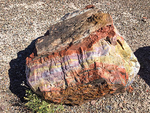 Vibrant colors of a petrified logBesides the beautiful badlands, there were plenty of colorful petrified logs scattered along the edges of the trail, as if they had been split by an ancient lumberjack before turning to stone (the logs that is, not the lumberjack). What a rich pallet of colors. The deep golds, greens, purples, and yellows of the logs, complemented the grays, blues, and browns of the surrounding hillsides beautifully, making them a perfect foreground for a very colorful photo.
The hike was only a mile, but there so much reward along the way.
After Blue Mesa, we drove about 10 miles south on the park road to the Rainbow Forest Museum, near the southern entrance to the park, from which we would start our second hike of the day – the Long Logs Trail to the Agate House Ruins.
From the Rainbow Forest Museum parking lot, we walked east along the park road a short distance to the Long Logs trailhead. From there we headed south on what used to be an old access road. At about ½-mile from the trailhead we came to a junction, and headed right towards the Agate House. We would save the Long Logs Trail for our return.
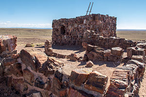 Agate House RuinsIn about ½-mile, we arrived at the Agate House, an 8-room building constructed entirely of chunks of colorful petrified wood. Archaeologists believe that it was occupied between 1050 and 1300 by ancient Pueblo people.
In the 1930s, under the direction of archeologist Cornelius B.Cosgrove, Jr., the ruins of the Agate House were partially reconstructed by the Civil Works Administration. Although it not a completely accurate replication of the original structure, it does give a better idea of what it might have been like to live here 700 years ago.
The house sits upon a knoll overlooking the badlands – I guess even the Pueblo people appreciated a good view. Although it is the only house in sight, the hundreds of similar petrified wood structure sites found throughout the park, show that it was likely once part of a much larger Pueblo community.
We retraced our steps back to the Long Logs trail junction, taking note of the numerous chunks of petrified wood alongside the trail. We looked at them differently now. In the eyes of the ancient Pueblo people, these were not just beautiful objects to look at, but useful building material.
 Long Logs TrailBack at the junction, we took the 0.6-mile Long Logs loop past some of the largest specimens of petrified trees in the park – some as long as 116 feet. Geologists believe that this area was the site of an ancient logjam, where years of floods and mudslides buried a pile of conifer trees, making this one of the largest concentrations of petrified wood in the park.
All in all, the hike to the Agate House and Long Logs was 2.4 miles – once again, a short hike with lots of reward.
For our final activity of the day, we decided to do one of the backcountry “Off the Beaten Path” hikes that required a bit more route finding skills, as there are no set trails or markers. The ranger at the Visitor Center had suggested “Martha’s Butte” as an interesting destination that would take us away from civilization for a bit. Plus, the butte has a solar marker petroglyph, which appears sliced in half (half light / half shade) during the summer solstice sunrise. Hopefully, we would find it.
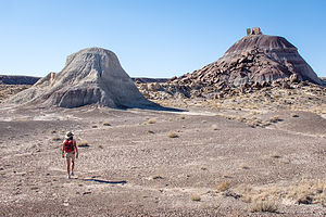 "Off the Beaten Path" to Martha's ButteAs directed by the ranger, we parked at a dirt pullout just before the Dry Wash Bridge near milepost 22. From there we crossed the road and followed the wash north for awhile before it bent sharply to the east. We were now heading northwest towards Martha’s Butte, about a mile away. Once the butte came in sight, it was quite easy to find our way.
There was another smaller hill just south of Martha’s Butte, where we stopped first to admire “Walker’s Stump,” a large petrified log sticking out of the clay hill at a strange angle. It got its name “stump” because it was originally thought to be just that – a petrified stump. However, in 1936, park naturalist Myrl Walker did some excavating and proved that it was just a log embedded in the clay.
When we got to Martha’s Butte, we noticed several scattered boulders at its base adorned with petroglyphs. One spiral one in particular was quite interesting and we wondered whether we had perhaps found the solar marker. Hard to tell when it is neither sunrise nor a summer solstice. However, looking it up later on the internet confirmed that it was indeed the solar marker.
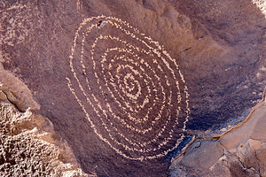 Solar Marker on Martha's ButteWe walked around the entire butte, admiring the many other interesting images carved into the rocks. Most of them were geometric patterns, but there were plenty of birds and four-legged animals as well.
What a great destination, and so secluded. We hadn’t seen another soul the entire time. Plus, it was kind of fun not being confined to a set trail, but being allowed to wander about somewhat aimlessly, just with a general direction in mind.
The whole hike, including our often random rambling, was 2.3 miles with only 40 feet of elevation gain.
I wish we had time to do another “Off the Beaten Path” hike, but it was getting late and time to head on to find a place to stay for the night.
We made one more stop at Newspaper Rock to gaze out over an area of rocks with over 650 petroglyphs carved on their faces. Obviously this area was hugely significant and sacred to the ancestral Pueblo people that called what is now Petrified Forest National Park their home.
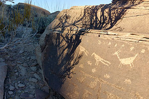 Pueblo artFeeling quite satisfied in having finally given Petrified Forest NP the time and admiration it deserved, we drove to nearby Holbrook, just 20 miles away, and checked into a Travelodge for the night.
From there we later walked to Mesa Italiana, a cozy restaurant, just ¼ mile from our motel, serving pizza, pasta, and other Italian specialties.
What a fabulous day it had been – three great and very distinct hikes with a variety of natural beauty and cultural history, and then Italian food to bring it to a close.
Description
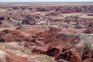 Painted Desert at Petrified Forest NPPetrified Forest National Park, which is located along I40 in eastern Arizona, consists of two main sections. The section south of I40 contains one of the world's largest concentrations of petrified wood. North of I40 are the colorful rocks and buttes that make up the badlands of the Painted Desert.
The best way to see the park is to drive the 27-mile park road from the southern entrance to the north. A good first stop is the Rainbow Forest Museum. Behind the museum is the ½-mile, self-guided Giant Logs Trail, which leads through one of the four major concentrations of petrified logs in the park. The largest petrified log is Old Faithful, which is 9 ½ feet in diameter.
A short spur road leads to Long Logs and the Agate House. At Long Logs there is a ½-mile loop trail that leads through the largest concentration of petrified wood in the park. Some of the logs are as long as 170 feet. The 1-mile-long Agate House Trail leads to an Anasazi pueblo made of petrified wood.
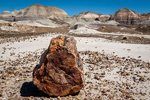 Petrified log imitating a rockContinuing north on the park road, you'll come to the Crystal Forest where the petrified logs were once filled with quartz and amethyst crystals. Although gem hunters have taken most of the crystals before this area was a National Park, there are still some very colorful logs to see along the 0.8-mile loop trail.
Further north, a 3-mile spur road leads to Blue Mesa, with its blue and purple-striped badlands. A fairly difficult, 1-mile loop trail descends into the mesa. Many consider this to be one of the most scenic trails in the park.
The next stop is the Puerco Indian Ruin, the remains of an Anasazi village occupied in the 1100 - 1300s. There are also petroglyphs carved out of the patina of the rocks surrounding the pueblo.
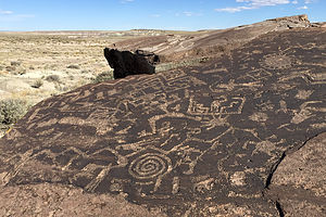 Petroglyphs by Martha's ButteThe park road then crosses I40 and enters the Painted Desert portion of the park. Along the road to the Visitor Center there are 8 overlooks, each affording a different perspective of this colorful landscape. One of the most spectacular is Pintado Point, the highest point along the rim of the Painted Desert. At Kachina Point is the Painted Desert Inn, now closed, and the trailheads for the Painted Desert Wilderness Trail and the Painted Desert Rim Trail. The Wilderness Trail steeply descends in switchbacks down the face of the badlands onto the floor of the Painted Desert. With a backcountry permit, you can camp here and watch the sun set over the badlands. The Rim Trail runs along the rim of the Painted Desert from Kachina to Tawa Point. Along the way there are spectacular views of the colorful badlands of the Painted Desert.
Amarillo, Texas to Grants
Saturday, September 24, 2016 - 6:30pm by Lolo361 miles and 7 hours from our last stop - 1 night stay
Travelogue
 Herb at Stone Age Climbing Gym in AlbuquerqueOnce we hit New Mexico, the scenery began to change for the better – more beautiful vistas of colored rock, mesas, and badlands. It felt like we had finally reached the West and that the SuburbanShip (the Lunatic Module) – knock on wood (or rust in this case) might actually make it home.
Since there was no physical activity yesterday due to the false promise of a fitness center at the Super 8, I searched once more for a climbing gym on route, to stretch the muscles and break up the monotony of another long driving day.
I repeated my methodology of a few days back, and used the Waze mapping app to search for terms like “rock,” “granite,” and “climbing” along our route. Once again, it worked. I found Stone Age Climbing Gym, just a stone’s throw (no pun intended) from I40 in Albuquerque, New Mexico.
I then continued my routine of calling to inquire about parking 45-feet of vehicles and was told that there was ample parking along the street across from them. They were right! We parked along the curb right across from the place.
The gym was great, but then again, as I previously said, I have rarely met a climbing gym that I didn’t like. The only down side to visiting new gyms is that you have to get belay tested in each one to make sure you know what you’re doing and won’t let your partner fall to the ground. I definitely agree that checking one’s competency is a necessity, but I wish there was some kind of nationally recognized belay certification so that you didn’t have to waste a half hour every time you visit a new gym. Plus, I zoned out and almost failed this one when I spent a bit too much time setting the rope through the belaying device.
Fortunately, the fog lifted and I rallied. We spent the next couple of hours joyfully climbing in what was a really nice gym.
Another hour and a half on the road brought us to our resting place for the night – a Travelodge in Grants, NM, which was located in walking distance to several dining establishments. After a quick Yelp and Trip Advisor search, we headed to the Asian Super Buffet, just a short distance from the motel.
“Super” was right. This place was unbelievable. I have never seen so much food for $9.99 a person. I could have eaten $30 worth of shrimp alone. Needless to say, we were so stuffed afterwards that we definitely needed that walk back to our motel.
Description
Continuing west along I40 with a side trip to Stone Age Climbing Gym in Albuquerque
Miami, Oklahoma to Amarillo
Friday, September 23, 2016 - 6:15pm by Lolo453 miles and 8.5 hours from our last stop - 1 night stay
Travelogue
 Guess what state we're in?Another long driving day – Oklahoma is certainly long. Thankfully, the SuburbanShip was behaving beautifully.
When looking for a destination for the night, we usually try to check in at least by 5:00, so we have time to relax a bit before figuring out how to feed ourselves. Amarillo, Texas seemed just about right.
Since the fitness center in the Econo Lodge back in Illinois gave me the opportunity to burn off some pent-up energy, I used “fitness center” as one of my criteria when using the Trip Advisor app to find a motel in Amarillo. Another criteria that we were looking for was walking distance to a restaurant, so that we wouldn’t have to face another Subway hero. That was a little more difficult in that I had to use Google Maps, zoom in on motels, and then see what was nearby.
The Super 8 Amarillo West looked like it would do the trick.
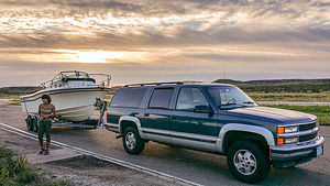 Hello TexasI will always remember this motel for the interesting exchange I had with the proprietor. While checking in, I asked her where the fitness center was. Much to my chagrin, she said, “About 4 miles away. We have free passes for you to use.” When she saw the disappointed look on my face, she said, “Why do you need a fitness center. You already look fit.” Herb and I tried not to crack up. I don’t think she really got this fitness thing.
After a shower and a drink in the room, we walked to nearby Joe Daddy’s, which was a pretty loud and rowdy local establishment, with Texas BBQ, “adult” drinks, and a live band. It was just the kind of place I would have pictured in Amarillo, Texas.
Description
Drive I44 southwest to I40 and stop at a Super 8 in Amarillo, Texas
Greenville, IL to Miami
Thursday, September 22, 2016 - 6:15pm by Lolo373 miles and 7.5 hours from our last stop - 1 night stay
Travelogue
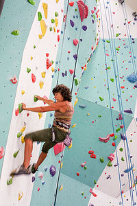 Zenith Climbing Center in Springfield, MOWhen we hit St. Louis, rather than continuing west on I70, we headed southwest on I44 to eventually link up with I40, a much gentler alternative, in terms of mountain passes and steep grades, than I70 or I80.
I didn’t think I could take another day where the highlight was stopping at a Subway in a truck stop, so I suggested we look for a rock climbing gym to get in some physical exercise, and break up the monotony of the drive, and hopefully combat the ill effects of a diet of Subway heroes.
My first step in implementing this bold plan was to use the Waze phone app to plot our route. Then I performed a search along route for terms that might appear in the name of a climbing gym, such as “rock,” “granite,” “climbing,” etc.
Bingo! I found the Zenith Climbing Center in Springfield, Missouri, just 7 miles south of I44.
The second challenge was to find out if we could park our 45-feet of tonnage somewhere nearby. I called the gym to ask, and was told that there was a church nearby with a very large parking lot where he felt confident we could fit.
Great! We were quite excited.
I have rarely met a climbing gym I didn’t like, and Zenith was no exception. It was practically brand new and almost completely empty, because most of the staff and people that climb here were off at a climbing competition in nearby Arkansas, a competition that Herb had actually heard of. It’s called 24 Hours of Horseshoe Hell, and is very unique in that you are scored on how many routes you can complete in a 24 hour period.
So, basically we had the gym to ourselves, which was great. It took us awhile to get used to the route grades here. Every gym tends to rate the difficulty of climbs differently, so we had to kind of figure out through trial and error which routes were appropriate for our abilities. In the case of this gym, the gradings were really stiff, meaning that they were really hard for their grade. While in some gyms, I can comfortably do 5.10s and even the occasional 5.11a, I struggled through 5.9s here – much more realistic to outdoor climbing.
Invigorated from our climbing session, we continued on another 2 hours before settling in for the night in a Microtel Inn in Miami, Oklahoma.
I don’t even remember what we had for dinner, but if I was to guess, it was a Subway hero or salad.
Description
Driving I44 towards I40 with a stop for the night in Miami, Oklahoma
Brother's house in Ohio to Greenville
Wednesday, September 21, 2016 - 6:15pm by Lolo386 miles and 8 hours from our last stop - 1 night stay
Travelogue
 The first of many many truck stopsWe said our goodbyes to my brother and his family and continued our way west. Fortunately, it was an uneventful, mole-free day – just more truck stops, Subway sandwiches, and Econo Lodges.
After 8 hours of driving, I was desperate for some form of fitness, but there really was no place to run from the motel. That was why I was so happy to find that the motel had a fitness center with a treadmill. I’m not really a treadmill fan, but beggars can’t be choosers, so I figured why not.
That evening I ran for 45 minutes, longer than I ever do on a treadmill. In fact, Herb even came to look for me at one point to see if I was okay. I was so glad to see him, because I couldn’t get the AC working and it was really hot in there. My hero Herb came to the rescue and plugged it in – why didn’t I think of that?
We ate our Subway salads, watched some TV, and went to bed. I hope this wasn’t going to become too much of a pattern.
Description
Drive along I70 from Ohio, through Indiana, to an Econo Lodge in Greenville, Ohio
Breezewood, PA to Brother's House in New Albany
Monday, September 19, 2016 - 6:15pm by Lolo284 miles and 5.5 hours from our last stop - 2 night stay
Travelogue
 Boat makes it to Jimmy'sWe hit the road early – not much else to do in an Econo Lodge in Breezewood, PA, and started the 6-hour drive to my brother’s house in New Albany, Ohio. He had arranged a place for us to park our 45-feet of stress just across from his house in an area where they were constructing new homes.
Things were going along pretty smoothly until about ½ hour away from Jimmy’s, when we began hearing a rattling sound coming from the boat trailer. Herb stopped and saw that the crack on the fender had extended to the point where he was concerned it would fall off. We tried calling a couple of boat trailer places to see if they had a replacement fender, but no luck. Instead we stopped at a Home Depot and Herb bought some clamps to keep it in place.
After leaving Home Depot, we began hearing a new sound - scraping noise coming from the driver side front tire, which seemed to correspond with the rotation of the wheel.
Herb said he felt like he was playing Whack-a-Mole, and the moles were winning.
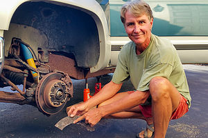 Rusty loose dust shield - Problem solvedHe had no idea what the new problem was, nor how long it would take to repair, so we told my brother we might be moving in for awhile.
As with our day at the Jersey shore, we decided to just enjoy the evening with my brother and his family, and not worry about the problem until the morning – it seemed like we were doing a lot of that lately.
Bright and early the next morning, Herb took the tire off the Suburban and saw that a piece of the very rusty, disc brake dust shield had broken off and was rattling around causing the noise. Since the broken off piece wasn’t essential to the braking system, Herb just removed it. When I saw how rusty things looked behind the wheel, I seriously questioned our wisdom in driving this thing across the country. However, at this point, there wasn’t much of a choice.
Since we were able to whack our second mole relatively quickly, we had the rest of the day to enjoy. My brother brought us to the lovely Inniswood Botanical Garden and Nature Preserve in nearby Westerville, Ohio, where we spent a few peaceful hours strolling through the woodlands and various gardens.
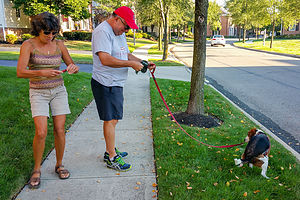 Charlie in actionBefore leaving the next morning we accompanied Jim on his morning constitutional with Charlie. Walking Charlie was quite a unique experience. He was so interested in sniffing everything along the way that he actually walked sideways, sort of like a crab, while my brother dragged him along. I had never seen anything like it. He also liked to mark his turf frequently with a little poop - I think there were about 3 of these "markings" on this walk alone. When we asked Jim if Charlie had been trained at all, he said “No, that would take away his personality.” Ok good. At least he hadn’t been ripped off by a dog trainer.
Time to hit the road. I am always sad leaving my brother's house. He and his wife are such great hosts that a visit with them is always a treat. The good food and laughter definitely lifted our spirits.
Description
I70 to my brother Jimmy's house in New Albany, Ohio
