- Home
- About
- Map
- Trips
- Bringing Boat West
- Migration West
- Solo Motorcycle Ride
- Final Family XC Trip
- Colorado Rockies
- Graduates' XC Trip
- Yosemite & Nevada
- Colorado & Utah
- Best of Utah
- Southern Loop
- Pacific Northwest
- Northern Loop
- Los Angeles to NYC
- East Coast Trips
- 1 Week in Quebec
- Southeast Coast
- NH Backpacking
- Martha's Vineyard
- Canadian Maritimes
- Ocracoke Island
- Edisto Island
- First Landing '02
- Hunting Island '02
- Stowe in Winter
- Hunting Island '01
- Lake Placid
- Chesapeake
- Provincetown
- Hunting Island '00
- Acadia in Winter
- Boston Suburbs
- Niagara Falls
- First Landing '99
- Cape Hatteras
- West Coast Trips
- Utah Off-Roading
- Maui
- Mojave 4WD Course
- Colorado River Rafting
- Bishop & Death Valley
- Kauai
- Yosemite Fall
- Utah Off-Road
- Lost Coast
- Yosemite Valley
- Arizona and New Mexico
- Pescadero & Capitola
- Bishop & Death Valley
- San Diego, Anza Borrego, Joshua Tree
- Carmel
- Death Valley in Fall
- Yosemite in the Fall
- Pacific Northwest
- Utah Off-Roading
- Southern CA Deserts
- Yosemite & Covid
- Lake Powell Covid
- Eastern Sierra & Covid
- Bishop & Death Valley
- Central & SE Oregon
- Mojave Road
- Eastern Sierra
- Trinity Alps
- Tuolumne Meadows
- Lake Powell Boating
- Eastern Sierra
- Yosemite Winter
- Hawaii
- 4WD Eastern Sierra
- 4WD Death Valley +
- Southern CA Deserts
- Christmas in Tahoe
- Yosemite & Pinnacles
- Totality
- Yosemite & Sierra
- Yosemite Christmas
- Yosemite, San Diego
- Yosemite & North CA
- Seattle to Sierra
- Southwest Deserts
- Yosemite & Sierra
- Pacific Northwest
- Yosemite & South CA
- Pacific Northwest
- Northern California
- Southern Alaska
- Vancouver Island
- International Trips
- Index
- Tips
- Books
- Photos/Videos
- Search
- Contact
Utah to California
Thursday, November 12, 2015 - 2:00pm by Lolo523 miles and 8 hours from our last stop - 1 night stay
Travelogue
Less than 700 miles to go – Woo Hoo! Reno was about 430 miles away, so stopping there for the night would put us in striking distance to make the final push the next day.
Also, there is an excellent art museum there that currently had a special exhibit called “Tahoe: A Visual History,” which surveyed historical art of Lake Tahoe and Donner Pass, two areas that we have grown to love in our recent travels.
The exhibit was arranged chronologically and covered over 200 years of the culture and history of the Lake Tahoe area – the Native Americans who first populated this region, the infamous and tragic story of the Donner Party, the laying of the Transcontinental Railroad by Chinese laborers, the logging and mining boom, the shift to tourism and the rise of resorts in the early 20th century, and the impact of climate change on the lake’s ecosystem.
I looked on Priceline for inexpensive hotels to stay in Reno. We stopped in one that advertised a $100 price, but had so many hidden service charges and fees that the total would have been more like $180. I only knew this before being suckered in, because there was a gentleman next to me at the hotel desk screaming about his final bill. We walked out and continued driving west.
After leaving Reno, we drove for another 100 miles before finding a place to stay in Auburn, California. We were almost home – or whatever home might mean these days.
We stayed at a Quality Inn, right next to a very highly rated restaurant called Joe Caribe Caribbean Bistro and Café. It was excellent – in fact, so much so that Herb wrote his first restaurant review on Trip Advisor, raving about their fish tacos. He gave it 5 stars.
Description
Drive from Wendover, Utah to Auburn, California
Wyoming to Utah
Wednesday, November 11, 2015 - 1:45pm by Lolo310 miles and 5 hours from our last stop - 1 night stay
Travelogue
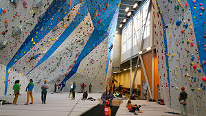 Momentum Rock Climbing GymYesterday was the long driving day, so that meant that today we could schedule in some fun. We picked out two very different types of activities in Salt Lake City: rock climbing at the indoor Momentum Gym and touring the Mormon Temple Square.
I have rarely made a climbing gym I didn’t like, and Momentum was no exception. The only down side to visiting new gyms is that you have to get belay tested in each one to make sure you know what you’re doing and won’t let your partner fall to the ground. I definitely agree that checking one’s competency is a necessity, but I wish there was some kind of nationally recognized belay certification so that you didn’t have to waste an hour every time you visit a new gym.
When I think of Salt Lake City, I think Mormons, so we couldn’t just pass through without visiting Temple Square.
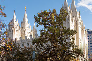 Salt Lake TempleWe started our visit at the South Visitor Center and asked if we could take a tour. They said we could and that it was free, and then had us wait for our tour guides in a sitting area with a video screen full of smiling, wholesome faces of various ethnicities upon which you could click to hear their story about how and why they became a Mormon. I think the goal of the “I’m a Mormon” program was to make people feel more comfortable that Mormons were normal people that lead normal lives, and therefore, you could and should become one too.
After getting through about three stories of Mormon conversions, our two tour guides arrived. They were young women – one from Paris and one from Italy – very courteous and very plainly dressed. They were also very, very passionate about the Church of Latter Day Saints.
They took us first to a model of the Temple in the Visitor Center, which was placed before a window opening out to the real thing. Since non-Mormons are not allowed to enter the Temple, this was about as close as we were going to get. I think the lack of access to the public adds to the belief that non-Mormons, such as us, have that secret cult-like stuff is going on in there. In any case, the architecture of the Temple is absolutely stunning.
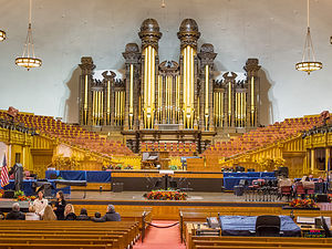 Large Mormon OrganOur guides were, however, able to take us into both the Tabernacle, home of the world-renowned Mormon Tabernacle Choir, and the Chapel, where weekly Sunday services take place.
Rather than stay overnight in Salt Lake City, we continued driving on I80 through Utah. As we did, I continued to play with the “Things to Do Nearby” function on the Trip Advisor app. Up came the “Tree of Utah,” an 87-foot high abstract sculpture of a tree on the edge of I80 on the barren Bonneville Salt Flats. Sounded pretty cool, but traffic was traveling at 70 mph, and there was no place to pullover. I rolled down the window and got my iPhone ready. I actually managed to capture it. It definitely did not look like a real tree, but more like 6 bowling balls protruding from a telephone pole. I have a problem with abstract art.
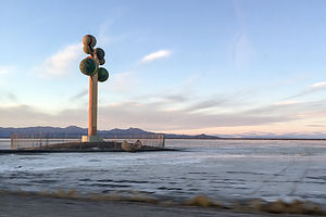 Karl Momen's "Metaphor: The Tree of Utah"To give it the respect it deserved, I googled it and found that the tree is supposed to be a metaphor, and it is also called the “Tree of Life.” It was created by the Swedish artist Karl Momen in 1982. The inscription on the trunk of the tree is Schiller's Ode to Joy, as sung in the choral climax of Beethoven's Ninth Symphony.
We continued on a few miles to the Best Western in the town of Wendover, the last town in Utah before the Nevada border. – in fact, we were so close to Nevada that we could see the lights of the casinos just 100 yards down the road from our motel.
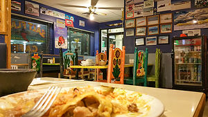 Pancho Special at the Salt Flats CafeWe checked on Trip Advisor for a place to eat (I was getting obsessed with this app), and selected the Salt Flats Café, a Mexican restaurant located in a Sinclair station truck stop back near the entrance to the Bonneville Salt Flats.
The ambience was just what we were looking for – rustic, casual, with photos of Salt Flats racers covering the walls. The colorful chairs with Mexican motifs were really cool as well. Everyone in the place knew each other, which is always a good sign. They only take cash, which was fine, because you didn’t need much of it. Herb and I both ordered the Pancho Special, which featured a chile verde burrito, steak tostada, steak enchilada, rice and beans – all for $6.95. One of them would have been enough for the both of us.
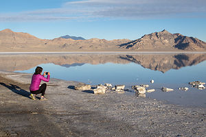
The next morning, before leaving Utah, we drove back out to the Bonneville Salt Flats to photograph this amazing place in the morning light. The salt flats are about 12 miles long and 5 miles wide and are comprised of approximately 90% common table salt. Near the center of the flats, the salt crust is almost 5 feet thick, but it tapers off to about 1 inch along the edges. .
 Truck on Bonneville Salt Flats with CoupleBonneville is on the National Register of Historic Landmarks because of its contribution to land speed racing, which has been going on since 1914. It was on the Bonneville Speedway that the 300, 400, 500, and 600 mile-per-hour land speed barriers were broken.
We were surprised to see that there was a shallow layer of water covering much of the flats, since we thought that the West was undergoing a severe drought. Maybe that was just California. In fact, the August racing events had been canceled for two years in a row because of heavy rains swamping the flats. I can imagine that wasn’t very good for the local economy.
Nebraska to Wyoming
Tuesday, November 10, 2015 - 1:45pm by Lolo660 miles and 10 hours from our last stop - 1 night stay
Travelogue
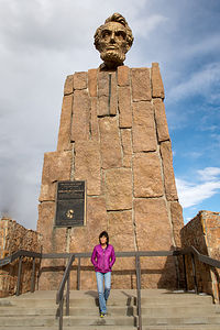 Lolo with Abe Lincoln's Head on a PedestalWe figured that we had to get some physical activity at least every other day, so since we climbed at Climb Iowa yesterday, this would be our long driving day.
To pass the time, Herb suggested I play with the Trip Advisor app to look for Things to Do “Near Me Now,” which is actually very useful when crossing the country with no particular plan in mind.
That’s how I discovered Happy Jack Road (Wyoming Highway 210), a 40-mile scenic alternative to I80 that connects the towns of Cheyenne and Laramie, Wyoming. After 400 miles of driving, we were about ready for Happy Jack.
It was great. We went from the streaming traffic of 80 to feeling like we were out in the middle of nowhere – just prairie and ranches and rocky plateaus.
Just before we got back to I80, we stopped at a Visitor Center – mainly to find a restroom -- and were surprised to find a giant 13 ½ foot statue of Abraham Lincoln’s head atop a 30-foot granite pedestal, obviously made to be visible from Route 80. It was built to commemorate Lincoln’s 150th birthday.
Why a bust of Lincoln in Wyoming you might ask, as I did? Well, before there ever was an I80, connecting New York City with San Francisco, in the early 1900s the old Lincoln Highway did the job. The statue originally stood alongside the highest point of the old highway, at Sherman Point (8,878 feet above sea level), but was moved to this location in 1969 when I80 was completed.
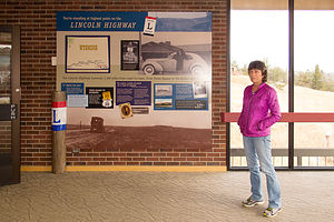 Lolo in Happy Jack Road Visitor CenterHappy Jack Road was a good diversion, and we were recharged to forge on. As we continued west through Wyoming, we began hearing forecasts for heavy snow in the higher elevations, which we had now officially entered.
Sure enough, shortly after dark it started to flurry. We needed to find a place to stay soon, but the next major town, Rock Springs, was about an hour away. I consulted the Trip Advisor app to find something highly rated (as we might be snowed in for a day), but reasonably priced. I found an extended stay hotel – hopefully our stay wouldn’t be that extended – called My Place. It even had a small kitchenette. We got there just in time before it started snowing more heavily.
We quickly went out to get takeout Chinese food at nearby Wonderful House, brought it back to eat in our room, and settled in for what we hoped would only be one night. It was kind of cozy. I was getting used to the life of a nomad.
The next morning we awoke to find that the forecasted snowstorm was thankfully a bomb. I reheated the leftover Chinese food for breakfast, and we surged on westward.
Iowa to Nebraska
Monday, November 9, 2015 - 1:30pm by Lolo393 miles and 6.5 hours from our last stop - 1 night stay
Travelogue
 Lolo enjoying Dinner at "The Kitchen"After being humbled by Kitty in the Climb Iowa gym, we continued driving on I80 West, eventually stopping for the night at the New Victorian Inn in York, Nebraska.
Despite the rather less than satisfactory experience with the last restaurant recommendation we received from a motel clerk in Iowa, we asked the girl behind the check-in desk for a good place to get a bite to eat. Without hesitation, she recommended The Kitchen, just a short walk up the road.
Our faith in local recommendations was restored. The Kitchen had a diner like setting, good service, an ample salad bar, and served breakfast all day. It was just what we were looking for.
Description
Drive from Davenport, Iowa to York, Nebraska
Ohio to Iowa
Sunday, November 8, 2015 - 12:45pm by Lolo515 miles and 8 hours from our last stop - 1 night stay
Travelogue
 Entrance to Iowa 80 Truck StopAfter leaving my brother Jim’s house in Ohio, we still had over 2,400 miles to go to reach our new temporary home, our RV, which was stored in Petaluma, California. We had somewhat of a time constraint as well, since we had to beat the moving truck with our entire life’s possessions to our reserved storage unit in Santa Rosa, CA.
However, we needed some way to break up the trip and get some physical exercise along the way. Then it hit me – a tour of rock climbing gyms across the country. I quickly googled Iowa rock climbing gyms and looked for matches not too far from I80. Bingo! – Climb Iowa in Grimes, the largest climbing gym in Iowa, and less than a mile off of 80.
It was too far to get to today (about 670 miles), so we stopped at a Days Inn in Walcott, Iowa, right near Iowa 80, the largest truck stop in America. We would save that treat for tomorrow morning. In the meantime, it was time to get some dinner, so after asking the hotel clerk for a recommendation, we headed over to Gramma’s Kitchen for some Iowa homestyle cooking.
 Herb belaying Kitty at Climb IowaWhat we learned at Gramma’s is that Iowans very much love their gravy, so much so that you can barely find your entrée beneath it. My turkey dinner was covered with a gelatinous brown blob, so salty that I could barely finish it. Meanwhile, at the table next to us, a man was asking for extra gravy for his steak. Our goal now was to get out of Iowa before our arteries clogged.
We couldn’t be so close to the largest truck stop in America and visit, so we stopped in for some Caribou coffee before continuing on 80 West. As one would expect at the largest truck stop, there was a Trucking Museum dedicated to the restoration and preservation of antique trucks and trucking artifacts. Maybe next time, but today I had climbing on my mind.
We arrived at Climb Iowa about 5 minutes before it opened. As we sat in the car, we noticed an elderly gray-haired woman, perhaps in her 70s, anxiously waiting by the door for it to open. Was she going to climb? I’m used to being the old lady in a climbing gym.
 Lolo and Kitty at Climb IowaLet’s just say that Kitty – that was her name; it was even embroidered on her harness – was the real deal. She was awesome, and so was the gym. I take back all my narrow-minded preconceptions that Iowa was such a flat state that it couldn’t possibly produce climbers.
Since that day, I have friended Kitty on Facebook and followed her achievements. She recently ice climbed a silo. That’s right. The people of Iowa have figured out a way to ice the sides of silos so that they can climb them, and Kitty was right there with her ice ax and crampons to show how it’s done. I hope that I will be like Kitty when I am 71. In fact, I wish I was like Kitty now.
New Jersey to Ohio
Friday, November 6, 2015 - 12:45pm by Lolo530 miles and 8 hours from our last stop - 2 night stay
Travelogue
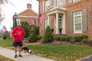 Jim and Charlie the BeaglePulling out of our driveway at the start of a cross country adventure has always filled me with anticipation and excitement about the adventures before us. This time, however, was a bit more emotional. We were leaving our home of 30 years for the final time and migrating West to start a new life. I couldn’t look back. From here on, it was forward – or else I would cry.
A visit with my brother Jim and his family is always a treat, so we made our first diversion off our planned I80 route to dip down to his home in New Albany, Ohio, voted, as he proudly states, the “Best Suburb in America” for two years in a row.
We were greeted enthusiastically by his very exuberant new Beagle pup, “Charlie,” who we had never met, but felt we knew from the dozens of posts my brother has made on Facebook of his new best friend. He was adorable, but not exactly the best watch dog, as he loves everyone he meets.
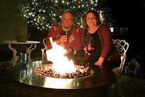 Jim and BevNew Albany is a very walkable community, so later that evening, instead of getting in our car to drive to dinner, we strolled to the center of town and had dinner at the Rusty Busket, a cozy tavern about a quarter mile from his house. What a nice change to be able to walk to restaurants.
After dinner, we spent the rest of the evening sipping wine around my brother’s firepit, catching up and laughing about old times.
The next morning we accompanied Jim on his morning constitutional with Charlie. Walking Charlie was quite a unique experience. He was so interested in sniffing everything along the way that he actually walked sideways, sort of like a crab, while my brother dragged him along. I had never seen anything like it. When we asked Jim if Charlie had been trained at all, he said “No, that would take away his personality.” Ok good. At least he hadn’t been ripped off by a dog trainer.
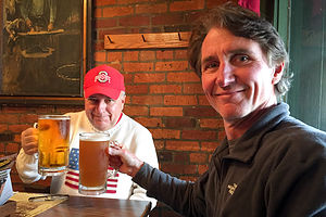 Jim and Herb with 32oz. BeersLater that day, we drove to the historic German Village in Columbus to have lunch at the famous Schmidt’s Sausage Haus. Herb is 100% German and loves a good “wurst,” so I think he was quite excited – or as excited as a German gets.
The place was mobbed, and we had to wait well over an hour to finally get a table. However, as promised by Jim, it was well worth the wait. Following Jim’s advice, Herb had a 32 oz. beer and the “Bahama Mama,” a huge platter of beef and port, hickory-smoked sausage. As if that was decadent enough, we had their famous Jumbo Cream Puffs for dessert. I was pretty sure we wouldn’t need to eat again until we got to the West Coast.
A stroll around the historic German Village helped get the digestion process started, but it had its work cut out for it.
The next morning it was time to say our goodbyes and hit the road – next stop Iowa.
San Francisco North / Petaluma KOA and Flight Home
Tuesday, September 8, 2015 - 11:00am by Lolo196 miles and 4 hours from our last stop - 2 night stay
Travelogue
Not much to report here -- just a full day of cleaning the RV and prepping it for storage once again.
We did manage to squeeze in an afternoon of climbing at Vertex, a gym in Santa Rosa. It is a much smaller gym than Planet Granite in San Francisco, and the climbs are graded much harder. I just had to adjust my mindset to the new gradings. Nothing was really that easy though, so we certainly got a good workout.
Time to go home. As we took the Sonoma County Airport Express to the airport, we wondered if this would be the last time we had to fly home to New Jersey. Hopefully, before we returned to California again, our house would be sold and we would be coming out west permanently.
I guess we will just have to wait and see.
Description
The Petaluma KOA is an award winning camping resort located within an hour’s drive of San Francisco, Napa and Sonoma Valley Wineries, giant redwoods, and Sonoma County and California Coastal Beaches. It is considered to be the RV resort in the San Francisco Bay area.
On its 70 acres, there are 312 spacious RV sites, 32 camping cabins, and 10 Wine Country lodges.
Other amenities include:
• Guided tours of San Francisco (from May through October)
• Huge heated pool and spa
• Inflatable waterslide
• Rock climbing wall
• Huge playground
• Petting zoo
• Karaoke
• Hayrides and live weekend entertainment
The campground is open all year.
Truckee
Thursday, September 3, 2015 - 9:15am by Lolo200 miles and 4 hours from our last stop - 5 night stay
Travelogue
The second pre-planned stop on our five-week long trip (the first being Tuolumne Meadows) was meeting Andrew, Tommy, and Celeste in Truckee for a long Labor Day weekend of climbing.
Since Labor Day weekend is an especially busy time in climbing areas, we had made our reservations at the Prosser Reservoir Campground, about 6 miles north of Truckee, well in advance.
Donner Memorial State Park, Rainbow Bridge, and Snowshed Tunnels
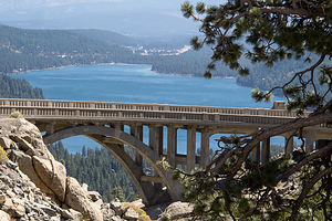 Rainbow Bridge and Donner LakeThe kids had been to Truckee before, but we hadn’t, so we were excited, as always, to see something new. Since they wouldn’t be arriving until late Friday night, we had all day Friday to explore the area on our own, and, as per Andrew’s instructions, to scout out climbing areas they hadn’t been to as yet.
We started out day at the Emigrant Museum in Donner Memorial State Park, on the eastern end of Donner Lake just south of I80 and 3 miles west of downtown Truckee. The park is named for the infamous Donner Party, a group of pioneers that met a tragic end on their 1846 journey west in this very spot of the eastern Sierras.
When the boys were little, they (and me) used to love playing a computer game called The Oregon Trail, where we took on the role of covered wagon leader, with all the responsibilities and difficult decisions that involved – how much and what type of food to bring, where and how to ford a stream, whether you should eat one of your oxen or have it pull your wagon, etc. I was usually lucky if my party made it out of Missouri.
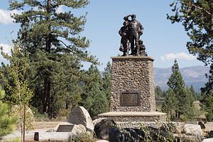 Donner Party MemorialThe game was very realistic and showed just how courageous and adventurous these pioneer families were. They left their old lives and most of their possessions behind them and entrusted their safe passage to their wagon leaders and trail guides. All along the way, they had critical decisions to make – having played the Oregon Trail game from the safety of my den, I felt for them.
One of the major decisions the Donner Party had to make was whether or not to take a recently discovered shortcut to California, which crossed Utah's Wasatch Mountains and Great Salt Lake Desert. It was advertised as saving 350 – 400 miles on easy terrain. Unfortunately, the route had never been tested.
Instead of quickening their passage, the difficult journey through the mountains and desert delayed them and depleted their supplies. Things just got worse and worse. When they finally reached Donner Lake in late October, a storm dropped 5 feet of snow. They were 12 miles shy of the Sierra Pass. They tried to make the pass through the snow, but had to retreat back to the eastern end of Donner Lake and hope that conditions would change.
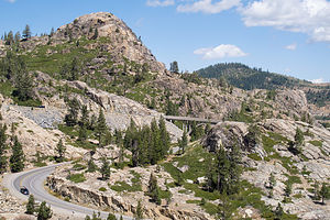 Rainbow Bridge and School RockTwo more attempts were made to get over the pass in 20 feet of snow, but they finally realized that they had to hunker down for the winter. Over the next four months they huddled together in cabins, make shift lean-tos, and tents. On November 29th, they killed the last of their oxen for food.
By the end of the winter, 40 members of the party had died, and 49 survived, many by resorting to cannibalism of their less fortunate family and friends.
The Emigrant Museum, which is on the very spot where these horrible events occurred, does a great job of telling their story, through compelling exhibits and an excellent movie.
Just outside the Visitor Center there is a stone pedestal commemorating the tragedy of the Donner Party. The stone marker is 22 feet tall, marking the height of the amount of snowfall during that fateful winter. Atop the pedestal stands a family of pioneers gazing west towards Donner Pass.
Besides preserving the emigrant experience, the museum also has exhibits that tell the story of the monumental challenge of the construction of the transcontinental railroad through Donner Pass. In 1868, after five years of a grueling construction effort by mostly Chinese laborers, the Sierra Nevadas were finally conquered by the Central Pacific Railroad when 1,659-foot Tunnel #6 through Donner Pass was completed.
All in all four tunnels, several miles of snowsheds, and two “Chinese Walls” were necessary to breach Donner Summit. Conquering Donner Summit was by far the most difficult challenge of the entire Sacramento to Ogden Central Pacific Railroad route.
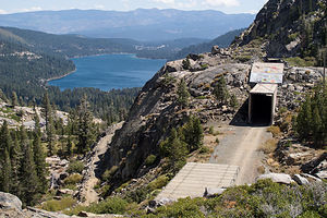 Snowshed Tunnel and Donner LakeI had always known that tunnels were needed to cut through the mountains, but I had never heard of snowsheds before, perhaps because on the East Coast, railroads don’t have to deal with avalanches and 20 feet of snow falling on their tracks.
We spent the rest of our day exploring the tunnels and snowsheds located along Donner Pass Road, west of Donner Lake, many of which we could walk through. There was a lot of brightly painted (obscenity-free) graffiti on much of them, but I would have to surprisingly say that that made them even more interesting.
A third topic of historical interest commemorated in Donner Memorial State Park is early motorcar travel and the construction of the Lincoln Highway (historic Route 40), which passed over Donner Summit on its route between Atlantic City and San Francisco. During the 1920s, the beautiful concrete-arched Rainbow Bridge was built to allow motorcars to get over the Pass without having to drive up and down steep 18% grades.
I am not sure which was more beautiful – the bridge itself or the views of Donner Lake and the surrounding mountains from it. Herb found a spot along the road above the bridge where he could get both in one frame, with the bridge nicely framing the lake in the background.
As we promised Andrew, we checked out two potential rock climbing areas: School Rock right near Rainbow Bridge and Snowshed Wall, located as you would expect, near a railroad snowshed, a short distance below the bridge. Both looked good, both in terms of climbing, ease of access, and tremendous views.
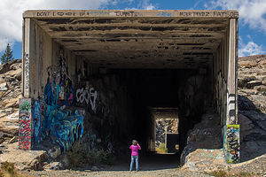 Lolo Photographing Snowshed TunnelWhen we got back to Prosser Reservoir Campground, I decided to go for a run on the dirt trails that veered off to and around the reservoir. Herb didn’t want to come, so I set off on my own and managed to get pretty lost – which I would have thought was impossible, except for the fact that I am very definitely spatially impaired. If I had only brought my phone, I could have looked on Google Maps where I was.
It wouldn’t have been so bad if it wasn’t starting to get dark. With my adrenaline pumping, I think I was running 4-minute miles in my attempt to get back to Herb and the motorhome in daylight – well, maybe that’s a little bit of an exaggeration. Anyway, I made it back, just as he was starting to worry about why I was gone so long.
Andrew, Tommy, and Celeste arrived around 11 pm. Usually they stay with us in the motorhome, but since they had other friends along this time, they camped in tents with them on the other sides of the campground. It was going to be a pretty chilly night for them – down around freezing. Nights like that really make me appreciate the motorhome even more.
Rock Climbing at Big Chief
 Andrew Leading Pow WowTommy knocked on our door early the next morning, sent by his brother on a mission to borrow a coffee mug. “I forgot how nice and toasty it is in here,” he said breathing out smoke from the cold air. He proceeded to sit down on the back couch, pretending to be interested in the educational video we were watching, totally forgetting about the purpose of his visit.
“Don’t you have somewhere else you’re supposed to be,” I finally said, and off he reluctantly went back out into the cold.
Later that morning, their friends left to go mountain biking, and we went with Andrew, Tommy, and Celeste to a climbing area called Big Chief, about 9 miles south of Truckee. Andrew suggested we take the Subaru Forester, because the last time he drove there in his Honda Civic, it almost bottomed it out several times on the bumpy dirt Forest Road that you have to go on for 5 miles to get to the trailhead.
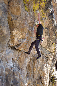 Tommy Leading Pow WowThere are several crags in the Big Chief Area, but they like the Center Wall, because it has climbs for climbers of all abilities, from 5.7 to 5.13+, most of which are sport routes. They thought this would be perfect place for all of us – even me – to have some fun. The other great thing about this wall is that it is in the sun for most of the day, so they would be able to thaw out from their chilly sleeping conditions.
There were so many good climbs that we spent the entire day there. I even managed to complete two 5.9s called War Path and War Paint. They did some more difficult ones, including a 5.11a called Pow Wow. I was starting to notice a theme here.
I really like climbing on volcanic rock because it tends to have a lot of features to hold onto. However, climbing outdoors does still intimidate me a bit, so I have to admit that I am happy when I am done for the day – especially after successfully completing a challenging climb.
I could very much understand why they liked this climbing area so much – volcanic rock, plenty of sport routes, a wide range of grades, afternoon sun, and great views.
Rock Climbing at Snowshed Wall
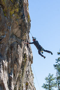 Herb Flailing on Pow WowAlthough tempted to go back to Big Chief for another day of climbing, we decided to explore one of the climbing areas near Donner Pass that we had scouted out the day before they arrived. Plus, I thought that they would be interested in seeing Rainbow Bridge and the tunnels and snowsheds along the old Transcontinental Railroad line.
The area we selected was called Snowshed Wall, appropriately named because of its location just beneath one of the snowsheds.
The approach was much easier than Big Chief – both the drive and hike in. Not that the Big Chief approach was a big deal. In fact, the hike in was quite nice. However, Snowshed Wall was visible from the parking access on Donner Pass Road and the walk in was less than 5 minutes.
Although they (not me) got a few climbs in, I would have to say that they very much preferred Big Chief.
After climbing, we parted ways – the kids drove down to King’s beach on Lake Tahoe to play beach volleyball with their friends, and Herb and I went back to Prosser Reservoir Campground to go for a run.
I tried to repeat the run that I got lost on, so I could figure out how I got so screwed up. Funny,
I didn’t realize how hilly it was at the time – probably because I was too worried about finding my way back to think about it. Maybe that’s a good training tip.
Secret Cove Beach
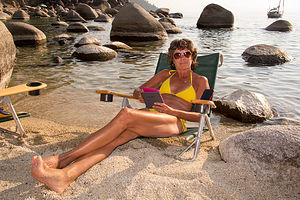 Lolo Chilling at Secret CoveHere we were again – back at our favorite Tahoe Beach. We were starting to feel like one of the regulars that we see every time we come here. Practically everyone had just come back from Burning Man, so it was interesting listening to them share tales of their experiences at this rather unique annual gathering in the desert.
However, the highlight of my day occurred when Herb struck up a conversation with someone we had met the last time we had been here. “Do you like Smashball?” he asked Herb. Before Herb even got a chance to answer, he handed Herb a paddle and started hitting a ball at him. I don’t think this was exactly how Herb planned on spending his time at the beach, but darn if he wasn’t pretty good at it. I was so proud.
Around 2:00 pm, just like last time, the winds picked up and the water that had been like glass all morning, got rough and choppy. They even have a name for this wind – the Tahoe Zephyr, and it appears every day like clockwork. No more dips for me.
Before leaving, Herb got roped into one more Smashball session, breaking their previous record of 50 consecutive hits. I think he is ready to go pro.
After such an active weekend with the kids, it was so relaxing to just hang out at this pristine beach – reading, taking a dip in the chilly water, chatting it up with the locals, reading some more, etc.
From here the trip was pretty much done – just the drive back to the Petaluma KOA and then prepping the RV for storage and flying home.
Description
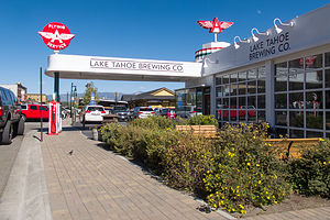 Downtown Truckee Flying A Service StationThe town of Truckee is located about 100 miles east of Sacramento just off I 80 and 11 miles north of Lake Tahoe. The historic downtown is steeped in Old West history. Back in the 1800s, railroad workers and lumberjacks frequented its many saloons, brothels, and gambling hall's. Although replaced today by trendy restaurants and boutiques, the downtown area is still fun to walk though.
Truckee is an outdoor enthusiast’s paradise with abundant recreational opportunities, such as skiing, hiking, and rockclimbing. Donner Memorial State Park is a wonderful place to learn more about this area’s fascinating history.
Nearby Prosser Reservoir Campground, just 6.5 miles north of Truckee, is a great place to camp. The 29-site campground is located at 5,800 feet on the west shore peninsula of the reservoir. There are no hookups.
Donner Memorial State Park
The park, which is located just south of I80 3 miles west of downtown Truckee, preserves the history of the area and the people who came to this part of the Sierra, including the infamous Donner Party and the Chinese builders of the transcontinental railroad.
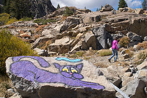 Lolo Hiking by the Snowsheds with Purple CatThings to see and do:
- Visitor Center and Emigrant Trail Museum
This interesting museum features compelling exhibits that tell the stories of the Emigrant Experience, the Donner Party, and the Chinese construction of the transcontinental railroad, as well as early motoring adventures over Donner Pass.
- Pioneer Monument
Adjacent to the Visitor Center stands a stone pedestal commemorating one of the darkest moments in American pioneering. In the winter of 1846-47, a group of 89 pioneers were en route to California when they encountered a severe snowstorm near Donner Pass, forcing them to spend the winter on the east side of the mountains. All but 49 of the party perished, and some of those that survived did so by resorting to cannibalism. The stone marker is 22 feet tall, marking the height of the amount of snowfall during that fateful winter. Atop the pedestal stands a family of pioneers gazing west towards Donner Pass.
- Tunnels and Snowsheds ot the Transcontinental Railroad
In 1868, after five years of a grueling construction effort by mostly Chinese laborers, 1,659-foot Tunnel #6 through Donner Pass was completed. The Sierra Nevadas had finally been conquered by the Central Pacific Railroad. All in all four tunnels, several miles of snowsheds, and two “Chinese Walls” were necessary to breach Donner Summit. Conquering Donner Summit was by far the most difficult challenge of the entire Sacramento to Ogden Central Pacific Railroad route.
Today, these tunnels and snowsheds can be explored by visitors. They are located along Donner Pass Road, west of Donner Lake.
- Rainbow Bridge
During the 1920s, this concrete-arched bridge near Donner Summit was built as part of historic Route 40, the primary highway for motorists traveling between Atlantic City, NJ and San Francisco before the construction of I80 in 1964. From the bridge the views of Donner Lake, the surrounding mountains, and the town of Truckee are spectacular.
- Donner Lake
Beautiful 2.7-mile long, 1-mile wide Donner Lake is popular for power boating, water skiing, sailing, kayaking, swimming, and fishing. From the lake, you can look up at rugged Donner Pass with the ill-fated party struggled to haul their wagons up the granite cliffs.
Sebastopol and Side Trips to San Francisco, Sonoma, Napa, and Marin Counties
Wednesday, August 26, 2015 - 9:00am by Lolo285 miles and 5.5 hours from our last stop - 8 night stay
Travelogue
Sonoma County is such a beautiful place with so many things to do, so we decided to head back to our base camp at the Petaluma KOA, where we would be in striking distance to the boys and lots of great activities.
Baker Beach, Planet Granite, and Pizzetta 211
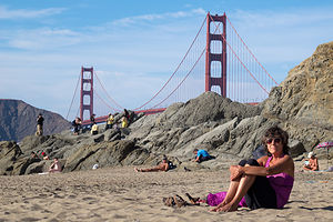 Lolo at Baker BeachWe had made arrangements with Andrew, Tommy, and Celeste to meet them at Planet Granite after they got out of work, but it was such a beautiful day that we decided to head down to San Francisco early and take a walk along the beach.
It is still so amazing to me that there can be such a beautiful beach within the limits of a major city. Being from New Jersey, we still have an issue with the Pacific Ocean water being so cold compared to the Atlantic, but the views definitely compensate. Its setting alone beneath the eucalyptus-covered rugged cliffs of the Presidio would be incredible enough, but the views of the Golden Gate Bridge and the Marin Headlands beyond it make it truly astounding.
Unlike our last time here, it was very warm, so people were actually frolicking in the water. It was such a lovely sunny day that it seemed like much of the city was out enjoying the beach in their own way – children frolicking in the water, couples walking hand in hand along the shoreline, nude volleyball players leaping around the sand – this is San Francisco after all.
Herb and I spent a pleasant hour soaking up the sun and the activity on the beach before heading out to Planet Granite.
Herb has been an avid rock climber for decades, but I am a rather recent and reluctant convert to the sport. However, now I absolutely love it and am usually the driving force for getting down to Planet Granite as often as possible when we are in the San Francisco area. It is an absolutely beautiful gym, with 50-foot high, floor-to-ceiling windows overlooking the Golden Gate Bridge, Alcatraz, and Crissy Fields. Plus, there are so many climbing routes of various difficulty levels that I could climb here for a week and never repeat a climb. It’s like a giant jungle gym for adults.
After a really fun and challenging two hours of climbing, we decided that 8:00 was about the time to quit and find some dinner. Rather than go out and sit in a restaurant when we were all sweaty, we picked up several pizzas from Pizzetta 211, one of their favorite pizza establishments in the Richmond district. I used to think that New York City had a monopoly on great pizza, but the artisan, thin-crusted pies with so many creative toppings at this place and so many others in San Francisco are truly amazing. For example, one of the pies we ordered was Farm Egg, Shiitake Mushrooms, Butter Braised Leeks, Truffled Pecorino, and Hazelnut Picada. A far cry from the pepperoni and peppers we normally add to our pie back in New Jersey.
Lake Berryessa and Napa Valley
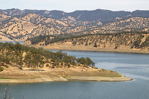 Lake Berryessa in DroughtAs I mentioned, we plan to move to Sonoma County once our house in New Jersey sells, so we are always on the lookout for how we can transition our old lives into new surroundings. One of the challenges in that transition is what to do about our 20-foot Grady White. Currently, we store it in our backyard and trailer it to destinations such as the Hudson River, Long Island Sound, the Connecticut River, Martha’s Vineyard, etc. The East Coast has so many great nooks and crannies that it is truly a boater’s paradise, and we were concerned about losing that when we move west, especially when California is in such an historic drought. We had seen firsthand just how devastating the drought was when we hiked near Lake Sonoma last year and saw how low the lake had become.
I had been told that Lake Berryessa in Napa County was one of the best places to boat, so we decided to take a drive to check it out – besides, I wanted an excuse to drive through Napa Valley.
However, although Sonoma and Napa Valleys are near each other as the crow flies, they are separated by the Mayacamas Mountains, so there are not many roads connecting the two, and those that do are usually quite steep and windy. However, at the southern end of the valleys, relatively flat Route 12 connects the two, so we began our drive north through Napa Valley in the town of Napa.
Another factor in our transitioning to a new home is proximity to a climbing gym. Strangely enough, at this point in my life, climbing a few times a week has become not just a luxury, but more of a necessity for my mental and physical well-being. So, just in case we expanded our eventual house search to Napa Valley, we stopped in the appropriately named Rockzilla gym in the town of Napa to make sure it would fit our needs. It was a really good gym, and the only one we have ever been to that has indoor chimney routes.
From there, instead of taking Route 29 through the Valley – we would save our vineyard tour for later -- we drove northeast on Highway 121 towards Lake Berryessa. The road got steep quite quickly and we climbed about 1,200 feet in the first 5 milea. For the next 40 miles it was pretty much up and down the whole way. I knew exactly what Herb was thinking – would we really want to trailer our Grady up and down this road?
When we got to our first view point of the lake near the Soda Creek Inlet, we were shocked. The Inlet was completely dry from the drought. Despite that, we could envision just how beautiful this lake would be, if only it had water.
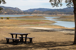 Lake Berryessa Dry Boat Launch RampWe continued driving on the Berryessa Knoxville Road, which traced the western shore of the lake, stopping first at the Bureau of Reclamation Field Office where we spoke to a ranger about the condition of the lake. It was, as she said, pretty dire and desperately in need of rainfall. At full capacity it is 23 miles long, 3 miles wide, and has 165 miles of shoreline. With such beautiful surroundings, this lake had such potential for some very awesome boating. Hopefully, the rains would come.
After this depressing stop, we continued on to the Oak Shores Day Use Area to have a picnic lunch. Once again, we could envision what a great place this would be to swim or launch or kayak, but the water was just too far away.
Spirits were a little low, as we seriously doubted this would be a good place for our boat – both in terms of the drive to get to it and the lack of water. We drove back down along the western shore, but instead of heading back towards the town of Napa, we took Route 128 west towards the town of Calistoga at the northern end of Napa Valley.
When we came to it, we took the alternative Silverado Trail, which parallels the section of 128 which goes through the valley, but is higher up and has much better views.
Calistoga is a very cute town, as our most of the towns in both Sonoma and Napa Valleys. Many of the names of the towns definitely let you know that you are in wine country – like Zinfandel and Kenwood.
From Calistoga, we could have taken one of the windy roads over the Mayacamas Mountains back to Petaluma – as was recommended as the shortest route by Google Maps – but we wanted to do the entire drive from Calistoga to Napa through the Valley. Also, we were pretty much done with roads that looked like intestines on the map and preferred using the flat Route 12 to get back to Sonoma.
So we spent an enjoyable 45 minutes driving past vineyards as far as the eye could see, avoiding the temptation – at least for now – of stopping in for a tasting.
My first Sonoma running club race and chillin’ in Sebastopol
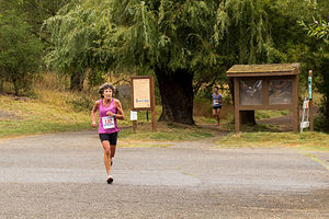 Lolo Racing with Empire RunnersWe are pretty much a family of runners. The boys ran cross country and track in both high school and college, and Herb and I run at least 3 or 4 times a week and compete in an occasional 5 or 10K race. However, my biggest love in recent years has been watching them run rather than participating myself, with the exception of an annual Turkey Trot.
When Andrew moved to San Francisco two years ago, he joined the running club that Celeste and her dad belonged to, which runs cross country and track races throughout the year. Tommy joined it as well when he moved there in August. Now that we were talking about moving to the area, they were very much pushing for us to join as well. I have been pretty competitive at the local level in the past, so they had high hopes of me running really fast – at least in the old lady class. Great.
So, I agreed to run in a 6K Empire Runners Club race in Spring Lake Park. This would be the first cross country race (as opposed to road race) of my life. I am not sure why at the tender age of 59 I am taking up rock climbing and cross country racing, but what the heck.
Not to make excuses, but my training had been rather light the last few months because of an ankle which I rolled while running behind Herb on the edge of a road. This happened the day after Andrew convinced me to register for the famous, and expensive, Bay to Breakers race in San Francisco on my upcoming visit.
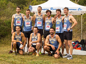 Andrew and Tommy with Empire Runners Club MensPushed by my rather obsessively competitive spirit, coupled with Andrew’s rather unrealistic faith in me being able to run 7 minute miles (which I hadn’t done in some time), I jumped back into training before the swelling even went down, and proceeded to sprain it again about a month ago.
Okay, enough with the excuses. Needless to say, it wasn’t my finest race, but it was fun nonetheless and made me want to train harder to get back to where I once was, and to not have Andrew ask me questions at the end of the race like, “What the heck happened to you? You looked like you were out for an afternoon jog.” Next time, I would show him.
The best part about racing is when it’s over, especially when followed by a big, delicious breakfast, which we had at the very popular Parkside Café in Santa Rosa.
Andrew, Tommy, Celeste, and Paul had raced very well, so they were rather uncharacteristically ready for a day of just relaxing and eating throughout the day. Great way to spend a day – if only we didn’t have to do that racing stuff first to earn it.
Point Reyes National Seashore
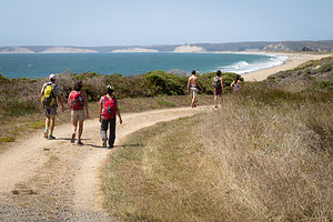 Hiking at Point ReyesThe Point Reyes National Seashore is an unbelievable treasure to have so close by. Just 40 miles north of San Francisco and 55 miles south of Sebastopol, it is an easy daytrip from either. Within its 71,000 acres, it has 110 miles of sandy beaches, over 150 miles of hiking trails, viewpoints for watching migrating whales and elephant seals breeding, and even a Tule Elk Reserve. Herb was especially excited about watching the elephant seals breed, but he was just going to have to wait until next winter.
On our last visit to Point Reyes, we had hiked in the Tule Elk Reserve, on sandstone cliffs high above the sea, but this time we (meaning our family and Celeste’s) chose to do the 5.5-mile Laguna Loop Trail, which would bring us out onto beautiful Limantour Beach.
After stopping briefly at the informative Bear Valley Visitor Center, we continued on to the trailhead, which was located right near the Hostel, just off Limantour Road.
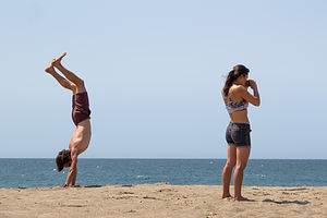 Andrew and Celeste at Point ReyesWe set off on the Laguna Trail which immediately began to climb for the next mile through coastal scrub and grassland before descending to the Fire Lane Trail. From here the trail remained pretty flat and at about the 2 ½ mile point, we found ourselves on a beautiful south-facing beach on Drakes Bay.
One of Herb and my fears of moving from New Jersey is replacing the beautiful beaches along the Jersey shore that we frequent so often, so we were delighted to find such a lovely one not too far from where we intended to move. A major difference though is that the Pacific is just too cold to swim in comfortably without wetsuits, so I don’t think we would be frolicking in the waves like we do back east. However, the incredible aesthetics certainly make up for it.
We made a note to return soon with beach chairs and books to spend a leisurely day in the sun. In fact, if you continue reading, you’ll see that we actually come back the very next day. Fortunately, there is a road and parking lot at the beach, so a 2 ½-mile hike laden with beach paraphernalia is not required.
This section of beach is part of the 16-mile Coast Trail, Point Reyes longest trail, which extends for 16 miles to the east to Palomarin Beach, near the southern tip of Point Reyes. However, we headed west along the Coast Trail, tracing the shoreline before it veered north back towards our cars.
Back at the trailhead, we played good Samaritans to a confused looking couple who had inadvertently hiked here rather than to where their car was parked back at Limantour Beach. Paul and Hilda kindly gave them a ride to their car before we proceeded to a late lunch at the Station House Café in the quaint town of Point Reyes Station, population 350.
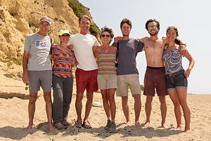 Happy Hikers at Point ReyesPoint Reyes Station is one of the many picturesque towns along the Northern California coast that cater to the crowds that leave the city and make the exodus up the coast each weekend to hike, bike, beach, shop, dine, and drink at these idyllic towns.
Although there were inside tables at the Station House Café, we decided to take one in their lovely patio garden, despite the warning that there might be some issues with bees. Fortunately, we didn’t encounter any, and we had a lovely, delicious lunch al fresco.
After lunch we said our goodbyes to Andrew, Tommy, and Celeste who headed down the coast back to the city where they went back to work the next day. They grumbled a bit about wanting to retire like we were, so they could do this kind of fun stuff every day, but we reminded them that they had a few more years of working life ahead of them before they got to that point.
Back to Limantour Beach
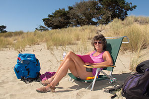 Lolo at Limantour BeachThis time we drove to the beach rather than hike and Herb loaded up his “system,” which consists of a large red backpack, stuffed with towels, books, and cooler and two wind guards attached to each of its sides, with the beach chairs draped over the poles. In all our times to various beaches, we have never seen this “system” duplicated. I am not sure if that is a good or bad thing.
Well, there’s not much to say about a day of sunning and reading at the beach, but let’s just say that it was really, really good.
I was just so happy that my sun-worshipping husband had found a place that made him happy.
North Sonoma Mountain Hike
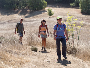 North Sonoma Mountain HikersSonoma County encompasses such an extraordinary geographical diversity – oceans, rivers, lakes, beaches and coastal cliffs, mountains and valleys, redwood forests, and more – and thankfully it has been blessed with some very forward-thinking land-use planning and conservation efforts, which have resulted in a majority of its acreage being preserved as open space for the public to enjoy.
There are 11 state parks in Sonoma County, ranging from beaches to mountains to redwood forests and historical sites, and I am proud to say that we have already been to 5 of them. It's nice to know that there are 6 more out there waiting for us to explore.
In addition to the state parks, there are 49 Sonoma County Regional Parks running the length of the county from Bodega Bay to Gualala on the coast, and from the Pacific to Sonoma Valley wine country. The parks encompass nearly 60,000 acres and have over 140 miles of hiking trails. We have already been to many of them, but it is nice to know that there are so many more to see.
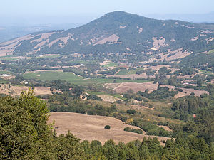 View from North Sonoma Mountain Regional ParkCeleste’s parents (Paul and Hilda) know the Sonoma area so very well, that they have pretty much been to all its park and hiked all its trails. That is why it was so nice to accompany them on a hike they had never been on before in the newly created North Sonoma Mountain Regional Park.
The vision for this park’s creation was connecting Sonoma Mountain with Jack London State Historic Park via a 4.5-mile multi-use trail. However, due to time constraints, we turned around after 3.3 miles and an elevation gain of 1,000 feet, with the promise of returning in the future to make the entire 9-mile, out-and-back trek to and from Jack London State Park.
Sonoma Plaza and Sonoma State Historic Park
We are quite enthusiastic history buffs, and being from the East Coast, we know our American Revolutionary War and Civil War history well, as there as so many wonderful historic sites to visit. However, we have a lot to learn about California’s history – from its period of Mexican influence to its brief independence to statehood.
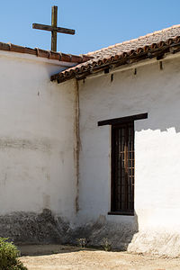 Mission San Francisco Solano de SonomaThe Sonoma State Historic Park, the site of the last of the 21 Spanish missions to be established and the place where the Bear Flag Revolt occurred, seemed as good a place as any to get up to speed on our California history.
We began our tour at the Visitor Center in the Sonoma Plaza, which was designed in the 1830s by Mexican Governor Mariano Guadalupe Vallejo. It is the largest Plaza in California and still serves as the town’s focal point today.
Our first stop was the Bear Flag Revolt monument in the northeast corner of the plaza, commemorating California’s short-lived history as an independent nation – in fact, it lasted less than a month. Briefly, this is how it went down.
During the early 1840s, many American settlers came to Alta Vista, but were prohibited by the Mexican government from owning land or holding office. Finally fed up, on June 14, 1846 they rode into Sonoma, arrested General Vallejo, and hoisted a hastily made Bear Flag right on this very spot in the Plaza. Without firing a single shot, they declared California an independent republic. However, less than a month later, an American naval vessel captured the Mexican capital at Monterey and claimed California for the United States. The Bear Flag was lowered from the Plaza and the Stars and Stripes rose in its place. Not completely forgotten though, the Bear Flag is the still the official flag of the state of California.
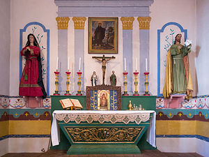 Mission San Francisco Solano de Sonoma AltarFrom there, we crossed the street to the Mission San Francisco Solano de Sonoma, founded in 1823 by Father Jose Altimira, This mission, which is the last and northernmost of the 21 missions in Alta California, was the only one to be built after Mexico had gained its independence from Spain. Like the other missions, its purpose was to convert Native Americans to Christianity. Unfortunately, this also seemed to involve using them as a cheap labor source.
The exterior of the Mission is made of white adobe with a plain wooden cross at the apex of its roof. There is a small museum inside with exhibits of mission life, religious paintings, and watercolors off all the California missions.
After viewing the exhibits, we entered the Mission’s most splendid room – the simplistically beautiful chapel. The long, narrow room, with white adobe walls like the exterior, is mostly empty, except for the raised colorfully painted wooden pulpit at the far end. A brightly painted green gate prevents visitors from entering the altar area. The soft choir music, sung in Latin, in the background added to the solemnity of the experience.
Our next stop was the Sonoma Barracks (or Presidio of Sonoma). In the 1830s, Mexican Governor Mariano Vallejo began construction of the Presidio of Sonoma as a way of countering the presence of Russians at Fort Ross. After its completion, Mexican soldiers were transferred from San Francisco to Sonoma and housed in this two-store, adobe building. Later in 1846 after the successful Bear Flag Revolt, the Barracks became the headquarters of the short-lived California Republic.
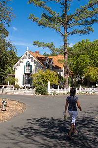 Lolo Approaching Lachyrma MontisOur final stop in Sonoma State Historic Park required a pleasant half-mile walk along a bike path northwest of the Plaza. The lovely path led us to Lachyrma Montis, the home of General Vallejo, whom you might remember as the Mexican Governor before the Bear Flag Revolt. Well, he stayed around afterwards and became both a U.S. General and a California State Senator. He embraced the American way of life and built a classic, Yankee-style, two-story Gothic home beside a spring. He named in Lachryma Montis (mountain tear), which is the Latin translation for Chiucuyem (crying mountain), the name of the free-flowing spring on the property. Vallejo and his family live in Lachryma Montis for 35 years.
On your way back to the Plaza, be sure to peek into the Toscano Hotel, an 1850s hotel and bar. We missed it on our way to Lachryma Montis. It is furnished with beautiful 19th-century period furniture. The bar downstairs is set up with old card tables and chairs, with antique photos and memorabilia on the walls. The kitchen and dining room, which are in a separate building behind this one, have blue-and-white checked tablecloths and a menu board listing the day’s specials.
The whole afternoon was an incredible, and very educational, trip back in time.
Description
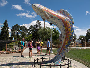 Santa Rosa Trout SculptureSebastopol is a charming town in Sonoma County, 52 miles north of San Francisco and about a 20-minute drive to the coast. Sebastopol is known for its apples and hosts an annual Apple Blossom Festival in April and the Gravenstein Apple Fair in August. Today, however, the apple orchards are becoming vineyards as wine-making moves more and more into the region.
Every Sunday, from April to mid-December, there is a Farmers market in the downtown plaza,
where people congregate to enjoy delicious fresh regional food, live music, and dancing.
Sebastopol is home to the artist, Patrick Amiot, known for his whimsical, cartoon-like, junk-art sculptures. There are over 200 of his wacky, found-object works scattered throughout Sebastopol, especially on Florence Street.
Two interesting side trips we took from Sebastopol:
Point Reyes National Seashore
The Point Reyes National Seashore is a 71,000-acre park preserve located on the Point Reyes Peninsula, about 40 miles north of San Francisco. It has 110 square miles of sandy beaches and over 150 miles of hiking trails.
Some interesting things to do within the park include:
- Bear Valley Visitor Center – exhibits and ranger-led programs
- Point Reyes Beach (Great Beach) – 11 mile expanse of Pacific shoreline
- Limantour Beach = sheltered beach with great birdwatching
- Mission Vision Overlook – panoramic view of Point Reyes Peninsula
- Point Reyes Lighthouse – great place to spot migrating gray whales in winter
- Chimney Rock – great viewing spot to watch elephant seals as they breed and molt
- Drakes Beach – sheltered beach beneath sandstone cliffs
- Abbotts Lagoon – 1.5-mile trail to diverse bird habitat and nesting area of snowy plover
- Tule Elk Reserve – hunted to near extinction in the 1800s, Tule elk were reintroduced in 1978 to this designated wilderness
Historic Sonoma Plaza
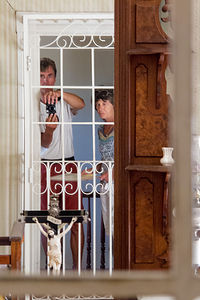 Herb and Lolo in Lachyrma MontisIn the 1830s, Mexican Governor Mariano Vallejo began construction of the Presidio of Sonoma as a way of countering the presence of Russians at Fort Ross. After its completion, soldiers were transferred to Sonoma from San Francisco. Vallejo also designed the Sonoma Plaza, which today is the largest Plaza in California. Today the plaza is a National Historic Landmark and still serves as the town’s focal point.
The eight-acre park is surrounded by many historical buildings and sites, including:
- The Mission San Francisco Solano de Sonoma
Founded in 1823 by Father Jose Altimira, this mission was the last and the northernmost mission in Alta California. It was the only mission built after Mexico had gained its independence from Spain.
- The Sonoma Barracks (or Presidio of Sonoma)
Mexican Governor Mariano Guadalupe Vallejo had this two-story, adobe building facing the central plaza built to house the Mexican soldiers transferred from San Francisco.
After the successful Bear Flag Revolt of 1846, in which a group of American immigrants took over the Pueblo of Sonoma and established their own California Republic, the Barracks became the headquarters of this short-lived insurrection.
- Site of the Bear Flag Revolt
During the early 1840s, many American settlers came to Alta Vista, but were prohibited by the Mexican government from owning land or holding office. Finally fed up, on June 14, 1846 they rode into Sonoma, arrested General Vallejo, and hoisted a hastily made Bear Flag at the northeast corner of the plaza. Without firing a single shot, they declared California an independent republic. The Sonoma Barracks became their headquarters.
The newly established California was very short lived. Less than a month later, an American naval vessel captured the Mexican capital at Monterey and claimed California for the United States. The Bear Flag was lowered from the Plaza and the Stars and Stripes rose in its place.
Today the Bear Flag is the official flag of the state of California. The monument to the Bear Flag can still be found in the northeast quadrant of the plaza.
- Lachryma Montis
After California became part of the United States, in 1849 General Vallejo embraced the American way of life and built a classic, Yankee-style, two-story Gothic beside a spring about a half mile northwest of Sonoma Plaza. He named in Lachryma Montis (mountain tear), which is the Latin translation for Chiucuyem (crying mountain), the name of the free-flowing spring on the property. Vallejo and his family live in Lachryma Montis for 35 years.
Lake Siskiyou Camp Resort
Sunday, August 23, 2015 - 7:15am by Lolo100 miles and 2.5 hours from our last stop - 3 night stay
Travelogue
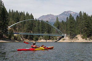 Lolo Kayaking in Wagon Creek InletThe drive north up 89 to Lake Siskiyou near Mt. Shasta was scenic and relatively short -- just a little over 2 hours – a perfect driving day for Herb.
We had been to Lake Siskiyou Camp Resort before and really enjoyed boating around the lake with the formidable Mt. Shasta looming over us. On our last visit, Mt. Shasta had been completed blanketed in snow making for some very awesome pictures. This time, however, we were shocked to see that the volcano was brown with only tiny patches of snow. Granted, it was August and last time we had seen it in May, but from what we heard and read, the snow deficit resulting from the drought was pretty historic. In fact, during the prior two winter seasons, the Mt. Shasta Ski Resort was barely able to open, hurting the local economy that depends on the influx of skiers to the area.
Kayaking around Lake Siskiyou
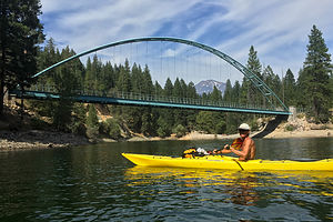 Herb Kayaking in Wagon Creek InletSince the day was still young, we launched our kayaks at the boat ramp, and spent the day paddling around the lake. I couldn’t believe what a difference the lack of snow on Shasta made on the overall experience. It probably would have been better if I didn’t know what I was missing, because then I could have enjoyed the lake and its beautiful surrounds more without lamenting what wasn’t.
Going counter-clockwise around the lake, we soon came to the Lake Siskiyou Splash Zone, where there were several large inflatable structures to climb up on and jump from. It looked like a lot of fun. I was tempted to get out of the kayak and play on some, but I hadn’t purchased a ticket, which costs $8 per hour. Also, everyone else playing on them was either under 10 years old or a parent.
Continuing on, at about halfway around the lake, we paddled into Wagon Creek Inlet and passed under the picturesque, green, arched pedestrian bridge, which provides a perfect frame for photos of Mt. Shasta in the background. This is my favorite part of the lake.
After floating and eating lunch, we continued along the northern shore of the lake, stopping once more at an interesting area where the shoreline is studded with stumps that are normally submerged during wetter times.
All in all, the trip around the perimeter of the lake was 5.9 miles and took us a little over 4 hours – and that’s with lots of just lean-back-and-float time included.
Hiking Gray Butte and Exploring Mt. Shasta City
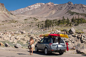 Subaru in Old Ski Bowl parking lotI often consult my Moon California Hiking book when selecting a hike. I like the way they rate hikes on a scale of 1-10 for scenic beauty and 1-5 on difficulty (one being the easiest). The hike to the top of Gray Butte near Mt. Shasta was rated a 10 and 2, respectively – perfect!!
The 14-mile drive along the Everitt Memorial Highway from Mt. Shasta City to the trailhead was a worthwhile activity in itself. We intentionally drove past the Panther Meadow Campground, where the trailhead was, and continued about another mile to the Old Ski Bowl parking lot, the highest point you can drive on Mt. Shasta.
While today, this is the starting point for several hikes, including the one to the summit, it used to be a downhill ski area. Built in 1959, this early day ski resort was pretty ill conceived. Located in a huge open cirque above the tree line at 8,000 feet, it was constantly plagued with avalanches, whiteouts, and road closures. During a 1959 storm that lasted 5 days, it received 16 feet of snow, breaking a Guinness Book of World Records record.
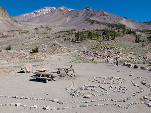 Lolo with Romantic Art WorkAlthough it was in operation for nearly 20 years, a huge avalanche in 1978, which destroyed its main chair lift, finally resulted in it permanently closing down. Eventually in 1985 a new ski park was built lower down on the mountain in an area below the timberline that was safe from avalanches. Ironically, its problems the last two years have been due to lack of snow.
It was too early for us to utilize one of the picnic tables in the cirque, but we did take time to admire the romantic art work – a heart and “Love” spelt out in large white rocks.
We drove the short distance back to the Gray Butte trailhead in Panther Meadows Campground. From the campground, we passed through lovely Panther Meadow, with Mt. Shasta constantly in our sights, before entering a red fir forest.
At about 0.6 miles, we came to a junction with the Gate Trail, which leads off to the north toward a volcanic valley that some believe to be the mountain’s sacred portal to the spiritual dimension. We decided to skip the spiritual dimension for today and continued south along the more secular Gray Butte trail.
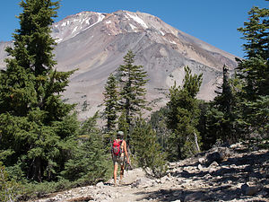 Lolo Hiking up to Gray ButteAs we continued our climb along the eastern side of the butte, the trees changed from red fir to hemlocks. In fact, this area is recognized as one of the best hemlock groves in northern California. About a mile into the hike, we passed through a clearing along the top of a large talus slope falling off to the east, where we could see Red Butte off to the left.
At about 1.2 miles, we made a sharp turn to the right (west) and began hiking along the southern side of Gray Butte. From here, our views were more of the manmade variety as the towers and antennas of the Gray Butte communication facility came into view off to the south.
At 1.6 miles, the trail went right (north), and we climbed along a clearing with stunted hemlocks. Another 0.3 miles and a short scramble over sharp volcanic rock brought us to the 8,119-foot summit of Gray Butte where we were rewarded with tremendous views of Castle Crags, Mount Lassen, and, of course, the ever present Mt. Shasta.
This is an out and back hike, so from there we retraced our steps down to Panther Meadow Campground.
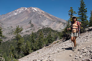 Lolo on Descent from Gray ButteRather than head right back to the campground, we decided to explore Mt. Shasta City for a bit, starting with lunch at the highly Yelp-rated Yaks Cafe. It did not disappoint with its artisan coffees, gourmet burgers, excellent salads and sandwiches, and much more. We had a very delicious salad and coffee.
Herb wanted to pick up some foam to support the kayaks on the roof rack, so we stopped in a local hardware store. Everyone was so extremely friendly, helpful, and yes, spiritual – something you don’t often find in a hardware store.
As with many other volcanoes, Mount Shasta is considered to be sacred, and spiritual seekers from around the world come here for healing and transcendence. Even customers in the hardware store were talking about their spiritual health. We just needed foam.
Like Sedona, Arizona, Mount Shasta is believed to be the site of a spiritual vortex, an area of high energy concentration originating from magnetic, spiritual, or unknown sources. Vortexes are also thought to be the gateway or portal to other realms, both spiritual and dimensional. If we had made a left rather than a right turn at The Gate trail junction on our hike earlier that day, we could have possibly entered one. We are just too boring and pragmatic to achieve transcendence on a hike.
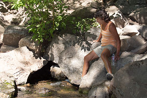 Lolo Approaching Headwaters of the Sacramento RiverWe headed next to Mt. Shasta City Park to search for and drink from the headwaters of the Sacramento River. The search was pretty easy – it was well signed out – but the filling of my water bottle was a bit more of a challenge, as I clambered on rocks and barely avoided falling into the headwaters on my hindquarters.
On the way back to the campground we made a stop at the Mt. Shasta Sisson Museum, a small, volunteer operated museum dedicated to preserving the history of Mt. Shasta area. It is on the same grounds as the oldest fish hatchery west of the Mississippi. Admission to the museum is free, but a $1 donation is suggested.
We spent a fun half hour exploring the photographs and exhibits explaining the history of the town and the mountain. Our favorite exhibit was one in which you could sit in a simulated train engine and pretend that you are the conductor – fun for kids of all ages.
Back at Lake Siskiyou Camp Resort, we sipped some wine on the beach overlooking the mountain before retiring back to our campsite.
It had been a very full and fun day.
Hiking to Heart Lake and Kayaking around Castle Lake
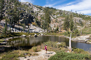 Heart LakeThe girl behind the counter at Yaks Café yesterday had told us that her favorite lake in the area was Castle Lake. She said that it was very beautiful and much more secluded and quiet than Lake Siskiyou – and a great place to launch kayaks.
It wasn’t very far from our campground – just a mile on the road back towards town, and then 7 miles south on Castle Lake Road.
This was a two activity stop, the first of which would be a 3-mile round-trip hike to even more secluded Heart Lake.
From the parking area, we followed the trail left along the eastern side of the lake. Fairly quickly, the trail veered away from the shoreline and began climbing up the eastern wall above Castle Lake. As we continued to climb, we occasionally caught views of the lake through the trees.
After hiking a little over a mile and making about a 600-foot elevation gain, we came to a saddle and began looking around for the trail. It certainly was not very clearly marked or heavily traveled. Finally, Herb spotted a faint trail to the right. I was not totally convinced, but it was the only game in town, so we followed it up toward a high ridge. Herb was right. Once we reached the top of the ridge, there it was – tiny but lovely Heart Lake right below -- and it really was shaped like a heart.
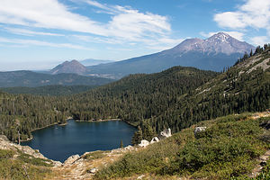 Mt. Shasta with Castle LakeWe walked the short distance down the trail to a rocky outcrop that extended into the lake. In fact, it was this protrusion of rock that gave the lake its heart shape. What a romantic place for lunch. I could practically hear the mushy things Herb was going to say to me over our turkey sandwiches.
After lunch, we walked counter-clockwise around the lake and continued west up a rocky trail to a tremendous view of Mt. Shasta with Castle Lake in the foreground below. What a beautiful spot!
The way back was easier to navigate and before long we were back at Castle Lake, where we launched our kayaks at the short, but steep ramp near the parking area.
The lake is stunning – set in a glacial cirque with water as blue as Tahoe’s. Its striking blueness is a result of its pureness and low nitrogen content. UC Davis scientists have been sampling and studying the lake since the 1950s.
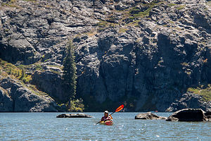 Lolo Kayaking Castle LakeWe started paddling along the western shore to the lake’s most prominent feature -- a high back wall of granite rising from the southwestern shore.
The whole trip around the perimeter of the lake was only 1.3 miles, so after returning to the boat launch, we decided to head back out on the lake. This time I had my eye on the second most prominent feature in the lake – a raft at the southern end, perfect for sunbathing. Unfortunately, a couple had beaten us to it and no amount of casually circling nearby triggered them to give it up. Oh well.
What a great paddle though! I was really enjoying all the opportunities for kayaking in some of the most beautiful lakes in California. We had gotten our kayaks out on the water more this trip than all the other trips combined. What a way to explore a beautiful area!
Sundial Bridge in Redding
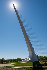 Sundial Bridge and SunOur drive back to our base camp in Petaluma took us south on I5 past the depressingly low waters of drought-ridden Shasta Lake, and near the town of Redding, where we exited to take a brief side trip to see the famous Sundial Bridge.
This steel, glass, and granite bridge, which was completed in 2004, was designed by the world renowned Spanish architect and engineer Santiago Calatrava. As its name suggests, the bridge is an actual functioning sundial, and one of the largest in the world. However, it is more of a technological marvel and work of art than a replacement for your watch, as its sheer size limits its time keeping abilities. The shadow traces such a large arc that it can only reveal the time between 11 am and 3 pm. Also, in winter the shadow is too far into the nearby arboretum to be seen. When the shadow is visible though, as it was when we were there, you can actually see it move, which it does at the rate of about one foot per minute.
It is definitely worth the stop for anybody passing through Redding.
Description
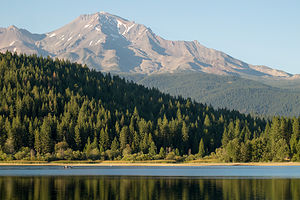 Mt. Shasta with Lake SiskiyouThe Lake Siskiyou Camp Resort is located just 3 miles west of Mount Shasta City, on the lovely shores of glacier-fed, 435-acre Lake Siskiyou. With fantastic views of snow-covered Mount Shasta from its shores, it is one of the prettiest reservoirs in Northern California.
The 7-mile dirt Lake Siskiyou Trail, which encircles the lake, is popular with walkers, joggers, and mountain bikers. The views of Mount Shasta along the way are awesome.
There is a large 150-site, very popular campground for RVs of any length, with full and partial hookups. There are 225 additional sites for tents. There is also a marina, boat rentals (canoes, kayaks, pedal boats, motorized boats), free boat launching, a fishing dock and fish-cleaning station, boat slips, and a swimming beach.
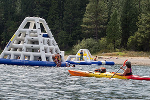 Lolo in Lake Siskiyou Splash ZoneRecreational opportunities on the lake include:
• swimming
• trout and smallmouth bass fishing
• low-speed boating (boat ramp and boat rentals available)
• hiking the Lake Siskiyou Trail

