- Home
- About
- Map
- Trips
- Bringing Boat West
- Migration West
- Solo Motorcycle Ride
- Final Family XC Trip
- Colorado Rockies
- Graduates' XC Trip
- Yosemite & Nevada
- Colorado & Utah
- Best of Utah
- Southern Loop
- Pacific Northwest
- Northern Loop
- Los Angeles to NYC
- East Coast Trips
- Martha's Vineyard
- 1 Week in Quebec
- Southeast Coast
- NH Backpacking
- Martha's Vineyard
- Canadian Maritimes
- Ocracoke Island
- Edisto Island
- First Landing '02
- Hunting Island '02
- Stowe in Winter
- Hunting Island '01
- Lake Placid
- Chesapeake
- Provincetown
- Hunting Island '00
- Acadia in Winter
- Boston Suburbs
- Niagara Falls
- First Landing '99
- Cape Hatteras
- West Coast Trips
- Burning Man
- Utah Off-Roading
- Maui
- Mojave 4WD Course
- Colorado River Rafting
- Bishop & Death Valley
- Kauai
- Yosemite Fall
- Utah Off-Road
- Lost Coast
- Yosemite Valley
- Arizona and New Mexico
- Pescadero & Capitola
- Bishop & Death Valley
- San Diego, Anza Borrego, Joshua Tree
- Carmel
- Death Valley in Fall
- Yosemite in the Fall
- Pacific Northwest
- Utah Off-Roading
- Southern CA Deserts
- Yosemite & Covid
- Lake Powell Covid
- Eastern Sierra & Covid
- Bishop & Death Valley
- Central & SE Oregon
- Mojave Road
- Eastern Sierra
- Trinity Alps
- Tuolumne Meadows
- Lake Powell Boating
- Eastern Sierra
- Yosemite Winter
- Hawaii
- 4WD Eastern Sierra
- 4WD Death Valley +
- Southern CA Deserts
- Christmas in Tahoe
- Yosemite & Pinnacles
- Totality
- Yosemite & Sierra
- Yosemite Christmas
- Yosemite, San Diego
- Yosemite & North CA
- Seattle to Sierra
- Southwest Deserts
- Yosemite & Sierra
- Pacific Northwest
- Yosemite & South CA
- Pacific Northwest
- Northern California
- Southern Alaska
- Vancouver Island
- International Trips
- Index
- Tips
- Books
- Photos/Videos
- Search
- Contact
Death Valley - Eureka Dunes
Tuesday, April 25, 2017 - 8:00am by Lolo137 miles and 3 hours from our last stop - 1 night stay
Travelogue
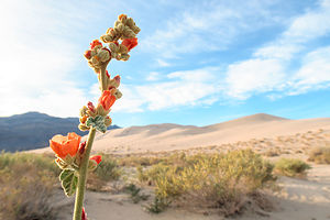 Desert BloomThis was to be a very different type of visit to Death Valley than our previous ones in that we would be heading out to some of its remote areas in our Subaru Forester.
As one should always do before heading out on 4WD roads, we stopped at the Furnace Creek Visitor Center to discuss road conditions with a ranger and to get some advice as to what would be appropriate for us. Although our Subaru is very capable off road, it’s not exactly a rock crawler, nor are its tires as beefy as the trucks devoted to this sport.
We originally thought we would drive out to the Racetrack, where the rocks mysteriously move when no one is looking, but the ranger told us that our tires would be eaten up by the rocks in no time, and we would most likely have to be towed out. Okay, forget that idea.
However, he did give us two good suggestions – the 40-mile drive to Eureka Dunes and/or also the 40-mile drive down the Saline Valley to the hot springs, both of which he felt our Subaru could handle without a problem. He even said that if we left soon, we should be able to get to Eureka Dunes with several hours of daylight to spare.
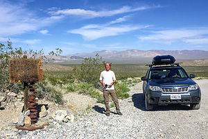 Crankshaft Junction on the way to Eureka DunesWe left the Visitor Center and headed north towards Scotty’s Castle. When we came to the junction for Scotty’s Castle/Ubehebe Crater, we took a left towards the crater. Actually, we had no choice as the road to Scotty’s Castle was so damaged by storms that it is closed, and expected to be so for quite some time. Rather than going all the way to the crater, at about 2.8 miles after the junction we turned right onto the Death Valley / Big Pine Road.
The dirt-and-gravel Big Pine Road was well-maintained and definitely navigable for a 2WD vehicle. At about the 18 mile point, we came to our first landmark – Crankshaft Junction, named for the castoff engine parts that less-fortunate travelers left at this remote site. It made you think a little bit.
We continued on for another 12 miles before turning left onto the South Eureka Road to the dunes. The road was a bit rougher and sandier than the Big Pines Road, but comfortably doable in our 4WD Subaru Forester. I’m not sure if it is advisable with 2WD, but that could certainly be confirmed by talking to a ranger.
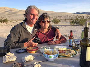 Cocktail hour at Eureka DunesIt was another 10 miles along the South Eureka Road to the campground near the base of the very impressive Eureka Dunes, the largest dune in California and the second largest in the entire U.S. The campground was dry (no water or flush toilets) and had only four designated sites. Fortunately, there was one left, which we grabbed. A bit further down the road, there are a few more dispersed campsites without the amenities of a picnic table and fire ring.
As striking as the dunes were, an even lovelier view from our campsite was of the Last Chance Mountains, rising 700 feet from the Eureka Valley floor, brightly painted by the evening light.
We spent a lovely evening, enhanced with wine and cheese, with our very interesting camping neighbor David, a professional photographer that currently lives in India in the same village as the Dalai Lama. He was visiting the states for two months because his photographs are being exhibited at several galleries throughout the country. Later that evening, he went back to his camper and returned with a copy of his recently published book, a stunning collection of portraits of Tibetan migrants. We were honored when he offered to take our photo with my cell phone.
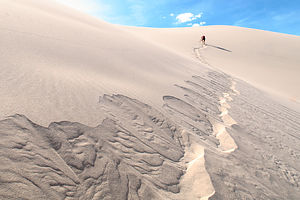 Making the dunes singThe next morning, Herb and I set out on our hike up the dune, an exercise I always find more grueling than anticipated – 2 steps forward, 1 step back. Plus, although we did get a relatively early start in the morning, it was already getting pretty hot up there.
It was actually a little tricky finding the summit, as each time we climbed to the top of a ridge, we saw another one higher. The guidebook said that it was 700 feet high, so we kept track of our progress on Herb’s altimeter watch.
There were portions of the hike that were so steep that I actually had to bend my body forward into the incline and use my hands as well. I looked like a gorilla. Meanwhile, each step on the really steep parts set off what looked like a river of sand, starting about 3 feet above us and continuing right below us for another dozen or so feet. The patterns we created were beautiful.
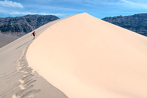 Almost thereBesides the intriguing visual effect, we were also making the dunes “sing.” Singing sand dunes are quite rare and there are only about 40 of them in the entire world. The singing is really more of a booming sound, and it is triggered by an avalanching movement of sand.
After a few false summits, Herb’s altimeter watch eventually showed a gain of 690 feet – good enough. We looked around and saw no higher ridge, so we declared ourselves at the top.
The way down was a heck of a lot more fun and took about a third of the time it took us on the way up. I felt like I was running down a hill of pudding.
All in all, the hike was a very rewarding, and exhausting, 2.1 mile round-trip.
Description
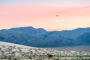 Desert Sunset with "Leonard the Drone"The Eureka Dunes are located in an enclosed basin at 3,000 foot elevation in the northwest corner of Death Valley National Park. Rising 700 feet above sea level, they are the tallest sand dunes in California and possibly the tallest in all of North America.
They are reached via a series of rutted dirt and gravel roads subject to washout, so reaching this area requires a 4WD vehicle.
The climb to the summit is about 2 miles (RT) and should be done early in the day or later in the evening when the temperature is cooler. The climb to the summit is challenging, as the slopes are steep and the loose sand gives way beneath your feet. During the steepest parts of the hike, the sand avalanches in rivulets and begins to sing. This “singing sand” phenomena, resulting from the friction of the sand grains sliding against each other, sounds like the bass note of a pipe organ. The views at the top are worth the struggle to get there.
As tall as these impressive dunes are, they are dwarfed by the colorfully striped limestone walls of the Last Chance Mountains, which rise 4,000 feet above the valley floor.
Rhyolite
Tuesday, April 25, 2017 - 7:45am by Lolo218 miles and 4.5 hours from our last stop
Travelogue
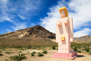 Lady Desert: The Venus of NevadaThe next morning, we headed east on 120, a beautiful road that brought us into Nevada, and then south to the town of Beatty, near the eastern entrance to Death Valley.
However, we couldn’t just breeze through Beatty without a stop at one of our favorite outdoor sculpture museums – the Goldwell Open Air Museum in Rhyolite. This place is literally in the middle of nowhere.
The museum, which is open to the public 24 hours a day 7 days a week, has seven monumental outdoor sculptures that are colossal not only in their scale, but in their dramatic setting amongst mountains and the Mojave Desert. It was precisely this stark setting that attracted a group of Belgian artists in the 1980s to choose this location to create their art.
 Where's Waldo?My two favorites sculptures were by Albert Szukalski, and they both involve an unusual technique he developed in which a live model is draped in plaster-soaked burlap and has to remain still until the plaster dries enough to stand on its own. I can’t even begin to imagine how uncomfortable this must have been for the models. It gets really, really hot here.
Szukalski’s largest work is entitled “The Last Supper,” and it consists of 12 white ghostly shapes arranged as in Leonardo da Vinci’s painting of the same name. The shapes have no faces or bodies – just drapes hanging on an invisible form.
My second favorite was aptly called “Ghost Rider.” As in Szukalski’s other works, a ghostly draped figure – minus the body inside – stood beside an actual real bicycle, as if it was getting ready to go for a ride.
 Ghost Rider of RhyoliteI also took the time this visit to walk the entire maze, which according to Strava was a tenth of a mile.
For anyone passing through this area, the Goldwell Open Air Museum is truly worth a visit.
Just up the road from Goldwell is the Rhyolite Ghost Town. Coming from the East Coast, ghost towns are still a bit of a novelty for us, and we can’t resist a poke around. Each of them has its own not-so unique story – someone discovers gold, thousands descend on area, town springs up, mines dry up, people leave, buildings crumble, tourists come.
At its height, Rhyolite had a population of 5,000, hotels, stores, a school for 250 children, an opera house, a railroad depot, an ice plant, an ice cream parlor, two electric plants, foundries and machine shops, and a hospital. Rhyolite even had a red light district which drew women from as far away as San Francisco.
 The old Cook Bank of RhyoliteToday, there is not much left of this once lively and boisterous town. Not nearly as much to explore as there is at Bodie State Historic Park near Bridgeport, California, where we really got a feel for what life must have been like in one of these boom towns.
All that remains intact in Rhyolite is a beautiful, old railway depot and the Bottle House, a home made from 50,000 beer and liquor bottles. The most photographed image in Rhyolite is of the ruins of the old three-story Cook Bank. In fact, it is the most photographed ruin in the entire state of Nevada.
As always, Rhyolite had been a very interesting stop, but it was time to head into Death Valley and figure out where we would be camping for the night.
Description
The small town of Rhyolite is located just off Highway 394, near the eastern edge of Death Valley National Park. It is only 35 miles from the Furnace Creek Visitor Center.
For such a tiny, remote town, there are two very interesting sights, which make it a very worthwhile side trip from Death Valley:
Goldwell Open Air Museum
 Ghostly PaletteThe Goldwell Open Air Museum is located just off State Highway 374, near the Rhyolite Ghost Town. The museum, which is open to the pubic 24 hours a day 7 days a week, has seven monumental outdoor sculptures that are colossal not only in their scale, but in their dramatic setting amongst mountains and the Mojave Desert.
It was this dramatic setting that led a group of prominent Belgian artists in the 1980s to choose this location as a place to create art freely. The museum was organized in 2000 after the death of Albert Szukalski, the Belgian artist who created the site’s first sculptures. His unusual technique involved molding shapes by draping plaster-soaked burlap over live models until the plaster dried enough to stand on its own. His largest work, “The Last Supper,” consists of 12 large white ghostly shapes arranged as in da Vinci’s painting of the same name. Another one of is pieces entitled “Ghost Rider” is a plaster figure getting ready to mount a bicycle.
Today artists continue to create in this spectacular and challenging landscape as part of an art residency and workshop program.
An on-site visitor center with exhibits is open from 10:00 am to 4:00 pm, Monday through Saturday. In summer it often closes by 2:00 pm because of the heat. Admission is free.
Rhyolite Ghost Town
 Rhyolite Ghost TownLike many western towns, Rhyolite sprang up from nowhere when in 1904 Shorty Harris and E. L. Cross discovered quartz on a nearby hill. Soon thousands of gold-seekers flocked to the area, settling in a sheltered desert basin which was named Rhyolite because of the silica-rich volcanic rock in the area. By 1908, the population grew close to 5,000, and the town had hotels, stores, a school for 250 children, an opera house, a railroad depot, an ice plant, two electric plants, foundries and machine shops, and a hospital. Rhyolite even had a red light district which drew women from as far away as San Francisco. One enterprising miner named Tom T. Kelly built a Bottle House, made from 50,000 beer and liquor bottles. That house is one of the buildings that still remains today.
As with so many other boom towns, Rhyolite declined as quickly as it rose. The financial panic of 1907 made it more difficult to raise capital, and soon mines began to close and the banks to fail. By 1910, production had significantly slowed and there were only 611 residents left in town. In 1911, the mine and mill were closed down and by 1916 the light and power in the town were turned off.
After 1920, Rhyolite became a tourist attraction and a setting for motion pictures. Today visitors can see several remnants of the town’s glory days: the railway depot, the Bottle House, and the ruins of the three-story Cook Bank and an old jail.
Lee Vining (Mono Lake)
Monday, April 24, 2017 - 6:45pm by Lolo300 miles and 5.5 hours from our last stop - 1 night stay
Travelogue
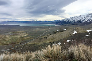 Approach to Mono LakeBecause of the record-breaking snowfall in the Sierras this past winter, the only way to get across the Sierras (besides going all the way down to Bakersfield) was Route 50 through South Lake Tahoe.
As a New Jerseyite for 60 years, I am still intrigued by this idea of “going to the snow,” where you can literally drive from 80 degree sunny weather to a winter wonderland within 4 hours. As we drove through the tiny town of Kyburz on 50, more and more snow appeared on the sides of the road. It even hailed on us for a good part of the way.
Eventually we crossed over and started heading down 395, also known as the Eastern Sierra Scenic Byway – and for good reason. For most of our drive, we had jaw-dropping views of snow-covered mountains both to west and east.
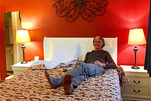 Herb relaxing in the Lake View LodgeKnowing we would not get to Death Valley that first day, we stopped at a motel in Lee Vining for the night. It was unseasonably cold and so windy that there were white caps on Mono Lake. We had hoped to eat at our favorite gas station (Whoa Nellie Deli), but were told that it was still closed for the season until the following week. The town was pretty much dead, so we made do for dinner with supplies from our cooler.
Lee Vining is worthy of much more than a mere drive there. It is in a beautiful location with so many wonderful things to do. I have tried to describe some of them in the Description section of this stop (see Tab above).
Description
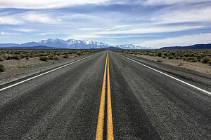 Sierra BoundLee Vining is a small town along the Eastern Sierra Scenic Byway (Highway 395) located on the southwest shore of Mono Lake and the eastern entrance to Yosemite National Park.
Some highlights in the area include:
Mono Lake
Mono Lake is located just off Highway 395 near the town of Lee Vining, California, 13 miles east of Yosemite National Park. Mono Lake is extremely unique. First of all, at over 1 million years of age, it is one of the oldest continuously existing lakes in the continent. Secondly, it is about 2 ½ times as salty as the sea and about 80 times as alkaline. This is because Sierra streams flow into Mono Lake bringing trace amounts of salts and minerals, but the lake has no outlet other than evaporation. As a result, the concentration levels of salts and minerals keeps growing each year. Thirdly, and the main reason Mono Lake is so popular, are the hundreds of spectacular “tufa towers” that rise from the lake. These intriguing calcium-carbonate sculptures were formed beneath the water when carbonates in the water combined with calcium from freshwater springs feeding into the lake. As lake levels dropped, these extraordinary-looking knobs, spires, and minarets became exposed. Most of the towers visible in the lake are from 200 to 900 years old and rise as high as 30 feet above the water.
Panum Crater is a small, dormant crater located just south of Mono Lake and east of Highway 395. The Crater, which last erupted in 1325 AD, is a perfect example of a rhyolitic plug-dome volcano. A marked and maintained trail leads around the rim of the crater, with spectacular views of the Eastern Sierras, Mono Lake and the Mono Basin. The crater is about 2,000 feet across. A side trip leads down into the lava dome at the center of the volcano where there are bizarre rock formations and huge chunks of obsidian everywhere. The rim and trail into the dome is about 2 ½ miles long with a total elevation gain of about 200 feet.
Black Point is a flat-topped volcanic hill on the north side of Mono Lake. It last erupted about 13,000 years ago beneath the waters of what was once a much deeper Mono Lake. As the cinders and lava cooled and hardened under water, the top split open to form several hundred-yard-long cracks, or canyon-like fissures, measuring from 20 to 50 foot deep and only a few feet wide. When the waters of Mono Lake receded after the Ice Age, Black Point became a peninsula. It is the only fully exposed underwater volcano on earth.
There really is no trail to the Black Point Fissures, and they can be challenging to find because they are not visible until you are standing at their edge. The best thing to do is to start at the BLM trailhead and follow the lines of footprints up the gently sloping butte across cinders and ash to the level plateau on top of the point. The fissures can be found about 800 feet beyond the small rocky promontory near the southeast corner, radiating northwards away from a small line of cliffs along the south edge of the summit plateau.
All the fissures have sloping sides so they can be entered without much difficulty. Be sure to do so to see the unusual knobby textures and colors along their walls.
On the way down, expansive views of Mono Lake and the Sierras lie before you.
Lundy Canyon is located about seven miles north of Lee Vining, along the eastern boundary of Yosemite National Park. The Lundy Canyon trail is the backdoor into the 20 Lakes Basin area of the Hoover Wilderness and along its way are some of the best waterfalls in the Eastern Sierras. The trailhead is located at the end of Lundy Lake Road, about 2 miles past Lundy Lake. Although the entire trail goes to Saddleback Lake (in 6 miles), most people turn around at 2.2. miles when the trail becomes much steeper and treacherous alongside a steep wall of unstable shale. For much of the hike, the trail rises alongside Mill Creek, passing several beaver ponds, lower Lundy Falls near the beginning of the trail, and the Upper Falls near the turnaround point where the trail begins to climb out of the canyon.
Home
Wednesday, February 22, 2017 - 9:45am by Lolo155 miles and 3.5 hours from our last stop - 1 night stay
Los Banos KOA
Tuesday, February 21, 2017 - 9:30am by Lolo421 miles and 8 hours from our last stop - 1 night stay
Travelogue
As we have learned from our previous trips to Southern California, I5 is surprisingly devoid of services north of Bakersfield. However, on our last drive north, we discovered the KOA in Los Banos, a nice campground just 3 miles off I5, about 3 1/2 miles from home.
Since all the sites are full hookups, it is a great place to start prepping the motorhome for storage - clean, vacuum, final dump, etc.
Description
KOA campground located just 3 miles west of I5, near the San Luis Reservoir State Recreation Area.
Joshua Tree National Park
Thursday, February 16, 2017 - 9:15am by Lolo100 miles and 2.5 hours from our last stop - 5 night stay
Travelogue
Day 1 – Get two campsites in Jumbo Rocks Campground and 4WD the Geology Tour Road
 Jumbo Rocks CampgroundThe weather during our visit to Anza-Borrego had been beautifully warm and sunny, but the next two days (Friday and Saturday) were forecast to be miserable – cooler temperatures, heavy rain, and wind. There was even snow forecast in Death Valley.
Poor Herb. He loves the warmth of the desert and had been so looking forward to a lengthy desert tour with such stops as Joshua Tree, Mojave Preserve, and Death Valley.
Rather than just giving up and going home, I tried to figure out how best to salvage the trip. Rock climbing is better in cooler temperatures than in normal desert heat, so I texted the boys and asked them if they wanted to join us in Joshua Tree, a premier rock climbing destination, for the long Presidents’ Day weekend. I was going out a bit on a limb here, because we didn’t have a campsite in Joshua Tree, nor did we know if we could get one. However, Jumbo Rocks Campground’s first-come-first-served policy, our ability to arrive there on a Thursday, and the forecast of rain for the next two days gave me hope.
 Geology Tour RoadThe boys immediately said yes, and asked us to grab a second campsite if we could, as their girlfriends and Celeste’s parents wanted to come as well. Oh boy, I had really set something in motion that lots of people were pretty excited about. I only hoped that I could deliver. Not only was I looking for one good campsite, but now I had to find two, preferably next to each other.
So, we set off from Anza-Borrego early Thursday morning and drove the 3 hours to the Jumbo Rocks Campground in Joshua Tree. We were able to get two sites next to each other, but the campground was much fuller than I expected. I am sure that if we had waited another day or even a few more hours, it would have been too late.
No rain yet, so we headed out in the Subaru to take a drive on the Geology Tour Road, an 18-mile dirt road through some of the park’s most distinctive geological formations. The first 5 miles of the drive, up until Squaw Tank, doesn’t required 4WD, the 8 mile loop around Pleasant Valley after that does.
 Geology Tour RoadThe drive is pure Joshua Tree scenery – jumbles of red rock boulder, hundreds of the name-sake Joshua trees, and the intriguing open expanse of the Pleasant Valley playa. On the way back, we stopped at Squaw Tank to see the small dam built by 19th century ranchers to collect rain water for their cattle. This was also an area used by nomadic Native Americans more than 1,000 years ago. The natural tanks were a great place to collect water and the openings in the rock could have been used for shelter. Stone mortars used for grinding see can be found in the bedrock.
Afterwards, we returned to the campground to settle in for the day. Jumbo Rocks is a beautiful destination in its own right, with huge boulders and interesting rock formations strewn throughout. It was nice to just sit in the back of the RV with a glass of wine, watching the rocks change colors in the evening light.
Day 2 – 4WD Covington Flats to Eureka Peak
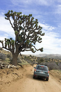 Off-roading to Eureka PeakWe had company coming and not much food left after 10 days on the road, so needed to do a massive food shopping adventure at the Vons in Yucca Valley.
On the way out of the park, we stopped at the Visitor Center in Twentynine Palms to ask the ranger for an interesting 4WD road to take with a Subaru Forester. He told us that most of the off-roading in Joshua Tree is fairly hardcore and that the heavy winter rains had made conditions even more challenging, but that we should have no problem with Covington Flats to Eureka Peak in the northwestern corner of the park. Perfect. That was right near the Vons. We would do the drive first and then food shop afterwards.
The Covington Flats area was a great suggestion. The roads were good and we got to see some of the park’s largest and oldest Joshua trees. Some of them were more than 30 feet high. The weather started to change for the worse during our drive, and by the time we got to Eureka Peak, the wind was so strong that we couldn’t even get out of the car to enjoy the wonderful view. Still it was a really fun 25-mile drive.
The food shopping was a lot less fun, but it was kind of exciting to be getting ready for visitors.
Day 3 – Awaiting company and a cozy dinner for 8 in the motorhome
 Sunset on Jumbo Rocks CampgroundWe awoke to the pitter patter of raindrops on our roof, which pretty much went on all day. Still, the view out the back window was nice and we had lots of good books to read.
Despite the lousy weather, the campground had totally filled up overnight. The forecast for Sunday and Monday was stellar, so I think people were willing to tough it out for one night in order to get a campsite.
Our whole gang arrived later that afternoon and since it was still raining, we all hung out in the motorhome. Amazing how much smaller it felt with eight people in it. Fortunately the mid-bath Lazy Daze has two couches in the back, between which you can set up a table. With that table and the dinette, we were able to fairly comfortably fit eight people for dinner. Let’s just say it was very cozy.
Day 4 – Rock Climbing – The Outbacks, The Blob, Bachar Boulder, and Barker Dam
 Heading to the next climbing areaJoshua Tree is one of the most popular climbing areas in the country, especially in the winter where its relatively warm weather attracts climbers from around the world. I think we pretty much had hit it at its peak weekend. However, with over 8,000 climbing routes, Joshua Tree can accommodate a lot of climbers. The problem is finding a place to stay, or even park. Already by early morning, all the campgrounds were full and the day parking areas were overflowing.
Andrew and Celeste have different climbing preferences than Tommy and Erin. Andrew and Celeste tend to prefer bouldering and challenging sport routes while Tommy and Erin like trad, multi-pitch climbs. Fortunately, we could find both in the Hidden Valley Campground area, where we were early enough to find parking – even for the motorhome, which the kids insisted on bringing to that we could have a place make lunch. We shouldn’t have listened to them.
 Tommy on Hobbit RoofHerb and I followed Andrew and Celeste through the Hidden Valley Campground to a popular bouldering area called “The Outbacks.” Meanwhile, Tommy and Erin went to the North Face of “The Blob,” a huge amorphous formation on the northwest side of the campground.
After watching Andrew and Celeste boulder for awhile, Herb and I went to find Tommy and Erin on the Blob. I am definitely the weak link in this climbing family, but they are always so nice about trying to set me up on a climb that I can do, which usually means something in the 5.7 to 5.9 range. Erin led a 5.7 climb called the Hoblett so that I could follow her up. I found the bottom part fairly easy, but there was a really awkward off-width to get through the overhang. Eventually, I got it, but not without a lot of squealing.
 Herb on Hobbit RoofNext, we moved to the back side of the Blob, where Tommy and Erin took turns leading a 5.10d called Hobbit Roof. It was a very cool looking climb, with an intimidating roof dissected by a large crack. “Old Man Herb” (the boys’ affectionate term for their dad when he is climbing) did it as well. I passed, still licking my wounds from the Hoblett.
While we were finishing up on the Blob, Andrew and Celeste stopped by to say hello on their way to the “Bachar Boulder,” where Celeste had a date with destiny on the classic JBMFP (John Bachar Memorial Face Problem), a V5 boulder problem which she had worked on repeatedly and somewhat obsessively on their last visit to Joshua Tree.
Boulder routes are referred to as boulder problems, because figuring them out and completing them is very much like solving a problem – finding just the right moves and holds and putting the sequence together. Many climbers will work on a difficult boulder problem for weeks or even years. It is often quite elegant and beautiful to watch, and a cause for celebration when achieved.
 Andrew on Bachar BoulderAlso, bouldering has its own difficulty grading system. Rather than the 5.0 – 5.14 grades used for trad and sport climbing, boulder routes are graded from V0 to V14. As far as difficulty, a V5 is about equivalent to a 5.12a/b trad/sport climb.
Although we didn’t get over to the Bachar Boulder in time to watch them, we heard later that Andrew flashed it the first time, and Celeste got to the very last move on three separate tries before falling.
Although I thought a lot of climbing had been done for the day, the kids were still ready for more. We decided to drive over to the Barker (not to be confused with Bachar) Dam to look for Gunsmoke, an 85 foot traverse rated V3.
Unfortunately, because we took the RV that morning, we were unable to get parking at the Dam, so Herb and I went back to the campground. However, they later reported that Andrew and Tommy simultaneously on-sighted Gunsmoke, while Celeste and Erin, too mentally drained from their previous efforts that day, wisely observed while drinking a beer.
Day 5 – Rock Climbing – The Outbacks, Intersection Rock, Bachar Boulder, and Tumbling Rainbow Formation
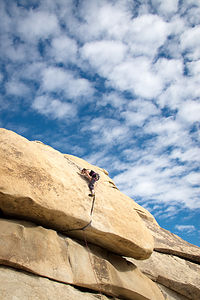 Erin on Hobbit RoofAnother day in Joshua Tree with the kids meant another day of rock climbing. We headed back to the Hidden Valley Campground area and once again split up – Andrew and Celeste went back to the The Outbacks to play on the False Hueco Boulder and Tommy and Erin went to do a multi-pitch climb on Intersection Rock. It’s called Intersection Rock because it is literally at the intersection of Park Boulevard and Barker Dam road, rising like an island in the pavement. It’s sort of the center of the Joshua Tree climbing world.
Herb and I bouldered with Andrew and Celeste for awhile, and I even completed a boulder problem. Although it was easy by their standards, it was still scary for me, as it required me to climb about 10 or 12 feet off the ground without ropes.
From our boulder, we were actually able to spot Tommy and Erin climbing up the rightmost diagonal crack on Intersection. They were on a 5.10b route called Right Ski Track. When looking at it, you could easily see how it got its name.
Before meeting up with Tommy and Erin, Andrew made a few attempts on Caveman, a V6+ that actually started inside what felt like a cave.
 Celeste (followed by her pony tail) coming off Bachar BoulderCeleste was still pretty obsessed with completing the Bachar Boulder problem of yesterday, so we all walked over and watched her make a few more very noble and courageous attempts. She gathered quite an enthusiastic crowd to cheer her on, but as yesterday, she fell right at the very last move. It often takes climbers months, or even years, to complete a difficult bouldering problem, so she knew she still had lots of time to get it on future trips to JT.
The day was still young, so after consulting the climbing guidebooks, we walked along the Hidden Valley Nature Trail towards a climbing crag called Tumbling Rainbow Formation in the Real Hidden Valley Area.
When we came to the climber’s trail, Tommy and Erin went right to get to the base of Fisticuffs, a Yosemite-like 5.10b trad crack climb, while the rest of us went left towards the base of Run For Your Life, a classic 5.10b sport face route.
For me, the approach to the base of a climb is often an event in itself. This was certainly one of those instances. There was one section that was so steep, that I only made it up because three very friendly and helpful climbers took pity on me and set up a rope for me to pull my way up on. I probably reminded them of their mother.
They were so so nice and so entertaining to listen to. They were on the climb Andrew wanted to do, so we waited and watched them. The climb was rated as a 5.10b R, which means that the bolts are pretty spread out, so a fall at certain places would not be good. I was starting to get really worried. Fortunately, our new friends came to the rescue again and volunteered to take our rope up with them so that they could set up a top rope for us. I really, really liked them now.
 Sunset over Jumbo Rocks CampgroundWhile we waited, we watched Tommy and Erin on Fisticuffs around the corner to the right. After completing their climb, they came over to join us, just as our new climbing buddies were leaving.
All the kids, and Herb, were able to successfully climb Run for Your Life on top rope. They then each took a go on the more difficult Runaway, a 5.11b just to the left. Although none of them got it cleanly, they did have fun trying.
I was dreading my climb back down from the base, but the boys set up a rope for me to lower myself down through the bad section. Thank God. If not, I would still be there now.
Another great day (our last in Joshua Tree) had been had by all - and another stunning sunset to enjoy.
That night Tommy and Erin drove to Palm Springs to have dinner with her grandmother, which made dinner for 6 seem almost spacious in the motorhome.
Description
 Covington Flats to Eureka PeakJoshua Tree, located 2 ½ hours east of Los Angeles and 2 ½ hours northeast of San Diego, encompasses 800,000 of pristine desert, one of the last great wilderness areas in the continental U.S. Two great desert systems meet within the boundaries of the park – the cooler, wetter, and higher Mojave Desert in the northwest and the hotter and drier Colorado Desert in the southeast.
The park’s namesake Joshua Trees are found in the Mojave section of the park, where they thrive on the cooler temperatures and higher elevation. They were named “Joshua” trees by early Mormon pioneers, who thought their thick, stubby branches resembled the arms of the prophet raised towards the heavens.
There are three visitor centers, one at each of the three entrances to the park: Joshua Tree (West Entrance), Oasis (North Entrance) and Cottonwood (South Entrance). Since there are no services (food, fuel, cell phone, etc.) within the park, visitors should stock up at one of the gateway towns just outside the park.
There are two major paved roads through the park:
- Park Boulevard – 45-minute drive through the northern section of the park, which traverses the most scenic portions of the park, including sweeping desert views, Joshua trees, and unique boulder formations.
- Pinto Basin Road - connects Park Boulevard with the southern portion of the park, passing from the higher Mojave Desert into the lower Colorado Desert.
Stops and activities along Park Boulevard include:
- Trailhead for the Boys Scout Trail (South) and the 7.1 mile round trip hike to Wonderland of Rocks, a maze of jumbled granite boulders with hidden groves of Joshua trees http://www.protrails.com/trail/160/joshua-tree-national-park-willow-hole...
- Hidden Valley - 1-mile loop trail along the interior of a rock-enclosed valley. Rock climbing is popular in this area.
- Keys View – a short side trip (5 miles each way) to an overlook atop the Little San Bernardino Mountains (5,185 feet elevation) with panoramic views of the Coachella Valley and mountains beyond.
- Keys Ranch – a short side trip (2 miles each way) to a 150-acre ranch in a remote rocky canyon. Most of the original buildings – ranch house, schoolhouse, store, and workshop – have been restored to the way they were when William Keyes died in 1969. 90-minute walking tours of the ranch are offered daily.
- Trailhead for 3-mile round trip Ryan Mountain hike, a short but strenuous climb with one of the best panoramic views of Joshua Tree from its summit http://www.protrails.com/trail/155/joshua-tree-national-park-ryan-mountain
- Queen Valley – a side trip through a network of 13.4 miles of dirt roads through the park’s most impressive groves of Joshua trees. This is also the starting point for the Geology Tour Road.
- Geology Tour Road –18-mile dirt road through some of the park’s most distinctive geological formations. There are 16 stops along the way, so allow approximately 2 hours for the round trip. RVs are not allowed, but two-wheel vehicles may go as far as Squaw Tank, stop #9. After that point, only 4-wheel drive vehicles are advised.
- Jumbo Rocks – a wide plateau of boulders, buttes, and domes that glow with fiery hues at sunrise and sunset. The 1.7-mile Skull Rock Nature Loop passes through a maze of spectacular rock formations.
http://www.protrails.com/trail/349/joshua-tree-national-park-skull-rock-... - Junction with Pinto Basin Road – turn right for the Pinto Basin Road towards the southern portion of the park and left towards the North Entrance in the town of Twentynine Palms, where the Oasis Visitor Center is.
- Fortynine Palms Oasis - A short distance from the Oasis Visitor Center on Highway 62 is the turnoff for Canyon Road and the trailhead for the 3.3-mile (round trip) Fortynine Palms Oasis Trail. The moderately strenuous trail climbs up a ridge where barrel cacti grow and then descends a rocky canyon to a pool surrounded by fan palms. At dawn and dusk, bighorn sheep are often seen here.
http://www.protrails.com/trail/211/joshua-tree-national-park-forty-nine-...
Stops and activities along Pinto Basin Road include:
- Trailhead for .3-mile Arch Rock Trail – this short trail leads through a boulder garden to a natural bridge nestled between two large boulders
http://www.protrails.com/trail/213/joshua-tree-national-park-arch-rock-n... - Cholla Cactus Garden – a 1/4 -mile nature trail loops through a dense forest of Teddy Bear Cholla, Silver Cholla, and Creosote. The best time to visit is early morning and late afternoon when the cholla are backlit by the most dramatic lighting.
http://www.protrails.com/trail/265/joshua-tree-national-park-cholla-cact... - Cottonwood Spring – located just 7 miles from the southern entrance to the park. In addition to a Visitor Center, several hikes begin from Cottonwood Spring:
The 3-mile loop trail to Mastodon Peak, a large rock formation that early miners thought looked like the head of a prehistoric Mastodon, with excellent views of the Eagle Mountains and the Salton Sea.
http://www.protrails.com/trail/162/joshua-tree-national-park-mastodon-pe...The 7.2 miles roundtrip trail to the Lost Palms Oasis wherefan palms, large boulders and spring-fed pools line a deep and narrow canyon floor.
http://www.protrails.com/trail/161/joshua-tree-national-park-lost-palms-...
Activities in the park include:
- Hiking - There are more than 191 miles of hiking trails in Joshua Tree, ranging from ¼-mile nature trails to 35 mile multi-day trips. For a list of hikes see:
http://www.protrails.com/area/24/joshua-tree-national-park#Trails - Rock climbing - In addition to its namesake Joshua Trees, the park is also known for its granite boulders that attract rock climbers from around the world. There are more than 4,500 established routes in the park, ranging from bouldering for beginners in the Wonderland of Rocks to multiple pitch climbs at Saddle Rock and Echo Rock. The most famous climb is Hidden Valley’s Sport Challenge Rock.
- Mountain biking and 4-wheel driving - Check out this link for a listing of dirt roads in the park: http://www.gorp.com/parks-guide/travel-ta-joshua-tree-national-park-scen...
There are 9 campgrounds in the park (none of which have hookups)
- Black Rock Canyon Campground (reserveble) - located in the northwest corner of the park at the end of Joshua Lane, 5 miles south of the town of Yucca Valley. Campsites are located on a hillside at the mouth of a canyon surrounded by Joshua trees, cholla cactus, and various desert shrubs. Several hiking trails start from the campground. There are 100 sites for tents or RVs up to 35 feet.
- Indian Cove Campground (reservable) - located in the northern part of the park at the end of 3-mile long Indian Cove Road, 7 miles from the town of Twentynine Palms.The campground is very popular with rock climbers because it lies within the Wonderland of Rocks. There are 101 sites for tents or RVs up to 35 feet.
- Hidden Valley Campground (first-come-first-served) - located in the northern section of the park along Park Boulevard, about 14 miles south of the town of Joshua Tree. Two miles from the campground at Barker Dam is the trailhead for a one-mile loop through the Wonderland of Rocks and a small lake that reflects the rock formations. This campground is very popular with rock climbers. There are 45 sites for tents and RVs up to 25 feet (no hookups).
- Ryan Campground (first-come-first-served) - located on Park Boulevard a few miles south of Hidden Valley Campground. The best hike in the park – the three mile roundtrip to the summit of Ryan -- Mountain starts here. There are 31 sites for tents and RVs up to 25 feet (no hookups).
- Sheep Pass Group Camp (first-come-first-served) - located a few miles east of Ryan Campground. There are six group camps for tents or RVs up to 25 feet.
- Jumbo Rocks Campground (first-come-first-served) - located about 9 miles south of the town of Twentynine Palms on the Utah Trail. Its unique granite rock formations make it a very popular spot for rock climbers. At 4,400 feet, this campground is the highest campground in the park. There are 125 sites for tents and RVs up to 25 feet.
- Belle Campground (first-come-first-served) - located on the Pinto Basin Road about 1.5 miles south of the junction with the Utah Trail. There are 18 sites for tents and RVs up to 35 feet.
- White Tank Campground (first-come-first-served) - located on the Pinto Basin Road about 3 miles south of the junction with the Utah Trail. There are 15 sites for tents and RVs up to 25 feet.
- Cottonwood Campground (first-come-first-served) - located on the Pinto Basin Road about 7 miles north of the Southern Entrance. There are 62 sites for tents and RVs up to 35 feet.
Flying J - Thousand Palms
Thursday, February 9, 2017 - 9:15am by Lolo200 miles and 5 hours from our last stop - 1 night stay
Travelogue
 Sunrise over Flying JLA traffic is awful. It took us hours to get east towards Anza-Borrego. Rather than pay to just sleep, we found a Flying J in Thousand Palms to spend the night. It was already close to 6:00 when we got there, so must of the parking spots were already taken by 18 wheelers. Some Flying J's separate the commercial trucks from the motorhomes, but this one didn't. We managed to squeeze ourselves into the very last spot in the entire lot. The only reason it was still there was that anything bigger than us wouldn't fit.
At least there was an In-N-Out nearby, so I didn't have to cook dinner.
Description
Flying J's are Travel Plazas that cater to truckers and RV's. Their numerous services include gas, dump station, propane, fast food restaurant, limited groceries, and even showers and a barber shop. However, the best feature of all is the section for overnight RV parking.
They are conveniently located on most of the interstates (except for the northeast).
Anza-Borrego State Park
Friday, February 10, 2017 - 9:15am by Lolo80 miles and 1.5 hours from our last stop - 6 night stay
Travelogue
Day 1 – Borrego Palms Canyon Hike
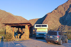 Our lovely campsiteAs I mentioned in the overview, our journey to Anza-Borrego came about as a result of a chance encounter in Yosemite with a fellow Lazy Daze owner, who not only told us how wonderful Anza Borrego was, but offered us their campground reservation at the Borrego Palms Canyon Campground, as they were unable to use it. This might not sound like much, but Anza-Borrego is extremely popular in February, and the campsite they had booked was the most highly-coveted one in the park. They weren’t kidding!
The campground had three sections: one for hookups, one for tent campers, and one for RV dry camping. Normally, I would have gone for the hookup, especially since we were going to be there 6 nights, but thankfully, I didn’t have the choice. While the hookup sites were nice enough, they were your usual asphalt parking lot with motorhomes separated by a few feet.
The dry camping area, however, was unbelievable. Our campsite, which was probably about an acre in size, was set right into the entrance to Borrego Palm Canyon, with incredible views out our back window. Rather than just an ordinary picnic table, we had a “Ramada” built by the Army Corp of Engineers in the 1930s. It was a beautiful stone and wooden structure that housed two large concrete picnic tables and a beautiful stone fireplace. We felt like the lords of the manor.
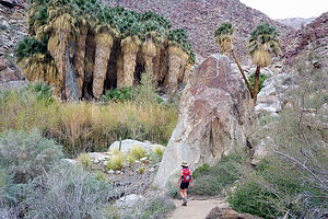 Our own little oasisAnother perk was that the trailhead for the 3.5-mile (RT) Borrego Palms Canyon hike, one of the premier hikes in the park, was in walking distance from our site.
Since it was only 3:30, we decided to set out on the trail that afternoon. In retrospect, I think it would have been better to do the hike in the morning when the morning sun paints the canyon with light. By 3:30, the shadows were already filling in the canyon.
For about a half mile, the trail meandered along a landscaped path bordered by boulders and ocotillo cacti before coming to our first creek crossing. From this point on, the trail became a bit confusing. I am sure that we zig zagged back and forth across that creek too many times in our attempt to follow the trail, but we couldn’t get too lost, as all we had to do was head towards the tops of the palm trees that we could see in the distance.
Eventually, we came to a short stone staircase, and after crossing the stream a few more times, we entered the Borrego Palm Oasis, one of the largest and last remaining naturally occurring native California palm groves on the planet.
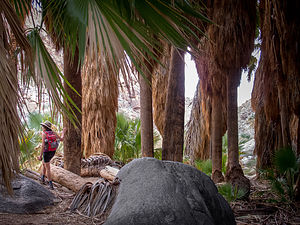 Lolo among the PalmsIt was so lush and green that it was hard to believe we were in a desert – not to mention all the stream crossings we had done and would have to repeat on the way back.
As impressive as the grove is, it has a lot fewer mature palms today as a result of severe flashfloods in 2003 and 2010, which wiped out a significant number of trees, the trunks of which are scattered throughout the canyon. I mistakenly bumped into a dead branch and was surprised to look down and find my leg bleeding. Palm trees always seem so innocuous to me, but even they have sharp thorns for defense.
The grove was making a comeback though. There were lots of cute little palm trees sprouting up throughout.
We retraced out steps back out of the canyon, crisscrossing the stream again and again. It was almost dark by the time we got back to our campsite. The sun disappears behind the canyon walls so early this time of year.
Day 2 – Hellhole Canyon Hike to Maidenhair Falls and 4WD to Fonts Point
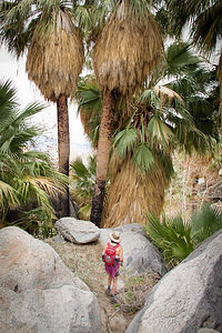 Hellhole Canyon palm oasisWe woke that morning, as we would every morning during our stay here, to an incredible view out our back window of the canyon, colorfully painted by morning light.
Our first stop that day was to the nearby Visitor Center, mostly to find out about 4WD road conditions, as that was something Herb very much wanted to do with our Subaru. We already had two excellent books: “California Desert Byways” and “The Anza-Borrego Desert Region,” which is pretty much the Bible for exploring the park, but it’s always wise to get some local knowledge as to the current road conditions.
While at the Visitor Center, we also picked up their informative “At Home in Anza-Borrego Desert Park Brochure,” which has recommendations for things to see and do in the park. I took it as my personal challenge to do as many of them as we could, which brought fear to Herb’s heart as he visualized any chance of his dream of just sitting still in the sun, reading a book and not moving, eluding him.
Herb watched warily as I checked Borrego Palms Canyon hike off on my Things to See and Do grid and plotted our next day’s adventure. He was not amused when I told him that I was going to try to get Bingo by checking off the entire grid.
First stop for the day – Hellhole Canyon, a 5-mile hike into a narrow canyon to a hidden waterfall oasis. This time we had to drive to the trailhead, which was just a mile south of the Visitor Center on Montezuma Valley Road (S22).
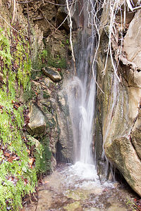 Maidenhair Falls in Hellhole CanyonThe hike began on the California Riding and Hiking Trail, where we meandered through typical desert scrubland before the Hellhole Canyon Trail split off at about 0.3 miles. We were able to identify cholla and ocotillo cacti, but there were plenty of other interesting desert plants that I wish we knew more about. We probably should have taken the short Nature Trail by the Visitor Center to learn more before setting out on our own.
Soon after the split, we came upon a pile of rocks resembling a grave with a sign reading “they didn’t bring enough water,” an ominous warning to those that do not take the harshness of the desert seriously. I think that danger applies to summer hikes, but I found myself instinctively checking to make sure my water bottles were in the side pockets of my backpack.
Eventually the trail climbed out of the wash and the walls of the canyon began closing in. There really was no set trail, so we spent the next mile and a half or so crisscrossing streams, bushwacking, and rock scrambling. It was quite confusing.
We eventually came to a grouping of about two or three short palm trees, but continued on hoping that this was not the oasis we were promised – and there was definitely no waterfall here. After a bit, we came to the second oasis, lusher and thicker, huddled around a stream.
We still had no idea where the waterfall was, but fortunately we met some returning hikers that told us we were almost there. They were right. After a bit more scrambling we arrived at a third oasis and lovely Maidenhair Falls, trickling over moss-covered canyon walls into a shallow pool.
I would say that we retraced our steps back, but we really had no idea just which of the many footprints in every direction were ours. We figured we would be fine if just followed the stream downwards.
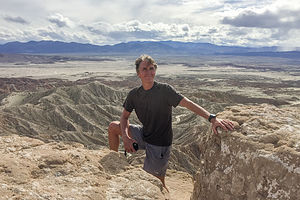 Herb on Fonts PointAll in all, the hike was 5.3 miles with about a 1,000 foot elevation gain.
Herb was itching to get the Subaru off-road, so we consulted his California Desert Byways guide for a recommendation. Since we were relatively new at this, and the Subaru is not as hardcore an off-road vehicle as a Jeep, we wanted to ease into this gently. Plus, we weren’t in it for the love of rock crawling, but rather as a means to get to some beautiful, desolate areas.
Fonts Point seemed like the perfect place to start – 7.8 miles round trip over a relatively easy, but very sandy road, with a big reward at the end – spectacular view of the Borrego Badlands, the Salton Sea, and the Fish Creek Mountains in the distance.
The Subaru performed like a champ and the drive was really fun. We would definitely be doing more of this during our stay in Anza-Borrego.
Day 3 – 4WD Fish Creek Wash, Wind Caves Hike, and Galleta Meadows
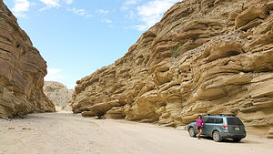 Fish Creek WashThe off-roading to Fonts Point yesterday had been so rewarding and fun that we decided to take on a longer and slightly more challenging one – the 25 mile (RT) drive up Fish Creek Wash to Sandstone Canyon. Plus, the author of our “California Desert Byways” guide said, “If you do only one drive in the park, this should be the one.” Sounded like a plan.
We packed lunch and headed out, this time east on Route 78 to the town of Ocotillo Wells. From there, we went south on Split Mountain Road for about 8 miles to the beginning of the Wash. At the entrance, we reset our odometer, so that we could follow the mile by mile description of the drive in Lindsay’s “Anza-Borrego Desert Region Guide,” considered the Bible by the Visitor Center.
After about a mile and a half of relatively easy driving, we entered Split Mountain Gorge, a narrow cut in the mountains where cliff walls, several hundred feet high, towered above us. The split separates the Vallecito Mountains on the right and the Fish Creek Mountains on the left.
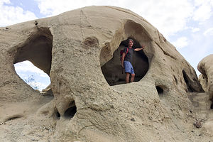 Herb in Wind CavesAt mile 3.8, we stopped to admire the fascinating anticlines on the canyon walls, where the rock layers had been bent and twisted into U-shaped bows and curves by tectonic activity millions of year ago. They were beautiful.
At mile 4.4, we parked at the trailhead for the Split Mountain Wind Caves. The trail was not exactly obvious. We followed a faint scar up the steep east side of the wash and eventually found the wind caves, a collection of sandstone formations with wind-eroded pockets, some of them large enough to crawl through and sit in. Even without the fascinating wind caves, the views of the Carrizo Badlands below made the 1.3-mile hike worthwhile.
Back in the Subaru, we continued along the Wash, bypassing the choice at mile 7.2 for the Loop Wash spur.
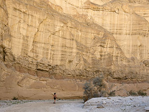 Sandstone CanyonAt mile 10.7 we came to an interesting sandstone rock formation known as the Layer Cake, because of its multi-colored bands of green and gray.
A little bit further, at mile 12.5, we reached Sandstone Canyon, a high wall, narrow slot canyon that was drivable until 1992, when thousands of tons of debris came tumbling down near its mouth. We parked at the entrance and walked for about a half mile into the canyon.
After a lunch break, we retraced our route back to Split Mountain Road.
As we were driving back to the campground along Borrego Springs Road, Herb noticed a huge metal elephant off to our right. We immediately turned off onto a dirt road and soon found ourselves driving past majestic elephants, rearing stallions doing battle, and frighteningly giant birds. We had found ‘Galleta Meadows! Or, at least a small part of it.
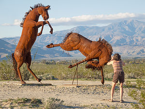 Galletta Meadows - Fighting StallionsIn preparation for this trip, Herb had watched dozens of YouTube videos on things to do and places to see in and around Anza-Borrego and had come across Galleta Meadows, a collection of more than 100 gigantic metal sculptures scattered across the barren landscape around the park.
Although we got out of the car to take pictures, you can actually just drive past the sculptures along the dirt road. We met a woman that told us that this is just a tiny sampling of the sculptures and that many more of them could be seen just north of the town of Borrego Springs.
Since it was already getting close to losing the good light of the day, we decided to save that for first thing tomorrow morning.
Day 4 – More Galleta Meadows, Alcoholic Pass Hike, and Little Surprise Canyon
 Galleta Meadows - Dueling ScorpionsWe awoke to another beautiful sunrise in Borrego Palm Canyon. Not wanting to miss the low light, we set out to find the main Galleta Meadow in search of the Sea Dragon.
This time, when we got to Christmas Circle in the town of Borrego Springs, we turned north on Borrego Springs Road. It wasn’t long before bizarre metal sculptures began randomly popping out of the desert landscape. They were everywhere.
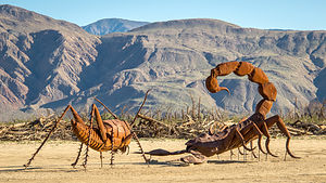
The first one we came across was a 15-foot scorpion waging battle with an equally large grasshopper. The detail was amazing.
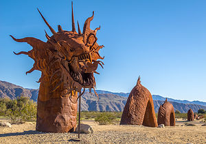
Our personal favorite was the Sea Dragon, a 350-foot long sea serpent whose body submerges and emerges from the ground. It even crossed the road. It has the head of a dragon and the tail of a rattlesnake. You have to see it to believe it.
 Desert SerpentNot all the sculptures were of frightening beasts, however. In fact, one of my non-scary favorites was of a prospector panhandling for gold. When I saw that his pan was filled with coins, I added a quarter of my own for good luck. Nearby him stood his horse, loaded down with a pack that was amazing in its detail.
Another fun one was a jeep crawling up a mound of rocks, very fitting for a park with hundreds of miles of 4WD roads.
You can spend a whole day exploring these unique sculptures – there are 130 of them in all, and I have a feeling next time we visit, there will be more.
They are the work of an artist named Ricardo Breceda, who was commissioned in 2008 by Dennis Avery, the owner of the Galleta Meadows Estate, to create a collection of prehistoric creations on his three square miles of undeveloped land in Borrego Springs. Since then, the collection has grown to include human figures, like the gold miner I mentioned, along with contemporary animals, such as big horn sheep, elephants, tortoises, horses, and more.
This alone makes a visit to Borrego Springs worthwhile.
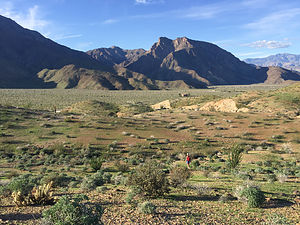 View of Coyote Canyon from Alcoholic PassSince we were already up in the northern part of the park, we drove into Coyote Canyon and hiked the steep 2.3-mile (RT) Alcoholic Pass Trail to a lovely view of Coyote Canyon and the surrounding mountains. We wondered about the name, but the only theory we found was that the trail, which is steep and full of switchbacks, wanders this way and that, sort of like a drunk – hence the name, Alcoholic Pass.
We had time for one more short hike, so we took the ranger’s recommendation and drove down to the trailhead for Hellhole Canyon, to do the short 0.6-mile hike into Little Surprise Canyon. It was a nice, short hike, but we were a bit too early in the season, as this hike is best when the wildflowers are blooming.
That evening Herb made a campfire in our lovely Ramada stone fireplace. This campsite really was awesome.
Day 5 – Slot Canyon Hike, Side Trip to the Salton Sea, and 4WD 17 Palms
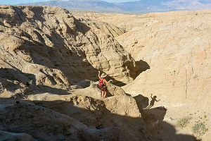 Approach to "The Slot"There are a lot of nice hikes in Anza Borrego, but the only one rated a 10 in my Moon California Hiking Guide was The Slot, a short hike down into a narrow siltstone canyon.
To get to the trailhead, we took the Borrego Springs Road southwest to Route 78 East. We drove about a mile and half on 78 to the unmarked, and difficult to find dirt Butte Pass Road. After about a mile, we took a left at the fork and continued for another mile to the parking area for The Slot.
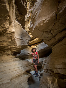 "The Slot"From the parking area, there is not an official trail marker, but there are plenty of footprints leading down into the ravine below. It’s quite steep and slippery.
From the bottom we turned left into a large crevice, which was the entrance to The Slot. As we proceeded through the canyon, the walls became taller and closer together. Soon we found ourselves squeezing through sections where the walls were less than shoulder width apart.
The twisting pink and tan siltstone walls, with the blue skies above, made for some very interesting photos.
At about 0.3 miles we passed underneath a rather precarious looking rock slab lodged between the two walls, forming a bridge above us. Hopefully, today wouldn’t be the day that it became dislodged.
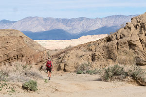 Out the other end of "The Slot"Soon afterwards, the canyon widened and we found ourselves on a jeep road, which we followed for about another mile before turning back. It was beautiful. There were colorful siltstone cliffs all around us and mountains on the horizon. There were even some wind caves in the distance. This would have been a worthwhile hike even without The Slot.
Rather than continue onto the wind caves, we decided to turn back, because we still had a full day ahead of us, as we planned to drive out to the Salton Sea, just beyond the eastern boundary of the park.
The Salton Sea has a rather interesting history:
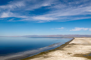 Salton SeaIt was formed in 1905 when the Colorado River breached its dikes and filled the Salton Basin. It took 18 months to get the river back on course, but the water remained. At 35 miles long and 15 miles wide, it is California’s largest lake.
In the mid-1900s, developers tried to market the Sea as the California Riviera, with vacation homes along its shores. To attract tourists, the lake was stocked with fish, which in turn attracted birds, making it a birdwatchers paradise as well.
However, irrigation runoff from the surrounding agricultural lands brought high quantities of fertilizer, pesticides, and salt into the lake, polluting the lake and killing off most of its fish. Needless to say, the dream of the area becoming a California Riviera never happened, and the area is quite economically depressed today.
Two other interesting facts about the lake: the surface elevation is about 227 feet below sea level and its salinity levels are greater than that of the Pacific Ocean, but less than the Great Salt Lake.
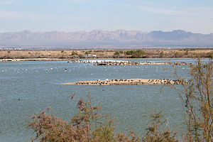 Salton Sea - Sonny Bono National Wildlife RefugeWe started our exploration of the area at the Sonny Bono National Wildlife Refuge area on the lake’s southern shore. This wildlife refuge was created in 1933 by President Hoover, before Sonny Bono was even born, but because of his efforts as a Congressman to try to save the Salton Sea, it was renamed in his honor in 1998.
The Refuge is located along the Pacific Flyway, so thousands of waterfowl and other birds spend the winter here feeding, resting, and nesting. Originally the refuge consisted of approximately 37,000 acres, but because of flooding, only 2,200 manageable acres remain. Dikes have been built to try to prevent further encroachment on the refuge.
From the observation platform behind the visitors center, Herb and I took the Rock Hill Trail along a levee and out to a hill overlooking the Salton Sea. From atop the hill, there was a great view of the Salton Sea, as well as numerous birds to observe. However, since Herb and I are not exactly birders, I am sure we didn’t fully appreciate what we were seeing.
The walk is supposed to be a 2-mile loop, but the second half of the loop was closed because of nesting birds. So, we retraced our steps back to the Visitor Center.
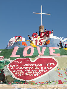 Salvation MountainUsually I am the one that does the majority of the trip planning, but this time Herb had taken charge using You Tube as his resource. It’s amazing how much information he had gathered about interesting places to see in the area. It was kind of nice to just sit back and enjoy the ride.
The first stop on Herb’s tour was Slab City, “the last free place in America,” located about 10 miles east of the Salton Sea. Slab City used to be a Marine training base, but after World War II, the military left, leaving concrete slabs behind – hence, “Slab City.”
Today squatters live on this state-owned land and don’t pay any rent. There are about 200 year-round residents, but in the winter they are joined by thousands of “snowbirders,” who come for the warmth and the free camping.
At the entrance to Slab City, we stopped at Salvation Mountain, something I had never heard of nor dreamt existed. You really have to see it to believe it.
The “mountain” is not a real mountain, but rather built, by a local named Leonard Knight using adobe mixed with straw, and about a half million gallons of brightly-colored paint. It stands 50-feet high and 150-feet across. It surface is entirely covered with Christian sayings, Bible verses, and calls to “Love Each Other”. I would say the style is early psychedelic.
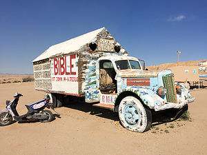 Salvation MountainThe state of California once tried to declare it a hazardous waste site and have it destroyed, but Knight and supporters of his mountain prevailed, and it now attracts thousands of tourists and folk art lovers from around the world. In 2000, the Fold Art Society of America declared it “a folk art site worthy of preservation and protection.”
After Leonard Knight entered long-term care in 2011, a group of volunteers was organized to protect and maintain the site. In 2012, Salvation Mountain, Inc. was established to support them. Many visitors bring paint to donate to the project.
Our tour of the Salton Sea and Slab City wasn’t over yet. Herb still had one more You Tube discovery up his sleeve – East Jesus, an experimental art community and art garden museum that is the antithesis of Salvation Mountain in terms of theme.
When we arrived at East Jesus, we were greeted by a guy reclining in a beach chair under a patio umbrella, who asked us if we had any questions. He even volunteered to give us a tour, which we declined as we wanted to wander about on our own. Admission is free, but we placed some money in the donation box strategically placed near his side.
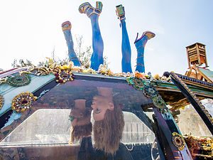 East Jesus experimental art communityI’ve never been to Burning Man, but I have a feeling this place was pretty close. I felt like I had stepped into a different realm with its own set of rules and worldview.
We spent the next hour of two fascinated by the thought-provoking artwork scattered about the garden. Everything was constructed of salvaged refuse and recycled materials; in other words, trash. However, one man’s trash is another man’s raw materials and boy did these artists put them to good use. Every piece had a powerful message to be absorbed and contemplated. Some of which I understood, and some of which I nodded my head knowingly and pretended that I did.
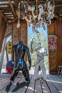 East Jesus experimental art communityIt really needs to be seen to be understood, but I will try to mention a few provoking pieces. One of my favorites was a wall of old TV sets with short messages in place of their screens, expounding the evils and corruption of mindless TV viewing and its incessant propaganda to buy more, think less, etc.
There were cars with legs sticking out of the tops and heads hanging down from the interior, an elephant made from rubber tires, a fallen house with the Wicked Witches legs sticking out from under it, a room with headless naked mannequins with goose heads hanging from the ceiling above them, etc., etc.
I can’t even begin to do justice to describing the works there. All I can say is that if your travels bring you anywhere near the Salton Sea, make sure to stop by.
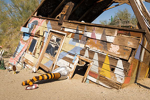 East Jesus experimental art communityI think we had pretty well covered the “Slab City” scene, so we headed back to Anza-Borrego. It had been an extremely full day already, but for some crazy reason, we decided to pack in a little more and take the 4WD road to 17 Palms Oasis, since we were passing right by the turnoff on our return into the park on S22.
It was a good dirt road, so it took us less than a half hour to travel the 3.8 to the parking lot for the oasis, which was visible from where we parked. The information board at the edge of the parking lot was a sober reminder that this was not just an entertaining stop at the end of a day of sightseeing, but literally a lifesaver for inhabitants and travelers of the past.
We walked the short distance to the oasis, whose greenery stood in stark contrast to the stark and barren desert around it. I confess to counting the palms. I couldn’t help myself. It was called 17 Palms, so I wanted to make sure. There were 30 of them. Okay. I guess the oasis was doing well.
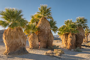 17 Palms OasisHowever, throughout the centuries the spring which feeds the oasis wasn’t always reliable, so early travelers with extra water would leave it in large glass jars in the shade of the palms for others to find. Travelers would leave notes attached to the jars.
Today that tradition lives on, but with much less serious consequences. After a short search, I found a barrel amongst the palms, which holds a journal for current day visitors to record their own feelings and experiences at the oasis.
Besides its human history, this particular oasis is also very important to the wildlife in Anza-Borrego because it is the only year-round watering hole for many miles.
It was a lovely stop, but I think we had had more than enough exploration for the day. It was definitely time to hit the campsite.
Day 6 – Pictograph Trail Hike, and 4WD Oriflamme and Pinyon / Nolina Canyons
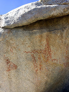 Pictographs on Pictograph TrailFor our last day in Anza-Borrego we decided to explore Blair Valley, south of California Route 78 along County Road S2.
We turned in at the sign for the Blair Valley Campground and continued on a dirt road through a lovely valley. It was a beautiful spot to set up camp. We drove 5 ½ miles, following the signs for the Pictograph Trail.
From the trailhead, the trail lead up through some lovely desert terrain. Very shortly after the trail began to descend (about a half mile from the trailhead), we encountered a large boulder on the right side of the trail with some faded red symbols painted on its north face. Although the meanings of the pictographs is not known, we do know that it was painted by the Kumeyaay Indians, who lived in the Anzo-Borrego Desert over two thousand years ago.
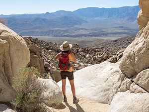 Views of Vallecito Valley from the end of the Pictograph TrailAfter he pictographs, we continued on through the wash, seeking the panoramic views our hiking book promised at the end. After about a mile, we came to an area where we were surrounded on three sides by tall rock walls. I thought at first that we had come to a dead end, but then we saw that the trail bent to the right, passing through a narrow canyon.
We entered the canyon and before long we were standing at the brink of a dry waterfall with a 150 foot dropoff below. From the edge we had a panoramic view of the far off mountains and the Vallecito Valley.
From there, we retraced our steps back out to the trailhead and the return drive through lovely Blair Valley.
Yesterday had been so action-packed that Herb very much wanted some downtime today to just sit in the sun and read. We thought it might be nice to drive out on another 4WD road and set up beach chairs in a scenic spot.
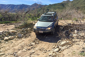 Oriflamme CanyonSince we were already down along S2, Herb chose the drive up Oriflamme Canyon, rated in our guidebook as a little more challenging than the roads we had driven on to date. I tried not to let the description freak me out -- loose rock, narrow shelf segments, possible rock fall, steep ascents and descents through switchbacks.
They were right, and we had to do a bit more rock crawling than we would have liked. There were several spots where I even got out of the Subaru to either move rocks out of the way or build ramps out of them. Finally, at about the 2 mile point we figured that this was not exactly the relaxing way we wanted to spend our last day, so we did an 18-point turn and returned to the joys of asphalt.
I felt really bad for Herb, because I had really been torturing him the entire time at Anza Borrego with a very aggressive schedule. I really wanted to find him a nice place in the sun to just read. As we drove back north along 78, I frantically looked through the off-road guide for a more suitable road for us to explore.
I directed Herb to make a turn onto Pinyon Wash where we drove for a few miles before bearing right on Nolina Wash. We came to a pretty spot, parked, took out our beach chairs, and spent the next 2 hours relaxing and reading. It was so very quiet and peaceful.
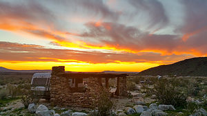 Last night at our beautiful campsiteThat pretty much wrapped up our visit to Anza-Borrego. The park is huge, but in our 6 days here we had covered a lot of ground and seen many of the recommended highlights in the park -- as Herb will attest too.
I am writing this blog about a month after our visit, and all I am seeing on the news is “Super Bloom in Anza-Borrego.” All the rain this winter has resulted in one of the most beautiful displays of wildflowers in decades. That would have been something to see.
Description
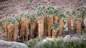 Borrego Palms OasisWith over 600,000 acres, Anza Borrego is the largest state park in the California state park system and the largest desert state park in the U.S. Its spectacular and undeveloped Colorado Desert scenery extends from the edge of the coastal mountains east to the Salton Sea and south almost to the Mexican border. The park is located about 2 hours northeast of San Diego
The elevation in the park ranges from just 200 feet near the eastern edge to 6,200 feet, resulting in a variety of ecosystems and a temperature range as high as 30 degrees.
Major activities in the park include:
- Four-wheel driving on its nearly 500 miles of dirt and rocky roads (of varying difficulty)
- Mountain biking along those same four-wheel drive trails
- Hiking along its 50 miles of trails with a variety of scenery palm oases, waterfalls, slot canyons, badlands, desert gardens, etc.
- Wildlife viewing - bighorn sheep, deer, bobcats, coyotes, mountain lions, Jackrabbits, desert cottontails, 50 species of lizards and snakes, hawks, etc.
- Enjoying the spring wildflowers
- Camping – there are 12 campgrounds inside the park, but it is one of the few California parks that allows open camping throughout its 600,000 acres
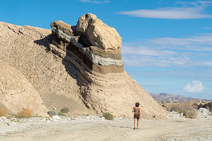 Layer Cake formation in Fish Creek WashThe small town of Borrego Springs lies at the center of the park and has ample services – lodging, restaurants, gas, grocery store, etc.
The park’s Visitor Center and the Borrego Palms Campground are just 5 miles west of the town of Borrego Springs. Be sure to pick up a copy of their ‘At Home’ magazine, which is a great source of things to do in the park.
Carpinteria Beach / Solvang
Tuesday, February 7, 2017 - 1:45pm by Lolo115 miles and 2.5 hours from our last stop - 2 night stay
Travelogue
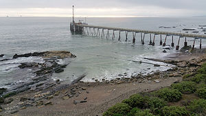 Seals on Carpinteria BeachCarpinteria State Beach, I believe, is the only place along the California coast that you can actually camp right on the beach with an RV. During our last visit, we were fortunate enough to do just that, but this time, because of the rainy weather, we chose to camp one row back, where we could still see and hear the water, but not pay $80 for the privilege.
Since it wasn’t exactly beach weather, we decided to take a side trip to Solvang, a touristy Danish village about an hour away. This has been a place I have always wanted to visit, ever since the tales of my brother taking my Mom and Dad there every time they visited him in California. I’m not quite sure why I was so drawn to this place, as I definitely do not share my Mom’s passion for kitschy gift shops, but I was, so Herb nicely agreed to spend the day at his version of hell.
The drive was lovely, but very steep and winding – not something we would have wanted to do in the motorhome. Thank goodness for our Subaru toad.
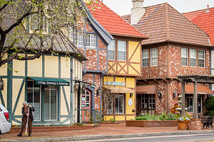 SolvangAlong the way, we stopped at the Cachuma Lake Recreation Area and were heartbroken to see that what had once been a beautiful lake set at the base of the San Rafael Mountains had been reduced by drought to a small winding river. I had forgotten that southern California was not getting the deluge of rain that we had escaped from in the north. The Marina and boat launch were hundreds of yards from the water. Still, the campground was quite active, and people were carting their kayaks and fishing boats down the make-shift ramp to what water was left.
When we arrived in Solvang, I understood just why my Mom loved this place so much, and why Herb was such a good husband for bringing me here. I tried to test the levels of his affection for me throughout the day by randomly asking him if he would buy me a cuckoo clock, wooden clogs, or at least a beer stein.
Kidding aside, we spent a fun few hours strolling through the village enjoying its windmills, Little Mermaid Fountain, Hans Christian Andersen statue, giant red clog, and other Danish icons – as well as the two gift shops which Herb limited me to.
 Aebleskivers and other unhealthy choicesThere are also several interesting museums dedicated to Danish culture and the Danish-American experience. The first one we stopped in was the Hans Christian Andersen Museum, located above a bookstore. I had forgotten how many of the stories I had enjoyed as a child had been written by him – much more upbeat than the Brothers Grimm.
A little bit off the beaten track was the Elverhoj Museum of History and Art, which was the former residence of one of Solvang’s most artistic families. Lovingly built, this hand-crafted structure, with its ornamental wrought ironwork, carved redwood door, and hand-painted panels is an excellent example of Scandinavian architecture. Unfortunately the Art Exhibition area was temporarily closed in preparation for an upcoming event, but the home was still interesting to explore.
The wonderful smells emanating from the numerous Danish bakeries were making us salivate, so we checked the Trip Advisor app to select a place for lunch.
I am as great believer in “when in Rome…,” so we decided to do the full touristy thing and have lunch at the Solvang Restaurant, where Miles and Jack had breakfast in the movie Sideways. I was all in, so for lunch I ordered their famous Aebleskivers and a bratwurst on the side – not exactly my usual healthy choice. It turns out that an Aebleskiver is actually a jam-filled donut. I ate four of them.
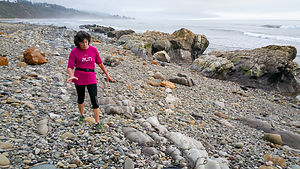 Run (kind of) along Carpinteria BeachBack at Carpinteria State Beach, I needed to run off the Aebleskivers, so Herb and I set off along the trails in the park. For awhile we ran alongside the railroad tracks, making me a bit nervous about what would happen if a train went by, as there was only about 8 feet between the tracks and the bushes. Fortunately, none did, but not wanting to risk returning the same way, Herb suggested that we continue on to see if there was a way to get down to the beach from the high bluff we were on.
Finally, after 3 miles, we came to a County Park with a steep staircase down to the beach. We had a bit of a debate as to whether to go this way or back the way we had come. My fear was that it was getting near sunset and we had no idea if we could make it all the way back to the campground unobstructed. I reluctantly agreed to take the beach route.
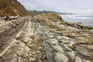 Herb's idea of a run along the beachWhenever I am nervous, I do things faster to get them over with, so I took off ahead of Herb so that if we did come to a roadblock, we would still have time to retrace our steps before dark. I have to admit that running at a quicker pace than usual along that beautiful hard-sand beach was a highlight.
The beach was pretty deserted, but eventually I found someone to ask whether or not we could get back to the campground this way. She told me that the beach eventually was closed due to harbor seal nesting, but right before that there was a path leading to the top of the bluff. Now I could relax.
Soon, however, my beautiful hard sand running surface turned into rocky debris, forcing us to walk the remaining mile. That was okay though - the sun was setting and it was quite beautiful. Plus, we got to see a natural tar pit – there are several on the park’s beaches and bluffs.
Description
Carpinteria State Beach
Just 12 miles south of Santa Barbara, Carpinteria State Beach offers a mile of beach for beach-side camping, swimming, fishing, and tidepool exploration. It is an extremely popular destination, so camping reservations should be made well in advance.
Harbor seals and sea lions can be seen December through May, along with an occasional gray whale passing through. Tidepools contain sea anemones, starfish, crabs, snails, sea urchins, and octopus. The Channel Islands and oil rigs can also be seen along the horizon.
The campground has over 200 sites with full or partial hookups, many of which are situated right on the edge of the beach. The campground is in walking distance to the lovely little town of Carpinteria.
Solvang
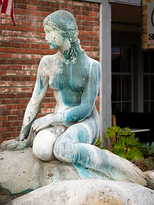 Hans Christian Andersen's Little MermaidSolvang is a Danish Village located in the Santa Ynez Valley, about 45 minutes northwest of Santa Barbara. Solvang was founded in 1911 by a group of Danes who traveled west to flee the harsh Midwestern winters. As is evidenced by the architecture and numerous bakeries, cuckoo clock, and wooden shoe stores, the village holds very tight to its Danish Heritage.
Today, over one million visitors a year come to Solvang to enjoy its Danish windmills, kitschy shops, restaurants, pastry shops, wine tasting rooms, and museums.
Morro Bay State Park and San Luis Obispo
Monday, February 6, 2017 - 1:15pm by Lolo327 miles and 6.5 hours from our last stop - 1 night stay
Travelogue
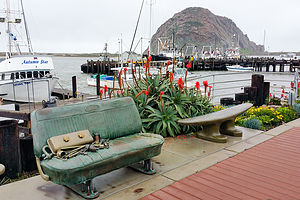 Street Art in Morro BayThis might sound totally unrelated to a travel website, but I have been trying to find indoor wicker chairs for our sunroom, but can only find them online. Herb absolutely refuses to buy an expensive chair that he hasn’t sat in and approved for comfort, so our sunroom has stood empty for almost a year.
Finally, I got my hands on a Ratana indoor wicker furniture catalog and called the manufacturer to ask where I could sit in one. After providing my zip code, I was told San Luis Obispo, about 5 hours south of us along US 101.
“How about taking the coast route to Anza-Borrego?” I asked Herb. “I5 is so boring.”
So, we made our first day’s destination Morro Bay State Park, a park we had visited in the past. Between the beautiful harbor and estuary, quaint waterfront, and iconic Morro Rock, there is so much here to make for an enjoyable visit. Kayaking to Morro Rock has been something on our list for quite some time. Unfortunately, however, like our last visit, the weather was thwarting us again. Undaunted, we would try to make the most of it.
The weather was pretty dreary when we arrived, but since it wasn’t raining, we decided to take a walk on the Marina Boardwalk just across the way. This trail, which is quite new (built in 2012), leads from the south side of the marina parking along the estuary for about a mile. It was quite lovely.
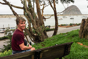 Herb and Morro RockThe next morning was cloudy, but still no rain to speak of, so we donned our sneakers and set off for a run, once again along the Marina Boardwalk trail, and then along the harbor towards Morro Rock, a huge volcanic plug rising 576 feet above the Bay at the entrance to the harbor.
That damn rock is so big that it fooled us into thinking we were close. After 3 miles, the sky began to darken, and we were still a good distance from the rock. We decided to just go a little further to a marina before turning back. I am so glad we did, because we came upon a romp (I looked that one up) of otters playfully floating on their backs, resting their cute little heads on each other’s bellies, and I swear, smiling at us. What a life!
I’m still disappointed that we didn’t make it to the rock though, especially after reading that you can climb 400 steps to the top of it. Maybe next time.
On our way south, we stopped at the furniture store in San Luis Obispo that carried the indoor wicker chairs we were interested in, and found them to be just what we were looking for. To celebrate we went to lunch at the Firestone Grill, known for their tri-tip sandwiches and great beer.
Rainy days can be fun after all.
Description
Morro Bay State Park
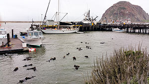 A Romp of Otters in Morro BayMorro Bay State Park is located on Morro Bay, 15 miles northwest of San Luis Obispo along scenic Highway 1. There is a 95-site campground in the park, 27 of which have partial hookups.
The most prominent feature in the area is Morro Rock, a 576 foot high volcanic plug that stands at the entrance to the harbor. This is one of nine “morros” or volcanic peaks that form a chain between Morro Bay and San Luis Obispo. There is a short causeway connecting the rock with the shore, but climbing on the rock itself is prohibited, because it is a reserved for the endangered peregrine falcon.
The calm waters of the bay are perfect for fishing, kayaking, and birdwatching. There are more than 15 miles of protected waters in the beautiful Morro Bay Estuary / Bird Sanctuary, which is home to California sea lions, harbor seals, sea otters, brown pelicans, and peregrine falcons.
The most popular hike in the park is to the 640-foot summit of Black Hill, one of the nine morros, from which there are spectacular views of Morro Bay and the nearby hills of Montana de Oro.
San Luis Obispo
San Luis Obispo is located at the junction of Highway 1 and US 101. Sometimes referred to as a “little Santa Barbara,” It is tucked into the mountains about halfway between Los Angeles and San Francisco.
Like many other towns and cities in California, San Luis Obispo was first established as a Spanish mission by Spanish Franciscan friars in 1772. Today the Mission San Luis Obispo de Tolosa is still an active church. The former friars’ quarters is now a small museum with artifacts from the Chumash Indians and the early Spanish settlers.
Today, the town’s main appeal is its charming, pedestrian-friendly downtown, with fine shops, galleries, and restaurants. Mission Plaza, with its brick paths and park benches along a creek, serves as the town square, often hosting festivals and concerts. During the school year the town bustles with students from California Polytechnic State University, more popularly known as Cal Poly.
