- Home
- About
- Map
- Trips
- Bringing Boat West
- Migration West
- Solo Motorcycle Ride
- Final Family XC Trip
- Colorado Rockies
- Graduates' XC Trip
- Yosemite & Nevada
- Colorado & Utah
- Best of Utah
- Southern Loop
- Pacific Northwest
- Northern Loop
- Los Angeles to NYC
- East Coast Trips
- Martha's Vineyard
- 1 Week in Quebec
- Southeast Coast
- NH Backpacking
- Martha's Vineyard
- Canadian Maritimes
- Ocracoke Island
- Edisto Island
- First Landing '02
- Hunting Island '02
- Stowe in Winter
- Hunting Island '01
- Lake Placid
- Chesapeake
- Provincetown
- Hunting Island '00
- Acadia in Winter
- Boston Suburbs
- Niagara Falls
- First Landing '99
- Cape Hatteras
- West Coast Trips
- Burning Man
- Utah Off-Roading
- Maui
- Mojave 4WD Course
- Colorado River Rafting
- Bishop & Death Valley
- Kauai
- Yosemite Fall
- Utah Off-Road
- Lost Coast
- Yosemite Valley
- Arizona and New Mexico
- Pescadero & Capitola
- Bishop & Death Valley
- San Diego, Anza Borrego, Joshua Tree
- Carmel
- Death Valley in Fall
- Yosemite in the Fall
- Pacific Northwest
- Utah Off-Roading
- Southern CA Deserts
- Yosemite & Covid
- Lake Powell Covid
- Eastern Sierra & Covid
- Bishop & Death Valley
- Central & SE Oregon
- Mojave Road
- Eastern Sierra
- Trinity Alps
- Tuolumne Meadows
- Lake Powell Boating
- Eastern Sierra
- Yosemite Winter
- Hawaii
- 4WD Eastern Sierra
- 4WD Death Valley +
- Southern CA Deserts
- Christmas in Tahoe
- Yosemite & Pinnacles
- Totality
- Yosemite & Sierra
- Yosemite Christmas
- Yosemite, San Diego
- Yosemite & North CA
- Seattle to Sierra
- Southwest Deserts
- Yosemite & Sierra
- Pacific Northwest
- Yosemite & South CA
- Pacific Northwest
- Northern California
- Southern Alaska
- Vancouver Island
- International Trips
- Index
- Tips
- Books
- Photos/Videos
- Search
- Contact
Bishop
Thursday, February 13, 2020 - 8:00pm by Lolo360 miles and 7 hours from our last stop - 5 night stay
Travelogue
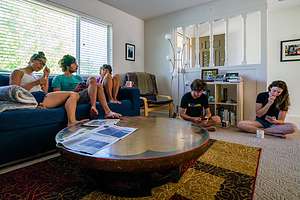 Home sweet homeAndrew and Celeste had made the decision last year to move from San Francisco to Bishop to try out a less-urban lifestyle in what is a world-class rock climbing destination. They are very dedicated rock climbers and were getting a bit tired of the trek from San Francisco to Yosemite every other weekend to climb, so they figured, why not move to a place where there was premier rock climbing practically in their backyard.
So, they found a great apartment in town, packed up their belongings, and headed over the mountains. They even were fortunate enough to be able to take their San Francisco jobs with them - and this was before Covid.
Now, a year later, they purchased a home, making that “temporary” lifestyle change more permanent. I had such mixed emotions about this - so happy for them that they were moving into their first home, and a bit sad that it was so far away.
Bishop and all of the Eastern Sierra is stunningly beautiful, so even though they are 6 ½ hours away from us now, it is not a hardship to go over the mountains to visit them. Their home is often the last stop on one of our road trips.
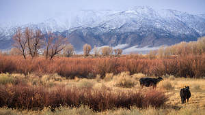 Not a bad neighborhoodSo, we spent days, along with Celeste’s parents and Tommy and Erin, moving Andrew and Celeste from their apartment to their new home, which was only two blocks away. We could literally carry some of their smaller things by foot.
Us and Celeste’s parents were getting so efficient at these moves that we considered going into business and calling ourselves Kapuna Movers. “Kapuna” is an Hawaiian word for elder or grandparent. Unfortunately, we weren’t grandparents yet, but we had the elder part down pat.
We did, however, have quite a scary incident, when Celeste’s dad had some chest pains. The Bishop hospital is not equipped with a team of cardiologists (or even “a” cardiologist) to handle possibly serious heart issues, so they did what they do for cases they are not equipped to handle - flew him to a hospital in Reno in a small plane with three paramedics on board. Fortunately, he was okay.
Once they were fully set up in their new home, Herb and I felt comfortable leaving to spend a few days in Death Valley.
Bishop
Friday, March 4, 2022 - 3:00pm by Lolo108 miles and 2 hours from our last stop - 2 night stay
Travelogue
Day 1 - Drive back to Bishop with a drive through the Alabama Hills and a stop at Copper Top BBQ for lunch
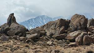 Mt. Whitney from Movie Flat RoadWe left Death Valley via State Highway 190 and 136, which brought us to US 395 in the town of Lone Pine. Our destination was Andrew and Celeste’s house in Bishop, but since they were working until 5:00, we had some time to kill.
So, rather than driving through Lone Pine on 395, we took a detour to Movie Flat Road, a 5.7-mile unpaved road through the Alabama Hills. For people our age, some of the scenery in the Hills might even be familiar from watching old Westerns. Hollywood filmmakers discovered this dramatic scenery back in the 1920s and filmed hundreds of movies (particularly westerns), TV shows, and commercials here, such as “How the West was Won,” “Rawhide,” and “Gunga Din.” And, it’s not just about old westerns. Plenty of current day movies, such as “Gladiator,” “Django Unchained,” and the new Lone Ranger have used the surrounding hills as a set as well.
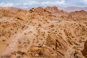 Mobius Arch Loop TrailThe Alabama Hills is one of our favorite places in the Eastern Sierra. They are both unique and stunningly beautiful, with hundreds of oddly-shaped boulders and towers set against the backdrop of Mount Whitney (the tallest mountain in the continental U.S.).
We stopped to take the short 0.6-mile loop hike to the iconic Mobius Arch, where photographers love to photograph Mount Whitney framed by the arch. So do Instagram influencers, so we had to wait our turn while a girl in pink spandex mugged it up for the camera. Wasn’t much of a photo today because it was so cloudy that Mt. Whitney wasn’t even visible.
Continuing up 395, we stopped for lunch in Big Pine at the Copper Top BBQ, an extremely popular place ever since it somewhat inexplicably won the title on Yelp of “America’s Best Restaurant.”
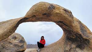 Lolo in Mobius ArchWe have passed right by it so many times in the past, but this time we finally succumbed to the tempting smells emanating from its smoker and grill.
It’s a small roadside place with outdoor tables and nice views of the Sierra. Their specialties are tri-tip and pulled pork, so Herb and I ordered one of each and shared. It was really good, but I think America’s Best Restaurant is a bit of a stretch.
We made our traditional last stop before arriving at Andrew’s at the Bishop self-serve car wash, where we washed an incredible amount of dirt, sand, and splattered bugs off the 4Runner. At this point, the truck was cleaner than us.
Andrew and Celeste are great hosts. We had a nice home-cooked meal and a cozy evening telling them about our adventures in Death Valley.
Day 2 - Volcanic Tablelands
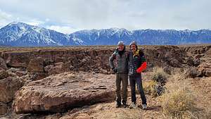 Andrew and Herb atop the Volcanic TablelandsThe next morning was a Saturday, their day for rock climbing. It was extremely windy out, so they decided to go to the Volcanic Tablelands rather than the Buttermilks because it would be more protected from the wind.
The Volcanic Tablelands is another one of Bishop’s popular bouldering areas. It’s located just north of Bishop in a stunning area where the floor of the Owens Valley rises abruptly, forming a 300 foot-high volcanic plateau. It’s quite beautiful and only 20 minutes from Andrew and Celeste’s house. Bishop truly is a climber’s paradise.
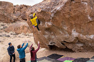 Andrew bouldering at the Happies in the Volcanic TablelandsIt was pretty cold out, so we told them to go ahead and we might meet them there later. Andrew called us and told us that it wasn’t too cold and that we should come. He incentivized us to come by telling us about a new way to get there that we would like.
Instead of driving to Chalk Hill Road and hiking from the climbers’ parking lot up a steep path to the top of the plateau (“tableland”), where they were climbing, he said there is actually a dirt road that would take us along the top of the plateau from which we could hike down to the climbing area. He said he would climb up to the road to greet us.
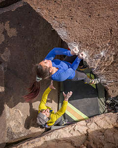 Celeste bouldering at the Happies in the Volcanic TablelandsTrue to his word, there he was a few miles out along this very infrequently traveled road. As we bounced along this terrific road. From there, he showed us the way down to the climbing area, where we hung out and watched them climb for awhile.
The rock in the Volcanic Tablelands is volcanic Bishop tuff, which is a solidified volcanic ash. It has a lot of sharp edges, pockets, and cracks, so after a few climbs their fingertips were pretty done.
After Herb and I climbed back to the top of the plateau, we continued along the road to see where it ended and why it was even there. After another mile or so, we came to a gate with a Beware of Dog sign and off in the distance was a beautiful home set against the snow-capped Sierra. What an incredible location for a home.
It was our last night in Bishop. I can definitely understand why Andrew and Celeste have made it their home.
Death Valley
Monday, February 28, 2022 - 4:30pm by Lolo75 miles and 2 hours from our last stop - 4 night stay
Travelogue
Day 1 - Saline Valley
.thumbnail.jpg) Saline Valley Warm Springs "bat pole"What makes the Eastern Sierra so special to us is the variety in topography and weather. You can pretty much dial in to whatever temperature you want just by driving 40 miles or so. After all, Badwater Basin, which claims some of the highest temperatures in the U.S. is only 80 miles as the crow flies from Mt. Whitney, the highest mountain in the Continental United States, with the cold temperatures that go with that elevation.
Saline Valley Warm Springs "bat pole"What makes the Eastern Sierra so special to us is the variety in topography and weather. You can pretty much dial in to whatever temperature you want just by driving 40 miles or so. After all, Badwater Basin, which claims some of the highest temperatures in the U.S. is only 80 miles as the crow flies from Mt. Whitney, the highest mountain in the Continental United States, with the cold temperatures that go with that elevation.
That’s what made the ability to ski one day, as we did yesterday at the beautiful June Lake Ski Area, and to be in Saline Valley Warm Springs of Death Valley the next, so intriguing.
.thumbnail.jpg) Warm Springs soaking poolAfter leaving Bishop, we drove south on 395 to the town of Big Pine and made a left (east) onto State Highway 168. From there it was about 16 miles for the turnoff (on the right) onto the Saline Valley Road.
Warm Springs soaking poolAfter leaving Bishop, we drove south on 395 to the town of Big Pine and made a left (east) onto State Highway 168. From there it was about 16 miles for the turnoff (on the right) onto the Saline Valley Road.
The turnoff for the Warm Springs can be easy to miss, so we reset our odometer so we could track our progress along the way. At exactly 32.7 miles (as our off-roading guide told us), we came to a big old truck tire on our left, making the turn onto Warm Springs Road.
The drive along Warm Springs Road was much rougher and sandier than the Saline Valley Road, as the Saline Valley Road is maintained and graded, but this one is not. Still, plenty of 2WD cars and even small motorhomes somehow make it through. Funny how motivational the thought of soaking in a beautiful palm oasis can be.
After about 4 miles into our bumpy drive to the Palm Spring Oasis, we came to a tall post with metal bats hanging from it - the infamous “Bat Pole” of Saline Valley.
.thumbnail.jpg) The wild burros of Saline ValleyAt about 6.5 miles, we arrived at the first oasis, where we had camped on a previous visit. However, we decided to continue on another mile to the second oasis, which we had also been to before. This one tends to be less crowded and it has two beautiful pools - one out in the open, hot desert sun, and the other tucked under the shade of a palm tree.
The wild burros of Saline ValleyAt about 6.5 miles, we arrived at the first oasis, where we had camped on a previous visit. However, we decided to continue on another mile to the second oasis, which we had also been to before. This one tends to be less crowded and it has two beautiful pools - one out in the open, hot desert sun, and the other tucked under the shade of a palm tree.
Both oases are amazing – prettier and better maintained than most commercial hot springs. They were developed in the 60s, before Saline Valley became a part of Death Valley National Park, by a group of hippies who made a semi-permanent camp here – taming the wild springs into several concrete, rock, and tile soaking pools. The camp even had a leader named “Wizard.” When he passed away, “Lizard” took his place. You can’t make this stuff up.
.thumbnail.jpg) Lolo enjoying a soak before the hikeThere are even showers, with soap and shampoo supplied, to use before entering the pool. In addition, there is a fully stocked bathroom, with Costco size toilet paper packages, cleaning products, air fresheners, etc.
Lolo enjoying a soak before the hikeThere are even showers, with soap and shampoo supplied, to use before entering the pool. In addition, there is a fully stocked bathroom, with Costco size toilet paper packages, cleaning products, air fresheners, etc.
This place certainly felt more like a commune than part of a National Park. The only stress here is deciding whether to soak in the sunny or the shady pool.
From the oasis, there is a very prominent red cinder cone about two miles east of the springs with a giant peace sign carved into it - also not done by the National Park Service, but rather the work of two hippies from San Francisco named Sunshine (of course) and Raymond (not as predictable) who were residents of the Valley in the 1960s.
In 1968, Sunshine decided to take a rake to the cinder cone, where she set about the herculean task of removing the surface red volcanic cinders and exposing the lighter-colored volcanic soil below to create a giant peace sign, which must be at least 100 feet in diameter.
.thumbnail.jpg) Random car set; Peace sign mountain in distanceI have no idea how she could have possibly done this, as it is so huge that when you are near it, you can’t actually see that it is a peace sign. Hopefully, Raymond and some other friends helped her.
Random car set; Peace sign mountain in distanceI have no idea how she could have possibly done this, as it is so huge that when you are near it, you can’t actually see that it is a peace sign. Hopefully, Raymond and some other friends helped her.
This peace sign was our hiking goal for the day, but first a quick soak in the sunny pool. That way we could have the cooling effects of evaporation on our hike, even though the temperature was a very comfortable 75 degrees.
We headed to the first palm oasis, a little less than a mile away, before heading across the Valley towards the cinder cone. We didn’t get too far before we came upon a car seat, just sitting there in the middle of nowhere. Of course, we had to each sit in it to have our picture taken.
.thumbnail.jpeg) Peace and Love is the theme hereFrom there we just kept walking toward the peace sign across the rocky terrain, which had dozens of washes and gullies running counter to the direction we were headed, which meant we had to constantly climb down one side and up the other of each of them. It seemed that no matter how long we walked, the cinder cone wasn’t getting any closer.
Peace and Love is the theme hereFrom there we just kept walking toward the peace sign across the rocky terrain, which had dozens of washes and gullies running counter to the direction we were headed, which meant we had to constantly climb down one side and up the other of each of them. It seemed that no matter how long we walked, the cinder cone wasn’t getting any closer.
Finally, after about another 1.2 miles, we snuck up on it and began the very steep ¾-mile climb up its side to the peace sign. It was very hard, and part of the way, the peace sign disappeared behind it.
We did find a giant heart along the way, made in the same fashion of scraping off the surface red cinders to expose the lighter color below. When we finally got up to the peace sign, it was hard to tell it was one, because it was so huge.
.thumbnail.jpg) Huge peace sign carved into the cinder coneGetting down the steep path was no piece of cake either as we slipped and slid on the loose scree. Then it was another mile back across the rocky washes to our palm oasis. Final tally was 4.5 miles.
Huge peace sign carved into the cinder coneGetting down the steep path was no piece of cake either as we slipped and slid on the loose scree. Then it was another mile back across the rocky washes to our palm oasis. Final tally was 4.5 miles.
My foot was aching quite a bit on the last mile. I’ve had a metatarsalgia (inflammation in the ball of the foot and bottom of the toes) in my left foot for the last couple of months, which means I am supposed to be resting it. I have trouble sitting still though, so it really hasn’t gotten any better, as I’ve pretty much continued going about my active life.
The steep climb and the volcanic rocks we had to walk over didn’t particularly help, but a soak in the hot spring and a glass of wine did a bit.
I promise I will rest it as soon as I get back home.
Day 2 - Saline Valley Sand Dunes, Salt Lake, and 4WD-drive to Hidden Valley
.thumbnail.jpg) Saline Valley Sand DunesWe got up early to watch the sunrise before heading out for another day of off-road exploration.
Saline Valley Sand DunesWe got up early to watch the sunrise before heading out for another day of off-road exploration.
When we got to the junction of Warm Springs and Saline Valley Roads, a man in purple-patterned long johns standing next to a fairly beat up camper on the side of the road called us over to see if we had jumper cables. He introduced himself as Miguelito and said that was his desert name. Hmm.. “Herb” seemed kind of nerdy in comparison.
Although we didn’t have jumper cables, Herbelito (which I now call him) did have a portable car jump starter. However, when Herb looked under the hood, he noticed stray wires sticking out of this guy's battery, which no longer seemed to be attached to anything. Miguelito had a grande problem. To satisfy him anyway, Herb tried to charge what was now as functional as a paper weight in terms of powering a vehicle.
.thumbnail.jpg) Saline Valley Sand DunesMiguelito seemed quite unperturbed about the situation, making me think that this was not the first time he had landed himself in such a position. Eventually, a ranger came along so Miguelito sent us off with a big thank you for our efforts. We should be so relaxed under adversity.
Saline Valley Sand DunesMiguelito seemed quite unperturbed about the situation, making me think that this was not the first time he had landed himself in such a position. Eventually, a ranger came along so Miguelito sent us off with a big thank you for our efforts. We should be so relaxed under adversity.
A few miles south of the Warm Springs are the Saline Valley Sand Dunes, a pristine and rarely visited set of dunes with the 10,000-foot Inyo Mountains as a backdrop.
Herb loves photographing sand dunes and I often serve as his sense of scale by running way ahead of him along the ridge towards the top. I have served this role on four other dune complexes in Death Valley - Eureka (my biggest challenge as it rises almost 700 feet from the valley floor), Hidden Dunes, Mesquite Dunes, and the remote Ibex Dunes.
.thumbnail.jpg) Saline Valley Sand DunesAfter this one, there is only one more in Death Valley to conquer - the even more remote Panamint Sand Dunes, which requires a 3.7-mile hike to just get to its base. We’ll have to see about that one.
Saline Valley Sand DunesAfter this one, there is only one more in Death Valley to conquer - the even more remote Panamint Sand Dunes, which requires a 3.7-mile hike to just get to its base. We’ll have to see about that one.
The Saline Valley Dunes were an easy one for me - thankfully, because of my bad foot. They are much smaller and intimate than the other dunes in the park - the tallest being only about 40 feet, making them much easier to climb.
They are also very infrequently visited, so we were treated to pristine, virgin sand without another footprint in sight.
.thumbnail.jpg) Salt LakeThe brown, tan, and black striated Inyo Mountains provided a wonderful backdrop and contrast to the lighter colored dunes.
Salt LakeThe brown, tan, and black striated Inyo Mountains provided a wonderful backdrop and contrast to the lighter colored dunes.
No matter how many times we come to Death Valley, and I think this is our 10th visit, we always find something new to explore. It is afterall the largest National Park in the continental U.S. - almost as large as the state of Connecticut.
And the variety of landscape is amazing - from sand dunes, to palm oases, to hot springs, to colorful canyons, to volcanic craters, to waterfalls, and even a lake with a shore lined with salt crystals.
.thumbnail.jpg) Remnants of salt mining on Salt LakeThat lake with the salt crystals, appropriately named Salt Lake, was next on our list, and located just a few miles south of the dunes on the Saline Valley Road.
Remnants of salt mining on Salt LakeThat lake with the salt crystals, appropriately named Salt Lake, was next on our list, and located just a few miles south of the dunes on the Saline Valley Road.
While this lake is usually completely dry in summer, we were fortunate to be here in late Winter when it is large enough to reflect the mountains beyond it. We spent an enjoyable half hour wandering along the Shoreline Trail admiring the salt crystal patterns on its shoreline.
As in many places in Death Valley, no matter how remote they are, there is often the presence of man, mostly in the form of mining of some sort.
.thumbnail.jpg) Sunrise in Hidden ValleyIn the early 1900s, salt was mined here, and transported by a Tramway over the Inyo Mountains to the Owens Valley. Some tramway towers and the structure across the lake are all that remain of what was once an active mining site.
Sunrise in Hidden ValleyIn the early 1900s, salt was mined here, and transported by a Tramway over the Inyo Mountains to the Owens Valley. Some tramway towers and the structure across the lake are all that remain of what was once an active mining site.
After the Salt Lake we continued south on the Saline Valley Road. When we got to South Pass, rather than continuing on the Saline Valley Road to the asphalt of Stage Highway 190 in Panamint Springs, we made a hard left onto Hunter Mountain Road and continued north through the park towards Hidden Valley.
A sign at South Pass warned that travel on Hunter Mountain Road might be difficult because of snow, but since it was dated over 2 weeks ago, we decided to take a chance, assuming that whatever snow that had fallen had melted. We were right, and the drive up and over the 7,270-foot high Hunter Mountain, despite a few patches of snow and ice, went fine
.thumbnail.jpg) Morning in Hidden ValleyIt was getting late and we wanted to find a place to camp for the night, so we skipped the side trip to the Goldbelt mining camp, which fortunately we had seen on a previous trip.
Morning in Hidden ValleyIt was getting late and we wanted to find a place to camp for the night, so we skipped the side trip to the Goldbelt mining camp, which fortunately we had seen on a previous trip.
It gets dark so early this time of year, so we wanted to camp out in the openness of Hidden Valley rather than in the narrows of Lost Burro Gap, where we would buy ourselves at least an extra hour of light.
Hidden Valley is at an elevation of about 5,000 feet, which means two things: lots of Joshua trees and much cooler temperatures than in Saline Valley. When we woke up the next morning it was 28 degrees, something most people would be surprised at in Death Valley.
Day 3 Drive from Hidden Valley to Ubehebe Crater, Fall Canyon Hike, and Panamint Springs Resort
.thumbnail.jpg) Teakettle JunctionIt was so so cold in the morning, which is the one thing I hate about camping in the 4Runner in winter. The other thing is that it gets dark so early, but that I can deal with by reading my Kindle
Teakettle JunctionIt was so so cold in the morning, which is the one thing I hate about camping in the 4Runner in winter. The other thing is that it gets dark so early, but that I can deal with by reading my Kindle
while tucked into my cozy bed. The cold is much worse.
We didn’t even make coffee, but rather turned the heat on and started driving. As it always does in the desert, we knew it would warm up in a few hours.
In about 5 miles we came to another one of Death Valley’s man-made attractions at Teakettle Junction, where the sign marking the junction of Racetrack and Hunter Mountain is strung with dozens of old teakettles.
.thumbnail.jpg) Teakettle JunctionNo one quite knows how this tradition began, but rumor has it that kettles were hung to show early settlers that there was water nearby. Another theory is that it was considered good luck to leave a kettle with a message on or in it for fellow travelers to read. When the number of teakettles get to be too much, Rangers remove them, and the process begins all over again. This must have just happened, because all the kettles were dated 2022.
Teakettle JunctionNo one quite knows how this tradition began, but rumor has it that kettles were hung to show early settlers that there was water nearby. Another theory is that it was considered good luck to leave a kettle with a message on or in it for fellow travelers to read. When the number of teakettles get to be too much, Rangers remove them, and the process begins all over again. This must have just happened, because all the kettles were dated 2022.
I thought it was quite clever how one traveler hung a single boot from the sign, which said, “Forgot the kettle, but left a boot.” Hope he has another pair.
All those teakettles got us thinking, so we pulled over and made ourselves some well-needed coffee.
We had the choice of continuing on to Ubehebe Crater and asphalt again, or a detour to the famous Death Valley Racetrack, where rocks mysteriously move across the dry lakebed on their own accord. We had watched those rocks sit still like rocks on the playa in past visits, so we continued on to Ubehebe Crater.
.thumbnail.jpg) Ubehebe CraterAfter 160 miles of off-roading on bumpy roads, we were finally back on the pavement and saw other people for the first time in two days. We stopped at the rim of the Ubehebe Crater, a large volcanic crater 600 feet deep and half a mile across. We had hiked down to the bottom of it twice before, so we decided to pass on it this time. Besides, my foot wasn’t great so I had to ration my hiking miles - no repeats, just new stuff.
Ubehebe CraterAfter 160 miles of off-roading on bumpy roads, we were finally back on the pavement and saw other people for the first time in two days. We stopped at the rim of the Ubehebe Crater, a large volcanic crater 600 feet deep and half a mile across. We had hiked down to the bottom of it twice before, so we decided to pass on it this time. Besides, my foot wasn’t great so I had to ration my hiking miles - no repeats, just new stuff.
We really wanted to stay in a motel tonight, but Death Valley is very busy this time of year, so we weren’t sure if we would find anything. Of course, there’s no cell coverage in the Park, so we would just have to try our luck.
.thumbnail.jpg) Fall Canyon hikeAs I mentioned, we were trying to do new things and see new places, so we decided to do the Fall Canyon hike off the Titus Canyon Road - the part before it becomes a one-way in the other direction.
Fall Canyon hikeAs I mentioned, we were trying to do new things and see new places, so we decided to do the Fall Canyon hike off the Titus Canyon Road - the part before it becomes a one-way in the other direction.
From the parking lot, you can either hike into the mouth of Titus Canyon, or take the trail behind the restroom left (north) towards Fall Canyon. We had driven through Titus Canyon from Beatty on our last trip and it was phenomenal.
We followed the path from the restroom which runs northwest across alluvial fan deposits along the base of the Grapevine Mountains.
.thumbnail.jpg) Fall Canyon hikeIn about a mile, we followed a steep rocky path down into a large wash and began heading right (east) up the drainage.
Fall Canyon hikeIn about a mile, we followed a steep rocky path down into a large wash and began heading right (east) up the drainage.
It wasn’t long before we entered the mouth of Fall Canyon, with its colorful striated walls of orange and black dolomite and limestone. As we progressed, the passage up the canyon got narrower and narrower.
.thumbnail.jpg) Fall Canyon hikeAfter 3.4 miles, we came to a dead end, where a dryfall blocked any further progress up the canyon. We later learned that we had passed right by a possible bypass, about 50 feet short of the dryfall. However, the climb up the southern wall was recommended for expert climbers only. I was a little disappointed we had missed it, but my aching foot was thankful. So instead of scrambling up rocks, we hiked back from whence we came.
Fall Canyon hikeAfter 3.4 miles, we came to a dead end, where a dryfall blocked any further progress up the canyon. We later learned that we had passed right by a possible bypass, about 50 feet short of the dryfall. However, the climb up the southern wall was recommended for expert climbers only. I was a little disappointed we had missed it, but my aching foot was thankful. So instead of scrambling up rocks, we hiked back from whence we came.
It was a very nice hike, often compared to the also spectacular Mosaic Canyon hike near Stovepipe Wells, which we had done last time. I think if I had to pick one it would be Mosaic Canyon in that you get to the good stuff much earlier in the hike, and the rocks were more colorful, although that might just have been a function of the lighting when we were there. In either case, you can’t go wrong with either.
.thumbnail.jpg) Panamint Springs ResortTime to think about where to stay. The choices were Furnace Creek and Stovepipe Wells, which we had been to on our last visit, or something totally different - the Panamint Springs Resort, which would place us in an area of the park that we were less familiar with.
Panamint Springs ResortTime to think about where to stay. The choices were Furnace Creek and Stovepipe Wells, which we had been to on our last visit, or something totally different - the Panamint Springs Resort, which would place us in an area of the park that we were less familiar with.
When we got a tiny bit of cell coverage near Stovepipe Well, we called and found out that they had a few cabins available, but we lost coverage before we could reserve one. We decided to head there anyway.
.thumbnail.jpg) Our fellow resort guestsThroughout our travels, we have learned to not take the inclusion of the word “resort” in a motel’s name literally. However, all we needed was a clean room, a hot shower, and a place to eat in walking distance, which they did. An extra bonus was the wonderful views of the distant Panamint Sand Dunes and 11,000-foot-high Panamint Mountains. Plus, it put us in close proximity to two stellar hikes - Darwin Falls and the Panamint Dunes.
Our fellow resort guestsThroughout our travels, we have learned to not take the inclusion of the word “resort” in a motel’s name literally. However, all we needed was a clean room, a hot shower, and a place to eat in walking distance, which they did. An extra bonus was the wonderful views of the distant Panamint Sand Dunes and 11,000-foot-high Panamint Mountains. Plus, it put us in close proximity to two stellar hikes - Darwin Falls and the Panamint Dunes.
After a very welcome and highly needed shower, we took a glass of wine and sat at a little table in front of the cabins where the views of the dunes and the mountains were unobstructed.
We followed that with dinner on the outdoor patio of the Panamint Grill, which turned out to be very good.
I enjoyed our experience there. Its unpretentious, western-style atmosphere was very fitting for the location. You know what they say: When in Rome….
Day 4 - Darwin Falls hike, Panamint Sand Dunes Hike, and Camp at Dunes trailhead
.thumbnail.jpg) Lower Darwin FallsThere are two great hikes from Panamint Springs - Darwin Falls and the Panamint Sand Dunes. We had a tough time deciding, so we chose to do both.
Lower Darwin FallsThere are two great hikes from Panamint Springs - Darwin Falls and the Panamint Sand Dunes. We had a tough time deciding, so we chose to do both.
First, Darwin Falls. As I mentioned earlier, Death Valley is full of surprises, including an idyllic waterfall fed by a perennial creek, in the deep, lush narrows of Darwin Canyon. Sounded good to me.
We drove west on Highway 190 to a turnoff on the left (I think it was marked) for Darwin Falls. From the turnoff, it was a 2-mile drive on a gravel, bumpy road to the trailhead parking lot, where there were only two other cars.
.thumbnail.jpg) Upper Darwin FallsFrom the parking lot, we set off on a well-traveled path along an open wash. After passing through two iron fences, the canyon began to narrow. At 0.8 miles, the rabbitbrush and indigo bush gave way to willows, cattails, and cottonwoods, and we began to hear the sound of flowing water. It was hard to believe we were in a desert.
Upper Darwin FallsFrom the parking lot, we set off on a well-traveled path along an open wash. After passing through two iron fences, the canyon began to narrow. At 0.8 miles, the rabbitbrush and indigo bush gave way to willows, cattails, and cottonwoods, and we began to hear the sound of flowing water. It was hard to believe we were in a desert.
In fact, the vegetation is so dense that we didn’t see the first waterfall (Lower Darwin Falls) until the last moment. It was lovely, plunging 20 feet onto a boulder where it splits into two channels, which flow into a shallow pool beneath. There was moss and maidenhair clinging to its wet walls, making it even prettier. This is the photo you usually see when googling Darwin Falls.
Most people turn around at this point, but the best was yet to come - Upper Darwin Falls. This part of the hike is not for everyone though, because it requires some rock climbing and route finding skills.
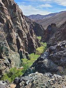 Darwin CanyonTo circumvent Lower Darwin Falls, we had to go back about 100 yards downstream and climb / scramble (Class 3 and 4) up a steep trail to ascend the side of the canyon. There were some areas with exposure that would not be fun for people afraid of heights. After climbing about 100 vertical feet in about a quarter of a mile, we reached a ledge with excellent views of the 60-foot unbroken cascade of Upper Darwin Falls, easily the most beautiful waterfall in the park.
This is an out-and-back hike, so we had to scramble back down to the Lower Falls - climbing down is always worse than up. It was only on the way down that we noticed how thick the vegetation is in the canyon. So much more lush and green than you would expect in Death Valley.
.thumbnail.jpg) View of remote Panamint Sand Dunes from the Panamint Springs ResortVery worthwhile hike. Next stop, the Panamint Sand Dunes! But first, a big lunch at the Panamint Grill at the “resort” we stayed at last night. That way we could just make sandwiches after our hike tonight.
View of remote Panamint Sand Dunes from the Panamint Springs ResortVery worthwhile hike. Next stop, the Panamint Sand Dunes! But first, a big lunch at the Panamint Grill at the “resort” we stayed at last night. That way we could just make sandwiches after our hike tonight.
To get to the trailhead for the Dunes, we drove down a rough gravel road for 6 miles, passing dilapidated, rusted-out vehicles of past travelers that braved this road without the benefit of 4WD. We see rusted out old cars like this all over the desert. I give them credit for trying.
The trailhead parking area had only one car in it. Hopefully, it belonged to a day visitor, because we were planning to camp here tonight, because it would be dark by the time we returned.
.thumbnail.jpg) Along the bumpy dirt road to the Panamint Sand Dunes trailheadJust to get to the dunes is a 3.7-mile hike and if you account for some time climbing up and playing on them, it would bring the total length of the hike (on sand) to more like 8 miles.
Along the bumpy dirt road to the Panamint Sand Dunes trailheadJust to get to the dunes is a 3.7-mile hike and if you account for some time climbing up and playing on them, it would bring the total length of the hike (on sand) to more like 8 miles.
Herb had serious doubts whether this hike was wise or even doable with the foot issue I was having (metatarsalgia), but I was determined to go for it. It was our final planned hike in Death Valley, as well as the last of the 6 sand dunes complexes in the park to conquer. Is there such a thing as dune bagging?
I convinced him that I would be fine and that my foot would have plenty of time to rest on our way back to Bishop and then home.
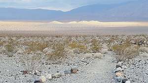 The start of the trail to the distant Panamint dunesIt was already 1:15 and since sunset was 5:45 (actually earlier because of the surrounding mountains), we got ready to start. In the meantime, the owner of the one sole car in the parking lot returned. When I asked him if he made it to the dunes, he said, “No, no matter how long I walked, they didn’t seem to get any closer” - and that was after one hour out and one hour back.
We always use Strava to track our hikes, serving two very important purposes for me: 1) By constantly looking at the distance traveled, I can actually believe the dunes are getting closer, even if they don’t appear to, and 2) it shows the track we are taking on a map, so we can just follow our breadcrumbs back to the car. Also, it helps us look back later and remember what hikes we did. As we age, that becomes more and more important.
.thumbnail.jpg) Finally there!Undaunted we set out across a rocky, sandy flat, populated mostly with creosote bushes. We’ve learned in past encounters with this bush that if you break a stem, it actually smells like creosote. Another fun fact is that it has the ability to secure more water for itself by inhibiting the growth of nearby plants - even other creosotes, so that is why they are dispersed the way they are. Seems like it is a “creosote eat creosote world” out in the desert. Good for us too, as there was plenty of space between them and us to hike through.
Finally there!Undaunted we set out across a rocky, sandy flat, populated mostly with creosote bushes. We’ve learned in past encounters with this bush that if you break a stem, it actually smells like creosote. Another fun fact is that it has the ability to secure more water for itself by inhibiting the growth of nearby plants - even other creosotes, so that is why they are dispersed the way they are. Seems like it is a “creosote eat creosote world” out in the desert. Good for us too, as there was plenty of space between them and us to hike through.
Eventually the rockier surface gave way to deeper sand, as we reached the sand apron surrounding the dunes. My foot appreciated the softer surface, but sand makes for slower progress. Plus, occasionally our feet would break through the top layer of sand and actually sink down several inches.
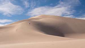 Lolo heading up the steep ridge of the Panamint Sand DunesAfter this happened a few times, we noticed it always occurred in places surrounded by deep holes of about 3 inches in diameter. Then it hit us. We were walking on top of some critters' homes and their tunnel system. Yikes! I picked up the pace.
Finally, the dunes really were getting closer and we knew now that we would make it. Most people don’t, and turn around well before getting to their base. Herb was so proud of me that he started referring to my foot as “the little bunion that could.”
.thumbnail.jpg) Tough getting down the steep sandAt about 3.5 miles we started to climb along the ridge up to the summit of the highest dune. These were really steep. Nothing like the cute Saline Valley Dunes that we scampered up two days ago.
Tough getting down the steep sandAt about 3.5 miles we started to climb along the ridge up to the summit of the highest dune. These were really steep. Nothing like the cute Saline Valley Dunes that we scampered up two days ago.
Herb sent me ahead because he likes taking photos of “Tiny Lolo” in large expanses. I don’t mind, because it is a very flattering photo.
Right on cue, as I was already struggling up the ridge, the wind picked up with a vengeance, blowing sand in our eyes and Herb’s camera, and making our progress very slow. My foot started to hurt quite a bit, so I sent Herb ahead, so I could take photos of “Tiny Herb.”
.thumbnail.jpg) Time to make the 4-mile trek back to the carWe didn’t make it to the top of the tallest one, but we got pretty close. A later check on Strava showed that we had climbed 1,000 feet since we left the car, 250 of which were in the last quarter mile up the dune.
Time to make the 4-mile trek back to the carWe didn’t make it to the top of the tallest one, but we got pretty close. A later check on Strava showed that we had climbed 1,000 feet since we left the car, 250 of which were in the last quarter mile up the dune.
We kept an eye on the time, because we wanted to get back to the car before dark. I especially didn’t want to be hiking on top of critter tunnels in the dark.
We hustled and covered the 4 miles back in an hour and a half. My foot was killing me the last mile.
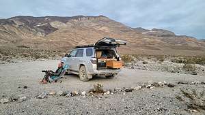 Camping at the Panamint Sand Dunes TrailheadOur car was still the only one in the small parking lot, so it looked like we would have it all to ourselves for the night, which was nice.
We were at a much lower elevation than our last camping at Hidden Valley, so it was warm enough to sit in our beach chairs and gaze at the stars. Death Valley National Park is an International Dark Sky Park because it has some of the darkest night skies in the U.S.
Herb stayed out longer, while I crawled into my cozy bed in the 4Runner and read my Kindle until I fell asleep. Sleeping was easy in a place so dark and quiet and peaceful.
Nice way to spend our last night in Death Valley.
Bishop
Friday, February 25, 2022 - 9:45am by Lolo360 miles and 7 hours from our last stop - 3 night stay
Travelogue
Day 1 - Drive to Bishop stopping at Mono Lake along the way
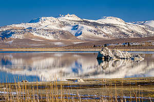 Mono LakeAs I mentioned in the past, our son Andrew and his wife Celeste, moved from San Francisco to Bishop in 2019 to try out a less-urban lifestyle in what is a world-class rock climbing destination. They were fortunate enough to be able to take their San Francisco jobs with them - and this was before Covid.
Bishop and all of the Eastern Sierra is stunningly beautiful, so even though they are 6 ½ hours away from us now, it is not a hardship to go over the mountains to visit them. Their home is often the first or last stop on one of our road trips.
The drive on Highway 395, also known as the Eastern Sierra Scenic Byway, is probably one of the most beautiful drives in the U.S. The 133-mile stretch from the Nevada border to Bishop is loaded with scenic vistas, each more beautiful than the next.
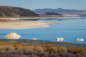 Mono LakeOne of our favorites along the way is Mono Lake, so we couldn’t resist just driving by without taking a detour to the County Park to visit the “tufa castles”.
These tufas, which are composed of precipitated calcium carbonate, were formed over a period of thousands of years by the interaction of freshwater springs and the highly alkaline waters of Mono Lake.
Normally they would just be hidden beneath the water, but as lake levels dropped, these extraordinary-looking knobs, spires, and minarets became exposed, some of them rising as high as 30 feet above the surface—and they do look like castles. Most of the towers visible in the lake are from 200 to 900 years old. It is such a unique and otherworldly place and definitely worth a stop.
Then it was on to Andrew and Celeste’s for a great home-cooked meal followed by a cozy night by the wood burning stove, just enjoying each other’s company.
Day 2 - Climbing at the Buttermilks and Off-Roading to Warm Springs Road
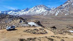 The view atop a hill in the ButtermilksWhenever we go to Bishop, we know that climbing is going to be a big part of it. Plus, Bishop is a premier climbing destination with numerous areas to do all types of climbing - trad, sport, and bouldering. That’s why they moved here.
Herb was still out photographing, so Andrew and Celeste headed out ahead of us to the Buttermilks, their favorite climbing area and one of California’s premier bouldering destinations. It was just a half hour from their house, out along the bumpy, washboardy Buttermilk Road.
.thumbnail.jpg) Bouldering in the ButtermilksBouldering is not Herb and my thing - we’re getting too old to take the kind of falls involved, even with a pile of crash pads below. So, for this portion of the day, we would just be spectators - not a bad thing as the landscape is amazing, with hundreds of huge boulders (or more technically, glacial erratics) strewn across a vast hillside with the snow-capped Sierra in the background.
Bouldering in the ButtermilksBouldering is not Herb and my thing - we’re getting too old to take the kind of falls involved, even with a pile of crash pads below. So, for this portion of the day, we would just be spectators - not a bad thing as the landscape is amazing, with hundreds of huge boulders (or more technically, glacial erratics) strewn across a vast hillside with the snow-capped Sierra in the background.
Before meeting up with them, we passed the main climbing area and drove up a short, but very steep hill, to a wonderful panoramic view of the Buttermilks. 4WD is definitely recommended. This is the hill where we camped back in July of 2020 to watch the Neowise Comet.
 Burn area from the Bishop Airport FireAfterwards we found them happily climbing with their friends. I really enjoy just hanging out, watching them climb, and enjoying the scenery.
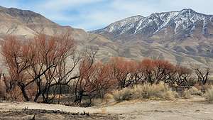
On the way back, Herb and I decided to take a drive out on Warm Springs Road toward the White Mountains to see the damage done by the recent Bishop Airport fire, which had raged through the Owens Valley, east of 395 and towards the White Mountains.
Herb usually gets up every morning to drive out into the Owens Valley to photograph the early morning light. On the few mornings he had, he had not seen any signs of the fire. However, today we drove further south to Warm Springs Road and then further east towards the White Mountains and came across an area of burn. Fortunately, this was mostly a vegetation fire with no damage to structures. Still it was sad to see the burnt Cottonwoods and reeds along the river.
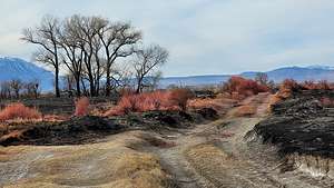 Burn area from the Bishop Airport fireThat night we went out to dinner at Andrew and Celeste’s favorite place, the Owens Valley Distillery, where they serve “Intelligently crafted, artisanal spirits." I think of myself as sort of a scholar, so I like my drinks intelligent.
Seriously, they serve phenomenal cocktails. I had a delicious rum cocktail called a Painkiller. There is also a rotating food truck there, and Andrew and Celeste seem to always know the chef - the beauty of small town living. The food was delicious, the cocktails inspiring, and it was within walking distance to their house - good thing, because these cocktails were potent.
After dinner, we went to Good Earth Yogurt on Main Street for wine and cheesecake. Gee, when did Bishop get so fancy?
Day 3 - Skiing at June Lake followed by the June Lake Brewery
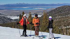 Awesome views of Mono Lake at June Lake Ski AreaHerb and I hadn’t skied in almost 3 years, so I was kind of anxious to try it again. I’m not a particularly great skier (Herb is much better), but I do enjoy a good intermediate trail. Andrew had been raving for some time about the June Lake Mountain Ski Area and telling me how much I would love it - plenty of wide intermediate trails, no crowds, no hassle, and great views. Sounded good to me.
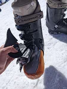 Equipment failure after first runWe had our own equipment, but they were a bit of antiques. I think they were probably at least 20 years old, and before the advent of shaped skis. The straight shape of my skis and its design, which literally looked like the wood flooring of a bowling alley lane, probably dated me a bit. Let’s just say I didn't exactly look like Susie “Chapstick.” That comment definitely dates me as well.
I was a little rusty and nervous, but on the first run everything seemed to be going fine and I was really enjoying myself. For some reason, at the very end, I felt a little less in control, but I definitely was feeling more confident.
Just before getting back on the chairlift for our second run, Herb pointed down at my right boot, which seemed to have cracked by the buckle nearest to the toe, exposing the orange padding inside.
_0.thumbnail.jpg) Happy skiersAt first he questioned whether it was a big deal, but when I went to open it, more of it started to crack. This was not good, so Andrew said he would take me inside to rent a pair.
Happy skiersAt first he questioned whether it was a big deal, but when I went to open it, more of it started to crack. This was not good, so Andrew said he would take me inside to rent a pair.
I took my now defunct boot off and carried somewhat embarrassingly behind him, as more and more pieces of it dropped in the snow, leaving a trail of “breadcrumbs” behind me. Oh, and the other boot started to crack as well.
I apologized to Andrew for taking time away from his skiing, but with a big grin, he informed me that this was the highlight of his day and proceeded to text Tommy photos of Mom’s first run.
We quickly got another pair of boots, I threw my old ones in the trash, and we were back out on the slopes in less than 20 minutes.
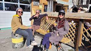 Apres ski at June Lake BreweryThe rest of the day went much smoother and we had a blast - 15 runs without any further incident.
Now, we were ready for the real event of the day that all of us had been looking forward to - some of us even more than skiing (you know who I’m talking about Celeste).
The June Lake Brewery is Andrew and Celeste’s weekend happy place, not just in winter, but all year round. This lovely little lakeside mountain village is known fondly as the ‘Switzerland of California’, because of its spectacular glacial lakes and high jagged mountain peaks.
It was already hopping (no pun intended) when we got there. They have a great selection of craft IPAs, which I love, and pilsners and wheat beers for Herb. There is also a food truck serving tasty Hawaiian soul food. It has a great apres-ski vibe.
Then it was back to the house for one more night before going on to Death Valley for a few days
Home
Wednesday, February 16, 2022 - 3:00pm by Lolo456 miles and 7.5 hours from our last stop - 1 night stay
Travelogue
Home Sweet Home
Barstow
Tuesday, February 15, 2022 - 2:45pm by Lolo84 miles and 1.5 hours from our last stop - 1 night stay
Travelogue
Barstow is a crossroads city where several major highways, including Interstate 15, Interstate 40, and California State Route 58, converge. There are many hotels and restaurants for travelers passing through.
Joshua Tree National Park
Monday, February 14, 2022 - 12:45pm by Lolo72 miles and 2 hours from our last stop - 1 night stay
Travelogue
Day 1 - Cholla Cactus Garden and Twentynine Palms
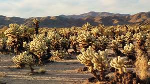 Cholla Cactus GardenIt was already 2:30 when we left the Salton Sea, not giving us much time to explore Joshua Tree today as it gets dark by 5:30. Before leaving Borrego Springs, I had made a reservation at the Cottonwood Campground in Joshua Tree, near the southern entrance to the Park, just in case that was how far we got before sunset. With a National Park Lifetime Senior Pass, the campside was only $12.50, so it wouldn’t be a big deal if we blew it off. I just like to have an insurance policy.
We arrived at the campground around 3:30, but the wind was picking up big time and was forecasted to get much worse - not very pleasant for camping. Plus, we really wanted to see the Cholla Cactus Garden at sunset, but that would mean a 21 mile drive north and then back again to the campground.
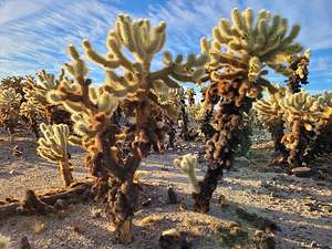 Cholla Cactus GardenSo, we made the decision to not camp, but rather to go to the Cholla Cactus Garden and then continue on to the town of Twentynine Palms and stay in a hotel there. However, Herb did utilize a bit of our $12.50 investment and took a 20-minute nap in our campsite.
We arrived at the Cholla Cactus Garden just in time to catch the setting sun dramatically backlighting the cacti. We weren’t the only ones with this idea, but fortunately the garden is so huge that everyone could have a cluster to themselves.
We set off on the ½-mile nature trail which wound its way through a dense forest of Teddy Bear and Silver Cholla cacti. They are called Teddy Bear for a reason – not for their cuddliness, as their furry little barbs are actually quite painful, but because they are probably the most adorable cacti, or even plant, I have ever seen.
The late afternoon light was amazing, casting a magical spell over the garden. It wasn’t long before I lost Herb as we each took off in separate directions in search of the most adorable and photogenic cholla. I think Herb took more photos of these cacti than he did of me over the entire trip.
.thumbnail.jpg) Herb cooking my Valentine's Day dinnerWe stayed there until it was dark and then continued on through Joshua Tree National Park to the town of Twentynine Palms, where we hoped to find a nice restaurant and hotel. Tomorrow we would come back into the park to do some more exploration.
Herb cooking my Valentine's Day dinnerWe stayed there until it was dark and then continued on through Joshua Tree National Park to the town of Twentynine Palms, where we hoped to find a nice restaurant and hotel. Tomorrow we would come back into the park to do some more exploration.
Unfortunately, Twentynine Palms was not what we hoped it would be. It got off to a bad foot in our minds when we stopped for gas and a road rage incident was going on right outside our car. We finally settled on an Americas Best Value Inn, which did have a not too desirable-looking Chinese restaurant a short walk away.
However, when we discovered that our room had a small kitchenette (more like two burners), I suggested to Herb that we stay in and cook one of our camping meals. It would be fun. He, rather reluctantly, agreed, and went on to make me a very nice Valentine’s Day dinner of powdered Idahoan Potatoes and Starkist lemon chicken. We paired it with a nice Chardonnay.
Day 2 - Hike Fortynine Palms Oasis Trail, Hike Ryan Mountain, and Off-Road on Covington Flat
.thumbnail.jpg) Herb approaching the Fortynine Palms OasisThe next morning the forecast was still calling for 45 mph gusts of wind, so we wondered whether it was even worth our while going back into the Park or whether we should just head home.
Herb approaching the Fortynine Palms OasisThe next morning the forecast was still calling for 45 mph gusts of wind, so we wondered whether it was even worth our while going back into the Park or whether we should just head home.
However, when we stuck our heads outside the door, it didn’t seem so bad, so we decided to head over to the Fortynine Palms Oasis Trailhead, which was quite nearby and get in a quick hike on a trail we had never been on before.
We set out on the trail which climbed steadily, though not too steeply, up a rocky slope with creosote bushes and barrel cacti along the way. No Joshua Trees though, as they prefer a bit higher altitude.
 Fortynine Palms OasisThings were going along just fine until I hit my foot against a rock, and lunged forward falling on my knees. The good news was that my left hand hit the rock first, softening the blow. The bad news was that my cell phone (which is my camera) was in that hand.
I almost cried when I saw the small bullet holes and cracks in the bottom fifth of the screen. There is a screen protector on there, but I wasn’t sure whether the cracks were on that or the actual phone screen itself. When we got home, we surprisingly found that the phone screen was fine. I strongly advise everyone to get a good screen protector.
Surprisingly, Herb didn’t hear my grunts as I fell and was about 20 years ahead of me going along his merry way. I yelled to him and he came running back. We spent a few minutes examining my and the phone’s bruises before continuing on. At least, the cracks were so low on my screen that I could still see through it well enough to compose photos.
 Atop Ryan MountainForging on, with my phone now safely tucked away in my backpack, we continued on over two more ridges before getting our first sighting of the palm grove, about a mile from when we started.
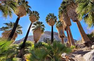
From there, we began descending towards the oasis, which looked so out of place from its surrounding arid landscape. Eventually, we followed the path through a group of boulders that ended right amongst the shady fan palms, which are arranged around a small greenish pool and a trickling stream.
These trees were planted by miners to mark the spring that now irrigates the trees. The oasis is also an important watering hole for native desert bighorn sheep and coyotes, as well as birds.
It was quite peaceful.
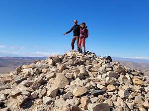 Top of Ryan MountainFrom there we retraced our steps one and a half miles back to the car. It wasn’t too windy yet, so we decided to drive back into the park to hike up Ryan Mountain, considered to be the best hike in the park.
We had been to Joshua Tree several times before, so we didn’t feel too bad passing right by some pretty cool spots. Ryan Mountain was one of the few things we hadn’t done.
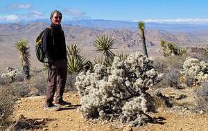
By now the wind was getting really pretty fierce, but we decided to do it anyway. The trail ascends pretty steeply - 1,000 feet over a mile and a half - up a series of stone steps cut into the bedrock. I took trekking poles with me this time so that I wouldn’t repeat my almost faceplant on the Fortynine Palms Oasis hike. Plus I kept my cell phone safely tucked away as well.
.thumbnail.jpg) Beautiful Joshua tree specimen among the Covington Flats roadAfter a mile and a half wandering always upward through boulders and Joshua trees, we reached the summit, marked by a pile of boulders, which we felt compelled to stand atop, despite practically being blown off of it.
Beautiful Joshua tree specimen among the Covington Flats roadAfter a mile and a half wandering always upward through boulders and Joshua trees, we reached the summit, marked by a pile of boulders, which we felt compelled to stand atop, despite practically being blown off of it.
From atop the exposed, 5,457-foot summit, there was an impressive panoramic view of the jumbled rock formations and Joshua tree forests that surround the peak, as well as the far off San Gorgonio and San Jacinto mountains. Lots of bang for your buck for a 3-mile hike.
Now, we just had to get down without being blown away. I always find going down a rocky trail much harder than going up, so I just took my sweet time. It was good to get back to the car and get out of the wind.
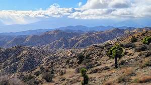 View from Eureka PeakBecause of the gusty wind, we decided that an off-road drive where we could enjoy the scenery from the comfort of the car might be a good idea. Although we had done the Covington Flats drive in the northwest corner of the Park before, we thought it was worth a repeat. It has some of the largest and oldest Joshue trees in the Park, as well as some of the lushest high desert in the region.
The drive took us along a well-graded dirt road for 25 miles, past many robust Joshua trees, and eventually out to 5,518-foot high Eureka Peak, where there was a tremendous 360 degree view of the Park, Yucca Valley, San Gorgonio and San Jacinto, and Palm Springs.
We didn’t want to stay in Twentynine Palms another night, so after finishing the Covington Flats drive, we headed to Barstow about two hours closer to home, and a place we were very familiar with.
Salton Sea Area
Monday, February 14, 2022 - 9:15am by Lolo160 miles and 4 hours from our last stop
Travelogue
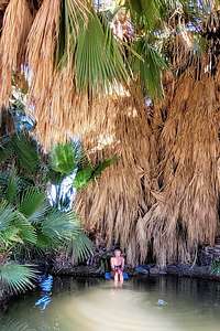 Lolo enjoying Five Palms Hot SpringThe southern entrance to Joshua Tree was only an hour and 45 minutes away, but Herb had discovered some interesting side trips around the Salton Sea kind of along the route, which would make the driving closer to 5 hours. That’s okay. That’s why it’s called a road trip.
It all started when Herb read about a place called the North Algodones Dunes Wilderness in one of his photography books. How could Herb, the desert aficionado, not have known about the largest dune system in California. Could it be that it was out in the middle of nowhere, or that it had no easy way to access it?
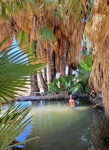 Herb loves a good hot springWell, that wasn’t going to stop us from trying. So instead of going the more direct route to Joshua Tree along the western shore of the Salton Sea, we went way, way south and east of it.
As Herb dove deeper down into Google Maps along the route, he stumbled upon something called the Five Palms Hot Springs. Now there is only one thing that can compete with a desert for Herb’s heart, and that’s a Hot Spring.
So, that’s how we found ourselves turning right on an unmarked sandy road, and driving until we saw palm trees. No mirage, but a real live oasis with palm trees surrounding a lovely hot spring, with no other soul in probably 20 miles.
Time for a soak! Herb felt pretty smug about his discovery.
Next, we continued on CA-78 towards the Algodones Dunes Wilderness. South of the Highway was the Imperial Sand Dunes Recreation Area, an off-highway vehicle park where thousands of noisy dune buggies raced up, down, and through the dunes.
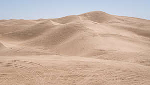 Imperial Dune Recreation AreaThere is a scenic viewpoint on CA-78, halfway across the width of the dunes where we stopped for a panoramic view over the dunes to the south, covered with tracks from the dune buggies.
To the north of CA-78 is the pristine North Algodones Dunes Wilderness area, but they are not easily accessible. The average hike to the crest of the dunes is 2 miles each way.
Hoping to get closer to being able to get out on the dunes, we decided to take the Niland-Glamis road (also called the Ted Kipf Road) north along the east side of the wilderness area.
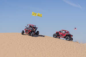 Dune buggies at the Imperial Sand Dunes Recreation AreaWe missed the turnoff the first time, because we were expecting a paved road, not the sandy washboard road which went on for 15 miles. Every time we crossed a wash, which was about every 50 yards, we would bounce and practically get whiplash - and still, the dunes got no closer.
I really was not enjoying this and regretted not going straight to Joshua Tree; although then we would have missed the lovely Five Palms Hot Spring.
After 15 miles of bouncing, Google Maps told us to make a right turn across the railroad tracks and then a quick left, paralleling the road we had been on. I think that road eventually petered out, but it might have gotten us closer to the dunes. At this point, I no longer had any interest in these dunes.
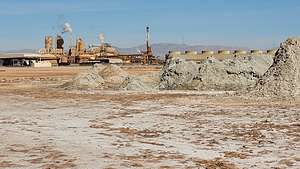 Niland Geyser FieldAfter about another 20 miles on dirt roads, we eventually came out onto CA-111 on the eastern side of the Salton Sea.
At this point I was ready to just hightail it to Joshua Tree, but Herb had another quirky spot he had discovered that he wanted to see - the Salton Sea Mud Pots, also known as the “Niland Geyser,” because it is located near the town of Niland. This was turning out to be quite the Valentine’s Day.
We entered “Niland Geyser'' into Google Maps, and found that it was right along our drive on CA-111. When we got there, we saw a solitary man walking towards us across a muddy field, dotted with volcanic-looking mud cones, and a large industrial complex in the background.
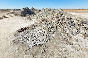 Niland Geyser FieldWe later learned that this was the Davis-Schrimpf Seep Field, and that it had gotten quite a bit of attention in the scientific press, which I’ll get to in a bit.
Ignoring the “No Trespassing” signs, as Herb never seems to think they are intended for him, we wandered out onto the field, where there was an obvious packed down path that indicated we were not the only ones to ignore the sign.
I was a little bit nervous, because around the cones the ground seemed soft in spots, and I worried that it might break through and I would get a scalded muddy foot. So, I kept my distance a bit more than Herb did.
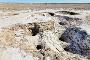 Niland Geyser FieldHowever, even from a distance I could hear bubbling, gurgling, and burping coming from inside the cones, which were actual live mud volcanoes. It smelled like rotten eggs, which is actually hydrogen sulfide gas escaping.
We had seen mud pots before in Yellowstone and Lassen National Parks, but these were unique in that they are actually moving about 20 feet each year, carving a 24,000 square foot basin in the ground, causing quite a bit of concern because of what is in its path. Currently the mud is creeping in the direction of the Union Pacific freight railroad tracks, a petroleum pipeline, fiber optic telecommunications lines owned by Verizon, and part of Highway 111.
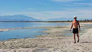 Strolling along the Salton SeaSo far, attempts to stop the mud pots’ relentless march have been futile. The Union Pacific Railroad even built a 100-foot wall that extended 75 feet underground to stop the mud from reaching its tracks, but undaunted the mud just oozed beneath the wall. Their next thought is building a bridge to go over them.
This was the stuff of science fiction. Reminded me of a movie that used to terrify me as a kid, “The Blob.”.
I have to give it to Herb. This was an interesting stop.
At this point, we were starving. We knew enough about the desolation of the Salton Sea area, especially the eastern shore, to not expect many fine dining options, so we had smartly packed sandwiches, which we ate at the Salton Sea State Recreation Area.
That and a quick walk on the beach and we were on our way to Joshua Tree.
Anza-Borrego State Park
Friday, February 11, 2022 - 10:00am by Lolo92 miles and 2 hours from our last stop - 3 night stay
Travelogue
Day 1 - Off Road to Sunset at Fonts Point
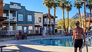 Palm Canyon Resort - Wild West themeAfter leaving San Diego, we headed northeast for 2 hours to Borrego Springs, a small town located in the center (like a donut hole) of Anza Borrego State Park.
Herb absolutely loves deserts, and with over 600,000 acres, Anza Borrego is the largest desert state park in the U.S. Its spectacular and undeveloped Colorado Desert scenery extends from the edge of the coastal mountains east to the Salton Sea and south almost to the Mexican border.
Before leaving San Diego we had booked two nights at the Palm Canyon Hotel and RV Resort, perfectly located less than a mile from the state park Visitor Center. Although we normally love to camp in our built-out 4Runner, the February days are just too short, and the nights too cool. So instead, we like to base ourselves in a comfy hotel room, where we can stay up later than 6:00 when it gets dark, shower, use a porcelain toilet rather than a shovel, go out to dinner, swim in the pool, etc. Herb knows it makes me a happier camper, or more correctly non-camper.
.thumbnail.jpg) Lolo enjoying sunset at Fonts PointThe Resort definitely had a Wild West theme with each room fronted with a frontier town facade - a saloon, jail, dentist, mercantile, etc. We stayed in the Stage House. It was a bit kitschy, but cute and comfortable. Herb promised me that next time we could stay in either the Dentistry or the Jail. He spoils me so.
Lolo enjoying sunset at Fonts PointThe Resort definitely had a Wild West theme with each room fronted with a frontier town facade - a saloon, jail, dentist, mercantile, etc. We stayed in the Stage House. It was a bit kitschy, but cute and comfortable. Herb promised me that next time we could stay in either the Dentistry or the Jail. He spoils me so.
The check-in process was extremely friendly. We were given chocolate chip cookies and a coupon for 2 free drinks in the saloon. Very neighborly.
We didn’t have many daylight hours left, so we immediately headed out to watch the sunset over the Badlands from Fonts Point, considered one of the best viewpoints in the State Park. In just 15 minutes we were at the start of the 4WD dirt road to the Point, located off of S22, also known as the Borrego Salton Sea Way.
.thumbnail.jpg) View of the Badlands from Fonts PointThe road to Fonts Point is 3.9-miles and pretty easy by 4WD standards. No high clearance is needed but there are some pretty sandy spots. There’s a pretty big payoff at the end - a spectacular view of the Borrego Badlands, the Salton Sea, and the Fish Creek Mountains in the distance.
View of the Badlands from Fonts PointThe road to Fonts Point is 3.9-miles and pretty easy by 4WD standards. No high clearance is needed but there are some pretty sandy spots. There’s a pretty big payoff at the end - a spectacular view of the Borrego Badlands, the Salton Sea, and the Fish Creek Mountains in the distance.
We set up our chairs, grabbed a cooler, and sipped on a glass of wine as the light changed on the Badlands below us. Herb informed me that tomorrow morning we would be driving through those very Badlands in our 4Runner. It looked very cool.
On our way back to the Stage House (our frontier name for hotel room), we stopped at Carmelita’s Mexican Grill where I had the largest Margarita of my life. Herb insisted we order the Grande size. It was like a bucket. A very enjoyable bucket though.
Day 2 - 50-mile off-road adventure (Hills of the Moon Badlands, Pumpkin Patch, 17 Palms Oasis, etc), and Sunset at Vista del Malpais
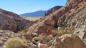 Hiking up Hawk CanyonAnza Borrego has hundreds of miles of 4WD, and today we were going to try to do our best to explore a good chunk of them.
This time instead of going north to S22 (the Borrego Salton Sea Way), we headed southeast on Borrego Springs Road to Highway 78, where we quickly got off the asphalt and took a left onto Buttes Pass Road, a dirt road that most people take to get to “The Slot,” Anza-Borrego’s most popular hike.
When we got to a fork - Slot Canyon to the left, Hawk Canyon to the right – we wisely chose the less traveled right, as Slot Canyon would be packed with happy tourists, squeezing their way through the narrow passageways, especially since it was a weekend.
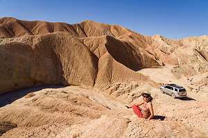 Off-roading through Hills of the MoonAbout 3 miles into our off-road journey, we made a left to take the side trip to Hawk Canyon, a fault-formed valley with sedimentary and sandstone rocks on the left (southwest side) and granitic rock on the right (northeast side). We stopped to stretch our legs and take a short, out-and–back hike into the Valley, which included some rock scrambling.
After our side trip, we drove back to Butte Pass Road, made a left, and continued about 2 miles north and then took a left on the San Felipe Wash Road. After another 2 miles we turned right on our planned higAhlight, the Hills of the Moon Wash, where we would weave our way through the Badlands that we had admired last night from Fonts Point.
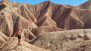 Herb playing on the Hills of the Moon BadlandsThis part of our off-roading day was my favorite. It was like driving through a moonscape - a very twisty moonscape with not another soul in sight. We stopped at about 3 miles to get out and scamper up the colorful mud hills, which are completely devoid of any vegetation. There were interesting patterns in the hills, which are created by the runoff of some of the mud when it rains.
From the top of the hill, I saw that we were no longer alone. A group of 5 jeeps was heading our way. Herb quickly moved the 4Runner further off the road so that they could safely pass.
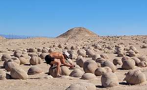 Herb "pumpkin" pickingI’m not sure how much further the road went, but we decided to turn around at this point. The road is so twisty and narrow that we didn’t particularly run into a situation where we met up with the jeep squad.
We drove back from whence we came, fortunately not meeting any more jeeps along the way. Back at the junction of the Butte Pass Road and the San Felipe Wash (mile 15 since we left the pavement of Highway 38), we hung a left onto Cross Across Trail, which led northeast towards S22 where we would eventually hit asphalt again.
After about 6 miles on the Cross Cut Road, we hung a right onto Basin Wash Road to make a side trip to the Pumpkin Patch, a field full of spherically-shaped rocks that are all the size of an average pumpkin.
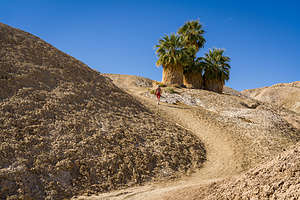 Lolo charging up to the Five Palms OasisIn about 6 more miles, we continued straight onto Tule Wash. At this point, we had actually left the boundaries of Anza Borrego State Park and were now in the Ocotillo Wells State Vehicular Recreation Area, where people with their dune buggies love to race up and down the dunes. The VRA area is huge, with over 85,000 acres of desert.
The parking lot for entry into the dunes was also the parking lot for the pumpkin patch. It was quite obvious that we were the only ones there planning an afternoon stroll through the pumpkin batch. The patch is really pretty bizarre, so we took the time to read the information board which explained how they were formed:
The “pumpkins” are actually a unique geologic feature called concretions, because the key ingredient to these formations is concrete. They are formed much like how a pearl forms. When loose sand becomes wet, it will naturally cement itself to a larger object such as a pebble or even an insect body. When the water evaporates, the sand becomes hardened around the object.
.thumbnail.jpg) Herb stalking the 5 Palm OasisAlthough all concretions do not have to be round, these are. After several years of wind erosion, these concretions have slowly emerged from the sand,while remaining stationary, and have been rounded by wind. Unlike their life beneath the saand where they grew larger and larger, they are now exposed to the wind, slowly whittling away.
Herb stalking the 5 Palm OasisAlthough all concretions do not have to be round, these are. After several years of wind erosion, these concretions have slowly emerged from the sand,while remaining stationary, and have been rounded by wind. Unlike their life beneath the saand where they grew larger and larger, they are now exposed to the wind, slowly whittling away.
So, I guess than that these pumpkins are getting smaller and smaller, but nothing we will ever notice in our lifetime. Geological time works in millions of years, not summer vacations.
Our odometer showed that we had been 26 miles since we left Highway 78. Our plan was to continue on and eventually come out on S22.
.thumbnail.jpg) Seventeen Palms OasisFrom the Pumpkin Patch we drove north on the Tule Wash for about 4 miles before turning left (northwest) onto the Arroyo Salado Wash, where we planned to explore two fan palm oases. The Arroyo Salado is one of the hottest and driest sections of Anza Borrego, so it’s pretty amazing that these oases survive. It’s even too harsh for creosote and ocotillo.
Seventeen Palms OasisFrom the Pumpkin Patch we drove north on the Tule Wash for about 4 miles before turning left (northwest) onto the Arroyo Salado Wash, where we planned to explore two fan palm oases. The Arroyo Salado is one of the hottest and driest sections of Anza Borrego, so it’s pretty amazing that these oases survive. It’s even too harsh for creosote and ocotillo.
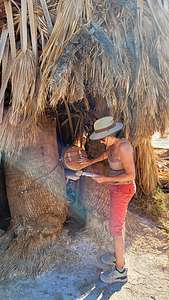 Lolo at the desert post officeWe came to Five Palms Oasis first where we parked the truck and walked up a short ravine to the oasis set atop a ridge. Although called Five Palms, there are only four fan palms remaining. At the crest of the ridge, just beyond the palms, there is an awesome view of the Borrego Badlands and even the Salton Sea.
A few miles further, we came to the unmarked turnoff for the Seventeen Palms Oasis - thank goodness for Gaia. The information board at the edge of the parking lot was a sober reminder that this was not just an entertaining stop at the end of a day of sightseeing, but literally a lifesaver for inhabitants and travelers of the past.
From the parking area, we walked the short distance to the oasis, whose greenery stood in stark contrast to the stark and barren desert around it. I confess to counting the palms. I couldn’t help myself. It was called 17 Palms, so I wanted to make sure. There were 30 of them. Okay. I guess the oasis was doing well.
.thumbnail.jpg) On the road to Vista del MalpaisHowever, throughout the centuries the spring which feeds the oasis wasn’t always reliable, so early travelers with extra water would leave it in large glass jars in the shade of the palms for others to find. Travelers would leave notes attached to the jars.
On the road to Vista del MalpaisHowever, throughout the centuries the spring which feeds the oasis wasn’t always reliable, so early travelers with extra water would leave it in large glass jars in the shade of the palms for others to find. Travelers would leave notes attached to the jars.
Today that tradition lives on, but with much less serious consequences. After a short search, I found an old barrel amongst the palms, which holds a journal for current day visitors to record their own feelings and experiences at the oasis.
Besides its human history, this particular oasis is also very important to the wildlife in Anza-Borrego because it is the only year-round watering hole for many miles.
After our 17 Palms stop, we headed north on the Arroyo Salado Wash for about 2 ½ miles where we came to a junction with the Truckhaven. We took the Truckhaven Trail, but after a mile realized it was taking us too far east, and we wanted to go west, so we turned around and returned to the Salado Wash, which we took north back up to S22 (Borrego Salton Sea Way).
.thumbnail.jpg) Tiny Lolo, Big Badlands at Vista del MalpaisWe drove on the pavement for 3 miles and then turned left onto the 4WD Thimble Trail with the intention of watching sunset at Vista del Malpais. We drove 2 miles south on the Thimble Trail and then turned left (east) onto Short Wash. There was one steep, rutty section on Short Wash, but nothing too difficult for the 4Runner to handle. After 1.3 miles we turned right on Vista Road and drove another 1.1 miles to the parking lot.
Tiny Lolo, Big Badlands at Vista del MalpaisWe drove on the pavement for 3 miles and then turned left onto the 4WD Thimble Trail with the intention of watching sunset at Vista del Malpais. We drove 2 miles south on the Thimble Trail and then turned left (east) onto Short Wash. There was one steep, rutty section on Short Wash, but nothing too difficult for the 4Runner to handle. After 1.3 miles we turned right on Vista Road and drove another 1.1 miles to the parking lot.
Not far as the crow flies from Fonts Point, Vista del Malpais is the lesser known of the two best viewpoints in Anza Borrego. They both overlook the Borrego Badlands, but Fonts Point has a higher vantage point. However, I actually like Vista del Malpais better because it is quieter and has a better 360 view of the badlands.
.thumbnail.jpeg) Sunset at Vista del MalpaisSo once again, we set up chairs and watched the sunset over the Badlands we had been playing in all day. Hard to believe we had driven through that!
Sunset at Vista del MalpaisSo once again, we set up chairs and watched the sunset over the Badlands we had been playing in all day. Hard to believe we had driven through that!
We had a long day - close to 50 miles of off-road exploring, so we thought we would just stay home and have dinner at the Big Horn Burgers and Shakes, right in our hotel. How could we pass up a place that advertised itself as the “Best Beef Wranglers and Booze Clerks” in Borrego Springs.
Ordering was easy. The only menu option was hamburgers, which turned out to be very good. We also used our coupon for two free drinks at the saloon, and I was pleased that they had a very good Chardonnay from our home county of Sonoma.
Time to hit the hay! Another big day tomorrow.
Day 3 - Off Road to Calcite Mine, hiking through two slot canyons, and seeing the Galleta Meadow sculptures
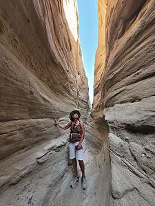 Calcite Mine Slot CanyonThere was one 4WD road that we didn’t have time to do yesterday, so we decided to add a third night to our stay in Borrego Springs so that we could. Actually, there are a lot of 4WD roads in Anza Borrego that we would like to do, but that would have to wait until a future trip.
This morning’s adventure would be a drive up Calcite Canyon to an old mine and two slot canyons. The turnoff for Calcite Mine road is located on S22 (Borrego Salton Sea Way), just east of the Salton View turnout (mile 38) and west of the Microwave Tower (mile 39).
The drive, which is graded as difficult (but really wasn’t) immediately drops steeply down the sandstone cliffs into the South Fork Palm Wash.
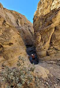 Calcite Mine Slot CanyonRather than take the left into the Palm Wash, where there is an arch and a slot canyon, we decided to go straight right on the Calcite Mine trail right past the yellow ROUGH ROAD sign - because apparently we are bad ass.
At 1.4 miles, we pulled off to the left in a parking spot that could fit two cars. This was the trailhead for the hike into the Calcite Slot Canyon.
A short walk from our car through a wash soon brought us into the smooth white, sculpted wavy walls of the Calcite slot canyon, considered to be one of the best slot canyons in California.
This slot canyon is different from others in Anza Borrego, in that its walls are smoother than the rough, corrugated walls of other canyons, such as The Slot, and is comprised more of tougher sandstone than the loose layers of dry mud often found in wash canyons.
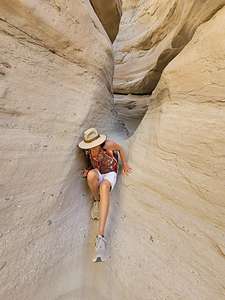 Calcite Mine Slot CanyonFor a half mile, we squeezed through the canyon, climbing over rocks, sliding down ramps, and just generally enjoying ourselves the entire way. It was beautiful and so much fun.
After about a half mile, we came to a ten-foot dry falls, which we figured was the end of the road. We turned around here and headed back, not realizing that a few hundred yards back there is a gap on the east wall through which you can exit the canyon and continue on foot to the Calcite Mine. Instead we returned to our 4Runner, and drove the ½-mile steep, rough road to the Mine.
Although this was an old mining site, there were no structures or equipment left behind to identify it as such. I didn’t even know what calcite was, but I later learned that this mine had a rich deposit of high-grade optical calcite that was used during World War II in the manufacture of precision bomb sights. However, a less expensive, synthetic substitute was soon created that had the same optical qualities as the calcite, so the mine was soon abandoned.
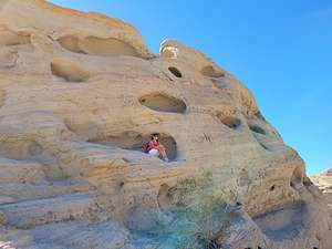 Wind caves near the Calcite MineFootpaths leave the Calcite Mine in several directions, but we first took the one that led to a sandstone formation with wind-eroded pockets in them, some of them large enough to sit in - so I did!
These pockets are called wind caves (or aeolian caves), because they were formed by the forces of wind, which sculptured the rock with sand like a sandblast. However, since the interior of the caves tends to be windless, they are usually not very deep.
The next path we followed was the one that led to the top of an 1,122-foot high hill with even better views of the badlands and the Salton Sea.
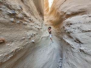 Parm Wash Slot CanyonThis was the end of the road, so we retraced our steps and drove the 2-miles down the rocky, steep Calcite Mine Road to the turnoff for the South Fork Palm Wash, just shy of S22, and took a right and followed the wash for about a ½ mile to the end of the vehicle-accessible portion.
From there we set out on foot. In about 200 yards we reached a small arch over the path and then in another 200 yards or so, we entered another slot canyon.
Unlike the smooth walls of the Calcite slot canyon, this one was rougher with conglomerate rocks embedded in its walls. In about a ½ mile we came to a 20-foot dryfall which blocked our progress, so we turned back and headed towards our car.
We did meet some people that were planning to do this hike all the way up to the Calcite Mine through the Calcite slot canyon. So, somewhere shy of the drywall there must have been a gap in the wall that we didn’t see that would allow you to exit the slot canyon and continue up a trail to the Calcite Slot and eventually the Calcite Mine.
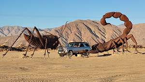 Herb breaking up a spat between a giant scorpion and a grasshopperIf you only have a 2WD vehicle or a 4WD without high clearance, parking in the lot on S22 and hiking is the only way to explore the slots and the mine. I think it is about a 4 or 5 mile hike and definitely not a bad option for exploring this fascinating area.
We headed back to the Palm Canyon Resort and spent some well-needed pool and hot tub time. It was pretty funny sitting in a hot tub surrounded by a Wild West frontier town - kitschy but well done.
There was one more thing I wanted to do in Borrego Springs before leaving the next morning, and that was exploring Galleta Meadows where there are dozens of bizarre metal sculptures, somewhat randomly popping out of the desert landscape. We had seen many of these sculptures on a previous visit, but they are definitely worth seeing again.
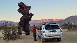 Herb showing this old dinosaur who's bossThey are the work of an artist named Ricardo Breceda, who was commissioned in 2008 by Dennis Avery, the owner of the Galleta Meadows Estate, to create a collection of prehistoric creations on his three square miles of undeveloped land in Borrego Springs. Since then, the collection has grown to over 130 sculptures, including human figures, like a gold miner, along with contemporary animals, such as big horn sheep, elephants, tortoises, horses, and more.
We had lingered too long in the hot tub, almost blowing seeing these sculptures in daylight, so we immediately headed out to our favorite one - a 15-foot scorpion waging battle with an equally large grasshopper. The detail was amazing.
I got out to take a picture, but soon got annoyed with Herb for driving into my carefully composed photo. However, I quickly realized this was “the money shot”. Herb and his beloved 4Runner breaking up an epic battle between a giant scorpion and a grasshopper.
.thumbnail.jpg) Happy Valentines Day!Next, we stopped to say hello to the Sea Dragon, a 350-foot long sea serpent whose body submerges and emerges from the ground. It even crossed the road. It has the head of a dragon and the tail of a rattlesnake. You have to see it to believe it.
Happy Valentines Day!Next, we stopped to say hello to the Sea Dragon, a 350-foot long sea serpent whose body submerges and emerges from the ground. It even crossed the road. It has the head of a dragon and the tail of a rattlesnake. You have to see it to believe it.
My other favorite capture was a series of two photos documenting Herb’s encounter with some sort of fierce prehistoric dinosaur. While at first, the dinosaur seemed to be in command of the situation, it was later subdued by my “alpha male” husband.
You can spend a whole day exploring these unique sculptures, but unfortunately we had run out of daylight.
We finished off our day, and our stay in Borrego Springs, with a pre-Valentine’s Day dinner at the Red Ocotillo, a highly-rated Borrego Springs organic garden-to-table restaurant with a lovely outdoor patio, and generous dishes prepared with only the finest fresh ingredients.
Tomorrow morning we would head towards Joshua Tree National Park with a few stops along the way.
San Diego
Tuesday, February 8, 2022 - 9:45am by Lolo544 miles and 10 hours from our last stop - 3 night stay
Travelogue
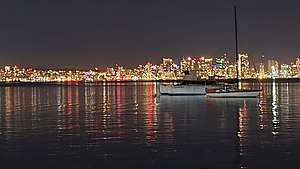 San Diego skyline from Humphreys Half Moon InnWhat should have been a 9 ½ drive turned into a 13-hour affair when a car accident on I5 through the Grapevine Pass kept us sitting still for close to 2 hours. That followed by the usual traffic getting around LA made for a much more epic journey than we had planned.
Fortunately, we had reserved a room at Humphreys Half Moon Inn on Shelter Island, right across from Coronado Island. It was absolutely lovely with palm trees and views of the San Diego skyline and Coronado Island.
We were pretty exhausted and cranky from our long drive, so we decided to stay in and eat the salads I had packed in our 4Runner’s mini frig. That and a few glasses of wine snapped us back into the proper mood.
Day 1 - Stroll along Shelter Island Waterfront and Black’s Beach
.thumbnail.jpg) Herb excited about a beach day at Black's BeachOur purpose for coming to San Diego in the first place was for Herb to soak up the sun he so craved, so after a morning walk along the Shelter Island waterfront, we set off to spend the day at Black’s Beach, on the southern end of Torrey Pines State Park.
Herb excited about a beach day at Black's BeachOur purpose for coming to San Diego in the first place was for Herb to soak up the sun he so craved, so after a morning walk along the Shelter Island waterfront, we set off to spend the day at Black’s Beach, on the southern end of Torrey Pines State Park.
While the beaches on the northern end of the Torrey Pines are accessible by car, this one required walking down a very steep and somewhat precarious trail that switchbacks its way down from the Glider Port parking lot to a beautiful 2.5-mile long sandy beach. The trail is only 1,000 feet long, but its 320-foot descent in that short distance, makes it feel much longer. However, the trail is well maintained and there are steps and handrails in the steeper sections.
Once we got down to beach level, we walked north about a ½ mile before setting up shop along the base of the cliffs.
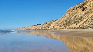 Black's BeachThe beach was lovely and, despite being a weekday, much more crowded than we expected. I guess an 80 degree in February brings out the crowds, as that is pretty warm even by San Diego standards.
After a full, relaxing day of reading, people watching, and taking strolls up and down the beach, we were fully recovered from our horrible drive the day before and ready to have some fun.
On the way back from the beach, we made the mistake of driving out to Sunset Cliffs to watch the sunset, as we were not the only ones. It seemed like everyone else in San Diego had the same idea and it was a bit of a madhouse. However, we did manage to squeeze into the last parking spot in one lot to get out to take a sunset photo before Herb said let’s get out of here. He’s more of a solitude kind of guy.
Day 2 - Balboa Park and the Hotel del Coronado
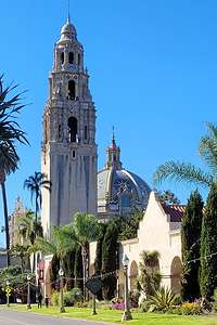 Balboa ParkThe next morning we headed over to Balboa Park, San Diego’s version of New York City’s Central Park and San Francisco’s Golden Gate Park.
I think that one of the qualifications for being a great city is having a great park -- one that serves as an extended backyard for its residents and yet can still attract visitors from around the world.
Everyone knows about the famous San Diego Zoo, but the park also has more than a dozen art, cultural, and science museums, as well as a replica of the Old Globe Theater where Shakespeare plays are performed.
We wisely made our first stop the Visitor Center on El Prado, the main avenue through the park, to get their advice on a plan of attack. Last time we were here, we went a little crazy and bought a Multi-Day Explorer Zoo Combo, which gave us admission to the Zoo plus 17 museums. This time we toned it down a bit and got the 4-museum Explorer Pass, which I believe was $56 each.
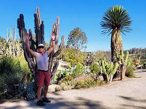 Herb in the Balboa Park Desert GardenWe then headed off east along El Prado towards the fountain and the Fleet Science Museum. Before going into the Fleet, we decided to follow the signs to the “Desert Garden,” which is separated from the rest of the park by a pedestrian bridge over busy Park Blvd.
Although it did have a wide range of beautiful desert plants, I came away with a few negative impressions. Firstly, since it is an area accessible 24/7, there were a few homeless tents hidden amongst the cacti. Secondly, there were several instances of plant graffiti, where people had etched their initials on the plants. Pretty stupid. Lastly, I am no botanist, so I think it would have really been helpful for the plants to be labeled as to what they were. That being said, the garden contained a very impressive collection of succulents.
Our next stop was the Reuben H Fleet Space Theater & Science Center, which has over 100 interactive exhibits, which makes it a wonderful place to bring children. It is also home to Southern California’s only IMAX Dome Theater.
 Lunch Break at Panama 66You could easily spend the whole day here, but we had three more museums to conquer. The IMAX movie we wanted to see wasn’t playing for another 2 hours, so we left thinking that if the timing worked out, we would return to see it at 1:00.
Next, it was on to the San Diego Museum of Art, the oldest and largest art museum in San Diego. It was wonderful. We particularly enjoyed its Masters of Photography, Of Sea and Sand - California Paintings, Modern and Contemporary Art, and Impressionism and Post-Impressionism Exhibits. This is my favorite museum in the Park and one in which I could easily spend an entire day.
Lunch time, so we grabbed a table at nearby Panama 66, a restaurant that occupies the open-air setting of the San Diego Museum of Art’s Sculpture Garden, known for its good food and locally crafted beers.
 Herb trying out a DeLorean in the Automotive MuseumAs we were finishing, I glanced at my watch and saw that it was 12:45, which would allow us time to hustle back to the Fleet Museum to catch the IMAX show I wanted to see: Into America’s Wild, a visually stunning cross-country adventure into the hidden wonders of the natural world.
Herb said he wanted to nap. I suggested he did that in the theater, but informed me that an IMAX film production was not conducive to napping. So we temporarily parted ways - Herb back to the 4Runner to take a nap on the bed in the back, and me to see some stunning natural wonders.
.thumbnail.jpg) Lolo trying to sneak in a nap at the Air and Space MuseumThe film was great and I was so happy to recognize so many of the featured places as places that we had visited. Afterall, exploring beautiful natural places is kind of our thing.
Lolo trying to sneak in a nap at the Air and Space MuseumThe film was great and I was so happy to recognize so many of the featured places as places that we had visited. Afterall, exploring beautiful natural places is kind of our thing.
I collected Herb from the parking lot, and we headed off to our last two museums for the day.
First stop, the Automotive Museum, which has a very impressive collection of over 80 historic cars and motorcycles. The cars on display offer a nostalgic look of the amazing history of cars in the 20th century, including a 1927 Bentley, 1931 Rolls Royce Phaeton, Steve McQueen's 1953 Allard, and a $75,000 1947 Cadillac. There was even a DeLorean for Herb to sit in, just as Marty McFly did in Back to the Future. They are meticulously preserved and ever so shiny.
 Lolo very much enjoying her exotic rum drink at the Hotel del CoronadoThe last of our four picks of the day was the Air and Space Museum. I can see why this is one of the most popular museums in the park. It has some very cool historic aircraft and spacecraft from all over the world, including a working flying replica of Lindbergh's Spirit of St. Louis, the actual Apollo 9 Command Module spacecraft, and artifacts from the Wright Brothers, Charles Lindbergh, Amelia Earhart, Neil Armstrong, Buzz Aldrin and other aviation and space pioneers.
 The lovely Hotel del CoronadoI probably should have considered a post-lunch nap like Herb did because I almost fell asleep while lying in a lunar module.
I was pretty excited about the next thing on our agenda - driving to Coronado Island and stopping at the iconic Hotel del Coronado for a sunset cocktail.
The Hotel is spectacular. Opened in 1888, it is one of the last surviving examples of a classic wooden Victorian beach resort. It is also the second largest wooden structure in the U.S. Through the years, it has hosted royalty, presidents, and celebrities and been featured in numerous movies, such as “Some Like it Hot,” which I watched before leaving on this trip in preparation for my visit.
Well, tonight it would be hosting us for a very large exotic rum cocktail at the beachside Taco Shack, where we enjoyed an incredible sunset in a truly incredible setting. I can’t believe Herb had to twist my arm to spend $17 on a cocktail, but I’m sure glad he did. My new favorite drink: Surfer’s Point - Cruzan Single Barrel, Plantation Grand Reserve, Lime Juice, Orgeat, Orange Juice, Myer's Dark Rum.
We ended our day with a lovely dinner at Humphreys Restaurant back at our hotel. It’s a very popular music venue, with live music offered almost every night - tonight included. We started off in the lounge, but we couldn’t hear each other at all over the music, so we moved to the quieter dining room. Nice to know we still wanted to talk to each other after 37 years.
Day 3 - Some resort pool and hot tub time
 Pool at the Humphreys Half Moon InnIt was our departure day, but we realized that we hadn’t partaken of the hotel’s beautiful facilities, so we got our bathing suits on and headed to the pool and hot tub in the lovely palm garden. We're usually too active on our supposed vacations to take the time to just relax. We will have to make an effort to do this more in the future - helps recharge for the next frenetic day.
While theoretically relaxing, we planned our next stop to Anza Borrego State Park in Borrego Springs and made a reservation at the Palm Canyon Resort for the next 2 nights. We would use that as a base camp for our 4WD off-road explorations into the Park, leaving the possibility of staying a 3rd night if we still wanted to do more there.
Ok, relax time over. Let's hit the road.
