- Home
- About
- Map
- Trips
- Bringing Boat West
- Migration West
- Solo Motorcycle Ride
- Final Family XC Trip
- Colorado Rockies
- Graduates' XC Trip
- Yosemite & Nevada
- Colorado & Utah
- Best of Utah
- Southern Loop
- Pacific Northwest
- Northern Loop
- Los Angeles to NYC
- East Coast Trips
- Martha's Vineyard
- 1 Week in Quebec
- Southeast Coast
- NH Backpacking
- Martha's Vineyard
- Canadian Maritimes
- Ocracoke Island
- Edisto Island
- First Landing '02
- Hunting Island '02
- Stowe in Winter
- Hunting Island '01
- Lake Placid
- Chesapeake
- Provincetown
- Hunting Island '00
- Acadia in Winter
- Boston Suburbs
- Niagara Falls
- First Landing '99
- Cape Hatteras
- West Coast Trips
- Burning Man
- Utah Off-Roading
- Maui
- Mojave 4WD Course
- Colorado River Rafting
- Bishop & Death Valley
- Kauai
- Yosemite Fall
- Utah Off-Road
- Lost Coast
- Yosemite Valley
- Arizona and New Mexico
- Pescadero & Capitola
- Bishop & Death Valley
- San Diego, Anza Borrego, Joshua Tree
- Carmel
- Death Valley in Fall
- Yosemite in the Fall
- Pacific Northwest
- Utah Off-Roading
- Southern CA Deserts
- Yosemite & Covid
- Lake Powell Covid
- Eastern Sierra & Covid
- Bishop & Death Valley
- Central & SE Oregon
- Mojave Road
- Eastern Sierra
- Trinity Alps
- Tuolumne Meadows
- Lake Powell Boating
- Eastern Sierra
- Yosemite Winter
- Hawaii
- 4WD Eastern Sierra
- 4WD Death Valley +
- Southern CA Deserts
- Christmas in Tahoe
- Yosemite & Pinnacles
- Totality
- Yosemite & Sierra
- Yosemite Christmas
- Yosemite, San Diego
- Yosemite & North CA
- Seattle to Sierra
- Southwest Deserts
- Yosemite & Sierra
- Pacific Northwest
- Yosemite & South CA
- Pacific Northwest
- Northern California
- Southern Alaska
- Vancouver Island
- International Trips
- Index
- Tips
- Books
- Photos/Videos
- Search
- Contact
Shiprock
Tuesday, May 3, 2022 - 1:45pm by Lolo85 miles and 1.75 hours from our last stop
Travelogue
 Dike radiating out from ShiprockWe have been intrigued by Shiprock ever since we first saw it on a driveby on Highway 64 back in 2002 on a trip through northern New Mexico. Rising 1,800 feet above the flat plains of the Navajo Indian Reservation, it can be seen from as far away as 100 miles. It’s pretty surreal.
The rock, which is actually a volcanic plug, is sacred to the Navajos, who call it Tse Bit’ A’i (Rock with Wings). According to Navajo legend, there was a time when the mountain moved like a bird, transporting the Navajo away from a distant land where they were under attack, to their present home in this part of the Southwest. Because of its sacredness to the Navajo, the peak is off limits to hikers, but can be approached from nearby roads.
 South side of ShiprockHerb had done his research and knew just what 4WD roads we could take to get up close to its base, as well as drive around most of it. Coming from Canyon de Chelly in the south, we had a scenic drive along Highway 13 before turning right onto Red Valley Road from which there are great views of Shiprock.
However, we got even closer by turning left onto a dirt road and drove about 4 miles to its base. Unfortunately, the wind was blasting with 50 to 60 mph gusts so we could barely open the car door to get out.
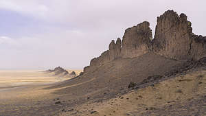 One of Shiprock's radiating dikesDetermined, we waited it out, and managed to sneak out during calmer periods to snap a few shots. Not exactly ideal conditions, but interesting in its own way, just how the sandblasting we got at Monument Valley also provided a unique perspective.
Unknownst to me before this trip, there are six volcanic dikes radiating from Shiprock like spokes on a bike. The longest and most impressive one runs southwards for 5 miles, rising up 150 feet along its narrow ridge.
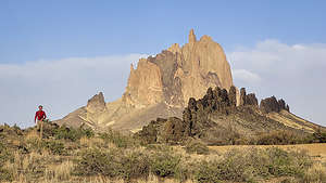 West side of ShiprockWhile I huddled in the car, Herb climbed up to the ridge of that dike to get a perspective very different from the normal iconic view of Shiprock.
Afterwards, we drove west along another dike to its end where there was what seemed to be the remains of a kiva, not impossible as this is a very sacred place that could have been used for religious ceremonies.
 West side of ShiprockThe wind had died down enough for us to be able to scramble up and along the narrow ridge of this dike, which provided, for me at least, my favorite view of all of Shiprock.
No matter what your spiritual beliefs, this is a very special place.
This was Navajo land so camping without permission was not allowed. Plus the wind was still an issue, so we drove on another hour to the Brentwood Inn in Farmington, New Mexico, from which we would base our exploration of the Bisti Badlands.
Canyon de Chelly
Monday, May 2, 2022 - 9:45pm by Lolo100 miles and 1.75 hours from our last stop - 1 night stay
Travelogue
 Antelope House Ruins OverlookAfter leaving Monument Valley we continued driving through the Navajo Nation to Canyon de Chelly. The Navajo Nation has its own government and laws separate from the United States. One of those laws, which I was just fine with, was strict enforcement of wearing masks both indoors and outdoors.
Canyon de Chelly National Monument is actually two canyons: Canyon de Chelly, which is the south fork, and Canyon del Muerto (“Canyon of the Dead”) the north fork.
Canyon de Chelly is one of the longest continuously inhabited places anywhere in North America, and archaeologists believe that human settlement in the canyon dates back about 5,000 years. These early prehistoric people used the canyon while hunting, but did not set up permanent homes. However, they did leave etchings on the canyon walls.
 Closeup of Antelope House RuinsAround 200 BCE, semi-agricultural people, known as the “Basketmakers,” began to inhabit the canyon and grew corn, beans, squash, and other crops. They are considered to be the ancestors of the Ancestral Puebloan People.
Around 700 CE, the Ancestral Puebloan peoples (Anasazi) began to build larger settlements of cliff dwellings, multi-storied, apartment-like buildings made with adobe bricks, along the canyon walls. Wooden ladders were used to navigate the various stories and to enter the round kivas, ceremonial pits. These are the cliff dwelling ruins that we see on the canyon walls today.
 Mummy Cave OverlookIn its heyday (1150 CE) Canyon de Chelly had about 800 inhabitants. Then, around 1300 CE the Ancestral Puebloan just abandoned the canyon, as the area entered a drought and they sought better farmlands. It is thought that they migrated south toward the more fertile Rio Grande Valley. Their descendants are the Pueblos of New Mexico, the Zuni, and the Hopi.
The Hopi continued to visit and partake in rituals in Canyon de Chelly from c. 1300-1700 CE, and they still revere the ruins today. The Navajo arrived in the region in the late 17th century CE, and they occupy the region today.
 Massacre Cave OverlookCanyon de Chelly National Monument was authorized in 1931 by President Herbert Hoover in order to preserve the important archeological resources that span more than 5,000 years of human occupation.
Today, although the monument is under National Park jurisdiction, about 40 Navajo families live down in the canyon from May to October growing corn, squash, beans, peaches and apples and grazing their sheep, cattle, and goats.
 Spider Rocks OverlookThe Canyon had been closed for 477 days because of Covid, which hit the Navajo population quite hard, so they were very happy that it was reopening and they could move back down from their homes on the rim.
As with most sites within the Navajo Nation, most areas are off-limits unless you are accompanied by a Navajo guide. In the case of Canyon de Chelly, all you can really do on your own is drive along the North and South Rim drives, stopping at overlooks along the way.
 Our "jeep" into the canyonYou used to be allowed to hike down to the White House ruins in the canyon, but that is no longer allowed because sadly cars at the trailhead were being vandalized. The only way to go down into the canyon today is on a Navajo jeep tour.
So, it looked like we would be doing the Rim drives and the jeep tour.
There are two hotels in the town of Chinle, but we decided to stay at the Thunderbird Lodge, within the bounds of the Monument, because it seemed more authentic than staying at a Holiday Inn. Plus they offered Jeep tours right from the lodge.
 No mask, no jeep rideBefore leaving on our tour of the Rims, we reserved a Jeep tour for 9:00 the next morning, even though the forecast was for those dreaded desert winds.
We decided to drive along the North Rim first, which goes along Canyon del Muerto, because evening light is better along the South Rim. We were surprised to find that the drive was really a highway outside the park, with spur roads into the overlooks.
Our first stop along the North Rim was Antelope House Ruin overlook. I went ahead of Herb and scanned the cliff walls for the ruin, not expecting to see much because the guidebooks say that it is in shadow all day. I was so excited when I looked at the bottom of a 600 foot cliff and saw an extensive complex of towers, vertical walls, and kivas, and it was in the sun!
Continuing up the North Rim, we turned off a side road to Massacre Cave and the Mummy Cave Overlook.
 Pictograph with my favorite KokopelliWe walked first to the right to visit the Mummy Cave Overlook. Although it wasn’t in the sun, which it was supposed to be, we could still see it quite clearly. This cave once provided shelter for about 60-75 people. Altogether some 70 rooms have been uncovered at Mummy Cave, and there are also at least three kivas. There is an impressive three-story tower near the eastern cave.
Back at the junction, we walked to Massacre Cave, which is the site of a horrible moment in history when in 1805, many Navajo tribes people, including women and children, took shelter in this cave while under attack from Spanish soldiers, killing all 100 people inside. I think it's the reason this canyon is named Canyon de Muerte.
That was it for the North Rim, so we returned to the Visitor Center and headed out along the South Rim.
 Petroglyph with horsesThe two highlights along the South Rim Drive are the White House Ruins Overlook and Spider Rocks Overlook.
We already knew that we could no longer hike down to the White House Ruins because of a problem with vandalism in the parking lot, but we were shocked to find that we couldn’t even drive to the overlook, as the road was blocked off. Needless to say, we were very disappointed.
We briefly stopped at all the overlooks along the way, but spent most of our time at Spider Rocks, an 800-foot sandstone spire that rises from the canyon floor at the junction of Canyon de Chelly and Monument Canyon.
 Junction RuinsWhile we were there, a large tour bus pulled in and about 40 teenagers got out. So much for peace I thought. However, I later ate my words, when these 40 high school students, which happened to be Native Americans, and their teachers walked in total silence along the path to the rock and then listened to their teachers talk about both the geology that resulted in the creation of this incredible spire as well as the spirituality and significance of it. I found myself trying to eavesdrop on their conversation.
That was it for the places we could visit on our own, so we returned to the Thunderbird Lodge for the night.
 Lush greenery in the canyonThe next morning was our Jeep tour and it was already getting windy. We were pretty lucky in that the group of 19 was divided into 3 jeeps, and we wound up in one with only 5 people, making it easier to take photos along the way.
The jeep was more of a tank than a jeep. I looked it up and it actually was an Austrian 6WD Pinzgauer army troop carrier, maybe a bit of an overkill for where we would be going today.
Our Navajo guide’s name was Harold. I was hoping for something a bit more colorful, but Harold would have to do. He was great and taught us so much about the history of the canyons and the Ancestral Pueblo (Anasazi), Hopi, and Navajo people that called it home throughout the last millennia.
 Antelope House RuinsOne of the first stops we made was to a wall of petroglyphs. Inhabitants of this canyon have been painting on the canyon walls for over a thousand years. Harold tried to explain how you can tell whether the artwork is Anasazi, Hopi, or Navajo by its content.
This particular wall had my favorite subject - Kokopelli, the hunchbacked flute player, which you can see lying on his back next to another almost frog-like human figure. Kokopelli is a kachina, or spirit, found in the mythology of the Hopi and other Pueblo Indians of the American Southwest. He’s a bit of a character, playing various roles,, including those of fertility spirit, trickster, and hunter.
 The greenery of the canyon floorAnother nearby wall had pictures of horses on it. Native Americans didn’t have horses until the Spanish brought them to North America in the 1500s, so this pictograph must have been made by either the Hopi or Navajo, who inhabited the canyon after the Ancestral Puebloan abandoned it.
The thing that surprised me the most was how lush the valley was. The bright green cottonwoods against the red rock background was stunning. It’s amazing what even a little water can do.
 White House RuinsWe passed several ruins including the Antelope House Ruins which we had seen from the North Rim yesterday. I recognized its kivas and three-storey tower.
One thing we hadn’t seen from above though was the pictograph of a swastika located just above the end of the wall on the left. What we learned was that Native Americans used this symbol long before the Nazis co-opted it. For the Native American, this symbol represented the four directions. It was also referred to as “whirling logs.” Because of its association with Nazis, in 1934 native craftspeople stopped using it as a design element on their pottery, rugs, etc.
However, the highlight of our trip down into the Canyon was seeing the White House Ruins, one of the most interesting and recognizable Ancestral Puebloan ruins in the entire Southwest. This 80-room complex was built by the Ancestral Puebloans about 1,000 years ago and is named for the long, white plaster wall in the upper dwelling.
 Closeup of White House RuinsThe lower block of buildings at the base of the cliff provided easy access to arable lands on the canyon floor, while the upper multi-storied buildings, set in the alcove in the cliff, provided sanctuary during enemy incursions. At one time they were connected, probably by ladders. During its heyday, the entire complex had about 80 rooms and housed as many as 100 people.
My next favorite stop was Harold’s ancestral home, where he showed us the hogan where his grandmother taught him to speak Navajo.
I forgot to mention that the wind was gusting so hard that we were pelted with sand the whole second half of the trip. However, we still loved it and found it very informative and worthwhile.
Next stop - Shiprock, also in the Navajo Nation.
Monument Valley Navajo Tribal Park
Sunday, May 1, 2022 - 4:00pm by Lolo37 miles and 1 hour from our last stop - 1 night stay
Travelogue
 Lolo setting off on the Wildcat TrailAfter leaving Valley of the Gods, we drove an hour back down Highway 163 to the Monument Valley Navajo Tribal Park, stopping once again along the way at Forrest Gump Point to take in the view of Monument Valley at the end of a straight line of highway. As always, there were people lined up to take their turn to position themselves on the centerline of the road.
We weren’t quite sure what our plans were for the day. There are really only two things you are allowed to do in the park without paying for a Navajo Guide to accompany you, and that was the 17-mile Scenic Drive and the 3.2-mile Wildcat hiking trail around the West Mitten. So, our plans were kind of made for us.
 Herb on the Wildcat TrailThere were still two big uncertainties for the day: when would the big winds forecasted for today start and where would we sleep tonight. Camping in big winds is very unpleasant.
Unknown to us before coming here today, there is a hotel right next to the Visitor Center called The View, aptly named because of its fabulous views of the Mittens. We went in to inquire about availability, but unfortunately they were completely booked that night. She mentioned something about cabins, but I thought she was referring to the rather undesirable looking structures near the hotel, so I really didn’t listen.
 Taking a break on the backside of West MittenOh well. We decided to do the Wildcat Trail hike first and then the scenic drive, because the wind was going to pick up as the day went on, and when that did happen we would rather be in the car than out on the trail.
The trailhead was near the two striated rocks that we had posed on yesterday. As we walked on the path that paralleled the road back towards the entrance kiosk, we saw a small building that said “The View Cabin registration.” To the right of that building were several rows of cabins on a bluff overlooking the same view that the hotel had. Oh my god I thought, if I had known this, I would have listened more carefully when inquiring about availability.
 Wind starting to pickup as we complete the Wildcat TrailDesperate to stay in one of these cabins, we went into the registration office and found out that there was in fact availability for a premium cabin along the first row where the views were unobstructed. We were so excited that we immediately grabbed it.
However, check in time wasn’t until 3:00, so we had lots of time to kill. We were also a little nervous because when booking our reservation, her computer went down, so we really hoped that this cabin was in fact ours for tonight. She assured us it was and said we could come back around 2:00 to see if it was ready for us.
 Sanctuary from the sandstorm in our cabinI was so relieved that we had a place to stay with four walls around us tonight because the forecast was calling for 50 to 60 mph wind gusts.
The weather was still calm, so we set out along the Wildcat Trail. The trail started from right near the cabins and led down a fairly steep, very sandy trail to a wash. From there it was a mostly level hike around the iconic West Mitten Butte across sand dunes and more washes, with good views of the neighboring cliffs and pinnacles.
I think most people spend their time in Monument Valley driving the scenic drive, so we pretty much had this traill to ourselves, which was nice.
 Looking out over the scenic driveAs I mentioned in the previous stop, the buttes of Monument Valley are created by erosion and weathering, sometimes separating a piece of rock from the main part, forming what looks like a thumb. When this happens, they are appropriately called “mittens.”
The other thing that makes them so stunning is their bright red color, due to the presence of iron oxides.
 Rain MesaWe made our ways counterclockwise around the West Mitten Butte, which looked so different when we got to the side where its thumb is hidden from view. Without its distinctive thumb, It looked just like any old butte.
When we were about three quarters of the way done with our hike and back into the deep sandy area where we would have to start climbing back up towards the cabins, the wind started with a vengeance, pelting us with sand. I had expected some kind of warning, but it had come on so suddenly.
 The "Totem Poles"To avoid getting sand in my eyes, I put my head down, pulled the brim of my hat over my eyes, and tried to follow Herb’s feet along the trail.
It was only about 1:00 when we made it up to the cabins, but we decided to stop in the office anyway, in the hopes that our cabin was ready. Unfortunately, it wasn’t, but she said she would text us when it was, so we continued on back to our car and sheltered there.
 The "Totem Poles"Finally, around 2:30 we got our cabin keys, and fought our way through the sandstorm with our luggage to the comfort and coziness of what turned out to be a really lovely cabin. There was even a separate bedroom with two bunk beds. I couldn’t help feeling nostalgic for the last time we had been to Monument Valley 20 years ago when our boys were just 11 and 13, and how much they would have loved this cabin.
The wind was now blowing so fiercely that the cabin was actually shaking. Plus our view of the Mittens was becoming more and more obscured by the blowing sand. However, the wilder it got outside, the cozier it felt inside.
 Sandstorm in Monument ValleyI began to wonder if we would be able to do the Scenic Drive, but around 5:00 we decided to give it a try. At least we would be protected from the elements.
As we drove through the gate down into the Valley, we couldn’t help but laugh when reminiscing about the last time we had traveled this scenic drive back in 2002. For some reason back then, I had gotten it in my head (I think from a Utah Mountain Biking Guide) that we should mountain bike this loop rather than drive it.
 Sandstorm in Monument ValleyThe Navajo woman at the entrance kiosk, as well as my 11- and 13-year old sons, were quite skeptical of using this mode of transportation along a 17-mile sandy road, but I was determined. Ever since our boys were little, we had always tried to encourage them to push themselves and go the extra mile so to speak.
So, off we went down the steep 500-foot descent onto a sandy washboard road, along which we spent the next few hours cycling the loop.
All the while we were pedaling, a constant flow of cars went by, kicking up clouds of the dry red sand. We must have been quite a spectacle because people were waving and cheering us on. I tried to let their cheering drown out the whining which was now coming from my younger son.
 "Three Sisters" through the stormBy the time we finished the ride, we were totally covered in a thin coat of red sand, and probably could have passed for Navajos. I think it was a great ride, and the only way I would have wanted to see it. They wouldn't admit it at the time, but I think they thought so too.
I have no regrets, and to this day, our sons are two of the most adventurous young men you can find. Perhaps, it was because of that day - probably not, but I like to think so.
Today, we would have an adventure of a different sort - battling the elements from the comforts of the inside of our car, hoping that we could at least open the car doors to get out and take a photo or two. I think we were destined to not experience this drive the way the millions of other visitors do.
 After the stormThere are eleven stops along the Scenic Drive:
- The Mittens and Merrick Butte (which we saw from the Visitor Center Overlook and our cabin)
- Elephant Butte
- Three Sisters
- John Ford’s Point
- Camel Butte
- The Hub
- Totem Pole and Yei be Chei
- Totem Pole and Sand Spring
- Artist’s Point
- North Window
- The Thumb
 Sun peeks out along the end of our driveFortunately, we had gotten some photos of the red rock “mittens” yesterday, because today they were cloaked in a cloud of sand, barely visible at some points and at others, when the wind temporarily died down, set against a bright blue sky.
Rather than being disappointed, both Herb and I thought that seeing the buttes this way was even more interesting than seeing them in their normal iconic state. So rather than the classic shots of stunning red buttes, we photographed them under very different atmospherics - more eerie and mysterious.
 Back at our cozy cabinWe made it back to our cabin, happy that what could have been a wash out day had turned out to be a fantastic one.
The next morning it was still very windy, but it was going to pretty much be a driving day for us anyway as we made our way to Canyon de Chelly.
Before leaving we took advantage of our Free Breakfast at The View hotel, which was quite hearty and in fact did have a fabulous view.
Gooseneck State Park, Muley Point, and Valley of the Gods
Saturday, April 30, 2022 - 11:00am by Lolo250 miles and 6 hours from our last stop - 1 night stay
Travelogue
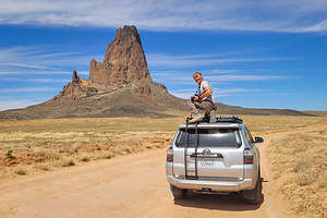 Algatha Peak near KayentaAfter leaving the Grand Canyon, we headed east along Desert View Drive and then northeast on 160 towards Monument Valley. However, today we would pass right by Monument Valley to explore some less famous destinations: Goosenecks State Park and the Valley of the Gods.
When we got to the town of Kayenta, we were hungry so we searched google for a place to eat. After being sent on a wild goose chase to a non-existent BBQ place in a Navajo housing development, we looked on Trip Advisor and found the Amigo Cafe, near the junction of 160 and 163, which we would be taking north towards Monument Valley.
 Quick stop in Monument Valley - more tomorrowThe cuisine was both Mexican and Navajo, but we both chose the Navajo Tacos which were absolutely delicious. Much better choice than the non-existent BBQ place.
After lunch, we took a little side trip on a dirt road off of Highway 163 towards a large rock formation that Herb had spotted back when we were driving up Highway 160. Herb insisted it was Shiprock, but I had to break it to him that we were in Arizona and Shiprock 100 miles to the east in New Mexico. That’s why I do the trip planning and documenting.
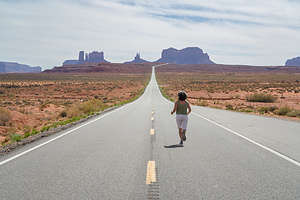 Forrest Gump Point - Run Lolo RunThe rock was actually called Agathla Peak (also known as El Capitan), and to Herb’s credit, like Shiprock it was a volcanic plug with jagged edges, created by a powerful gaseous explosion. However, Shiprock is much larger - but not large enough to see from 100 miles away. It was pretty darn cool just hanging out there on the side of the Highway.
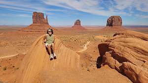
We were driving right by Monument Valley, so we decided to make a quick stop to find out a little more about where we could stay the following night. The man at the kiosk told us that the pass, which was $20 per carload, was good for two days. In that case, we would buy it now and take a quick drive to the Visitor Center Overlook.
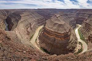 Goosenecks OverlookI’ll talk more about Monument Valley tomorrow, but for now we drove to the Visitor Center where there is an iconic view of three landmark buttes: West Mitten, East Mitten, and Merrick.
Without getting too technical, these and the other buttes in Monument Valley are made of three principal rock layers. The hard protective layer on top is Moenkopi Formation, the middle is softer de Chelly Sandstone and the base is Organ Rock Shale.
They are created by erosion and weathering, sometimes separating a piece into what looks like a thumb. When this happens, they are appropriately called “mittens.” Their and the valley floors' red color is due to the presence of iron oxides.
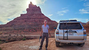 Valley of the Gods Scenic DriveBetween the Visitor Center and the gates for the scenic drive, there are two round boulders with vertical striations that serve as an excellent foreground for a photo of the Mittens. It’s a little corny and cliche, but that didn’t stop me from posing atop one of them.
Time to move on now. We had other things to see today, but we would be back tomorrow to drive the 17-mile scenic drive.
About 12 miles north of Monument Valley along Highway 163 (now in Utah), the speed limit is reduced, cars come to a stop alongside the highway, and people wander out to the center of the road. Fortunately, we had done our homework and knew that this was Forrest Gump Point.
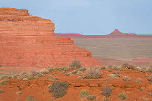 Evening in Valley of the GodsIt was in this very spot along a long straight road that leads to a majestic view of Monument Valley where Forrest Gump decided after running for 3 years, 2 months, 14 days, and 16 hours to just suddenly stop and sit down in the road.
In honor of that fabulous scene, today people express their own awe with the beauty at the end of that road by sitting, jumping, doing handstands, or whatever floats their boat on the yellow dotted line in the middle of the road. Of course, we had to stop as well. How could we not?
Our next stop was in the town of Mexican Hat, obviously named for a rock formation shaped amazingly like a Mexican Hat.
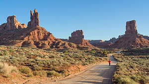 Evening stroll in Valley of the GodsAt the junction of 261 and 316, we took a 3.5-mile side trip to Goosenecks State Park Overlook, paid our $10 entry, and gazed down 1,000 feet at several huge river bends meandering through a deep canyon formed by a series of stepped cliffs and terraces. It is so twisty that it takes 5 miles to progress westward just 1 mile on its way to Lake Powell.
We had thought about camping here, but the bluff was quite exposed and it was already getting windy, so we decided to move on.
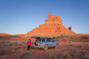 Getting ready to settle down for the nightContinuing north on 261, we passed the entrance to the Valley of the Gods (for now) and drove through a series of switchbacks to a place called Moki Dugway where there is an incredible view of Monument Valley towards the south and the Valley of the Gods about 1,000 feet below.
From there, we continued up the dirt road to Muley Point. After 3.7 miles we came to a view of the goosenecks of the San Juan River.
After another mile and a half we came to the end of the road at Muley Point from which there was a wonderful view of Monument Valley, as well as a 360 degree panorama of the Navajo Mountain, the Henrys, and Sleeping Ute Mountain.
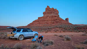 Herb the Happy CamperWe returned down the road from whence we came to head toward our final destination of the day, and hopefully a place to camp - Valley of the Gods.
The Valley of the Gods is a smaller and less visited version of Monument Valley in that it too has red rock, isolated sandstone buttes and pinnacles, and cliffs rising above the desert floor. And, it has something that Monument Valley doesn’t offer - overnight camping.
We set out on the 17-mile scenic drive through the Valley, keeping our eye out for a good spot to camp for the night. The road was a bit bumpy in places, but definitely okay for 2WD cars.
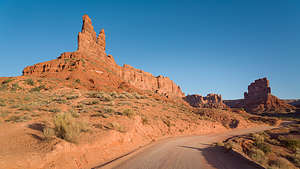 Valley of the Gods in morning lightThere were quite a few vehicles already tucked into camping spots for the night, so we kept our eyes out for a place with nice views to spend the night. About half-way around the drive, we pulled into a spot, but soon moved it when we realized that the high butte to the west of us was going to put us in shade much earlier than if we just moved another 100 yards down the road.
We spent a lovely evening wandering along the road photographing the red rock formations in the evening light.
The next morning, we drove the remainder of the scenic loop and then headed back towards Monument Valley to spend the day.
Grand Canyon - South Rim
Wednesday, April 27, 2022 - 10:00am by Lolo380 miles and 6 hours from our last stop - 3 night stay
Travelogue
Day 1 - Arrive at Grand Canyon and Yavapai Point for Sunset
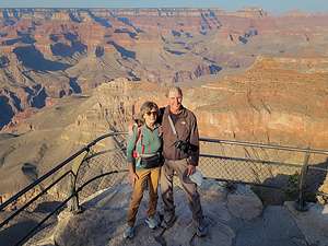 We have arrived!Herb and I hadn’t been to the Grand Canyon since 2002, so we were pretty excited about returning. I mean who wouldn't be excited at the prospect of experiencing the breathtaking beauty and grandeur of this remarkable canyon, attested to by the fact that close to 6 million visitors choose to do so every year.
Since we’ve moved out West 6 years ago, we have visited some of the most beautiful places that this country has to offer, so I wondered whether we would still be “Wowed” by the Grand Canyon. Well, to put it simply, yes and maybe even more so.
When we were planning this trip, we decided to treat ourselves to a night at the iconic El Tovar Hotel, right on the rim, and amortize our lodging expenses by camping the other two nights at Mather Campground.
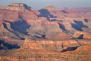 Sunset at Yavapai PointHowever, when we arrived and saw that the nights were dropping down into the low 30s, we wimped out and decided to grab two nights at the Yavapai Lodge, which was located back from the rim a bit, but half the price of El Tovar. I love camping in the 4Runner, but I also love a bathroom and a shower. It definitely seemed like the right thing to do.
The Lodge was great, set in a forest of pines with a large, clean, and comfortable room. Perfect! They even let us check in early. A quick nap and we were ready to start exploring.
Using our tried and true Photographing the Southwest book, I had planned out an itinerary based on the best places to be at sunrise and sunset, and good things to do to fill out that time in between. Tonight the plan was to photograph the sunset at Yavapai Point.
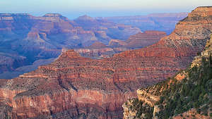 Sunset at Yavapai PointWe drove our car over to the Visitor Center and from there we walked along the South Rim Trail past Mather Point (also a good spot for sunset) and on to Yavapai Point, considered to be less crowded than Mather Point and with equally great views and orientation to the setting sun.
It was just a little over a mile walk to Yavapai Point, which we discovered was right next to the Yavapai Geology Museum, which was unfortunately closed already. Right next to the museum there was a viewing area that extended out over the canyon a bit, which was fairly crowded with people taking turns photographing the canyon from along the outer wall.
The view was truly stunning from here - wide open to the west with the Plateau Point Trail winding its way down below and a sheer cliff with juniper trees.
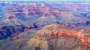 Sunset at Yavapai PointWe waited our turn and took some photos before moving on to a more secluded area just to the right of the official viewing area, where we sat on some rocks just a short step down from the South Rim Trail - but far enough away from the edge to not be worrisome. I had read too many instances of people taking their final selfie too near the edge.
We spent the next hour watching the light change and fill the canyon with brilliant reds and yellow. It truly takes your breath away.
Afterwards we walked back along the South Rim Trail to our car and drove back to the Yavapai Lodge. We both admitted we were so much happier heading back to a warm room and a shower rather than to the back of our 4Runner in the campground.
Early night tonight. Tomorrow the plan was Sunrise and Yaki Point, which was going to require a shuttle to get to.
Day 2 - Sunrise at Yaki Point, South Kaibab Trail hike, and move into El Tovar
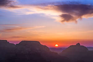 Sunrise at Yaki PointThe South Rim of the Grand Canyon is a pretty busy place, so a shuttle system was put in place a while ago to control the traffic and parking issues that would result if everyone was driving to all the scenic viewpoints. Many of the most exceptional scenic overlooks have now been closed to private vehicles and can only be reached via the shuttle.
It’s really not a problem though, because the shuttles are free, run every 15 minutes, and pretty much take you anywhere around the South Rim that you want to go.
The plan for today was to rise at 4:15, drive over to the Visitor Center, and take the 5:00 am shuttle (Orange line) to Yaki Point, which is one of the scenic overlooks that prohibit private vehicles. I’m not exactly a morning person, but it all went pretty smoothly and wasn’t too traumatic.
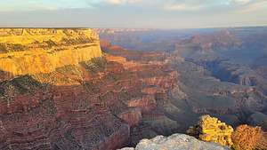 Sunrise at Yaki PointYaki point, like Yavapai Point, is a prime destination for watching the sun rise on the South Rim, with miles and miles of canyon offering layer upon layer of depth to play with light and shadows.
When we got there, there was only one other photographer with a tripod set up in exactly the place we wanted to be. No problem though. There was plenty of spectacular scenery for everyone.
About 15 minutes after our arrival, the sun began to rise between two silhouetted plateaus off to the east, painting the sky in orange and yellow layers.
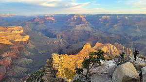 Herb and tripod photographing Sunrise at Yaki PointOnce that show was over, we shifted our position to face west and watched the sun light up the canyon sides in soft reds, yellows, and greens. Not to be corny, but it was truly magical.
We spent some time talking to the other photographer and his wife, a couple named Pavel and Monique from Poland doing a 1 month tour of the American West. It was fun to share in their enthusiasm for the beautiful scenery we were experiencing.
When the sun was done doing its morning show, we took the shuttle back to the Visitor Center, and went back to the Yavapai Lodge where we got in a good hour-long nap before we had to check out. Herb and I congratulated ourselves for our wise decision of staying here where it was warm and comfy rather than camping. We must be getting old.
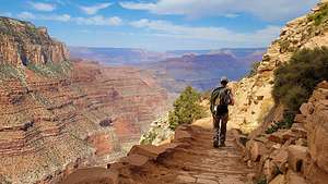 Hiking the South Kaibab TrailEnough gazing at the canyon. Time to get down into it, where we could experience its awesome depth firsthand, and surround ourselves on all sides with its massive walls - a much different perspective than viewing from the Rim.
There are two really good trails to hike down into the canyon from the South Rim - the Bright Angel trail, which we had hiked a mile and a half down into the canyon about 20 years ago, and the South Kaibab Trail, which was supposed to provide even more scenic views, if possible.
So off we were again to catch the shuttle (Orange Line) from the Visitor Center to the South Kaibab trailhead. Based on the backpacks and trekking poles associated with our fellow shuttle riders, I don’t think we were the only ones with this plan in mind.
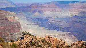 Hiking the South Kaibab TrailI was particularly worried about what appeared to be a class trip of about 20 fourteen year olds, so when the shuttle stopped, I made Herb hurry out to get started on the trail before they did.
The South Kaibab trail is pretty awesome, with several great viewpoints along the way. Unlike most of our hikes which usually climb mountains, this one started at the Rim and went down and down through a series of switchbacks, bringing us down about 1,500 feet in elevation over a mile and three quarters. The downhill is always difficult to totally enjoy, as you know it will turn into a steep uphill on the way back.
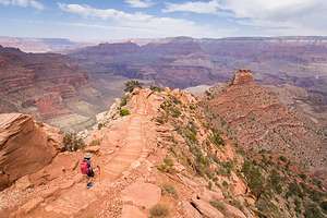 Hiking the South Kaibab TrailAfter three-quarters of a mile, and about a 900 foot loss in elevation, we came to Ooh-Aah Point, where there is a panoramic view both to the west, which was our usual view, as well as towards the infrequently-visited eastern Grand Canyon.
However, somehow the class trip had passed us while we stopped to take photos along the way down, so they were now pretty much in control of Ooh-Aah Point, where they were enjoying a snack while their leader tried to assess whether they wanted to continue on. I have to say their leader was awesome. I certainly didn’t envy any adult responsible for a group of 14-year olds on a hike with some potentially steep drop offs. He did seem to have them very much in control though.
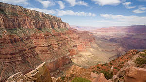 Hiking the South Kaibab TrailSo rather than linger, we forged on continuing our descent to Cedar Ridge, the next suggested viewpoint. I would have to say that our approach to Cedar Ridge was my favorite part of the hike with views below us of the trail which we would follow, seemingly leading off and over to the unknown, and O’Neill Butte just beyond, jutting up from the canyon floor.
When we finally arrived at Cedar Ridge, I thought we were done, but fortunately we had read that there was an outcrop at the far end of the ridge with an even better view into the canyon. They were right.
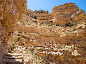 Hiking the South Kaibab TrailCedar Ridge is the turnaround point most day hikers, and it was for us as well. The hike back up to the rim was pretty strenuous - over a 1,400 elevation gain in a mile and a half. A lot of people, some of them even younger than us, were struggling a bit more than we were. Also, the rim was at an elevation of over 7,000 feet and we hadn’t really had time to acclimate to the higher altitude. Still we plugged along at a good pace, and were even complimented for such by a gentleman that was using us a pacers.
The way up wasn’t as scenic because all the good stuff was behind us. However, that gave us a good excuse to stop every once in a while and gaze behind us.
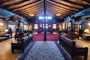 Lobby of El TovarIt was still a little early to check into the El Tovar Hotel, so we had a late lunch/early dinner in the Dining Room. I love National Park Lodges for their rustic, yet elegant ambiance. The Dining Room was constructed of native stone and Oregon Pine, and had murals on the walls reflecting the customs of four Native American Tribes – the Hopi, the Apache, the Mojave and the Navajo.
Many prominent guests, such as Teddy Roosevelt, Paul McCartney, Bill Clinton, and many more, have dined here in the past. The atmosphere alone was enough to make this a positive experience, but the food was good as well. The menu is traditional, integrating both international and local Southwest influences.
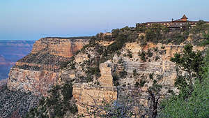 El Tovar, our home for the nightI love National Park Lodges, so I was very excited about our stay at the El Tovar Hotel. Besides its lovely dining room, lounge, and rooms, it definitely had Location, Location, Location - perched directly on the canyon rim.
Finding a place to watch the sunset was easy this time. All we had to do was cross the inviting porch - with a brief testing of a rocking chair - and then stroll along the South Rim trail.
We strolled west along the rim, stopping at benches along the way to take in the scenery. I wanted to find out where the Red Shuttle line, which would take us to Hermit’s Rest (our plan for tomorrow) was, so we continued on for about three quarters of a mile before turning back.
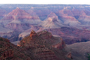 Sunset view from El TovarOn our way back, there was a group of about a dozen people at the top of the Bright Angel Trail whooping and cheering for some runners coming up the trail. We soon figured out what the excitement was about. These runners were just the grueling Rim-to-Rim-to-Rim run, a 47-mile run with over 11,000 feet of elevation gain. I knew this because our son Tommy had accomplished this amazing feat a few years ago. It’s absolutely crazy.
The R2R2R trail starts by a 9 mile descent on the Bright Angel trail. Then runners cross the canyon floor for 7 miles, before hitting the steepest part of the North Kaibab Trail where they climb 7 miles up a 15% - 20% grade to the North Rim. It’s quite an accomplishment.
All we did today was one and a half miles down and then one and a half miles up. I felt like a bit of a weenie.
No early wakeup for sunrise tomorrow. I wanted to sleep in and enjoy every minute of our stay at El Tovar.
Day 3 - Chilling at the El Tovar Hotel and exploring the Hermit’s Rest section of the park
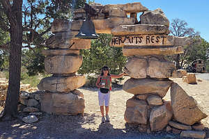 Hermit's restWe had been moving at a pretty frantic pace since we left home, so we thought a little relaxation would be rejuvenating. Herb chose to load the photos he had taken so far onto his laptop, and I read a book on a bench in the sun overlooking the rim. I think this might have been a trip highlight.
After checking out (so sad), we had lunch again in the El Tovar Dining Room before heading out on our day of exploration along the Hermit’s Rest Road.
Parking in Grand Canyon Village is pretty tough, so we left our car in the El Tovar lot and walked three-quarters of a mile west to the shuttle (Red Line), which would take us to Hermit’s Rest, at the end of Hermit Road. From there our plan was to spend the day walking 8 miles along the rim, arriving at Hopi Point, which is supposed to be one of the best sunset locations on the South Rim.
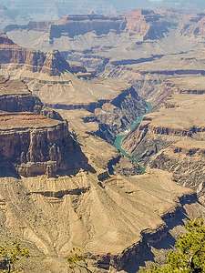 Finally we see the riverWe didn’t have to wait long at all for the shuttle, which made nine stops along the way to the very end of the Rim Trail at Hermit’s Rest, where we got off.
Hermit’s Rest is an iconic, historical structure designed by famed architect Mary Colter to resemble an old miner’s cabin with native stonework, a giant alcove fireplace, and a front porch. Today it is a snack bar, so we grabbed a cup of coffee and drank it on the porch.
This is not the only building she designed in the Grand Canyon. She also designed the Hopi House (next to El Tovar), Bright Angel Lodge, Lookout Studio (near the Bright Angel Trail), Desert View Watchtower (along Desert View Drive), and the Phantom Ranch (down by the river). She is definitely the face of man-made (more correctly, female-made) beauty in the park.
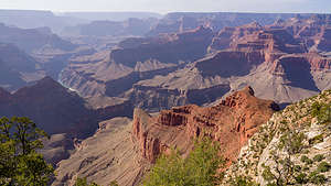 Along the hike from Hermit's RestAs I mentioned, the westernmost end of the South Rim Trail sets out from Hermit’s Rest and extends east for 13 miles to the South Kaibab Trailhead. Today we would do the 7.5 miles from Hermit’s Rest to Hopi Point.
We left Hermit’s Rest around 2:00 pm, which would allow us a leisurely pace to time Hopi Point with sunset.
The first stop along the way was Pima Point, where we caught our first glimpse of the Colorado River as it enters the Granite Gorge rapids.
The next stop was Monument Creek, which I don’t remember much about, but after that came the Abyss, where there was a beautiful view 2,600 feet straight down over sheer cliffs that descend to the Grand Canyon’s Redwall Formation.
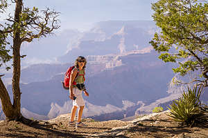 Along the hike from Hermit's RestFrom Mojave Point, we got a glimpse of the river again, 5,000 feet below us. From here you can theoretically see three rapids: Salt Creek, Granite, and Hermit, and possibly even rafts negotiating the whitewater. Unfortunately, we didn’t have binoculars, we could see sections of whitewater.
We arrived at Hopi Point around 6:00 pm, just at the early stages of golden hour. We were not the only ones with the idea of watching sunset from here, but I think we might have been the only ones that earned it by walking all the way from Hermit’s Rest rather than just jumping off the shuttle here.
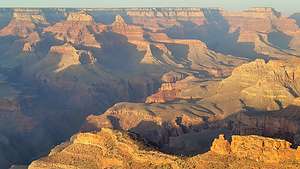 Sunset at Hopi PointHerb positioned his tripod up against the rail where no one could get in front of him and waited. From here there was an excellent, although distant, side view of Wotan’s Throne and Vishnu Temple.
At this time of day, the shuttle doesn’t make a stop at Hopi Point, so we had to walk a short distance to Powell Point, where the shuttle back to Grand Canyon Village would stop.
From the Grand Canyon Village, we walked back to the El Tovar parking lot where we had left our car, and drove over to the Yavapai Lodge where we had booked a room.
Day 4 - Drive Desert View Drive and continue on towards Monument Valley
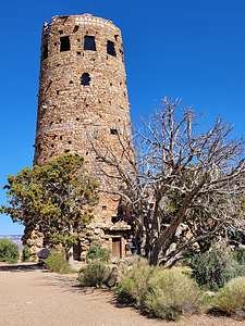 Mary Colter's Desert View WatchtowerOur drive east towards Monument Valley took us along the very scenic Desert View Drive, which follows the rim for about 22 miles from Grand Canyon Village to Desert View and the East Entrance to the park.
We were anxious to get on to new scenery so we made only two quick stops along the way. The first was Moran Point, which is the closest location to two of the most recognizable landmarks in the canyon - Vishnu Temple and Wotan’s Throne.
Our next stop was to see another one of Mary Colter’s creations: the Desert View Watchtower. Often referred to as the architect of the southwest, the architecture of the ancestral Puebloan people served as her model. The Desert View Watchtower was patterned after the Round Tower of Mesa Verde.
The Tower, which blends into the rock of the canyon walls, exemplifies her belief in designing buildings that would become part of its surroundings. It reminded me of Frank Lloyd Wright’s philosophy in his design of Falling Water.
From here we said our goodbyes to the Grand Canyon and continued on towards Monument Valley.
Rainbow Basin
Tuesday, April 26, 2022 - 9:15am by Lolo460 miles and 8 hours from our last stop - 1 night stay
Travelogue
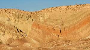 Rainbow BasinOn most of our trips to the Southwest we stop for the night in Barstow, as it is the perfect one-day drive (8 hours), and is the crossroads to many destinations further east. The town itself doesn’t have much to offer, except for numerous moderately-price hotels and some decent restaurants, but we have found one gem just 8 miles north of town in a completely uninhabited part of the Mojave Desert - Rainbow Basin.
We had discovered Rainbow Basin on our last pass through Barstow and found it to be a very rejuvenating experience after a long day of driving on interstates, especially during the golden hour, which is usually when we arrive.
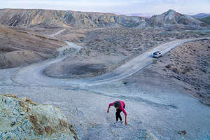 Rainbow BasinDespite its close proximity to Barstow, it is totally remote and undeveloped. There isn’t even a visitor center. The only evidence of man is the unpaved 4.6-mile loop BLM road that winds through the colorful gorges. Before the start of the loop road is the Owl Canyon campground, which is first-come-first-served and costs $6.
The Basin is part of the Calico Peaks range in the Mojave Desert. Noted for its colorful and interestingly shaped sedimentary rock formations, it was named a National Natural Landmark in 1966.
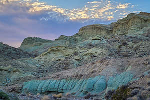 Rainbow BasinThe park is pretty small but packs a lot of stunning scenery along its 4.6-mile scenic dirt loop road. We got there in time for golden hour, and spent a delightful two hours scampering up and around the interesting rock formations, which at this time of day light up in colorful blues and reds.
The wind was picking up, as it seems to always do in the desert this time of year, so we headed back to town to grab dinner at a new Italian place we had discovered on our last visit - DiNapoli’s Firehouse on Main Street (Route 66), just a short walk from the Rodeway Hotel where we were staying.
Capitola
Wednesday, March 30, 2022 - 9:00am by Lolo40 miles and 1 hour from our last stop - 1 night stay
Travelogue
.thumbnail.jpg) Soquel Creek flowing through Capitola BeachI was really excited about going to Capitola. Seeing a friend's Facebook post of the brightly colored houses on Capitola Beach made me think of the colorful fishermen’s homes on the island of Burano in Italy.
Soquel Creek flowing through Capitola BeachI was really excited about going to Capitola. Seeing a friend's Facebook post of the brightly colored houses on Capitola Beach made me think of the colorful fishermen’s homes on the island of Burano in Italy.
When researching these bright multi-colored houses, I found out that they are actually part of the Capitola Venetian Hotel, which is built right on the sand of Capitola Beach. I immediately booked a night in one with a view of the beach.
So not only were we going to see these houses, but we were going to stay in one. I was psyched!
But first, a little history of Capitola:
.thumbnail.jpg) Herb enjoying Capitola BeachCapitola likes to bill itself as the oldest seaside resort on the West Coast. Even if this is not exactly true, it has been a destination for vacationers for over 140 years and has a rather interesting history.
Herb enjoying Capitola BeachCapitola likes to bill itself as the oldest seaside resort on the West Coast. Even if this is not exactly true, it has been a destination for vacationers for over 140 years and has a rather interesting history.
The history of Capitola begins in 1865, when a German immigrant named Frederick Hihn who came to California during the Gold Rush, bought the land that is now Capitola Village from a rancho grantee named Martina Castro.
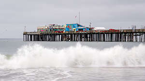 Capitola WharfA few years later, he leased a parcel of land near the wharf to S. A. Hall. He planned to settle down as a farmer, but his daughter had different ideas. Instead, she suggested that he set up a tent camp along the beach.
Like a good father, he did as his daughter suggested, and Camp Capitola welcomed its first guests in the summer of 1874 - the basis for its claim as the oldest seaside resort in the West. By 1884, Capitola had become the destination of thousands of summer visitors.
There’s one other bit of Capitola history that I can’t pass up sharing - a bird attack in Capitola was actually the inspiration for Alfred Hitchcock’s movie “The Birds.”
.thumbnail.jpeg) Lovely evening in CapitolaIn August of 1961, Capitola residents awoke to hordes of seabirds dive-bombing their homes, crashing into cars, and spewing half-digested anchovies over the town.
Lovely evening in CapitolaIn August of 1961, Capitola residents awoke to hordes of seabirds dive-bombing their homes, crashing into cars, and spewing half-digested anchovies over the town.
At the time, Alfred Hitchcock was living a few miles away. He called the local newspaper for details. He worked them into his new movie, which he set at Bodega Bay, about a hundred miles up the coast.
It took several decades for scientists to figure out the cause of these birds’ erratic behavior. They now believe the culprit was domoic acid, a neurotoxin produced by certain types of algae blooms, which causes disorientation and seizures in marine animals.
.thumbnail.jpeg) Shark Fin CoveToday, fortunately, that toxin is closely monitored for, so we had no angry birds diving-bombing us on the beach to worry about.
Shark Fin CoveToday, fortunately, that toxin is closely monitored for, so we had no angry birds diving-bombing us on the beach to worry about.
Okay, back to the present.
Our stay at the Capitola Venetian Hotel exceeded expectations. The room was very nicely furnished and we did have a view over the tops of the next row of colorful houses of the beach and the wharf.
The weather had much improved, so after a walk to the end of the Capitola Wharf, we grabbed our beach cheers and spent a very pleasant couple of hours on Capitola Beach. It really is a unique place.
.thumbnail.jpg) Railroad tracks by Shark Fin CoveOur room was so nice that instead of dining outdoors on a cool evening, we got takeout food from the My Tai Beach Restaurant and ate it in our room looking over the beach.
Railroad tracks by Shark Fin CoveOur room was so nice that instead of dining outdoors on a cool evening, we got takeout food from the My Tai Beach Restaurant and ate it in our room looking over the beach.
What a wonderful stop.
On the way home the following day, we stopped once more at Shark Fin Cove in Davenport, which we had scouted out on our way south. If you are paying attention at all while driving on the Pacific Coast Highway, you can’t miss this giant rock shark fin rising from the water.
We pulled into the small dirt pullout on the west side of the road. From there we looked down at a beautiful cove. In between us and the cove was a fairly steep path down to a railroad track and then two choices - right to an even steeper path down to the beach, and left to an overlook.
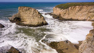 Shark Fin CoveNot sure if I could maneuver myself down to either, I sent Herb ahead and told him to take photos.
I hate being left behind, so I gradually worked my way down the first steep path to the railroad tracks. Herb was kind of surprised to see me.
We went left towards the overlook which provided a stunning view of the cove and some tiny people playing on the beach. I kept urging Herb to go down to the beach, but he said we would do that on a future visit when I was more mobile.
This was definitely a place we would return to.
Pescadero
Tuesday, March 29, 2022 - 8:15am by Lolo100 miles and 2.5 hours from our last stop - 1 night stay
Travelogue
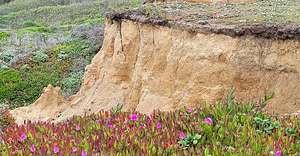 Bluff Trail - James V. Fitzgerald Marine ReserveOur drive down the Pacific Coast Highway took us over the Golden Gate Bridge and through San Francisco and the town of Pacifica before arriving at our first stop, the James V. Fitzgerald Marine Reserve in the small coastal community of Moss Beach.
The Reserve is considered to be one of the best tide pooling locations in all of California. Unfortunately, our visit wasn’t timed with low tide, when the rocky reef and its long, creviced tide pools are exposed. Tidepooling wouldn’t have been that easy for me anyway in my orthopedic boot, so it was just as well.
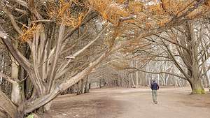 Cypress Trail - James V. Fitzgerald Marine ReserveHowever, we did walk a short distance on the Bluff Trail through a lovely grove of Monterey Cypress trees to a stunning overlook on top of the bluffs
The weather was quite gray and shrouded in clouds, but that actually added to the atmospherics of the grove.
From there we continued along Route 1 through Half Moon Bay to a stunning section of the coast in the town of Pescadero. There was lots to see in Pescadero, but not many places to stay. Fortunately, I had reserved a cute little cottage at the Pescadora Creek Inn.
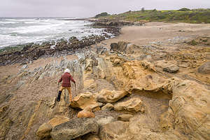 Determined to reach the tafoni on Pebble BeachThe weather wasn’t great - damp and cool - so we decided to check in first, and wait for the weather to improve.
The cottage was lovely with a cozy gas fireplace, a claw-footed bathtub, and decorated with period antiques. It was very cozy and comfortable. So, we lit the fireplace and took a quick nap in the feather bed, before heading out to explore the area.
Our first stop was Pebble Beach, a small cove with a pebbly coarse sand beach - hence the name. The multi-colored pebbles are so pretty that the park actually has a large sign warning not to remove the pebbles. I later realized I unknowingly smuggled some in the opening in my boot.
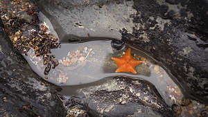 Tide Pools at Pebble BeachI managed to hobble my way down the stairs leading to the south end of the cove where the tide pools are. It was low tide, so we were in luck. With my stupid boot, I wasn’t able to get too close, but I did manage to find a tiny little red starfish.
However, what this beach is most well known for, and the reason we wanted to come here is that it is one of the few places on the coast that has tafoni - uniquely textured sandstone with holes and honeycomb-like structures. The other place we have seen these intriguing rocks is Salt Point State Park along the Sonoma Coast.
.thumbnail.jpg) Tafoni on Pebble BeachThe tafoni was about another 100 yards north on the beach, requiring me to hobble over wet pebbly sand and unlevel rocks. With my orthopedic boots, trekking poles, and determined face, I must have been quite a sight, but I did eventually get there and it was worth it!
Tafoni on Pebble BeachThe tafoni was about another 100 yards north on the beach, requiring me to hobble over wet pebbly sand and unlevel rocks. With my orthopedic boots, trekking poles, and determined face, I must have been quite a sight, but I did eventually get there and it was worth it!
There are several theories as to how these amazing rocks were formed, but the most common one is salt weathering. According to this theory, saltwater collects on the surface of the permeable sandstone from the nearby waves and mist. As the saltwater evaporates, the salt it leaves behind works its way into the rock pores, where it crystallizes and pushes the pores open further. Wind, rain, and tidal water also contribute to their weathering.
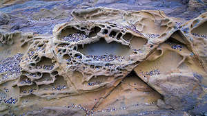 Tafoni on Pebble BeachI’m not sure if the tide or people did it, but many of the honeycomb openings were filled with the lovely multi-colored pebbles this beach is named for. It was like a curio cabinet.
After we got back up the stairs to the parking lot, we decided to walk south along the Arroyo de los Frijoles Trail along the bluff towards Bean Hollow State Beach, which is about a mile away. We decided to just walk as far as I felt able, well actually less than that as I had to get back.
.thumbnail.jpg) Tide Pools along the Arroyo de los Frijoles TrailAt one point Herb went down a steep trail to an extensive set of tide pools. Unfortunately, I was unable to follow, but it was pretty cool photographing him from above.
Tide Pools along the Arroyo de los Frijoles TrailAt one point Herb went down a steep trail to an extensive set of tide pools. Unfortunately, I was unable to follow, but it was pretty cool photographing him from above.
The weather was still pretty lousy - mist and clouds - but we continued down the Pacific Coast Highway to Pigeon Point Lighthouse, just 4 miles further south.
We made the turn onto Pigeon Point Road and followed along the edge of the bluffs for about three quarters of a mile before stopping for a very nice view of the lighthouse, with lots and lots of wildflowers in the foreground.
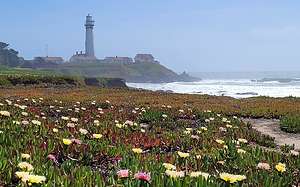 Pigeon Point LighthouseFrom there we continued on to the parking lot for the lighthouse. At 115-feet tall, it is one of the tallest lighthouses in the United States. Before its construction in 1872, there were numerous shipwrecks along this rocky section of the coast. One of the ships that went down was the 175-foot clipper ship, the Carrier Pigeon, which was so close to completing its journey from Maine around Cape Horn to San Francisco before running around on some offshore rocks. I imagine that is where the lighthouse’s name came from.
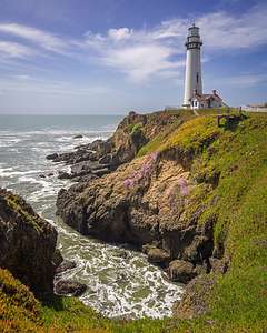 Pigeon Point LighthouseThe lighthouse was first lit on November 15, 1872 using an 8,000 pound Fresnel lens, which has 1,008 prisms and stands 16 feet tall. The lighthouse was operated by the Coast Guard until 1995, when it was transferred to the California State Parks system. Today, the lighthouse is lit only once a year, usually in mid-November, and large crowds of photographers come to photograph its 24 radiating beams of light.
Today the old lighthouse staff housing buildings have been converted to a hostel run by Hosteling International. I wish we had known that when planning this trip as It would have been very fun to stay here.
From the lighthouse parking lot we took a short walk to a boardwalk that led out to the end of a point, overlooking a steep wildflower-covered ravine with the tall white lighthouse towering above. It was my favorite perspective of all.
There is one more good location to view the lighthouse favored by many photographers. It’s just a short 0.3-mile drive further down Highway 1 to a pullout on the west side of the road. A bride and groom had already beaten us to it.
It had been a very full day with many cool things to see. Now it was back to our cozy cottage at the Pescadero Creek Inn.
1996 ST1100 for Sale in Santa Rosa - SOLD
Saturday, March 26, 2022 - 12:00pm by Herb23 miles and 1 hour from our last stop - 1 night stay
Travelogue
 1996 ST1100Well,, it is a difficult choice to make for a person that has been riding a motorcycle since he got his license at 17, but I think I will give up riding on pavement for good.
I think the combination of being 66 years of age, the narrow twisty mountainous roads of the west, increased traffic, and a near high-side when an oblivious driver in a car cut me off has made the difficult choice clearer. Maybe I'll get a dual sport and ride with my boys in the eastern sierra around Bishop, just to keep the feel of two wheeled power between my legs.
Anyway, my baby needs to roam the country, and she has been sitting in a golf cart garage behind my desk making me feel guilty that she is not out exploring the world. She needs a new rider who will take her out for multiple 400 to 600 mile days in a row exploring the beauty of the country. Take her back east, up the Rockies, or maybe to Alaska.
I bought her new in 1996, when at age 40 and after a ten years without a bike, and with two new boys aged 4 and 2, I managed to convince Lolo that I could ride her safely and not risk certain death on the road. I bought this bike over the BMW because the power curve was so much smoother and linear. No need to shuffle gears to keep her hustling, she pulls easily in any gear you're in. With the upgraded alternator that the 1996 model had, running several heated jackets and heated grips is not a problem, and she kept us riding through the 12 months of the New Jersey weather.
She has gone down once at about 15 mph on her right side. It was winter, with temperatures in the 30's and I took her out on a downhill, decreasing radius turn about 1 mile from my garage. I had done this 1000's of times before, but this time I noticed a sheen on the turn which turned out to be spilt diesel fuel. It is true what they say about time stopping in times of stress. I remember vividly the angle of the bike increasing ever so slowly till I finally realized it was going to go down. I bruised my right butt cheek, but was able to get her back up, and continue my ride. The only evidence is a scrape on the metal tip over guard under the plastic which I replaced. Both mirror covers have slight cracks from driveway drops, but I have bought 2 new ones to replace them and they are included in the sale.
 1996 ST1100At this point she has almost 46,000 highway miles, and is barely even broken in. The Honda water cooled V-4 can easily go to 200k miles with regular oil and fluid changes. As an adult driver, with testosterone fully in check, her tachometer has rarely seen much use above 4k rpm, but she will easily and smoothly power up from 1500 to the 8k redline.
She has safely and securely transported me from the tip of Maine, to the tip of Florida at Key West, and cross the country without the slightest incident.
I am an engineer of germanic descent, and have gotten intimate with her through the years in keeping all her bits and pieces in top shape. Carbs were balanced and tuned so she vibrates not a bit. Valve clearances too were fully in specification. Brake calipers were regularly lubed, pads replaced, and pistons and seals replaced as required. The radiator was flushed and brakes and clutch fluid bled regularly.
Her rear end has been lovingly lubed, erh, better make that her final drive pinion gear has been lovingly lubed with the Honda Moly 60 Grease every other year or whenever the rear wheel was removed.
She has had a steady diet of Mobil 1 10w-40, and the OEM oil filters.
To maximize safety, and comfort for long rides, I fitted her with every possible safety feature that I could find including:
- ST1100 Multi-Tour Sport Heli Bars
- BackOff-MC Rear Brake Light Modulator
- Kriss Starburst Headlight Modulator
- Throttlemeister Bar End Cruise Control
- GIVI Monokey E 460 Rear Luggage Rack and Case with backrest and brake light
- Hot Grips heated motorcycle grips with 2 High/Low Heat Positions
- Console Mounted Heat-Troller Rheostat and Socket for Gerbing Jacket Liner Medium36
- Clearview Windshield +6" high+ 2" each side
- OEM Windshield
- Alaskaleather Sheepskin seat pads, Rider and Passenger
- RKA Expandable Tank Bag
- RKA ST1100 Linerbags
- RAM Handlebar Mount for Cellphone or GPS
- Geza Gear Cover
Also included are maintenance and repair items including:
- Honda Common Service Manual
- Honda 1991-1996 ST1100 Service Manual
- Extra Plugs and Oil Filters
- Extra washers and O rings for rear end lubrication
 1996 ST1100Tires were replaced at the start of my cross country trip in 2015, and except for the ride to the west coast, little extra miles were accumulated locally.
For less than the price of a modern mountain bike, you will be getting a classic Sport Touring Motorcycle, with legendary Honda reliability, that could easily take you cross the country tomorrow.
More images can be found at https://www.cross-country-trips.com/photo-albums/2015-cross-country-moto...
Cash Only Purchase. Asking $3,299 and a rider who will treat her well.
Serious inquiries should email me at herb@cross-country-trips.com
Thanks for reading this far. Let me know what you think!
Herb
Update as of 4/12/22 - after posting this ad on the local Craig's List I had two very interested parties and sold the bike to the first guy who responded. It was a difficult day for me, but I'm sure that I have made the right decision.
Death Valley
Wednesday, February 19, 2020 - 8:15pm by Lolo75 miles and 2 hours from our last stop - 3 night stay
Travelogue
Day 1 - Saline Valley
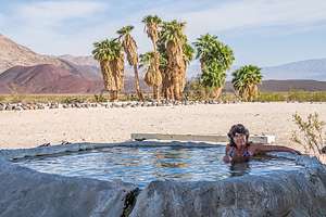 Saline Valley Warm SpringsAfter leaving Bishop, we drove south on 395 to the town of Big Pine and made a left (east) onto State Highway 168. From there it was about 16 miles for the turnoff (on the right) onto the Saline Valley Road.
The turnoff for the Warm Springs can be easy to miss, so we reset our odometer so we could track our progress along the way. At exactly 32.7 miles (as our off-roading guide told us), we came to a big old truck tire on our left, making the turn onto Warm Springs Road.
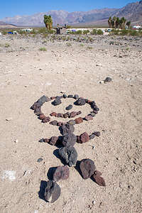 Saline Valley rock artThe drive along Warm Springs Road was much rougher and sandier than the Saline Valley Road, as the Saline Valley Road is maintained and graded, but this one is not. Still, plenty of 2WD cars and even small motorhomes somehow make it through. Funny how motivational the thought of soaking in a beautiful palm oasis can be.
After about 4 miles into our bumpy drive to the Palm Spring Oasis, we came to a tall post with metal bats hanging from it - the infamous “Bat Pole” of Saline Valley.
At about 6.5 miles, we arrived at the first oasis, where we had camped on a previous visit. However, we decided to continue on another mile to the second oasis. This one tends to be less crowded and it has two beautiful pools - one out in the open, hot desert sun, and the other tucked under the shade of a palm tree.
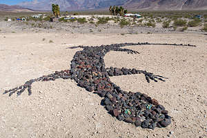 Saline Valley rock artBoth oases are amazing – prettier and better maintained than most commercial hot springs. They were developed in the 60s, before Saline Valley became a part of Death Valley National Park, by a group of hippies who made a semi-permanent camp here – taming the wild springs into several concrete, rock, and tile soaking pools. The camp even had a leader named “Wizard.” When he passed away, “Lizard” took his place. You can’t make this stuff up.
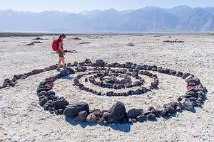 Lolo participating in the rock artThere are even showers, with soap and shampoo supplied, to use before entering the pool. In addition, there is a fully stocked bathroom, with Costco size toilet paper packages, cleaning products, air fresheners, etc.
Plus, there is random artwork near the bathrooms - giant lizards, stick men, insects, spiral mazes, peace signs, and more made from the volcanic black and red rock that is scattered all about.
This place certainly felt more like a commune than part of a National Park. The only stress here is deciding whether to soak in the sunny or the shady pool.
Day 2 - Saline Valley - Cinder Cone Hike
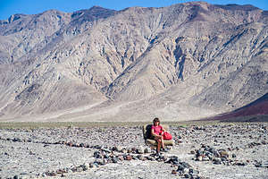 Random car seat along the way to the Peace SignFrom the oasis, there is a very prominent red cinder cone about two miles east of the springs with a giant peace sign carved into it - also not done by the National Park Service, but rather the work of two hippies from San Francisco named Sunshine (of course) and Raymond (not as predictable) who were residents of the Valley in the 1960s.
In 1968, Sunshine decided to take a rake to the cinder cone, where she set about the herculean task of removing the surface red volcanic cinders and exposing the lighter-colored volcanic soil below to create a giant peace sign, which must be at least 100 feet in diameter.
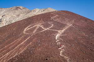 Lolo on her way up to the Peace SignI have no idea how she could have possibly done this, as it is so huge that when you are near it, you can’t actually see that it is a peace sign. Hopefully, Raymond and some other friends helped her.
This peace sign was our hiking goal for the day. We headed to the first palm oasis, a little less than a mile away, before heading across the Valley towards the cinder cone. We didn’t get too far before we came upon a car seat, just sitting there in the middle of nowhere. Of course, we had to each sit in it to have our picture taken.
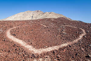 Peace and LoveFrom there we just kept walking toward the peace sign across the rocky terrain, which had dozens of washes and gullies running counter to the direction we were headed, which meant we had to constantly climb down one side and up the other of each of them. It seemed that no matter how long we walked, the cinder cone wasn’t getting any closer.
Finally, after about another 1.2 miles, we snuck up on it and began the very steep ¾-mile climb up its side to the peace sign. It was very hard, and part of the way, the peace sign disappeared behind it. When we finally got up to the peace sign, it was hard to tell it was one, because it was so huge.
Getting down the steep path was no piece of cake either as we slipped and slid on the loose scree. Then it was another mile back across the rocky washes to our palm oasis.
Final tally was 4.5 miles.
Time for a shower, soak, and bed.
Day 3 - Eureka Dunes
 Eureka DunesThe next morning, we drove back north on the Saline Valley Road to the Big Pine Road. We then turned right (east) and drove for about 25 miles and then made a right onto South Eureka Road.
From there, it was another 10 miles along the 4WD South Eureka Road to the primitive campground near the base of the impressive Eureka Dunes. At 700 feet, it is the largest dune in California and the second largest in the entire U.S.
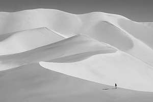 Eureka DunesThe campground was dry (no water or flush toilets) and had only four designated sites, but fortunately we were able to get one. If this campground is full, there are more dispersed campsites down the road, but it is kind of nice to have a picnic table and an outhouse.
Winter is a great time to visit the dunes, because even in the afternoon it is usually not too hot to hike them. Around 3:00 we set off towards the northern end of the dune and then started our slog up. I always find hiking in deep sand so grueling - 2 steps forward, 1 step back.
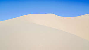 Eureka DunesHerb always sends me ahead, because he likes having a tiny person in his photo to give a sense of scale to this amazing expanse of dunes. In fact, unknown at the time, of course, he took a photo of me along one of the ridges, which went on to win best monochrome photo for 2021 in all of Northern California. That photo is now moving on to complete at the PSA (Photography Society of America) level.
There were portions of the hike that were so steep that I actually had to bend my body forward into the incline and use my hands as well. I looked like a gorilla. Meanwhile, each step on the really steep parts set off what looked like a river of sand, starting about 3 feet above us and continuing right below us for another dozen or so feet. The patterns we created were beautiful.
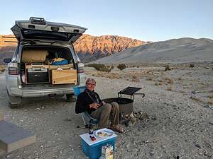 Eureka Dunes campsiteBesides the intriguing visual effect, we were also making the dunes “sing.” Singing sand dunes are quite rare and there are only about 40 of them in the entire world. The singing is really more of a booming sound, and it is triggered by an avalanching movement of sand.
It was actually a little tricky finding the summit, and I’m not actually sure that we ever did. as each time we climbed to the top of a ridge, we saw another one higher. We had reached the summit on a previous trip, but as we were now cutting into cocktail hour, we declared victory on the ridge below the summit and started the much more fun trek down. I felt like I was running down a hill of pudding. All in all, the hike was a very rewarding, and exhausting, 2.2 mile round-trip with some significant elevation gain.
Back at our campsite, we made dinner, sipped wine, and watched the sunset. As striking as the dunes are, an equally stunning view from our campsite was of the Last Chance Mountains, rising 700 feet from the Eureka Valley floor, brightly painted by the evening light.
Day 4 - Hidden Dunes and back to Bishop
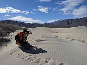 Hidden DunesOn our way out on the South Eureka Road, we decided to take a detour and hike to the Hidden Dunes, the Eureka Dunes’ smaller and lesser-known brother. You don’t even see them when driving along the Eureka Valley Road, because they are obscured from view by a pair of small mountains.
After driving about 6 miles north from the Eureka Dunes (3.5 miles shy of getting back to the Death Valley / Big Pine Road), we turned left on a hard-to-find, unmarked side road - I think it might be named Dry Well Road - at the end of which was a small parking lot.
There was no defined trail, so we set out across a rocky, sandy flat continuously aiming ourselves towards the triangle of sand peeking out from the gap between the two dark, rocky mountains in the distance. We were able to make good time on the hard, firm surface, so it only took us about an hour to cover the 3 miles to the Gap.
.thumbnail.jpg) Hidden DunesAs we rounded the corner, the dunes came out of hiding, seemingly out of nowhere. It was like a portal to another world.
Hidden DunesAs we rounded the corner, the dunes came out of hiding, seemingly out of nowhere. It was like a portal to another world.
We climbed up along the ridge on the first dune and followed its spine to the summit, probably about a 150 foot climb. It was so quiet and pristine, a whole different experience from visiting the other more popular dunes in the park. The only footprints to be found were our own.
The dune fields supposedly go on for 2.5 miles to the south, but we only had time for about ½ mile, before turning back.
Rather than go back down along a ridge, we ran playfully down its steep side, heels sinking in the sand to slow us down, all the while creating rivulets that began to “sing” as the friction of the sand grains sliding against each other sounded like the bass note of a pipe organ.
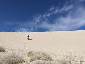 Hidden DunesOn a hike without a well-defined trail, you not only have to think about finding your destination, but also about finding your way back to your car. The old-fashioned way is to take note of a landmark before heading out too far, to which you will navigate back towards later. In the case of this hike, there was a white wellhead mound in the parking lot.
However, we usually rely on the Strava app (or Gaia), which records our hikes as they are happening (distance, speed, etc.) and marks our progress on a map - a more techy version of Hansel and Gretal’s breadcrumbs.
We easily found our way back to the car. The entire hike was 7.2 miles with 100-feet of elevation gain. Very worthwhile and highly recommended.
Now it was back to Bishop and another cozy night with Andrew and Celeste in their new home before heading back to Sonoma.
