- Home
- About
- Map
- Trips
- Bringing Boat West
- Migration West
- Solo Motorcycle Ride
- Final Family XC Trip
- Colorado Rockies
- Graduates' XC Trip
- Yosemite & Nevada
- Colorado & Utah
- Best of Utah
- Southern Loop
- Pacific Northwest
- Northern Loop
- Los Angeles to NYC
- East Coast Trips
- Martha's Vineyard
- 1 Week in Quebec
- Southeast Coast
- NH Backpacking
- Martha's Vineyard
- Canadian Maritimes
- Ocracoke Island
- Edisto Island
- First Landing '02
- Hunting Island '02
- Stowe in Winter
- Hunting Island '01
- Lake Placid
- Chesapeake
- Provincetown
- Hunting Island '00
- Acadia in Winter
- Boston Suburbs
- Niagara Falls
- First Landing '99
- Cape Hatteras
- West Coast Trips
- Burning Man
- Utah Off-Roading
- Maui
- Mojave 4WD Course
- Colorado River Rafting
- Bishop & Death Valley
- Kauai
- Yosemite Fall
- Utah Off-Road
- Lost Coast
- Yosemite Valley
- Arizona and New Mexico
- Pescadero & Capitola
- Bishop & Death Valley
- San Diego, Anza Borrego, Joshua Tree
- Carmel
- Death Valley in Fall
- Yosemite in the Fall
- Pacific Northwest
- Utah Off-Roading
- Southern CA Deserts
- Yosemite & Covid
- Lake Powell Covid
- Eastern Sierra & Covid
- Bishop & Death Valley
- Central & SE Oregon
- Mojave Road
- Eastern Sierra
- Trinity Alps
- Tuolumne Meadows
- Lake Powell Boating
- Eastern Sierra
- Yosemite Winter
- Hawaii
- 4WD Eastern Sierra
- 4WD Death Valley +
- Southern CA Deserts
- Christmas in Tahoe
- Yosemite & Pinnacles
- Totality
- Yosemite & Sierra
- Yosemite Christmas
- Yosemite, San Diego
- Yosemite & North CA
- Seattle to Sierra
- Southwest Deserts
- Yosemite & Sierra
- Pacific Northwest
- Yosemite & South CA
- Pacific Northwest
- Northern California
- Southern Alaska
- Vancouver Island
- International Trips
- Index
- Tips
- Books
- Photos/Videos
- Search
- Contact
Lake Powell - Defiance House and across from Annie’s Canyon
Saturday, September 5, 2020 - 3:00pm by Lolo47 miles and 3.5 hours from our last stop - 1 night stay
Travelogue
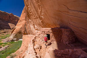 Defiance House kivaAfter a morning hike up to the ridge overlooking the Waterpocket Fold, we pulled up anchor and headed out of Halls Creek Bay and then north on the main channel to Forgotten Canyon (Buoy 106), at the end of which was a hike to the Defiance House Ruin, an Anasazi dwelling more than 700 years old.
We continued up Forgotten Canyon until the water ran out. There were already four boats parked there, with anchors buried in the sand. One boat had an interesting anchor set up. He used a ski rope with a stick put through the handle into the sand. As expected, the stick had tipped over, basically meaning that this boat was not secured at all, but it was boxed in by other boats and probably wouldn’t go anywhere. Just in case, Herb put the stick back in.
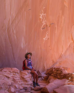 Lolo sitting beneath an anatomically correct pictographFrom there we trudged through some muck before getting to the main trail, eventually coming to a series of switchbacks that led up to the ruins on a shelf on the canyon wall. The site consisted of two dwellings, a ceremonial kiva, and several kitchen pits, which have been restored by the National Park Service. However, by far my favorite was the large pictograph of three warriors “defiantly” (hence the name) waving their clubs and shields in an apparent duel. They were even anatomically correct.
That was as far north as we planned to go, so after leaving Forgotten Canyon, we headed back south passing right by Halls Creek Bay, and started looking for good anchorages for the night. We came upon one promising one, right across from Annie’s Canyon, but were concerned that there might be too much wake, being that it was along the main channel - although it did have a bit of a place to tuck in behind a rocky outcrop.
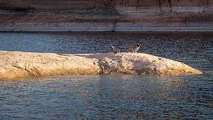 Cocktail hour at our campsite across from Annie's CreekWe continued on for about another mile, and after finding nothing more appealing, we turned back and Herb did his anchor management magic, making us feel that we were secure. Surprisingly, there was very little boat traffic the rest of the day.
The views were great, as always, so we set our camping chairs up on a rock overlooking the main channel and sipped wine and watched the sunset.
Lake Powell - Halls Creek Bay
Friday, September 4, 2020 - 3:00pm by Lolo48 miles and 3.5 hours from our last stop - 1 night stay
Travelogue
 Our campsite in Halls Creek BayAfter leaving Register Rock, without ever getting to sign the register, we cruised on up the main channel, bypassing the left turn which would have taken us up the Escalante Arm. We cruised into Iceberg Canyon to look for an inviting campsite, but found nothing great.
We figured we would try Halls Creek Bay, where we had a terrific campsite last visit along the west side of the Bay that was set against the Waterpocket Fold. Camping along here would allow us to take a pretty decent hike.
But first, time to gas up at Halls Creek Marina and pick up some ice. While Herb handled the fuel, I went into the store to get ice. I was pretty appalled. We have been so careful wearing masks and social distancing during Covid - after all, we are in the vulnerable age group now and Herb has asthma.
 Swimming to the caves (?) from our Halls Creek campsiteApparently here, Covid was a hoax. The girl checking people at the door had a mask haphazardly below her nose (I hate that) and she just kept waving people in. There were probably well over 30 maskless, 20-somethings in that store acting like life was totally normal. Their attire definitely gave away their political affiliation and covid denial. I grabbed a bag of ice and got out of there as fast as I could.
From there we crossed back over to Halls Creek (Buoy 93), a large bay barely noticeable from the main channel because of its narrow opening. Along its 12 miles, there are innumerable coves that cut into the southernmost toe of 100-mile long Waterpocket Fold, many of which have sandy beaches for camping.
 View from the ridge above our campsite in Halls Creek BayWe managed to find a nice quiet home for the night in a shallow cove, hopefully too small for houseboats to join us. The scenery was incredible and there was much more opportunity to hike for longer distances than we had been able to so far at our previous camping spots - good, because I was beginning to feel a little confined on the boat, and then I get cranky.
We were getting in a groove now - cruise in the morning, find camping early afternoon, swim / float, and then hike when the sun got low.
This particular cove had a rocky promontory jutting out into the lake with what looked like a series of caves in them. I swam out to them, smeared my way up the rock, and tried to enter. No cave, just a deep cutout. Still, very cool.
 Gazing out at the Waterpocket Fold from the ridge above our campsiteWhen I got back, Herb went for a swim. He’s a much stronger swimmer than me, so he continued on and around the promontory where I couldn’t see him any more. He was gone pretty long, but as I was just starting to get nervous, I spotted his head coming around the bend.
That evening, we took a lovely hike up to the ridge that looked out over the bay on one side, and the Waterpocket Fold on the other. Another evening of breathtaking views. For us, the best campsites were those with expansive views and the opportunity to hike at least a mile.
In the morning, before setting out, we took another, longer 2.5-mile hike up to the ridge towards the Waterpocket Fold. So, so beautiful.
Lake Powell - Reflection Canyon and Register Rock
Thursday, September 3, 2020 - 2:45pm by Lolo48 miles and 3.5 hours from our last stop - 1 night stay
Travelogue
 Incredible reflections in Reflection CanyonI love just cruising in the boat, watching the scenery go by, and what breathtaking scenery there was. We cruised up the San Juan Arm for about 18 miles, dipping into Desha and Deep Canyons before turning around and returning to the main channel where we took a side trip into Reflection Canyon.
It was easy to see how this beautiful winding gorge got its name. The reflections of the sandstone cliffs in the crystal clear water were astounding. It was actually confusing to look at because the reflections were so real, that you couldn't distinguish them from their source - like twin extensions of the reality.
 Lolo swimming amongst the reflectionsIt was so beautiful, I had to jump in and try to touch them. That’s what’s so nice about Lake Powell in summer. The water is a balmy 80 degrees, making it very easy just to dip in and out all day.
We were here at noon time, which is usually not the best time of day to photograph, but apparently not with these reflections. My very favorite was of a rather non-distinct rock, which when paired with its reflection took on the appearance of a torpedo.
 Our campsite by Register RockOnce back in the main channel, we continued north looking for a place to camp for the night.
We tried to find the spot near Chuckwalla Springs where we camped last time, but we couldn’t find it. Everything can look different when the water levels change. We went a little further north and found a nice little cove by Register Rock, just across the lake from Hole-in-the-Rock, of tenacious Mormon fame.
 Register Rock where Mormons signed their namesBack in 1879, the San Juan Mission of Mormons was traveling from Escalante to Bluff, Utah, when they came to the edge of a precipitous 1,200-foot cliff above what was then the Colorado River. The only way to continue on was to lower the wagons down the natural crevice to the river level, where it could be forded.
After months of blasting and hand chiseling to widen the crevice, they successfully lowered 83 full-sized wagons, 1,000 head of livestock, and 250 people to the river. I’m sure the livestock were very happy with that.
 Evening reflections by Register RockAfter fording the river, they stopped to briefly to memorialize their treacherous descent to the river by carving their names on a rock, before continuing on their difficult journey, which was far from over. Unfortunately, those names are now under water.
Well that rock, now known as Register Rock, was the one we were camping by. However, we had a much easier time of getting to it - no oxen had to be lowered no rivers had to be forded, no months of chiseling away at rock. I felt a little wimpy as I sipped my glass of wine at the base of Register Rock.
Lake Powell - San Juan Arm
Wednesday, September 2, 2020 - 2:45pm by Lolo52 miles and 3.5 hours from our last stop - 1 night stay
Travelogue
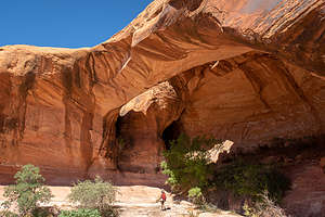 Lolo approaching Jack's ArchEarly the next morning, we head out, continuing up the main channel of the lake, hoping to find a more secluded anchorage for tonight’s camping. Not all coves and canyons are equal in terms of good overnight anchoring, and we definitely preferred one that had a beach of sorts that we could get out on to hike or at least stretch our legs.
We relied heavily on the “Lake Powell and its 96 Canyons Boating and Exploring Map” that we had ordered on Amazon before leaving on this trip. We ordered the laminated version because our paper one got torn to pieces in the wind on our last trip here. It provides a description of every canyon along the lake and how good the camping options are. It’s difficult for any map or guidebook to stay current because lake levels are always changing, often making navigability and camping very different.
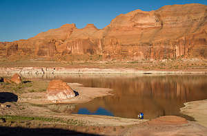 Our campsite in the San Juan ArmAfter cruising a few miles up West Canyon and not finding anything that excited us enough to stop for the day, we continued up the lake, stopping first at the Dangling Rope Marina to get gas. After this, our next opportunity to fill up wouldn’t be until Halls Crossing, 50 miles further on, and even more if we decided to do a side trip up either the Escalante or San Juan River arms.
We decided to head to what was probably our favorite camping spot from our last visit, just at the entrance to the San Juan River arm. However, this time we pulled into the cove on the nearer side of the bluff we camped by before. From this spot, we could hike to Jack’s Arch, a 48-foot high, 56-foot wide arch in a cave, in a low cliff, a little less than a mile away.
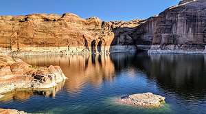 View from the ridge above our campsite in the San Juan ArmThere was no real trail along the sandstone, but I was actually able to find Jack’s Arch on google maps, so I could easily see the general direction we wanted to go. Sure enough, we found it easily, and it was quite impressive and best of all, there was not another soul in sight.
When we got back to the boat, we decided to move it to the other side of the bluff, to our previous camping spot, because it had a much more open expanse with incredible views of the sandstone cliffs.
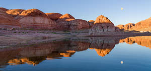 Evening reflections in the San Juan ArmLast time we were here, it was 105 degrees, and I remember being so hot that I spent the entire afternoon on our float huddled under the bow of the boat in the shade - sort of like a precog in "Minority Report."
Herb, who loves the desert heat, went off by himself for a hike up the ridge. I had to control myself from laughing when he returned holding one of the soles of his chaco sandals that had literally detached when the adhesive holding them on melted.
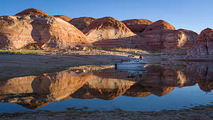 Lolo waking up in a sea of reflectionsThis time it was a relatively comfortable 90 degrees, so around 6:00 pm we clambered up to the top of the ridge above our anchorage where we could look out at the San Juan Arm on one side and the main Colorado River channel on the other. Our boat looked so cute down below.
That night when the sun got low the sandstone cliffs surrounding us turned an incredible orange-red hue. This would be a hard camping spot to beat.
The next morning when I awoke, Herb was already gone, off to take photos in the morning light. When I finally extracted myself from the cuddy cabin, I found myself and our boat in a sea of reflections. Sure enough, there was Herb atop the ridge above our campsite, looking down on me with his camera.
Lake Powell - Gunsight Canyon
Tuesday, September 1, 2020 - 2:30pm by Lolo24 miles and 1.5 hours from our last stop - 1 night stay
Travelogue
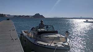 Big day at the Stateline Boat LaunchLaunching the boat at the Stateline Boat Ramp went off without a hitch, and the motor started up with the first turn of the key.
It felt great to be cruising in the boat again, especially in such spectacular scenery - 186 miles of colorful rock formations, natural arches and bridges, and so many canyons, bays, and coves that there is 1,960 miles of shoreline to explore.
The last time we were here in 2018, the lake levels were just high enough to allow us to take the Castle Rock Cut out to the main channel. The cut becomes impassable at 3613 feet (elevation level), out to the main channel requiring boats to take the longer (just by a few miles) route around Antelope Island.
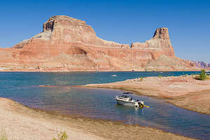 Gunsight Canyon campsiteLake levels freshly measured today were 3,599 feet, so around Antelope Island we would go. It probably would have been fine, and there were a few boats even bigger than ours going through the Cut, but we had no desire to risk it and possibly screw up this much-needed vacation. Besides, we didn’t mind a few more cruising miles.
We decided to skip popular Warm Creek Bay and continued on to Gunsight Canyon, just shy of Padre Bay, on the northern side of the channel at Buoy 17. The canyon was named by early rivermen who thought the large butte at the mouth of the canyon resembled a giant gunsight.
We hoped this smaller canyon, squeezed between the two larger bays, would have less camping options for houseboats and thus be more secluded.
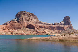 Lolo strolling from our camp spotSoon we were anchored just a short distance from the shore in a shallow, solitary cove. It was a little bit weedy, but we thought that that might serve as an extra deterrent to anyone trying to join us for the evening. I’m not exactly sure what the etiquette is for how close to anchor near someone, but with so many coves and miles of shoreline, we felt that it would be pretty obnoxious of anyone to come in here.
Well, apparently obnoxiousness is not in short supply on big houseboats, and we were joined not just by a boat, but a flotilla - 50 foot houseboat, 2 ski boats, 4 jet skis, and about 12 people. Oh, and they partially blocked our view as well. It was totally ridiculous and definitely put a damper on our first night on the lake.
A glass or two of wine improved our moods and we positioned ourselves with a good view of Gunsight Butte, rising more than 1,000 feet above the Lake, just across the water from us. Like most of the rock formations surrounding the lake, it is made of Entrada Sandstone and has a lovely rich-red hue, especially at sunset.
Wahweap Resort and Marina Campground
Monday, August 31, 2020 - 2:30pm by Lolo415 miles and 8 hours from our last stop - 1 night stay
Travelogue
 Camping at Wahweap before the launchThe next day was just another 420 miles of driving, with a stop at an In-n-Out in St. George, Utah as a treat.
Finally we arrived at the Wahweap Campground, which was just a short distance from the Stateline Boat Ramp where we would launch tomorrow.
I felt very nostalgic that night, as we reminisced about the last time we had camped here. It was 18 years ago, and our then 12 and 14-year old sons spent the entire evening skateboarding down the steep path to the lake. Hmm..maybe I’ll give them a call.
Barstow Calico KOA
Sunday, August 30, 2020 - 2:30pm by Lolo464 miles and 9 hours from our last stop - 1 night stay
Travelogue
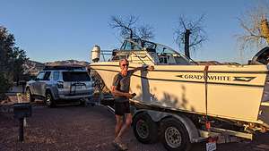 Along the long drive to Lake PowellThe first day we drove 470 miles, fortunately most of it on I5, to a KOA in Barstow, California. We, especially Herb the driver, were exhausted, but spirits were high because we were so excited at the thought of being in Lake Powell in 2 days.
We felt quite luxurious having two bedrooms to choose from - we could sleep in the cuddy cabin of the boat or on the very comfy sleeping platform Herb had created for us in the back of the 4Runner. Both areas were pretty cluttered right now with our stuff, so I slept in the 4Runner and Herb slept in the boat.
Yosemite Valley
Monday, November 9, 2020 - 10:00am by Lolo245 miles and 5 hours from our last stop - 6 night stay
Travelogue
Day 1 - Arrival in time to catch the alpenglow
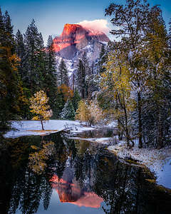 Arriving just in time to catch the alpenglowWhenever we drive to Yosemite with the motorhome, we take the more southern route up through El Portal on Highway 140 as it is a bit more gentle an approach than Highway 120 through Groveland. That being said, Google Maps decided to automatically change our route to the slightly faster (by 5 minutes) 120 route and we didn’t notice that until we had driven about an hour beyond the decision point.
We were in no mood to turn back so we continued onto Groveland. Hmm...there seemed to be a little snow on the ground here. When we got to the Park Entrance, we were told that we could not continue without chains because the roads between here and Crane Flat were not yet plowed. She said that Highway 140 up through El Portal was clear. Great. This made our stupid mistake, even stupider. I felt largely responsible, because I am the navigator and am supposed to be paying attention, but I still blame Google Maps for changing our selected route. Herb was taking this extremely (almost frighteningly well).
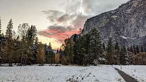 Catching the last bit of light by Sentinel BridgeNot having chains with, and not wanting to deal with snowy, nail-biting roads, we asked the Ranger how we could best recover from our mistake and go around to the El Portal entrance without going all the way back to Stockton. She gave us a route that went back through Groveland and down the Priest Coulterville Road, which she said was perfectly fine for motorhomes such as ours. Besides adding another hour and a half to our trip, she was right.
We got into the Valley around 4:30, just in time to catch the Alpenglow on Half Dome from Sentinel Bridge - and to make it even more perfect, the meadows and peaks (but fortunately not the roads) were covered with a lovely blanket of snow.
Day 2 - El Cap Meadow, Cathedral Beach, Valley View, and chasing the alpenglow
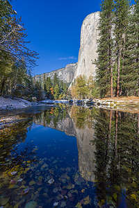 More El Cap ReflectionsHaving been to Yosemite Valley so many times, we didn’t feel compelled to rush around seeing all the sights, incredible as they may be. Instead, we took a leisurely drive around the Valley Loop in the motorhome, stopping at various favorites along the way. We used it as a base camp for making lunch, taking naps, getting warm, etc.
One of our favorite things to do is park near El Cap Meadow where the unobstructed view of El Cap in all its massiveness is humbling. I still can’t believe that our son Tommy and his now fiancee Erin, climbed the Nose, spending 3 nights sleeping on narrow ledges on its face. My palms still sweat at the thought of it.
From the meadow, we like to wander across the road and along the Merced River over to Cathedral Beach, where the reflections of El Cap in the river are astounding. No matter how many times we come to this spot, this view always takes our breath away.
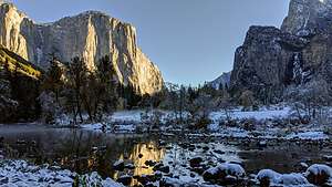 Valley ViewOur next stop along the loop road was the very popular Valley View near the end of the Northside Drive, where El Capitan, on the left, and Cathedral Rocks, on the right, frame a magnificent valley view. Usually there is a crowd here, but because of Covid there were no big tour buses in the parking lot today.
I had been so enamored with the alpenglow last night that I told Herb I wanted to be positioned well for tonight’s show. Back in 2018, I had experienced a very beautiful alpenglow on Sentinel Dome so I wanted to see if I could repeat that tonight.
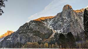 Maybe some alpenglow?We parked along the Southside Drive near Swinging Bridge and set off on foot. I made Herb come with me to show him the spot where we could watch Sentinel Dome light up during Alpenglow. Not wanting to just stand there in the hopes that it would do a repeat performance, he set off to wander about on his own.
After about a half hour, a couple came up to me and asked what I was looking at. I explained to them that I was waiting for the Alpenglow to hit Sentinel Dome, fully assured that this was a phenomenon that occurred every night.
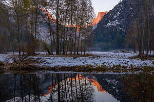 Herb capturing alpenglow reflectionsI waited and waited and finally an orange-red glow lit up the top of the ridge. Oh, here it comes I thought, as I waited for it to move down the face and paint the entire rock a bright red, just like last time. But, poof. It just went out. What?
Meanwhile, I looked to the left off in the distance and saw Half Dome fully aglow. Darn it! That’s where Herb had headed. I started running that direction but didn’t get there in time. Herb said he had met the couple I had been explaining alpenglow to. They made the connection between the two of us because of his tripod and camera equipment.
Lessons learned. Apparently, a really spectacular alpenglow only occurs during certain atmospheric conditions.
Day 3 - Church Bowl, Ahwahnee Hotel, Ahwahnee Meadow, and more wanderings
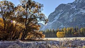 Ahwahnee MeadowThe days are pretty short in November, especially when you are in a Valley with those tall rock cliffs blocking the sun on both ends of the day. The campground doesn’t get sunlight until late morning, so we usually like to get out of there early and drive it over to the Church Bowl Picnic Area along the Ahwahnee Drive, where there is lots of morning light. From there we could make breakfast, have coffee, read, and venture out whenever we felt like it.
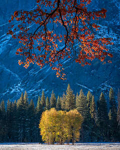 Ahwahnee MeadowCoffee done, we headed out on the path that ran alongside the meadow towards the Ahwahnee Hotel, just a half mile away. The morning light was already streaming through the trees and onto the snow-covered grasses of the meadow. What a lovely morning to be in the Valley.
Whenever we are in the Valley, I always feel a yearning to stop in at the beautiful historic Ahwahnee Hotel, with its rustic wooden-beamed ceiling and floor-to-ceiling windows overlooking Royal Arches. We have so many wonderful memories here of nights spent playing cards and reading books by the fire or in one of its many nooks and crannies.
It was much quieter due to Covid. We debated whether we should get take-out dinner some night and eat it in one of the sitting areas in the Grand Lounge, but when we mentioned that to our overprotective sons, they said, “Are you crazy!” Darn.
As we usually do, we strolled out behind the hotel and walked along the path to the Merced River before returning back across the meadow. By this time, much of the Valley was lit, so we took a drive and parked on the other side of the Valley near the cute little church, which served as our base camp for the remainder of they day.
The rest of the day was spent wandering, taking photos, more wandering, more photos, etc. Not a bad life.
Day 4 - Hike up to Glacier Point
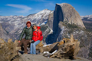 Glacier Point after hiking up from the ValleyThere aren’t any hikes in and from the Valley left that we haven’t already done, but doing them in different seasons sort of makes them new again. We decided to do the Four Mile Trail up to Glacier Point, with a 3,200-foot elevation gain. I have a bone to pick with the person who named this trail. If they can rename the Ahwahnee Hotel the Majestic, I can rename this 4.8-mile hike the Five Mile Trail.
This is a great hike, but a very strenuous one as well. We started from the Valley Floor and after a brief flat area wandering through some boulders, which we had played around on with the boys in visits past, we began to climb. In fact, from that point on, all we would do is climb, as we had a lot of vertical feet to gain.
There were already some patches of snow on the trail before we started the climbing part, so we sat on a log and put on our Microspikes. We used to use Yaktrax but Herb likes Microspikes better because they have better grip and they pack down smaller. They are kind of like the chains you put on your car tires and just as hard to put on.
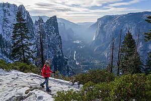 Hiking down from Glacier PointThey really do work though. Everyone we passed on the trail was half our age, but we were passing them. I felt like the little engine that could, steadily plugging away up that hill, while the young’uns were slipping and sliding all over the place. Very empowering.
The scenery started slowly, since we had to get above the Valley trees first, but once we did, all the icons of the Valley come into view - Yosemite Falls, Cathedral Rocks, El Cap, Half Dome, Clouds Rest, North Dome, and more. It was like a tour of Yosemite’s greatest hits. The tremendous views were a great distraction from the fact that we were climbing and climbing along a continuous series of switchbacks.
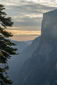 Hiking down from Glacier PointAt about 3 miles we came to the turnoff for Union Point, where there is a great viewpoint. Many hikers use this as a good turnaround point, but not us - we were going all the way!
As we came around to the northeast side of the valley wall, Half Dome came into view. The switchbacks were now done and the trail became less steep. One more mile to go.
Once we came off the Four Mile Trail, we continued left down a paved trail to what is one of the best views in Yosemite, and we pretty much had it all to ourselves. So different from summer when bus loads of tourists line up for selfies.
Although we were retracing our steps on the way down, the views were completely different in this direction - Half Dome, Yosemite Falls, those miles of switchbacks, and finally to my favorite view of all looking out over El Capitan and the western Yosemite Valley during Golden Hour.
I would like to give my special thanks to my Microspikes, that allowed me to hike up like a little tractor and hike down without slipping and sliding and hurting myself.
Day 5 - Reflections
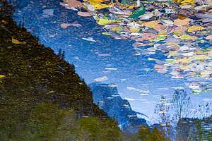 Reflections of Half DomeToday was all about reflections: reflections of rock formations in the Merced River and reflections of life during Covid.
I’ll start with reflections of life during Covid. I think it would be safe to say that we will all in some way be changed by the experience of 2020, hopefully for the better -- more compassionate and generous to others, more introspective and thoughtful, and definitely more appreciative of what we used to take for granted.
Secondly, I think it has taught us that we are not just individuals responsible for ourselves, but part of a vast network of family, friends, neighbors, and strangers who are healthier, happier, and stronger because of each other.
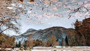 Reflections of North DomeThirdly, I think I, anyway, have learned to treat life’s simple moments as precious times to be savored: a hug from our grown-up children, a glass of wine with friends, a trip to a museum, and on and on.
So today I was thankful that Herb and I were healthy and once again in Yosemite Valley together, a place that has been so special to us over the years, and to still be able to get so excited about experiencing its beauty.
Enough with the waxing philosophically. Here are two images of reflections of Yosemite in the Merced River, one taken by each of us. Both of them are shot directly down into the water. Mine (the second one) became much more interesting when I flipped it upside down, revealing a watery sky filled with leaves.
Final Day - Ahwahnee Meadow, El Cap Meadow, and Inspiration Point
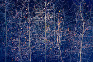 Nature's ornaments in the treesOur last day in the Valley had arrived. As with every other morning, we left the dark campground early to find a spot in the sun. There are so many good choices, but we decided to return to El Cap Meadow and wander around there. We took off towards the river where the morning light was streaming through the trees.
We met a guy about our kids age, just sitting in a beach chair staring up at El Cap. He told us that he was going to climb it tomorrow and that he had done it three times in the past. Of course I had to tell him that our son had done it as well.
During our wanderings,we came across a large log which we swore was the one we had sat on during our first visit to Yosemite back in 1986. Maybe not, but close enough. Herb set up the tripod and we took a photo of the two of us with El Cap as a backdrop. We looked so tiny.
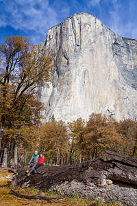 We look so tinyWe needed to get some exercise, so we decided to do the hike up to Inspiration Point, which started from the Wawona Tunnel overlook parking lot. We had done this hike in the past, but then again we pretty much had done every hike in the Valley at least once, but they are all worth a repeat.
As usual, the parking lot was busy, but not as much as pre-Covid when tour buses dispense dozens of camera-clad tourists at the overlook to capture this iconic view of the Valley. It is a phenomenal view, rivaled only by the view from Glacier Point overlook, which we had hiked up to the other day. We had to work much harder for that one.
Feeling the need to earn our photo, we set off on the Inspiration Point trail, which started right from the parking lot. It’s pretty steep, gaining over 1,100 feet in just a little over a mile.
Once again, we learned that Yosemite secret: you only have to hike about a mile from the road to leave the crowds behind. And, if the trail is steep, as this one was, you will practically have it to yourselves within the first 100 yards.
The trail was a bit snow-covered, but not enough to warrant putting on our Microspikes. At 1.3 miles we reached “Old Inspiration Point,” which is where the road to Yosemite Valley used to go in the days before the Wawona Tunnel was built.
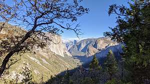 View from Inspiration PointThe views are now mostly obscured by trees, but as we discovered in the past, if you just hike a short distance down to a lower granite shelf, the views of El Cap, Half Dome, and Yosemite Falls are unobstructed and breathtaking. In fact, this was the site of our 2013 Gaidus Family Christmas Photo.
The views might not have been objectively better than those from the parking lot, but it certainly felt like they were from the solitude of this ridge.
Our escape to Yosemite Valley had been a wonderful break from the confinement at home, because it was so easy to socially distance and feel safe when traveling in the motorhome. For the past week, life had felt almost normal.
Goodbye for now Yosemite. We will be back!
Bishop
Thursday, April 1, 2021 - 8:30pm by Lolo45 miles and 1 hour from our last stop - 5 night stay
Travelogue
Day 1 - Arrival in Bishop
We arrived purposely after 5:00, so they could finish their work day without us distracting them. They made a nice dinner for us and we spent the night chatting and catching up. Oh, and lots of long overdue hugging.
Day 2 - Herb and I entertaining ourselves while they worked
.thumbnail.jpg) Herb running along the Bishop Creek CanalI managed to convince Herb to go with me for a run along the Bishop Creek Canal which is just a short distance from Andrew’s house. In my opinion, it’s the perfect running trail - flat, nice dirt surface, and unbelievable views. We ran 5 miles out and back, having to occasionally wait for cows to get out of the way.
Herb running along the Bishop Creek CanalI managed to convince Herb to go with me for a run along the Bishop Creek Canal which is just a short distance from Andrew’s house. In my opinion, it’s the perfect running trail - flat, nice dirt surface, and unbelievable views. We ran 5 miles out and back, having to occasionally wait for cows to get out of the way.
The rest of the day was spent doing laundry, loading thousands of photos to our laptops, and food shopping.
That night friends of theirs came over to join us for a BBQ. They have met so many really interesting and like-minded people that any fears I had of them being lonely and missing their friends in SF were put to rest.
Day 3 - Off-road motorcycling and bouldering in the Buttermilks
 Off-roading on the Bishop trailsSince they moved to Bishop, both Andrew and Celeste have bought off-road motorcycles to enjoy the hundreds of miles of off-road trails in the area. Herb has ridden motorcycles for years, but almost exclusively on asphalt, so Andrew wanted to give him an opportunity to do some off-roading with him.
Andrew and Herb set off from the house on the motorcycles, and Andrew took him on some of his favorite trails before heading over to the Buttermilks to meet up with Celeste and I, who would drive over with the truck. Herb had a blast. Not sure if he is ready to buy an off-road bike yet, but it certainly will be fun to borrow one when we visit.
We all met at the parking for the bouldering area and entered the second phase of the day - bouldering.
First, a very brief primer on bouldering. Bouldering is a form of rock climbing that does not use ropes because it is done on “boulders” that are not too high. To protect from injury, crash pads are placed on the ground to soften the climber’s fall. In addition to the pads, other climbers stand at the bottom with arms extended upward to catch or slow the climber down if he falls. However, in the Buttermilks, the boulders are pretty darn big, some as high as 45 feet.
 Andrew bouldering in the ButtermilksBouldering is not Herb and my thing, so for this portion of the day, we would just be spectators - not a bad thing as the landscape is amazing, with hundreds of huge boulders (or more technically, glacial erratics) strewn across a vast hillside with the snow-capped Sierra in the background.
After doing that for awhile, we moved into phase 3 (their lifestyle is exhausting), in which Andrew and now Celeste would ride the motorcycles and Herb and I would follow them in the truck. Herb said that the roads they went on into the Foothills of the Sierra were a lot rougher than what Andrew had taken him on. I can’t believe how good Celeste has gotten on that bike in such a short time.
Finally it was time for Phase 4 - cocktail hour and dinner at the Mountain Rambler, finally an event I could participate in.
Day 4 - Sport climbing in Pine Creek Canyon and 4WDing to the Warm Springs
 Celeste sport climbing in Pine CreekToday we would tag along with the kids to watch them sport climb in Pine Creek Canyon, a stunningly beautiful canyon nestled between Mount Tom and the Wheeler Crest, less than a half hour from their house.
This is just one of the many climbing areas near Bishop. It alone has over 630 routes, including multi-pitch trad climbs and one of the largest collections of sport climbs in the state. Just the hike into the canyon itself was worth the trip, even if I personally didn’t get to climb. I just love the beautiful scenery and watching them do what they love.
They usually try to get Herb and I on a climb that is less difficult than what they do, but neither of us had climbed in almost a year and a half because the climbing gyms had been closed because of Covid. I declined, but they did get Herb, who has climbed a lot in his life, to agree to give it a shot.
As must be done in sport climbing, somebody (Celeste in this case) has to lead the climb and set up a top rope on top for the rest of us to use. Herb managed to enjoy the climb. He was surprised that he had not lost that much strength during the hiatus, but did say he had very little endurance.
After watching them climb a few more climbs, we left while they joined some of their friends. Before going back to the house, Herb and I decided to take a 4WD trip back by the canal behind their house to try to find the Warm Springs, where another species of pupfish lives. We were really into pupfish this trip. This would be our third species - kind of like collecting Pokemon cards.
It was a very bumpy, sandy, and longer than we expected drive, but we finally found two very pretty small ponds that did have pupfish in it. It also had a family in it as well. They told us that the pupfish liked to nibble on people. Eww!!!
Day 5 - Andrew and Celeste work and we hike the Druid Stones Loop
 Lolo of the Druid StonesOur last full day in Bishop. The kids had to work (they are so jealous of us retirees), so we went off on our own for the day.
We decided to hike the Druid Stones Loop, a hike popular with locals both for hiking as well as bouldering on the stones. We had been up to the stones once before to watch them climb. This time we planned to continue on past the stones and do the entire loop.
The trailhead was only 10 minutes from their house. There were a few cars in the parking lot along Bir Road, but since we had a 4WD with high clearance we were able to drive in another quarter mile to a closer parking area.
The trail starts strong with about a mile of switchbacks up a steep slope, climbing about 1,700 feet in a little under 2 miles. At a fork we took a left and continued for another quarter mile or so until we came to a distinct boulder field on the left with one prominent one sticking up above the rest. This is the Druid Stone. Actually I thought they were all collectively called the Druid Stones, but in any case, they all had Celtic-themed names. This is where we had been a few years back to watch them climb.
 Hiking down from the DruidsFrom here there was a great view of Bishop and the Owens Valley, the White Mountains to the east, and the Sierra Nevada mountains to the west.
Rather than go back down, we added on the almost 3-mile loop. I confess that we got a bit lost in the beginning of the loop because we wandered too far into the Druid Stones, but a leprechaun led us back to the trail.
This was definitely our day for getting lost, because once we hiked the switchbacks back to our car, we thought it was a no-brainer to get back to Bir Road. Well, we must not have been paying attention because we drove for a lot more than a quarter mile on dirt roads.
 One of the more interesting graves at the Paiute CemeteryEventually we came out to a Native American cemetery called Sunland. It was different from any cemetery I had ever been to, perhaps with the exception of Baja. It was so personalized, with photos and objects important to the deceased laid atop the graves, which by the way were not below ground level but a raised mound. It was upsetting to see how many young people there were.
However, the one that made us smile was that of “Buz” Rogers who had a funnel at the foot of his grave with a sign above it. reading, “Dying of Thirst, Pour Bud Here.” I am not sure if I am proud or embarrassed to admit it, but Herb did have a Bud in the truck refrigerator, which he did retrieve and pour down Buz’s funnel.
Hiking up to the DruidsAnother wonderful home-cooked meal back at the ranch on our last night in Bishop.
The Narrows and Papoose Flat 4WD Road
Thursday, April 1, 2021 - 8:45am by Lolo60 miles and 4.5 hours from our last stop
Travelogue
.thumbnail.jpg) Along the 4WD Papoose Flat RoadAfter leaving Eureka Dunes our next stop was Andrew and Celeste’s house in Bishop, but we didn’t want to arrive too early because they were working until 5:00.
Along the 4WD Papoose Flat RoadAfter leaving Eureka Dunes our next stop was Andrew and Celeste’s house in Bishop, but we didn’t want to arrive too early because they were working until 5:00.
I suggested to Herb that we should do the Narrows and Papoose Flat 4WD Road which would take us from the Big Pine / Death Valley Road up and over the mountains and into Big Pine - a 26 mile, 3 ½ hour adventure. We had done this ride before and it was very fun and scenic.
The first part of the drive took us up through a long, narrow canyon to the Narrows, a high-walled gap in the dark laminated rock. The ride wasn’t too bad, but I wouldn’t exactly call it Easy. Also, the route can get pretty confusing because the Forest Road names in the 4WD Guide we were using didn’t always match the ones on the signposts along the way. Fortunately, Herb had our old tracks from our last time through on Gaia, a mapping application, so we could pretty much follow our breadcrumbs.
 Papoose FlatThe highlight of the ride was arriving at Papoose Flat, a unique and otherworldly landscape with granite spires somewhat randomly strewn throughout the desert scrub. One of the granite outcrops even had a large arch, which I thought looked like a map of the U.S. with Florida on the wrong side. You could see the Sierra Nevada mountains through the arch.
The Flat, which lies at the crest of the Inyo Mountains which separate Saline Valley from the Owens Valley, was once a food gathering place for the Paiute Indians, who spent the summer and fall in the Inyo Mountains gathering pinyon nuts and killing game for winter.
After leaving the Flat, we descended through a series of switchbacks back to where we started. Some sections were so rocky that we had to get out and construct, or repair, existing rock ramps to smooth things out a bit.
.thumbnail.jpg) Along the 4WD Papoose Flat RoadReally interesting ride, but if this was classified as Easy, I’m not sure how anxious I am to get on a Moderate. Plus, I think that the road conditions had gotten worse since the last time we did this.
Along the 4WD Papoose Flat RoadReally interesting ride, but if this was classified as Easy, I’m not sure how anxious I am to get on a Moderate. Plus, I think that the road conditions had gotten worse since the last time we did this.
We got to Big Pine with still some time to kill, so we went to our favorite truck wash in Bishop and washed away the inches of sand and dust we had accumulated during our last week of off-roading.
Once that was done, we texted Andrew that we were on our way. He was so excited to see us that he was actually waiting outside at the end of the driveway for us. The feeling was mutual.
