- Home
- About
- Map
- Trips
- Bringing Boat West
- Migration West
- Solo Motorcycle Ride
- Final Family XC Trip
- Colorado Rockies
- Graduates' XC Trip
- Yosemite & Nevada
- Colorado & Utah
- Best of Utah
- Southern Loop
- Pacific Northwest
- Northern Loop
- Los Angeles to NYC
- East Coast Trips
- Martha's Vineyard
- 1 Week in Quebec
- Southeast Coast
- NH Backpacking
- Martha's Vineyard
- Canadian Maritimes
- Ocracoke Island
- Edisto Island
- First Landing '02
- Hunting Island '02
- Stowe in Winter
- Hunting Island '01
- Lake Placid
- Chesapeake
- Provincetown
- Hunting Island '00
- Acadia in Winter
- Boston Suburbs
- Niagara Falls
- First Landing '99
- Cape Hatteras
- West Coast Trips
- Burning Man
- Utah Off-Roading
- Maui
- Mojave 4WD Course
- Colorado River Rafting
- Bishop & Death Valley
- Kauai
- Yosemite Fall
- Utah Off-Road
- Lost Coast
- Yosemite Valley
- Arizona and New Mexico
- Pescadero & Capitola
- Bishop & Death Valley
- San Diego, Anza Borrego, Joshua Tree
- Carmel
- Death Valley in Fall
- Yosemite in the Fall
- Pacific Northwest
- Utah Off-Roading
- Southern CA Deserts
- Yosemite & Covid
- Lake Powell Covid
- Eastern Sierra & Covid
- Bishop & Death Valley
- Central & SE Oregon
- Mojave Road
- Eastern Sierra
- Trinity Alps
- Tuolumne Meadows
- Lake Powell Boating
- Eastern Sierra
- Yosemite Winter
- Hawaii
- 4WD Eastern Sierra
- 4WD Death Valley +
- Southern CA Deserts
- Christmas in Tahoe
- Yosemite & Pinnacles
- Totality
- Yosemite & Sierra
- Yosemite Christmas
- Yosemite, San Diego
- Yosemite & North CA
- Seattle to Sierra
- Southwest Deserts
- Yosemite & Sierra
- Pacific Northwest
- Yosemite & South CA
- Pacific Northwest
- Northern California
- Southern Alaska
- Vancouver Island
- International Trips
- Index
- Tips
- Books
- Photos/Videos
- Search
- Contact
Laekjavik Coast (East Fjords)
Sunday, June 4, 2023 - 9:00am by Lolo60 miles and 1.5 hours from our last stop
Travelogue
 Roter Stuhl auf FelsenThe following morning before leaving Vestrahorn, we drove back through the access gate to show Herb and Paul the Viking Village that Hilda and I had enjoyed so much the day before.
Then it was back on the Ring Road again. Today, we would be leaving the highly-traveled areas along the southern portion of the Ring Road and heading north along the eastern fjords, along an area referred to as the Laekjavik Coast, which extends for about 60 miles from Vestrahorn to the village of Djupivogur.
 Black sand Beach black and EystrahornAs soon as we pointed our van north, It was like we were entering an entirely new Iceland, or more correctly an old one of how things used to be before it was discovered by tourists from around the world.
The Ring Road along the East Fjords follows an incredibly beautiful rocky coastline, with steep cliffs and mountains dropping dramatically down to the ocean, sea stacks off the coast, and the occasional quaint fishing village along the way.
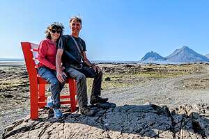
 Djupivogur's Eggin í GleðivíkWe hadn't gotten too far before we came across a rather random bright red chair set atop a rock alongside the road. It is called Roter Stuhl Auf Felsen (Red Chair on a Rock), and, of course, it had to be sat on. There was a very nice view of Eystrahorn (Vestrahorn’s sister mountain) behind us. I wish I knew the story behind this, but thank you to whoever had the foresight to place it in this lovely location.
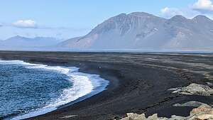
A little further along, we turned off into a pullout for the Hvalnes Lighthouse. From the lighthouse area, we climbed up a small hill and looked down upon a beautiful black sand beach with Eystrahorn (Vestrahorn’s sister mountain) in the background.
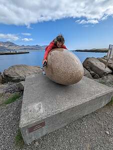 I felt a need to hug oneContinuing on, we stopped at the small village of Djupivogur, which has the oldest port in Iceland, dating back to the 16th century.
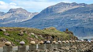
It also had some more contemporary art - 34 over-sized eggs along the jetty. It’s called The Eggs of Merry Bay (Eggin í Gleðivík in Icelandic) and they are a tribute to the 34 native birds of eastern Iceland.
Each stone specimen accurately depicts the shape, patterns, and colors of the individual bird egg it represents. Each egg has a sign giving the bird’s name (both genus and species) in Latin and its common name in Icelandic. Of course, Herb found it necessary to photograph Turdus Iliacus
I couldn’t resist hugging one.
Then it was on to Seyðisfjörður, considered the most beautiful village in Eastern Iceland, for lunch.
Skaftafell - Svartifoss and Skaftafellsjökull
Friday, June 2, 2023 - 4:45pm by Lolo50 miles and 1 hour from our last stop - 1 night stay
Travelogue
 Herb's PylsursAfter leaving Fjaðrárgljúfur Canyon, we drove for about another hour to Skaftafell, where we planned to spend the night.
Skaftafell was once its own National Park, but in 2008 it became part of the larger Vatnajökull National Park. Vatnajökull has a lot of superlatives associated with it: not only is it one of the largest national parks in Europe, but its ice cap (also called Vatnajökull) is the largest ice cap in Europe. It is so large that if covers 11% of the surface area of Iceland - or at least it did before global warming began melting most of the world’s ice caps.
 Heart-shaped SvartifossVatnajökull National Park has several entry points, but Skaftafell is the best place to explore the park from the southern side.
We didn’t know it yet, but the Skaftafell campground would be the nicest one we would stay in during the entire trip. Most of the campgrounds in Iceland are basically grassy areas that you park on with a range of facilities. All have bathrooms and most have showers, but usually not enough for the amount of people camping there.
 SvartifossThis one was in a lovely setting with a gravel area to park in surrounded by a grassy area to sit out in. It also had great facilities (lots of bathrooms and showers, laundry, etc.). However, even more importantly, it was located near the trailhead for the two hikes we planned to do today: Svartifoss (waterfall) and Skaftafellsjökull (glacier), so we didn’t have to move the campers.
Since this was going to be our base camp for the day’s activities, we got there right around lunchtime. We were not particularly creative with our menu when cooking in the van, mostly because we ate out whenever possible.
 Svartifoss close-upHowever, we did find that Herb’s bratwurst (sort of a German Pylsur) and Hilda’s salads were easy and tasty. So that’s what we did.
This was the first day that it was actually warm enough to sit outside in shorts and a t-shirt, definitely not the Iceland we expected. We were very, very lucky with the weather - the forecast had 10 days of sunshine and fairly warm (for Iceland) temperatures in the upper 50s and lower 60s - definitely much better than the cold, rainy weather more typical this time of the year.
 Approaching SkaftafellsjökullAfter lunch and a brief siesta, we set out on a 3-mile hike to Svartifoss, which is Icelandic for “Black Waterfall,” because of its beautiful backdrop of black hexagonal basalt columns.
The water originates from the Svinafellsjokull glacier, also in Vatnajökull National Park, and plunges 80 feet over a cliff into a heart-shaped amphitheater surrounded by tall black basalt columns. These columns were created by lava rapidly cooling and contracting over centuries, typically splitting into six-sided columns.
 SkaftafellsjökullIf you look really close, you can see that the rock faces are marked by narrow horizontal bands. This is due to slow fracturing events as the columns cascade downwards. Bit by bit, the basalt crystals break off and plunge into the river at the base of the falls.
Although not necessarily one of the tallest waterfalls we would see, it certainly is one of the most picturesque, and served as the inspiration for architect Guðjón Samúelsson’s design of Reykjavik’s Hallgrímskirkja, the largest church in Iceland.
After Svartifoss we hiked another 3.5-miles to Skaftafellsjökull, a glacier tongue spurting off from Iceland's largest ice cap, Vatnajökull. Just like “foss” means waterfall in Icelandic, “jökull” means glacier. I had now doubled my Icelandic vocabulary
 Happy HerbIt was massive, despite the fact that over the last decade, Skaftafellsjökull has been receding dramatically, serving as another example of how climate change is steadily affecting the glaciers in Iceland and how stronger environmental policies are needed asap to preserve the world’s glaciers.
Foolishly we thought we would be able to walk on the glacier, not realizing that there would be so much water between our trail and it, because of the great amount of melting occurring. So, we satisfied ourselves by admiring it from afar.
 Happy LoloI became curious as to why the edge of the tongue was so black and dirty looking, so when I got home I tried to find out why.
What I discovered is that a substance called Cryoconite, which is a powdery windblown dust made of a combination of small rock particles, soot and bacteria, gets trapped in holes in the glacier’s surface.
 My wine barWhile many of the materials in cryoconite are natural materials, human activities based on coal use have increased the amount of black soot in cryoconite since the substance was first discovered in 1870, causing glaciers to darken in a phenomenon scientists call “biological darkening.” Besides being aesthetically unpleasing, this darker surface absorbs rather than reflects heat from the sun’s rays, making snow and glaciers melt more quickly.
Skaftafellsjökull was still an overwhelmingly impressive sight to see, so we figured we should enjoy it while we still could. I only hope that it will still be around for my grandchildren (who don’t exist yet) to enjoy in their lifetime.
What an incredible variety of experiences in two short hikes!
 View from our camper at 10 pmWhen we got back to our campsite, it was still a lovely evening, a bit cooler, but still warm enough to sit outside for cocktail hour.
Later on, after everyone had gone to bed, I walked outside our camper and was treated to a splendid display of colors - snow-covered mountains squeezed between blues and the golden light of pre-sunset. It was 10:00 pm, but there was still plenty of light in the land of the Midnight Sun.
Fjaðrárgljúfur Canyon
Friday, June 2, 2023 - 9:30am by Lolo4 miles and 0.25 hours from our last stop
Travelogue
 Fjaðrárgljúfur CanyonAs I mentioned, Herb and I had watched hours of YouTube videos about Iceland while planning our itinerary. I hate to admit that one of those was a Justin Bieber music video where he was prancing around on precarious outcrops over a stunning canyon called Fjaðrárgljúfur.
It popularized that canyon so much and became so overrun with visitors that local authorities closed it to the public to protect the vegetation. In fact, when we looked for directions to it on Google Maps, it still said it was temporarily closed.
Since it was only a 2 mile diversion off the Ring Road, we decided to ignore that, as Google is not invincible, and try going there anyway. Luckily, we did, because there were already plenty of people there.
 Fjaðrárgljúfur CanyonJustin Bieber has good taste. It is an absolutely stunning narrow river canyon, approximately 100 meters tall and 2 km in length running through layers of soft granular rock, with Gothic-like spires and odd geological formations at the top.
It looks like it belongs in the world of Game of Thrones, and for good reason, as dragons fly through it in the Season 8 Trailer.
No dragons or Justin Bieber’s today though - just people like us out enjoying this amazingly beautiful setting.
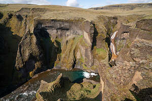 Mögáfoss in Fjaðrárgljúfur CanyonThe only sign that Justin Bieber had been there is that there are now fences along the edge of the canyon preventing us from doing fancy dance moves out on a precarious outcrop
At the head of the canyon we came to the beautiful Mögáfoss (waterfall), where the Möga river meets the Fjaðrá river and cascades down into the canyon.
That was the end of the trail, so we hiked back from whence we came and continued on the Ring Road to Skaftafell National Park, where we planned to spend the night.
Eldhraun Lava Fields
Friday, June 2, 2023 - 8:30am by Lolo10 miles and 0.5 hours from our last stop
Travelogue
 Eldhraun Lava FieldLeaving the town of Vik, we continued east along the southern end of Iceland through an amazing variety of landscapes.
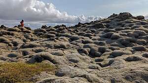
Our first stop of the day was the Eldhraun Lava Fields, right alongside the Ring Road. Covering over 218 square miles, it is the biggest lava field in the world.
.thumbnail.jpg) Eldhraun Lava FieldsThis lava field was created by one of the most violent volcanic eruptions in history, the Lakagígar eruption in the 1700s. This eruption, which lasted from 1783 to 1784, was a cataclysmic event for Iceland, which led to disease, crop failure, and famine. As a result, between 50 and 80% of domestic animals and 20% of the human population perished.
Eldhraun Lava FieldsThis lava field was created by one of the most violent volcanic eruptions in history, the Lakagígar eruption in the 1700s. This eruption, which lasted from 1783 to 1784, was a cataclysmic event for Iceland, which led to disease, crop failure, and famine. As a result, between 50 and 80% of domestic animals and 20% of the human population perished.
The Eldhraun Lava Fields are an example of how plant life begins after a volcanic eruption. At first the lava flow is barren, but then a process of colonization begins, very often, as in this case with mosses. It seemed like a weird juxtaposition, but Iceland does get a lot of rain, so mosses thrive.
.thumbnail.jpg) View from Eldhraun Lava FieldsThe Eldhraun lava field is covered with a special type of moss called woolly fringe moss, a very fragile moss which takes about a hundred years to grow. That is why environmental scientists were so angered by Justin Bieber dancing and trampling the moss here in the filming of his famous music video “I’ll Show You”.
View from Eldhraun Lava FieldsThe Eldhraun lava field is covered with a special type of moss called woolly fringe moss, a very fragile moss which takes about a hundred years to grow. That is why environmental scientists were so angered by Justin Bieber dancing and trampling the moss here in the filming of his famous music video “I’ll Show You”.
The landscape is so otherworldly that NASA astronauts used this lava field to train for the Apollo 11 mission, because they believed that Eldhraun’s landscape and geological conditions would match those of the moon.
The view of the surrounding landscape from the lava fields was lovely and pristine. Hard to believe that this was the site of such a cataclysmic event.
Vik - Dyrhólaey and Reynisfjara Black Sand Beach
Thursday, June 1, 2023 - 6:45pm by Lolo21 miles and 0.5 hours from our last stop - 1 night stay
Travelogue
.thumbnail.jpg) Dyrhólaey promontoryBefore settling down for the night in a campground in the small village of Vik (population 750), we drove out to the end of the Dyrhólaey peninsula, near the southernmost point of Iceland.
Dyrhólaey promontoryBefore settling down for the night in a campground in the small village of Vik (population 750), we drove out to the end of the Dyrhólaey peninsula, near the southernmost point of Iceland.
Until 1918 the Dyrhólaey promontory actually was the southernmost point of mainland Iceland, but then the Katla volcano erupted creating the landmass of Kötlutangi which is now the southernmost point. As we would continue to learn, volcanic activity very much shaped the landscape of Iceland and continues to do so to this day.
.thumbnail.jpg) ArnardrangurThe Dyrhólaey Reserve is split into two sections: Háey (“the high island”) and Lágey (“the low island”) that each offer different views and experiences.
ArnardrangurThe Dyrhólaey Reserve is split into two sections: Háey (“the high island”) and Lágey (“the low island”) that each offer different views and experiences.
The higher area is where the lighthouse is and the best views of the iconic rock arch. Unfortunately, this area is only reached by a rough 4WD or a hike from the lower area.
So instead, we stayed straight at the fork and parked in the lower area parking lot. From there we followed a gravel pathway in the direction of the water for only about 100 feet before reaching the first viewing area, where we looked out over a large volcanic rock, named Arnardrangur, rising from the sand.
.thumbnail.jpg) View from DyrhólaeyDuring low tide you can walk right up to Arnardrangur, but waves were beginning to lap its base and we weren’t sure if the tide was going out or in, so not a good idea for today.
View from DyrhólaeyDuring low tide you can walk right up to Arnardrangur, but waves were beginning to lap its base and we weren’t sure if the tide was going out or in, so not a good idea for today.
From there we continued up a small hill, from which there was a great view of Reynisfjara Black Sand Beach and its iconic basalt sea stacks known as Reynisrangar. These sea stacks were featured in Season 7 of Game of Thrones. More about them a little later.
There was also a beautiful arch made of basalt.
.thumbnail.jpg) Hálsanefshellir Cave on Reynisfjara BeachIt was too windy to walk to the lighthouse, so we drove over to Reynisfjara Black Sand Beach to see the Reynisrangar sea stacks up close. The waves on this beach can be so powerful that they even post warning levels for the day as to how dangerous the waves are. Tourists have actually been swept out to sea. Today was yellow. However, a bigger problem was the wind which was blowing so hard that we were being pelted with the black sand.
Hálsanefshellir Cave on Reynisfjara BeachIt was too windy to walk to the lighthouse, so we drove over to Reynisfjara Black Sand Beach to see the Reynisrangar sea stacks up close. The waves on this beach can be so powerful that they even post warning levels for the day as to how dangerous the waves are. Tourists have actually been swept out to sea. Today was yellow. However, a bigger problem was the wind which was blowing so hard that we were being pelted with the black sand.
I knew about the sea stacks on Reynisfjara Beach, but we were delighted to also find a beautiful basalt cave, known as Hálsanefshellir. This would be the first of many times that we would see basalt columns along our journey. After all, Iceland was created by volcanic activity.
.thumbnail.jpg) Hálsanefshellir CaveOutside the cave, lots of people (half my age) were climbing up and posing on the basalt columns. For some reason, I felt a need to do the same.
Hálsanefshellir CaveOutside the cave, lots of people (half my age) were climbing up and posing on the basalt columns. For some reason, I felt a need to do the same.
A little further down the beach we came close to the two iconic basalt sea stacks known as Reynisrangar.
Since this is Iceland, of course there is a legend explaining their creation. In fact, there are several versions, but all of them involve trolls.
Trolls are very much a part of Icelandic mythology, and many Icelanders still believe in, or at least don’t totally deny, their existence.
.thumbnail.jpg) Climbing the basalt columns of ReynisfjaraOne legend says that the stacks originated when two trolls dragged a three-masted ship to land unsuccessfully and when daylight broke they became needles of rock. Trolls do not do well with sunlight.
Climbing the basalt columns of ReynisfjaraOne legend says that the stacks originated when two trolls dragged a three-masted ship to land unsuccessfully and when daylight broke they became needles of rock. Trolls do not do well with sunlight.
Another more contemporary legend claims that these large basalt columns were once trolls that kidnapped a woman and killed her. The bereaved husband followed the trolls to Reynisfjara where he froze them, turning them into stone.
The wind was getting so bad that we decided to head back to the town of Vik and find the campsite.
.thumbnail.jpg) Reynisrangar iconic basalt sea stacksFrom there we walked to Restaurant Suður-Vík, which had a cozy, pub-like setting with good food. It seemed like there were a lot of locals there, which is always a good sign.
Reynisrangar iconic basalt sea stacksFrom there we walked to Restaurant Suður-Vík, which had a cozy, pub-like setting with good food. It seemed like there were a lot of locals there, which is always a good sign.
After dinner, we decided to walk to the Vík i Myrdal Lutheran Church, which we’ve seen in so many photos, most of them from atop a hill or with a field of lupine in the foreground - neither of which we could find.
We did find the church, however, and it is very beautiful, in a simple way, as most of the older churches in Iceland are.
It sits atop a prominent hill, visible from everywhere in the village, or at least when it’s not as foggy as it was tonight.
.thumbnail.jpg) Vík i Myrdal Lutheran ChurchBesides being a beautiful location for a church, it was placed here for a more ominous reason. The Mýrdalsjökull glacier, which lies on top of the Katla volcano, is directly north of Vik. It last erupted in 1918 and is thought to be overdue for another eruption. If it does, it could melt enough ice to trigger an enormous flash flood, wiping out the entire town. The church is believed to be the only building that could survive such a flood. The people of Vik even hold periodic drills and are trained to rush to the church at the first sign of an eruption.
Vík i Myrdal Lutheran ChurchBesides being a beautiful location for a church, it was placed here for a more ominous reason. The Mýrdalsjökull glacier, which lies on top of the Katla volcano, is directly north of Vik. It last erupted in 1918 and is thought to be overdue for another eruption. If it does, it could melt enough ice to trigger an enormous flash flood, wiping out the entire town. The church is believed to be the only building that could survive such a flood. The people of Vik even hold periodic drills and are trained to rush to the church at the first sign of an eruption.
We tried to take an interesting shortcut back to the campground, which required us to slip and slide a bit down a steep ravine. However, we made it back to our home for the night, tired and happy.
Skogafoss
Thursday, June 1, 2023 - 11:00am by Lolo20 miles and 0.5 hours from our last stop
Travelogue
.thumbnail.jpg) Skogafoss double rainbowContinuing along the Ring Road along the Southern part of Iceland, in less than a half hour we came to another beautiful waterfall called Skogafoss, named after the river that feeds it. By now the crowds from Reykjavik had caught up to us.
Skogafoss double rainbowContinuing along the Ring Road along the Southern part of Iceland, in less than a half hour we came to another beautiful waterfall called Skogafoss, named after the river that feeds it. By now the crowds from Reykjavik had caught up to us.
What we would gradually learn during our travels was that each of the waterfalls we visited was unique and distinct from the others - definitely not a “seen one, seen them all” situation.
Skogafoss is one of the biggest waterfalls in Iceland, with a vertical drop of 60 meters and a width of 25 meters and although we couldn’t walk behind it, like we did at Seljalandsfoss, we could go right up to it and get equally drenched.
.thumbnail.jpg) Lolo and her rainbowThe waterfall kicks off so much spray that when it’s sunny there is almost always a beautiful rainbow, sometimes even a double one. Today, conditions were just right for a double, and I was lucky enough to have one encircle me.
Lolo and her rainbowThe waterfall kicks off so much spray that when it’s sunny there is almost always a beautiful rainbow, sometimes even a double one. Today, conditions were just right for a double, and I was lucky enough to have one encircle me.
As with most things in Iceland, there is a legend about this waterfall. The story goes that around the year 900, a Viking Settler named Þrasi Þórólfsson hid a chest filled with gold and treasures behind Skogafoss and said that the first man who went behind the falls would find great treasures.
.thumbnail.jpg) The path to the topIt was said that in olden times one could see one side of the chest protruding from the waterfall. Many tried to retrieve it but the falls were just too powerful.
The path to the topIt was said that in olden times one could see one side of the chest protruding from the waterfall. Many tried to retrieve it but the falls were just too powerful.
One man almost succeeded by tying a rope to the handle of the chest and pulling. He was only able to obtain the ring of the chest, which is said to now hang from the church door in the small village of Skógar.
As far I know, no one has successfully gone behind the falls, so it must still be there.
.thumbnail.jpg) Cascades above SkogafossNo treasure hunting for us today. Instead we hiked up the 527 steps of the steep path to the right of the waterfalls where we looked down on Skogafoss and its rainbow.
Cascades above SkogafossNo treasure hunting for us today. Instead we hiked up the 527 steps of the steep path to the right of the waterfalls where we looked down on Skogafoss and its rainbow.
The top of the falls is the turning around point for most of the crowd, but we continued on for about a mile along a path that traced the Skoga River, passing several other smaller falls and cascades along the way.
The trail continued on for many more miles, passing as many as 30 small waterfalls, but we had lots of things to see and do today, so we turned around and headed back from whence we came.
Seljalandsfoss
Thursday, June 1, 2023 - 9:00am by Lolo80 miles and 1.75 hours from our last stop
Travelogue
.thumbnail.jpg) Seljandafoss before the crowdsReykjavik had been great, but we were anxious to set out on our journey along the Ring Road. We decided to go in a counter-clockwise direction, which meant we would be doing the highly touristed sections along the Southern Coast first before getting to the quieter and more remote Eastern, Northern, and Western sections of the island.
Seljandafoss before the crowdsReykjavik had been great, but we were anxious to set out on our journey along the Ring Road. We decided to go in a counter-clockwise direction, which meant we would be doing the highly touristed sections along the Southern Coast first before getting to the quieter and more remote Eastern, Northern, and Western sections of the island.
.thumbnail.jpg) SeljandafossSo today, we would see two beautiful waterfalls and a lovely black sand beach with basalt columns and sea stacks off the coast before settling in for the night in a campground in Vik, the southernmost village in Iceland
SeljandafossSo today, we would see two beautiful waterfalls and a lovely black sand beach with basalt columns and sea stacks off the coast before settling in for the night in a campground in Vik, the southernmost village in Iceland
Our first stop along the Ring Road was Seljalandsfoss, just 1 hour and 40 minutes from Reykjavik, so you have to get here early to beat the tour buses. As you can see from me being the only one on the trail, our 9:00 arrival was good enough to get the falls to ourselves, if only for a brief period.
The most distinguishing feature of Seljalandsfoss is a pathway that stretches from the front of the waterfall around to the back, where there is a cave-like rocky overhang where you can see through the falls.
 Behind the fallsIt’s very wet back there, but fortunately we had on rain pants and rain jackets. I, however, had no protection for my phone, so I had to let Herb be in charge of behind the waterfall photos.
The source of this lovely waterfall is the river Seljalandsá, which has its origins underneath the glacier Eyjafjallajökull. This is the glacier that erupted in 2010, sending a plume of volcanic ash over 9 km into the sky, disrupting air travel across all of Western Europe for almost a month. Volcanic activity is a real thing in Iceland, sort of like hurricanes are in Florida, and wildfires in California, a natural disaster that people have learned to live with.
Another interesting fact is that the tall cliff that the waterfalls flows over once marked the country's coastline. The sea is now located across a stretch of lowlands visible from the waterfall.
So, we learned our first Icelandic word today: "foss," which means waterfall, and there are over 10,000 fosses in Iceland. With a population of only 372,000 people that means there is a waterfall for every 37 people. Imagine that in the U.S.
Oh, and one last fun fact. This waterfall, along with a multitude of South Iceland’s most famous natural attractions, can be seen in Justin Bieber’s music video for his song ‘I’ll Show You’.
Next stop - Skogafoss.
Reykjavik
Tuesday, May 30, 2023 - 8:45am by Lolo50 miles and 0.75 hours from our last stop - 2 night stay
Travelogue
Day 1 - Arrival, Laugardalslaug, and getting an overview of the city
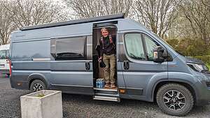 Our home for the next 2 weeksAfter arriving on a red-eye at 8:00 am Iceland time, we stopped in the duty-free store to buy wine and vodka, saving us about 30% on what we would have to pay for it in a liquor store. Liquor is very expensive in Iceland.
We then got a cab, which brought us the short 4 miles to McRent to pick up our camper van, where we were given an-hour long instruction on both the van and what to expect in Iceland. It was the same model that we rented for our travels through Spain in 2019 and the Alps in 2017, so we were very familiar and comfortable with it, but I can imagine that there are a lot of mishaps with first timers.
For us, this van was the perfect size - not too big for the narrow streets of Europe, but big enough to be comfortable in and not want to strangle each other. I highly recommend camping as a means to explore Iceland and immerse oneself in the landscape, culture, and local people of a country.
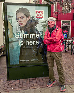 Herb's feelings about Iceland's weatherOne thing we did learn from our briefing though was that Iceland can get very, very windy, especially along the West, so much so that they told us they would text us when it got bad enough for us to stop our driving for the day, or at least slow it down to under 20 mph. We did get a few texts from them, but fortunately we were not in the high wind areas at the time.
Before driving to our campground in Reykjavik, we stopped at a Bonus grocery store (which is the biggest supermarket chain in Iceland) to stock up on supplies for the trip. It’s always difficult food shopping in a new country for the first time, as the food choices can be quite different and nothing is where you expect it to be. However, the employees were extremely helpful.
Then it was directly to our campground in Reykjavik for a well-needed nap.
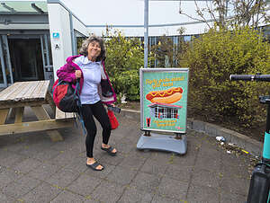 Iceland, the land of delicious Pylsurs (hot dogs)Reykjavik is where most people start their Iceland vacations, so it was a very well-equipped campground with ample restrooms and showers, a nice cooking and dining facility, and electric hookups.
It was also right next door to Reykjavik’s Laugardalslaug, the town’s public thermal baths and swimming pool complex. Every Icelandic town and village has a pool. I think it’s important for the residents because it is often very cold and rainy here and in the winter there is very little daylight. Plus, the endless geothermal energy makes it possible to provide hot water at little to no expense. Unfortunately, we didn't think photos were allowed in the pool, so we have no pictures.
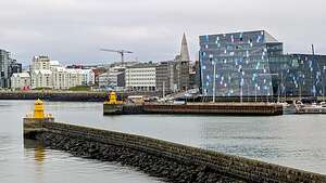 The Harpa Concert Hall from the Old PierThe thermal bath is an Icelandic norm that can be traced back to the early years in Iceland. Icelanders are very passionate about their pools and their hygiene in the pool. Therefore, they have very strict rules before you can step foot in them.
Step #1: Take your shoes off before entering the dressing room and either leave them out front or put them in a locker.
This is where I made my first mistake by trying to shove my entire backpack into what was only meant to be a shoe locker. It locked when I closed it, but when I tried to re-open it to get my bathing suit out, my wristband didn’t work. A very lovely Icelandic woman informed me that I had a blue wristband, which was for lockers in the dressing room, while the shoe locker required a black band to open it. I must have looked really upset, because she volunteered to run to the front desk for me and get a black wristband. I thanked her profusely and told her if she was ever in San Francisco and did something really stupid, I would be happy to help her out.
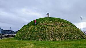 The Þúfa (th-oo-fha)I wasn’t even up to the difficult part of the process yet, and I had already messed up.
Step #2: Get undressed in the dressing area and lock your clothes and belongings in your locker. Take your bathing suit, towel, and shampoo with you (this is a naked shower), and wash every body part with soap before putting your bathing suit on.
Okay, I almost handled this one, but realized I left my bathing suit in the locker
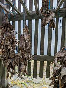 Little hut with dried fish (harðfiskur)Rule #3: Don’t even think about stepping back into the locker room if you are wet, because this will make the floor slippery and upset the locals. Since I had left my bathing suit in my locker, I had to totally dry myself with my little microfiber towel, which took another 5 minutes or so. By now, I was sure Herb was wondering what the heck happened to me.
Finally, I joined a perplexed-looking Herb in one of the hot tubs. “Don’t ask,” I told him.
Rule #4: Don’t pee in the pool
Okay, I got this one.
By the time we got back to the campground, our friends Hilda and Paul had arrived in their camper. Also, Herb has an Icelandic college buddy (John) that spends his summers in Reykjavik, so he came over to the campground as well.
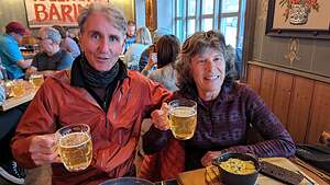 Enjoying Íslenski BarinnJohn offered to drive us around Reykjavik in his car to give us an overview of the city and then grab dinner in town.
We got the lay of the land on our drive with him, which made our self-guided walking tour the next day much better.
While most of our time was spent in the car, we did get out at the end of the Old Harbor pier to see one of Iceland’s largest artworks called the Þúfa (th-oo-fha). Created by artist Ólöf Nordal in 2013, it is a large grassy mound constructed out of 4,500 tons of gravel, with a winding path circling it all the way to the top and a tiny wooden hut on top.
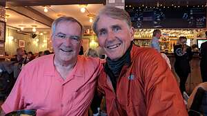 Herb and his Icelandic college buddy JohnAfter making our way to the top, we peeked inside the little hut, where we saw dried fish (harðfiskur) hanging. Hardfiskur has been a very popular and healthy snack with Icelanders for centuries. It's full of protein and nutrients.
Afterwards, John brought us to one of his favorite restaurants, Íslenski Barinn, a cozy yet lively pub-like setting serving traditional Icelandic food. I was surprised to see puffin on the menu as an appetizer. I very much wanted to see puffins this trip, but not on a crumpet.
As per John’s recommendation, I had the GRATINERAÐUR PLOKKFISKUR (Traditional gratinated fish pie) with cheese, onion, Béarnaise sauce, rye bread & butter.
Herb, the less adventurous eater, had his go to fish and chips. We both thoroughly enjoyed our dinners.
Day 2 - Exploring the city on foot
We had set aside the whole next day to do a self-guided walk of the city. Reykjavik is a beautiful city - clean, safe, and renowned for its culture, history, and natural beauty. There are tons of excellent restaurants serving fresh lamb and seafood, a dozen museums, galleries, and cafes. And you can see an awful lot in a 6.5-mile walk.
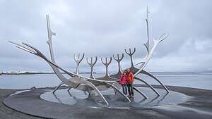
While strolling to town along the Sculpture and Shore walk from our campsite, we came to Reykjavik’s famous gleaming steel “Sun Voyager” sculpture, which resembles a Viking long-ship. Vikings, as well as trolls, are a very big part of Iceland’s history and mythology and we would be encountering them (or references to them) all along our journey.
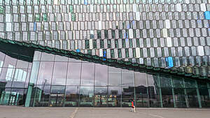 Harpa Concert CenterWe continued on to the beautiful Harpa Concert Hall, home to the Iceland Symphony Orchestra, Icelandic Opera and Reykjavík Big Band, which hold regular concerts throughout the year.
Harpa was designed by the Danish firm Henning Larsen Architects in co-operation with Danish-Icelandic artist Olafur Eliasson. The structure consists of a steel framework clad with geometric shaped glass panels of different colors, made to look like the crystalline basalt columns commonly found throughout Iceland.
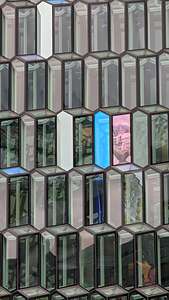 Glass panels of the Harpa CenterThe facade is constantly changing, depending on how the light hits the panels. Reflections of the city and the harbor also often appear and disappear with the light.
Reykjavik has 11 museums devoted to history, art, culture, and Vikings, but for some reason we wound up at the Icelandic Phallological Museum. I don’t know how that could have happened. In all fairness, it is the 2nd most popular museum in the city.
Wow! A whole museum devoted to the study and appreciation of mammalian penises. I have no comment.
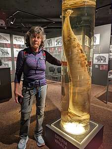 Lolo enjoying the Phallological MuseumThe museum, which is also commonly called the Penis Museum for obvious reasons, began as a private collection in 1974 of a man named Sigurdur Hjartson who taught at a school near a whaling station in West Iceland and always seemed to be coming across maritime penises. As a joke, his friends at the station started giving him more. By 1997, when his collection reached an impressive 62 specimens, the Icelandic parliament gave him a grant to establish a public display. What a country!
Today, there are over 300 penises from almost all land and sea mammals in Iceland, from a tiny hamster member to a 6-foot-long specimen from a sperm whale.
It’s definitely not just about giggling at penis jokes (although we did have our fair share of that), but actually a serious science museum whose mission is to advance the “ancient science” of Phallology, which examines how male genitalia have influenced history, art, psychology, and literature.
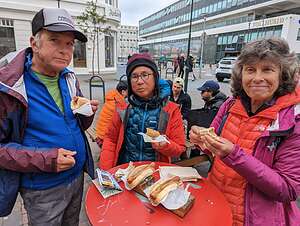 Enjoying a wiener at Bæjarins Beztu PylsurIn addition to the approximately 300 penis specimens on display, there are also historical artifacts, oddities, and artwork. I went there expecting just to giggle, but I actually learned a lot.
Continuing with the wiener theme, we decided to have our first Icelandic Pylsur (hot dog) at Bæjarins Beztu Pylsur, made famous when BIll Clinton had a Pylsur here in 2004. You can’t make this stuff up.
An Icelandic Pylsur is no ordinary hot dog. They are made mostly from Icelandic lamb, along with pork and beef. And not just any lamb, but organic, free range, grass fed, and hormone free. Before becoming a hot dog, these sheep literally roamed the countryside munching on berries and leaves. They pretty much have a better life than us; that is, until they don’t and find themselves in a bun with fried onions, ketchup, mustard, and remoulade.
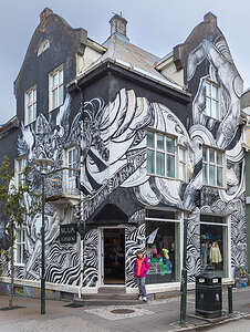 Icelandic Street ArtMoving on from wieners, we continued our walk down Laugavegur Street, Reykjavik’s main shopping area with plenty of trendy restaurants, bars, and shops for high-end Icelandic designs and fun souvenirs
It also was a great place to see some examples of Icelandic street art. Because of its relative isolation, street art was slow to come to Iceland, but it has certainly made up for lost time. Starting in the 1990s, artists began covering city buildings, walls, and alleyways with amazing works of art. Many of them can be seen along Laugavegur, the main shopping street.
 Rainbow StreetMy favorite was one called “Ode to Mother,” which totally covered the surface of a shop on Laugavegur 23. Although I would like to pretend that my sons painted this in my honor, this mural was actually painted by Belgian street artist Cara To and inspired by a song of the same name by the Icelandic band Yija.
Another interesting one, also on Laugavegur, was inspired by a famous medieval Icelandic saga called Laxdœla Saga, which means that the monster in the mural isn’t a vampire at all; it’s a kind of Icelandic undead creature called a draugur that sucks the will out of its victims.
Hmm..sounds like the dementors in Harry Potter to me.
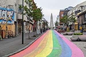
We continued on to Skolavordustigur, another one of the main streets in downtown Reykjavík, famous for the fact that it has been dressed up in the colors of the rainbow to celebrate Reykjavík Pride. It is a symbol of the Icelandic people's joy and support for diversity.
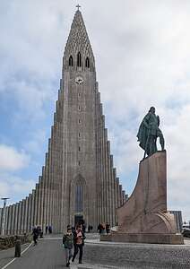 HallgrimskirkjaIt leads to the beautiful Hallgrimskirkja Lutheran Church, Iceland’s tallest church. Its beautiful exterior was designed to look like basalt columns to reflect Iceland’s volcanic origins. It really did look like many of the basalt cliffs we would see later in our journey.
The statue on the right is Leifur Eiríksson, the best known hero of Viking age and the first European to arrive in America.
We took an elevator to the top of Hallgrimskirkja’s 75-meter tower where there were panoramic views of the city. In the upper right, is the Harpa Concert Center with the Þúfa hill behind it.
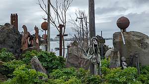 Reykjavik's Recycled HouseOn our way back to the campground along the Sculpture walk, we decided to continue a bit further, eventually coming to an inviting narrow dirt pathway to what turned out to be one of Reykjavik’s hidden gems - the Recycled House, probably the most unusual site in the entire city.
As we stepped onto the premises , we were greeted by creepy figures in the tall grass.
Once we passed the guardian bogeymen, we came to the Recycled House. It was created by the locally renowned filmmaker Hrafn Gunnlaugsson, who initially purchased the house while he was looking for a workplace to create props for his Viking movies, but later transformed it into an unconventional medley of scrapped metal, timber, and other materials, all of which were incorporated as part of his now redesigned home.
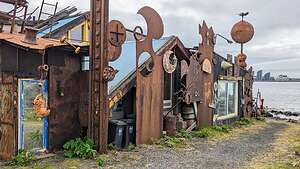 The Recycled HouseOriginally, every metal sheet that was incorporated into the house featured a lustrous hue. However, following an extended period of time where the building was completely exposed to the elements, exceedingly so due to its proximity to the ocean, most of the metallic color was replaced by orange rust which in turn became the place’s most prominent characteristic.
Despite the house’s iconic and unusual appearance, the city council of Reykjavik didn’t embrace Gunnlaugsson’s creativity at all, treating his residence as an eye sore that needed to be removed.
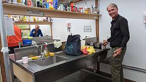 Dinner in the Campground Cooking FacilityGunnlaugsson still lives in this house that he worked so hard to create. I only realized afterwards that he is actually sitting in a chair huddled in the doorway.
I am so glad we stumbled on this hidden gem.
That night, back at the Reykjavik Campground, we decided to use the cooking facility to make dinner. It was quite fun, mingling with the other campers, each of us struggling to get the burners started. It seemed like everyone else there was half our age. Traveling in a camper van around the country definitely seems to be something done by millennials and not seniors. I’d like to think that we are as hardy and adventurous as millennials.
Mosquera Island
Monday, March 27, 2023 - 1:15pm by Lolo0 miles and 0 hours from our last stop - 1 night stay
Travelogue
 Pre-dawn landing on Mosquera IslandThis was our last morning waking up on the boat. It felt weird to think it was over. We had gotten so used to our routine and the wonderful people we were spending time with.
However, we had one more fun stop before getting to the airport on Baltra Island.
While it was still dark, we loaded up on the pangas for a wet landing on tiny Mosquera Island, so small that I almost couldn’t find it on the map.
 Here comes the sunIt’s located between Baltra (where we would fly out of) and North Seymour Island, which we had visited on our first night arriving in the Galapagos. We had seen and experienced so much over the last 10 days, that that felt like months ago.
It’s basically just a long, narrow sand spit with a large population of sea lions, plus some marine iguanas and Sally Lightfoots.
 Hey buddyAfter a wet landing, they let us loose to run free on the beach. We looked as excited as kindergartners being let out for recess.
The sun hadn’t even come up yet when we arrived, so we got to watch the animals wake up as well, many of the sea lions looking pretty sleepy. I could relate.
 Warming up with the sunWe saw our old friends, the marine iguanas, draping themselves over a beautiful white rock, trying to catch the first morning rays to warm up their cold-blooded bodies. Their black against the brilliant while of the rocks made for a nice contrast in the early morning light.
 Sally LightfootWe too stood on the shoreline watching the sun make its first appearance above the horizon. Herb captured it rising between my outstretched legs as if I was some sun goddess willing it to rise.
The sea lions were very cute, playful, and friendly, some of them even coming up and touching us - not the aggressive male bulls, but the cute little ones. They rolled in the sand, played in the surf, and even posed for us.
 Well-timed rainbowThe Sally Lightfood crabs were out and about, busy scurrying around the shoreline. Two of them looked like Sumo wrestlers about to do battle. I saw my first one running down a hill - he looked quite different from his more dignified stationary pose.
We even saw some spotted stingrays swimming along the shoreline.
When the time to leave approached, a beautiful rainbow crossed the sky over the sea - a magical ending to a magical vacation.
Recap of wildlife we saw today: sea lions, marine iguanas, Sally Lightfoot crabs
San Cristobal Island
Sunday, March 26, 2023 - 10:00pm by Lolo0 miles and 0 hours from our last stop - 1 night stay
Travelogue
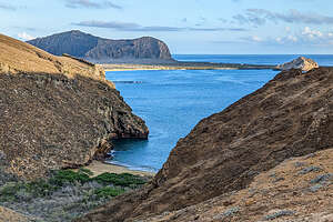 Hike up Punta PittThis was it. Our last full day in the Galapagos. Tomorrow we fly back to Quito and then home. It seemed like we had been here for a very long time, but still I didn’t want it to end.
While we slept, our trusty captain moved us from Espanola to San Cristobal, the easternmost island in the archipelago and also the provincial capital. It was the site of the first human settlement in the Galapagos and the first island Charles Darwin visited in 1835.
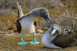 Blue-footed boobiesThe island was formed by four large shield volcanoes fused together by successive lava flows to form a single island.
We began our day with an early morning wet landing on Punta Pitt, a volcanic tuff formation that serves as a nesting site for many sea birds - all three types of boobies, both types of frigatebirds, swallow-tailed gulls, and storm petrels.
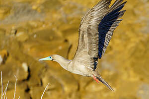 Red-footed booby in flightFrom the beach, it’s a fairly strenuous hike uphill (two hours round trip) to the top of tuff, where it flattens out into a beautiful landscape of tuff cones, colorful vegetation, panoramic views of the sea, and seabirds everywhere.
There were lovely views along the way and once on top the red vegetation and rocky cliffs over the sea were stunning.
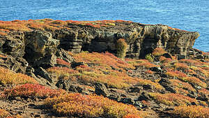 View from top of Punta PittIt is the only site in the Galapagos where you can see all three species of boobies (blue-footed, red-footed, and Nazca) and two species of frigatebirds (Magnificent and Great) nesting in the same area.
Since the boobies have very different nesting preferences - red-footed boobies nest in the bushes, Nazca boobies nest in the cliffs, and the blue-footed boobies in the middle of the trails - you won’t find them next to each other.
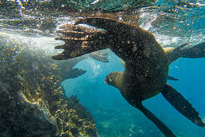 Snorkeling with the sea lionsAlso, since there is no competition between them for food, they get along just fine when they do meet, because they don’t have to compete to survive.
We came across our old friends (and my personal favorite), the blue-footed boobies, playfully, dancing, flirting, and nesting right in our path.
 View of Kicker Rock from Cerro Brujo BeachThey have such personality and attitude that it’s hard not to anthropomorphize and think you know what they are thinking.
The red-footed boobies were much harder to find, because they nest in the bushes, and there is inevitably a branch or more blocking their cute little faces. Or, they were flying through the air, just close enough that we could detect their red feet.
 Cueva del BrujoWe found two out of the three species of boobies - the Nazca boobies were nowhere to be found. They build their nests in cliffs, so I have a feeling they were down near the beautiful volcanic cliffs overlooking the sea.
It was a lovely hike, one of the nicest we had done this trip.
Back on the Tip Top IV, we switched gears, donned our wetsuits and headed out on the pangas to hopefully snorkel with the sea lions, as Tui and Monica thought was a strong possibility.
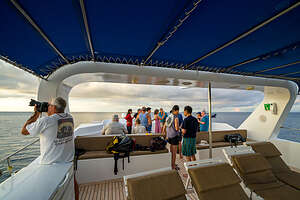 Farewell Party on the upper deckBoy, were they right. We spent an hour with literally dozens of sea lions doing acrobatics in the water, zipping between our legs, swimming upside down, and so many other entertaining things. It was crazy and so exhilarating!
Later that afternoon we went for a panga ride to Cerro Brujo, a beautiful white coral sand beach and lagoon. It was one of the first sites visited by Charles Darwin in the 1830s.
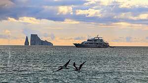
From the beach, we had our first view of Kicker Rock, one of the Galapagos’s most iconic landmarks, and one of the things I most wanted to see. It is the remnants of a vertical tuff cone formation that rises 500 feet above the ocean. It is striking.
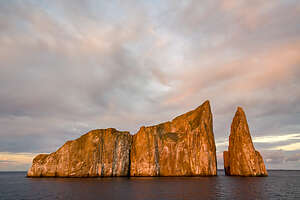 Circling Kicker RockThe sheer walled volcanic tuff cone has been eroded in half with a narrow channel in between, giving it its characteristic shape of a sleeping Lion (Leon Dormido).
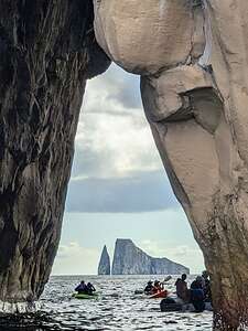
After strolling the beach for a while, we went back out in kayaks and the pangas to Cueva del Brujo, an arch through which there is a great view of Kicker Rock.
We also cruised into an inlet that ended with cliffs hundreds of feet high surrounding us on three sides.
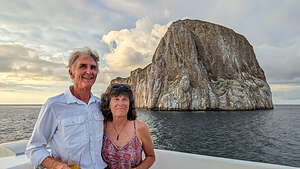 Happy CoupleIt was quite the day, but it wasn’t over yet. Tonight was the big farewell party back on the ship. Tui surprised us with a bottle of rum and some guava juice, which we thoroughly enjoyed on the upper deck, while the ship slowly circled Kicker Rock as the sun went down.
It was probably one of the most amazing sunsets of an entire trip full of amazing sunsets. The sky went from yellow and reds, to bright red, to orange all in a span of 45 minutes.
We laughed, we hugged, we took photos of each other. We had become quite the family over the last 10 days.
It was going to be tough going home tomorrow.
Recap of wildlife we saw today: Blue-footed boobies, red-footed boobies, sea lions

