- Home
- About
- Map
- Trips
- Bringing Boat West
- Migration West
- Solo Motorcycle Ride
- Final Family XC Trip
- Colorado Rockies
- Graduates' XC Trip
- Yosemite & Nevada
- Colorado & Utah
- Best of Utah
- Southern Loop
- Pacific Northwest
- Northern Loop
- Los Angeles to NYC
- East Coast Trips
- Martha's Vineyard
- 1 Week in Quebec
- Southeast Coast
- NH Backpacking
- Martha's Vineyard
- Canadian Maritimes
- Ocracoke Island
- Edisto Island
- First Landing '02
- Hunting Island '02
- Stowe in Winter
- Hunting Island '01
- Lake Placid
- Chesapeake
- Provincetown
- Hunting Island '00
- Acadia in Winter
- Boston Suburbs
- Niagara Falls
- First Landing '99
- Cape Hatteras
- West Coast Trips
- Burning Man
- Utah Off-Roading
- Maui
- Mojave 4WD Course
- Colorado River Rafting
- Bishop & Death Valley
- Kauai
- Yosemite Fall
- Utah Off-Road
- Lost Coast
- Yosemite Valley
- Arizona and New Mexico
- Pescadero & Capitola
- Bishop & Death Valley
- San Diego, Anza Borrego, Joshua Tree
- Carmel
- Death Valley in Fall
- Yosemite in the Fall
- Pacific Northwest
- Utah Off-Roading
- Southern CA Deserts
- Yosemite & Covid
- Lake Powell Covid
- Eastern Sierra & Covid
- Bishop & Death Valley
- Central & SE Oregon
- Mojave Road
- Eastern Sierra
- Trinity Alps
- Tuolumne Meadows
- Lake Powell Boating
- Eastern Sierra
- Yosemite Winter
- Hawaii
- 4WD Eastern Sierra
- 4WD Death Valley +
- Southern CA Deserts
- Christmas in Tahoe
- Yosemite & Pinnacles
- Totality
- Yosemite & Sierra
- Yosemite Christmas
- Yosemite, San Diego
- Yosemite & North CA
- Seattle to Sierra
- Southwest Deserts
- Yosemite & Sierra
- Pacific Northwest
- Yosemite & South CA
- Pacific Northwest
- Northern California
- Southern Alaska
- Vancouver Island
- International Trips
- Index
- Tips
- Books
- Photos/Videos
- Search
- Contact
Kuyima Eco Tour Whale Watching Camp
Friday, February 22, 2019 - 10:30am by Lolo280 miles and 6.5 hours from our last stop - 1 night stay
Travelogue
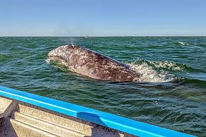 Close encounter with a gray whaleWhale watching was the major reason for us coming to Baja in the first place, and if we could actually experience these impressive mammals up close, then we would consider the trip a success. They did not disappoint.
Baja is the place to go if you want to see gray whales, as they spend their winters there (usually from January to April) after making their long 7,000 mile journey south from the cold waters of Alaska. Tourists from around the world flock to Baja during these 4 months to see these massive, gentle animals that weigh up to 50 tons and are nearly 15 meters long.
There are three major places in Baja that they migrate to: Ojo de Liebre in Guerrero Negro, Laguna San Ignacio, and Bahia Magdalena. The shallow and protected waters of these bays are perfect for birthing and nursing calves.
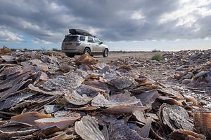 Pile of shells on road to Kuyima Eco Tour campEach of these areas offer whale-watching experiences, where you can see them spout, breach, and spyhop (vertically poking its head out of water to take a look around). Unlike other whale-watching destinations, the gray whales of Baja actually seek out human contact and will often come right up to the boats, allowing themselves to be touched.
We chose Laguna San Ignacio, because it is regarded as the best place to experience a close-up encounter with the whales. The Laguna, which is located 33 miles southwest of the town of San Ignacio, has several eco tour operators offering whale-watching excursions - from single day 3-hour trips to 3-4 day packages where you stay in a cabana and go out each day. There are also options to camp, either with your own equipment or theirs.
Before leaving home, we had reserved two nights of camping, with our own equipment, and a 3-hour whale watching excursion with Kuyima Eco Tours. It cost us in U.S. dollars, $50 per person for the whale watching boat tour and $7 per night for camping - a bargain considering the experience is truly priceless.
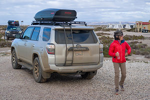 A bit windy at the Kuyima Eco Tour campWhen we arrived in the town of San Ignacio, we stopped in the Kuyima office to confirm our reservation. From there, we drove the 33 mile road out to the lagoon. The road is paved the first 27 miles, and the remaining 6 miles of dirt road were easily navigable.
Upon arrival we were greeted by a very friendly, English-speaking staff member named Adriana, who showed us our campsite and explained the facilities, which consisted of environmentally-friendly toilets, sun-heated freshwater showers, drinkable water for cooking and washing, and a dining palapa offering reasonably-priced meals.
The weather was windy and freezing, so we put on every bit of warm clothing we had packed. There would be no sun-heated shower for us tonight.
The campsite location was lovely, set atop a small bluff overlooking the lagoon and the pangas we would be going out in tomorrow morning. We got out our chairs and a glass of wine and watched the changing light of a beautiful sunset over the lagoon.
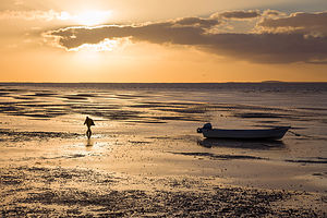 Low tide in Laguna San IgnacioWhen it got dark, we took out our cooking gear and made our standard backpacking feast - Idahoan powdered potatoes and two pouches of Starkist lemon chicken, which is surprisingly tasty and much better than the freeze-dried commercial stuff.
Adriana came around to our campsite to tell us that our whale-watching tour was moved up from 10 am to 8 am to try to beat the strong winds that were forecasted tomorrow. I really hoped this would come off, as seeing the whales was the main reason we had driven 1,200 miles to this lagoon.
Because of the strong winds, we decided to sleep in the back of the 4Runner rather than set up a tent. Herb had built a nice sleeping platform in the back for just these types of occasions. My main problem with the platform is that there is only about a 6 inch clearance above my face when I am lying down, making me feel a bit claustrophobic, but it’s fine as long as I don’t think about it too much.
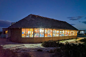 Campers gathered for dinner in cozy palapaWe actually slept quite well and woke up to a sunny, but chilly morning. The winds weren’t too bad yet, so we were hopeful. Our camping neighbors came over to say hi. They were a couple from San Diego that absolutely loved Baja and came down every year to spend several weeks. Their knowledge of the peninsula was invaluable, so we planned to get together after the boat tour so that they could mark up our Baja maps with places to see.
It was really cold, so we basically put everything we had on. I had five layers on top, the last three being a winter jacket, another down winter jacket, and a rain jacket to protect my down jacket from water. Long johns beneath long plants, gloves, and water shoes completed my outfit. Meanwhile, I had packed mostly sundresses and shorts for this trip, which I feared would never see the light of day.
We gathered near the pangas where we were given our life jackets and instructions as to where we could and couldn’t touch the whales, if the opportunity to do so arose. They also explained that whale watching in Baja is highly regulated, so our time in the section of the lagoon where the whales hung out was limited to 90 minutes, so that each eco tour operator would have their chance.
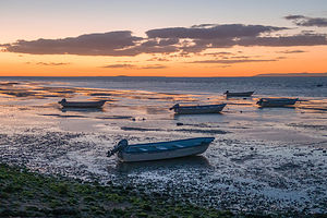 Our ride for tomorrows whale-watching tourSince we were going out in low tide, we had to wade out to and climb into the pangas. I felt pretty smug that I had brought water shoes, while most people had to take off their sneakers, but not so much so after I realized that I had worn small socks, which became and remained totally drenched during the entire trip.
Although the pangas could accommodate 8, we were fortunate to have only 6 people, plus Max, our captain. We moored out towards the opening of the lagoon, where the 120 or so gray whale inhabitants like to hang out. When we got there, Max just idled the engine and we waited.
It wasn’t long before we saw our first whale breach in the distance. Excitedly, everyone said “There’s one,” and pointed. Then another one and another one appeared, and soon they were so common that no one felt the need to announce them. Mostly they breached, sometimes flipping their tail in the air, but sometimes they spyhopped, which meant vertically poking their heads out of water to take a look around.
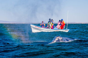 Rainbow whale spoutThey were really difficult to photograph because everything happened so quickly. Although many came within a few feet of the boat, we were never able to actually touch one, but that didn’t really diminish this amazing experience.
Our 90 allotted minutes in the whale watching zone went by so quickly, and we were so mesmerized with watching the whales that we didn’t notice that indeed the wind had picked up and there were now whitecaps in the lagoon. However, Captain Max got his 6 very satisfied passengers back to camp safe and almost dry. Everyone was exuberant about what they had experienced.
Back at camp, we had to decide what to do next. It was not even noon yet, and the winds were going to just get stronger and stronger as the day went on. Since we were not going out on another tour tomorrow, we decided to not camp that night, but to move on, as there were so many places we wanted to still see.
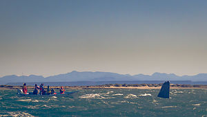 Spyhopping in the Lagunaefore leaving, however, we had a cup of coffee with John and Mary, our Baja expert neighbors, in the cozy and warm palapa where we spent an hour marking up our Baja maps with places they recommended to see, including many off-road adventures.
We said our goodbyes and headed back along the road to the lovely town of San Ignacio, where we thought we might spend the night. Realizing Kuyima had only charged us for the deposit, we stopped in the office near the plaza to pay the balance - quite trusting on their part.
We spent some time wandering around the square, where there is a beautiful mission and picturesque examples of colonial architecture. This was by far, the nicest town we had seen yet. What we were to continue to learn is that the towns in Baja Sur were much better kept, preserved, and attractive than in the north, perhaps because of (or the result of) the influx of tourists.
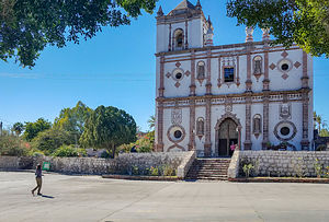 Mision San IgnacioAlthough spending the night in San Ignacio would have been fun, our time in Baja was limited, and we had so much we wanted to see. So we decided to drive on for a few hours, trying to stop for the night at Eco Tour Las Tres Virgenes (with the virgins being three stunning dormant volcanoes).
Description
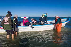 Boarding our pangaEvery October, gray whales begin their 7,000-mile migration from the cold waters of the Alaskan seas to the warm lagoons of Baja California Sur, where they mate and give birth to their calves. The journey, which takes them two to three months, is the longest annual migration of any mammal.
Arriving in January, they remain until about April before returning north. During those four months, tourists from around the world flock to Baja to see these massive, gentle animals that weigh up to 50 tons and are nearly 15 meters long.
There are three major places in Baja that they migrate to: Ojo de Liebre in Guerrero Negro, Laguna San Ignacio, and Bahia Magdalena. The shallow and protected waters of these bays are perfect for birthing and nursing calves.
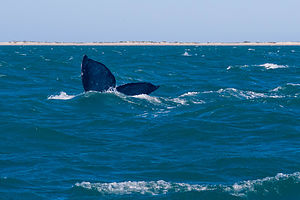 Whale tailEach of these areas offer whale-watching experiences, where you can see them spout, breach, and spyhop (vertically poking its head out of water to take a look around). Unlike other whale-watching destinations, the gray whales of Baja actually seek out human contact and will often come right up to the boats, allowing themselves to be touched.
Whale watching in Baja is highly regulated and the number of boats allowed in the lagoons at one time is tightly controlled. Guides take out groups of 6-8 people at a time in small, very seaworthy, fishing boats called pangas.
Laguna San Ignacio is regarded as the best place to experience a close-up encounter with the whales. The Laguna, which is located 33 miles southwest of the town of San Ignacio, has several eco tour operators offering whale-watching excursions - from single day 3-hour trips, to 3-4 day packages where you stay in a cabana and go out each day. There are also options to camp, either with your own equipment or theirs.
It is an experience not to be missed.
Catavina
Thursday, February 21, 2019 - 12:30pm by Lolo106 miles and 2.5 hours from our last stop - 1 night stay
Travelogue
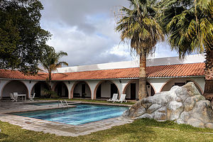 Hotel Mision CatavinaAfter leaving San Quintin, we had intended to stop at “La Lobera,” a sea lion sanctuary about a half hour south. However, the rains had made the 3-mile dirt access road to the sanctuary a muddy mess. The deep tire tracks, which showed vehicles turning around, made us decide not to take the chance. Besides, we had already seen so many sea lions in La Jolla. Still, it would have been nice to see.
Continuing on, we stopped to get gas in the small village of El Rosario, the last gas until Jesus Maria, 360 km south. Every guidebook insists the necessity of doing this. It was also our first mercado (market) stop. Like most roadside stores in northern Baja after the rains, the parking lot was a muddy mess. However, since I had not allowed Herb to bring more than the allowable beer across the border (rules are rules), he was going to get a 12-pack of Tecate no matter what it took.
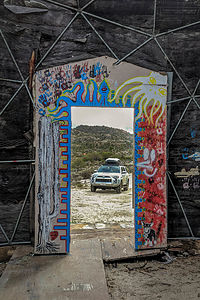 Looking out from the old Catavina cave painting museumThere wasn’t much on the narrow, winding road between El Rosario and Catavina - just llanta (tire) shops, cacti, junk yards, cow crossing signs, more cacti, billboards no longer advertising anything, and dilapidated buildings covered in graffiti. Throughout the drive, on any surface that could be written on were the words “Morena, La Esperanza de Mexico” (The Hope of Mexico), which I assumed to be a politician running for office. One more thing about the cow crossing signs. Everyone of them had the cows wearing shiny red shoes. I have no idea why, even after googling it.
As we approached Catavina, the road led us through beautiful boulder fields, sprinkled with cacti and other desert plants, another example of the natural beauty to be found in Baja.
As we entered town there were a couple of pickup trucks selling gas out of tanks in the back of their trucks to those foolhardy enough not to have gassed up in El Rosario (in the north) or Jesus Maria (in the south).
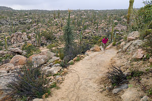 Hiking up to the Catavina cave paintingsRather than stop to see the cave paintings, we decided to check into our hotel first. I had reserved a room at the Hotel Mision Catavina, owned by the same people that owned the Hotel Mision Santa Maria in San Quintin.
Like the Mision Santa Maria, the hotel was lovely - nice updated rooms, a courtyard with a fountain, and a nice restaurant. In addition, this hotel had a courtyard pool, but unfortunately the weather was much too cold to enjoy it. At $85 American dollars a night, it was a bit pricier than its sister hotel, but it was the only game in town. It was still cheap by American standards for a hotel of this caliber. Except I was annoyed that I did have to pay 30 pesos for an hour of internet.
We then set out to see the nearby are the Catavina Cave Paintings (Pinturas Rupestres), the most accessible cave paintings in Baja. The directions said to look for the blue INAH sign at kilometer 76 on the east side of Mexico 1. It didn’t look like an entry there, so we continued on for another 100 meters or so and pulled onto a dirt road marked Museo and campground.
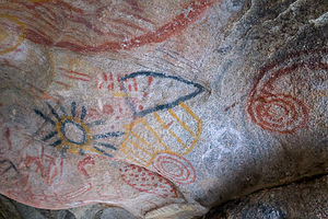 1,000 year old Cochimi cave paintingsThe Museo turned out to be a dilapidated and crumbling geodesic dome, interesting, but long past its days of being informative. We continued down the dirt road through the campground past fields of cacti and other desert plants. There wasn’t a camper to be seen. We still were unsure if this was the place to see the cave painting. We hoped not, because with all the boulders on the hill, we wouldn’t know which one to look in.
Realizing we were in the wrong place, we got back on Mexico 1, turning off this time, as instructed, at the INAH sign. This was obviously the right place. There were information signs, which would have been informative if we knew Spanish, as well as an extremely well-marked trail, delineated by white stones, leading up a hill to a series of boulders.
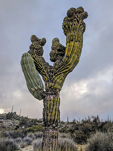 Anatomically correct cactusWe waited in the car for a few minutes waiting for the rain to stop, before proceeding up the trail to the cave, an easy 10-minute walk.
The paintings are tucked inside a small cave at the top of a hill. They were fabulous - colorful yellow, red, and black geometric designs, abstract shapes, and a predominant sun, created by the Cochimi people about a 1,000 years ago. We sat in the cave for a few minutes, just us, and the spirits of the artists that adorned this cave so long ago.
That night we had dinner in the cozy hotel dining room. I was quite pleased with my planning so far, having found some pretty nice oases of civilization along the way.
Description
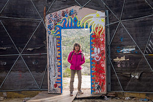 Old Catavina cave painting museumCatavina is a small town in the middle of the desert with a mini market and one hotel. There is no longer a gas station, but in its place are several pickup trucks selling barrel gas. Because there is not much between El Rosario and Guerrero Negro, it is a popular overnight stop for people passing through.
However, beyond its convenience as a stopover, Catavina has much to offer on its own. The terrain around the small town is a photographer's paradise, with its striking boulder fields sprinkled with cacti and desert plants.
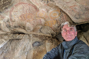 Herb enjoying the artAlso nearby are the Catavina Pinturas Rupestres, the most easily accessible cave paintings in Baja. To find them, at kilometer 76 look for the INAH sign on the east side of Mexico 1. Park your car hear and follow the well-marked trail up the hill to the paintings - about a 10 minute walk. Their are informational signs along the way explaining the history and significance of this site. Unfortunately, they were all written in Spanish.
The paintings are tucked inside a small cave at the top of a hill. The drawings, done in yellow, red, and black minerals, depict a sun, geometric designs, and other abstract shapes. They were believed to have been created about a 1,000 years ago by the Cochimi people.
San Diego
Sunday, February 17, 2019 - 10:30am by Lolo550 miles and 10 hours from our last stop - 2 night stay
Travelogue
 Trail down to Black's BeachAfter a very cool and rainy winter in Sonoma Valley, Herb was craving some well-need sun and warmth. In fact, that was the major impetus behind the decision to make the long drive to Baja.
The weather this winter had been so crazy throughout the West that we shouldn’t have been totally surprised when on our way over Tejon Pass, just north of LA, it started to snow. Fortunately, we were able to get over the pass before that section of I5 was closed.
Exhausted from our long drive, we stopped at a Days Inn in Encinitas for the night.
San Diego is a very worthy destination in itself, so rather than rushing across the border the next day, we decided to enjoy a day in San Diego visiting some old favorites and exploring some new.
 Winter erosion on Black's BeachWe drove along the coast from Encinitas, stopping at Black’s Beach on the southern end of Torrey Pines State Beach, near the Glider Port. This was an old favorite from past visits. Getting to the beach requires descending 320 feet down a steep trail, with steps and handrails in the steep sections to make things a bit easier.
Upon reaching the bottom, we were astounded to find that there was barely any beach left. What had happened to our beautiful, wide sandy beach?
We had an informative exchange with a naked man feeding the seagulls. I tried to remain in eye contact at all times. Firstly, he explained that this is what winter storms do to this beach every year, with this one being a particularly bad one, but it would return in the spring. Secondly, upon hearing about our plans for the following week, he quite alarmedly warned us of the dangers and safety issues of traveling through northern Baja. “Be really careful,” was his parting words.
 The sea lions of La JollaMy worst fears were coming to life - murderers, rapists, drug cartels, caravans filled with terrorists, “oh my.” Maybe Trump and Fox News were right. Nah, just kidding.
Thankfully, cooler heads (Herb’s) prevailed, so rather than turn back and rush towards the safety of home (my idea), we forged on. Not to give away the ending, but the Mexican people turned out to be some of the friendliest, most generous people we have met in our travels. Turns out they are just like us. As the great Mark Twain once said:
“Travel is fatal to prejudice, bigotry, and narrow-mindedness, and many of our people need it sorely on these accounts. Broad, wholesome, charitable views of men and things cannot be acquired by vegetating in one little corner of the earth all one's lifetime.”
 California brown pelicansBased on our friend’s suggestion, we headed next to La Jolla Cove to see the seals and sea lions. We had been to La Jolla before, but somehow had missed the stretch of waterfront where the seals and sea lions like to hang out. There were dozens of them, just chillin’ on the beach. Unlike Point Reyes where you had to stay back at least a 100 yards from the sea lions, here you could practically ride them - if it wasn’t for the disembodied voice over a loudspeaker which piped up whenever a person got a bit too close.
As interesting as the sea lions, were the California brown pelicans also inhabited this stretch of the waterfront. I had never seen so many so close before. Their beaks were certainly quite impressive and very capable of storing a good meal.
After some delicious Italian sandwiches at Sicilia Bella, we headed over to Cabrillo National Monument out at the tip of the Point Luma Peninsula. We had been there a few years back, but it had rained so hard that we felt it was worth a return visit.
 Point Loma tide poolsUnfortunately, we were thwarted once again - this time with Presidents Day traffic. The road leading up to the gatehouse was backed up for almost a mile. Instead of waiting, we decided to park alongside the road next to the Naval Cemetery and walk down the road to the tidepools.
The walk turned out to be longer and steeper than we expected, but eventually we got there and joined dozens of others scrambling along the rocks down to the tide pools. At the national park booth, I picked up a brochure identifying the various sea life to be found in the pools, but for some reason, nobody was home. We did not see a single crustacean, anemone, or fish of any sort. Still it was very pretty.
Our final stop of the day was the Costco in Chule Vista, where we stocked up on some supplies and exchanged dollars for pesos.
Tomorrow was the big day!
Description
The following is in no way intended to be a complete listing of sights to see in the San Diego area, but just those that we chose to visit during our quick pass through.
Torrey Pine State Beach
 Resident of Black's BeachTorrey Pines State Beach in La Jolla extends for three miles from Carmel Valley Road in the north to the Glider Port at Torrey Pines Scenic Drive.
The north section of the beach is more easily accessible by car and is the choice for families.
Black’s Beach on the southern end is only accessible via two steep trails from the top of the cliff, where the parking lots are. This difficult-to-get-to beach is mostly frequented by two types: surfers looking to enjoy the huge winter swells, and nudists looking to enjoy some privacy. The nudists tend to hang out north of the Glider Port, while the surfers head to the south.
The south trail, which begins just south of the Glider Port, is easier and better maintained than the north trail, in that it has steps and handrails in the steeper segments. The north trail is much steeper and should be avoided if you are subject to vertigo. Both trails are about 1,000 feet long and have an elevation loss of about 320 feet.
It’s also fun to watch the hang gliders and paragliders soar from the Glider Port, atop the cliffs above Black Beach.
La Jolla
 The good life for a Lo Jolla sea lionThe Native Americans originally called the site La Hoya, meaning “the cave,” referring to the grottoes that dot the shoreline. When the Spaniards arrived, they changed the name to La Jolla (same pronunciation), meaning “the jewel.”
Today, La Jolla certainly is a jewel, and a very expensive one at that. With its stunning coastline and upscale restaurants, shops, and galleries along Girard and Prospect Streets, it is one of the most affluent communities in America.
Along the waterfront is La Jolla Cove, a small cove flanked by two rocky points, where seals and sea lions, as well as California brown pelicans, like to hang out. The ocean here is part of the protected La Jolla Ecological Reserve and Marine Park.
The Museum of Contemporary Art San Diego is located on a bluff above the waterfront in what was once the residence of philanthropist Ellen Browning Scripps. The museum has over 4,000 works representing every major art movement of the past half century, with a particularly strong emphasis on California artists.
The University of California, San Diego is located in La Jolla, as well as the Scripps Institution of Oceanography, Scripps Research Institute, and Salk Institute.
Cabrillo National Monument
 Point Loma tide poolsLocated at the tip of the Point Luma Peninsula in San Diego, the Cabrillo National Monument marks the site where in 1542 Juan Rodriguez Cabrillo became the first European to set foot on the West Coast of the United States. The Visitor Center has an “Age of Exploration” exhibit and film.
Right past the gatehouse, a road leads down to the tide pools, where you can clamber around on the rocks looking for tiny crustaceans, fish, and other sea life that live in these pools.
After visiting the tide pools, drive back up the road to the main road and turn right.Near the Visitor Center is a small circular plaza with a 14-foot statue of the explorer. The Plaza has an excellent view of San Diego and the harbor.
A short walk from there leads to the Old Point Loma Lighthouse, the highest point in the park. The lighthouse and adjacent Assistant Keepers’ Quarters has exhibits presenting what life was like for the lighthouse keepers in the 1880s.
Just south of the lighthouse is the Whale Overlook, a prime vantage point for viewing migrating Pacific gray whales traveling back and forth between Alaska and Baja California during the months of December through March.
The self-guided, two-mile Bayside Trail begins near the lighthouse and leads visitors through one of the last remaining remnants of a coastal sage scrub forest in the world. This trail offers views of San Diego harbor and the city beyond.
Border Crossing and San Quintin
Tuesday, February 19, 2019 - 10:15am by Lolo210 miles and 5 hours from our last stop - 2 night stay
Travelogue
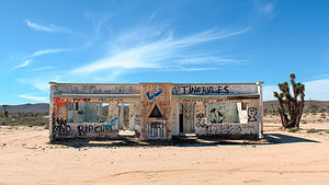 More examples of the economically disadvantaged Baja NorteI have to admit that I was a little nervous about crossing the border. Since I am much more of a stickler for rules than Herb is, to his annoyment I insisted that he bring in only the allowable three liters of beer (per person). If not, I wasn’t coming, fearing I would be thrown into a Mexican prison for smuggling in a 30-pack of Bud. Oddly, they do allow you to bring in six liters of wine or hard liquor, which doesn’t really make any sense to me, but it is the rule - so I followed it. They even have a bizarre rule where you are only allowed to bring in one stair stepper - that’s right. One is allowed, not two.
As per our agreement, Herb had performed his pre-departure duties of taking care of incidentals to keep us safe and out of jail. Discover Baja is a great resource for anyone traveling to Baja. Through them, Herb was able to get the highly suggested Mexican auto insurance ($25 per day for our intended stay) and the required FMM tourist permits to enter the country. I highly suggest getting the FMM tourist permit through them ahead of time, rather than at the Mexico Immigration Office. Their website also has great info on road conditions and places to see, as well as discounts on hotels, restaurants, and campgrounds throughout Baja.
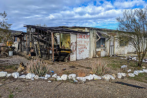 Closed for businessWe very carefully followed the instructions provided by Discover Baja for crossing the San Ysidro / Tijuana border, first stopping at the blue building with the Mexican flag to get our FMM stamped. It was quite uneventful. They didn’t even search our car for excess Budweiser or stair steppers.
Back in the car, we crossed over the border and followed the signs for Playas de Tijuana/Rosarito-Ensenada. There are not that many paved roads to choose from in Baja, so all we had to do was follow Mexico 1 the whole way. 1 is supposed to be a toll road, but when we came up to our first toll booth, there was no one in the booth, but just a woman outside it holding a basket. At first we thought she was the toll collector, but when we asked how much, she said “libre,” which even with our limited Spanish vocabulary, we understood to mean free. She was just looking for a donation. This same thing happened at every toll both we passed through.
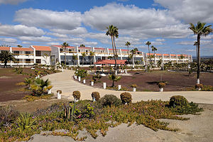 Hotel Mision Santa MariaFirst impressions of northern Baja were that it was a lot more undeveloped than I had anticipated, with much squalor, neglect, and poverty. Many structures (both homes and businesses) were dilapidated. There were junk yards and open garbage dumps (sometimes burning) in every village. The biggest business along the highway was selling llantas (tires) because the roads were so bad. Dogs, cats, chickens, and cows wandered freely alongside and sometimes even on the roads. Asphalt was non-existent except on the few highways that criss-crossed the peninsula, meaning that after a rain, all else was mud. In fact, we saw little girls coming home from school, wearing their Catholic school uniforms, navigating their way through and around the mud, seemingly with without a care. This was, after all, what they knew of life. Who was I to judge?
The other issue that made things quite stressful was the narrowness of the roads and the lack of a shoulder. For the entire duration of our time in Baja, we traveled on two-lane, undivided highways, with large trucks coming so close that you feared for your mirror each time one passed. The frequency of memorials along the road was a testament to just how dangerous these roads can be. Plus, when you left the towns and villages, the roads often became mountainous and winding. However, one thing I would have to say is that the speed limits reflect these dangers and are often quite slower than you would expect on a highway in the states.
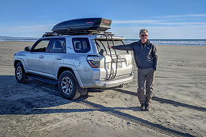 Driving along the beach in San QuintinBecause of my trepidation with traveling in Baja, I had researched hotels and made reservations for our first few nights, selecting the ones in Moon Baja that had stars next to them.
We had chosen the town of San Quintin because it was about the right distance from San Diego (5 hours), had lots of services, and it had what looked like a really nice hotel called the Hotel Mision Santa Maria, right on a wide sandy beach. At $66 American dollars a night, it was a bargain and the most expensive hotel in San Quintin. In hindsight, I wouldn’t have booked two nights if I knew the weather was going to be so cold that we couldn’t spend time on the beach.
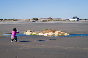 Lolo photographing the shipwreckThe town itself wasn’t so nice, so I was glad that we had to leave Mexico 1 and drive down a dirt road for 3 miles to get to the hotel. I was so relieved when I saw it. It was lovely.
Every room faced the beach and was recently renovated. There was a lovely sunny courtyard with a fountain, and a restaurant on site. The old woman of the optical illusion that I explained in the trip overview was giving way to that lovely young lady.
When making the reservation, on the hotel’s website there was a photo of a vehicle driving on the beach. We asked the desk clerk (the one who spoke English) about the possibility of us doing this. He explained that it was, but that they had to open a gate for us to get through.
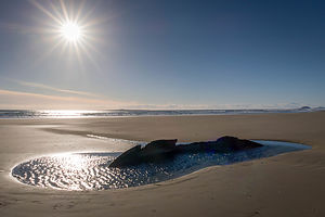 Old shipwreck along the San Quintin beachAfter settling into the room, we decided to head out onto the beach. Sure enough, an employee was there to open the gate for us. Concerned about us getting past the big bumps and drops through the wash preceding the beach, he actually walked out onto the wash to show us the way, using the universal language of pointing and waving his arms in the air when we veered the wrong way.
The beach had hard sand and was quite easy to drive on. In fact, in seemed to serve as a highway of sorts for locals that sped by in their 2WD cars. Too bad the weather wasn’t better as we would have loved to spend the day relaxing and reading on a sunny beach, but the temperatures were surprisingly cool, even this far south. It didn’t feel much different than home.
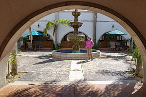 Courtyard of Hotel Mision Santa MariaFar too chilly to put the beach chairs out. Instead, we just explored. Probably the most interesting find was a small pool of water containing the remains of an old shipwreck.
When we headed back to the hotel, our friend was waiting for us to open the gates. He, as everyone else we encountered while in Mexico, was extremely friendly and helpful.
That evening we had a delicious dinner in the hotel dining room. Herb had the chile relleno, which became his go-to during the trip and I had a very good chicken stuffed with spinach and peppers. That plus 2 glasses of white wine cost the equivalent of $22 American dollars (or 424 pesos, which seems so much more).
The next morning we awoke to clear skies, but chilly winds. After our standard breakfast of coffee and Nature Valley Oats and Honey Bars in the room, we took a 4-mile stroll out on the beach. Deciding it was too cool and windy, we spent the day reading in the sunny courtyard, protected from the wind.
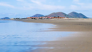 Our hotel off in the distanceLater that afternoon, I went for a 5-mile run on the beach, which basically consisted of me running back and forth on the hard sand in view of Herb’s watchful eyes from our balcony. It felt so good to stretch the legs after so much driving.
We returned to the hotel dining room that evening, this time having quesadillas and a veggy omelette.
It had been a nice first stop in Baja, and a place I would highly recommend to anyone making the drive down Mexico 1.
Description
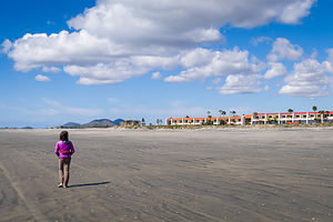 A stroll on the beachSan Quintin, in northern Baja about 5 hours south of the border, is a popular overnight spot for travelers heading south on Mexico 1. The town is primarily agricultural, with strawberries and tomatoes being the main crops. Most visitors head out to the beaches outside of town to spend the night, where it is quieter and more picturesque.
The nicest place to stay is the Hotel Misión Santa Maria, located on a beautiful, sandy beach, with all rooms facing the beach. There is a restaurant and bar on-site.
Yosemite Valley
Tuesday, February 20, 2018 - 4:15pm by Lolo245 miles and 5 hours from our last stop - 5 night stay
Travelogue
Day 1 - Arrival in the Valley
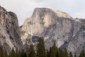 Hello again Half DomeWe arrived in the Valley around 3:30 in the afternoon, giving us just about an hour of daylight left to run around taking photos. The only downside to these spectacular tall granite walls is that they make the short days of winter even shorter. Still, they are well worth the trade-off.
Corny as it might sound, every time I enter this Valley, it feels like coming home.
We didn’t tow the Subaru behind this trip, so we were going to have to maneuver around the Valley and find parking in our motorhome. One thing we didn’t realize when deciding to come here this time of year was that mid- to late- February is the time of year when Horsetail Falls normally puts on its show, so the Valley is packed to the brim with tripod-wielding photographers.
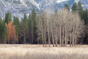 The barren trees of winterWhen conditions are right - clear skies and enough snow for the waterfall to flow - there is a “firefall effect” in which the flow glows orange during sunset. The phenomenon only happens during mid- to late-February (usually peaking February 17 - 19), because during that time the setting sun hits Yosemite Valley at just the right angle to illuminate the upper reaches of Horsetail Fall.
Thousands of people come to the Valley during this time period to see the “Firefall,” and it has created a traffic nightmare as people just stop in the middle of Northside Drive and leave their cars to get to a good photo vantage point.
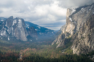 View along Four Mile TrailAs a result, in 2018, the National Park Service decided to test a new traffic pattern. The section of Northside Drive, from Yosemite Valley Lodge to the El Capitan Crossover, was closed to anyone without a permit to park within the “event zone.” Each day 300 free permits are made available (250 can be reserved online ahead of time and 50 are issued each day on a first come, first served basis). Since Northside Drive is the only way to exit the Valley normally, the rest of the roads were changed from one-way to two-way.
However, the 2018 winter so far had been a dry one, so there was no water flowing in Horsetail Falls. In other words, it was a dud. However, undaunted the Park Service continued to enforce their new traffic pattern, despite the fact that it was no longer needed.
So, we parked alongside the road in the non-event zone and got some pretty eventful photos anyway. Even barren trees are beautiful in this Valley.
Day 2 - Hiking the Four Mile Trail
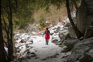 Setting off on Four Mile TrailThere aren’t any hikes in and from the Valley left that we haven’t already done, but doing them in different seasons sort of makes them new again. We decided to do the Four Mile Trail up to Glacier Point, with a 3,200-foot elevation gain. I have a bone to pick with the person who named this trail. If they can rename the Ahwahnee Hotel the Majestic, I can rename this 4.8-mile hike the Five Mile Trail.
This is a great hike, but a very strenuous one as well. We started from the Valley Floor and after a brief flat area wandering through some boulders, which we had played around on with the boys before, we began to climb. In fact, from that point on, all we would do is climb, as we had a lot of vertical feet to gain.
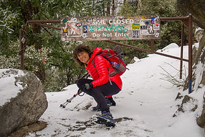 What sign?It wasn’t long before the trail became snow-covered - not deep, jbut ust a few inches of packed snow. Unfortunately, we had not brought along our Yaktraks, but they weren’t really needed as long as conditions didn’t get worse.
The scenery started slowly, since we had to get above the Valley trees first, but once we did, all the icons of the Valley come into view - Yosemite Falls, Cathedral Rocks, El Cap, Half Dome, Clouds Rest, North Dome, and more. It was like a tour of Yosemite’s greatest hits. The tremendous views were a great distraction from the fact that we were climbing and climbing along a continuous series of switchbacks.
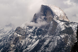 It's snowing on Half Dome!!At about 3 miles, we came to a gate with a sign that said “Trail Closed - Do Not Enter.” It didn’t look so bad beyond the gate, and there were other footprints forging on, so rightly or wrongly, we decided to duck under the gate and just go a “little bit” further.
We went another half mile to the turnoff for Union Point, a great viewpoint and place to have lunch. As we sat there eating, ominous clouds started moving into the Valley. By the time we finished lunch, it had even begun to lightly snow.
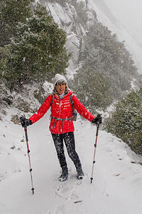 Winter Wonderland along the Four Mile TrailBack at the main trail, we met someone hiking down from Glacier Point, who had gotten a much earlier start this morning than we did. He said the views were becoming obscured by the clouds, and the trail conditions were worsening by the minute. Perhaps continuing on would not be such a wise idea after all. We decided to turn back rather than take the chance.
As we hiked back down the switchbacks, it really started to snow in earnest. It was truly a winter wonderland. I absolutely loved it!!
By the time we got back to the car, the meadows were already covered with a lovely blanket of snow. Time to get the motorhome safely tucked back into our campsite in Upper Pines before it got any worse.
I knew what we would be doing tomorrow - wandering the Valley taking photos of every one of its icons.
We had one more full day on our own before the kids arrived from San Francisco late tomorrow (Friday) night.
Day 3 - Wander around the entire snow-covered Valley taking photographs
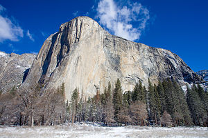 The Mighty El CapWhen we opened the blinds the next morning, we were greeted with a lovely scene. The campground was covered in a pure white blanket of snow, and kids were already out, some still in their pajamas, throwing snowballs, making snow angels, and building snowmen.
I felt like a little kid waking up at Christmas. Herb was pretty excited as well, as he would get to spend the entire day wandering through the snow-covered Valley with his camera.
We decided to take the motorhome to use as a base camp for our day’s adventures, driving the entire Valley Loop, stopping at places to hike from along the way.
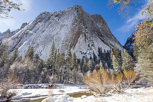 Middle Cathedral RockOur first stop was Sentinel Bridge, where we parked the motorhome and took a short walk into the meadow. How different everything looked when covered in snow.
From there we continued on to the El Cap Crossover and parked on Northside Drive just past the blockade for the Firefall “event zone.” From there we took a walk over to Southside Drive and Cathedral Beach, one of our favorite spots to photograph El Cap.
Fortunately I was wearing my bright red down jacket, which contrasted so much with the brilliant whiteness of the snow that I could be spotted in any picture, no matter how far away.
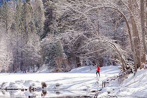 Lolo enjoying the snowAfterwards, we continued along Southside Drive, parking just west of the Yosemite Chapel, and used that as a base camp for the rest of the day. After lunch, we separated. I set out for a long walk while Herb stayed closer to home with his tripod.
My walk, which turned out to be a 4-mile one, took me through the meadow, over to Lower Yosemite Falls, back across Sentinel Bridge where I said hello to Half Dome, past the Yosemite Chapel, and back. It was so pristine and peaceful. Herb looked pretty peaceful and happy as well.
After a brief break in the motorhome to get warm, we set out again, this time west through the meadow, across Swinging Bridge, and followed undeveloped paths across the meadow towards Northside Drive.
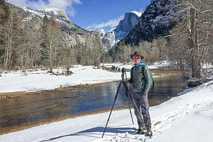 Herb doing what he loves bestHerb moves a lot slower than me when he is photographing, so I found myself quite a bit ahead of him as the sun was beginning to disappear behind the granite walls. All of a sudden I came upon a spot where I had a great view of Sentinel Rock with the late afternoon light setting it aglow in brilliant red. It’s a phenomenon called alpenglow, which occurs as the scattered light from the setting sun hits the mountains. It was stunning.
I snapped a few shots with my iPhone, and then immediately ran back to find Herb, as I was sure he did not want to miss this. I got him back there just in time to take a photo or two before the show was over. He already had gotten one of Half Dome.
When photographing this Valley, it’s all about timing, whether it be the season or time of day. You could literally spend the entire day in one place, photographing it throughout the day, and each photo would be different.
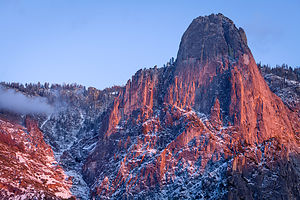 Alpenglow on Sentinel RockHerb usually hates the cold, but today was so wonderful that I don’t even think he noticed it. He was so happy pressing the shutter that he never even bothered to put gloves on. My hands were freezing.
Around midnight, the boys and their girlfriends arrived for the weekend. Tommy and Erin had their new Promaster camper van, and despite the fact that it hadn’t been converted to a camper yet, they slept in it anyway on an air mattress. This did allow for a bit more roominess in the motorhome, although we have slept 6 in it. Soon, Andrew and Celeste would have a camper as well and then it would even roomier.
Everyone was leaving the nest.
Day 4 - Hiking the Yosemite Falls Trail with the kids
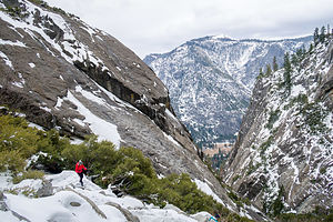 Yosemite Falls HikeUsually when the boys and their girlfriends come to Yosemite, they spend most of their time rock climbing. However, the snow, as well as a few injuries, made that impossible. Instead, we decided to do a big hike - to the top of Yosemite Falls, a strenuous 7.2-mile round-trip hike that climbs 2,425 feet above the Valley floor. Just looking up at the top of the falls and thinking about getting there on foot from the Valley Floor is pretty daunting.
We have done this hike twice in the past, once in the summer, and another time during a Thanksgiving trip with the boys, when we actually did encounter snowy conditions during the last mile.
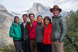 Happy family on the hike to the top of Yosemite FallsThis time we would be starting off in snow, but fortunately, this time we had Yaktraks, which are truly life-changing and make otherwise impossible winter hikes possible. They are lightweight, easy to put on, and affordable ($21 on Amazon) traction cleats that fit over your shoes, keeping you from slipping and sliding on the snow and ice. After getting caught in snow on this very hike that Thanksgiving trip, we got them for each other for Christmas.
The trail begins next to Sunnyside Walk-in Campground (known to climbers as Camp 4), the rock climbers’ campground behind Yosemite Lodge. This hike doesn’t fool around. In the first half mile, it climbs steeply along a series of over three dozen switchbacks.
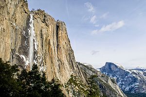 Trickling Yosemite FallsAt the 1 mile point, there is a short spur trail to Columbia Rock, where there is a breathtaking, 180-degree view of Yosemite Valley from Half Dome in the east to the Cathedral Spires in the west. It’s a great place to take photos, so we did just that.
In that one mile we had already climbed 1,000 feet in elevation, yet we still had not gotten a glimpse of the waterfalls. In fact, our first indication that we were getting closer to the falls was by hearing it, before we rounded a bend and it finally came into view. However, unlike past times, it was more of a trickle than a roar, for the same reason the Firefall was a dud - not much snow melt this winter.
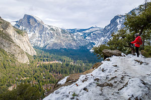 Lolo contemplating the awesomeness of YosemiteHowever, it still was pretty awesome, so we forged on. The last quarter mile before reaching the top is a series of torturous, seemingly endless switchbacks. At the top, there is an Overlook which is actually below the top, which looks down from above back up at the falls. To get to it you have to go down an intimidating series of steps cut into the rockface, made even more intimidating by the fact that they were covered in snow and ice.
Since we had already done this Overlook in the past when the waterfall was really flowing, and the stairs did look really precarious, we collectively decided to declare victory and head back down.
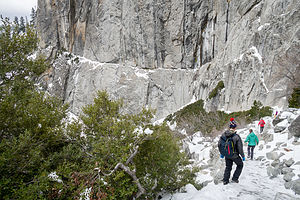 Hiking down from Yosemite FallsAs always, going down a steep trail is often worse, especially on the knees, than going up. However, either I am getting in better shape as I age (or experience as I like to call it), or all the fun and laughter that comes along with hiking with the boys was a great distraction, because for some reason, the whole hike didn’t feel all that exhausting. In fact, it was quite fun!
We spent that evening, as we spend many cold evenings in Yosemite, cozying up in the Ahwahnee (excuse me, Majestic) Grand Lounge reading and playing cards. While I was there I made reservations for tomorrow's Sunday Brunch, something which has become a bit of a customary way for end our weekends with the kids in Yosemite.
Day 5 - Ahwahnee Brunch, Run around the Valley, and Departure
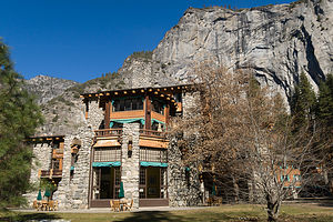 Ahwahnee BackyardAs I mentioned above, it has become something of a Gaidus Family tradition to wrap up every visit to the Valley with Sunday Brunch in the Ahwahnee Dining Room. Plus, Erin, our newest addition to the family, had never eaten here before, so we thought it was about time she did.
Although the food is quite good, it’s the setting that I savor the most> With its 34-foot-high beamed ceilings, granite pillars, chandeliers, and floor-to-ceiling windows, the dining room is truly “majestic,” although I will never call this iconic hotel by its new name.
Another tradition is walking the meal off a bit in the Ahwahnee backyard, enjoying the view of Royal Arches and strolling along the Merced River.
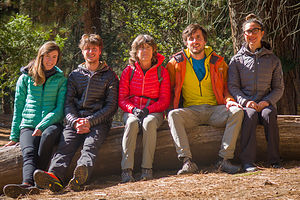 Post-brunch happy familyBefore heading back to the city, we decided to go for a family run - well sort of. Andrew and Celeste went for a long 10-miler, Tommy, Erin, and I went for a more leisurely 4 miler, and Herb and his tripod went for a photographic stroll.
After the kids left, Herb and I spent the remainder of the day wandering the meadow.
Tomorrow morning it was time for us to head home as well. Another great trip to Yosemite - is there any other kind?
Description
Yosemite National Park lies near the eastern border of California in the heart of the Sierra Nevada Mountains. Its spectacular waterfalls, soaring granite cliffs, and lush meadows are just a few of the reasons it is considered by many to be nature’s ultimate masterpiece. In the words of John Muir, “it is surely the brightest and the best of all the Lord has built.”
This description will focus on Yosemite Valley, which is the section of the park we visited. Although the Yosemite Valley is just a small portion of Yosemite’s 761,268 acres, it is part receives 95% of its visitors. In fact, an estimated 4.1 million people visit the Valley each year, making it extremely crowded.
Two one-way roads traverse Yosemite Valley: the east-bound Southside Drive and the west-bound Northside Drive, which wind through woodlands and meadows along the base of the 3,000-foot-high granite cliffs. As of today, cars are still allowed to enter and drive through the valley, but visitors are highly encouraged to park their vehicles and use the park’s free shuttle bus, which stops at the major attractions in the valley.
Virtual Tour of Yosemite Valley Highlights
- As you enter the valley, the first sight you’ll see is the 620-foot Bridalveil Falls flowing down from a hanging valley to the valley floor. From the parking area, a short paved path leads to the base of the falls. This is one of the few falls in Yosemite that does not completely dry up in the summer.
- Just past the Bridalveil Fall parking area, the Southside Drive begins to trace the Merced River. Soon El Capitan comes fully into view. This 3,000 foot high granite cliff is the largest single piece of exposed granite in the world and one of the most famous landmarks in Yosemite. If you look closely, you might see small dots that are actually rock climbers along its face.
- Continuing east on the Southside Drive are two riverside picnic areas and beaches: Cathedral Beach and Sentinel Beach.
- Right after the Sentinel Beach parking area is the trailhead for the 4-Mile trail, which ascends more than 3,200 feet from the valley floor to Glacier Point and one of the most spectacular views of the valley.
- A short distance further is Swinging Bridge, another picnic and swimming area. This area is also the westernmost point of the 8-mile bicycle loop that goes through the eastern part of the valley. From this point on, the bike path parallels the road.
- Next stop is the picturesque tiny Yosemite Chapel where many outdoor enthusiasts choose to exchange wedding vows.
- Now you enter the congested and developed portion of the valley.
- Right past the chapel, you can either take a left onto Sentinel Bridge towards Yosemite Village and the park exit, or you can continue straight towards Curry Village, the campgrounds, and Happy Isles Nature Center. For now, let’s stop at Sentinel Bridge for what is probably the most spectacular Half Dome viewpoint in the park. It’s a great spot for a photograph of Half Dome with the Merced River in the foreground.
- Continuing east on the Southside Drive, you pass Housekeeping Camp and Curry Village. Curry Village has lodging, restaurants, bicycle and raft rentals, a grocery store, and other shops. Curry Village is also one of the main parking areas in the valley.
- From Curry Village you can either take Northside Drive across the Ahwahnee Bridge back to Yosemite Village and the park exit, or continue east to the campgrounds. The Happy Isles Nature Center is also this way, but only shuttle buses are allowed on the road to it.
- The Happy Isles Nature Center features exhibits on the natural history of the park. It also serves as the trailhead for some of the best hikes in Yosemite. 1.5 mile trail leads to the top of Vernal Falls and then continues another 1.5 miles to the top of Nevada Falls (two waterfalls that flow even in the summer time). From there you can continue even further into the backcountry of Yosemite, including the cable route up the back of Half Dome.
- From Curry Village, the Northside Drive crosses the Ahwahnee Meadow, a wonderful spot to gaze at Half Dome during sunset, and enters Yosemite Village, the main center of visitor services in the park. Here you’ll find the park’s main Visitor Center, restaurants, lodging, shops, a grocery store, a post office, a medical clinic, the Ansel Adams Gallery, an Indian Cultural Exhibit and more. It’s also a good place to park your car and jump on the shuttle.
- A short dead end road from Yosemite Village leads to the majestic old Ahwahnee Hotel, which has played host to Queen Elizabeth, President John F. Kennedy, and Clint Eastwood, to name a few. This beautiful six-story rock structure offers tremendous views from every room. Within the hotel is the elegant and quite expensive Ahwahnee Dining Room (jackets required for dinner).
- Back on the Northside Drive heading west from Yosemite Village, the next stop is the Yosemite Falls parking area. At 2,425 feet, Yosemite Falls is the highest waterfall in North America. It is actually three waterfalls in one, with an upper, middle and lower section. A short walk from the parking lot along a paved walk leads to the base of Lower Yosemite Falls. This is the most visited landmark in the valley. Except in summer when the fall temporarily dries up, you’ll be sure to be covered in spray.
- A little further west on the Northside Drive is Yosemite Lodge, which marks the end of the developed area of the park going west.
- Right after Yosemite Lodge is Sunnyside Campground/Camp 4, a place where most rock climbers choose to congregate. From this campground begins the popular and strenuous Yosemite Falls hike, which ascends 2,600 feet from the valley floor to the top of the Upper Falls. The views from the top are incredible.
- Continuing west, there is nothing but woods and meadows from which to enjoy the views. Along the road there are several pullouts where you can stop and walk down to the Merced River for a swim. Just after the El Capitan Bridge, you’ll come to the El Capitan Meadow where you’re sure to find people looking through binoculars at the miniscule rock climbers clinging to the granite face.
- Just to the west of El Capitan, Ribbon Falls plunges over 1,600 feet down to the valley floor. It is the seventh highest waterfall in the world. However, it too dries up in the summer time.
- Finally the road nears the end of the Northside Drive at Valley View where El Capitan, on the left, and Cathedral Rocks, on the right, frame a magnificent valley view.
Several guided bus tours are also available. The 2-hour Valley Floor Tour is a great way to get acclimated. Visitors ride through the valley in an open tram while a guide leads a informative discussion of Yosemite’s history and geology. There are many photo stops along the way. In addition, there are bus tours out of the valley to Glacier Point, the Mariposa Grove of sequoia trees, and Tuolumne Meadows.
Although much of Yosemite can be enjoyed from the comforts of your car or a shuttle, the best way to truly experience Yosemite is do get out and experience it more directly..
Things to do in Yosemite
- Hike one of the many trails around the valley, ranging from an easy walk to the base of Lower Yosemite Falls to the strenuous 16-mile round trip hike up the back of Half Dome via cables
- Take an overnight backpacking trip
- Bike along the 12 miles of bicycle paths that loop through the Valley. Rentals are available at Curry Village and Yosemite Lodge.
- Rock climb in one of the premier climbing places in the world
- Raft down the calm waters of the Merced River through the valley. Rentals are available at Curry Village.
- Swim or tube in the Merced River. Besides the designated beaches, there are many pullouts along the road from which you can walk down to the river.
- Join one of the many ranger walks, which are offered daily
- Take a free art class at the Yosemite Art and Education Center
- Photograph the amazing scenery of the valley and surrounding granite cliffs
- Browse the Ansel Adams Gallery and see some of the photographs that first made Yosemite famous
- Relax in the meadow while gazing up at Half Dome or El Capitan
- Dine at the 5-star Ahwahnee Hotel, where presidents and royalty have stayed
Although many try to see Yosemite in a day, it is best to devote several days to seeing all the park has to offer. Besides the numerous hotels, lodges, and cabins in the Valley, there are three RV campgrounds: Upper Pines (238 sites), Lower Pines (60 sites), and North Pines (81 sites). That’s less than 400 campsites to accommodate all the people that want to camp here.
Since these campgrounds usually fill-up within the first hour they become available, it is essential to make your reservations as soon as possible. Campground reservations are available in blocks of one month at a time, up to five months in advance, on the 15th of each month at 7 am Pacific time. For example, if your arrival date is July 15 through August 14, the first day you can make reservations is March 15. The National Park Reservation System can be found at www.recreation.gov. Good luck!
Home
Monday, October 22, 2018 - 2:45pm by Lolo547 miles and 9 hours from our last stop - 1 night stay
Travelogue
Home Sweet Home
Indian Wells (Palm Springs)
Saturday, October 20, 2018 - 9:15pm by Lolo134 miles and 2.5 hours from our last stop - 3 night stay
Travelogue
 This ain't Mojave anymoreVisiting old friends who had just bought a house in Indian Wells was the impetus for this whole trip. Herb just had to sneak in a little desert off-roading first. This trip was to be a journey between two extremes - the primitiveness of the desert and the luxuriousness of a home in Indian Wells. Good thing we did it in this order.
Elke and Dennis’ new home was beautiful and it was great just to sit and chat after 11 years of not seeing each other. Funny thing about old friends in that it is so easy to just pick up where you left off.
Day 1 - failed attempt at Joshua Tree National Park and Hike in Tahquitz Canyon
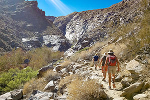 Hike to Tahquitz CanyonOn our first full day together, we decided to take them off-roading in Joshua Tree National Park, which was only about 40 minutes away. Our plan was to enter via the southern entrance, drive up Cottonwood Road, do the off-road, 12-mile Geology Tour, hike 3 miles up Ryan Mountain in the Park, and then come home. A pretty ambitious plan, that was not meant to be
A heavy rain the week before had washed out the Cottonwood Road and the southern entrance to the park was closed. It wasn’t a dirt road that had been washed out, but the main asphalt one into the park.
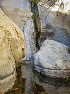 Tahquitz CanyonUndaunted, we changed plans. We drove back to Palm Springs to do the Tahquitz Canyon hike, which was listed in our hiking book as a 1 in difficulty, but 10 in scenery.
Tahquitz Canyon is part of the Agua Caliente Band of Cahuilla Indians Reservation. During the 1960s and 1970s it became a popular place for partiers and homeless people to congregate until the Aqual Caliente Band decided to close it to public use in the late 1970s and clean it up. It just reopened in 1999 and they now charge a pretty hefty fee of $12.50 to hike the 2 mile trail.
We managed to navigate our way through the Visitor Center Gift Shop without spending any more money and set out on the trail.
 Nothing like old friends (Tahquitz Canyon)The nicely maintained trail climbed up the canyon. At about ¾ of a mile, we climbed a series of rock steps cut into the canyon side, eventually bringing us to where in the springtime, a 50-foot waterfall cascades down into a deep pool great for taking a dip in during the summer heat. However, at this time of year it is dry, so we had to use our imagination. Unfortunately the $12.50 fee was not imaginary.
The walk back was quite pretty as we were not looking out over the canyon with the city in the background. All in all, the hike was 2 miles with a 350 elevation gain.
That evening we had a nice casual dinner at Giuseppe’s Pizza in Palm Springs. Although I am not a big fan of the desert heat, it was awfully nice to be able to sit out on the patio at night and be warm. Nights get pretty chilly in Santa Rosa.
Day 2 - Palm Springs Aerial Tramway and hiking the Desert View Trail
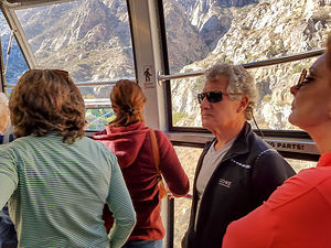 Palm Springs Tramway to San Jacinto summitWe had tried getting tickets yesterday for the Palm Springs Aerial Tramway, but being a Sunday, they were totally book. However, we did manage to get 4 tickets ($25 each) for 10:00 am today, which would put us on the first tram up the mountain in the morning.
The Tramway scooted us 2 ½ miles up Chino Canyon, from the desert floor at 2,643 feet to the top of Mt. San Jacinto State Park, at 8,516 feet in just 10 minutes. During the ride, the car rotated, giving passengers a panoramic view of the canyon and the valley floor below.
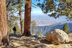 View from Desert View TrailIn the Mountain Station on top, there are two restaurants, observation decks, a museum, two theaters, a gift shop, and over 50 miles of hiking trails. We avoided the touristy stuff and immediately set off for the Forest Ranger Station just down the path from the station.
The most popular trail is the short, but highly scenic Desert View Trail, but before doing that we decided to take a less traveled 4 mile loop through a lovely forest. Although it was short and relatively flat, we definitely felt the elevation change.
 Desert View TrailAs advertised the 2-mile long Desert View Trail had better views. There are five notches along the way where you get different views of the valley below. By far the best view was at Notch 3.
After descending back to the desert on the tramway, on our drive back to Palm Springs, Elke gave us a bit of a celebrity tour, showing us where many movie stars lived when Palm Springs was the playground for the rich and famous starting back in the 1920s.
Part of the reason it became so popular was the legendary “Two-Hour Rule” of Hollywood studios put Palm Springs on the map as a perfect getaway. Actors under contract had to be available within two hours from the studio just in case last-minute film/photo shoots had to occur.
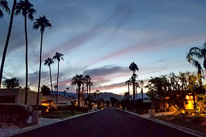 Evening In Indian WellsSome of the celebrities that purchased homes were Frank Sinatra, Dean Martin, Sammy Davis Jr., George Hamilton, Bob Hope, Bing Crosby, Kirk Douglas, Cary Grant, Jack Benny. Several ladies were frequent visitors included Marilyn Monroe, Dinah Shore, Kitty Carlisle, Lily Tomlin, Elizabeth Taylor, and Susan Sommers. There must have been some interesting parties!
That evening (our final), we had dinner at a nice Italian Restaurant in Palm Springs called Le Donne Cucina Italiana, once again enjoying dining on their outside patio.
It had been a great trip, with so much variety!!
Quirky attractions in Yerma
Saturday, October 20, 2018 - 8:45pm by Lolo40 miles and 1 hour from our last stop
Travelogue
 Peggy Sue's 50s DinerHerb and I didn’t just re-enter civilization. We flung ourselves in with gusto, stopping for breakfast at Peggy Sue’s 50s Diner and visiting Calico Ghost Town during its Halloween Festival. There couldn’t possibly have been a greater contrast between the solitude and barrenness of the Mojave Road and these two tourist attractions. I think Herb was trying to get me to appreciate the desert more.
Everytime we pass through on I15, we talk about stopping at Peggy’s Sue’s, but the time was never right as we always seemed to be rushing to get somewhere. This morning we were in no particular rush. We had to get to our friends’ house in Indian Wells later that afternoon, but that still gave us several hours to kill.
 Lolo enjoying something other than a granola bar for breakfastPeggy Sue’s is part diner, part roadside attraction. When it first opened in 1947, it had 3 booths and 9 counter stools. Today it is huge, with half a dozen rooms to accommodate their large clientele. In 1987, Peggy Sue and her husband Champ restored the diner to its original state. Prior to that, Peggy Sue worked in the movies and Champ worked for Knott’s Berry Farm. During that time they accumulated an extensive collection of movie and TV memorabilia, which is now displayed throughout their diner.
I was only born in the 50s, so most of the stuff reminded me of my parents. There were posters and statues of Betty Boop, Marilyn Monroe, Elvis Presley, and so many more icons of the 50s.
Since we’re from New Jersey, the diner capital of the world, this place probably wasn’t as much of a novelty to us as to many of our other fellow travelers. That 6-page menu didn’t scare us.
However, after being in the desert for 3 days, we were experiencing a bit of culture shock - so many people, so much food, so much neon. Still it was fun and the food was great, both in terms of quality and quantity.
 Lolo hits Calico Ghost TownAnother place I always wanted to visit when near Barstow is the Rainbow Basin Natural Area, a geological formation in the Calico Peaks range with a 8.2-mile hike I wanted to do. However, although we had some time to kill, we didn’t have that much time, so Herb suggested that instead we visit the nearby Calico Ghost Town.
Now that I look back on it, I guess this could be considered a gradual transition from 3 days of feeling like an 1860s traveler on the Mojave Road to now feeling like an 1880s silver miner; and then tonight, we would be in Palm Springs, whose heyday was in the 1940s. It was kind of like a time machine.
I had never heard of Calico before today, but Herb had seen it featured on several YouTube travel videos. What we didn’t realize is that not only would we be hitting it on a weekend, but it was also their Halloween Ghost Haunt, meaning admission was now $20 instead of $8, plus $5 for parking and the shuttle.
 All aboard the Calico trainBodie Ghost Town in Bridgeport has pretty much jaded us in terms of ghost towns. Bodie is the real deal, preserved in a state of “arrested decay,” where the buildings are left the way they were, still furnished and stocked with goods. Calico was much more touristy and most of the old buildings are now gift shops.
Still, it did have an interesting history and a very pretty natural setting. During the 1880s, the largest silver strike in California took place here. Over a 12-year period, Calico produced over $20 million in silver ore. Things were going great for the town until the mid-1890s, when the silver lost its value, and consequently the town lost its population, becoming a “ghost town” - the typical boom and bust so common in mining towns of the day.
In the 1950s, Walter Knott purchased Calico and architecturally restored all but the five original buildings to look as they did in the 1880s. Today Calico is a State Historical Landmark.
 Halloween in Calico Ghost TownIn addition to wandering along Main Street and dipping into a few gift shops, we decided to splurge on two additional attractions, the first of which was taking a ride on the Calico Odessa Railroad. This was very uncharacteristic for Herb, so I was a bit suspicious of his motives. Pretty sure it was trying to make me like the remoteness of Mojave better than the kitchiness of more popular attractions. It was working.
For $4.50 each, we boarded the train and spent 8 minutes chugging up and around a hill past historical sites, old mining equipment, and lots of scary skeletons with cowboy hats. It was pretty informative and made me wish I had taken the time, when I still could, to learn about my maternal grandfather’s time as a silver miner in Colorado.
Next stop, the Maggie Mine, the only silver mine that visitors can enter. We took the 1,000-foot self-guided tour through the mine and did learn more about the minerals in the local rocks and what the life of an 1880s miner was like.
Continuing our journey through time, we took the shuttle back to our car and headed south towards Indian Wells, right outside Palm Springs.
Mojave Road - Near Marl Springs (mile 77) to entrance to Afton Canyon (mile 116)
Friday, October 19, 2018 - 3:00pm by Lolo39 miles and 4 hours from our last stop - 1 night stay
Travelogue
 Mojave Post OfficeNext morning, it was coffee and Nature Valley Honey ‘n Oat granola bars again before hitting the road.
We were getting on near 20 miles from Rock Springs, so right on queue at mile 70.7, we arrived at Marl Springs. For early travelers, this was probably the most vital water source on the whole route, because afterwards it was another 30 miles across the barren Devil’s Playground and often uncrossable Soda Lake before reaching Soda Springs. There might not have been a Mojave Road if it wasn’t for this spring.
Like the previous two springs (Piute and Rock), this one also had a military outpost, which actually withstood an Indian attack in 1867. Once the U.S. mail was taken off the Mojave Road and the fort was no longer needed, Marl Springs became the headquarters for one of the earliest cattle operations in the Mojave. When the National Park Service acquired ownership of the land, all the ranches and cattle were removed, and today there is nothing but a corral and an old water trough to mark its once significant role.
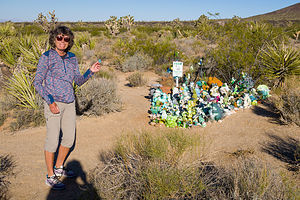 Lolo ready to make our contribution to the Frog GardenIt was a little confusing leaving Marl Springs, so we were careful to follow the cairns, always keeping them on our right. The next stretch of the road had great views of dramatic lava flows and cinder cones, the biggest one being Cima Dome.
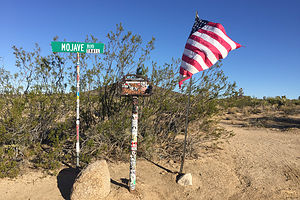
But first, we had a true Mojave Road icon to visit - the Mojave Road Mailbox (mile 74.0), put there by the Friends of the Mojave Road in 1983. Inside the box is a book in which passing travelers are asked to sign, including information as to the number of people in their party, the date, and their impressions of their journey. We signed it under our trip personas - Dora the Explorer and Nigel Thornberry. It seemed like a good idea at the time.
Although not mentioned in our guidebooks, Herb had seen on Youtube that there is a frog garden a short distance behind the mailbox. Being the well-prepared travelers we are, we had brought along a tiny little rubber frog to add to the mix. I hoped he would make friends, as he was the smallest one in the crowd.
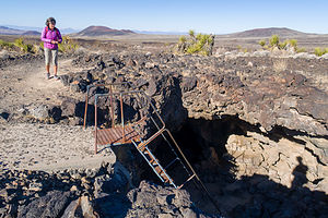 Approaching the lava tubeAt mile 79.0, we left the Mojave Road for a quick diversion 3 miles north on the Aiken Cinder Mine Road to a lava tube. From the parking lot, it was just a short ¼ mile walk to the tube entrance where there was a metal ladder to climb down into the tube.
This was not our first lava tube, so we knew a little bit about how they were formed. First of all, not all lava is the same. The kind that forms lava tubes has got to be the low-viscosity, basaltic type that spreads out smoothly like hot maple syrup. As the lava flows, it began to cool. However, the upper layer of the flow would cool first, forming a hard crust, while the liquid lava below kept moving underneath, creating a tunnel, or as geologists call it, a lava tube.
At mile 85.5, we crossed the Kelbaker Road, connecting Kelso Depot in the south and the town of Baker on I15 to the north. Once again, we continued on.
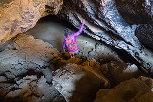 Lolo enters the Lava TubeIn 2 more miles we came to Seventeenmile Point (mile 87.8), the midpoint on the longest stretch of the Mojave Road without water - 17 miles to Soda Springs to the west, and 17 miles to Marl Spring to the east. From here, Soda Lake, the next potential problem, came into view.
Soda Lake is actually a misnomer, as there is no water in Soda Lake. It’s actually a dry lake. However, it does have standing water during wet periods, and there is sometimes water right beneath the surface, both of which can cause vehicles to sink in and get stuck. The ability to safely cross it depends on how long it’s been since the last rain and how big that rain was. Herb had called the Ranger Station before we left home and was told that we would have no problem.
We came to the eastern edge of Soda Lake at mile 96.9. It was pretty easy to see what track we should follow across the lake as there were green metal fence posts driven into the ground to show the way. We could see that some people had tried to drive outside the posts and had dug in and created ruts. They probably had done that for fun. We, however, didn’t need any extra excitement and greatly enjoyed our smooth 5 mile ride across the lake.
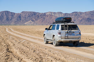 Crossing Soda LakeIn the old days, the route across the lake used to go directly to Soda Springs, frequently called Zzyzx, which has a very interesting history - too long for me to go into here, but I would very much suggest googling it. Since the area around the actual Soda Spring gets too muddy, the Mojave Road now takes a more southerly path across the lake.
Our path guided us right to a large pile of rocks on the western edge of the lake called the Travelers Monument (mile 100.9). Every traveler that passes this way is encouraged to add a stone to the pile. Since Herb had researched this trip so thoroughly, we were prepared with a stone from our garden. It had sat waiting in our cupholder the whole way, along with the penny for the Penny Can and the frog for the Frog Garden.
After leaving the lake, we continued on, soon leaving the Mojave National Preserve and entering the BLM’s Rasor Off-Highway Vehicle Area, where people like to bring their jeeps and race around across the sand and rocks. Since people pretty much drove anywhere they wanted here, it became even more important to look for the cairns that would keep us on the route of the Mojave Road.
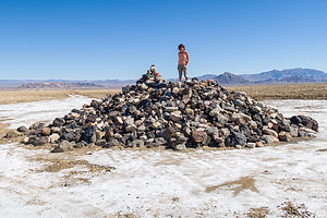 Lolo atop the Travelers MonumentWe continued on across the Mojave River Floodplain coming to the intersection with Rasor Road (mile 104.3), a dirt road that was just 5.1 miles away from I15 in the north. The guidebook warned that beyond this point lie drifting soft blow sand and rough conditions. Quite honestly, I felt that this would be an appropriate place to declare victory and get back to civilization, but Herb was having none of it. He wanted another night of camping in the desert.
In another 10 miles, we reached Basin Road, another road which led to I15. Although Herb was not ready to take it yet, this would be the road we would use tomorrow morning, as we had already decided that we did not want to go through Afton Canyon, which would require us driving through the Mojave River (twice).
We started looking for a nice place to camp for the night. There were a few potentials, but we continued on under the lower railroad bridge at the mouth of the Afton Canyon before turning around and selecting one just about a mile shy of Basin Road.
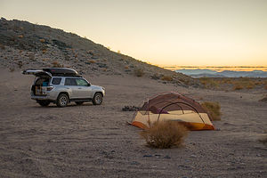 Our final campsite along the Mojave RoadIt was okay, but not nearly as nice as the one last night. It was definitely less remote. The railroad was nearby so we saw and heard freight trains passing, and the Cave Mountain Iron Mine was behind us in the hills. The sandy conditions, however, were conducive to setting up the tent, making sleeping much easier.
Tonight’s gourmet meal consisted of Knorr Rice with 2 packages of Chicken of the Sea pink salmon thrown it. Really not bad and we actually prefer them to the commercial backpacking meals.
The next morning it was coffee and a Nature Valley granola bar and back out to civilization via Basin Road. We had done it - 116 miles on the Mojave Road with the 4Runner and Herb performing like champs.
Mohave Road - Fort Piute (mile 23.7) to just shy of Marl Springs (mile 77)
Thursday, October 18, 2018 - 2:45pm by Lolo53 miles and 4 hours from our last stop - 1 night stay
Travelogue
 Piute Gorge OverlookThe next morning we had what would become our go-to breakfast before hitting the road - coffee and a Nature Valley Oats ‘n Honey granola bar. For some reason, neither of us felt like making oatmeal.
We followed the bumpy babyhead road back out to the main road and turned right (south) and followed the power lines for about a mile and a half before turning right (west).
At mile 31.4, we took another diversion and drove a short distance north, past an old corral and onto the Piute Gorge Overlook. From there, we took a hike down into a canyon in search of the Piute Spring. Although we never found the spring itself, it wasn’t too tough to realize we were near, as the dry barren desert was replaced with the lush greenery of willows and cottonwoods along the Piute Creek. I can see why this area was so important for the people that braved the crossing of this desert.
 Hike down to Piute SpringsWe continued west through the Lanfair Valley, happily following the reliable cairns across numerous washes. The vegetation along this stretch was mostly creosote bushes, yuccas, and mesquite.
After about mile 35, the first Joshua trees appeared. They were widely scattered at first, but as the road began to climb, they became more dense. They are happiest above 4,000 feet. The happier they are, the more interesting and numerous their branches are.
 Lolo and the Penny CanAt Mile 41.4, we came to the famous “penny can” hanging out by a wire from the limb of a Joshua tree. We dutifully stopped to add our pennies (which we had placed in the cupholder at home in anticipation of this moment) to the collection already in the can. According to Dennis Casebier, the author of our guide, as the Mojave Road was being developed into a recreational trail in 1983, this can appeared with a few pennies inside. Tradition then took over, and to this day travelers still stop to make their tongue-in-cheek contribution to Mojave Road maintenance. Hey, it all adds up.
At mile 42.0, we crossed the Ivanpah-Lanfair Road, a well-maintained county road that could deliver us to civilization in about 20 minutes - Goffs, 17 miles to the south, and Ivanpah,19 miles to the north. We forged on passing my favorite desert vegetation - Joshua trees, cholla cactus, and yucca.
 Watson WashSoon we came to mile 49.5, where the Mojave Road drops down along a very steep hill with deep gullies carved out by flash floods into Watson Wash. Herb had watched enough hours of YouTube videos of people driving the Mojave Road to know that this was the place we could get ourselves into the most trouble. We both got out of the car at the top of the hill to reconnoiter the situation. Fortunately, we were in agreement - it wasn’t worth the risk. We took the short bypass along Cedar Canyon Road and rejoined the Mojave Road at mile 50.5 - so technically, we would do the whole Mojave Road to the river, except for 1 mile.
Shortly after we got back on the Mojave Road, at mile 51, we turned off into the Rock Springs parking lot, where I visited my first porcelain toilet since starting our journey. However, this spot had more historical significance than that in that it was the location of the second spring along the east to west route across the Mojave, conveniently placed about 25 miles from the last (Piute Springs).
As we had learned at Piute Springs, wherever there is a water source in the desert, there is a military outpost to protect it. Camp Rock Spring was established in 1866 and manned for two years until the U.S. Mail was taken off the Mojave Road and the presence of an Army was no longer needed.
 Rock House at Rock SpringsAt the edge of the parking lot stood an interesting stone structure called the Rock House, made from rocks in the surrounding area, so it blended quite nicely into the environment. It was built in 1929 by a man named Bert George Smith, who was recovering from exposure to poison gas during World War I. He thought the desert environment would help him regain his health. Well, I guess he was right, because although we was expected to not survive long, he lived in this house for 25 years. Beyond the house was a short 1 ⅓-mile loop hike down a ravine to the spring with lovely desert views along the way.
We had hardly gotten driving again before we came to the Government Holes (mile 52.5), another source of water quite close to Rock Springs, which was a well dug in 1859 by teamsters employed by Phineas Banning. Although travelers did make use of this well, it was mainly used for cattle operations, as cattle grazing was quite extensive in the Mojave right up until 1990 when the National Park Service acquired ownership of the ranches and shut down the water. The only remnants of this period in the Mojave Road’s history are a windmill, water tanks, and a corral. There was also a gunfight here in 1925 where two men, Matt Burts and J. W. Robinson, killed each other.
 Joshua trees along the Mojave RoadBack on the Road, we continued through Round Valley and soon arrived at the highest point on the Mojave Road at an elevation of 5,174 feet. At the crest, the vegetation was mostly sagebrush, as that is what flourishes at high elevations. Then, as we dropped back down into Cedar Canyon, the vegetation changed to juniper, pinion, and the occasional Joshua tree. I never would have imagined how much variety in plant life there is in the desert.
At mile 62.2, we crossed the Kelso-Cima Road, the last good road we would intersect until Kelbaker Road at Mile 85.5. I wasn’t particularly thrilled with the guide book warnings: “Do not attempt this stretch with only one vehicle. Be sure to have adequate supplies of gasoline and survival provisions.” However, our gas levels looked good and spirits were still high, so we continued on towards this more primitive and isolated section of the road.
 Our favorite campsiteThe next four miles or so were pretty rough, but compensated for by having some of the best scenery so far - Providence Mountains, Kelso, Valley, and Cima Dome.
It was getting close to 3:00, so we starting thinking about finding a place to lay our heads for the night - hopefully in a tent, rather than gasping for breath outside the door of our 4Runner. Fortunately, two of our guidebooks indicated that there there was good camping a short distance down a wash at mile 68.4.
They were right. It was a lovely spot - flat sandy area to pitch a tent, large boulder to shower behind, and great views. The only thing that could have made me happier was a porcelain toilet instead of a shovel.
 Sunset from our campsiteAfter two days in the desert, a shower sounded pretty good. Fortunately, Herb had brought along one of the best camping-related purchases he has ever made - a helio pressure shower. He filled the bag with water, let the sun heat it up, and then we used a foot pump to power the nozzle to spritz us. It was wonderful. I highly recommend it. It’s only $99.95 on Amazon. I will list it on the right side of the page with the books we recommend.
That evening’s meal consisted of cocktail hour with wine and cheese, followed by powdered Idahoan Roasted Garlic and Parmesan powdered mash potatoes with 2 bags of Starkist Lemony Chicken thrown in. I never thought I would say these words, but it was delicious.
Clean and fed, we took a lovely evening stroll along the wash. There’s nothing like the evening colors in the desert.
