- Home
- About
- Map
- Trips
- Bringing Boat West
- Migration West
- Solo Motorcycle Ride
- Final Family XC Trip
- Colorado Rockies
- Graduates' XC Trip
- Yosemite & Nevada
- Colorado & Utah
- Best of Utah
- Southern Loop
- Pacific Northwest
- Northern Loop
- Los Angeles to NYC
- East Coast Trips
- Martha's Vineyard
- 1 Week in Quebec
- Southeast Coast
- NH Backpacking
- Martha's Vineyard
- Canadian Maritimes
- Ocracoke Island
- Edisto Island
- First Landing '02
- Hunting Island '02
- Stowe in Winter
- Hunting Island '01
- Lake Placid
- Chesapeake
- Provincetown
- Hunting Island '00
- Acadia in Winter
- Boston Suburbs
- Niagara Falls
- First Landing '99
- Cape Hatteras
- West Coast Trips
- Burning Man
- Utah Off-Roading
- Maui
- Mojave 4WD Course
- Colorado River Rafting
- Bishop & Death Valley
- Kauai
- Yosemite Fall
- Utah Off-Road
- Lost Coast
- Yosemite Valley
- Arizona and New Mexico
- Pescadero & Capitola
- Bishop & Death Valley
- San Diego, Anza Borrego, Joshua Tree
- Carmel
- Death Valley in Fall
- Yosemite in the Fall
- Pacific Northwest
- Utah Off-Roading
- Southern CA Deserts
- Yosemite & Covid
- Lake Powell Covid
- Eastern Sierra & Covid
- Bishop & Death Valley
- Central & SE Oregon
- Mojave Road
- Eastern Sierra
- Trinity Alps
- Tuolumne Meadows
- Lake Powell Boating
- Eastern Sierra
- Yosemite Winter
- Hawaii
- 4WD Eastern Sierra
- 4WD Death Valley +
- Southern CA Deserts
- Christmas in Tahoe
- Yosemite & Pinnacles
- Totality
- Yosemite & Sierra
- Yosemite Christmas
- Yosemite, San Diego
- Yosemite & North CA
- Seattle to Sierra
- Southwest Deserts
- Yosemite & Sierra
- Pacific Northwest
- Yosemite & South CA
- Pacific Northwest
- Northern California
- Southern Alaska
- Vancouver Island
- International Trips
- Index
- Tips
- Books
- Photos/Videos
- Search
- Contact
Bilbao
Friday, June 7, 2019 - 9:30am by Lolo116 miles and 2.5 hours from our last stop - 1 night stay
Travelogue
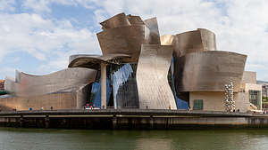 Bilbao Guggenheim MuseumOne of my favorite parts of travel is variety and the contrast of wildly different experiences. Today would be just that, as we started our day in the pristine natural beauty of the Picos de Europa and would end it in an old industrial city, also with plenty of beauty, but of the man-made kind.
The drive to Bilbao was about 2 ½ hours, much of it a repeat of our side trip to Santillana del Mar. We were in a bit of a hurry as we wanted to secure a spot for the night in an Aires, called the Area de Autocaravanas de Kobetamendi, located in Bilbao. Otherwise, there really wasn’t much of an alternative as there are no commercial campgrounds in, or even near, the city.
As I mentioned in my overview, Aires are inexpensive (often free) places where overnight parking for camper vans is permitted. Most of them providing electricity, water fill, and waste disposal. Almost every city, large or small, has one located in either walking distance or near a bus stop to the major attractions of that city.
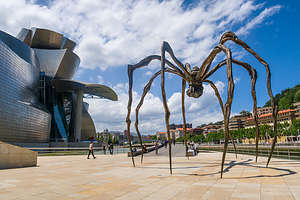 "Maman," the 30-foot spiderThe one in Bilbao was supposed to be one of the better ones in that it had a wonderful panoramic view overlooking the city and was located very close to a bus stop. It cost 15€ per night and included electricity and WiFi.
We got there by 11 am, about the time when people were leaving, so we had no trouble getting a spot, and it was a good one in that we had a great panoramic view out over the city. We could even see a little bit of the Guggenheim museum.
Another wonderful amenity in this Aires is that they had warm fresh bread every morning - something which I forgot to mention is a staple of every campground in Spain. Pretty much every morning of our trip so far, the first sight I would see when I woke up and looked out the window were men in bathrobes carrying baguettes.
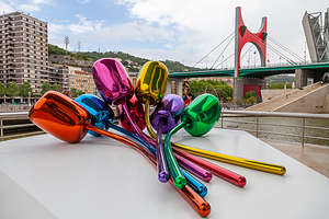 Jeff Koons’ giant roof-top “Tulips”But I digress. Back to the fascinating city of Bilbao.
After a lunch of sandwiches on our fresh Aires’ bread, we walked the short distance down the hill to the bus stop which would bring us to the Nervión River, along which we could walk about a mile to the Guggenheim Museum. We got to see a bit of the non-touristy part of the city during our bus drive, and it was quite a contrast to the cities we had been to so far - much grittier, poorer, and more industrial. Plus, we were in Basque country now, so the language was different than the Spanish we had heard in the rest of the country - lots of x’s and k’s.
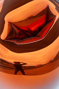 "Tulip" reflectionsThe walk along the river was nice, and there was much activity as people were setting up for the World Stand Up Paddleboard Challenge, which was to start the following day. As a result, there were lots of paddle boarders in the river practicing or just goofing off before the big day.
Of course, our destination for the day -- as it was every other tourist in the city -- was the famous Guggenheim Museum, designed by Canadian-American architect Frank Gehry and opened in 1997. The museum, with its gleaming titanium tiles that sheathe the exterior like giant herring scales, single-handedly transformed Bilbao from an industrial wasteland of gritty factories and shipyards into an international art and tourist destination.Having seen it so many times in photos, it was still such a thrill to actually see it in person.
As we approached the museum, we came upon a 30-foot spider on the terrace along the riverbank. Her name is Maman, which means “Mommy” and the artist that created her is Louise Bourgeois, a French-American artist. As we strolled beneath her spindly legs, Herb pointed upward at its belly, where there was an egg sac of marble eggs.
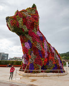 Koons' "Puppy"When we entered the museum, we found ourselves in an incredible 45-meter-high Atrium, with curved volumes and large glass curtain walls connecting the inside and the outside. There were no straight lines to be found here, which is one of the signature traits of Gehry’s architectural design. The three levels of the building, and its 20 galleries, are organized around the Atrium and connected via curved walkways, staircases, and titanium and glass elevators.
We took the elevator to the third floor, so that we could start at the top galleries and wander back down. I have to say though that as impressed and awed as we were by the architecture - both inside and out - we were not so much by the actual works of art, with some exceptions, on display. In fact, one of the criticisms of this museum is that the architectural structure overwhelms its function as a place to display artwork. People come to see that more than its contents. In any case, it is an amazing experience to wander through.
One of my favorite artworks in the museum is Jeff Koons’ “Tulips,” a gigantic stainless steel bouquet of colorful flowers located on a terrace off the atrium that overlooks the river. The flowers are over 2 meters tall and 5 meters across. The reflections of the museum and its visitors in its shiny surface create a very interesting funhouse mirror effect.
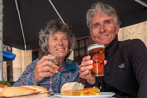 Pintxos (tapas) in the Plaza NuevaKoons has another piece outside the main entrance to the museum named “Puppy.” It’s 42-foot-tall, highland terrier, made from over 60,000 plants and flowers that grow through a steel mesh framework. Puppy was supposed to be a temporary visitor, but the people of Bilbao fell in love with it and bought it. I, for one, am glad they did.
We crossed the River Nervión on the Puente La Salve and walked north a bit for what turned out to be the best views of the exterior of the Guggenheim. On this side of the river, there was much more graffiti - some just artistic expressions, but others of a more political nature. Apparently, the Basque country, also had activists in a separatist movement from the rest of Spain (similar to what we had seen in Barcelona). "We are not Spain!" was painted on many a wall.
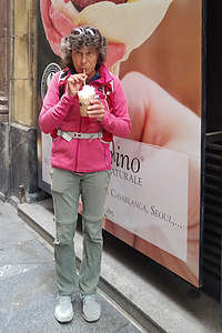 Lolo enjoying her birthday cafe con helado (ice cream)We continued on towards the Casco Viejo, Bilbao’s old city. That is definitely something European cities have that we don’t in the states - “casco viejos,” or old towns. The U.S. simply isn’t old enough. And, my favorite places in each of the casco viejos we have visited are the plazas, where families and friends come to gather in the evenings, especially on Friday evenings, as this was.
Herb and I grabbed a table alongside the Plaza Nueva, and ordered some tapas (called pintxos in Basque country) in a local bar. It was a great place to people watch. Kids from age 5 to probably 15 were playing soccer in the square. Every kid in Spain seems to always be carrying a soccer ball. The people at the table next to us took out little books that looked like hymn books and starting singing in Basque. It was pretty magical.
Although we tried to blend in, somehow I think everyone knew we were Americans - not sure I exactly know why, and not sure I want to. After dinner, I went to pose for a picture on the square, and as I did so, a young boy probably no older than 7, said in not great, but understandable English, “Can you please move, you are in our goal.” Oops. How did he know I was an American. Perhaps it was because I was oblivious to the fact that I was standing in their goal posts.
Before heading back to the bus stop, I stopped at a cafe to have what has become one of my favorite drinks of the trip - cafe con helado (ice cream) with lots of whip cream on top. It was my birthday, so I deserved it.
Description
Once an industrial wasteland of gritty factories and shipyards, the city of Bilbao has been transformed into an international art and tourist destination. It is one of the great treasures of Spain’s Basque Country, a region that often considers itself separate from Spain and even has its own language.
Guggenheim Museum
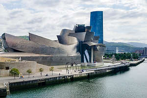 Bilbao Guggenheim MuseumFor most visitors, the Guggenheim Museum is the main draw, and it has played a major role in lifting Bilbao out of its postindustrial depression.
Designed by Canadian-American architect Frank Gehry and opened in 1997, this museum of modern and contemporary art is one of modern architecture’s most iconic buildings, with its gleaming titanium tiles that sheathe the exterior like giant herring scales, reflecting the colors that light projects onto it.
Critics have said that the structure overwhelms function in that it is most famous and loved for its architecture rather than the art contained within it, which is considered no better than other art museums in Europe.
As you enter the Museum, you enter the 45-meter-high Atrium, with curved volumes and large glass curtain walls connecting the inside and the outside. There are no straight lines to be found here, one of the signature traits of Gehry’s architectural design. The three levels of the building are organized around the Atrium and connected via curved walkways, staircases, and titanium and glass elevators. The Atrium functions as an axis for the museum’s 20 galleries.
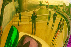 More "Tulip" reflectionsOther artists have added their touch to this amazing museum. Outside on the terrace along the riverbank lives Maman (“Mommy”), a 30-foot spider by French-American artist Louise Bourgeois.
Guarding the main entrance is Jeff Koons’ 42-foot-tall, highland terrier “Puppy,” made from over 60,000 plants and flowers that grow through a steel mesh framework. Although originally intended to be temporary, the people of Bilbao fell in love with it and bought it.
Another piece by Koons is Tulips, a colorful stainless steel giant bouquet of seven tulips located on a terrace off the atrium overlooking the river. The flowers are huge - more than 2 meters tall and 5 meters across. The reflections of the museum and its visitors in its shiny surface create a fun house mirror effect.
The museum is open from 10 am - 8 pm every day but Monday.
Casco Viejo (Old Town)
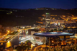 View of Bilbao from the back of our camperSouth of the Guggenheim Museum on the other side of the Ria de Bilbao is the city’s old quarter, with its tight labyrinth of charming old stone lanes, a 14th-century Gothic Cathedral, the 19th century Plaza Nueva, and boisterous tapas (called pintxos here) bars.
Camping in Bilbao
While there are no official commercial campgrounds in Bilbao, there is an aire (place for campers to park overnight) in the city. It is called Area de Autocaravanas de Kobetamendi, and it is located atop a hill with panoramic view of Bilbao. It costs 15€ per night and includes electricity and WiFi. A bus stop into the city is located a short distance down the hill.
Santillana del Mar and the Altamira Cave
Wednesday, June 5, 2019 - 10:15am by Lolo94 miles and 2 hours from our last stop
Travelogue
 Altamira Museum and CaveRainy days can be good sometimes, because they force you to do something different. If today had been sunny we would be on the Ruta del Cares trail right now -- which, don’t get me wrong, would have been great, and is hopefully something we would do tomorrow. Instead, we were heading to the tiny little village of Santillana del Mar.
During our time in Spain so far, we had been to cities of all shapes and sizes - from Barcelona to Granada to Cordoba to Salamanca to Ronda - and they were all great in their own way, but I was about ready for a tiny village, so Santillana del Mar, with a population of 4,000 and only three cobblestone streets to wander navigate sounded like a welcome change.
Before getting to the village, we took the turnoff for the Altamira Cave Museum to check out a different kind of art than that which we had been exposed to so far along our journey through Spain.
 Lolo wandering along the cobblestone streets of Santillana del MarAltamira is pretty much synonymous with prehistoric cave paintings, and for good reason. If you’ve ever seen pictures of cave walls and ceilings covered with paintings of bison, horses, and deer, it was probably Altamira.
The Altamira Cave was discovered in 1879 by the young daughter of a local archaeologist. The paintings are over 14,000 years old and considered to be the best examples of prehistoric art in the world
As you might expect, it became a very popular tourist destination, so much so that in 2002, the cave was closed to the public in order to prevent further deterioration of the art.
However, today there is a museum and a replica cave, allowing visitors such as us to experience it as if it were real. It was quite amazing.
 Romanesque Church in village of Santillana del MarFrom there, we drove less than two miles to the village of Santillana del Mar and found parking at an “Aires.” As I mentioned in my Trip Overview, Aires are inexpensive (and often free) places where overnight parking for camper vans is permitted. This particular one didn’t have any services, but it was in a nice rural setting, free, and very close to town. We didn’t need overnight parking, but it served the purpose of providing us a place to park for a few hours.
It was a beautiful village, so peaceful and quiet compared to the crowds we had been encountering up to now. There are only three streets in the village, so it didn’t take us too long to see all its sites - the plaza, a stunning Romanesque church, the lovely honey-colored mansions with flower boxes in every window, and school children playing bullfight. The village was absolutely charming and for our tastes, the size was just right.
Description
 Altamira Museum and CaveSantillana del Mar is a lovely little stone village near the northern coast, in the province of Cantabria, one hour east of Picos de Europa and 1½ hours west of Bilbao.
According to Jean-Paul Sartre, this village, consisting of three cobbled streets, a few squares, honey-colored mansions, and a stunning Romanesque Church, is “the prettiest village in Spain.”
Just 2.5 km south of the village is the Altamira Cave, whose 14,000 year old prehistoric cave paintings are world famous and considered to be one of the best examples of prehistoric art in the world.
 Beer break in Santillana del MarThis incredible cave whose walls and ceilings are filled with paintings of bison, horses, deer, and other animals was first discovered in 1879 by the young daughter of a local archaeologist. It became a very popular tourist destination, so much so that in 2002, the cave was closed to the public in order to prevent deterioration of the art.
Now a museum and replica cave sit near the original site, allowing visitors to experience and appreciate these amazing examples of prehistoric art.
Parque Nacional de Los Picos de Europa
Tuesday, June 4, 2019 - 9:45pm by Lolo25 miles and 0.75 hours from our last stop - 3 night stay
Travelogue
 Our campground in the Picos de EuropaIt had been a long driving day - hard to believe we were in Salamanca just this morning. Then there was the side trip up the winding road to the Basilica de Covadonga, which was awesome by the way.
Herb was pretty beat from driving. That’s why I was pretty surprised when he agreed to my suggestion of checking out the trailhead and parking situation for the Ruta del Cares hike we were planning to do tomorrow, before we checked into our campground.
It didn’t look like a big deal on Google Maps, but it turned out to be another very winding road, which ended in very rough stones with no place to turn around - oops!. After an 8-point turn and some less than kind words, Herb got the van turned around and pointed to the campground, with the very strong suggestion of no more stops.
Well, at least we learned something. We would take a taxi to the trailhead and back.
 Lolo heading off on the Rute del Cares TrailFinally, around dinner time, we pulled into Camping Naranjo de Bulnes. As promised when I called them earlier, there were plenty of sites to choose from, as it was still early in the season.
After spending so much time in cities, it was nice to once again be camping surrounded by natural beauty, which really is more our thing. The lovely mountain views and a nearby river quickly improved morale - a well-deserved beer didn’t hurt either.
The facilities were very nice and there was even a little WiFi to be had near the reception office.
All this was a plus, as the real reason we had chosen this campground was its proximity to the Ruta del Cares Trail (just 8 km away), one of the three epic hikes in Spain that I had selected during my research back home.
 Along the Rute del Cares TrailHowever, the weather was not great, and the forecast for tomorrow was no better - pretty much rain and wind all day. Argghh! This would be the second time that our planned hike would be thwarted by weather. With the wind situation closing El Caminito del Rey last week, we just waited around another day and got it in. Hopefully, the same would happen here, and we would get a good day to hike the day after tomorrow.
Like the El Camiito del Rey, the Ruta del Cares is another hike along a gorge with precipitous drop-offs, but unlike El Caminito del Rey, this one had no handrails. I definitely wanted good conditions to do it in -- like no big winds pushing me off..
Meanwhile we had a so-so weather day to kill. Fortunately, I had a plan. The little stone village of Santillana del Mar and the nearby Altamira caves had been on my list as a place to stop when we continued east to Bilbao. Although it was an hour away, we figured it was better than sitting in the van in the rain.
 Along the Ruta del Cares trailIt turned out to be a really worthwhile destination, so much so that rather than describe that excursion here, I thought I would give it the dignity of its own stop - see next page for a description of our excursion to Santillana del Mar.
By the time we got back to the campground, the skies had cleared, and it was a very nice evening. Perhaps we would be able to hike the Ruta del Cares tomorrow.
Sure enough, the next morning the sun was shining and the winds were light. We packed up for the day and headed over to the campground office, where the girl that checked us in promised to call us a taxi to take us to the trailhead. After our trial run at driving to the trailhead the other day and having to do a 10-point turn on sharp rocks to get out of there, Herb had definitely decided that no matter how expensive the cab was, it would be worth it. It actually wasn’t bad - just 8 € each way.
 Along the Ruta del Cares trailAs we drove through the quaint little town of Asturia, our taxi driver kept beeping and sticking his arm out the window. At first I thought he was expressing his annoyance with other drivers, but then I realized that they were all beeping back and waving. They just all knew each other and were saying good morning.
We said our goodbyes at the trailhead with the promise of calling him to retrieve us when we were done in about 6 or 7 hours.
I was pretty excited, as the Ruta del Cares is considered to be one of the most breathtaking trekking trails in all of Europe. We had already virtually experienced the trail by watching several YouTube videos, but nothing can compare to the real thing.
The 7.5-mile trail traverses the Picos de Europa National Parque, connecting the town of Poncebos (where we were) in the north to Cain in the South. Since it’s a 65 mile drive between the towns, most people do it as an out-and-back, which means it is really a 15-mile hike.
The first mile or so is a steady climb - the only along the otherwise relatively flat route. Once on top, the most beautiful part of the route begins and the stunning scenery just keeps on going all the way to Cain.
The trail, which was hacked out of the cliff face, runs alongside the Cares Gorge (appropriately nicknamed the Divine Gorge) with stunning limestone mountain peaks rising all around us.
 Along the Ruta del Cares trailWe had to be careful not to get too distracted with the scenery, because the footpath is quite narrow (less than 1 ½ meters) in places and precariously close to the edge, with a 1,000 meter drop straight down to the river. It was much scarier than the Caminito del Rey hike we had done earlier in the trip, as there were no handrails to prevent us from falling over the edge.
The scenery was so distracting that before we knew it we were at the other end. The final stretch into the tiny village of Cain led us through a series of tunnels chiseled out of the limestone and across a footbridge over the Cares River. The village was very quaint, with just a few restaurants and a cafe. Unfortunately the cafe was closed, destroying my dreams of having an American before hiking back.
On the way back the wind really started to pick up as it funneled through the gorge. This would make the narrow, precarious parts of the trail even more exciting. I found myself leaning in towards the wall and staying as far away from the edge as possible.
 I'm not sure which one of us is more curiousWhen we were almost back to Poncebos, we encountered a few of the trail’s famous, friendly mountain goats, who were a lot less concerned about the wind than I was. No leaning into the cliff for them.
They certainly were not shy. They were so curious and anxious to interact that Herb spent a good half hour photographing them. There are more photos of goats than there are of me on this trip.
The hike had very much lived up to my anticipation of it. It was absolutely stunning, every inch of the way.
Back at the trailhead, we called our taxi driver who delivered us back to our campground, beeping and waving at everyone along the way.
Description
 Along the Ruta del Cares trailPicos de Europa National Park contains some of Europe’s most spectacular scenery and some of Spain’s finest walking country. Its stunning limestone mountain peaks are the highest in Spain, and lie just 15 miles inland from the Atlantic Ocean.
One of the most famous hikes in all of Spain is the Ruta del Cares in the Picos de Europa. The 7.5-mile trail runs alongside the Cares Gorge (nicknamed the Divine Gorge) along an amazing footpath hacked out of the cliff face, at the edge of the 1,000 meter deep gorge. At times the trail is rather narrow and a bit precariously close to the edge. It is considered to be one of the most breathtaking trekking trails in all of Europe.
The trail goes from the town of Poncebos in the north to Cain in the South.
The nearest camping to the start of the trail is Camping Naranjo de Bulnes in the town of Asturias (8 km from trailhead).
Basilica de Covadonga
Tuesday, June 4, 2019 - 2:30pm by Lolo240 miles and 4.5 hours from our last stop
Travelogue
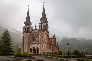 Basilica de CovadongaFrom the moment I saw a photo of the Basilica de Covadonga during my trip planning research, I knew I had to get there. Its beauty was haunting, especially during the atmospherics of a coming storm.
As we drove the 5 hours from Salamanca to our intended campground in Asturias, right outside the Picos de Europa National Park, I began strategizing how I could convince Herb that it was he that wanted to take the ½ hour side trip up a windy mountain to see the Basilica. The fact that it had started to drizzle didn’t make it any easier - or maybe in a way it did, because the photo that first got me going on this place was taken during just these conditions. That, plus my charm got him to make the turn.
There was a little bit of grumbling about where we would park when we got there, but no problem. We pulled right up and parked in front of it, as if we owned the place.
 Santa Cueva, a hillside cave where, according to legend, the Virgin Mary appeared in 722 ADIt was even better in real life - a stunning pink granite, 19th century, neo-Romanesque basilica, set against the dramatic soaring mountains of the Picos de Europa - with a bit of mist and clouds to add to the atmospherics.
Unsure as to whether it was open, we tried the doors, and sure enough it was. We entered and found that we had it all to ourselves - so serene compared to the crowded cathedrals and monasteries we had been to so far along this trip.
After leaving the church, we walked down to the Santa Cueva, a hillside cave where, according to legend, the Virgin Mary appeared before a battle between the Christians and the Muslims in 722 AD. Her appearance spurred the Christian army on to victory and marked the beginning of the 800-year Reconquista. Today there is a beautiful chapel set inside the cave, which has now become a pilgrimage site.
This was definitely a very worthwhile stop.
Description
 View of the Basilica from Santa CuevaThe Basilica de Covadonga, located 5 km up a steep, winding road in the remote northern Picos mountains, is an incredibly grandiose 19th-century, neo-Romanesque, pink granite basilica. Its beauty is even further enhanced by its dramatic setting, tucked between soaring mountains. It is a breathtaking sight.
The significance of this location is that it was the site of the Muslims first defeat in Spain by the Christians, marking the beginning of the 800-year Reconquista. According to legend, before the battle, in 722 AD, the Virgin Mary appeared in a hillside cave, just a short walk from where the basilica is today. A chapel has been installed in the cave, known as the Santa Cueva.
Today it is still a pilgrimage site.
Salamanca
Sunday, June 2, 2019 - 7:30pm by Lolo310 miles and 6 hours from our last stop - 2 night stay
Travelogue
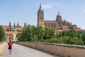 Lolo walking across the Roman Bridge towards the Salamanca CathedralWe arrived at Camping Don Quijote, on the outskirts of Salamanca, quite late in the afternoon -- not bad, considering we had toured the Mezquita in Cordoba just that morning.
The campground was top-notch - good-sized plots, a large pool, 5-star restaurant on site, and adjacent to a lovely park along the Tormes River. The walking/bike path along this river and our walking legs would be our means of getting to the Salamanca Old City in the morning.
I was quite excited about visiting Salamanca as it is one of Spain’s most picturesque cities and home to Spain’s oldest and most prestigious university. Also, the Lonely Planet’s 1000 Ultimate Experiences book lists Salamanca’s Plaza Mayor as the most beautiful plaza in Spain. That’s a lot of superlatives for one medium-sized city. Oh, and it was also declared a UNESCO World Heritage City in 1988.
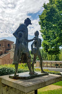 Don Quixote and his sidekick Sancho PanzaThe river path from the campground into town was quite lovely, although we did lose our way a few times when it veered inward. However, after about 5 ½ miles and close to 2 hours, we arrived at a 1st century AD Roman Bridge, which is open only to promenading pedestrians.
We walked out on the bridge where there was an excellent view of the Salamanca Cathedral, with its double domes - one over the 12th century Romanesque half and one over the newer 16th-18th century Gothic / Baroque cathedral. These two churches are actually joined together - but more on that later.
Continuing our walking tour, we passed by the Salamanca Cathedral (for now) and strolled up the Calle Rua Mayor, Salamanca’s main drag, and into the absolutely beautiful Plaza Mayor, Spain’s finest plaza, and in my humble opinion a rival to Venice’s St. Mark’s Square. It gave me goosebumps.
 Plaza Mayor, Spain’s finest plazaRather than have lunch at one of the fancier restaurants that lined the perimeter of the plaza, we decided to select a bit more casual establishment, called the Vinoteca Taperia, back in the hopping Calle Rua Mayor. We were on the early side, so when we sat down at one of the tables on the patio along the street, we were ignored for awhile by the waiters who were having their own lunch before things got busy.
Finally, they got around to us and we had a wonderful lunch of tapas: spinach roll with ham sauce, crunchy chicken with mustard and honey sauce, salmon tartare and guacamole (my favorite), plus sangria and a Heineken (seriously?) for Herb. It was delicious.
After that, we continued our walk, stopping to admire the Casa de las Conchas, a house whose facade is encrusted with more than 300 scallop shells, before entering the Salamanca Cathedral - or more correctly, Cathedrals, an old one and a new one, joined together and both part of the tour.
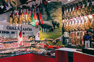 Jamon, as far as the eye can seeWe started in the New Cathedral, which by U.S. standards would not be considered so new, as it was begun in the early 16th century and completed at the end of the 18th century. During those centuries, architectural design changed a bit, so the church has both Gothic and Baroque architectural elements and decoration. Its impressive dimensions (104 meters in length, 48 meters in width, and a 38 meter high dome) give the interior an overwhelming sense of spaciousness.
The Old Cathedral, which we entered next, had a very different feel to it - more cozy and intimate. It was built in the 12th century in the Romanesque style. Its main altar features one of Europe’s oldest organs and more than 50 paintings of biblical scenes dating back to the 15th century. There is a 110-meter clock tower, called La Torre Del Gallo, which you can climb up for beautiful views of the Old Town. Either it was closed or we missed it. Too bad.
After the Cathedral, we made the long walk back along the river to our campground - for a total distance of 15 miles that day. Fortunately, the sights along the way were a good distraction, so we hardly noticed.
 Approaching the Salamanca CathedralAs soon as we got back to the campground, even before jumping in the pool, we made reservations at the very popular and highly rated campground restaurant - so different than in the U.S. where campgrounds rarely have restaurants and even if they did, I highly doubt reservations would be needed.
With all the calories we burned today, we deserved a hearty dinner, so ordered a giant plate of meats and roasted vegetables to share. Very yummy. It was called the Carne for Two. That an a bottle of wine cost us 36 €.
I was really starting to fall in love with Spain!
Description
 Plaza Mayor, Spain’s finest plazaSalamanca is an ancient university town located in the Castilla and Leon region, about 130 miles northwest of Madrid. It is one of Spain’s most picturesque cities, and it Old City was declared a UNESCO World Heritage City in 1988. Its university is the oldest in Spain and one of the most prestigious academic centres in Europe
The Carthaginians first conquered the city in the 3rd century BC. It then became a Roman settlement before being conquered and ruled by the Moors until the 11th century. As a result, the Old City has an interesting mix of Roman, Moorish, Romanesque, Gothic, and Renaissance monument.
Its major sites include:
- Plaza Mayor - Spain’s most beautiful plaza (according to Lonely Planet’s 1000 Ultimate Experiences)
- Calle Rua Mayor - Salamanca’s Main Drag with restaurants, tapas bars, and shops
- Casa de las Conchas - facade encrusted with more than 300 scallop shells
- Salamanca Cathedral- 12th-century Romanesque church adjoining the much larger and newer Gothic / Baroque “New Cathedral” begun in the 16th century and completed in the 18th century
- Roman Bridge (1st century AD) - open only to promenading pedestrians
Montserrat Monastery
Wednesday, May 22, 2019 - 9:45am by Lolo0 miles and 0 hours from our last stop
Travelogue
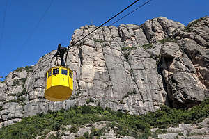 Cable car to Montserrat MonasteryWe had a pretty long list of things we wanted to see in Barcelona, but we had been such eager beavers that we had checked off most of them in the first two days (and 30 miles of walking). That gave us time to use our third day to squeeze in something I had really found intriguing during our pre-trip research - a side trip to Montserrat, a Benedictine monastery nestled on the side of a 1,236-meter mountain with weird, bulbous limestone peaks, reaching up like gnarled fingers.
The journey up to Montserrat is the most popular day trip from Barcelona, and pretty easily accomplished via several legs of transportation. We started our day by walking to the Arc de Triomf metro station, where after a bit of confusion we took the L1 to the Placa d’Espanya.
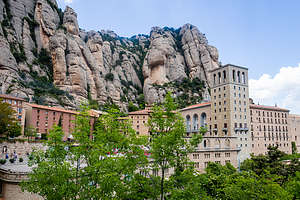 Montserrat MonasteryOnce at the Placa d’Espanya station, we walked to the platform for the R5 train and went through the process of purchasing our ticket for Montserrat. I say process, because there are many options. The first decision we had to make is whether we want to take the cable car or the rack railway up to the Monastery. That would also determine what stop we should get off.
We chose the cable car option, which is called the “Aeri de Montserrat,” because it is said to be more scenic and exhilarating. Exhilarating sounded good. We would just have to make sure we got off at the Aeri de Montserrat stop rather than the latter Monistrol de Montserrat stop, which is for the Rack Railway.
decided to go for it all and bought a "ToT Montserrat" ticket for €53.85 each.
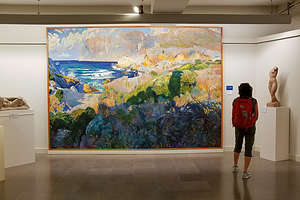 Lolo enjoying the Montserrat Museum“ToT” in hand, we started the second leg of our journey on the R5 train. In about an hour, we got off at the Aeri de Montserrat stop and got on the line for the cable car. We just missed the cutoff for the first car, but another one came within about 15 minutes. Since we were first to get on the next car, we got the best position in the car, right by the windows leading up the mountain. The journey, which lasted just 5 minutes, was scenic as promised, passing over the River Llobregat, the village of Monistrol, and the Santa Cova shrine.
Upon arriving at Montserrat, we decided to start our visit at the Museum, for which our “ToT” ticket would allow us free entry. The museum was actually much more impressive than we had expected, with works by El Greco, Caravaggio, Picasso, Monet, and Degas. We also really enjoyed looking at over a dozen depictions of the Monastery by various painters throughout the centuries.
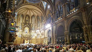 The boys choir getting ready to performThen we had to decide whether to add more goodies to our ticket, like museum entry, free funicular rides to the top of the mountain, or a buffet lunch. We Afterwards we headed over to the basilica to try to get a seat to hear the famous boys choir sing, which they do at 1 pm and 6:45 pm each day - and have been doing so since the 14th century (different boys I assume). We thought we were plenty early, but all the pews were already full, so we took our position, along with many others along the steps on the left side aisle.
As we waited, we watched a long line of people along the right aisle of the church take their turn in front of the “Black Virgin,” a revered wood-carved statue of the Virgin Mary with Jesus on her knee, which is placed behind the main altar. The statue is enclosed in a protective glass case, with only her hand, which holds a royal orb, extending out. As each person approached the statue, they rubbed the orb and gave the sign of the cross. This continued throughout our entire time in the church, even through the boys choir singing.
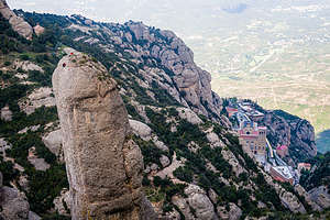 Rock climbers enjoying the viewAt 1 pm on the dot, we were treated to the angelic voices of the 50 boys, aged 9 to 14, singing Virolai, a hymn written by Cataonia’s national poet, and Salve Regina. It gave us goosebumps.
As part of our “ToT” ticket, we had a free buffet lunch, which turned out to be fabulous. It even included all the wine and beer you could drink, which is kind of dangerous in early afternoon.
Quite satiated, and perhaps a bit tipsy, we headed over to the Funicular de Sant Joan (also part of our “ToT”) and took a 10-minute ride to the top of the mountain, where we looked down on an awesome view of the basilica.
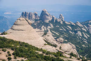 Bulbous limestone peaks of MontserratFrom there we did a 7.5 km loop hike to Sant Jeroni, Montserrat’s highest peak. The views along the way of the unique rock formations were stunning. We also stopped to talk to a few rock climbers enjoying the limestone cliffs along the way.
Time to go, so we repeated our day in reverse - funicular to cable car to train to metro to our comfy hotel near the Arc de Triomf in Barcelona.
What a great day! Montserrat is definitely a very worthwhile day trip from Barcelona.
Description
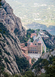 Looking down from atop the Funicular de Sant JoanMontserrat is a Benedictine monastery nestled on the side of a 1,236-meter mountain located about 30 miles northwest of Barcelona. It’s name, meaning “serrated mountain,” comes from the weird, bulbous limestone peaks, which reach up like gnarled fingers.
The monastery, which is Catalunya’s most important pilgrimage site for 1,000 years, was established in 1025 to commemorate the site where shepherds were visited by a vision of the Virgin Mary, complete with celestial light and a chorus of music. Hymns explain how the mountain was carved by angels with golden saws. This is a very important place for devout Catholics.
The 11th-century church was replaced in the 1800s with a Neo-Romanesque basilica, inside of which resides Montserrat’s top attraction - La Moreneta (“Little Brown One” or “Black Virgin”), a revered 12th-century Romanesque wood-carved statue of the Virgin Mary with Jesus seated on her knee. The statue is located behind the main altar and is enclosed in a protective glass case, with only her hand holding a royal orb extending out. Each day, hundreds of people line up on the right side of the church to get their chance to rub the orb.
Every day at 1 pm and 6:45 pm, the famous Montserrat boys choir performs, usually to a full house. This tradition has been going on since the 14th century.
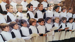 Angelic Montserrat boys choirIn addition to the basilica, there is an excellent art museum ranging from Egyptian mummies to Gothic altarpieces, to Spanish masterpieces, to Impressionist paintings. It is well worth a visit.
To get away from the crowds visiting the monastery, take the 10-minute Funicular de Sant Joan to the top of the mountain, where there are excellent views of the monastery below. From the top, there is a 7.5 km loop walk to Sant Jeroni, Montserrat’s highest peak, with wonderful views along the way.
Today, the monastery is the most popular day trip from Barcelona, and the best way to get there is to take the R5 train from the Placa d’Espanya station. On arriving at the train station you will be faced with a selection of ticket options. Not only will you need to decide whether you would like to take a rack railway or a cable car from the bottom of Montserrat Mountain to the top. You will then have the choice of a number of combination tickets covering everything from a simple return journey to inclusion of lunch or entrance to the museum with the ticket price.
The "ToT Montserrat" ticket includes everything: return train journey, choice of either the cable car up to Montserrat mountain or the Rack Railway, free entry into the Montserrat museum, free funicular rides to the top of the mountain, plus a free buffet lunch at the restaurant at Montserrat. The cost of this ticket is €53.85 per person.
Cordoba and the Mezquita
Saturday, June 1, 2019 - 8:45pm by Lolo100 miles and 2 hours from our last stop - 1 night stay
Travelogue
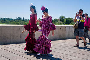 Flamenco dancers in CordobaWhile the Alhambra is the most visited tourist attraction in Spain with over 2 million visitors per year, the Mezquita in Cordoba comes in second, with approximately 1.5 million annual visitors. Always intrigued by photos of its rhythmic series of giant red-and-white colored arches, we decided to add ourselves to the tourist tally.
As I have mentioned before, European cities are much more camper friendly than those in the states, so we were able to find a campground right in Cordoba, called El Brillante Municipal Camping, in walking distance (1.5 miles) to the Mezquita. Another difference between Spanish and U.S. campground is if you call ahead either a day before or same day and find out they have an available site, they will save it for you without taking down a credit card number. They just trust that you will show up or have the courtesy to call if not.
We arrived at the campground early enough on a Saturday to visit the Mezquita, as it was open until 7 pm on Saturdays. Unlike the Alhambra, tickets for the Mezquita do not have to be purchased in advance, but something made me check their website anyway. Lucky I did, because I found out that the hours for today were different than a normal Saturday because of a special festival in Cordoba. Rather than 7 pm, they would be closing at 2 pm today, which was in about an hour. However, they would be open tomorrow morning at 8:30 am.
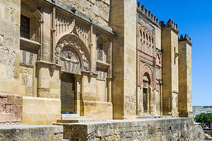 The MezquitaIt was really hot, and the campground pool was not open yet (as it wasn’t technically summer - despite it being well over 90 degrees), so we decided to walk to the historic center near the riverfront, where we could at least enjoy the exterior of the Mezquita and wander through the old city.
Along the walk we saw several women of all ages, shapes, and sizes dressed in flamenco outfits. I don’t think they were actually flamenco dancers, but rather just dressed up as part of the festival.
Just to be sure, we went to the Mezquita first to confirm that it was in fact closed. It was. Still there was plenty more to see and do.
Before I describe our experience in Cordoba, I think it would be helpful to know a little more about the history of this incredible city. I wish I had done more homework before our visit rather than waiting until writing this afterwards. Anyway, for what it’s worth, here is my very, very brief history of Cordoba:
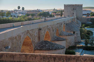 Roman bridge over the Guadalquivir RiverCordoba was first founded as a Roman colony in 152 BC, and served as the capital of Rome’s Baetica province (what is today Andalucia). There are several remnants of its Roman past to explore, such as the Roman bridge over the Guadalquivir River and the remains of a first-century Roman temple.
After the Roman Empire fell in the 5th century AD, the Visigoths took over the city for awhile until it was conquered by Muslim invaders in 711, who turned Cordoba into the Islamic capital of the entire Iberian peninsula.
Every good Muslim city, especially one of such prominance, needs an impressive mosque to show off its power, culture, and influence - hence, the Mezquita.
Construction of the Mezquita (Spanish for “mosque”) began in 785, under the rule of Abd al Rahman I, and lasted for about 200 years. Later caliphs enlarged the mosque, adding a new minaret, orange tree courtyard, outer naves, and other features.
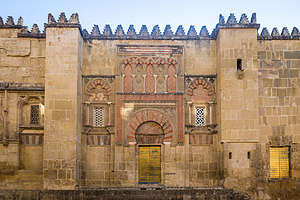 Mezquite (Take 2)During the 10th century, Cordoba was the largest city in Western Europe, and also one of the most impressive, with dazzling mosques, libraries, a university, and highly skilled artisans in textiles and glazed tiles. During that time Muslims, Christians, and Jews in the city coexisted quite peacefully.
However, Christians were not just sitting idly by while Muslims ruled the Iberian peninsula. The Spanish Reconquista (Christian attempt to take back the Iberian peninsula from the Muslims) lasted almost from the time Muslims arrived in the 8th century until Grenada fell in 1492. Cordoba was recaptured in 1236 by King Ferdinand III, and the Mezquita began to be used as a church.
Fortunately for all of us today, the Christian conquerors did not destroy the Islamic features of the mosque, but simply built their own Renaissance cathedral inside it. As a result, the Mezquita is a remarkable example of both Moorish and Renaissance architecture.
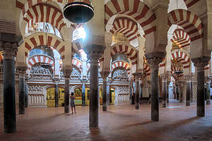 The Mezquita's forest of Islamic red-and-white archesHopefully, that provides a little context for what we would be seeing during our wanderings.
From the Mezquita, we wandered downhill and walked across the Guadalquivir on an the ancient Roman bridge built in the first century AD that once was along the Via Augusta, which connected Rome to Cádiz. While the foundation is the original Roman construction, most of the present structure dates from the Moorish reconstruction in the 8th century. 247 meters in length, it now has 16 arcades. It has been renovated several more times over the last 12 centuries.
After crossing the bridge, we came to the Museum of Al-Andalus Life, which occupies a fortified gate that was built by Christians in the 14th century to protect what was then the Christian city. I looked sadly at the sign saying that it too was closed for the festival.
We made our way back across the bridge, past the Mezquita and along the narrow winding alleyways of the Jewish quarter, dating back to the late Middle Ages. It was so much quieter here, as somehow we had lost all the tourists near the Mezquita. Cordoba is an extremely hot city, but they had it figured out. There was almost constant shade (except high noon) because of the narrowness of the streets and the thick whitewashed walls kept the interior of the buildings relatively cool. Colorful doors and windows and pretty patios behind iron gates helped counter the boring whitewash.
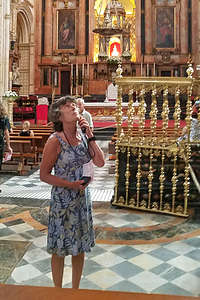 Lolo in the cathedral portion of the MezquitaOn the way back to the campground, we passed the remains of a first-century Roman temple, which was discovered in the 1950s during a remodeling of City Hall. What remains today are the towering columns and base of what was once a massive temple.
Foolishly we thought that we could get a bite to eat on our walk back, but it was only 5:30, way to early for a proper dinner in Spain, especially on a Saturday. We finally gave up, and I am embarrassed to say, went to a McDonalds, just a short distance from our campground. My excuse was that I needed their free internet to load up photos. We had Big Macs and I had a cafe con helado (coffee with ice cream) and Herb had a McCerveza. It was fun - plus it was the only game in town at this hour, which at home is the Early Bird Special.
Cordoba was so hot that we wanted to get our walk and visit to the Mezquita done in the cool of the morning. If we could do that and get back to the campground before checkout at noon, we would move along on our journey north across Spain.
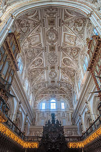 17th century Baroque-style choirWhen we got to the Mezquita around 8:30, I was a little nervous that it still wouldn’t be open, but there was already a crowd gathering near the entrance gate. The doors opened and we were let into the Patio de los Naranjos (Orange Tree Courtyard), where when this was a mosque, the Muslim faithful would wash before prayer.
After purchasing our entrance tickets for 10 € - best 10 € I ever spent - we entered the hypostyle prayer hall and were immediately immersed in the forest of red-and-white giant double arches that the Mezquita is famous for. Each of the arches is supported by a marble, granite, or jasper column salvaged from ancient Roman and Visigothic ruins. There are 856 columns in total. It was absolutely breathtaking.
As I mentioned in my brief history, when Cordoba was recaptured in 1236 by King Ferdinand III, they turned the Mezquita into a church. Thankfully, they pretty much left things alone, with the exception of eliminating part of the column hall to make room for a Renaissance cathedral right smack in the middle of the building, surrounded by the forest of Islamic red-and-white arches.
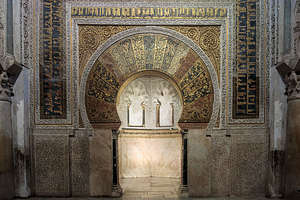 Mezquita horseshoe-arched Mihrab (prayer niche)It is an amazing comingling of the two religions. However, the nave’s towering Renaissance arches and dome were meant to emphasize the triumph of Christianity over Islam.
In the 17th century, a Baroque-style choir was added across from the alter, with 109 beautiful mahogany-carved choir stalls, each depicting scenes from the Bible - Mary’s life on one side and Jesus’ life on the other. Above was an incredible barrel-vaulted ceiling, also in the Baroque style.
Continuing on, we left the Christian worship space and once again entered the Islamic world and its equivalent of the church’s high altar - the Mihrab, a horseshoe-arched, beautifully decorated prayer niche set into the wall facing Mecca. It was from here that the imam would read scripture and give sermons.
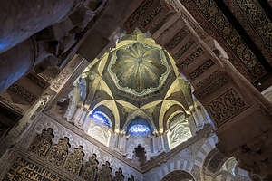 Dome above the MihrabThe arch was adorned with shimmering gold tesserae with vegetal motifs and intricate calligraphic bands of quotes from the Quran. Unlike the Christian portion of the Mezquita, where the walls were adorned with paintings were of saints and Jesus, Muslims do not adorn their worship space with human figures.
Above the mihrab, was a dazzling dome, built of crisscrossing ribs that create pointed arches all lavishly covered with gold mosaic. It was all absolutely stunning.
We had wanted to climb up the belltower for views of the city, but tickets were already sold out. Just as well. This would allow us to walk back to our campground before noon checkout, so that we could move on to our next destination - Salamanca.
I have to confess to another stop at McDonalds for another cafe con helado and free Wifi to load photos.
Description
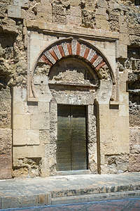 Let's hope the Mezquita doors will open for us todayCordoba was first founded as a Roman colony in 152 BC, and served as the capital of Rome’s Baetica province (what is today Andalucia). There are several remnants of its Roman past to explore, such as the Roman bridge over the Guadalquivir River and the remains of a first-century Roman temple.
After the Roman Empire fell in the 5th century AD, the Visigoths took over the city for awhile until it was conquered by Muslim invaders in 711, who turned Cordoba into the Islamic capital of the entire Iberian peninsula.
Every good Muslim city, especially one of such prominance, needs an impressive mosque to show off its power, culture, and influence - hence, the Mezquita.
Construction of the Mezquita (Spanish for “mosque”) began in 785, under the rule of Abd al Rahman I, and lasted for about 200 years. Later caliphs enlarged the mosque, adding a new minaret, orange tree courtyard, outer naves, and other features.
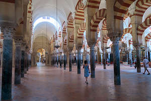 Lolo wandering along the forest of Islamic red-and-white archesDuring the 10th century, Cordoba was the largest city in Western Europe, and also one of the most impressive, with dazzling mosques, libraries, a university, and highly skilled artisans in textiles and glazed tiles. During that time Muslims, Christians, and Jews in the city coexisted quite peacefully.
However, Christians were not just sitting idly by while Muslims ruled the Iberian peninsula. The Spanish Reconquista (Christian attempt to take back the Iberian peninsula from the Muslims) lasted almost from the time Muslims arrived in the 8th century until Grenada fell in 1492. Cordoba was recaptured in 1236 by King Ferdinand III, and the Mezquita began to be used as a church.
Fortunately for all of us today, the Christian conquerors did not destroy the Islamic features of the mosque, but simply built their own Renaissance cathedral inside it. As a result, the Mezquita is a remarkable example of both Moorish and Renaissance architecture.
It is truly a fascinating building, famous for the forest of pillars and arches inside the main hall. It is the second most visited tourist attraction in Spain (after the Alhambra) with over 1.5 million visitors per year.
Ronda
Thursday, May 30, 2019 - 8:45pm by Lolo75 miles and 2 hours from our last stop
Travelogue
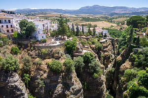 Ronda above the 300-foot deep the El Tajo GorgeNot wanting to waste a precious day in Spain, after being turned away from our scheduled El Caminito del Rey because of high winds, we decided to take a side trip to Ronda, one of Andalusia’s most beautiful white villages, less than an hour away.
There are a string of these lovely villages throughout the Andalusia region, painted white because of the scorching summer heat. Ronda is one of its largest and most popular, as we would soon learn.
Ronda’s main attraction is its dramatic setting, set atop the 300-foot deep El Tajo Gorge, which separates the village into two parts - the New Town and the Old Town.
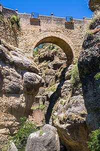 Ronda's Puente NuevoAlthough our main interest was in exploring the Old Town, we had to park in the New and navigated our way through the crowded streets (much more people than we expected) to the Puente Nuevo, the iconic bridge which connects the new town to the old. Funny how although it was built in 1793, it is still considered the “New” Bridge. Spain, with its millenniums of history, has a different way of viewing time than we do in the much younger United States.
After crossing the bridge, we tried to walk down into the gorge, because that is what Rick Steve’s did in the YouTube video we watched, and it looked very cool. However, we were thwarted pretty early on by a locked gate - not exactly sure why.
Still it was interesting wandering around the winding lanes of the old town, which dates back to Islamic times when it was an important cultural center and fortified city filled with mosques and palaces. In its heyday, it was second only to Granada during the last years of Moorish rule in Spain. It fell in 1485, just seven years before Granada.
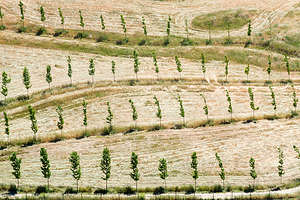 Young olive grove in RondaEventually, we crossed back over the Puente Nuevo into the other world of the new town, with its traffic, restaurants, bars, and up-scale shops. The New Town is also home to the Plaza de Toros, the oldest bullring in Spain (built in 1785).
Funny how most of the crowds stayed on this side of the gorge, although we found the other to be much more picturesque and interesting - all the better for our experience.
Before heading back, we stopped to have a cup of coffee on the terrace of the Hotel Hemingway - where I would like to think he did the same.
Hopefully, tomorrow the wind would cooperate so we could do our hike on El Caminito del Rey.
Description
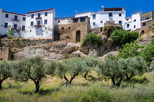 Olive grove in the white village of RondaRonda, one of the most beautiful white villages in Andalusia, sits dramatically above the 300-foot deep El Tajo Gorge. The gorge separates, which was carved out by the Rio Guadalevin, separates the city in two.
South of the gorge is Ronda’s old town, dating from Islamic times when it was an important cultural center and fortified city filled with mosques and palaces. It was second only to Granada during the last years of Moorish rule in Spain. It fell in 1485, just seven years before Granada.
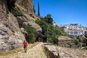 Herb wandering through Ronda's Old TownThe new town is perched atop steep cliffs on the northern side of the gorge. This is where you will find most of the visitors enjoying the many restaurants and parks. It is also home to the Plaza de Toros, the oldest bullring in Spain.
Three bridges cross the gorge connecting the old town with the new, the most iconic of which is the Puente Nuevo, built in 1793. Spain’s idea of new is definitely different than in the United States.
Ardales and the Caminito del Rey
Wednesday, May 29, 2019 - 7:15pm by Lolo95 miles and 2 hours from our last stop - 3 night stay
Travelogue
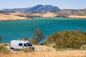 One of the lovely Embalses (Reservoirs) in ArdalesThis was probably the stop I was most excited about, as it is home to one of Spain’s most iconic and popular hikes - the Caminito del Rey. In fact, it is so popular that you actually need tickets for entry, which go on sale in January of every year.
Part of its draw is its legendary past as the most dangerous hiking path in the world, clinging to the sides of the sheer walls of the Garganta del Chorro, a 4-km long gorge that is 400 meters deep.
A brief bit of history to set the scene:
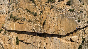 The Caminito del ReyThe original path was built in 1905, not as a tourist attraction, but rather as a means for hydroelectric plant workers to transport materials between two hydroelectric plants at either end of the gorge. Every day workers would precariously walk the 4 km along a narrow, concrete path attached to the walls of the gorge by steel beams. There were no railings or fences of any sort to protect them from falling down into the gorge. To make matters worse, the path deteriorated over the years, resulting in large gaps bridged only by narrow steel beams that the workers had to balance their way across. Add the wind that whips through this gorge to that, and you have some pretty challenging work conditions.
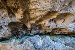 Looking down into the Garganta del Chorro gorgeIn 1921 the Spanish King Alfonso XIII crossed the walkway for the inauguration of the dam - in fact, that is how the route got its name, which means “the King’s little path.”
However, over the years, as more and more people lost their lives falling off the walkway, the local government closed it in 2000. Understanding the value and potential of this incredibly beautiful place, the regional government of Andalusia and the local government of Malaga agreed in 2011 to invest 9 million € in a joint restoration project.
The refurbished and totally safe El Caminito del Rey reopened in March 2015 and received over 3,200 visitors during its first few days. It has been a great boon to the local economy, with tickets (1,100 per day) pretty much selling out every day.
Fortunately, I remembered to go online in January and managed to get 2 tickets for May 30 at 9:30 am (the first group to be let on the path).
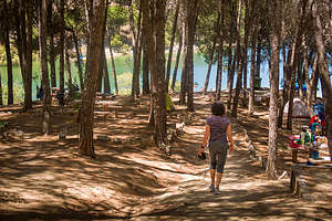 Camping Parque ArdaleOnce I had successfully gotten tickets, I booked a campsite for three nights at Camping Parque Ardales, mostly because they advertised that they were just 1 km away from the entrance of the Caminito del Rey, meaning we would not have to move the camper van to get to our hike.
The two hour drive from Grenada to Ardales was beautiful, leading us past groves of olive trees and awesome views of the aquamarine waters of the Embalse (Reservoir) del Guadalhorce, which we would be camping on - an added benefit I hadn’t realized when booking our campsite.
 Tunnel to the Caminito del Rey trailheadAfter checking into our lovely campsite, we decided to scout out how to get to the Caminito del Rey, so that we would be sure to be on time for our entry the following morning.
The 1 km must have been measured by a crow, because the actual walking distance was 2 miles - still, perfectly fine. The walk took us through the campground, out along the road, through a very dark and long tunnel where Herb banged his head several times, and then a short distance along a trail to the kiosk. Ok,simple enough and accomplished in under a half hour.
After that we hiked back, somehow missing the turnoff for the tunnel (which is a shortcut back to the road), but that was okay because it brought us to the Mirador des Embalses, where there was a beautiful view of the Embalse del Conde del Guadalhorce, a huge reservoir that dominates the landscape - and the one we were camping on!
 Lolo making sure the fencing looks soundEven without the Caminito del Rey, this area is a very worthy destination.
That evening after a humble dinner of salad and tortellini, we took a walk through the campground to a point that jutted out into the Embalse del Guadalhorce. It gets dark so late in Spain that we could still find our way along the trail at 10 pm.
The next morning we got up bright and early, and left our campsite at 8:00 in time to walk the 2 miles for our 9:30 appointment with the Caminito del Rey. When we arrived at the kiosk at 8:45, there were already dozens of people ahead of us anxiously waiting to get started. As 9:30 came and went, the crowd began to get a bit restless. Finally, one of the official gatekeepers announced, “Cerrado, demasiado ventoso,” and everyone started to grumble and walk away. It took me a few minutes, even with my 60+ hours of duolingo, to realize that she had said, “Closed, too much wind.”
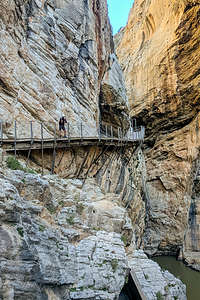 Herb on the Caminito del ReyIn dismay, we went to the official who spoke English and asked her what we could do. She told us that we could go online to their website and change our ticket to any day in the next 30 days. The only possible day we had was tomorrow, so we tried to do it on our phones right there. When even she couldn’t get it to work, she walked into the office and came out with tickets for anytime the next day - however, adding the caveat that the wind could be an issue then as well. At least it was a possibility.
Not wanting to waste the day, we decided to take a side trip to the white village of Ronda (about an hour away), something that had been on my list of possible stops after this one. Rather than describe that excursion here, I thought I would give that lovely village the dignity of its own stop - see next page
 Crossing the gorgeAfter we got back from Ronda, I figured I would take advantage of our prime location on the Embalse del Guadalhorce and spend some time on the beach just a short distance away. I set up my chair and blanket and spent the next hour reading and watching Spanish families happily recreating on the lake, in all sorts of watercraft, my favorite being the paddle boats with water slides on the back.
Feeling peaceful, I took a nap on my towel only waking up when a giant wind blew my chair away. Oh no. There was that damn wind that had thwarted our hike earlier in the day. I was not feeling particularly optimistic about the Caminito del Rey being open tomorrow.
However, the next morning we awoke to the beautiful sound of silence - no wind. Excited that we might have a chance to do our hike, we quickly got ready and headed over to the trailhead to be in the first group let out at 9:30.
 Lolo crossing over the windy suspension bridgeThings looked promising. We were let through the first gate and handed hairnets and a helmet - not because they expected you to fall into the gorge, but to protect in case of falling rocks. A guided tour was let on the pathway first, and about 10 minutes later, our group of about 60 hikers was allowed to proceed as well.
Our strategy was to hang back just enough to lose our group and be able to take photos unimpeded, but not too slow so the next group would catch up to us. The strange thing was, no group every caught up to us. Only later did we realize why. We were the only group let on that day because right afterwards it was shut down again because of demasiado ventoso (high winds). We practically had the whole thing to ourselves.
It was wonderful. The new boardwalk that they built to replace the precarious concrete one was wide and had handrails - perfectly safe and not even a little bit scary. Hanging off the gorge walls 100 meters above the river, the path snaked around the dramatic cliffs, providing breathtaking views around every turn.
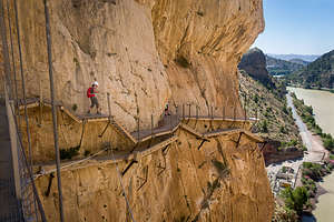 Lolo hiking on the new route, with the old deteriorated one belowWhen rebuilding the new path, they just built it above the old pathway, which allowed us to see how lucky we were that they had replaced it.
It wasn’t until the final stretch when we crossed a long suspension bridge over the gorge that we realized just how bad the wind was. It really whipped pretty fiercely through the gorge, causing the bridge to swing quite a bit. Still, there was no danger of falling as there were steel cables to hold onto. Plus, the incredible views of the ravine and the valley beyond were a good distraction.
It was a pretty awesome day. We were so so glad we were able to get on it before it closed.
Description
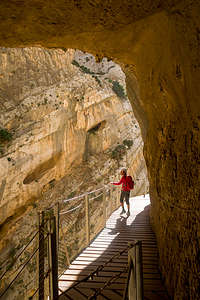 Lolo along the Caminito del ReyArdales is a town in the Andalusian region that lies on the beautiful Embalse del Conde del Guadalhorce, a huge reservoir that dominates the landscape and is a paradise for those looking for water recreation.
As if that isn’t a big enough draw to the region, Ardales is also home to the site of the legendary Caminito del Rey path that was once considered the most dangerous pathway in the world, as it goes along the sheer walls of the Garganta del Chorro, a 4-km long gorge that is 400 meters deep.
The original path, which was completed in 1905, was built to provide workers with a means to transport materials between two hydroelectric plants at either end of the gorge. The path, which was made of concrete resting on steel rails deteriorated over the years, resulting in large gaps bridged only by narrow steel beams that the workers had precariously walk across with the steep drop into the gorge below.
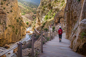 Lolo along the Caminito del ReyIn 1921 King Alfonso XIII crossed the walkway for the inauguration of the dam, giving the path its name with means “King’s path.”
Over the years, several people lost their lives falling off the walkway. After two more deaths in 1999 and 2000, the local government closed both entrances.
After a 9 million € refurbishment project in which 2.9 km of wide wooden boardwalks with handrails were installed, the newly safe El Caminito del Rey reopened in March of 2015. The new boardwalk that hangs 100m above the river, snakes around dramatic cliffs, providing breathtaking views all along the way.
Lonely Planet has listed it as one of its best attractions, so now it is so popular that you need to buy tickets in advance on their website.
Granada
Monday, May 27, 2019 - 1:00pm by Lolo200 miles and 4 hours from our last stop - 2 night stay
Travelogue
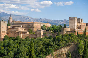 View of Alhambra from AlbaicinThe 4-hour drive inland to Granada was beautiful, with olive trees as far as the eye can see. In fact, I learned afterwards that there are 250 million olive trees in Spain and that they produce almost half of the world’s olive oil. I used to always think Italy when buying olive oil, but Spain produces three times as much and makes some of the best in the world.
The scenery got even more beautiful and surreal as we got closer to Granada and passed through an area that I later learned is called the Barrio de Cuevas or the Neighbourhood of Caves, where homes are built into the red craggy hills. It was like a Hobbit village with front doors cut into the side of the rock and tiny white chimneys poking out of the hills. Known as troglodytes, people have been living in these caves for centuries.
The backdrop of the Sierra Nevada mountains behind them certainly didn’t hurt the view.
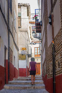 Lolo strolling up the steps of the AlbaicinSoon we were in Granada, home to Spain’s most visited tourist attraction. I had been warned by friends that have been there that it is a selfie-stick madhouse, but we figured we just had to do it. When I tried to buy 14 € General Admission tickets a month before our trip, they were sold out, so I bought 46 € tickets through Nhue tours for a 3-hour, small group (less than 20), English speaking tour of the Alhambra, Generalife, Alcazaba and Nasrid Palaces. Rick Steve had emphasized to make sure the tour included the Nasrid Palaces, as that is the highlight.
While doing my research, I had learned that campers can actually park overnight in the Alhambra parking lot. I was skeptical at first, but several non-official Alhambra websites seemed to confirm that it was possible. However, when we read how difficult it is to navigate through the streets of Granada, we got cold feet and decided to stay at an official campground called Reina Isabel on the outskirts of the city where we could catch a bus into the Granada Old Town, where all the tourist action is.
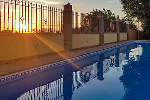 Pool at Camping Reina IsabelThe campground was lovely, and had a beautiful pool - minus the giant slides and fake alligators of La Marina - perfect for dipping into after a long, hot day of sightseeing. The Andalucian area of Spain gets very hot in the summer.
Our tickets to the Alhambra were for the following day at noon, but since we still had plenty of time today, we decided to take the bus and explore the Old Town surrounding the Alhambra. But not before taking a refreshing dip in the pool.
The bus dropped us off at the Palacio de Congresos, about a mile and a half from the Alhambra. Since that was tomorrow’s activity, we headed instead to the Albaicin, the old Moorish quarter of the city on a hill overlooking the Alhambra. Remember, Granada was under Islamic control until the Reconquista in 1492, and the Alhambra was the last stronghold of the Moorish kingdom in Spain.
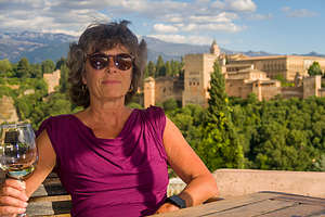 Lolo enjoying her wine from atop the AlbaicinOur goal was to walk up to the top of the hill to the Plaza San Nicolas, said to be one of the most romantic views in all of Europe, especially at sunset when the Alhambra glows red in the evening light. Not knowing exactly how to get there, we started at the River Darro and just kept walking up along the maze of narrow, winding cobblestone streets.
Finally, we heard music and found a lovely plaza lined with cafes and restaurants at the top of the hill. The view of the Alhambra below with the Sierra Nevada backdrop did not disappoint.
Even better though was sipping wine on the terrace of the El Huerto de Juan Ranas with an uninterrupted view of the Alhambra and Generalife below. It was absolutely breathtaking. I tried to take tiny sips to prolong the experience.
 Strolling in the AlbaicinAfterwards we walked back down through a different series of narrow alleys, through the Sacromonte, or gypsy cave quarter, where the best flamenco shows can be found. Unfortunately, we were a bit too early for that, so we continued down and along the River Darro stopping to eat at one of its many restaurants.
In retrospect, I enjoyed exploring the Albaicin even better than touring the Alhambra because it was uncrowded and felt more real. Besides the unimpeded views of the Alhambra’s exterior were in the evening light far exceeded looking over and around the hoards of people touring its interior. Still, they both are very much worth the effort.
The next morning, we took the bus back into the Old Town and wandered up the steep hill to the Alhambra ticket office where our tour would commence at noon. We had some time to kill, so we wandered around further up the hill, eventually stumbling upon a cemetery called the Cementerio de San José de Granada.
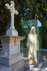 Cementerio de San José de GranadaFor some reason, and I don’t think I’m particularly morbid, I like wandering around cemeteries. They are very peaceful and often have very interesting art. One of the more noteworthy ones was a larger than life-size Jesus enclosed in a glass box.
At noon we met up with our tour guide and group and spent three very informative hours exploring the various parts of the Alhambra.
There are entire books about the Alhambra, so I am not going to even attempt to go into a detailed description of it, as I would in no way be able to do it justice. To really understand it, you have to experience first hand, which 8,000 people do each and every day.
However, very very briefly, the Alhambra is not just one building, but rather a palace and fortress complex of buildings perched atop a rocky hill overlooking the city of Granada. Built by the Nasrid sultans between 1238 and 1358, during the reign of Ibn al-Ahmar, the founder of the Nasrid dynasty, it served as the palace and fortress of the Moorish (Islamic) monarchs. Its name, which means “red castle” in Arabic, comes from the reddish color of its outer walls that were particularly vibrant when it was first built.
The Nasrids were the last Muslim Dynasty in Spain. They surrendered to the Christians during the Catholic Reconquista in 1492, ending almost 800 years of Islamic Rule in the Iberian peninsula.
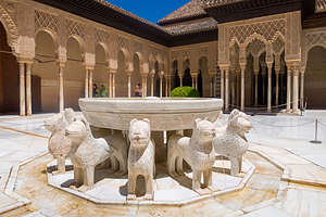 Courtyard of the Palace of the LionsThere are four major sights within the Alhambra complex:
- Nasrid Palaces - exquisite Moorish palace and the stunning centerpiece of the Alhambra
The complex was originally divided into 3 sections: the Mexuar, or royal offices, where justice was administered and state affairs were carried out; the Palacio de Comares, which was the official residence of the king; and the Palace of the Lions, which was the private area of the palace, where the Harem was located.
My favorite parts of the Nasrid Palace include:
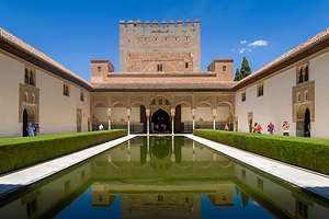 Courtyard of the MyrtlesThe Court of the Myrtles, an elegant patio named for the myrtle hedges that surround the central pond and the bright green colour of which contrasts with the white marble of the patio. It was also called the Patio of the Pond or the Reservoir. The apartments of the sultan’s women looked over this courtyard: two apartments for wives on either side, and a dorm for the concubines at the far end.
 At the north end of the courtyard is the 45 meter high Comares Tower, the highest tower in the Alhambra. The Comares Palace was the official residence of the king and within it is the beautiful Hall of the Ambassadors, which functioned as the throne room. It was here that the sultan sat upon his throne receiving foreign emissaries.
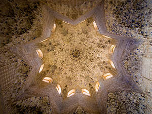 The Seven Heavens of the Islamic Paradise in the Hall of the AmbassadorsIt was the most majestic hall of the palace. Its ceiling is a representation of the Seven Heavens of the Islamic Paradise, with God's throne on the eighth heaven. The hall is completely covered by decorative inscriptions in Arabic script.Muslims avoided making images of living creatures, as that was thought to be God’s work alone. One particular phrase, “only Allah is victorious” is repeated 9,000 ties throughout the palace.
 According to legend two very significant historical events took place in this room in 1492: the last Moorish king surrendered the city of Granada to the Catholic Monarchs thereby ending the 700-year Reconquista, and Christopher Columbus convinced the Catholic Monarchs to give their approval for his expeditions to the Indies. Those are two pretty big historically game-changing events.
However, my overall favorite part of the Nasrid Palaces was the courtyard of the Palace of the Lions, where 12 marble lions hold up a gurgling fountain. The courtyard layout uses the proportions of the golden ratio. Its 124 slender columns are placed in such a way that they are symmetrical on numerous axes.
- Generalife Gardens - the sultans’ summer palace and lovely manicured gardens and orchards
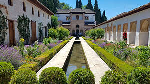 Generalife Gardens of the AlhambraA simple one-way path leads through the manicured gardens, past ponds and fountains, to the sultan’s bright white summer palace. The gardens were irrigated by a royal aqueduct which diverted water from the Darro River into the Alhambra.
 In contrast to the decorativeness of the Nasrid Palace, the buildings in the Generalife are all quite solid and simple. The emphasis was on the fountains and the gardens.
The Moorish kings considered this garden to be the closest thing on earth to the Quran’s description of heaven. The Generalife became a leisure place for them when they wanted to get away from the official affairs of the palace.
- Alcazaba Fort - remains of the 13th-century citadel.
- Charles V’s Palace - the Christian Renaissance palace built within the Alhambra after the Reconquista.
Charles V very much respected the Alhambra’s beauty, so he built a modern Renaissance palace for official functions, but used the existing Nasrid Palaces as his royal residence. The palace, which was designed by Pedro Machua, a pupil of Michelangelo’s, has a unique circle-within-a square design. The palace is square, but within its center is a roofless, two-tiered circular courtyard ringed by 32 marble columns.
This is actually the oldest part of the Alhambra complex. Built in the 13th-century, it once defended a medina (town) of 2,000 Muslims living within its walls. A winding staircase leads to the top of a tower to Alhambra’s best viewpoint
Our tour guide was very adept at steering us into less crowded areas of the complex during our tour making it a very pleasant and educational experience.
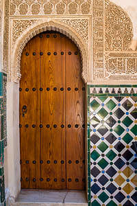 Lovely tilework and decorative Arabric script in the AlhambraHe also emphasized that if it wasn’t for two people, we probably would not be experiencing the history and beauty of the Alhambra today:
- A wounded Spanish soldier during the Napoleonic Wars - In 1812, Napoleon’s troops invaded Granada and seized the Alhambra, looting and damaging large portions of it. Their attempt to blow up the palace was thwarted by a wounded soldier left behind in the palace, who single handedly diffused the bomb saving this beautiful building for future generations.
- Washington Irving - the Alhambra’s remarkable beauty and historical significance were not appreciated until Irving visited the Alhambra, fell in love with its architecture and history, and wrote Tales of the Alhambra, a collection of stories which brought this incredible site to the world’s attention, thereby preserving it for future generations.
So often in history, it is the actions of a few brave and insightful people that change the course of history. Those are the stories I love to hear.
Exhausted from our full day of touring in the heat of a Granada summer, we caught our bus back to Camping Reina Isabel and sunbathed and swam in the lovely pool beneath the hot Andalusian sun. .
Description
While I will not attempt to do an in-depth description of all Granada has to offer -- there are numerous guidebooks to do just that -- the following are some of the interesting sites that we enjoyed:
Alhambra - Spain's most visited attraction:
- Monumental complex of buildings atop a rocky hill, overlooking the city of Granada that was once the palace and fortress of the Moorish monarchs. It was built between 1238 and 1358, during the reign of Ibn al-Ahmar, the founder of the Nasrid dynasty.
- Its name, which means “red castle” in Arabic comes from the reddish color of its outer walls that were particularly vibrant when it was first built.
- The Nasrids were the last Muslim Dynasty in Spain to surrender to the Christians during the Catholic Reconquista in 1492, ending almost 800 years of Islamic Rule in the Iberian peninsula.
- Today, the Alhambra attracts 8,000 visitors a day and tickets must be purchased well in advance: www.tickets.alhambra-patronato.es
- The Alhambra consists of four sights clustered atop the hill:
- Palacios Nazaries - exquisite Moorish palace and the stunning centerpiece of the palace complex
- Charles V’s Palace - the Christian Renaissance palace built within the Alhambra after the Reconquista
- Generalife Gardens - the sultans’ summer palace and lovely manicured gardens with pathways, patios, pools, and fountains
- Alcazaba Fort - remains of the 13th-century citadel. A winding staircase leads to the top of a tower to Alhambra’s best viewpoint
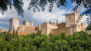 View of Alhambra from Albaicin
Albaicin - Medieval Moorish town dating back to the Nasrid Kingdom of Granada
- UNESCO site
- Located atop a hill overlooking the Alhambra
- Lovely narrow alleyways and small squares to wander through
- Plaza San Nicolas - great panoramic views
- Terrace of El Huerto de Juan Ranas - great place to sip wine with an uninterrupted view of the Alhambra and Generalife below.
Sacromonte - gypsy cave quarter with best flamenco guitarists, dancers and singers

