- Home
- About
- Map
- Trips
- Bringing Boat West
- Migration West
- Solo Motorcycle Ride
- Final Family XC Trip
- Colorado Rockies
- Graduates' XC Trip
- Yosemite & Nevada
- Colorado & Utah
- Best of Utah
- Southern Loop
- Pacific Northwest
- Northern Loop
- Los Angeles to NYC
- East Coast Trips
- Martha's Vineyard
- 1 Week in Quebec
- Southeast Coast
- NH Backpacking
- Martha's Vineyard
- Canadian Maritimes
- Ocracoke Island
- Edisto Island
- First Landing '02
- Hunting Island '02
- Stowe in Winter
- Hunting Island '01
- Lake Placid
- Chesapeake
- Provincetown
- Hunting Island '00
- Acadia in Winter
- Boston Suburbs
- Niagara Falls
- First Landing '99
- Cape Hatteras
- West Coast Trips
- Carmel
- Burning Man
- Utah Off-Roading
- Maui
- Mojave 4WD Course
- Colorado River Rafting
- Bishop & Death Valley
- Kauai
- Yosemite Fall
- Utah Off-Road
- Lost Coast
- Yosemite Valley
- Arizona and New Mexico
- Pescadero & Capitola
- Bishop & Death Valley
- San Diego, Anza Borrego, Joshua Tree
- Carmel
- Death Valley in Fall
- Yosemite in the Fall
- Pacific Northwest
- Utah Off-Roading
- Southern CA Deserts
- Yosemite & Covid
- Lake Powell Covid
- Eastern Sierra & Covid
- Bishop & Death Valley
- Central & SE Oregon
- Mojave Road
- Eastern Sierra
- Trinity Alps
- Tuolumne Meadows
- Lake Powell Boating
- Eastern Sierra
- Yosemite Winter
- Hawaii
- 4WD Eastern Sierra
- 4WD Death Valley +
- Southern CA Deserts
- Christmas in Tahoe
- Yosemite & Pinnacles
- Totality
- Yosemite & Sierra
- Yosemite Christmas
- Yosemite, San Diego
- Yosemite & North CA
- Seattle to Sierra
- Southwest Deserts
- Yosemite & Sierra
- Pacific Northwest
- Yosemite & South CA
- Pacific Northwest
- Northern California
- Southern Alaska
- Vancouver Island
- International Trips
- Index
- Tips
- Books
- Photos/Videos
- Search
- Contact
Home
Wednesday, August 29, 2018 - 1:00pm by Lolo4 miles and 187 hours from our last stop - 1 night stay
Travelogue
Home Sweet Home!
South Lake Tahoe area
Tuesday, August 28, 2018 - 12:00pm by Lolo150 miles and 3.5 hours from our last stop - 1 night stay
Travelogue
 Secret Cove on Lake TahoeSince we were in no particular rush to get home, we decided to squeeze another day into our mini-vacation and spend the night in South Lake Tahoe. Usually we stay at Camp Richardson, but last year we discovered another alternative called Campground by the Lake. It has the advantage of being located right across the street from the lake, but I do still like Camp Richardson for its proximity to the Tallac Historic Site. It’s nice to have two good choices in South Lake Tahoe.
That afternoon we drove up to Secret Cove, one of a series of secluded, pristine beaches along Highway 28 on the remote Nevada eastern shore of the lake. It is one of Herb’s favorite beaches, which means a lot coming from a beach aficionado, so we come back to it every time we are in the area.
Along this section of the lake, the highway is way above the lake, so we had to hike down a fairly long, steep path to the beach, lugging our beach chairs and cooler.
We were quite surprised when we got our first sighting of the beach - or what was left of it. The lake was so high, which I guess is good news, that there was barely and beach left. The boulders that we had tucked ourselves behind in previous years were now in the water. We managed to find a bit of unoccupied sand and spent the afternoon reading and cooling off in the lovely clear water.
When we got back to Campground by the Lake that evening, we walked across the street to the beach to watch another beautiful sunset over Lake Tahoe.
Description
I am not even going to attempt to give a full description of what Lake Tahoe has to offer, as we only spent a short time on its southern shore.
However, briefly, Lake Tahoe is one of the highest elevation lakes (6,255 feet high) in the U.S., as well as the second deepest (1,645 feet deep) – Crater Lake is the deepest. It is located along the border between California and Nevada. The four shores of the lake are each quite different. The north is quiet and upscale, the west and east are more rugged and less developed, and the south shore is busy and tacky with neon-lit hotels and casinos. The 72-mile drive around the lake is very scenic.
Lake Tahoe is known for its clear blue and green waters and the panorama of mountains that surround it on all sides. It is a year-round destination with swimming, boating, kayaking, and various other kinds of water sports during the summer; hiking, backpacking, and camping all year round; and tremendous skiing and snowboarding in the winter.
Tuolumne Meadows
Wednesday, August 22, 2018 - 11:45am by Lolo236 miles and 5.5 hours from our last stop - 6 night stay
Travelogue
Day 1 - Hiking to Elizabeth Lake and Unicorn Peak
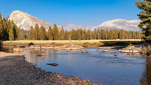 View of Lembert Dome from Tuolumne MeadowsWe had arrived in Tuolumne Meadows last evening, too late to do much of anything but a quick walk out into the Meadow just to absorb the peace and beauty of this incredible place before turning in for the night.
Today we had the whole day to ourselves before the arrival of our guests for the weekend, so we decided to spend it hiking, which is pretty much what one does in Tuolumne Meadows. We had hiked most of its trails in previous visits, so Herb suggested one that we do a new one, the hike up to Elizabeth Lake.
Herb sort of lured me into this hike before I knew what I was getting into. He billed it as a 5-mile round trip hike, right from our campsite, to a lovely alpine lake - and oh, we could continue on for a bit towards Unicorn Peak if we felt like it.
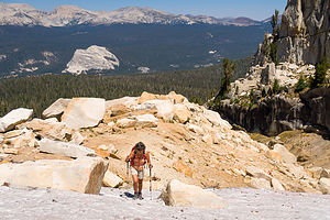 Lolo attacks the ravineWe packed up a lunch and set off through the campground to campsite B49, next to which is the trailhead to Elizabeth Lake. The trail started off with a moderate climb through a forest of lodgepole pine and mountain hemlock before joining up and running alongside Unicorn Creek.
The views got better and better as we climbed out of the woods, with the imposing Mount Conness and Ragged Peak behind us and Unicorn and Cathedral Peaks laid out before us.
After about 2 ½ miles we reached the shores of Elizabeth Lake (elevation 9,580 feet) and followed the path along the northeast shore of the lake. Before continuing on and up to Unicorn Peak, we stopped for a picnic lunch on the banks of the lake, all the while staring up at this unique rock formation, wondering just how the heck we were going to get up there, as there is no designated trail. We also took note of a cliff below it to hopefully ensure that we would not come down that way and find ourselves at the brink of it.
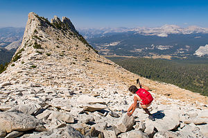 Lolo loving the talus fieldAfter much deliberation, we decided to scramble up the rocky ravine to the left of it, hoping to find a navigable trail to the right once we got on top. It was a long, tough slog up a rocky 1,300 feet to a height of 10,752 feet, made even more difficult by the fact that we were not acclimated to high elevation yet, having driven from near sea level the day before.
On top of the ravine at last, we thought it would be quite obvious as to how to get to the base of Unicorn Peak. However, Unicorn Peak turned out be not as unique as we thought, and we at first mistook another rock formation, the Cockscomb, for our real goal. After pulling out a map and orienting ourselves based on recognizable features, such as Cathedral Peak and Budd Lake, we were able to get back on track and found Unicorn Peak’s saddle.
That was the good news. The bad news was that we had to make our way across a vast talus field, along which we had to use our trekking poles to test the stability of each rock before we trusted stepping on it. It was probably only about 300 yards, but it felt like it took forever.
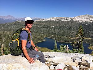 Herb enjoying the view of Elizabeth LakeFinally, we managed to get near the base of Unicorn Peak, which was our goal for today. Getting to the summit is quite technical. The South Summit is the only one that doesn’t require climbing gear to get to the top, but it still requires doing class 3 – 4 scrambling to get to the top. Perhaps we would save that for another day.
However, the fun wasn’t over yet as we had to decide how to best make our way back down to Elizabeth Lake when there was no obvious trail. Plus, we wanted to avoid winding up at the top of that cliff we had noticed from our lunch spot on the lake. There was no way we wanted to work our way back to the ravine that we had climbed up, so we just kept heading down, taking the path of least resistance, and keeping the lake in our sights. There was quite a bit of bushwhacking involved along the way. Some cairns would certainly have been nice.
Finally we made it back down to the lake and continued on back to the campground. It was probably the hardest 8-mile hike we have ever done. I would take 5 miles on a trail over 300 yards on talus any day.
Day 2 - Hiking to Dog Lake and Hanging out in the Meadow
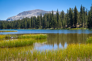 Dog LakeBeth and Richard (Erin’s parents) arrived at our campsite bright and early Friday morning, ready for a full day together before the kids arrived later tonight. What a different feeling from last year, when we were meeting them for the first time, with 8 hours to spend alone together before Tommy and Erin’s arrival - which could have been awkward if we hadn’t been so compatible. I guess it says a lot for Tommy and Erin’s judgment of their parents that we would get along just fine and be great friends before they even arrived. They were right.
Once their tent was set up and all food stored in the bear box, we decided to go on a hike to Dog Lake, one of the easier to reach alpine lakes in Yosemite.
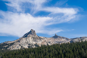 View of Unicorn Peak from the MeadowWe parked at the Dog Lake parking area just west of the Tuolumne Meadows Lodge. From there, we crossed Tioga Pass Road and followed the trail, which rose pretty steeply for the first mile as it wound its way through a lodgepole pine forest. I felt bad because I had told Beth that the trail was pretty flat and easy - Oops.
At the ¾ mile point we came to the junction for Lembert Dome, which is really a worthwhile hike with great views of Tuolumne Meadows and the surrounding peaks from its summit. It does, however, require a bit of scrambling up a steep slabby section towards the top, so we figured it would be better to save this for another day when our guests were more acclimated to the altitude.
So, instead we continued on for another mile to the shores of pretty Dog Lake with views of Mount Dana and Mount Gibbs in the distance. Although there is a path that circles the lake, we satisfied ourselves with a picnic lunch on its shoreline.
All in all, the hike is a moderate 3.5 miles (RT) with a 600-foot elevation gain.
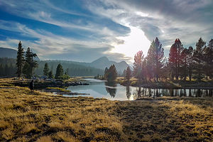 Lovely Tuolumne MeadowsOne of the loveliest places to spend late afternoon / early evening in Tuolumne is wandering around the Meadow. So, we packed chairs and a cooler of wine and cheese, loaded up the car, and parked along the road where a wide trail ( 0.1 mile east of the Visitor Center) led out into the meadow.
In about a ½ mile the trail crosses a footbridge over the Tuolumne River and leads to a rocky beach along its shore - the perfect place to enjoy the lovely views of Cathedral Peak, Unicorn Peak, the Cockscomb, and Echo Peaks to the south and Lembert Dome to the north, enhanced greatly by the wine and cheese in our cooler.
I would have to say that I looked at Unicorn Peak a lot differently now that we had actually hiked up to it from our campsite. I was pretty proud of myself.
The kids didn’t arrive until close to midnight, but once a mother, always a mother, so I waited up for their arrival.
Day 3 - Hanging out at Tenaya Lake and Hiking up Pothole Dome
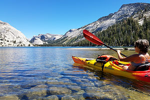 Lolo kayaking on Tenaya LakeIt is not difficult to see why Tenaya Lake is referred to as the “Jewel of the High Country.” With its glacial blue waters, surrounded by granite domes, it has to be one of the most beautiful lakes in the Sierras.
So, today we decided to spend the first part of our day, lounging on its sandy beaches, swimming in its chilly waters, and paddling in our kayaks around its shoreline.
Herb stores the kayaks on top of the motorhome when we travel, which requires quite a bit of heavy lifting to get them up there, but feels worth it when we find a lake like Tenaya. Although we have kayaked around Tenaya several times, it was nice to give our guests a chance to experience paddling around this beautiful lake.
Since we are not a group that just sits around well, afterwards we decided to take a hike to the top of Pothole Dome, a short hike that has a lot of bang for its buck. The parking lot for Pothole Dome is located about 1 ½ west of the Visitor Center.
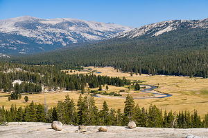 View of Tuolumne Meadows from atop Pothole DomeThe trail begins along a meadow before reaching the base of the Dome. From that point on, there is no trail, but rather an easy scramble up whatever route you choose to the top. And, as its name implies, there actually are lots of potholes on Pothole Dome, formed by glaciers trapping flowing water, in which swirling rocks slowly drilled out a hole.
From the top, there are superb views of the Tuolumne River flowing through the meadow, as well as many of Tuolumne’s famous domes and peaks, such as Fairview Dome, Lembert Dome, Mount Dana, and Mount Gibbs. Not bad for a 1 ½ mile hike with only a 200-foot elevation gain.
That view of the river flowing through the meadow was just too tempting to resist, so that evening, we loaded up chairs, cameras, fishing rods, hors d’oeuvres, and wine and spent a lovely evening fishing, laughing, and watching the light change over its surrounding peaks.
Day 4 - Guests Departure and Hiking the John Muir Trail along the Lyell Fork
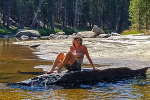 Lolo chillin' along the Lyell Fork of the Tuolumne RiverSunday - time for working folk to head back to the real world, while us retirees tried not to gloat about being able to linger around paradise for another day or two.
While Beth and Richard got an early start on their long drive back to the LA area, Tommy and Erin stayed for a while, mostly hoping to meet up with Ethan, one of his co-workers who was speed hiking the John Muir trail from Yosemite Valley to Mt. Whitney, hoping to do its 211 miles in 7 days, while hikers take 3 weeks.
Fortunately, there was just enough cell coverage in Tuolumne, for Tommy and Ethan to plan a brief meet up at the Tuolumne Meadows Store, before he had to forge on. He needed to get out of Yosemite National Park that day because he was traveling light and didn’t have a bear canister, which is required of all backpackers in the park.
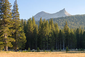 View of Unicorn Peak from the MeadowWhen he arrived, he looked great - just like he was out for a Sunday stroll. We gave him a tuna sandwich and bought him an ice cream in the store, which he very much appreciated, although he confessed it did put an * on his totally unsupported through hike. Still, he said it was worth it.
We wished him well, and off he went.
Tommy and Erin left shortly afterwards, and Herb and I spent the rest of the day hiking from our campsite along the Lyell Fork of the Tuolumne River, on the Pacific Crest / John Muir Trail. An easy hike, as we were saving ourselves for the big hike to Clouds Rest tomorrow.
Day 5 - Hiking to Clouds Rest
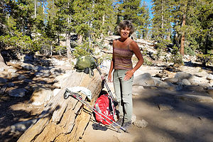 Lolo getting ready to hit the trail to Clouds RestThe hike to Clouds Rest has been on our bucket list for literally 10 years, but I have avoided it and made excuses for not doing it equally that long, not just for its strenuous 14 miles over rugged terrain at high elevation, but for its somewhat dicey ending, described in one book as “a promenade across a narrow and precipitously edged ridge composed of piled sheets of granite resembling huge stacks of pancakes or a line of toppled dominoes, with terrifying drop offs on either side.” My palms sweat just reading that.
However, I was braver now (having become a rock climber of sorts some 5 years now) and we were probably in the best hiking shape we have ever been. It was now or never.
We were up early and on the trail by 7:59 am - early for me, but necessary as the hiking time estimates were 8 to 11 hours. When we got to the trailhead at the southwest end of Tenaya Lake, there were a few cars already there, but we had no trouble finding a parking spot - probably because this was a weekday.
The first 2 ½ miles of the hike was a repeat for us, as it is the trail that also leads to Sunrise Lakes, which we had done two years ago. It starts off pleasantly enough, wandering through mini meadows and forests on fairly level ground for the first mile and a half. Don’t get lulled into complacency though, because at that point the trail gets rough and steep, climbing 1,000 feet in a 1-mile stretch.
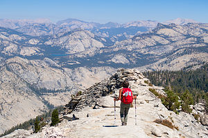 Lolo approaches the Clouds Rest summitAt 2.3 miles we came to the junction for Sunrise Lake, but continued straight towards Clouds Rest, 4.7 miles more. This first section is really the toughest part of the hike.
From the trail junction, we began to descend for about a half mile to a lovely alpine meadow and a tree-ringed pond. I wasn’t particularly happy about the descent, as I knew that what goes down, must come up, and I much prefer my return to be all downhill. We continued along on fairly level ground through a lupine forest until about the 4.3-mile point, where we once again began to climb.
At 4.9 miles, we beared right at the T junction for Cloud’s Rest and got our first sighting of Clouds Rest, which we were sneaking up on from behind. As we climbed through a forest of western white pines, we began to get glimpses of some of Yosemite’s iconic rock formations.
At 6.8 miles, we came to the marker for the Clouds Rest Foot Trail to its summit. This was it. I must admit my body had a Pavlovian response to that sign - my palms began to sweat a bit and my heart quickened a few beats.
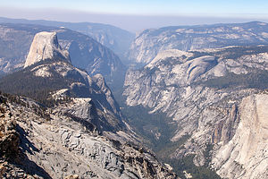 View from atop Clouds RestI took a deep breath and continued onto the narrow footpath, scrambling across rocks, with the steep drop-offs I had been promised on either side of me. I was comforted that the drop-offs were not straight down, but rather at a steep angle, giving one the feeling of more room, although the effect of falling would be the same. This went on for about 300 yards before emerging on the much wider, and safer, summit.
I would have to say that it wasn’t as bad as I had feared, and, although still a bit anxious, I was not totally dreading the fact that I had to cross it again on our way back.
The views at the summit were totally worth it. All of Yosemite was sprawled out before us - the ever popular Half Dome looming over Tenaya Canyon, North Dome, Mt. Hoffman, Yosemite Valley, the Clark Range, and all the Yosemite top hits. It was breathtaking.
We met a hiker from Arizona that was doing an impressive hiking “hat trick” over a three day period - Mt. Hoffman, Clouds Rest, and the Half Dome cable route. We have since become friends on facebook, enjoying each other’s adventures.
After eating lunch, we headed back out across the narrow section, and although I was less scared than before, it was still nice to finally place my foot on wider, solid ground. A guy less than half my age, who looked very hesitant to start his trek across, asked me how it was. “Not so bad,” I proudly responded. “Good,” he said, “because I don’t feel like dying today.” So, apparently I wasn’t the only one that had been dreading this.
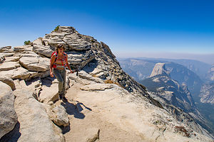 Lolo escaping from the Clouds Rest summitThe way down was long, and not helped by my rolling my ankle a bit on a root on totally flat ground shortly after coming off the summit. How ironic that I had gotten through the tough parts and messed up on the easy stuff - probably because I had been so deliberate in my steps on the rocky, steep parts, but a bit too nonchalant afterwards. It hurt a bit, but I was able to continue - not sure what my choice would have been.
The way back seemed much longer than the way there, even though it was mostly downhill. I guess we were tired and there was no longer the anticipation of the summit to distract us.
When we got back to the car, I took my hiking boot off, and my ankle was fairly swollen and black and blue. Lucky for me, and Herb who would have had to carry me, that it wasn’t any worse. This was the end of our trip anyway, so at least I wouldn’t be missing out on any more hiking opportunities.
I would have to say that I was proud and exhilarated by having finally faced my fears and experienced this truly incredible trail.
Another awesome Yosemite adventure had come to a close. Tomorrow we would head home, stopping for a night in South Lake Tahoe along the way.
Description
In my past Yosemite National Park trip stop descriptions, I have focused on Yosemite Valley. However, this time our foray into Yosemite included a few days in beautiful Tuolumne Meadows along the Tioga Pass Road in the northern part of the park.
Tuolumne Meadows is very different from Yosemite Valley. At an altitude of 8,600 feet, it is high country and therefore, considerably cooler and wetter. As its name implies, Tuolumne is a beautiful sub-alpine meadow along the Tuolumne River, surrounded by rugged snow-covered mountain peaks and glacially-carved granite domes. The rock is porphyritic granite, which has a tendency for exfoliation, resulting in the distinctive dome shapes that are found here.
Hiking and rock climbing are extremely popular in this section of the park and tend to be much less crowded than the Valley. In contrast to the big walls in the Valley, the rock climbing routes on the major domes in the Meadow are shorter.
There are very few services in Tuolumne and the Tioga Pass Road is usually only open from Memorial Day through late October / early November, depending on the snowfall. During the summer (mid-June to mid-September), camping is available at Tuolumne Meadows Campground. It is extremely popular, so reservations are strongly recommended. However, there are also many sites saved as first-come-first-served. There is also a small grocery store, grill, post office, and gas station.
Lake Powell - Rainbow Bridge National Monument
Saturday, July 7, 2018 - 8:15am by Lolo56 miles and 3.5 hours from our last stop
Travelogue
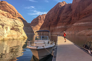 Rainbow Bridge boat dockWe awoke early on our last morning on the lake with the intention of beating the crowds to Rainbow Bridge National Monument, Lake Powell’s most popular destination. We had purposely positioned ourselves in the San Juan Arm last night, so that it would be a quick run of just 8 miles down the lake to Forbidding Canyon (Buoy 49), at the end of which lies the trail to the bridge.
When we got to the end of the canyon, there was only one other boat tied up a dock, which could hold dozens, and large tour boats as well. So although not first to arrive, we were pretty close and thrilled to have the opportunity of experiencing this wonder in peace and solitude.
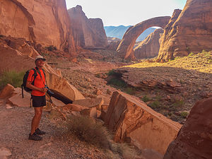 Herb approaching Rainbow BridgeThe trail from the dock to Rainbow Bridge is less than a mile, with current water levels. As we were hiking in, the people belonging to the solitary boat at the dock passed us, meaning that now we would truly have the Bridge to ourselves. How thrilling, considering it is visited by over 300,000 people a year.
We have seen a lot of arches and bridges in our travels, but this one was truly impressive. At 290 feet tall and 270 feet across, it is the largest natural bridge in the world. To give some idea as to how large that actually is, the U.S. Capitol building would fit neatly underneath it.
What makes this a “bridge” rather than an “arch” is that it was formed by water. In the case of Rainbow Bridge, it was formed by water flowing from the Navajo Mountains eroding the sandstone on its way down to the Colorado River. It is considered sacred by the Navajo as a symbol of deities responsible for creating clouds, rainbows, and rain - the essence of life in the desert.
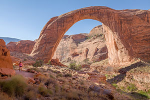 Lolo and Rainbow Natural BridgeStanding in solitude beneath this awe-inspiring arch, it was understandable why the Navajo considered this place sacred. What a fitting way to conclude an amazing trip on this beautiful lake.
Our 50-mile cruise back to Wahweap was a bit rough, in that there was so much weekend boat traffic that the wakes were bouncing off the canyon walls churning up the water. Fortunately, we didn't have to wait too long to pull the boat at the Stateline boat ramp, as most people were putting in for the weekend.
From there, it was a long 900-mile drive back to Santa Rosa, where after a 2 1/2 year separation, our boat would finally be home.
Lake Powell - San Juan Arm
Friday, July 6, 2018 - 8:15am by Lolo50 miles and 2.5 hours from our last stop - 1 night stay
Travelogue
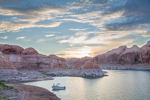 Our campsite in the San Juan ArmWe made a bit of a tactical error today. Having gotten a bit frustrated yesterday trying to find a good campsite, and having to go back to the same one (although a good one it was), we decided to skip the morning hike and start our journey south early in the hopes of beating the Friday afternoon rush for a campsite.
We had bypassed the San Juan Arm on our journey up the lake, with the intention of exploring it on the way back, so we decided that today was the day.
Our trusty “Lake Powell and its 96 Canyons Boating and Exploring Map” (see Books to the right) indicated that just a short distance up the arm there is a small cove on the north shore of the mouth that has some good campsites.
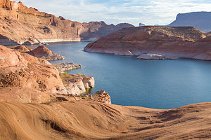 View from the ridge above our campsiteIt was right - there were good campsites with good hiking opportunities, and there was no one there. So we took it. The problem was that it was already 105 degrees and it was only 10 am. What were we going to do for the next 9 hours until it got cool enough to get out of the water?
My approach was lying on our float under the bow of the boat where there was shade while reading my kindle. Herb, who claims to love desert heat, decided to go for an afternoon hike on the rocks above our campsite. Good luck, I thought.
I tried to keep a straight face when he returned in about a half hour holding the sole of his Chaco sandals, which had literally detached when the adhesive holding them on melted.
Now, I had promised Herb I would uncomplainingly camp on the boat for 7 nights so that he could get Lake Powell out of his system and bring the boat back to California, so I was saying nothing. I could huddle in the shade under the bow for two more days if necessary. After the false alarm about our son last weekend, I could handle anything.
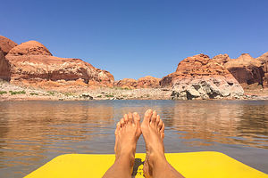 Floating in the San Juan ArmSo, when Herb suggested that maybe it made sense to pull the boat tomorrow and leave on a high note rather than push it towards a death march, I said, “Ok, if that’s what you want.”
Feeling like a Precog in “Minority Report,” I eventually extracted myself from the water and joined Herb for an evening hike. We clambered up to the top of a ridge from which we could see the San Juan Arm on one side and the main Colorado River channel on the other. The scenery was probably the best yet of all our campsites, which is saying a lot. Our boat looked so cute down below.
That night as we were making dinner and watching the sunset, I was a little sad that this was our last night. If only all day could be like early mornings and evenings, this would truly be Paradise.
Lake Powell - Halls Creek Bay
Wednesday, July 4, 2018 - 9:45pm by Lolo63 miles and 3.5 hours from our last stop - 2 night stay
Travelogue
Day 1 - Hole-in-the-Rock and Lagorce Arch
 Our campsite in Halls Creek BayMorning hike complete and anchors stowed, we continued our journey north towards Halls Creek, with a few diversions along the way.
At Buoy 66, we stopped at Hole-in-the-Rock, the site of one of the most daring and difficult journeys ever made during the pioneer days - and that is saying a lot. In October of 1879, a party of 230 Mormons, 83 wagons, and 1,000 cattle were sent out to build a settlement on the San Juan River. Their journey brought them to Panguitch, Escalante, down what is today known as the Hole-in-the-Rock, a narrow and steep crevice in the western rim of Glen Canyon.
The pioneers spent the winter working on the crack, slowly enlarging the opening with only pick axes, shovels, and small supplies of blasting powder. The drop to the river below was nearly 2,000 feet with an average grade of 25 degrees, although some places were as steep as 45 degrees.
 Lagorce ArchFinally, on January 26, 1880, the expedition slowly made its way down the precarious “road” where a ferry had been built to get them across to the eastern side of the Colorado River where there was a route for them to continue on.
Although one-third of the trail is now under water, the rest is still visible. Staring up at that steep crevice, I had a hard time imagining how they had accomplished this amazing feat.
At Buoy 68, we took a short diversion up a portion of the Escalante Arm to Davis Gulch, a deep, narrow canyon that meanders for two miles before reaching Lagorce Arch, a huge natural window, 100 feed wide and 75 feet high. Fortunately lake levels were just high enough to reach the arch, but things dried up right afterwards. It was eerily quiet and quite impressive.
 Lolo exploring rocks around Halls Creek BayBack on the main channel (Colorado River) again, we continued up to Halls Crossing where we gassed up at the marina.
From there we crossed back over to Halls Creek (Buoy 93), a large bay barely noticeable from the main channel because of its narrow opening. Along its 12 miles, there are innumerable coves that cut into the southernmost toe of 100-mile long Waterpocket Fold, many of which have sandy beaches for camping.
We managed to find a nice quiet home for the night in a shallow cove, hopefully too small for houseboats to join us. The scenery was incredible and there was much more opportunity to hike for longer distances than we had been able to so far at our previous camping spots - good, because I was beginning to feel a little confined on the boat, and then I get cranky.
We were getting in a groove now - cruise in the morning, find camping early afternoon, swim / float, and then hike when the sun got low. That evening, we took a lovely hike and once again slept under the stars in the back of our boat.
Day 2 - Defiance House Ruins
 Defiance House RuinsThe next morning, before departing, we went on another hike before it got prohibitively hot, which unfortunately was by 8 am.
After a quick dip, we pulled up anchor and headed out of Halls Creek Bay and then north on the main channel to Forgotten Canyon (Buoy 106), at the end of which was a hike to the Defiance House Ruin, an Anasazi dwelling more than 700 years old.
We anchored when the water ran out, and then trudged through some muck before getting to the main trail. It was a bit confusing, and soon we found ourselves bushwhacking through high grass and weeds. I hate to admit it, but we had missed the turnoff for the ruins, and only realized it when we heard voices coming from high up on the canyon wall.
 Playing on the Waterpocket FoldBack we went, taking the established trail up a series of switchbacks to the ruins on a shelf on the canyon wall. The site consisted of two dwellings, a ceremonial kiva, and several kitchen pits, which have been restored by the National Park Service. However, by far my favorite was the large pictograph of three warriors “defiantly” (hence the name) waving their clubs and shields in an apparent duel. They were even anatomically correct.
That was as far north as we planned to go, so after leaving Forgotten Canyon, we headed back south, peaking into several canyons in search of a good camping spot. Everything seemed to already be occupied by houseboats, so we decided to go back to the same place we camped last night, hoping that our theory that it was too small for a houseboat was correct. It was, and we settled in there for another night.
 Waterpocket Fold near our campsite on Halls Creek BayThen it was swim and hike again when the sun got low. Fortunately, there was enough open spaces and rocks to scramble up to make each hike somewhat unique.
I realized I haven’t mentioned yet what we were eating for dinner. We had some backpacking freeze dried dinners like Lasagna and Chicken Alfredo, but what we found we like much better was Knorr’s soup with either some packaged tuna, salmon, or chicken thrown in. All of this was done in a single pot on a Jetboil, which we ate directly ate out of - no muss, no fuss. It was actually quite good. Perhaps, the wine helped.
Lake Powell - Chuckwalla Springs Cove
Tuesday, July 3, 2018 - 9:30pm by Lolo45 miles and 3 hours from our last stop - 1 night stay
Travelogue
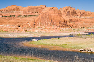 Our campsite in Chuckwalla Springs CoveI love cruising in the boat - I had forgotten just how much fun it is. Plus, it’s a great way to keep cool (or relatively so) on a scorching hot day while taking in some gorgeous scenery along the way.
We cruised right on past Dangling Rope Canyon at Buoy 42, the last chance for gas until Halls and Bullfrog Marinas, over 50 miles away.
At Buoy 49, we took a quick detour into Forbidden Canyon, at the end of which was the hike to Rainbow Natural Bridge, Lake Powell’s most popular destination, but decided we would hit it on the way back, earlier in the morning, with fewer tourists and better lighting.
Although tempted, at Buoy 57, we cruised right past the entrance to the San Juan Arm and continued up the main channel (the Colorado River) towards Bullfrog, all the while on the lookout for a good camping spot for the night.
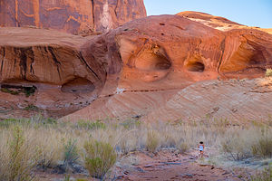 Lolo hiking near Chuckwalla SpringsMost of the canyons were already occupied by large houseboats and their fleet of ski boats, jet skis, and inflatable giraffes. However, since we were smaller, we could go places houseboats couldn’t. Just a few miles north of the San Juan Arm (at Buoy 62), right past popular Reflection Canyon, we found Chuckwalla Springs Cove, with a nice secluded beach and red rock formations across the way.
We spent the afternoon swimming, floating on our raft, and, as always, enjoying the incredible scenery.
Towards late afternoon, two jet skis entered our paradise and hung for awhile at the entrance to the cove. Then one left, but the other remained and proceeded to do donuts for the next half hour. Finally, we figured out what was going on. They were the scouts that were sent ahead to find a place for a houseboat to camp. Sure enough, not one, but two, houseboats arrived and set up camp about 100 yards away from us. I guess during 4th of July week, we were lucky to have had even a few hours of solitude. .
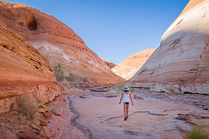 Lolo hiking up the Chuckwalla Springs washThis camping spot had better hiking opportunities, and less muck, so when the sun got low and the temperatures dropped (at least a wee bit), we, like nocturnal desert animals, became active and set out around the end of the cove, across the spring, and up a wash to explore the beautiful rock formations that we had been looking at all day.
With the 100+ temperatures, I had had doubts that we would be able to do any hiking at all, but there was a small window at the end of each day (after 7:00 pm) and early in the morning (before 7:00 am), when it was comfortable enough to get out of the water and onto the land.
That evening we decided that rather than set the tent up on land, we would just sleep on the boat - not in the cuddy cabin where it was too stuffy, but on our thermorests out in the open in the back of the deck, where we could fall asleep by counting stars. I could get used to this.
The next morning, before it got to hot, we set out on another walk along the wash across the way, capturing the rock formations in a different light.
Then it was anchors away, as we continued our journey north along Lake Powell.
Lake Powell - Gunsight Canyon
Monday, July 2, 2018 - 9:00pm by Lolo17 miles and 1 hour from our last stop - 1 night stay
Travelogue
 Our campsite in Gunsight CanyonLaunching the boat at the Stateline Boat Ramp went off without a hitch, and the motor started up with the first turn of the key - not bad after sitting neglected for 9 months.
It felt great to be cruising in the boat again, especially in such spectacular scenery - 186 miles of colorful rock formations, natural arches and bridges, and so many canyons, bays, and coves that there is 1,960 miles of shoreline to explore.
The lake level was 3610, high enough to allow us to take the Castle Rock Cut (impassable at 3585 feet) out to the main channel, rather than the longer route around Antelope Island.
 Camping in Gunsight CanyonWe decided to skip popular Warm Creek Bay and continued on to Gunsight Canyon, just shy of Padre Bay, on the northern side of the channel at Buoy 17. We hoped this smaller canyon,, squeezed between the two larger bays, would have less camping options for houseboats and thus be more secluded.
We were right, and soon we were anchored just a short distance off a sandy beach - or at least it did become sandy after about 15 feet of schlepping our camping gear through a bit of muck.
While Herb set up the tent, I spent a productive hour building a sidewalk across the muck, using slates that I found scattered about the beach. Sometimes it’s nice to have life reduced to the simple tasks of survival.
 View from tent in Gunsight CanyonWe spent the afternoon swimming and floating in our very own private paradise. While gazing at the surroundings from my float, I saw just why this canyon got its name. Gunsight Butte, the formation at the entrance to the canyon, had two high points on either end - just like a gunsight.
Unfortunately, there wasn’t much opportunity for hiking in this canyon, but even if there was, the 100+ degree heat pretty much kept us in the water until early evening. I was developing a better understanding for why animals in the desert are nocturnal.
That night we slept with the fly off the tent, and just lied there gazing up at the Milky Way. What an incredible experience!
Page
Sunday, July 1, 2018 - 9:00pm by Lolo879 miles and 17 hours from our last stop - 1 night stay
Travelogue
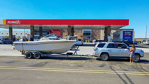 Towing the boatRather than bore anyone reading this blog (and myself writing it) about the pickup of the boat in Lake Mead and trailering it to Lake Powell, which took us 2 days, I am going to start my narrative with our arrival in Page, Arizona, on the shores of beautiful Lake Powell.
Rather than launching the boat in late afternoon on a Sunday (a very busy time for a boat launch) and searching for a canyon to camp in for the night, we had decided ahead of time to stay in a hotel in Page and launch early Monday morning. I somewhat randomly chose the Page Boy motel, a bit of a disappointment but since we are campers, we coped.
Before going to the hotel, we dropped the boat and trailer off at the Wahweap Resort and Marina for the night. Surprisingly the resort lets people do that for free.
Freed from the boat and before checking into our hotel, we decided to scout out the Horseshoe Bend Overlook, one of the area’s most popular and photographed sites. It was early afternoon, not the best time to photograph it, so we figured we would check it out now and then come back at sunset and then again for sunrise tomorrow morning when the lighting would be more dramatic.
The parking lot was a zoo, even though this was the worst time of the day to see it - extremely hot and bad lighting. Well, here we were too joining the mass of humanity along the ¾-mile trail over a sandy ridge to the edge of a cliff overlooking a sharp, dramatic bend in the Colorado River. There were no guardrails and the drop to the river was 1,000 feet, making it a bit intimidating to get close enough to view the entire river rounding the rocky peninsula.
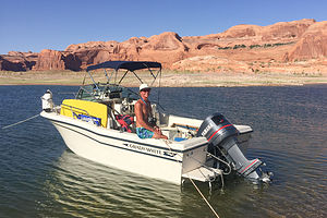 Herb and his boatIf it was this crowded now, what would tonight be like?
We checked into our motel, relaxed a bit, had a pizza at nearby Strombolli’s, and then headed back to the Horseshoe Bend Overlook.
We never did get to the Overlook that evening, for reasons I still have trouble reliving. Let me first give away the ending and say that nothing bad happened - just a very, very bad false alarm.
As we were jockeying for a parking space, I noticed a had a missed call from a Texas phone number - just an annoying sales call I thought. Then my phone rang again - same number. This time I picked it up. The man on the other end identified himself as being part of the International Emergency Response Center, and that they had received an SOS call from my son’s Garmin Inreach Explorer, a satellite communication device which he owns because he is often climbing, mountaineering, skiing, etc. in rather remote places. He said it was strange that they did not receive their GPS coordinates with the SOS, which might mean the device was deep inside a backpack, which might indicate a false alarm. We told him that all we knew is that he was rock climbing somewhere in the Eastern Sierra.
I’m not going to go into the details of how we spent the next three hours before learning that they were fine. Suffice it to say, it was the longest three hours of my life. Jacob (our contact at the IERC), however, was great, and very comforting. He called us about 20 minutes later to let us know that they had received their coordinates. They were located along the ridge of Mt. Conness, a remote mountain outside the eastern boundary of Yosemite. A ground search crew was being dispatched to the area, as it was too dark to send out a helicopter.
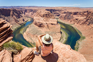 Lolo overlooking Horseshoe BendWhile we were on the phone with him, he told us that they had moved 120 feet, and that this movement was a good sign. Over the next couple of hours, Jacob called us periodically to give us their coordinates, which allowed us to see that they were moving at a good pace down the ridge of Mt. Conness.
Herb was extremely comforting and tried to convince me that the most likely explanation was a false alarm - a google search confirmed that the particular device he owned had been responsible for several false SOS’s in the past. Still, we just had to hear his voice.
Finally, at 10:00, we received word that they had met up with the rescuers (over a dozen of them) and they were fine. My son was quite surprised to be greeted by name by a search and rescue crew, as they had no idea that they had sent out an SOS. The rescue team asked to see his satellite communicator, and sure enough, the Power was Off. No signal should have been sent. I’m sure he was relieved that they knew it was not his fault.
One of the responders let him use his satellite phone to call us - there is absolutely no cell phone coverage in that area so it was the only way he could talk to us. I can’t tell you how good it was to hear his voice.
We were emotionally and physically drained. No early wake-up for sunrise at Horseshoe Bend for us. I think we really needed to sleep in.
It definitely put things in perspective. There would be no complaining and sweating the little stuff for us this trip.
Home
Thursday, May 31, 2018 - 5:45pm by Lolo187 miles and 4 hours from our last stop - 1 night stay
Travelogue
Home Sweet Home!
