- Home
- About
- Map
- Trips
- Bringing Boat West
- Migration West
- Solo Motorcycle Ride
- Final Family XC Trip
- Colorado Rockies
- Graduates' XC Trip
- Yosemite & Nevada
- Colorado & Utah
- Best of Utah
- Southern Loop
- Pacific Northwest
- Northern Loop
- Los Angeles to NYC
- East Coast Trips
- Martha's Vineyard
- 1 Week in Quebec
- Southeast Coast
- NH Backpacking
- Martha's Vineyard
- Canadian Maritimes
- Ocracoke Island
- Edisto Island
- First Landing '02
- Hunting Island '02
- Stowe in Winter
- Hunting Island '01
- Lake Placid
- Chesapeake
- Provincetown
- Hunting Island '00
- Acadia in Winter
- Boston Suburbs
- Niagara Falls
- First Landing '99
- Cape Hatteras
- West Coast Trips
- Burning Man
- Utah Off-Roading
- Maui
- Mojave 4WD Course
- Colorado River Rafting
- Bishop & Death Valley
- Kauai
- Yosemite Fall
- Utah Off-Road
- Lost Coast
- Yosemite Valley
- Arizona and New Mexico
- Pescadero & Capitola
- Bishop & Death Valley
- San Diego, Anza Borrego, Joshua Tree
- Carmel
- Death Valley in Fall
- Yosemite in the Fall
- Pacific Northwest
- Utah Off-Roading
- Southern CA Deserts
- Yosemite & Covid
- Lake Powell Covid
- Eastern Sierra & Covid
- Bishop & Death Valley
- Central & SE Oregon
- Mojave Road
- Eastern Sierra
- Trinity Alps
- Tuolumne Meadows
- Lake Powell Boating
- Eastern Sierra
- Yosemite Winter
- Hawaii
- 4WD Eastern Sierra
- 4WD Death Valley +
- Southern CA Deserts
- Christmas in Tahoe
- Yosemite & Pinnacles
- Totality
- Yosemite & Sierra
- Yosemite Christmas
- Yosemite, San Diego
- Yosemite & North CA
- Seattle to Sierra
- Southwest Deserts
- Yosemite & Sierra
- Pacific Northwest
- Yosemite & South CA
- Pacific Northwest
- Northern California
- Southern Alaska
- Vancouver Island
- International Trips
- Index
- Tips
- Books
- Photos/Videos
- Search
- Contact
Death Valley National Park
Tuesday, March 30, 2021 - 1:00pm by Lolo280 miles and 7 hours from our last stop - 2 night stay
Travelogue
Along the Harry Wade Road - Saratoga Springs Marshland and Ibex Dunes
 Along the Harry Wade Road to Ibex DunesWe had been to Death Valley many times and pretty much thought we knew it all, but on our last visit to the Park, Herb purchased “The Explorer’s Guide to Death Valley National Park” at the Visitor Center gift shop. We have found it to be an invaluable resource for finding the more remote and isolated gems in Death Valley.
It was from this book that Herb discovered the Ibex Dunes, located in the remote and scarcely visited southeastern part of the Park, just south of the Saratoga Springs marshland. One of the reasons it is scarcely visited is that the road to get to it is very rough and requires a 4WD vehicle with high clearance.
After leaving Barstow, we drove north of I15 and then in the town of Baker, we took Route 127 north for 30 miles to the barely obvious Harry Wade Historical Monument, and the start of the Harry Wade Road.
 Saratoga Springs in Death ValleyWe stopped at the historical marker to read the tale of Harry Wade, who with his family and 100 other wagons, was part of the Death Valley ‘49ers, a group of pioneers from the East who foolishly tried to take a short cut through Death Valley to get to the Sutter’s Fort gold prospecting area in the Central Valley.
Well, things didn’t go so well for the party in Death Valley, which is often the case, so Harry set out and found an exit route for his ox-drawn wagon, saving his and his family’s lives. Today that exit route is known as the Harry Wade Road. It was designated a California Historic Landmark in 1957.
Well, if it was good enough for Harry, it was good enough for us, so we turned left on Harry Wade Road and drove along a well-graded road with lovely views of colorful rocks to our right. I named them “Charlie Brown” rocks because of the zig-zagging pattern of their colorful layers, similar to the shirt Charlie Brown always wore.
 Looking down at the Saratoga SpringsAt 2.7 miles, we passed the turnoff for the Ibex Dunes (for now) and continued on to the turnoff for the Saratoga Springs marshland at mile 5.8, another lesser-known Death Valley destination that we had read about in our “The Explorer’s Guide to Death Valley National Park.” From there it was a 3.9 mile drive to the parking area.
I assume this area was named for the more famous Saratoga Springs in New York, but the similarities ends with the fact that they both have springs. The New York version doesn’t even have any pupfish inhabiting its spring.
The Death Valley version is an extremely isolated and lovely marshland, set at the base of a colorful brown, tan, and white rock formation. It is home to the Saratoga Springs pupfish, or Cyprinodon nevadensis to be exact, one of nine pupfish species that have evolved separately in the springs of Death Valley and the Owens Valley, and the first to have been discovered.
 Saratoga Springs pupfishWe set off first to walk along the left side of the marsh, hoping to get close enough to the pools to see some of its inhabitants. However, the shrubs along its edge were too thick and wet to get to the water’s edge.
We noticed a road leading up the side of the interesting, colorful rock formation on the other side of the marsh, so we headed back to where we started and headed to the right side of the marsh, this time finding that we could actually get down to a small beach at the water’s edge.
Herb spent the next hour stalking the little fellas with his 100-400mm telephoto lens, which he later renamed his “pupfish” lens. He hoped to catch them in the act of mating, but apparently they weren’t in the mood right now.
Afterwards, we walked up the road along the end of the rock formation where there was a lovely view of the marshland below.
 Ibex DunesWe drove back out to the Harry Wade Road and retraced our route back for about 3 miles to the Ibex Junction and turned left onto a rocky but very passable road. I don’t know how, but after we had driven about 5 or 6 miles, I glanced down at my phone where I had marked the Ibex Dunes, and saw that we had gone too far. How the heck had we missed it.
We got out of the car and looked back down the road towards the east and there they were. We debated whether or not we should just start hiking to them from here, but we would have had to do a lot of navigating through sagebrush and crossing over of dried shallow washes. There really is no one set trail to the dunes. You just have to find some good terrain, set your sight on your goal, and start hiking towards it.
 Ibex DunesI hit Find Directions on Google Maps and it indicated that we could start walking towards the dunes from a point on the road about a mile and a half back. We drove back towards that point and sure enough there was a sandy road leading to the dunes. However, it was blocked by a sign that said “Wilderness Restoration - Foot and Horse Traffic Only,” where there was room to park our truck.
As we set off on foot towards the dunes, we noticed several tire tracks from vehicles that had chosen to disregard the sign and find a way around it.
Of course we had timed our hike with the golden hour, and the dunes were starting to put on their evening show, as their dull monotone tans turned to bright beige with deep shadows in their nooks and crannies. The Saddle Peak Hills behind them did their part and took on a reddish glow.
 Ascending the Ibex DunesIbex Dunes might not be the tallest in Death Valley - that honor goes to the Eureka dunes - but I do think they very well might be the most stunning.
There are two distinct sections to the dunes. The ones on the left (north) are higher, while those on the left have a scattering of smaller ones leading more gently along the ridge to the top. We hiked in the direction of the one at the very right end, which was also the most brightly lit, but switched directions when the one to the left of it assumed that honor. It felt like we were racing the ever changing light.
As we got closer, we noticed some structures just south of the dunes, which we later learned was an abandoned talc mine. Perhaps that was the reason for the old road. It was interesting to see the juxtaposition of man-made structures with such a pristine natural setting.
 Ibex DunesDeath Valley has a rich mining history that went on from the 1850s through 1915, and in some cases even later. Of all the minerals and dreams of riches, borax and talc, rather than the more glamorous gold and talc, produced the most wealth, and there are old mining buildings to be found throughout the more remote sections of the park.
We would have liked to hike to the mine, but with the shortness of golden hour, we had to prioritize how we spent our time. So we picked up our pace and headed to the most beautifully-lit section of the lower dunes on the southern end and started our trek up along the ridges towards the top. An added bonus was that these dunes are so pristine and remote that there was not another footprint on them, and there probably hadn’t been any in days. We had this amazing landscape all to ourselves.
By the time we got back to the car, the sun had dipped behind the hills and the dunes had returned to their flatter monotone tan.
We spent the night camping in that parking spot. Not single car passed us the whole night.
Continuing along the Harry Wade Road - Salt Creek and Eureka Dunes
 Salt Creek TrailRather than drive back out to Route 127 and take the asphalt route up and into Death Valley, we decided to continue along the Harry Wade Road which led north for another 30 or so bumpy miles before merging into the paved Badwater Road.
We drove right past Badwater Basin, as it was crowded and we had been there several times in the past, and continued north with our final planned destination for the day being the Eureka Dunes.
After stopping for gas (a very important thing to think about in Death Valley, we stopped at Salt Creek to see if we could see another one of Death Valley’s pupfish species, the Salt Creek pupfish, more formally known as Cyprinodon salinus.
There is a mile-long Interpretative Trail that traces the creek, providing information along the way about this unique habitat and the tiny, yet hardy, fish that call it home. These little 2-inch fish are found nowhere else on Earth.
.thumbnail.jpg) Herb stalking a pupfishSalt Creek is a remnant of an ancient freshwater lake that once covered much of Death Valley, but dried up about 10,000 years ago. Over the millennia the creek gradually changed from freshwater to saltwater due to the continuous evaporation of its shallow water each summer, thereby concentrating its salts. Along the way, the hardy little pupfish evolved to survive in its changing environment.
Herb stalking a pupfishSalt Creek is a remnant of an ancient freshwater lake that once covered much of Death Valley, but dried up about 10,000 years ago. Over the millennia the creek gradually changed from freshwater to saltwater due to the continuous evaporation of its shallow water each summer, thereby concentrating its salts. Along the way, the hardy little pupfish evolved to survive in its changing environment.
Today the Creek is a seasonal stream, forming pools during the spring, where in the heat of the summer, the pupfish can hunker down and go dormant when the main creek runs dry. Then when it rains and their habitat expands, they wake up and come out again.
 Salt Creek pupfish working on specie survivalFortunately, we were here during their active season, so we were lucky enough to observe some performing their courtship ritual, which is quite fascinating.
We could tell which ones were the males because they are luminescent yellow, purple and blue, in order to attract the rather bland-looking tan-colored ladies and let them know they are interested and ready to breed. The males are quite territorial and aggressive, chasing other males away from their turf, while simultaneously trying to entice a female into his turf.
Once he has lured one in, they cuddle up beside each other, form an s-shape, and start to wiggle. During this wiggle, the female releases an egg and the male releases sperm, which immediately fertilizes the egg. Sometimes, the female hangs around for another round. The fertilized eggs take about 10 days to hatch. A single female typically lays somewhere between 50 and 800 eggs in a single season.
Life is short for the Salt Creek pupfish, usually just one year, so they have to make the most of it.
 Eureka DunesAfter a picnic lunch in the Salt Creek parking lot, we set out for our next and final destination of the day - the Eureka Dunes. We continued driving north towards Scotty’s Castle, which unfortunately is still closed from the damage done during a 2015 flood when the area received close to its annual average rainfall in just five hours.
At the junction for Scotty’s Castle/Ubehebe Crater, we took a left towards the crater. Actually, we had no choice as the road to Scotty’s Castle was so damaged by storms that it is closed, and expected to be so for quite some time. Rather than going all the way to the crater, at about 2.8 miles after the junction we turned right onto the Death Valley / Big Pine Road.
The dirt-and-gravel Big Pine Road is well-maintained and definitely navigable for a 2WD vehicle. At about the 18 mile point, we came to our first landmark – Crankshaft Junction, named for the castoff engine parts that less-fortunate travelers left at this remote site. It made you think a little bit.
 Ascending the Eureka DunesWe continued on for another 12 miles before turning left onto the South Eureka Road to the dunes. From there, it was another 10 miles along the 4WD South Eureka Road to the primitive campground near the base of the impressive Eureka Dunes. At 700 feet, it is the largest dune in California and the second largest in the entire U.S.
The campground was dry (no water or flush toilets) and had only four designated sites, all of which were already taken. Thankfully, further down the road there were more dispersed campsites, so we grabbed one not far past the official primitive one, with the outhouse. Last time we were here, there were only 3 other campers in the area. This time there were at least 30. I think there is a lot of pent-up demand for camping during the pandemic.
Late March/Early April is a great time to visit the dunes, because even in the afternoon it is usually not too hot to hike them. Around 4:00, we set off towards the northern end of the dune and then started our slog up. I always find hiking in deep sand so grueling - 2 steps forward, 1 step back.
 Lolo avoiding a black hole on Eureka DunesThere were portions of the hike that were so steep that I actually had to bend my body forward into the incline and use my hands as well. I looked like a gorilla. Meanwhile, each step on the really steep parts set off what looked like a river of sand, starting about 3 feet above us and continuing right below us for another dozen or so feet. The patterns we created were beautiful.
Besides the intriguing visual effect, we were also making the dunes “sing.” Singing sand dunes are quite rare and there are only about 40 of them in the entire world. The singing is really more of a booming sound, and it is triggered by an avalanching movement of sand.
It was actually a little tricky finding the summit, as each time we climbed to the top of a ridge, we saw another one higher. We had reached the summit on our last visit, but as we were now cutting into cocktail hour, we declared victory on the ridge below the summit and started the much more fun trek down. I felt like I was running down a hill of pudding. All in all, the hike was a very rewarding, and exhausting, 2 mile round-trip.
 Eureka Dunes in morning lightBack at our campsite, we made dinner, sipped wine, and watched the sunset.
Before leaving the next morning, we got in the truck and drove to the southern end of the dunes, which was just starting to be lit by the early morning sun. We didn't even have our coffee yet. Behind them were the equally impressive colorfully striped limestone walls of the Last Chance Mountains, which rise 4,000 feet above the valley floor.
This was an exciting day for us. We were headed to Bishop later today where we would see our son Andrew and his wife Celeste for the first time in 5 months. An overabundance of caution during the pandemic had kept us apart. Today they were going to get some pretty long hugs.
Description
In 1994, the Desert Protection Act added an additional 1.2 million acres to Death Valley National Monument and upgraded its status to National Park, making it the largest national park outside of Alaska. The park is located on the eastern border of a remote section of California with some small portions extending into Nevada. Despite its remoteness, it is one of the most highly visited parks in the national park systems. Many of these visitors come all the way from Europe and Japan to experience the extremes of this stunningly beautiful desert.
Death Valley received its name from the unfortunate forty-niners who were forced to cross the burning sands here in order to avoid the severe snowstorns in the nearby Sierra Nevada on their way to the California Gold Rush. Many perished along the way, and those that survived remembered it as a place of suffering and death. The current names of many of the places in Death Valley reflect its harshness: Dead Man Pass, Funeral Mountains, Furnace Creek, Hell’s Gate, Devil’s Golf Course, Starvation Canyon, etc.
The valley itself is over 130 miles long, but only about 12 miles wide, flanked on both sides by unvegetated reddish mountains. From an elevation of about 3,300 feet in the north, the land slopes steadily downward to an elevation of 279 feet below sea level at Badwater, the lowest point in the western hemisphere. In fact, 70 miles of the desert floor is below sea level, accounting for its extremely high termperatures, which can exceed 130°F in summer.
In many ways, not much about the valley has changed since the pioneers first crossed here. Its intense heat, frigid cold, and the driest air imaginable still make it one of the most inhospitable locations on earth. However, today’s visitors can enjoy Death Valley and see most of its highlights from the comfort of their air conditioned cars and stay in comfortable, and even luxurious, hotel rooms at night.
The park is criss-crossed by a network of roads, ranging form washboard dirt ones to paved, well-maintained highways, making the most popular destinations quite accessible. The Furnace Creek Visitor Center, near the center of the park, is a great place to get oriented and to begin an exploration of Death Valley. This greenness of this area is a surprise to most visitors who come to the park expecting to see nothing but miles and miles of sand. Fed by warm springs, this area is a verdant oasis with palm trees as tall as 50 feet. There are also two world-class resorts here: the elegant Furnace Creek Inn and the more down-to-earth Furnace Creek Ranch.
Highlights traveling south from Furnace Creek on Route 190
- About 5 miles south of the Furnace Creek Visitor Center is Zabriskie Point, one of the most spectacular overlooks in the park. A short walk uphill from the parking lot brings you to a panoramic view of Golden Canyon and the surrounding vibrantly colored badlands. The views are particularly stunning in the lowlight of early morning or late afternoon.
- Another 1.5 miles down the highway s the turnout for Twenty-Mule Team Canyon road, a one-way dirt road that rejoins the highway in 2.7 miles. The road winds through Twenty-Mule Team Canyon with close-up views of the same colorful badlands seen from Zabriskie Point. RVs and trailers are not allowed on this road.
- 4.5 miles further south on 190 is a turnoff for Dante’s View (restricted to vehicles less than 25 feet). The road to Dante’s View climbs steeply to an overlook 5,000 feet above the valley floor, where the temperatures average 20° F cooler than in the valley. From this viewpoint, which most consider the most breathtaking in the park, one can see the lowest point (Badwater) and the highest point (Telescope Peak) in the park.
Highlights traveling south from Furnace Creek on Badwater Road
- About 1.8 miles south of the Visitor Center is the turnoff for Badwater Road. 1.5 miles further south on Badwater Road is the parking lot for the popular hike into Golden Canyon. A well-marked nature trail (2 miles RT) leads into the narrow canyon, wedged in by eroded cliffs and the slopes of golden badlands.
- Back on Badwater Road, continue south past Artist Drive (get that on the way back as it is a one-way road going north). Around 9 miles south of Golden Canyon is the turnoff for the unpaved spur road to Devil’s Golf Course. The road leads to an odd and forbidding landscape created by salt and erosion on a lake bed that dried up 2,000 years ago. The result is a jagged terrain of salty white miniature mountains and spires, less than 2 feet high. The name comes from the feeling that “only the devil could play golf on such rough links.”
- About 8 miles south is the Badwater Basin, the hottest and lowest point in Death Valley accessible by car. Surprisingly, its permanent spring-fed pools also make it one of the wettest. Legend says that it got its name from a surveyor whose mule refused to drink it. Although not poisonous, it is similar in composition and taste to Epsom salts. Despite its apparent inhospitableness, it is home to water beetles, insect larvae, and a soft-shelled saltwater snail that slowly adapted to these conditions.
- Turning back north on Badwater Road towards Furnace Creek, in 8 miles you come to the turnout for the one-way, 9-mile paved Artist Drive, which winds through a colorful display of sedimentary and volcanic rock hidden from the main road. It received its name from the rainbow of colors—red, pink, yellow, orange, and brown—that paint these rocky hills. About half-way through the loop is the parking lot for Artists Palette, one of the most colorful areas along the loop. Artist Drive is restricted to vehicles less than 25 feet.
Highlights traveling north from Furnace Creek on Route 190
- About 1.7 miles north of the Furnace Creek Visitor Center are the remains of what was once the Harmony Borax Works. Borax, which the prospectors called “white gold,” was once a big business in Death Valley. In the 1880s, Chinese laborers were hired to rake borax “cottonballs” from the valley floor and bring them to the Harmony Borax works to be purified. From there the refined borax was loaded onto the famous twenty-mule team wagons and transported 165 miles across the desert to the train station in Mojave. From there it was shipped to processing plants where it was used to make soaps, disinfectants, and food preservatives. Between 1883 and 1927, more than $30 million worth of borax was produced in Death Valley. A short trail leads past the ruins of the old borax refinery and some outlying buildings. More information on the mining of borax in Death Valley is available in the Borax Museum at the Furnace Creek Ranch.
- 12 miles further north on 190 is the turnoff for the 1.2 mile gravel road to Salt Creek, home to the famous Death Valley pupfish. When the lake that once covered Death Valley dried up thousands of years ago, the desert pupfish was the only fish that managed to adapt to the harsh conditions here. Isolated from each other in scattered salty pools, springs, and creeks, nine types of pupfish have evolved. A tenth has already become extinct. They are found no place else on earth. The pupfish can often be seen from the short wooden boardwalk nature trail that crisscrosses the stream and marshes.
- About 21 miles north of the Visitor Center, Highway 190 turns west towards Stovepipe Wells and the west entrance to the park. At this point, you can either continue on 190 or head north on the North Highway another 32 miles to Scotty’s Castle, the major man-made attraction in Death Valley.
Highlights along the North Highway (traveling north)
- The drive to Scotty’s Castle on the North Highway is a very scenic one with desert stretching out on the west and mountains rising to the east. About 10 miles north on the North Highway is a pullout with great views of Death Valley’s renowned alluvial fans. These fans are something like an hourglass with debris from the mountains funneling through a narrow opening and spilling out in a wedge shape into the valley. They come in many shapes and sizes. The ones near this viewpoint are smaller and steeper.
- 25 miles further north in the remote Grapevine Canyon looms the unlikely sight of a Moorish Castle. Construction of what was more officially called Death Valley Ranch was begun in 1922 by Chicago millionaire Albert Johnson, whose doctors had advised him to spend more time in a warm, dry climate. However, the mansion is known as Scotty’s Castle, named after Johnson’s unlikely friend, Walter Scott. Walter Scott was a cowboy that had traveled with Buffalo Bill’s Wild West Show in the 1880s before taking up prospecting. Albert Johnson was one of Scotty’s gullible investors in his “secret gold mine” in Death Valley. After several trips west to see the mine, Johnson realized that he was being duped by Scotty. Despite that, Johnson truly enjoyed his new friend and the tall tales he told. Scotty helped Johnson conceive the idea of this vacation villa in Death Valley and lived in it after Johnson’s death.
- In 1970, Scotty’s Castle was purchased by the National Park Service from the foundation to whom Johnson had willed it. Today the colorful history of the castle is brought to life by rangers dressed in 1930s clothing that welcome you as if you were Scotty’s guests. The one-hour guided tour is excellent, both for its inside look at this unusual mansion as well as for the stories about the eccentricities of the two men that built it. Tours depart every 20 minutes from 9 am to 5 pm. Plan to arrive early because they fill up quickly.
- About 1.5 miles down Grapevine Canyon heading back south on the North Highway is the turnoff for the 8 mile road to Ubehebe Crater. This half-mile wide, 600-foot deep crater was formed by volcanic explosions several thousand years ago. Dark cinders and volcanic fragments cover the surrounding countryside. From the parking area there is a steep trail up to the crater’s rim. Be prepared to battle some very gusty winds.
- Because of its remote location, few visitors get to see the famous Death Valley Racetrack, where rocks mysteriously move across the dry lakebed on their own accord. Although no one has actually seen the rocks move, they are known to move because of the trails they leave behind them. After studying the phenomenon for decades, scientists now believe they have solved the mystery. The surface of the lakebed is a fine clay that becomes very slippery when wet. After a rain, heavy winds as high as 70 mph blow the rocks across the slick surface. A 4-wheel drive vehicle is needed to reach the Racetrack, which is 27 miles past Ubehebe Crater on a rough dirt road.
Highlights traveling west along Route 190 from the junction with the North Highway
- Just west of the junction is the parking area for the surrealistic Devil’s Cornfield. On both sides of the road are odd-looking clumps of brush four to ten feet tall that resemble corn stalks. They are actually arrowweed bushes, whose stems were used by Native Americans to make arrow shafts.
- A few miles further west on 190, pull over on the shoulder by a roadside display where the Sand Dunes come close to the highway. These are the highest of a 14-square-mile field of dunes. Although there are no trails to follow, hikers are free to roam the dunes on their own. The best time of day to visit the dunes is in the morning or late afternoon when the temperatures are cooler and the lighting is more dramatic.
- Two miles further west is the village of Stovepipe Wells, Death Valley’s first tourist resort. The village actually got its name from an historic site about 5 miles north where an old stovepipe was sunk into the sand to form the shaft of a well. For years this well was used by travelers as a source for water. Around 1926 a developer planned to build a small resort near the well. However, his lumber trucks got stuck in the sand before he could reach it. Rather than unload and reload his trucks, he decided to try and dig a well where they were. They struck water and stayed. That spot is the current location for Stovepipe Wells. Today the village has a motel, general store, saloon, restaurant, and campground.
Campgrounds that will accomodate RVs in Death Valley
- Furnace Creek Campground (136 sites, no hookups) – located just north of the Visitor Center. Open year round. This is the only park campground that takes reservations.
- Mesquite Spring Campground (30 sites, no hookups) – located 5 miles south of Scotty’s Castle. Open year round.
- Panamint Springs Resort (40 sites, 12 hookups) – located 30 miles west of Stovepipe Wells on Route 190. Open year round. This campground is privately operated and takes reservations.
- Stovepipe Wells Campground (200 sites, 15 hookups) – located in the village of Stovepipe Wells. Open year round.
- Sunset Campground (1000 sites, no hookups) – located .25 miles east of the Furnace Creek Ranch. Open October through April.
- Texas Spring Campground (92 sites, no hookups) – located near Sunset Campground. Open October through April.
- Wildrose Campground (30 sites, no hookups) – located 30 miles south of Stovepipe Wells off the Trona-Wildrose Road. Open year round.
In addition to the park campgrounds, there are two privately-owned campgrounds in the park:
- Furnace Creek Ranch Campground (26 sites, all full hookups) - located at The Ranch just south of the Visitor Center. Open year round. Guests can enjoy the Ranch’s natural spring-fed swimming pool, shower facility, coin operated laundry, tennis courts, shuffleboard, volleyball, Bocci Ball and basketball court.
- Panamint Springs Campground (37 sites, 12 full hookups) - located at the western end of Death Valley National Park on Highway 190 in the town of Panamint Springs
Rainbow Basin National Natural Landmark
Monday, March 29, 2021 - 12:30pm by Lolo80 miles and 2 hours from our last stop - 1 night stay
Travelogue
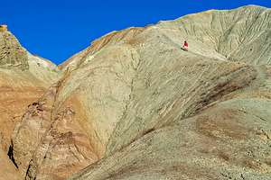 Along the Rainbow Basin Loop RoadWe had been through Barstow half a dozen times on our way to Nevada and Utah, but had never taken the time to visit Rainbow Basin, just an 8 miles north of town. Well, this time it was our destination for the day, and it was long overdue.
Despite its close proximity to Barstow, it is totally remote and undeveloped. There isn’t even a visitor center. The only evidence of man is the unpaved 4.6-mile loop BLM road that winds through the colorful gorges. Before the start of the loop road is the Owl Canyon campground, which is first-come-first-served and costs $6.
The Basin is part of the Calico Peaks range in the Mojave Desert. Noted for its colorful and interestingly shaped sedimentary rock formations, it was named a National Natural Landmark in 1966.
When we arrived, we decided to take a reconnaissance drive along the one-way, 4.6-mile dirt loop road, scouting at good spots to return to during the golden hour. The first 2 miles were definitely the most photogenic.
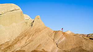 What goes up, must come downWe returned to the Owl Campground and took one of the 22 first-come-first-served spots. There were plenty of spots available. After lunch, we hiked a mile or so up the wash that began at the edge of the campground. By the time we got back to our campsite, the wind had picked up significantly, making it a bit difficult to just sit at the campsite.
So, we got back in the truck and set out on the scenic loop road again. What a difference the low light can make. We spent the next two hours, scampering up the now radiant rock formations, or more correctly, Herb made me scamper up them while he stayed below photographing me. My job was to provide a sense of scale. The smaller I was, the better.
By early evening it had gotten so windy that we didn’t know how we could possibly cook dinner at the campsite, so we decided to go back to Barstow to grab dinner and a hotel room.
Quirky Mohave Desert Stops
Monday, March 29, 2021 - 12:15pm by Lolo75 miles and 2 hours from our last stop
Travelogue
Herb had a list of quirky desert stuff for us to explore today in the Mojave Desert area near Joshua Tree. I think he found them in Atlas Obscura.
Desert Christ Park
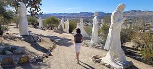 Desert Christ ParkThe first stop on his agenda was Desert Christ Park, located on the grounds of the Evangelical Living Hope Church, overlooking the desert town of Yucca Valley.
The idea for this park was conceived in 1951, when a sculptor named Antone Martone, came up with the idea of creating statues out of steel-reinforced concrete. His dream was to place a 10 foot, 5-ton 'resurrected Christ' on the rim of the Grand Canyon. However, when the Grand Canyon wouldn’t accept this gift (because of issues over separation of church and state), he renamed it “the unwanted Christ” and looked for someone to take it. That’s when the Reverend Eddie Garver, entered the picture and offered up his property on the hill above Yucca Valley to display it. Since that first “unwanted Christ,” more than 40 bright-white sculptures portraying the life and teachings of Christ have been added to the property.
Noah Purifoy Desert Art Museum
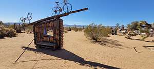 Noah Purifoy Desert Art MuseumContinuing our Mojave Desert art tour, we drove about 20 minutes, some of it on dirt roads, to the Noah Purifoy Desert Art Museum in the town of Joshua Tree, where we were greeted by an enthusiastic old woman -- we assumed the caretaker of the property -- who said that she had known Noah before he died in 2004. Wow! That is 17 years of dedication to preserve Purifoy’s works and artistic vision.
Purifoy lived and worked on this 10-acre property from 1989 until his death, creating dozens of assemblage sculptures and installations. He often expressed opinions on social events through his art; being a black artist, social injustice was often a theme.
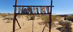 Noah Purifoy Desert Art MuseumWe spent an interesting and enjoyable hour wandering around, and sometimes into, these large-scale sculptures, or assemblage pieces as he called them, made from junked materials such as burnt wood, castoff metals, old rubber tires, chairs, and bikes, toilets, broken computer keyboards, and apparently whatever else he could get his hands on. I guess, one man’s junk is another man’s art.
Many of the assemblages were in disrepair, which was part of his intention - to display them in their natural environment and let nature take their course on them.I have to admit that although I really liked most of the pieces, there were a few that, in my humble opinion, seemed like something I might come across in the corner of a junkyard, or maybe they were just further along in the process of decay.
In any case, they were very much a part of their surrounding desert environment, which very much added to their impact and our experience interacting with them.
Giant Rock
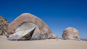 Giant RockThe last item on Herb’s quirky Mojave agenda was not man-made, but rather a rock - not just any rock though, but a seven story high one covering 6,000 square feet, claimed by many to be the largest freestanding boulder in the world.
Over the years, the rock has attracted scientists studying its electromagnetic forces (a vortex), UFO believers, who believe that the vortex is a portal for celestial spirits, and Native Americans who consider it to be sacred. We came because it is a big rock, like the ones our sons like to climb.
What made the rock even more interesting was the arc-shaped piece in front of it that had split off from the main rock in 2000 revealing a white granite interior. Some say the break occurred due to a bonfire that burned next to the rock, but according to Hopi Prophecy if it split in the middle, mankind would be doomed, but if it split to either side, mankind would have a chance to survive. Whew! Kind of ironic visiting this place during the pandemic.
Herb was feeling pretty smug, having successfully delivered a day full of fun and quirky attractions, but it was not over yet.
Our next destination, and hopefully camping spot, was Rainbow Basin, just north of the town of Barstow.
Ladder Slot Canyon Hike and Indio
Sunday, March 28, 2021 - 12:15pm by Lolo100 miles and 2.5 hours from our last stop - 1 night stay
Travelogue
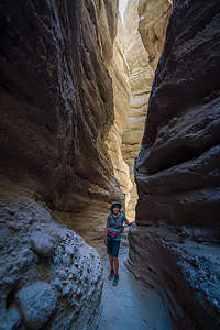 Ladder Slot Canyon HikeOur drive today took us past the stark and mostly abandoned Salton Sea, a very different reality from the vision that developers had of creating a California Riviera, a place where Hollywood movie stars would vacation. To attract tourists, the lake was stocked with fish, which in turn attracted birds, making it a bird watcher's paradise as well.
However, irrigation runoff from the surrounding agricultural lands brought high quantities of fertilizer, pesticides, and salt into the lake, polluting the lake and killing off most of its fish. Needless to say, the dream of the area becoming a California Riviera never happened, and the area is quite economically depressed today, and pretty much abandoned. The lake is actually beautiful, and if you squint, you can almost imagine what it could have been.
There are some very interesting attractions to see in the area, especially if you are interested in desert art, such as Salvation Mountain and East Jesus. We visited both of them during our trip here in 2017.
.thumbnail.jpg) Herb coming out of Ladder SlotHowever, today we were just passing through on our way to the Ladder Slot Canyon hike in the Mecca Wilderness outside the small desert city of Mecca, just north of the Salton Sea.
Herb coming out of Ladder SlotHowever, today we were just passing through on our way to the Ladder Slot Canyon hike in the Mecca Wilderness outside the small desert city of Mecca, just north of the Salton Sea.
This is an extremely popular hike with Palm Beach area residents, so it was not great that we would be hitting it on a Sunday. Sure enough, the trailhead parking at the end of the dirt Painted Canyon Road was almost full. However, since it was early afternoon, most people were returning to their cars and leaving.
From the trailhead we walked about a quarter of a mile before we came to a small trail sign pointing left to the entrance of Ladder Canyon.
After making our way around a rockfall, we came to our first ladder, where we unfortunately had to wait about 20 minutes while a family of 5, including grandma, two children, and a small dog made their way down the ladder before we could go up. Grandma had to be cajoled a bit before taking that first step. In all fairness, it actually is harder going down than up these ladders. When they were finished, we asked another large family coming down to let us scamper on up before they began their god-knows-how-long descent.
The trail then bends into the canyon itself and we climbed a few more ladders, with less waiting this time. The entire narrow section of the slot canyon continues for about ¾ of a mile, where it then continues up the wash to a ridgeline and an awesome view of the Salton Sea.
I was a bit concerned about warnings from people about getting lost once you got out of the slot because there were so many trails to choose from. My concerns were relieved when Herb pointed to a large 12-foot arrow on the trail built out of rocks, which pointed us in the direction we wanted to take to go down Painted Canyon. He also had the trail loaded onto his Garmin watch.
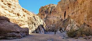 Hiking down Painted CanyonThe trail went along the ridge for awhile with views down into Painted Canyon on our right, where we would be headed next to complete our loop hike. We passed several more huge rock arrows along the way.
Painted Canyon was lovely, with its multi-colored rock walls. It reminded me a bit of our hike out of Golden Canyon in Death Valley. After two more small ladders to deal with, we were back to the part of the trail where we first turned left into the Ladder Slot. Before we knew it, we were back at the car.
What an Excellent hike!
We drove on to the larger town of Indio where we stayed in a Days Inn in walking distance to a great Mexican restaurant called El Mexicali
There was so much variety in texture and experiences today - just the way we like it.
Anza-Borrego State Park
Thursday, March 25, 2021 - 12:00pm by Lolo326 miles and 6 hours from our last stop - 3 night stay
Travelogue
Day1 – Borrego Springs Resort and Spa
 Borrego Springs Resort and Spa dining roomWe got to the park just in time to stop at the Visitor Center to get information about 4WD road conditions so that we could plan our next couple of days. It was a bit late to start looking for campsites along one of the washes, so we decided to spend the night at the Borrego Springs Resort and Spa. From there we would plan our next couple of days off-roading. We must be getting soft.
The hotel was very nice and quite luxurious compared to what could have been for this evening. The resort restaurant had just reopened, so we were happy that we could have dinner without having to get back into the car.
It was our very first indoor dining experience, but there was only one other table in the large dining room occupied, so I felt very comfortable. Apparently the etiquette for indoor dining is that you wear your mask until you sit down, but then you can take it off. However, out of habit, any time the waitress came near, I grabbed for it. I just felt it was the courteous thing to do. The setting was very nice and the food was pretty good. The menu was a bit limited because they were just starting up again. It must be really hard for these restaurants to respond to the closures and re-openings.
Day 2 – Coyote Canyon and Sheep Canyon
.thumbnail.jpg) Alternative to bushwhackingThe next morning, I stepped out onto our patio and saw about a dozen ladies being led in a aqua aerobics class in the pool below us. I was getting a little embarrassed, as we had told our friends that we were going on a remote camping trip in our truck to the desert and the mountains. We would eventually get there. For now, we were enjoying the novelty or normal life.
Alternative to bushwhackingThe next morning, I stepped out onto our patio and saw about a dozen ladies being led in a aqua aerobics class in the pool below us. I was getting a little embarrassed, as we had told our friends that we were going on a remote camping trip in our truck to the desert and the mountains. We would eventually get there. For now, we were enjoying the novelty or normal life.
The following morning, based on a knowledgeable friend’s recommendation, we let some air out of our tires and took the 4WD road through Coyote Canyon to Sheep Canyon, where we were able to get a campsite in the primitive campground. It was about a 14-mile drive of sandy and rocky roads.
One of the prime motivators for camping here was a hike described in the Anza-Borrego Desert Region guidebook (referred to as Bible by the Visitor Center staff). On page 98, the author described a 1-mile (RT) hike which went from the campground to a lovely spring grotto with a 20-foot waterfall and tree-shaded pool. It sounded lovely.
To his credit, he did describe the trail as steep and rugged, requiring several stream crossing, and scrambling over large boulders. Oh, and thorny plants all over, very anxious to poke you in the same of self defense. There was no real obvious trail. Occasionally, we would come across a cairn to encourage us that we were going in the right direction.
 Camping in Sheep CanyonFinally we found it, but with the water levels being low this spring, the waterfall was not quite as inspirational as the photo in the guidebook. Still, it was quite nice.
I was not looking forward to bushwhacking through more cacti and climbing over boulders, so we decided to just get our feet wet and follow the stream down to the campground. It was a fairly good plan, with just one minor faux pas, when I misjudged the depth of the stream when stepping off a rock into it and did a faceplant. Fortunately, the only thing hurt was my pride. I was now totally soaked, but the day was warm enough to make it refreshing. Plus, that would be my shower for the day.
We managed to get back to the campsite without any further mishaps, and had a nice evening cooking out and sipping wine while watching the sun set.
Day 3 – Fish Creek Wash, Olla Wash, and the Mud Palisades
.thumbnail.jpg) Split Mountain GorgeThe next morning we watched the sun come up and then headed back, continuing along through Sheep Canyon and Coyote Canyon back to the Visitor Center.
Split Mountain GorgeThe next morning we watched the sun come up and then headed back, continuing along through Sheep Canyon and Coyote Canyon back to the Visitor Center.
Our plan for today was to explore and spend the night in Fish Creek Wash, which we had been to and liked on a previous trip, seeing some new things we had not had time for the last time.
From the Visitor Center it was about a 40-minute drive (on asphalt) to the beginning of the Fish Creek Wash. To get there, we drove on Route 78 to the town of Ocotillo Wells. From there, we went south on Split Mountain Road for about 8 miles to the beginning of the Wash. At the entrance, we reset our odometer to 0.0, so that we could follow the mile by mile description of the drive in Lindsay’s “Anza-Borrego Desert Region Guide.”
 Along the Olla WashAfter about a mile and a half of relatively easy driving, we entered Split Mountain Gorge, a narrow cut in the mountains where cliff walls, several hundred feet high, towered above us. The split separates the Vallecito Mountains on the right and the Fish Creek Mountains on the left. It’s one of my favorite spots along the wash.
At mile 3.8, we stopped to admire the fascinating anticlines on the canyon walls, where the rock layers had been bent and twisted into U-shaped bows and curves by tectonic activity millions of years ago. They were beautiful.
At mile 4.4 is the trailhead for the very popular 1.3-mile (RT) hike to the Split Mountain Wind Caves, where there is a collection of sandstone formations with wind-eroded pockets, some of which are large enough to crawl through and sit in. It is truly worth doing, but since we had done it last time and wanted to see some new sights, we continued on.
We continued along the Wash, bypassing the choice at mile 7.2 for the Loop Wash spur. At mile 10.7 we came to an interesting sandstone rock formation known as the Layer Cake, because of its multi-colored bands of green and gray.
.thumbnail.jpg) Lolo amongst the ChollaA little bit further, at mile 12.5, we reached Sandstone Canyon, a high wall, narrow slot canyon that was drivable until 1992, when thousands of tons of debris came tumbling down near its mouth. You can park at the entrance and walk for about a half mile into the canyon. We did that last time, so instead we continued on. This was now all new territory for us.
Lolo amongst the ChollaA little bit further, at mile 12.5, we reached Sandstone Canyon, a high wall, narrow slot canyon that was drivable until 1992, when thousands of tons of debris came tumbling down near its mouth. You can park at the entrance and walk for about a half mile into the canyon. We did that last time, so instead we continued on. This was now all new territory for us.
At mile 13.2, we came to the turn off for the Olla Wash, where we planned to camp that night. For now though, we passed it and drove another 0.4 miles to the Fish Creek Overlook, where we scampered up to an awesome view across the Fish Creek and Carrizo Badlands.
From there we drove back 0.4 miles and entered the Olla Wash, which goes for 2 miles, ending at the very impressive Mud Palisades. The ranger at the Visitor Center had told us that this was one of her favorite places in the park, so since it was something we hadn’t seen, we decided to try it.
During the 2 mile drive, we scouted out possible campsites for the night. This was a very lightly traveled Wash, so there were several good options. We chose one that was set against a colorful rock backdrop with my very own cholla garden.
 Morning light on the Mud PalisadesFrom there we walked the mile to the Mud Palisades, but unfortunately they were already in the shade, so we decided to come back at sunrise, during the golden hour.
Back at the campsite, we read, sipped wine, strolled amongst the cholla, and watched a full moon rise over the rocks behind us, without another soul in miles.
The next morning we rose early, skipped breakfast and coffee, and drove the 1 mile to the Mud Palisades to catch the sunrise. As we had hoped, the dull tans of yesterday afternoon had become a brilliant red. I could see how they got their name, as their deeply eroded cliff faces, made of mudstone, made them look like the defensive walls of an old fortress or castle.
Description
 Borrego Palms OasisWith over 600,000 acres, Anza Borrego is the largest state park in the California state park system and the largest desert state park in the U.S. Its spectacular and undeveloped Colorado Desert scenery extends from the edge of the coastal mountains east to the Salton Sea and south almost to the Mexican border. The park is located about 2 hours northeast of San Diego
The elevation in the park ranges from just 200 feet near the eastern edge to 6,200 feet, resulting in a variety of ecosystems and a temperature range as high as 30 degrees.
Major activities in the park include:
- Four-wheel driving on its nearly 500 miles of dirt and rocky roads (of varying difficulty)
- Mountain biking along those same four-wheel drive trails
- Hiking along its 50 miles of trails with a variety of scenery palm oases, waterfalls, slot canyons, badlands, desert gardens, etc.
- Wildlife viewing - bighorn sheep, deer, bobcats, coyotes, mountain lions, Jackrabbits, desert cottontails, 50 species of lizards and snakes, hawks, etc.
- Enjoying the spring wildflowers
- Camping – there are 12 campgrounds inside the park, but it is one of the few California parks that allows open camping throughout its 600,000 acres
 Layer Cake formation in Fish Creek WashThe small town of Borrego Springs lies at the center of the park and has ample services – lodging, restaurants, gas, grocery store, etc.
The park’s Visitor Center and the Borrego Palms Campground are just 5 miles west of the town of Borrego Springs. Be sure to pick up a copy of their ‘At Home’ magazine, which is a great source of things to do in the park.
Cambria
Tuesday, March 23, 2021 - 11:45am by Lolo300 miles and 5 hours from our last stop - 1 night stay
Travelogue
 Pups at the Elephant Seal RookeryCambria is a lovely little seaside town along the Central Coast, just south of San Simeon and the much-visited Hearst Castle (unfortunately closed due to Covid during our visit). Besides the natural beauty of its beaches, there are plenty of art galleries, shops, restaurants, and walking paths to enjoy.
Rather than crawling into the back of the 4Runner for our first night on the road, we decided to start our first post-vaccination journey with some socially distanced human activities - staying in an Inn and going out for dinner. Needless to say, I was very excited.
Rather than stay in town, we booked a night at the Castle Inn, right across the road from the picturesque Moonstone Beach, where a mile-long boardwalk traces the coastline, with several options to get down to the beach itself. However, we would save that stroll for sunset.
 Elephant Seal RookeryFor now, we hopped back in the car, and drove up Route 1, passing the turnoff for Hearst Castle, to the Piedras Blancas Light Station, just 12 miles north of Moonstone Beach. Unfortunately, access to the lighthouse was closed, because during Covid tours are only given on Saturdays.
Oh well, we returned down Route 1 for about 2 miles to the Elephant Seal Rookery where we were treated to dozens of northern elephant seals lolling about on the beach. The number of seals, and what they are doing, will vary based on the month you visit. The following is a very brief description of what you can expect based on the month you are here.
January through mid-February is when the females give birth, usually just a few days after their arrival on the beach. The moms will bond and nurse the pups for about 5-weeks, during which time she loses about 40% of her body weight. At the end of that time, she comes into esterus and mates with the harem master and then returns to the sea, leaving her weaned, one month-old pups on shore to fend for themselves.
 Moonstone Beach in CambriaIn March, the adult males, who have also lost 40% of their body weight, boogy out as well, leaving the beach to the pups, who now start venturing down to the water to begin their self-taught swimming lessons. Because much of their swim practice occurs at night, we didn’t get to see this. When they feel ready, they head out to sea where they will forage until their return to the rookery in the fall.
Between late March and July, the elephant seals return to the rookery to undergo their annual moult, where they grow a new layer of skin and hair, as the old layer falls off in patches. Once that is complete, they head off to sea for their second migration of the year.
.thumbnail.jpg) Outdoor dining and the Moonstone Beach Bar and GrillThe cycle starts all over again when the first adult males return to the rookery in late November through December, ready to breed again. Only the strongest and most aggressive will become a harem master, so competition gets pretty tough at this time, and the battles can get pretty bloody.
Outdoor dining and the Moonstone Beach Bar and GrillThe cycle starts all over again when the first adult males return to the rookery in late November through December, ready to breed again. Only the strongest and most aggressive will become a harem master, so competition gets pretty tough at this time, and the battles can get pretty bloody.
The pregnant females arrive in December as well and will give birth from mid-December through January. About 5 weeks afterwards, she will get a visit from the harem master and it starts all over again.
We were at the rookery at the end of March, so we saw lots of already weaned pups as well as some adults who had returned for the moult. Quite fascinating and interesting to watch. It would be great to catch them in either the mating or birthing process, but what they are doing most of the time is lying like lazy sunbathers with the occasional flipping of sand onto themselves to keep cool.
When we got back to the Castle Inn, we walked to the nearby Moonstone Bar and Grill to check out the menu. It was only 4:30, but a line was already forming outside for its 5:00 opening, so we returned to the Inn for a quick shower and change, and hurried back to place ourselves at the end of what was now a quite formidable line. Wow! This place must be good. We were concerned that we might not get in and would have to wait for all those ahead of us to finish their dinners before we could be seated. However, the place was pretty big and open for both indoor and outdoor dining, and most seemed to choose indoor. This left room for us on their lovely outdoor patio, complete with ocean view, which we would have chosen anyway. Plus, we were more comfortable eating outdoors, as this was our first dining-out experience since the start of Covid.
 Fiscalini Ranch Preserve Bluff TrailIt was wonderful. We were so excited to finally be out dining and feeling normal that we would probably have enjoyed even a mediocre meal, but that was not our experience. The food was delicious, the glass of wine was an extremely generous pour, and the view was lovely.
A post-dinner stroll along the mile-long Moonstone Beach boardwalk during sunset completed what I consider a perfect day.
The next morning, before leaving the Cambria area, we went for a hike at the Fiscalini Ranch Preserve, a 364-acre property with 11 trails, bounded on each side by lovely residential areas. We took the bluff-trail, which had stunning views and a scattering of interesting driftwood benches to sit on to just relax and enjoy the scenery.
Pretty awesome start to a post-vaccination road trip!
Pismo Beach
Wednesday, March 24, 2021 - 10:15am by uberHerb48 miles and 1 hour from our last stop - 1 night stay
Travelogue
 My favorite Morro Bay OtterOur drive from Cambria to Pismo Beach took us right through the town of Morro Bay, a place we had visited two times in the past, but always with bad weather. Today was perfect, and reinforced my desire to someday kayak out to Morro Rock, a 576 foot volcanic plug that stands at the entrance to the harbor.
However, since we didn’t have the kayaks along, we satisfied ourselves with gazing at it from the Morro Bay T-Pier, where the cuddly little otters like to hang out. If reincarnation is a thing, I want to come back as an otter, because I have never seen a more carefree and playful creature than an otter. They are utterly adorable, as they playfully float on their bags, resting their cute little heads on each other’s bellies. You can just stand there smiling, watching them for hours.
We made one more stop at the Monarch Butterfly Grove before getting to Pismo Beach. Timing is everything, and we knew that we had missed the October - February window for the gathering of 110,000 butterflies on the eucalyptus trees in this grove. We, and a dozen or so other ill-timed tourists, saw one either dumb or very independent monarch fluttering around the grove. I wonder what he was thinking?
Our next and final stop for the day was Oceano Dunes State Vehicle Recreation Area (or OHV), a 5.5 miles stretch at the southern end of Pismo Beach that allows off-highway dune buggies to play in the huge sand dune complex. Racing around dunes is not exactly the 4Runners specialty. We were just there to be able to drive on the beach and camp.
 Pismo Beach camping4WD is highly recommended, not just because of the deep sand, but also, to get to the camping area one has to cross the Arroyo Grande Creek, which is only passable at lower tides. There was very little water in it when we drove over it in mid-afternoon. The other recommendation is to make sure you camp above the high tide line, or you might wake to find yourself with the sound of the surf a bit closer than you would like.
We found a place to settle for the night, and spent the evening watching dune buggies zipping up and down the beach after returning from their more adrenaline-pumping ride through the dunes.
There was one near calamity when a pick-up truck pulling a trailer with a dune buggy on it got too close to the surf and got stuck. The next hour involved some frantic detaching of vehicles and desperate pushing onto the drier sand. Thankfully, they made it in time.
The next morning we got up early because we had a 6 hour drive ahead of us to get to Anza-Borrego State Park. Unfortunately, the tide was too high to cross over the Arroyo Grande Creek, so we had to wait about an hour for the tide to fall.
Shasta Lake
Wednesday, July 17, 2019 - 1:45pm by Lolo213 miles and 4 hours from our last stop - 6 night stay
Travelogue
Day 1 - Launch at Packers Bay and camp in cove on Sacramento Arm
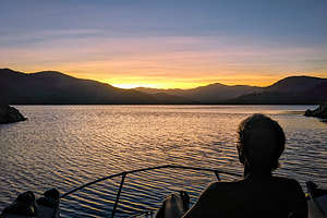 Herb enjoying his first sunset on Shasta LakeSince we moved the boat West in 2016, we had been anxiously searching for a place to use our Grady White. Of course, there is the ocean, and I’m sure we will eventually get to that, but we were more interested in finding a place to waterski, swim, and camp.
We would have loved to put the boat in Lake Tahoe, but they are quite strict as to what types of engines can be used. The lake is incredibly pristine, so I can see their motivation for keeping it so. Unfortunately, our carbureted, two-stroke engine is not allowed on the lake.
So that pretty much pointed us to Shasta Lake, California’s largest reservoir, which because of the heavy snows the last two winters was pretty close to capacity and back to having over 300 miles of shoreline and dozens of coves to explore and camp in. As a result, it is one of California’s top recreational destinations.
Another thing we think about when trailering our boat is the drive. For example, Lake Berryessa is nearer to us but requires us to drive up some pretty steep, twisty hills. The drive to Shasta Lake, on the other hand, is pretty straightforward - just under 4 hours and most of it on I5.
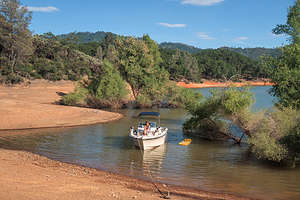 Our cove in O'Brien's InletThere are seven boat launches on the lake, but we chose to launch at Packers Bay, as it was the closest and had the biggest parking lot.
Our only mission that day was to find a place to camp for the night, so we cruised a bit up the Sacramento Arm before finding a little rocky cove to camp in, where we tied up to some dead trees near the shoreline.
Later that evening, a deer climbed down the steep rocks surrounding the cove to visit us. We had know idea as to why - there was no food and he didn’t even take a drink in the lake. However, he did take a swim to the other side of the cove. Strange.
Even stranger, after it got dark we noticed two shiny circles at the top of the rocks surrounding the cove, which we eventually realized were a pair of eyes staring down at us. As far as we knew, it had to be some kind of cat, as they are the only animals I know whose eyes glow in the dark. Mountain lions are found around Shasta Lake, so we were pretty sure that that was what was looking down at us. I just hoped he didn’t know how to swim and climb a boat ladder.
Day 2 - Cruise Sacramento Arm, select camping spot, and swim
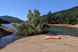 Tommy and Erin's home for the nightTommy and Erin were planning on joining us for the weekend, so we set out today on a cruise to look for shoreline for them to camp on, as our 20-foot Grady White is not big enough to fit four people - although if necessary, they could sleep out on the back deck.
It wasn’t long before we realized this was going to be harder than we thought. Unlike Lake Powell, where there are miles of flat, sandy shoreline upon which to set up a tent, the shores of Shasta Lake are not only steep, but thickly forested with pine and oak trees.
Finally we found something that might work up the Sacramento Arm, along the O’Brien Creek Inlet. It had a small sandy beach with a small hill with a flat enough spot on top to pitch a tent. Not perfect, but workable. Plus, the cove was really nice for swimming.
We continued our cruise to see if we could find something better, but there really wasn’t, so we came back and anchored for the night. The rest of the afternoon was quite relaxing, as we spent it reading, swimming, and floating.
Day 3 - Set up Camp and relax in our cove
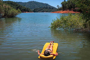 Lolo enjoying her floatWe were kind of afraid that if we left someone would take the camping spot we had found for Tommy and Erin, especially since it was Friday and flat shoreline was extremely scarce. So, pretty early in the morning we cruised back to the Packers Bay boat launch to pick up our tent, so we could set it up on the spot we wanted to save. That way we wouldn't have to hang out and guard our spot the whole day.
Once that was done, we pretty much just chilled the rest of the afternoon reading, swimming, snorkeling, and floating.
Later in the day, two large houseboats invaded our private cove and anchored along the shoreline about 50 yards north of us. Still, it wasn’t too invasive in that we were at the very end, so no boats would be cruising by us, kicking up a wake. Plus, there was a large tree in the water between us and them providing quite a bit of shade and privacy.
Day 4 - Pickup Tommy and Erin, Birthday Lunch at Bridge Bay Restaurant, and waterskiing
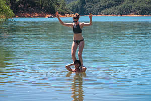 Tommy and Erin have arrivedTommy and Erin had driven up the night before and camped in the van nearby, so they were ready for us to pick them up at the boat launch bright and early.
We brought them back to our home in the O’Brien’s Creek Inlet, where we spent the morning swimming. Afterwards, we headed out on the boat for a cruise around the lake and a stop at the Bridge Bay Restaurant to celebrate Tommy’s 28th birthday, which was coming up next week.
The view from our table on the outdoor patio of the lake was fantastic, and the food was quite good as well. We each indulged a bit with a celebratory cocktail, something we normally wouldn’t do mid-day, but it was after all Tommy’s birthday.
After lunch, we went for a cruise up the McCloud Arm of the lake. Shasta Lake has three major arms, each created by a river that flows into it: the Sacramento River, the McCloud River, and the Pit River. Taking it a step further back, The Sacramento River's source is the Klamath Mountains, the McCloud River's source is Mt. Shasta, and the Pit River flows from Alturas.
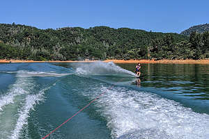 Tommy slalom skiingI think Tommy was anxious to waterski, as he had done it, on our boat at least, since he moved out West in 2013. We headed back up the Sacramento Arm and into O’Brien’s Inlet where the water was a bit more protected and calm as it wasn’t out in the major channel.
I had forgotten how much fun water skiing can be. It was quite a successful afternoon, as each of us got up the very first time - Tommy and I each on a slalom ski and Erin on two skis.
I used to try to slalom at least once every year just to prove that I still wasn’t old. With the boat living on the opposite coast for the past few years, I hadn't had a chance to try, so I was quite excited (and relieved) that I could still do it.
Then it was back to our campsite in the cove for more swimming and fun with Tommy and Erin. Not a bad life.
Day 5 - Waterski some more, drop Tommy and Erin off, and camp in Pit Arm
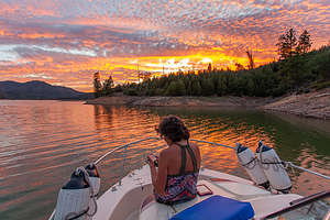 Our new campsite near the mouth of the Pit ArmBefore dropping Tommy and Erin off to at the Packers Bay Boat Launch so they could go back to their real working lives, we did another round of waterskiing in O’Brien’s Inlet. Another successful session as we each got up first time again. I still got it!!
After saying our goodbyes at the boat launch, Herb and I decided to cruise around the lake and find a different spot to camp. We would have a lot more options now that we didn’t have to worry about a flat shoreline to set up a tent. All we need was a place to toss an anchor.
We found a nice spot to anchor near the mouth of the Pit Arm where we were oriented towards the sunset. Sure enough, it put on quite a show for us. Lovely
Day 6 - find camping with view of Mt. Shasta
 View of Mt. Shasta from our campsite on Slaughterhouse IslandThis morning we went in search of a view of Mount Shasta from the lake. We had seen it the other from near the Dam, but wanted to see if we could find a campsite with a view.
We did find a pretty cool spot near the mouth of the Sacramento Arm on the north end of Slaughterhouse Island - it had a nice ring to it. I think this is only an island when water levels are high as Google Maps showed it as a peninsula. Whatever it was, it was a good spot with a nice view up the lake of snow-covered Mount Shasta. Plus there was even a nice pine forest behind us that we could take a stroll through. It was good to use the legs after sitting in a boat so long.
There was even a small bluff with a flat top where we set up our chairs and a beach umbrella - the sun was really quite hot. It did require us, however, to step through some pretty mucky quick-sandy like stuff at the shoreline - tough to keep the sandals on
We spent the rest of the afternoon swimming, reading, and looking at Mt. Shasta.
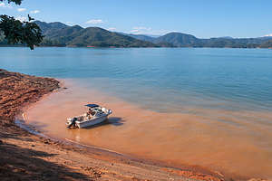 Our campsite on Slaughterhouse Island (with view of Mt. Shasta on the right)
Day 7 - Cruise up McCloud River Arm and home
After 6 nights sleeping on a small boat, I get a bit antsy, especially when there was really no place to anchor and hike, as we had been able to do in Lake Powell and Lake Mead.
We decided to take one more cruise, this time all the way up the McCloud River Arm before pulling the boat and driving home.
Description
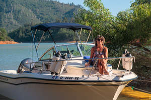 The first mateShasta Lake, located near the town of Redding, is California’s largest reservoir. When at full capacity it has 365 miles of shoreline and dozens of coves to explore and camp in.
Shasta Lake was created in 1948 when the Shasta Dam was constructed across the Sacramento River. As a result of the dam, the lake has four major arms, each created by an approaching river: the Sacramento River, the McCloud River, Squaw Creek, and the Pit River.
In addition to providing electrical power, flood control, and water storage, the lake has become one of California’s top recreational destinations. There are nine marinas offering a variety of services, including houseboat rentals and seven boat launches.
Bishop
Friday, May 3, 2019 - 12:30pm by Lolo360 miles and 7 hours from our last stop - 4 night stay
Travelogue
Day 1 - Arrival in Bishop
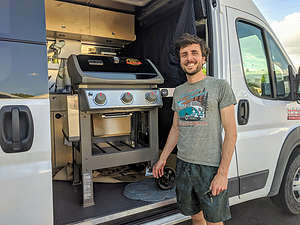 Andrew and his birthday surpriseThe last half of our 7 hour drive to Bishop is always a treat - starting with Route 50 through South Lake Tahoe, and then down 395 through Bridgeport, Lee Vining, June Lake, and Mammoth Lakes. It’s an incredibly scenic drive.
We arrived around 4:30, just near quitting time for their remote workday. Celeste had planned a big surprise from all of us for Andrew’s birthday - a new Weber Gas Grill for their backyard, something never possible when they were living in a small apartment in San Francisco.
Wanting to support local businesses rather than Amazon, Celeste had ordered it from High Country Lumber, a nearby hardware store that Andrew had come to love. I never thought my son would have such a fondness for hardware stores, but Celeste said he was always finding excuses to go there during the week.
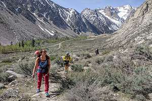 Hike into Pine Creek CanyonThat was the problem. Bishop is a very small town and everyone knows each other’s business. Celeste was so afraid that if he walked in there, they would spill the beans on the BBQ they were assembling for him. So, all week long, every time Andrew said he was going to High Country Lumber, Celeste would make some excuse to stop him, and say let’s do it when your parents and Tommy get here - as if that was a way to entertain your guests who had just driven 7 hours to see you.
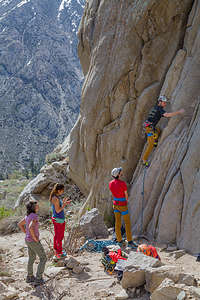 Climbing in Pine Creek CanyonSo, when we arrived, we pretended we needed a hose clamp for the car and asked Andrew if he knew where we could get one. Of course he said High Country Lumber, and quickly volunteered to join us. So off we went - me, Herb, Andrew, and Tommy to shop for a hose clamp. Celeste said she would stay behind, but actually she was going to drive their van over after we left, as that was the only vehicle that would fit the grill.
When we got to the hardware store, we spent a ridiculously long time stalling in the hose clamp aisle waiting for Celeste to come. I think Andrew was starting to get suspicious that something was going on. When she pulled into the parking lot, he got even more confused.
Finally, an employee rolled out a beautiful new Weber Grill and placed it by the van. I think it still didn’t sink in that it was his until we all herded him towards it. Let’s just say he was very, very pleased.
After getting it home, we tested it out with marinated chicken kabobs, the ingredients for which Celeste had gotten ahead of time. They were delicious and just the beginning of many more delicious meals to come.
Day 2 - Climbing in Pine Creek Canyon and the Buttermilks
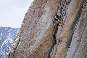 Tommy climbing in Pine Creek CanyonWhenever we are away with the kids, we know that climbing is going to be a big part of it. Plus, Bishop is a premier climbing destination with numerous areas to do all types of climbing - trad, sport, and bouldering.
This morning we would start in Pine Creek Canyon, a stunningly beautiful canyon nestled between Mount Tom and the Wheeler Crest, less than a half hour from Andrew and Celeste;s apartment.
This is just one of the many climbing areas near Bishop. It alone has over 630 routes, including multi-pitch trad climbs and one of the largest collections of sport climbs in the state.
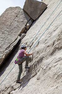 Even Lolo hits the walls of Pine Creek CanyonJust the hike into the canyon itself was worth the trip, even if I personally didn’t get to climb. I just love the beautiful scenery and watching them do what they love. However, they ignored my usual chant of “I don’t have to climb,” and informed me that indeed I did and that they would find something appropriate for my abilities. Oh boy.
We started off on “Mustache Wall,” the first wall on our left when we entered the canyon. True to their promise, they set up a top rope on Gimpenator, a 5.8 which is considered a warm-up by everyone else but me. However, we all “sent” it, including me.
Next they set up on B-Gizzle, a 5.10d climb on a left facing corner with a thin crack. Crack climbing requires jamming your fingers and feet into various sized cracks and hauling yourself up. It’s really rough on the fingers. They all successfully completed the climb and made me get on it too. I didn’t get very far, but I did get further than anyone expected, especially me.
While climbing B-Gizzle, the boys noticed that the man on the route next to us was Marty Lewis, the climber who authored most of the climbing guides for the Bishop area. He quite a legend in climbing circles.
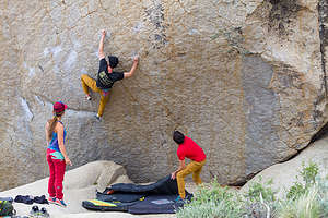 Tommy bouldering in the ButtermilksAfterwards we moved on to Gateway slab, just to the left of Mustache Wall where they did a 5.9 called Vanadium Miner’s Daughter and a 5.7 called King Dirtbag. I think the main motivation to be the first one to ever do a specific route is that they get to give it a creative name.
You would think that one climbing area per day would be sufficient, but oh no - not with this group. Now it was time for the Buttermilks, their favorite climbing area and one of California’s premier bouldering destinations. It too was just a half hour from their apartment, out along the bumpy, washboard Buttermilk Road.
First, a very brief primer on bouldering. Bouldering is a form of rock climbing that does not use ropes because it is done on “boulders” that are not too high. To protect from injury, crash pads are placed on the ground to soften the climber’s fall. In addition to the pads, other climbers stand at the bottom with arms extended upward to catch or slow the climber down if he falls. However, in the Buttermilks, the boulders are pretty darn big, some as high as 45 feet.
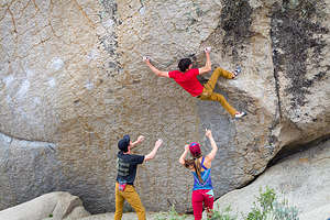 Andrew bouldering in the ButtermilksBouldering is not Herb and my thing, so for this portion of the day, we would just be spectators - not a bad thing as the landscape is amazing, with hundreds of huge boulders (or more technically, glacial erratics) strewn across a vast hillside with the snow-capped Sierra in the background.
It was a great place to just hang out, enjoy the scenery, and watch Andrew, Tommy, and Celeste puzzle out the “problems” they were working on. The word “problem” is used in bouldering because climbers often spend weeks and even months, working out all the moves to complete a particular bouldering route. The difficulty of a bouldering problem is graded on a scale from V0, being easiest, to V16.
Celeste’s “puzzle” for the day was a climb called Junior Achievement, a V7/V8 that can be pretty rough on the fingertips. She made significant progress before her finger skin ripped a bit, shutting her down for the rest of the day.
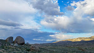 Late afternoon in the ButtermilksTommy worked for awhile on a boulder problem “Checkboard,” a V8 described on Mountain Project as having an “exciting last move high off the deck.” I'd say. He made some great attempts and came really close, but fell on the last big move.
The last puzzle for the day was “Zen Flute,” a V10 that requires a sizable dyno (short for "dynamic") finish where the climber has to make an all-out leap of faith to a jug (big hold) - quite exciting for both the climber and any spectating moms. Tommy came so so close, and Andrew did “send” it, complete with a primal scream. I think he had a little bit of a home court advantage.
I was exhausted from just watching them. Time for a beer at the Mountain Rambler.
Day 3 - Skiing at Mammoth Mountain
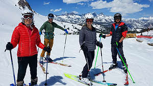 Mammoth Mountain SkiingYou can’t climb hard every day, so today was declared a rest day, which apparently is defined differently for twenty-year-olds than sixty-year-olds.
Our “rest day” was skiing Mammoth Mountain, which despite the fact that it was May, was still open for business, with most of their trails still open.
One of the many nice things about living in Bishop (elevation 4150 feet) is that you can enjoy a warm, sunny day pretty much all year round, and still just drive 45 minutes up to Mammoth Mountain (elevation 7,800) to ski, pretty much any day from November until June. Not bad.
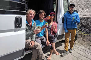 Apres ski celebration in Andrew's vanI’m not the best of skiers, but still, there were plenty of intermediate trails for me to enjoy, and the conditions were perfect - not a bad first time spring skiing in the West! I felt a little bad that the rest of them felt compelled to ski the same trails as Herb and I, so I kept telling them to go play on the black diamond runs. However, they sweetly said that they could do that anytime, but it wasn't everyday that they could ski with us. Awww…
It was a fabulous day, followed by “celebratories” (alias cold beers that you have earned) back at Andrew and Celeste’s van in the parking lot, and then a night of BBQing chicken kabobs back in Bishop on Andrew’s new birthday grill. Pretty perfect day.
I could get used to this.
Day 4 - Climbing in Owens River Gorge and the Volcanic Tablelands
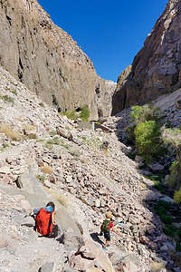 Hike down into the Owens River GorgeCeleste had to work today, but Andrew took the day off and suggested we go climbing - what a surprise! Today we would go to the Owens River Gorge, a third climbing area, this one with more options for me and Herb to climb, in that it has 416 sport climbing routes, which is the kind of climbing we like to do - none of this dropping a few feet down onto a crash pad when falling from a boulder. The time of my life where I would have considered that a positive experience passed quite some time ago. I’ll stick with a rope.
As with Pine Creek Canyon and Buttermilks, the drive to the trailhead to hike down into the Gorge was less than a half hour from Andrew and Celeste’s apartment - no wonder they moved here.
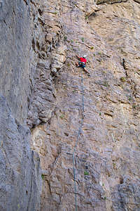 Andrew climbing in the Dilithium Crystal area of the Inner Gorge.The drive along the Gorge Road was pretty unspectacular – flat and brown with lots of power lines. Usually when you approach a climbing area, you know it, because you see beautiful rock walls, and it’s exciting, but a gorge kind of sneaks up on you, and you don’t know it’s there until you are at its rim, and even then you might not see much until you hike down into it.
The hike down into the gorge is quite steep and a little bit intimidating, but no steep drop-offs so it was okay. The gorge itself is over 10 miles long and has many different areas to climb in. Today, we were headed to the Dilithium Crystal area in the Inner Gorge.
As I said, Andrew and Tommy were anxious to get me on a climb, so they set up shop at a 5.8 called Lava Java. I hoped I liked the climb as much as the name. 5.8 is about my outdoor limit, although I think I did do a 5.9 and 5.10a once. I love gym climbing but I am much more intimidated by outdoor climbing.
As must be done in sport climbing, somebody (Tommy in this case) had to lead the climb and set up a top rope on top for the rest of us to use. This was a very easy climb for the boys and for Herb, but just about the right amount of challenge for me. I “sent” it with a minimum of whining. The rest of them used it as a warmup.
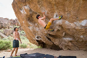 Tommy bouldering in the Volcanic TablelandsGreat, now that I did that, I thought they would leave me alone, but they weren’t done with me yet. The next climb we set up on was a 5.10b called Coffee Achiever (hmm...I’m seeing a coffee theme here). Andrew did the leading and set up and tried to convince me that I should at least try it. I did make fairly good progress, and made it about half way up, before taking a few falls and giving up. An outdoor 5.10b is a bit over my pay grade. The rest of them made it look easy.
Now, I was officially done, but they continued on, setting up on a 5.11b called Photon Torpedo, which Andrew successfully led. Herb did well, getting it after taking (hanging on the rope) a few times.
It was starting to get too hot, so Tommy decided to skip it and save himself for climbing at the Volcanic Tablelands next. That’s right, we were going to another climbing area, where Celeste would meet us now that the workday was over.
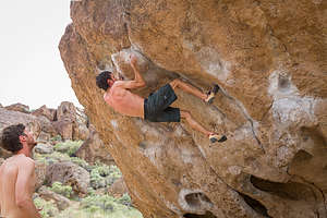 Andrew bouldering in the Volcanic TablelandsThe Volcanic Tablelands is another one of Bishop’s popular bouldering areas. It’s located just north of Bishop in a stunning area where the floor of the Owens Valley rises abruptly, forming a 300 foot-high volcanic plateau. It’s quite beautiful and only 20 minutes from Andrew and Celeste’s apartment.
Climbers refer to this area as the Happy / Sad Boulders because those are the two areas where the most routes have been established. The Happy Boulder area alone has 418 routes and the Sad Boulder area has 187. We went to the Happy’s, and that is pretty much describes the way I was feeling that evening.
To get to the Happy Boulders, we had to walk up a steep path to the top of the plateau where we were greeted with hundreds of boulders strewn throughout the plateau. They all looked pretty much alike to me, but the boys knew them all by name, features, and grade of difficulty.
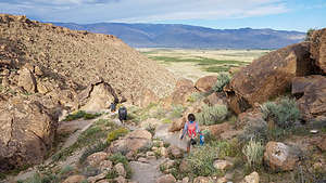 Hiking out of the Volcanic TablelandsIt was beautiful up here, so Herb and I had no problem just following them to their boulders and watching them work out their “problems.” They had a very successful evening. They started off on a V6 called The Hulk, and did back to back “sends.” Next up was Acid Wash, a more difficult V9 route, which they didn’t “send” but made significant progress - in other words, this would become one of their “projects.” They finished off with back to back “sends” on a V6 called the Gleaner.
Not a bad day’s work. They pretty much were done after that. The rock in the Volcanic Tablelands is volcanic Bishop tuff, which is a solidified volcanic ash. It has a lot of sharp edges, pockets, and cracks, so after a few climbs their fingertips were pretty raw.
In fact, Celeste didn’t climb at all this evening because her fingertips were still too raw from her efforts on Junior Achievement the other day.
Well that brings us to the conclusion of what had been an extremely active and fun Birthday Bash - 4 climbing areas and downhill skiing at Mammoth Mountain. Time for us to go home while we are still able.
Description
Bishop is my favorite town in the Eastern Sierra. It is located along US 395 between the towns of Mammoth Lakes and Big Pine. It lies at the northern end of the Owens Valley with the Sierra Nevada mountains to the east and the White Mountains to the west.
One of the town’s claims to fame is that it is the "Mule Capital of the World," holding a week-long festival each May called Bishop Mule Days. Part mule show, part test of skills, and part Wild West Show, this annual event has been attracting crowds for over its 47 year history, growing from a crowd of 200 in its early days to becoming an international world class event with more than 30,000 fans. Over the course of a week, more than 700 mules compete in 181 events including calf roping, steer roping, barrel racing, flat racing, carriage driving, team chariot racing, and even dressage.
The reason we go to Bishop is for the excellent rock climbing. The three major climbing areas in Bishop include:
The Owens River Gorge is a steep 10 mile long canyon just north of Bishop that is a very popular destination for rock climbing. With 416 sport-climbing and 52 trad routes it is California’s most concentrated sport climbing area. The climbing is on volcanic tuff and features edges, pockets and cracks. Although there is a full range of difficulty level, the best climbs are in the 5.10 to 5.11 range. The most popular walls are located in the Central Gorge – Warm Up Wall, the Pub, the Social Platform, and the Great Wall of China, which feature tons of 5.8 to 5.11 sport routes. Summers get a bit too hot to climb in the gorge.
Buttermilk Country, one of California’s premier bouldering destinations, is located southwest of Bishop along the western edge of the Owens Valley. These massive glacial erratic boulders sit in the foothills of the Sierra Nevada under an impressive backdrop of high peaks just a mere four miles to the west. There are 243 bouldering routes, many of which top out at over 20 feet.
The Volcanic Tablelands, another popular bouldering destination, lie just north of Bishop in an area where the floor of the Owens Valley rises abruptly, forming a 300 foot-high volcanic plateau. Along the southern tip of the plateau there are numerous canyons and washes containing thousands of boulders. The Happy Boulder area with 418 routes and the Sad Boulder area with 187 routes are the most popular. Because of its 4,500 foot elevation, the Volcanic Tablelands are climbable year round.
Pine Creek Canyon is a beautiful canyon nestled between Mount Tom and the Wheeler Crest with over 630 routes, including multi-pitch trad climbs and one of the largest collections of sport climbs in the state.
Home
Saturday, October 5, 2019 - 1:15pm by Lolo375 miles and 7.5 hours from our last stop - 1 night stay
Travelogue
 Lovely scenery on our detour around the Kern Canyon fire near BakersfieldNormally I don’t have much to say about the final drive home on one of our trips, but this one was a little more eventful than most.
We woke up really early deciding to not even make coffee, but to just hit the road and pick some up on our way through Bakersfield, less than an hour away. Well, that plan didn’t work. We were about halfway to Bakersfield on Highway 178, when we were stopped with a road closure due to a fire in the canyon between us and Bakersfield.
We asked the nice gentleman blocking our progress how we should get to Bakersfield then, and he told us we had to go all the way back to Lake Isabella and take Highway 155 up its western shore and then White River Road. A quick check on Google Maps showed us that our 15 minute drive to Bakersfield had now turned into a 2 hour one along roads which looked like an xray of someone’s intestines.
 Lolo enjoying pea soup at Pea Soup Andersen'sWhat choice did we have? We have learned since our move to California that a road being out can often mean miles and miles of extra driving, unlike New Jersey where you just go around a problem, because there’s always another road nearby.
I have to say though that the drive certainly was scenic and we saw places that we would never have seen otherwise. Up close Lake Isabella is a really beautiful lake and the drive along the road down from Glenville to Bakersfield was alongside an amazing series of beautiful rolling hills.
Finally we made it back to I5 and everything was pretty much straightforward from there. Since we hadn’t seen a fruit or vegetable in a few days, we decided to stop for lunch at Pea Soup Andersen’s in Santa Nella. You can’t miss the windmill beckoning from the highway. A bowl of delicous pea soup and a salad put our digestive tract and expectations back on track.
From there it was a smooth 3 more hours home.
