- Home
- About
- Map
- Trips
- Bringing Boat West
- Migration West
- Solo Motorcycle Ride
- Final Family XC Trip
- Colorado Rockies
- Graduates' XC Trip
- Yosemite & Nevada
- Colorado & Utah
- Best of Utah
- Southern Loop
- Pacific Northwest
- Northern Loop
- Los Angeles to NYC
- East Coast Trips
- Martha's Vineyard
- 1 Week in Quebec
- Southeast Coast
- NH Backpacking
- Martha's Vineyard
- Canadian Maritimes
- Ocracoke Island
- Edisto Island
- First Landing '02
- Hunting Island '02
- Stowe in Winter
- Hunting Island '01
- Lake Placid
- Chesapeake
- Provincetown
- Hunting Island '00
- Acadia in Winter
- Boston Suburbs
- Niagara Falls
- First Landing '99
- Cape Hatteras
- West Coast Trips
- Burning Man
- Utah Off-Roading
- Maui
- Mojave 4WD Course
- Colorado River Rafting
- Bishop & Death Valley
- Kauai
- Yosemite Fall
- Utah Off-Road
- Lost Coast
- Yosemite Valley
- Arizona and New Mexico
- Pescadero & Capitola
- Bishop & Death Valley
- San Diego, Anza Borrego, Joshua Tree
- Carmel
- Death Valley in Fall
- Yosemite in the Fall
- Pacific Northwest
- Utah Off-Roading
- Southern CA Deserts
- Yosemite & Covid
- Lake Powell Covid
- Eastern Sierra & Covid
- Bishop & Death Valley
- Central & SE Oregon
- Mojave Road
- Eastern Sierra
- Trinity Alps
- Tuolumne Meadows
- Lake Powell Boating
- Eastern Sierra
- Yosemite Winter
- Hawaii
- 4WD Eastern Sierra
- 4WD Death Valley +
- Southern CA Deserts
- Christmas in Tahoe
- Yosemite & Pinnacles
- Totality
- Yosemite & Sierra
- Yosemite Christmas
- Yosemite, San Diego
- Yosemite & North CA
- Seattle to Sierra
- Southwest Deserts
- Yosemite & Sierra
- Pacific Northwest
- Yosemite & South CA
- Pacific Northwest
- Northern California
- Southern Alaska
- Vancouver Island
- International Trips
- Index
- Tips
- Books
- Photos/Videos
- Search
- Contact
Alvord Desert, OR
Tuesday, September 10, 2019 - 3:30pm by Lolo
225 miles and 4.5 hours from our last stop - 1 night stay
Travelogue
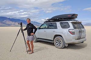
 Herb doing what he loves bestBefore last week, I had never even heard of the Alvord Desert, and probably most of you haven’t either. It’s located in a very sparsely populated area of southeastern Oregon, about 20 miles north of the town of FIelds, which I’d also never heard of.
We had found out about this place from a book we had been using to plan our trip, called “Photographing Oregon, a guide to the natural landmarks of Oregon,” by Greg Vaughn. It covers the most photogenic natural locations in the state, like coastal cliffs, waterfalls, volcanic peaks, wildlife refuges, or stark white alkali lake beds such as this.
The playa of the Alvord Desert cover is 20 miles long by 6 miles wide. Once a giant lake with a depth of 200 feet, today it is a dry alkaline flat, totally dry from July through November. When it is dry, you can safely drive on it. However, heavy rains can transform it into a sticky mud that even 4WD vehicles have trouble driving on.
 Dust devils forming on the playaTucked into the Steens Mountain rain shadow, it receives about 6 inches of rain a year, making it one of the most isolated, driest, and unique land formations in the state. Just what Herb loves.
Our original intent was to camp at the Alvord Hot Springs, a family run, rustic spa on the edge of the playa. This being our third night sleeping in the truck, we thought a shower would be nice.
When we pulled into the parking lot of the Hot Springs, we weren’t particularly impressed with the facilities - old corrugated containers used as accommodations and camping in the parking lot. Plus, all we saw was a bathroom and no showers.
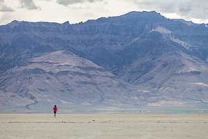
 Lolo running on the playaMaybe there were some but we didn’t even stop to ask and just drove along and out onto the playa where we could have the whole vast expanse to ourselves. Soap and wash clothes would have to do for another night.
I tend to get a little antsy just sitting, and that whole playa was just laying out there before me, so I got on my running shorts and headed out. We had parked along the edge of the playa, where some bushes were growing, so I figured it would be easy enough to find. But, just to be safe, I recorded my run, as I do all my runs, on an app called Strava, which not only keeps track of your time, distance, pace, heart rate, etc., but also creates a track on a map so that you can see your route - kind of like bread crumbs. It has saved me from getting lost on many occasions. Not to be a braggy mom, but my son Tommy is one of the software developers for this app, so I can complain to him if I get lost while using it.
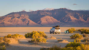
 Our home for the night on the Alvord DesertMy original intention was to just run along the edges of the playa, but the middle looked so inviting, so I started heading out towards the other side. Distances are so deceptive on water and I guess dry salt flats. It seemed like I was running forever and getting no closer to the other side. Soon, I noticed some pretty ominous storm clouds building in the distance, so I figured I better get out of the middle of the playa and head back closer to where Herb was. Thank God for Strava, because everything looked the same, and I would have had a really difficult time finding our 4Runner, which was tucked along the bushes near the edge. It certainly was exhilarating though. Tomorrow, I definitely would shower.
The storm never did come to us, but it did provide some pretty dramatic skies that evening.
Description
 Alvord Desert PlayaAbout 20 miles north of the town of Fields, Oregon, lies the vast, stark white alkali lake bed, or “playa,” of the Alvord Desert. Tucked into the Steens Mountain rain shadow, the Alvord Desert is one of the most isolated, driest, and unique land formations in the state.
The Alvord Desert was once a giant lake extending 100 miles with a depth of 200 feet. Today, it is a 20 mile long by 7 mile side alkaline flat that is dry from July through November. When it is dry, you can safely drive on it. However, heavy rains can transform it into a sticky mud that even 4WD vehicles have trouble driving on.
 Sunset over the playaThere are five springs located around the perimeter of the desert: Mickey Hot Springs, Alvord Hot Springs, Tule Springs, Buckbrush Springs, and Borax Lake Hot Springs.
At Alvord Hot Spring, the only one suitable for soaking, there is a rustic spa with two concrete pools with awesome views of the Alvord Desert.
When heading to this area, make sure to fill up on gas in either Burns or Fields.
- ‹ previous
- 4 of 9
- next ›
Alvord Desert location map in "high definition"
Javascript is required to view this map.
