- Home
- About
- Map
- Trips
- Bringing Boat West
- Migration West
- Solo Motorcycle Ride
- Final Family XC Trip
- Colorado Rockies
- Graduates' XC Trip
- Yosemite & Nevada
- Colorado & Utah
- Best of Utah
- Southern Loop
- Pacific Northwest
- Northern Loop
- Los Angeles to NYC
- East Coast Trips
- Martha's Vineyard
- 1 Week in Quebec
- Southeast Coast
- NH Backpacking
- Martha's Vineyard
- Canadian Maritimes
- Ocracoke Island
- Edisto Island
- First Landing '02
- Hunting Island '02
- Stowe in Winter
- Hunting Island '01
- Lake Placid
- Chesapeake
- Provincetown
- Hunting Island '00
- Acadia in Winter
- Boston Suburbs
- Niagara Falls
- First Landing '99
- Cape Hatteras
- West Coast Trips
- Burning Man
- Utah Off-Roading
- Maui
- Mojave 4WD Course
- Colorado River Rafting
- Bishop & Death Valley
- Kauai
- Yosemite Fall
- Utah Off-Road
- Lost Coast
- Yosemite Valley
- Arizona and New Mexico
- Pescadero & Capitola
- Bishop & Death Valley
- San Diego, Anza Borrego, Joshua Tree
- Carmel
- Death Valley in Fall
- Yosemite in the Fall
- Pacific Northwest
- Utah Off-Roading
- Southern CA Deserts
- Yosemite & Covid
- Lake Powell Covid
- Eastern Sierra & Covid
- Bishop & Death Valley
- Central & SE Oregon
- Mojave Road
- Eastern Sierra
- Trinity Alps
- Tuolumne Meadows
- Lake Powell Boating
- Eastern Sierra
- Yosemite Winter
- Hawaii
- 4WD Eastern Sierra
- 4WD Death Valley +
- Southern CA Deserts
- Christmas in Tahoe
- Yosemite & Pinnacles
- Totality
- Yosemite & Sierra
- Yosemite Christmas
- Yosemite, San Diego
- Yosemite & North CA
- Seattle to Sierra
- Southwest Deserts
- Yosemite & Sierra
- Pacific Northwest
- Yosemite & South CA
- Pacific Northwest
- Northern California
- Southern Alaska
- Vancouver Island
- International Trips
- Index
- Tips
- Books
- Photos/Videos
- Search
- Contact
Yosemite Valley, CA
Saturday, June 2, 2012 - 8:45am by Lolo
75 miles and 2 hours from our last stop - 2 night stay
Travelogue
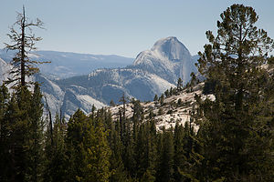 Back of Half Dome from Tioga Pass RoadNo matter how many times I visit Yosemite, I will never cease to be awed. This year, Herb wanted to enter the park from the east and drive the 45-mile Tioga Road up over the pass and through Tuolemne Meadows before gradually descending towards the Valley. This route allows for a more gradual assimilation to the park’s grandeur, as opposed to the heart-stopping visual overload you get when emerging from the Wawona Tunnel in the west.
The 56-mile Tioga Road from the East Gate through Tuolemne Meadows to Crane Flat is a drive full of superlatives with the largest subalpine meadow in the Sierra Nevada providing a lovely setting for the greatest concentration of granite domes in the world. Then there are the incredible vistas, my favorite being the panoramic view from Olmsted Point, where we got our first glimpse of our old friend Half Dome—not the familiar iconic image seen from the valley floor, but of its less familiar rounded derriere.
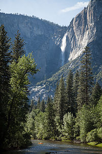 Yosemite Falls from Housekeeping Camp BridgeI was a little skeptical about our accommodations for the night. When we tried to book our stay a few days ago, the only thing available was Housekeeping Camp.
We have pretty much experienced every mode of habitation in Yosemite. From least to most luxurious – backpacking, tent camping, RV camping, Curry Village cabins, and my all time favorite, the Ahwahnee Hotel. Also, one hint: try to do them in this order, because once you are in the Ahwahnee, you are never going to want to leave.
So, this was going to be a new Yosemite experience. First let me say that the location of Housekeeping Camp is phenomenal – just a stone’s throw away from a nice sandy beach along the Merced River with terrific views of Yosemite Falls. The units (as they are romantically referred to) are pretty rustic. They consist of three concrete walls with the fourth wall being a canvas curtain that you can tie closed. The roof is canvas and extends out over a small patio area with a picnic table and a bear-proof food-storage box. Inside the “unit” is a bunk bed, double bed, small table, and a mirror. Linens for the bed are an extra $2.50 per night. Not exactly the Ahwahnee, but comfortable enough.
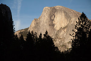 Half Dome from Ahwahnee MeadowI was a little jealous when we took a walk through the Camp. So many of the other units were so cozily decorated, with cute little outside lights, lamps from home, nice quilts, etc. – so warm and homey. Ours had more of a prison cell feel . But in all fairness, we were not prepared for this. My goal was to stay outside as much as possible.
That evening Herb and I got a bottle of wine and some cheese and crackers and settled ourselves in the Ahwahnee Meadow to watch the sun set on Half Dome. Being seasoned veterans of sunsets in Yosemite, we knew enough to hang around after the granite face was in shadow, because the best was yet to come – the beautiful alpenglow that casts a reddish light on the previous darkened dome. I could watch this every night.
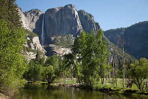 Yosemite Falls and Merced RiverI also developed a new photographic technique, quite by accident. While trying to take a picture of Half Dome while lying on a blanket in the meadow, my knees got in the way. It is absolutely uncanny how much bare knees pressed together can look like butt cheeks. When I showed Herb my masterpiece, we laughed so hard it hurt. Maybe I was on to something – the next Ansel Adams.
A lovely evening in the meadow and a few glasses of wine helped make our Housekeeping unit seem a bit cozier.
The next day was a big one – the hike up to the top of Yosemite Falls. We had done this hike 26 years ago when we first came to Yosemite, but I think they made it higher and steeper since then. It is 7.2 miles RT and climbs over 2,700 feet.
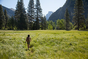 Lolo Hiking to Camp 4Yosemite Falls is the seventh highest waterfall in the world. If you count the lower falls as part of it, it would be the third largest. The falls drops 2,400 feet over the granite cliffs feeding the Merced River, which runs through the Valley. Late May is a particularly good time to do this hike because the snow melt is still keeping the falls roaring.
The trail begins next to Sunnyside Walk-in Campground (known to climbers as Camp 4), the rock climbers’ campground behind Yosemite Lodge. It’s interesting to just walk through this camp and see climbers from all over the world just hanging out or prepping to do some pretty incredible, or crazy depending on your viewpoint, stuff on the sheer rock walls. Every climber dreams of doing El Capitan or Half Dome, and Herb is one of them. He had been an avid climber in the 1980s, going to the Shawnagunks in New Paltz, NY, every Saturday for over 10 years. Then kids came along and that hobby got put on hold for awhile until they grew up to become his climbing partners. However today, all he had was me, and a pretty strenuous hike ahead of us.
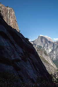 Half Dome from Yosemite Falls HikeThe first half mile of the hike climbs steeply along a series of over three dozen switchbacks through a dense pine forest. At the 1 mile point, there is a short spur trail to Columbia Rock, where there is a breathtaking, 180-degree view of Yosemite Valley from Half Dome in the east to the Cathedral Spires in the west. We met a nice couple here from North Carolina, who were in the process of negotiating whether to continue to the top or to call it a day. It really is a very strenuous hike, and Columbia Rock is a very noteworthy and respectable destination in itself.
In that one mile we had already climbed 1,000 feet in elevation. Herb had his altimeter watch on and I kept asking him every few minutes for our progress. I need constant reinforcement. We had still not gotten a glimpse of the waterfalls. In fact, our first indication that we were getting closer to the falls was by hearing it, before we rounded a bend and it finally came into view.
The last quarter mile before reaching the top is a serious of torturous, seemingly endless switchbacks. I was so happy to finally reach the top. My thighs were screaming. From the top, there was a short, but intimidating, series of steps cut into the rockface, which led down to the Yosemite Fall Overlook. This was a real white knuckler -- for me anyway -- as I clutched the guardrail and looked out over the steep drop below. From the overlook we looked down from above at the falls cascading over the edge.
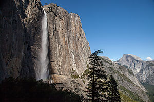 Yosemite Falls and Half DomeBack up the creepy stairs, we were on the surprisingly flat top of land above the falls. From there we crossed the footbridge over the creek and hiked another .8 miles to Yosemite Point (along the trail to North Dome). My 7.2 mile RT hike was quickly changing to an 8.8er. However, it was worth the extra steps, because besides another incredible panorama of the Valley, we had a great unobstructed view of the Lost Arrow Spire, a really unique rock spire rising from the valley floor. This too is another classic climbing route, but unfortunately we did not see any climbers on it today.
A well deserved break was needed, so we hiked back to the creek and then went upstream a bit to relax and have lunch. It would have been tempting to take a dip, but the thought of being swept over the edge of the falls kept me on dry land.
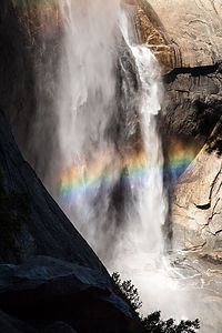 Rainbow at Base of Yosemite FallsAs always, the hike down a steep trail is almost worse than the way up—much tougher on the knees. After much groaning, and asking Herb every five minutes for our progress on his altimeter, we once again reached Camp 4 and limped our way back to our car, which was parked across the meadow at Swinging Bridge – technically making my total mileage closer to 10. I was very exhausted and expected to be in much pain tomorrow.
Back at Housekeeping Camp, we hung out on the beach for awhile and took a refreshing dip in the river, which washed away much of the trail dust accumulated over the day. After a real shower back in camp, we headed out, equipped once again with wine and cheese, to enjoy our last night in Yosemite. Rather than watch the sun set over Half Dome again, we chose to give El Capitan, the other great monolith in the park, our respect. So, we settled in El Cap Meadow and watched the sun go down on the tiny, tiny climbers on the wall. Much to Herb’s amusement, I continued trying to perfect my new photographic technique.
Another lovely evening in the Valley.
We really were in no particular hurry to leave the next morning. The only thing we needed to do that day was to get to a motel near enough to San Francisco Airport to catch a flight home very early the next morning. So, we hung by the beach in the morning and then went over to the Ahwahnee Hotel for lunch.
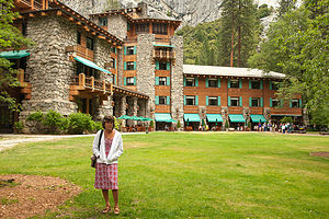 Lolo post lunch at the AhwahneeI love National Park Hotels, and the Ahwahnee is definitely one of its most beautiful. We have eaten here on each of our visits to Yosemite, so this would make 5. We usually like to have lunch here instead of dinner, because it is just as nice, but about half the price. The food is excellent, but quite honestly I wouldn’t care what they served me. I just love sitting in that beautiful dining room with its 34-foot-high floor-to-ceiling windows gazing out at the granite cliffs.
What a nice way to end another wonderful trip to Yosemite.
NOTE: About 8 weeks after we returned home, we received a letter from the Yosemite National Park Service informing us that we were one of the lucky visitors that had been staying in the park during an outbreak of the deadly rodent-borne hantavirus. Fortunately, for us, the cases were only linked to the tent cabins in Curry Village, not Housekeeping Camp. The CDC estimated that as many as 10,000 people could be at risk for the disease.
Description
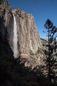 Yosemite FallsYosemite National Park lies near the eastern border of California in the heart of the Sierra Nevada Mountains. Its spectacular waterfalls, soaring granite cliffs, and lush meadows are just a few of the reasons it is considered by many to be nature’s ultimate masterpiece. In the words of John Muir, “it is surely the brightest and the best of all the Lord has built.”
This description will focus on Yosemite Valley, which is the section of the park we visited. Although the Yosemite Valley is just a small portion of Yosemite’s 761,268 acres, it is part receives 95% of its visitors. In fact, an estimated 4.1 million people visit the Valley each year, making it extremely crowded.
Two one-way roads traverse Yosemite Valley: the east-bound Southside Drive and the west-bound Northside Drive, which wind through woodlands and meadows along the base of the 3,000-foot-high granite cliffs. As of today, cars are still allowed to enter and drive through the valley, but visitors are highly encouraged to park their vehicles and use the park’s free shuttle bus, which stops at the major attractions in the valley.
Virtual Tour of Yosemite Valley Highlights
- As you enter the valley, the first sight you’ll see is the 620-foot Bridalveil Falls flowing down from a hanging valley to the valley floor. From the parking area, a short paved path leads to the base of the falls. This is one of the few falls in Yosemite that does not completely dry up in the summer.
- Just past the Bridalveil Fall parking area, the Southside Drive begins to trace the Merced River. Soon El Capitan comes fully into view. This 3,000 foot high granite cliff is the largest single piece of exposed granite in the world and one of the most famous landmarks in Yosemite. If you look closely, you might see small dots that are actually rock climbers along its face.
- Continuing east on the Southside Drive are two riverside picnic areas and beaches: Cathedral Beach and Sentinel Beach.
- Right after the Sentinel Beach parking area is the trailhead for the 4-Mile trail, which ascends more than 3,200 feet from the valley floor to Glacier Point and one of the most spectacular views of the valley.
- A short distance further is Swinging Bridge, another picnic and swimming area. This area is also the westernmost point of the 8-mile bicycle loop that goes through the eastern part of the valley. From this point on, the bike path parallels the road.
- Next stop is the picturesque tiny Yosemite Chapel where many outdoor enthusiasts choose to exchange wedding vows.
- Now you enter the congested and developed portion of the valley.
- Right past the chapel, you can either take a left onto Sentinel Bridge towards Yosemite Village and the park exit, or you can continue straight towards Curry Village, the campgrounds, and Happy Isles Nature Center. For now, let’s stop at Sentinel Bridge for what is probably the most spectacular Half Dome viewpoint in the park. It’s a great spot for a photograph of Half Dome with the Merced River in the foreground.
- Continuing east on the Southside Drive, you pass Housekeeping Camp and Curry Village. Curry Village has lodging, restaurants, bicycle and raft rentals, a grocery store, and other shops. Curry Village is also one of the main parking areas in the valley.
- From Curry Village you can either take Northside Drive across the Ahwahnee Bridge back to Yosemite Village and the park exit, or continue east to the campgrounds. The Happy Isles Nature Center is also this way, but only shuttle buses are allowed on the road to it.
- The Happy Isles Nature Center features exhibits on the natural history of the park. It also serves as the trailhead for some of the best hikes in Yosemite. 1.5 mile trail leads to the top of Vernal Falls and then continues another 1.5 miles to the top of Nevada Falls (two waterfalls that flow even in the summer time). From there you can continue even further into the backcountry of Yosemite, including the cable route up the back of Half Dome.
- From Curry Village, the Northside Drive crosses the Ahwahnee Meadow, a wonderful spot to gaze at Half Dome during sunset, and enters Yosemite Village, the main center of visitor services in the park. Here you’ll find the park’s main Visitor Center, restaurants, lodging, shops, a grocery store, a post office, a medical clinic, the Ansel Adams Gallery, an Indian Cultural Exhibit and more. It’s also a good place to park your car and jump on the shuttle.
- A short dead end road from Yosemite Village leads to the majestic old Ahwahnee Hotel, which has played host to Queen Elizabeth, President John F. Kennedy, and Clint Eastwood, to name a few. This beautiful six-story rock structure offers tremendous views from every room. Within the hotel is the elegant and quite expensive Ahwahnee Dining Room (jackets required for dinner).
- Back on the Northside Drive heading west from Yosemite Village, the next stop is the Yosemite Falls parking area. At 2,425 feet, Yosemite Falls is the highest waterfall in North America. It is actually three waterfalls in one, with an upper, middle and lower section. A short walk from the parking lot along a paved walk leads to the base of Lower Yosemite Falls. This is the most visited landmark in the valley. Except in summer when the fall temporarily dries up, you’ll be sure to be covered in spray.
- A little further west on the Northside Drive is Yosemite Lodge, which marks the end of the developed area of the park going west.
- Right after Yosemite Lodge is Sunnyside Campground/Camp 4, a place where most rock climbers choose to congregate. From this campground begins the popular and strenuous Yosemite Falls hike, which ascends 2,600 feet from the valley floor to the top of the Upper Falls. The views from the top are incredible.
- Continuing west, there is nothing but woods and meadows from which to enjoy the views. Along the road there are several pullouts where you can stop and walk down to the Merced River for a swim. Just after the El Capitan Bridge, you’ll come to the El Capitan Meadow where you’re sure to find people looking through binoculars at the miniscule rock climbers clinging to the granite face.
- Just to the west of El Capitan, Ribbon Falls plunges over 1,600 feet down to the valley floor. It is the seventh highest waterfall in the world. However, it too dries up in the summer time.
- Finally the road nears the end of the Northside Drive at Valley View where El Capitan, on the left, and Cathedral Rocks, on the right, frame a magnificent valley view.
Several guided bus tours are also available. The 2-hour Valley Floor Tour is a great way to get acclimated. Visitors ride through the valley in an open tram while a guide leads a informative discussion of Yosemite’s history and geology. There are many photo stops along the way. In addition, there are bus tours out of the valley to Glacier Point, the Mariposa Grove of sequoia trees, and Tuolumne Meadows.
Although much of Yosemite can be enjoyed from the comforts of your car or a shuttle, the best way to truly experience Yosemite is do get out and experience it more directly.
Things to do in Yosemite
- Hike one of the many trails around the valley, ranging from an easy walk to the base of Lower Yosemite Falls to the strenuous 16-mile round trip hike up the back of Half Dome via cables
- Take an overnight backpacking trip
- Bike along the 12 miles of bicycle paths that loop through the Valley. Rentals are available at Curry Village and Yosemite Lodge.
- Rock climb in one of the premier climbing places in the world
- Raft down the calm waters of the Merced River through the valley. Rentals are available at Curry Village.
- Swim or tube in the Merced River. Besides the designated beaches, there are many pullouts along the road from which you can walk down to the river.
- Join one of the many ranger walks, which are offered daily
- Take a free art class at the Yosemite Art and Education Center
- Photograph the amazing scenery of the valley and surrounding granite cliffs
- Browse the Ansel Adams Gallery and see some of the photographs that first made Yosemite famous
- Relax in the meadow while gazing up at Half Dome or El Capitan
- Dine at the 5-star Ahwahnee Hotel, where presidents and royalty have stayed
Although many try to see Yosemite in a day, it is best to devote several days to seeing all the park has to offer. Besides the numerous hotels, lodges, and cabins in the Valley, there are three RV campgrounds: Upper Pines (238 sites), Lower Pines (60 sites), and North Pines (81 sites). That’s less than 400 campsites to accommodate all the people that want to camp here.
Since these campgrounds usually fill-up within the first hour they become available, it is essential to make your reservations as soon as possible. Campground reservations are available in blocks of one month at a time, up to five months in advance, on the 15th of each month at 7 am Pacific time. For example, if your arrival date is July 15 through August 14, the first day you can make reservations is March 15. The National Park Reservation System can be found at www.recreation.gov. Good luck!
- ‹ previous
- 6 of 7
- next ›
Yosemite Valley location map in "high definition"
Javascript is required to view this map.
