- Home
- About
- Map
- Trips
- Bringing Boat West
- Migration West
- Solo Motorcycle Ride
- Final Family XC Trip
- Colorado Rockies
- Graduates' XC Trip
- Yosemite & Nevada
- Colorado & Utah
- Best of Utah
- Southern Loop
- Pacific Northwest
- Northern Loop
- Los Angeles to NYC
- East Coast Trips
- Martha's Vineyard
- 1 Week in Quebec
- Southeast Coast
- NH Backpacking
- Martha's Vineyard
- Canadian Maritimes
- Ocracoke Island
- Edisto Island
- First Landing '02
- Hunting Island '02
- Stowe in Winter
- Hunting Island '01
- Lake Placid
- Chesapeake
- Provincetown
- Hunting Island '00
- Acadia in Winter
- Boston Suburbs
- Niagara Falls
- First Landing '99
- Cape Hatteras
- West Coast Trips
- Burning Man
- Utah Off-Roading
- Maui
- Mojave 4WD Course
- Colorado River Rafting
- Bishop & Death Valley
- Kauai
- Yosemite Fall
- Utah Off-Road
- Lost Coast
- Yosemite Valley
- Arizona and New Mexico
- Pescadero & Capitola
- Bishop & Death Valley
- San Diego, Anza Borrego, Joshua Tree
- Carmel
- Death Valley in Fall
- Yosemite in the Fall
- Pacific Northwest
- Utah Off-Roading
- Southern CA Deserts
- Yosemite & Covid
- Lake Powell Covid
- Eastern Sierra & Covid
- Bishop & Death Valley
- Central & SE Oregon
- Mojave Road
- Eastern Sierra
- Trinity Alps
- Tuolumne Meadows
- Lake Powell Boating
- Eastern Sierra
- Yosemite Winter
- Hawaii
- 4WD Eastern Sierra
- 4WD Death Valley +
- Southern CA Deserts
- Christmas in Tahoe
- Yosemite & Pinnacles
- Totality
- Yosemite & Sierra
- Yosemite Christmas
- Yosemite, San Diego
- Yosemite & North CA
- Seattle to Sierra
- Southwest Deserts
- Yosemite & Sierra
- Pacific Northwest
- Yosemite & South CA
- Pacific Northwest
- Northern California
- Southern Alaska
- Vancouver Island
- International Trips
- Index
- Tips
- Books
- Photos/Videos
- Search
- Contact
Mount Vernon Trail, VA
Sunday, April 30, 2000 - 9:00am by Lolo
101 miles and 1.75 hours from our last stop
Travelogue
I have this tendency to always try to squeeze in just one more activity. Herb affectionately refers to it as my "trying to stuff 10 pounds into a 5 pound bag."
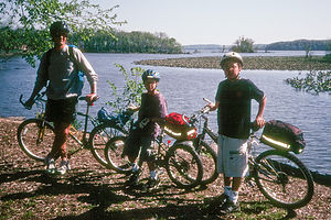
 Herb and boys on bike traiIt was our last day of vacation, and it was only about a 6 hour drive from Richmond to home, so I felt there was plenty of time for just "one more" fun stop along the way. Herb might of thought that I was just casually looking at maps as we drove home, but I was actually scheming. Sure enough, I checked the map and found that we would be passing quite close to Mount Vernon. I had read about a really nice bike trail that began near Mount Vernon and ran along the Virginia side of the Potomac for 18 miles. It didn't take too much convincing to get the family to stop. I promised them we would only do a part of it.
We parked at Fort Hunt National Park, about 2 miles east of Mount Vernon, along the George Washington Memorial Parkway. (One word of caution for RVers. The stone overpasses on the George Washington Memorial Parkway are really only high enough if you drive in the middle of the road.)
Starting at Fort Hunt National Park we rode north along the river. One of the nicest parts was the section through the Dyke Marsh, a wildlife preserve with over 250 species of birds. Shortly past there, we turned around and head back towards Mount Vernon. It was a truly great family ride, not too many hills and lots of things to see."
Description
In 1973, the National Park Service constucted the 18.5 mile Mount Vernon Trail along the Potomac River, paralleling the George Washington Memorial Parkway. This very popular running and biking trail runs along the Potomac River's Virginia shoreline from Theordore Roosevelt Island, near the Lincoln Memorial, south to Washington's Mount Vernon.
The northern portion of the trail has scenic views of Washington D.C. monuments before arriving at Ronald Reagan National and Gravelly Point in Arlington.
The trail continues south through the Old Town of Alexandria and requires riding on the street. The route becomes a little tricky here as there are two choices. The original route follows Pitt Street through the town, while the newer "river route" follows Union Street and provides easy access to the waterfront parks and restaurants in the Old Town Center.
Outside of the town, the trail continues along the river through Dyke Marsh, a wildlife preserve with over 250 species of birds, past the fortifications of Fort Hunt Park, and through Riverside Park. The trail becomes quite hilly and curvy before reaching Mount Vernon."
- ‹ previous
- 10 of 11
- next ›
Mount Vernon Trail location map
Javascript is required to view this map.
