- Home
- About
- Map
- Trips
- Bringing Boat West
- Migration West
- Solo Motorcycle Ride
- Final Family XC Trip
- Colorado Rockies
- Graduates' XC Trip
- Yosemite & Nevada
- Colorado & Utah
- Best of Utah
- Southern Loop
- Pacific Northwest
- Northern Loop
- Los Angeles to NYC
- East Coast Trips
- Martha's Vineyard
- 1 Week in Quebec
- Southeast Coast
- NH Backpacking
- Martha's Vineyard
- Canadian Maritimes
- Ocracoke Island
- Edisto Island
- First Landing '02
- Hunting Island '02
- Stowe in Winter
- Hunting Island '01
- Lake Placid
- Chesapeake
- Provincetown
- Hunting Island '00
- Acadia in Winter
- Boston Suburbs
- Niagara Falls
- First Landing '99
- Cape Hatteras
- West Coast Trips
- Burning Man
- Utah Off-Roading
- Maui
- Mojave 4WD Course
- Colorado River Rafting
- Bishop & Death Valley
- Kauai
- Yosemite Fall
- Utah Off-Road
- Lost Coast
- Yosemite Valley
- Arizona and New Mexico
- Pescadero & Capitola
- Bishop & Death Valley
- San Diego, Anza Borrego, Joshua Tree
- Carmel
- Death Valley in Fall
- Yosemite in the Fall
- Pacific Northwest
- Utah Off-Roading
- Southern CA Deserts
- Yosemite & Covid
- Lake Powell Covid
- Eastern Sierra & Covid
- Bishop & Death Valley
- Central & SE Oregon
- Mojave Road
- Eastern Sierra
- Trinity Alps
- Tuolumne Meadows
- Lake Powell Boating
- Eastern Sierra
- Yosemite Winter
- Hawaii
- 4WD Eastern Sierra
- 4WD Death Valley +
- Southern CA Deserts
- Christmas in Tahoe
- Yosemite & Pinnacles
- Totality
- Yosemite & Sierra
- Yosemite Christmas
- Yosemite, San Diego
- Yosemite & North CA
- Seattle to Sierra
- Southwest Deserts
- Yosemite & Sierra
- Pacific Northwest
- Yosemite & South CA
- Pacific Northwest
- Northern California
- Southern Alaska
- Vancouver Island
- International Trips
- Index
- Tips
- Books
- Photos/Videos
- Search
- Contact
Eastern Sierra - South (Mammoth Lakes, Bishop, and Lone Pine), CA
Monday, May 18, 2015 - 6:30am by Lolo
0 miles and 0 hours from our last stop - 10 night stay
Travelogue
After leaving San Francisco, we spent the next 10 days traveling up and down the incredibly beautiful Eastern Sierra Scenic Byway, officially known as 395, between Mammoth Lakes and Lone Pine. Much of that time, it was just Herb and I, but the kids joined us in the middle for a long Memorial Day Weekend. The following is a day by day breakdown of our explorations.
Day 1 – Across the Sierra to Mammoth Lakes
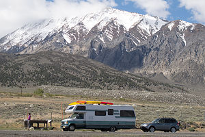 Lazy Daze at base of SierraThere is no easy way for an RV to cross the Sierra – it’s just a matter of the lesser of evils in terms of mountain passes. Plus, even in mid-May, the passes are often closed due to snow.
Fortunately, Herb had purchased a book on Amazon entitled “Mountain Directory West for Truckers, RV, and Motorhome Drivers.” It’s pretty expensive – I think Herb paid about $30 for it used, but when you consider the dangers it helps you avoid, it is money well spent. The guide tells you where the steep grades are, how long they are, how steep (%) they are, etc.
For example, Google Maps suggested we cross the Sierra via Sonora Pass, but this book informed us that there are several sections of 26% grade. 8% grade is a white-knuckler. I can’t even imagine what 26% grade would be like.
So, using the information in this book, we chose to go a few extra miles to get a few less % points. The route we chose was 50 East from Sacramento to Lake Tahoe and then 89 South. However, we ignored Google Maps again and rather than continue on 89 through Monitor Pass, we got off 89 and headed north on 88 towards the town of Minden, Nevada. It added a few extra miles to our trip, but who cares. It probably added years to our lives as well.
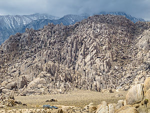 Alabama HillsThe drive was still no cakewalk, and had its share of steep, windy hills, but it was much better than the alternatives. I highly recommend buying this book. At least, you’ll know what’s ahead of you.
It was a pretty long driving day – about 7 hours and 331 miles, so Herb was very ready to stop in Mammoth Lakes at a campground we were familiar with from last year, the Mammoth Mountain RV Park, just a short distance off 395.
Elevation really makes a big difference in weather, and Mammoth Lakes is always a lot colder than Bishop, its neighbor just 45 minutes to the south. It got to about 40 degrees that night, something that Herb wasn’t very happy about.
Day 2 – Keough Hot Springs
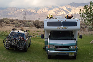 Camping at Keough Hot SpringsWe had a few days to kill before Andrew, Celeste, and Tommy arrived for the Memorial Day Weekend, so we decided to do something that they wouldn’t be interested in, like sitting still in a hot spring. They don’t sit still for more than 5 minutes at a time.
Most of our vacation time with the boys now is centered around climbing, so this time we planned to meet up in Bishop, a premier rock climbing destination. Actually, we had originally picked Truckee near north Lake Tahoe, but the weather forecast was so abysmal that we made a quick switch last week.
Because of the last minute switch, it was a little hard to get a camping reservation, especially since Memorial Day means Mule Days in Bishop, and it is a very big deal. Every campground I called to inquire about a site responded, “Oh no, I am sorry dear. We have been booked for months. Don’t you know it’s Mule Days?” No, I didn’t.
Fortunately, a very nice woman at the Browns Millpond Campground said that she would squeeze me into a site near the storage area – not optimal, but it was literally the only option we had. Besides, we don’t spend much time at the campground anyway.
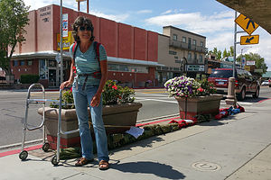 Lolo with Walker Reserving a Spot for Mule Day ParadeI will explain Mule Days a little further down, when we come back to Bishop and stop in at the Tri-County Fairgrounds to see what it was all about.
For now, we just passed through the town, bustling with Mule fans and drove 7 miles south to the Keough Hot Springs Resort.
Unfortunately, our timing wasn’t exactly ideal as it was a Tuesday, and every Tuesday they close the pool to empty and clean it. However, on a bright note, their 10-site campground was empty, so we had our pick of sites. It was actually a very nice location with great views of the White Mountains to the east.
We had borrowed a book about hot springs in the West from Celeste’s parents, so we knew that there were also a few primitive, natural pools about a ½ mile down the road from the campground, rather unglamorously referred to as “Keough Hot Ditch.” Since the “Ditch” is fed from the stream flowing from the resort, and therefore further from its 130 degree source, it has had time to cool down to temperatures in the low 90s. This was perfectly fine for me.
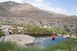 Herb Soaking in Keough Hot DitchThe dirt road to get to the “Ditch” was quite bumpy and rutty, but no problem for our Subaru. There aren’t many pools, and some of them were already taken, but we did manage to find a fairly nice one about 8 feet in diameter. It was quite shallow, so we were able to put our beach chairs in the pool and still keep our heads above water. It was very relaxing – kind of like being back in the womb.
Unfortunately, the pools are located under power lines, so there was a constant buzzing sound, which I wasn’t particularly crazy about. Plus, the lines obstructed what would have been very nice views of the White Mountains.
Herb is a much bigger fan of soaking in hot springs than me, so after a while I got restless and went for a run along the dirt road north towards Bishop. This was my first run in a long time because of my ankle, so I was pretty pleased that I was able to cover 5 miles. When I got back, Herb was still happily sitting by, and sometimes in, his little pool.
That evening I discovered that we did indeed have neighbors in our campground, but the four-legged, big-eared kind. As dusk fell, about a dozen jackrabbits came out to feed on the grass near the motorhome. When I went out to take their picture, they all quickly dispersed back into the bushes, but I was patient, and it took only a few minutes of being silent and not moving before they all returned to continue their munching.
Day 3 – Keough Hot Springs and the Alabama Hills
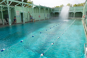 Keough Hot Springs Resort Lap PoolThe next morning we awoke early for the 7:00 am lap swimming session at the resort pool. Herb loves to swim, and when we are home in New Jersey he goes three times a week to the local YMCA, where he swims for an hour and a half. I, however, am uncomfortable putting my face underwater, so I don’t exactly swim very efficiently.
The facility was quite impressive. There was a 100 X 40 foot swimming pool, which for the lap session was divided into 6 swimming lanes. A waterfall of cool water cascaded down into one end of the pool, cooling it off to a comfortable swimming temperature of 86 to 89 degrees. Right next to the swimming pool was a smaller shallow pool meant for soaking. Since it was only 2 feet deep and not meant for exercising, it was kept at 104 degrees.
 Lolo with the Lone Ranger and TontoAlthough the facility was enclosed on all four sides, it had no roof, so you could look up at the sky and surrounding mountains – or at least I could because I kept my head out of the water. Herb, however, with his face down in the water was missing the view. At least there was some advantage to my ungainly swimming style.
The swimming lanes were all occupied, but lap pool etiquette encourages people of similar swimming ability to share a lane. I, however, had no peers, so I went and lolled about in the hot soaking pool, while Herb went into one of the lap lanes.
Being as hyperactive as I am, I was not very happy with this situation, so when Herb’s lap partner left, I seized the opportunity and jumped into his lane, figuring he would have to put up with my slower speed. I had already calculated that I would have to do about 53 laps to swim a mile, or 27 to do a ½ mile. Since I got a late start in the pool, there was no way I could do 53, but I did manage to reach my more modest goal of 27. Herb lost count but I am pretty sure he did well over a mile. I tried to explain to him that my form actually resulted in a more intensive work-out because it was so inefficient that I had to do more work to cover the same distance. He thought that was stupid.
We decided to book a second night at Keough, so that we could swim again tomorrow morning, and spend the rest of the day exploring Lone Pine and the Alabama Hills, about an hour south on 395.
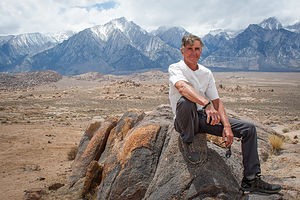 Herb with SierraThe trip along the 395 corridor is always a treat, especially this year as the late spring snow had covered the surrounding mountain tops with a nice white topping. This stretch of road was a bit of a repeat for Herb, who had come north along this way just a week or so ago on his cross country motorcycle trip. We passed right by the Manzanar Japanese Internment Camp because Herb had just been there and continued on to the Lone Pine Film History Museum, which he hadn’t visited.
I knew the Alabama Hills had been the setting for many Hollywood westerns, but I had no idea just how many movies, TV shows, and commercials had been filmed here right up to the present. Its dramatic landscape and relatively close proximity to Hollywood (3 hours) had made it a very popular movie set.
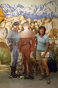
The museum, although small, has a vast collection of memorabilia from the hundreds of movies and TV shows that had been filmed here since the 1920s. I hadn’t thought about Roy Rogers or the Lone Ranger since my childhood, and there they were on posters and life-sized cardboard cutouts. Although I recognized a lot of films and its stars, like John Wayne and Gene Autry, much of it was before my time. I think someone our age or older would get a bigger kick out of this museum, because so much of it was part of their growing up. My mother would have loved it.
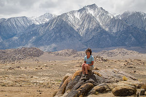 Lolo with SierraStill, it’s not just about old westerns. Plenty of current day movies, such as Gladiator, Django Unchained, and the new Lone Ranger have the surrounding hills as a set as well.
We watched a very informative 15-minute documentary called “Lone Pine: Where the Real West Becomes the Reel West,” purchased the “Movie Road Touring Brochure” for $1 and then set out to see the real thing.
Most of the locations for the old movie sets are located along the 5.7-mile dirt Movie Flats Road. To get there, we turned onto the Whitney Portal Road and followed it for about 2.5 miles, until we came to a plaque and a turnoff for Movie Flats Road. The plaque, which was dedicated by Roy Rogers talks about the movie history of the area.
The brochure that we purchased meticulously measured out the mileage to get to each of 10 filming locations along the Movie Road. After diligently stopping at the Gunga Din Tent City and the Rawhide Gravesite, and trying to imagine in our minds what the set once looked like, we looked at each other and said, “What the heck are we doing?” We didn’t know these movies and even if we did, there was no set to look at, but just beautiful scenery. And speaking of that beautiful scenery, I was missing most of it because I had my nose in the brochure reading about a movie I had never seen. I chucked the brochure in the back of the car and started looking out the window.
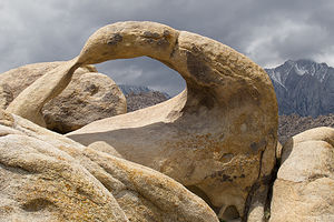 Mobius ArchWow! This was a pretty awesome place, especially if you are a rock climber. There were hundreds of oddly-shaped boulders and towers, just asking to be climbed. To add to the sensory overload, snow-capped Mount Whitney, the tallest mountain in the continental U.S., loomed in the background.
Several dirt side roads branched off Movie Flat Road and lead right up to the base of many of the formations where people were climbing. Now we’re talking. Too often when we climb with the boys, we have to hike and rock scramble for miles to get to the start of a climb. Here I could practically start from the hood of our car. I would love to bring the boys back here when they arrived this weekend.
No longer obsessed with finding movie locations, we really enjoyed our ride through the Hills. What we really wanted to see was Mobius Arch, the arch that frames Mount Whitney in the iconic photographs of the mountain. We found the turnout for the trailhead and sat for a moment trying to determine just how threatening the ominous clouds marching our way were. Since the trail was short, just a mile or less, we decided to go for it.
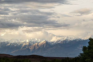 Eastern Sierra from CampgroundIt wasn’t long before we came to Lathe Arch, a very unique arch in that it is perfectly flat and doesn’t really arch at all. Just past Lathe Arch we rounded a big rock and were greeted by Mobius Arch, whose window is about 6 and a half feet high. Despite our best efforts of clambering around on the nearby rocks to locate the iconic vantage point, we never quite got the mountain enclosed in the arch. However, I think we captured some other, less familiar perspectives of this very interesting and unique rock formation.
As Tommy says, “Mountains make their own weather,” and this one looked like it was about to make some on us. Although it continued to threaten as we continued along Movie Flat Road, it never did actually rain on us.
When we came to the end of Movie Flats Road, we turned right onto Moffat Ranch Road, which continued on dirt for about another 4 miles before joining 395 just north of Lone Pine. The entire loop from 395 to 395 was about 12 miles, and although dirt and bumpy, very doable even in a regular passenger car.
That night we barbecued back at Keough Hot Springs and watched the jackrabbits peek at us from the bushes.
Day 4 – Keough Hot Springs, Bishop, and Mule Days
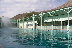 Keough Hot Springs Resort Lap PoolWe awoke early again to get to the resort pool for the 7:00 lap session. This was very unlike me. I neither like to get up early nor swim laps, but today I was driven by the goal of swimming a mile.
This time when we got to the pool there was an empty lane, so I quickly jumped in with Herb so that I could flail about with only him to bother. Over the next hour and a half I plugged away at my mission – doing the crawl for 3 laps and breast stroke for 1, pausing at the end of the pool each time to catch my breath.
When I was up to 48 of my 53 required laps, I noticed that everyone was getting out of the pool. Oh, shoot! It was 8:30 and the lap session was over. I snuck in another lap, hoping they wouldn’t yank me out of the pool. I was completing my 50th when they started removing the ropes that separated the pool into lanes to get it ready for the aerobics session. Feeling like an outlaw, I turned and started my 51st lap. Herb, who had completed his mile some time ago and was already out of the pool, came to my aid and explained to the lifeguard that I was trying to finish the last few laps of achieving my first mile swim. I don’t particularly think it was necessary for him to further explain that I was very Type A, so it would probably kill me if I only got in 52. In any case, the lifeguard was nice enough to let me finish.
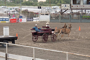 Mule Days CompetitionFor a non-swimmer that hates to get up early, I felt pretty darn good. We had already had a great work-out, and we still had the whole day ahead of us.
Back at the campsite, we met Liisa and Ed, a very nice couple from Marin County, who when they learned we planned to move to California, were extremely helpful in giving us suggestions about towns and areas we might want to live in. I don’t know if it’s just my imagination, but everyone out here seemed so friendly and willing to go out of their way to help us. We exchanged email addresses with them, with the promise of getting in touch when we were ready to move.
It was Thursday, and the kids would be arriving tomorrow, so I was kind of anxious to get over to the Browns Millpond Campground to make sure that we really had a spot for the weekend. As I mentioned, every campground was full because of Bishop Mule Days, but Stacy at the Millpond Campground said she would find a place to squeeze us in.
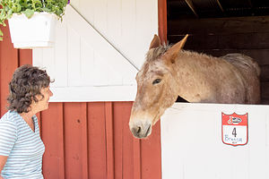 Lolo with MuleThe Brown family seems to have a monopoly on campgrounds in the area: Brown’s Millpond Campground where we would be staying, Brown’s Owens River Campground, Brown’s Town Campground, and even the Keough Hot Springs Resort.
Since only the Brown’s Town Campground has an RV dump, we stopped there on our way to Millpond to get it ready to handle more company. It cost us $5 to dump. It would have been $10 if we weren’t staying in one of the other Brown’s campgrounds.
When we got to Millpond, Stacy, as promised, gave us a nice site along the little stream that passes through the campground. There was no water or electric on this site – those sites had been booked up months ago. After all, it was Mule Days in Bishop.
We really needed to find out more about this Mule Days thing, so we got in the Subaru and headed into Bishop.
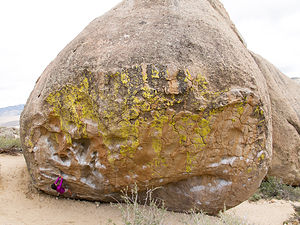 Lolo on Buttermilk HighballI love Bishop. It’s just about the right size to be quaint yet still have enough interesting things to see and do. We stopped in first at Galen and Barbara Rowell’s Mountain Light Gallery, which is probably my favorite photo gallery, rivaled only by the Peter Lik gallery in La Jolla. The stunning, vibrant mountainscapes in the Mountain Light Gallery are both breathtaking and humbling.
After the gallery, we popped into Wilson’s Eastside Sports, the local climbing shop, to get a guide book for the local climbing areas. Neither we nor the boys had climbed in the Bishop area before, so Herb and I wanted to scout out some of the climbing areas before their arrival. Just like everyone else we have met this trip, the staff was extremely friendly and helpful and willing to spend a lot of time describing the various options for climbing. When I told one of the staff that I was a little freaked out by the description of the approach down in the Central Gorge climbing area, he told me not to worry. The trail had been upgraded with some stone stairways, so it was no longer as precarious as the older guidebooks suggested. Since that was the area the boys had already said they wanted to climb, I felt much better that I wouldn’t be cheating death to join them.
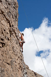 Lolo Climbing Central Owens River GorgeMeanwhile, out on Main Street, people were already strapping lawn chairs to the street posts to claim their viewing spot for the big Mule Day Parade on Saturday. There was even a walker strapped to a planter. I’m not sure I understood the thought process. How were they going to get to their walker without their walker?
No self-respecting traveler with a travel blog can come to Bishop during Memorial Day Week and not at least see or smell a mule, so off we went to the Tri-County Fairgrounds where all the action was. Although it was only Thursday, and most of the big events were on the weekend, the fairgrounds were already bustling. There were tents with vendors selling all types of cowboy and mule-related clothing, crafts, and souvenirs. There was even a large area set aside for RV camping, which I guess we could have considered if we hadn’t found Millpond Campground.
I guess the best way to describe Mule Days is that it is part mule show, part test of skills, and part Wild West Show. Over its 47 year history, it has grown from attracting a crowd of 200 to becoming an international world class event bringing in more than 30,000 fans. Over the course of a week, more than 700 mules compete in 181 events including calf roping, steer roping, barrel racing, flat racing, carriage driving, team chariot racing, and even dressage.
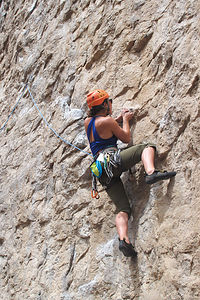 Celeste Climbing Central Owens River GorgeTo better appreciate Mule Days, it is important to know a few fun facts about them:
Mules are pretty unique in that their parents come from different species. A mule’s dad is a donkey (or less politely, a jackass) and its mother is a horse. The size of the mule produced by this unlikely pair is completely determined by the mom. For example, if Mom is a Budweiser Clydesdale, the result is going to be one big mule.
The good news about mules is that they are better in so many ways than their parents. They are less stubborn, more intelligent, and faster than their dad, the donkey, and more patient, sure-footed, and hardy than mama, the horse. The bad news is that their chromosomes are a little confused in that they have 63 (a mixture of a donkey’s 62 and a horses’s 64), and an odd number does not work very well in chromosome pairing. Hence, most mules are infertile.
Before this trip, I never knew that mules could come in so many shapes and sizes, or that they were superior in so many ways to horses. I was anxious to see what they could do, so when we were told that there was a free competition going on in the arena, we scurried just in time to watch.
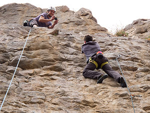 Andrew Photographing Tom ClimbingThis particular competition involved two mules pulling a wagon with two people in it. The mules had to zig and zag their way through an orange cone maze – kind of like they were taking a driving test -- then pause before a platform while the person in the back of the wagon took a barrel from the platform and placed it in the wagon. Then they circled the arena again, once more weaving in and out of the cones before returning to the platform. Then came the tricky part that drove the crowd wild. The mules had to back the wagon up into position alongside the platform close enough for the person in the wagon to pick up the barrel, which they just left there a few minutes ago, and place it back in their wagon. Apparently, backing up is not something easy for mules to do, so when they successfully accomplished this feat, I joined my fellow mule fans and clapped like it was the greatest thing I had ever seen.
Before leaving the fairgrounds, we stopped by the stables to see the mules up close and personal. They were actually very pretty animals. There were several for sale, but I couldn’t convince Herb that we needed one. Maybe when we moved out West.
Day 5 – Scouting out climbing areas, kids arrival
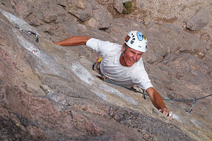 Herb Climbing from AboveIt was the Friday before Memorial Day Weekend, and the kids would be driving in from San Francisco tonight. Once they did, we knew it would be non-stop physical activity, so today we would just take it easy.
We had bought a Bishop ares rock climbing guide at Wilson’s yesterday, so we figured it would be a good idea to check out some of the areas ahead of time. That way we wouldn’t waste time trying to find things when the kids were here.
Bishop is a premier rock climbing destination with many options for both “trad” (traditional) and sport climbing, as well as bouldering. Without getting too technical, “trad” and “sport” climbing is done on rock walls using ropes. Some means of protection along a climbing route is used to prevent the climber from falling to the ground. In “trad” climbing, the lead climber carries a rack of gear and places his own protection in the rock, while in “sport climbing,” pre-placed protection bolts are already there. Alternatively, bouldering, as its name implies, is not done on a rock wall, but rather on freestanding boulders. Since the routes tend to be short, rather than use ropes, crash pads are placed on the ground to protect a climber’s fall.
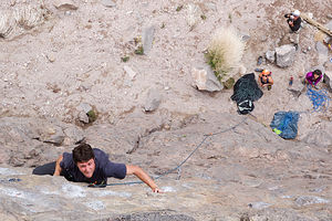 Tom Climbing from AboveAlthough the boys do all three types of climbing, they tend to enjoy sport climbing the most. That was the main reason we chose Bishop. The Owens River Gorge just north of Bishop has 416 sport climbing routes and is the most concentrated sport climbing area in California.
The Gorge itself is over 10 miles long and has many different areas to climb in, but the most popular, and the one the boys had their eyes on, was the Central Gorge. This was also the area which had the precarious approach to it that the nice man in Wilson’s Eastside Sports tried to comfort me about yesterday.
Whenever I am afraid of something, I like to just hurry up and get it over with, so I suggested to Herb that we go check it out today, so that tomorrow when it really mattered, I would be able to do it without being a wienie in front of the kids.
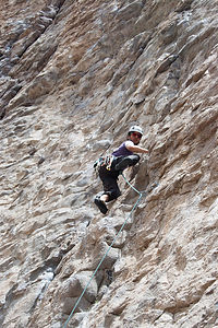 Andrew on LeadThe Central Gorge parking area was only about 20 minutes from our campground – north on 395 for a few miles, then right at the Paradise Swall Meadows, and then left on Gorge Road for 4.8 miles. In fact, that its proximity is why we selected Brown’s Millpond Campground – that plus the fact that it was north of town, so we wouldn’t have to deal with Mule Day Parade traffic.
The drive along Gorge Road was pretty unspectacular – flat and brown with lots of power lines and some very ominous clouds moving our way. Usually when you approach a climbing area, you know it, because you see beautiful rock walls, and it’s exciting, but a gorge kind of sneaks up on you, and you don’t know it’s there until you are at its rim, and even then you might not see much until you hike down into it.
When we got to the Central Gorge parking lot, it started to rain pretty hard. We got out of the car for a peek at the trail which lead down into the gorge, but decided it didn’t make sense to hike down in the rain when the trail might be slippery, especially since the reason I was here in the first place was to convince myself that the trail wasn’t precarious. It didn’t look too bad. I would just deal with it tomorrow when I had to.
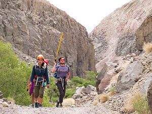 Celeste and Andrew Leaving Central CanyonLater that afternoon after the rain stopped, we went to check out another climbing area called the Buttermilks, which is famous for its bouldering. This area was also about 20 minutes from our campground, but in the opposite direction from the gorge. It was a very pretty and unique landscape – hundreds of huge boulders (or more technically, glacial erratics) strewn along a vast hillside with the snow-capped Sierra in the background.
About 3 ½ miles along the bumpy, washboard Buttermilk Road, we pulled into a small pullout on the right to pay a visit to Grandma and Grandpa Peabody, two of the largest boulders in the area, and probably the most famous and popular as well. They were huge – about 45 feet high.
It made me really nervous watching people climbing them. The bouldering pads on the bottom, which are the only thing between the climber and the ground, looked so tiny and inconsequential compared to the rock.
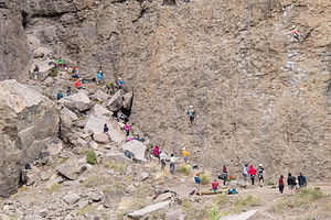 Crowd at Great Wall of ChinaWe continued driving a short distance to the Birthday Boulders parking area, where the boulders were at least a bit more reasonably sized – the kind a mother would prefer her sons to climb on.
Speaking of our sons, they called to say they were on their way and should arrive by around 8:00 pm – oh, and could we have dinner hot and ready then? Fortunately, I had bought a frozen lasagna platter back at the Pasta King near Sebastopol, so their request was an easy one to fill.
They arrived right on time, in very high spirits for the weekend ahead. They had come via the Tioga Pass route through Yosemite, the scenery along which would raise anyone’s spirits, especially these three.
It was great to be together again, even if only for a few days.
Day 6 – Owens River Gorge
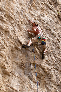 Herb on LeadThe next morning, the kids got up bright and early, ready and rearing to go – if only they had been this chipper in the morning and easy to wake back in the days of high school.
We were one of the first ones to arrive at the Central Gorge parking lot. The hike down wasn’t nearly as bad as I anticipated. It was steep, and there was some loose rock, but there were no steep drop-offs, which I dread. It was, however, pretty strenuous on the knees, as steep downhills always are.
Since we were early, we were able to set up on the usually overcrowded, Warm Up Wall, just a short distance to the left when we got to bottom of the gorge. The reason for its name and its popularity is that it has a fair number of easy to moderate climbs in the 5.7 To 5.10 range, which are great for climbers to warm up on. In my case, however, these climbs are not warmups, but rather an amazing achievement.
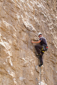 Tom on LeadThey all took turns leading various 5.9s and 5.10s and I did a 5.7 and 5.8. Climbing can be pretty boring to talk about, but it is really fun to do and watch. Rather than explain the various climbs we did, I will let the photos do the talking.
After Warm Up Wall we walked north along the gorge and crossed the river to the Great Wall of China, another popular wall on the other side of the gorge.
At least there is a river flowing through the gorge now. For decades, the LA Department of Water and Power, which owns and controls the flow of water through the gorge, basically dewatered the Lower Gorge, eliminating one of the best brown trout fisheries in California. After decades of court battles, more water is now being released and the brown trout are returning. Plus, from an aesthetic point a view, a gorge with water running through it is much nicer than one without.
The Great Wall of China had much fewer moderate climbs. Most of them were in the 5.10c to 5.13 range, so there was little for me to do but spectate, which was fine. They did, however, get me to try a 5.9, which although I didn’t complete, I got higher on it than any of them expected, especially me.
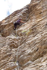 Andrew on LeadOnce again, I will let the photos do the talking to show what climbing is like on this wall.
What the photos don’t show, however, was a pretty frightening event. First, we heard a girl scream, and when we looked her way, we saw a big block of rock come off the wall about 100 yards from us. Fortunately, it didn’t hit anyone, but it would have been tragic if it did. Getting hit by loose rock is probably the biggest danger when climbing. That’s why it’s even more important to be wearing your helmet when you are just watching than when you are climbing.
Celeste and Andrew, especially Celeste, never want to stop climbing, so they tried to ignore the big black clouds that were headed our way. I was concerned because I knew I had to climb that steep trail out of the gorge and didn’t particularly want to do so while dodging lightning. Sensible heads prevailed and we quickly hiked through the gorge and up, which I might add was quite strenuous. We got to the car just in the nick of time before the skies opened up and it began to pour.
Still, we had gotten in a very full and fun day.
Day 7 – Owens River Gorge and the Buttermilks
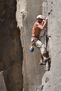 Herb Climbing on Lolo's BelayEveryone thought the Owens River Gorge was pretty amazing and that we had barely touched the surface of all the wonderful climbs awaiting us down there, so off we went once more to the Central Gorge, and the steep descent down into it. I have a feeling no one even gave that steep trail into and out of the gorge a second thought, except me. I kept daydreaming about the Alabama Hills and how you could drive a car right up to the base of a climb. But I kept my mouth shut, because so far, they really don’t think of me as old, and I wasn’t quite ready to give that up.
So down we went once more. Today was a little busier and there was already a decent crowd on Warm Up Wall, but the Negress Wall right to its left had a few routes open – a 5.9 and several 5.10s, perfect for starting the day. There wasn’t much for me to climb there – although I did play around with and got pretty far on the 5.9 -- but they found another way for me to participate – lead belaying Herb.
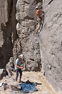 Lolo's Questionable Belay of HerbI really wasn’t very happy with this idea. It was a lot of responsibility. I had belayed people on top rope plenty of times, but that was much more straightforward. All you had to do was keep pulling rope in as the climber ascended, and if they fell, it would only be for a foot or two. However, with lead belaying you have to feed rope out as the climber ascends, while at the same time being ready to pull it in tightly if they fall. And lead falls can be much longer – twice the distance from their last piece of protection. For example, in sport climbing, which this was, if the climber clipped into a bolt and then climbed another 10 feet before reaching the next bolt and fell, they would fall 20 feet – not hitting the ground, but still having a pretty exciting experience. In fact, there is a term for this type of fall. It’s called a “whipper,” and it’s not too much fun for either the climber or the belayer, who also gets to join in the excitement by being yanked off the ground.
So needless to say, I told them I preferred to just read my book. They didn’t relent though. They said if I was going to consider myself a real climber, and if Herb and I ever wanted to go climbing, just the two of us, I would have to learn. Besides it would be the perfect time to learn, as it was a relatively easy climb for Herb, which he was unlikely to fall on, and they were right there to help me.
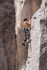 Andrew's "Foot Free" MantelIt went fine. No whippers were taken and I successfully fed line out as he ascended and lowered him down when he was done. However, a look back at the series of photos Tommy took during this process didn’t exactly inspire confidence. First there was a picture of me looking down at the rope with a very confused look on my face; then a picture of Herb doing a move on the rock; then back to me looking baffled; then Herb on the rock, etc. I always had him, and nothing bad would have happened, but I just looked really dopey.
Herb actually did take a whipper, in fact twice, later that day, but fortunately not with me belaying. After the Negress Wall, we moved down a short distance to Pub Wall, where they all took turns leading various climbs. Herb was leading one of them, with Tommy belaying, when as I described above, he got about 10 feet above his last piece of protection and fell, letting out a very interesting noise as he dropped about 20 feet, pulling Tommy off the ground in the process. He was about 50 or 60 feet off the ground when this happened, so there was no danger of him hitting the ground, but it was still pretty exciting, especially for Herb, who hadn’t taken a whipper in 30 years. Undaunted, however, and encouraged by his offspring, he tried again, taking another whipper in the very same spot. I give him a lot of credit, because he went for it a third time, this time grabbing a quickdraw to get through the spot where he had fallen twice before.
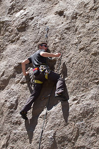 Tom Yelling Clipping!Afterwards he looked a little shaken, but not too bad. It’s actually good to take a safe fall once in a while to gain the confidence that you need on a lead. However, I think he had about enough practice falling for the day.
I really wasn’t looking forward to that steep hike out of the gorge again, so I convinced Herb to take the longer, and much less steep, trail out through the lower gorge while the kids went the normal way and then picked us up at the Lower Gorge parking lot. I figured it would take about the same time either way. Along the way, we passed the LA Department of Water and Power hydroelectric plant, and then hiked the rest of the way out on a paved road. The timing was pretty perfect -- the kids said they only had to wait for us about 5 minutes.
I would have thought that we had had enough activity for the day, but silly me. They wanted to see the Buttermilks, which is an area southwest of Bishop famous for its bouldering. We stopped first at the campground to pick up some cheese and crackers and cold beers and then drove out to and along the bumpy unpaved Buttermilk Road, which Herb and I had scouted out a few days back.
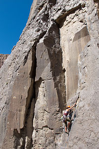 Celeste on LeadIt really is an amazing place, with an incredible amount of boulders of all shapes and sizes, but mostly big. We showed them Grandma and Grandpa Peabody, the 45+ plus feet pair of boulders whom we had met the last time, and then moved on to the slightly tamer Birthday Boulders area, where there were some more reasonably-sized boulders.
Herb and I were done for the day, but we spent a very pleasant hour or so sipping a cold beer while watching them work on some routes on Ranger Rock, with the sun dipping down on the snow-capped Sierra behind them. The lighting was incredible.
On the way back to the campground, we stopped at the Bishop Burger Barn, a local hangout highly recommended to us by Stacy, our campground host. It was exactly what we needed – great burgers and fries, an outdoor patio to sit on, and the ability to bring your own beer. I, however, went for a tasty chocolate milkshake.
When we got back to the campground, we loaded the pictures from the last two days from all of our cameras onto the computer and relaxed in the back while putting on a slide show. Wow. We had certainly done a lot – and to think we had another full day with them tomorrow before they would have to head back to San Francisco.
Day 8 – Alabama Hills and Volcanic Tablelands
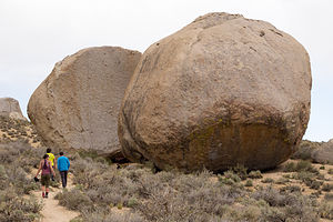 Grandma and Grandpa PeabodyI really wanted to climb at the Alabama Hills today, not just because the approaches to the climbs were short – although that was part of it – but because I thought it was really beautiful and Andrew, Celeste, and Tommy should see it too. At first they objected because it was an hour drive, but we told them it was a beautiful drive and we would more than make up for the lost time in not having to hike in so far to get started.
The climbing area is accessed from the Movie Flat Road where Herb and I had diligently searched for Gunga Din Tent City and other movie filming locations before giving up to concentrate on the scenery. It was hard to believe that that was only a few days ago.
We took the first of many dirt roads that branched off from Movie Road and drove right up to an awesome rock formation, appropriately named the Shark Fin. Now this was my kind of approach – we practically bumped into it with the car. There was even a 5.7 and a 5.8 for me to play on.
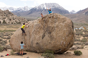 Offspring and Celeste Bouldering Ranger RockAlthough those climbs were easy for them, they were very exciting and enjoyable for me -- probably two of my favorite climbs ever. I banged my knee when climbing and left quite a bit of blood on the rock. I still have a scar, which I like to point to, look contemplative, and say, “shark.”
After two days of hard climbing, I think they all enjoyed these climbs on Shark Fin as well. What was not to like? It was so incredibly scenic –interesting shaped rock formations as far as the eye could see and snow-covered Mount Whitney looming down from above.
After Shark Fin we moved on to another rock, whose name I can’t recall. This time we actually had to walk about 100 feet from the car, but I sucked it up. As on the Shark Fins, the routes were in the more moderate range, so Andrew, Tommy, and Celeste took the opportunity to practice setting up anchors for a multi-pitch climb. It made Herb and I more comfortable about their safety in this sport seeing how conscientious they were and how well they worked together, always helping and checking up on each other.
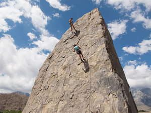 Lolo on Shark FinI go to do another 5.8 as well. For me, this was probably my best climbing day ever, with several climbs that were challenging yet doable. Plus I thought this area was really beautiful.
We drove back out along the rest of Movie Flat Road, stopping at a very scenic spot to take our 2015 Gaidus Family Christmas photo. I think if you look close you can even see my shark scar.
There was still a few more hours of daylight, so rather than go back to the campground to relax like normal people, we sought out another climbing area that we had not yet been to – the Volcanic Tablelands, just across 395 from our campground.
I knew I wouldn’t get through a whole day with them without having to climb up a steep hill, but this one really wasn’t too bad. Like the Buttermilks, this was an area for bouldering, and there were thousands of them, much less intimidating – in size anyway – than the Peabodies in Buttermilk Country.
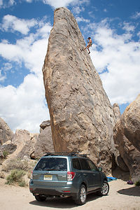 Shark Fin with Subaru and AndrewClimbers refer to this area as the Happy / Sad Boulders because those are the two areas where the most routes have been established. The Happy Boulder area alone has 418 routes and the Sad Boulder area has 187. We went to the Happy’s, and that is pretty much describes the way I was feeling that evening.
Like the Owens River Gorge, the rock in the Volcanic Tablelands is volcanic Bishop tuff, which is solidified ash from volcanic eruptions. This type of rock tends to be very rough on the hands and features a lot of edges, pockets, and cracks.
Once again, Herb and I sat back and just watched. Bouldering is a lot more cerebral than rope climbing and the routes are even referred to as boulder problems, because figuring them out really is like solving a difficult puzzle. You just have to figure out the sequence of holds that best fits your climbing strengths.
As with last night at the Buttermilks, the scenery got more and more beautiful as the sun got lower in the sky. The walk out, looking out over the Owens River Valley was breathtaking.
This was our last night together, so we loaded up everybody’s photos again so that we would all have them and enjoyed another great slide show.
Boy, were Herb and I going to miss them. They are so full of life and energy that it is contagious. When I look back at the pictures taken over the three days we were together, I can’t believe that all of that could have taken place in such a short time.
Day 9 – Kids Leave, Keough Hot Springs again
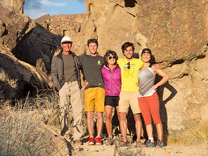 Happy Campers at the Happy’sAs always, it was sad to see them go, but Herb and I could not have kept up their pace too much longer. We love being active, and I think from most people’s standards we are extremely active, especially for our age, but we do enjoy the occasional down day in between.
When the boys called that night to say that got home safely, they told us that night that on their drive back to San Francisco through Yosemite, they stopped at Daff Dome in Tuolumne Meadows to squeeze in a climb. They’re crazy.
We weren’t sure exactly what we wanted to do from here. We had 10 days before we needed to be back in Petaluma to celebrate Celeste’s dad’s and my birthdays, so there was plenty of time for some more exploration.
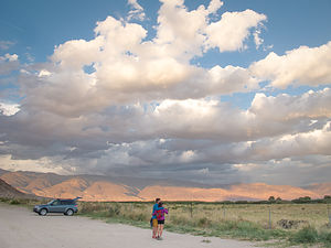 Lolo and Tom Enjoying Happy SunsetToday we just wanted a breather, so after doing laundry and food shopping, we headed back to the Keough Springs Resort and plopped our butts in one of the natural hot springs in “Keough Ditch” for the afternoon.
It was such a nice night that after dinner we returned to the Ditch with a bottle of wine, placed our beach chairs right in the pool, and gazed up at the stars. Herb was totally relaxed. I, however, was a little nervous about the low-flying bats and was convinced they wanted nothing more than to tangle themselves up in my hair. Herb tried to reassure me that that was just an old wives tale and that these bats had a built in sonar system and absolutely had no desire to get stuck in my hair. That sounded logical, but every time one whipped by within inches of my head, I smacked my face down into the pool, and I hate putting my head under water. Herb was quite entertained. I, however, was not.
Day 10 – Keough Hot Springs, Manzanar, Hike to Lone Pine Lake
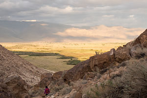 Lolo Hiking out of the Happy'sThe next morning we arose early once more to swim laps in the resort pool. This time there was no empty lanes, so Herb had to join someone else, leaving me with nowhere to go. Then I noticed that there was an elderly woman in the end lane, going as slow as I do. When I asked if she minded if I joined her, she was hesitant at first because she said she swam slow and crooked, but after telling her that I did the same, she welcomed me in.
I don’t know how I ever did 53 laps the other day, because today I had trouble doing even half of that. I felt like a rock. Oh well. I had fun chatting with my lane partner each time we stopped at the same end of the pool. She had lived in Bishop for over 40 years and gave me the insider’s view of what that was like. It gets pretty isolated in the winter, because there is no easy way to get through the Sierra towards the coast. She thinks that is why Bishop has sort of stood still in time and not changed nearly as much as many other California towns.
Herb and I still weren’t sure how we wanted to spend our next 10 days, but we figured we would start with a hike that we wanted to do at the base of Mount Whitney, and then stay somewhere in Lone Pine.
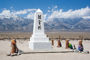 Manzanar Memorial ObeliskThis would be our third trip down 395 to Lone Pine -- fourth if you count Herb’s ride through here on his motorcycle a few weeks back. It was beginning to feel like a commute, but a very nice one at that.
As we passed the Manzanar National Historic Site, I asked Herb if he minded if we stopped there briefly, even though he had done so on his motorcycle trip. It seems like we both were repeating many of the things we had done alone, because we each wanted our other half to see it as well.
Unlike most of the Historic Sites we have had the privilege of visiting, this is not one that we as Americans can be proud of. This particular facility was one of ten relocation centers set up by the U.S. Government during World War II to forcibly intern Japanese American citizens. During the three years it was in operation, more than 10,000 people were sent to this center alone to be housed and held against their will for the duration of the war.
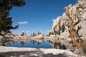 Lone Pine LakeI always find the films at National Parks visitor centers very informative, so I asked Herb if he would mind he I watched the 22 minute one they were starting shortly. He had already seen it, so he wandered around looking at the exhibits while I went into the auditorium.
There were only about 5 of us sitting in the seats, and one Japanese gentleman in a Park uniform with a Volunteer badge standing before the stage, greeting each of us as we entered. When the time for the film to start arrived, he introduced himself as someone who had once been interned in this very camp. I started mentally calculating in my head. World War II had ended 70 years ago. This guy looked no older than me, and I’m sure his life had been much more challenging than my cushy one.
As we waited while more people drifted in, he asked us if we had any questions before he started the film. Well, apparently we did because for the next half hour, everyone in the room was mesmerized by this soft spoken man who brought us back in time with him into the life on a 9 year old boy, taken with his family from his home and brought to live in this camp.
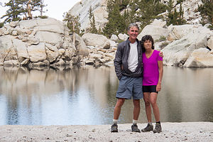 Herb and Lolo at Lone Pine LakeI thought it was interesting how he answered a question about how he felt when he was brought here and whether he was frightened. He explained that his parents had been tenant farmers, and that he worked beside them on the farm and had very little exposure to other children his age. When he arrived at the camp, there were hundreds of kids to play with. For him, that was pretty exciting. He also told us about their neighbor, who was kind enough to store their belongings until their release. That neighbor even traveled a long distance to visit them at the camp to make sure they were being treated well. However, he reminded us that although not everyone or everything about the experience was bad, what happened to him and his fellow Japanese Americans was a shameful period in our history.
Finally, he had to stop our questions so that he could start the film. The film was very interesting, but there is still nothing that can compare to hearing about an experience from someone that has been through it themselves.
I think during the hour or so that I had been missing, Herb began wondering if I hadn’t been interned myself.
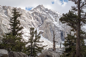 Lone Pine Lake HikeAfter Herb and I found each other again, we drove the car along the 3.2-mile auto tour road through the camp. With the exception of two reconstructed barracks and a mess hall, everything else in the camp has been long gone.
At the far edge of the camp, lies the camp cemetery, where a single, white concrete obelisk stands before the dramatic backdrop of the Sierra. Three large characters on the front of the monument translate to “Soul Consoling Tower.” Colorful ribbons and scarves and other assorted offerings, like coins and even sake, adorn the posts around the obelisk. Every last Saturday in April, hundreds of former internees, their families and friends, and a growing number of young people take a pilgrimage to this site to remember, honor, and reflect on the experiences of the people that were unjustly interned in this camp.
I highly recommend that anyone visiting Manzanar stop at this cemetery for a moment of reflection.
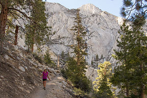 Lolo Hiking from Lone Pine LakeAfter our stop at Manzanar we continued on 395 South and turned right onto the Whitney Portal Road in Lone Pine. This time we passed right by the turnoff for Movie Flat Road and continued on the paved road for 13 miles to its end and the trailhead to the summit of Mount Whitney.
Our objective today was much more modest than summiting Whitney. Even if we wanted to, getting a permit to do so is a difficult task, as the number of people allowed on the mountain at any one time is limited. Even day hikes that enter the Mount Whitney Zone require a day permit. However, the friendly and helpful staff back at Wilson’s Eastside Sports in Bishop had recommended an excellent day hike to Lone Pine Lake that stayed within the John Muir Wilderness and did not require a permit.
We set off on same trail that hikers to the summit take, but passed no one, as it was much too late in the day for people heading to the summit to start. The trail led mostly through forest, but frequently opened up to expansive views of the Owens Valley and the White Mountains to the east. Although the trail climbed 1,700 feet in just 2 miles, the numerous, tight switchbacks made it seem relatively flat.
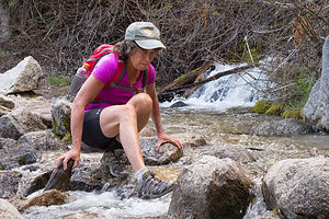 Lolo Crossing Stream Like a CrabMy problem was those pesky streams to cross, and there were several of them. While Herb agilely hopped along the rocks, I used a rather less graceful method that required five rather than two points of contact with the rock, sort of like a crab. Despite my cautious approach, I still managed to totally soak my feet. Fortunately, it was a warm day, because wet feet at high elevation are not a good thing.
After 2 ¼ miles, we came to a trail junction, and took a short side trail to the left down to lovely little Lone Pine Lake, a sandy lake surrounded by the imposing granite walls of Whitney Canyon. We spent an enjoyable hour strolling the shores of the lake, photographing the reflections of the evergreens, boulders, and cliffs in its clear, placid waters.
The lake is at an elevation of 10,050 feet so it was a bit chilly, but it felt very refreshing and clean. From here back to Whitney Portal it was all downhill, so except for having to cross the streams again, it was an easy hike out.
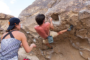 Andrew on Happy BoulderAfter the hike, we drove back to Lone Pine and checked into the Boulder Creek RV Resort, a nice little campground with a pool, right on 395. We still didn’t have a plan for the next few days, so we figured we would spend that evening looking at options. After much deliberation, we agreed to head to the coast near Morro Bay where we could perhaps use our kayaks, and then drive north possibly stopping in Carmel or Monterey.
Later that evening after dark, as we were taking a walk around the campground, we spotted a Lazy Daze just like ours. Of course, one Lazy Dazer can’t just pass another one without chatting for hours on end about the various merits and advantages of owning this most wonderful of all motorhomes, so Herb called out to the gentleman sitting beside it, “I like your rig,” which must be a secret code recognized only by fellow Lazy Dazers. I think they should come up with a secret handshake as well.
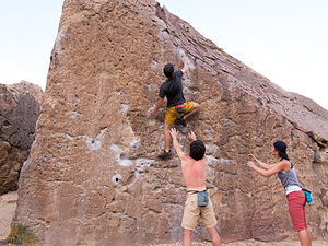 Tommy on Happy BoulderSo that’s how we met Bill, a really wonderful and informative guy from the San Diego area, interested in so many of the same things we are, particularly photography and travel – oh, and of course Lazy Daze motorhomes. He and Herb talked for hours that night, and even found each other the next morning to continue. I practically had to pull Herb away so that we could get on with our plans for the day.
We eventually parted with Bill – he towards June Lake to go fishing with a friend, and we towards the coast – or at least I thought so at the time.
Before heading out, we looked once more at the weather for Morro Bay and saw that the forecast had changed to fog and low 60s for the next few days. For my desert rat husband, this was totally unacceptable and he declared, “We’re going to Death Valley instead.” That was a bit of an extreme shift, and a testament to just how different California is from New Jersey. In New Jersey, we can’t just drive in a different direction for 3 hours and have such drastically different climates. Here you can practically dial in to what you want.
Well, Death Valley wasn’t exactly what I wanted and I want spouse points for agreeing to this. I hate being hot – in fact, our oppositely malfunctioning thermostats are probably the biggest difference between Herb and me. Otherwise, we are uncannily similar. However, good wife that I am, I agreed, especially after I found out that we could stay at the Furnace Creek Ranch Campground and use their pool.
Description
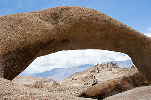 Herb with ArchThe Eastern Sierra Scenic Byway, officially known as Highway 395, runs the entire length of the Sierra Nevada Range, from south of Lone Pine to Carson City. The scenery along the way is breathtaking and full of variety – snow covered mountains, incredible lakes, ancient bristlecone forests, natural hot springs, and so much more.
I have broken up our journey along the Scenic Byway into two stops:
• South - from Mammoth Lakes to Lone Pine
• North - from June Lake to Bridgeport
The following is a description of a few of the stops we enjoyed along the Eastern Sierra southern section:
Keough Hot Springs
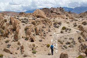 Herb Hiking the Alabama HillsKeough Hot Springs is a resort, located in the Owens Valley about 7 miles south of the town of Bishop. The resort, which was established in 1919, has a 100 X 40 foot pool meant for swimming laps and doing aerobics, as well as a 15 X 40 meant for soaking. The hot springs flows from the ground at a scalding 130 degrees and is fed into a spray system that flows like a water fall into the larger pool in turn cooling the water to a comfortable for exercising 86 to 89 degrees. The smaller pool, which is meant for soaking, is kept at 104 degrees and has a depth of 2 feet. Since both pools are free flowing, they have a constant flow of fresh mineral water throughout the day. The pools are emptied, cleaned, and then filled again every Tuesday.
In addition to a few luxury tent cabins, there is a small campground with 10 water and electric sites. Swimming is not included in the camping fee, but is an additional $10 for a day pass.
Outside the boundaries of the resort, and downstream from the resort pool, is a series of primitive natural pools known as the “hot ditch.” The pools, which are quite shallow, have temperatures in the low 90s.
Climbing areas in Bishop
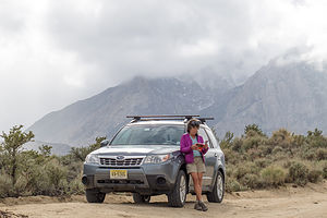 Lolo and Forrester in ButtermilksThe Owens River Gorge is a steep 10 mile long canyon just north of Bishop that is a very popular destination for rock climbing. With 416 sport-climbing and 52 trad routes it is California’s most concentrated sport climbing area. The climbing is on volcanic tuff and features edges, pockets and cracks. Although there is a full range of difficulty level, the best climbs are in the 5.10 to 5.11 range. The most popular walls are located in the Central Gorge – Warm Up Wall, the Pub, the Social Platform, and the Great Wall of China, which feature tons of 5.8 to 5.11 sport routes. Summers get a bit too hot to climb in the gorge.
Buttermilk Country, one of California’s premier bouldering destinations, is located southwest of Bishop along the western edge of the Owens Valley. These massive glacial erratic boulders sit in the foothills of the Sierra Nevada under an impressive backdrop of high peaks just a mere four miles to the west. There are 243 bouldering routes, many of which top out at over 20 feet.
The Volcanic Tablelands, another popular bouldering destination, lie just north of Bishop in an area where the floor of the Owens Valley rises abruptly, forming a 300 foot-high volcanic plateau. Along the southern tip of the plateau there are numerous canyons and washes containing thousands of boulders. The Happy Boulder area with 418 routes and the Sad Boulder area with 187 routes are the most popular. Because of its 4,500 foot elevation, the Volcanic Tablelands are climbable year round.
Lone Pine Area
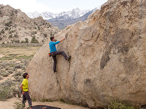 Tommy Bouldering with an IPAThe Lone Pine Film History Museum houses memorabilia from the hundreds of films, commercials, and television shows that were filmed in the nearby area over the past 100 years. Since the early years of filmmaking, directors and actors have made the 3-hour trek from Hollywood to the tiny town of Lone Pine to use the dramatically beautiful Alabama Hills as the backdrop for their films. Although mostly known for the “westerns” filmed here, with such cowboy heroes as John Wayne, Gene Autry, and Roy Rogers, it has also been the site for early silent, post-war, and science fiction films. The museum has an 85-seat movie theater where visitors can watch an interesting 15-minute documentary, “Lone Pine: Where the Real West Becomes the Reel West.” Admission is $5 for adults.
The Alabama Hills are a range of hills and rock formations, just west of Lone Pine, that lie at the foot of the eastern Sierra Nevada Mountains. Mount Whitney, the tallest mountain in the continental U.S., towers over the hills. Although the same age as the sharp, glacially chiseled ridges of the Sierra, the Alabama hills are more rounded as a result of chemical weathering. When the hills were still covered with soil, percolating water rounded the granite blocks and sculpted the interesting arches and potato-shaped boulders you see today. These interesting formations make it a popular rock climbing destination.
The outstanding and dramatic scenery of the hills has also attracted Hollywood filmmakers from the 1920s to the present. Hundreds of movies (particularly westerns), TV shows, and commercials have been filmed here over the past century. The Lone Pine Film History Museum is a great place to learn about the film history of the area. The 5.7-mile unpaved Movie Flat Road through the Hills goes past the filming locations for such greats as “How the West was Won,” “Rawhide,” and “Gunga Din.” A “Movie Road Touring Brochure,” is available online or at the museum.
The origin of its name is quite interesting and surprising. In the 1800s, prospectors in the area sympathetic to the Confederate cause named their mining claims after the confederate warship Alabama, which was wreaking havoc on the Union fleet.
Whitney Portal is the gateway to Mount Whitney, the tallest mountain in the continental U.S., and the main starting point for treks up to its summit. It is located at the end of the 13-mile Whitney Portal Road, which begins from 395 in the town of Lone Pine. Although hiking into the Mount Whitney Zone requires a permit, there are several day hikes that can be done within the John Muir Wilderness section without a permit, such as the hike to Lone Pine Lake.
The Manzanar National Historic Site marks the site of the former Manzanar Relocation Center, one of ten internment camps into which the U.S. government forcefully interned more than 110,000 Japanese American citizens during World War II. The Manzanar facility operated from March of 1942 through November of 1945, housing and holding without their will over 10,000 Japanese Americans. Today this site, which is preserved and operated by the National Park Service, informs visitors about the legacy of this shameful period in U.S. history. Inside the Visitor Center there are extensive exhibits as well as a 22-minute informative film. Adjacent to the Visitor Center are two reconstructed barracks and a mess hall, the only three original camp structures that remain. A 3.2 mile auto tour takes you past remnants of orchards, gardens, and building foundations, as well as the camp cemetery, located at the foot of the majestic Sierra. Admission is free.
- ‹ previous
- 4 of 9
- next ›
Eastern Sierra - South (Mammoth Lakes, Bishop, and Lone Pine) location map in "high definition"
Javascript is required to view this map.

Hi, Lolo,
This is a very well written travel log, thank you very much! :) The pictures are really well done, too.
Cheers,
Zach
Thanks for the comment Zachary,
Glad you found something worthwhile in our website.
Safe Travels,
Herb
I have checked in with your blog off and on over the years, and have really enjoyed it. My husband and I love traveling in our 24 foot trailer with our two boys (10 and 8) and have been wanting to adopt your practice of 3-week+ trips in the summer. What an amazing gift to raise your boys with those experiences, and I am glad they still join you in adventures now that they're grown! I was excited to read about your Eastern Sierras travels, as we are Bishop locals. In fact, our home backs up to the fairgrounds, which is a special kind of fun/craziness during Mule Days, as you can imagine.
Hi Julie,
Thanks for the kind words about our website. I'm glad that we have inspired you to take a 3+ week trip with your own two boys as well.
You have lots of great places to see out west. No need to spend almost a week crossing the country to get to the mountains.
We were actually going to be at Mule Days this year,, (climbing and bouldering), but plans have changed. It looks like a great time.
Safe travels,
Herb