- Home
- About
- Map
- Trips
- Bringing Boat West
- Migration West
- Solo Motorcycle Ride
- Final Family XC Trip
- Colorado Rockies
- Graduates' XC Trip
- Yosemite & Nevada
- Colorado & Utah
- Best of Utah
- Southern Loop
- Pacific Northwest
- Northern Loop
- Los Angeles to NYC
- East Coast Trips
- Martha's Vineyard
- 1 Week in Quebec
- Southeast Coast
- NH Backpacking
- Martha's Vineyard
- Canadian Maritimes
- Ocracoke Island
- Edisto Island
- First Landing '02
- Hunting Island '02
- Stowe in Winter
- Hunting Island '01
- Lake Placid
- Chesapeake
- Provincetown
- Hunting Island '00
- Acadia in Winter
- Boston Suburbs
- Niagara Falls
- First Landing '99
- Cape Hatteras
- West Coast Trips
- Burning Man
- Utah Off-Roading
- Maui
- Mojave 4WD Course
- Colorado River Rafting
- Bishop & Death Valley
- Kauai
- Yosemite Fall
- Utah Off-Road
- Lost Coast
- Yosemite Valley
- Arizona and New Mexico
- Pescadero & Capitola
- Bishop & Death Valley
- San Diego, Anza Borrego, Joshua Tree
- Carmel
- Death Valley in Fall
- Yosemite in the Fall
- Pacific Northwest
- Utah Off-Roading
- Southern CA Deserts
- Yosemite & Covid
- Lake Powell Covid
- Eastern Sierra & Covid
- Bishop & Death Valley
- Central & SE Oregon
- Mojave Road
- Eastern Sierra
- Trinity Alps
- Tuolumne Meadows
- Lake Powell Boating
- Eastern Sierra
- Yosemite Winter
- Hawaii
- 4WD Eastern Sierra
- 4WD Death Valley +
- Southern CA Deserts
- Christmas in Tahoe
- Yosemite & Pinnacles
- Totality
- Yosemite & Sierra
- Yosemite Christmas
- Yosemite, San Diego
- Yosemite & North CA
- Seattle to Sierra
- Southwest Deserts
- Yosemite & Sierra
- Pacific Northwest
- Yosemite & South CA
- Pacific Northwest
- Northern California
- Southern Alaska
- Vancouver Island
- International Trips
- Index
- Tips
- Books
- Photos/Videos
- Search
- Contact
Ardales and the Caminito del Rey, Spain
Wednesday, May 29, 2019 - 7:15pm by Lolo
95 miles and 2 hours from our last stop - 3 night stay
Travelogue
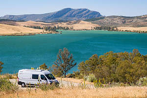 One of the lovely Embalses (Reservoirs) in ArdalesThis was probably the stop I was most excited about, as it is home to one of Spain’s most iconic and popular hikes - the Caminito del Rey. In fact, it is so popular that you actually need tickets for entry, which go on sale in January of every year.
Part of its draw is its legendary past as the most dangerous hiking path in the world, clinging to the sides of the sheer walls of the Garganta del Chorro, a 4-km long gorge that is 400 meters deep.
A brief bit of history to set the scene:
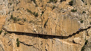 The Caminito del ReyThe original path was built in 1905, not as a tourist attraction, but rather as a means for hydroelectric plant workers to transport materials between two hydroelectric plants at either end of the gorge. Every day workers would precariously walk the 4 km along a narrow, concrete path attached to the walls of the gorge by steel beams. There were no railings or fences of any sort to protect them from falling down into the gorge. To make matters worse, the path deteriorated over the years, resulting in large gaps bridged only by narrow steel beams that the workers had to balance their way across. Add the wind that whips through this gorge to that, and you have some pretty challenging work conditions.
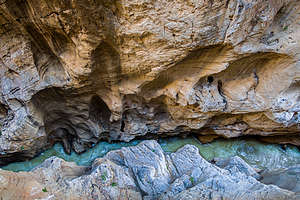 Looking down into the Garganta del Chorro gorgeIn 1921 the Spanish King Alfonso XIII crossed the walkway for the inauguration of the dam - in fact, that is how the route got its name, which means “the King’s little path.”
However, over the years, as more and more people lost their lives falling off the walkway, the local government closed it in 2000. Understanding the value and potential of this incredibly beautiful place, the regional government of Andalusia and the local government of Malaga agreed in 2011 to invest 9 million € in a joint restoration project.
The refurbished and totally safe El Caminito del Rey reopened in March 2015 and received over 3,200 visitors during its first few days. It has been a great boon to the local economy, with tickets (1,100 per day) pretty much selling out every day.
Fortunately, I remembered to go online in January and managed to get 2 tickets for May 30 at 9:30 am (the first group to be let on the path).
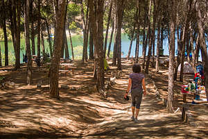 Camping Parque ArdaleOnce I had successfully gotten tickets, I booked a campsite for three nights at Camping Parque Ardales, mostly because they advertised that they were just 1 km away from the entrance of the Caminito del Rey, meaning we would not have to move the camper van to get to our hike.
The two hour drive from Grenada to Ardales was beautiful, leading us past groves of olive trees and awesome views of the aquamarine waters of the Embalse (Reservoir) del Guadalhorce, which we would be camping on - an added benefit I hadn’t realized when booking our campsite.
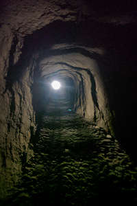 Tunnel to the Caminito del Rey trailheadAfter checking into our lovely campsite, we decided to scout out how to get to the Caminito del Rey, so that we would be sure to be on time for our entry the following morning.
The 1 km must have been measured by a crow, because the actual walking distance was 2 miles - still, perfectly fine. The walk took us through the campground, out along the road, through a very dark and long tunnel where Herb banged his head several times, and then a short distance along a trail to the kiosk. Ok,simple enough and accomplished in under a half hour.
After that we hiked back, somehow missing the turnoff for the tunnel (which is a shortcut back to the road), but that was okay because it brought us to the Mirador des Embalses, where there was a beautiful view of the Embalse del Conde del Guadalhorce, a huge reservoir that dominates the landscape - and the one we were camping on!
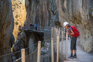 Lolo making sure the fencing looks soundEven without the Caminito del Rey, this area is a very worthy destination.
That evening after a humble dinner of salad and tortellini, we took a walk through the campground to a point that jutted out into the Embalse del Guadalhorce. It gets dark so late in Spain that we could still find our way along the trail at 10 pm.
The next morning we got up bright and early, and left our campsite at 8:00 in time to walk the 2 miles for our 9:30 appointment with the Caminito del Rey. When we arrived at the kiosk at 8:45, there were already dozens of people ahead of us anxiously waiting to get started. As 9:30 came and went, the crowd began to get a bit restless. Finally, one of the official gatekeepers announced, “Cerrado, demasiado ventoso,” and everyone started to grumble and walk away. It took me a few minutes, even with my 60+ hours of duolingo, to realize that she had said, “Closed, too much wind.”
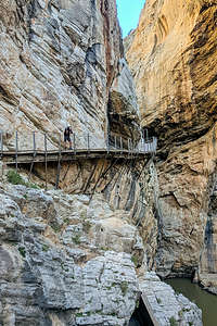 Herb on the Caminito del ReyIn dismay, we went to the official who spoke English and asked her what we could do. She told us that we could go online to their website and change our ticket to any day in the next 30 days. The only possible day we had was tomorrow, so we tried to do it on our phones right there. When even she couldn’t get it to work, she walked into the office and came out with tickets for anytime the next day - however, adding the caveat that the wind could be an issue then as well. At least it was a possibility.
Not wanting to waste the day, we decided to take a side trip to the white village of Ronda (about an hour away), something that had been on my list of possible stops after this one. Rather than describe that excursion here, I thought I would give that lovely village the dignity of its own stop - see next page
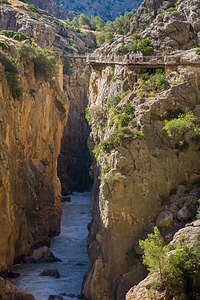 Crossing the gorgeAfter we got back from Ronda, I figured I would take advantage of our prime location on the Embalse del Guadalhorce and spend some time on the beach just a short distance away. I set up my chair and blanket and spent the next hour reading and watching Spanish families happily recreating on the lake, in all sorts of watercraft, my favorite being the paddle boats with water slides on the back.
Feeling peaceful, I took a nap on my towel only waking up when a giant wind blew my chair away. Oh no. There was that damn wind that had thwarted our hike earlier in the day. I was not feeling particularly optimistic about the Caminito del Rey being open tomorrow.
However, the next morning we awoke to the beautiful sound of silence - no wind. Excited that we might have a chance to do our hike, we quickly got ready and headed over to the trailhead to be in the first group let out at 9:30.
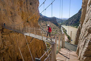 Lolo crossing over the windy suspension bridgeThings looked promising. We were let through the first gate and handed hairnets and a helmet - not because they expected you to fall into the gorge, but to protect in case of falling rocks. A guided tour was let on the pathway first, and about 10 minutes later, our group of about 60 hikers was allowed to proceed as well.
Our strategy was to hang back just enough to lose our group and be able to take photos unimpeded, but not too slow so the next group would catch up to us. The strange thing was, no group every caught up to us. Only later did we realize why. We were the only group let on that day because right afterwards it was shut down again because of demasiado ventoso (high winds). We practically had the whole thing to ourselves.
It was wonderful. The new boardwalk that they built to replace the precarious concrete one was wide and had handrails - perfectly safe and not even a little bit scary. Hanging off the gorge walls 100 meters above the river, the path snaked around the dramatic cliffs, providing breathtaking views around every turn.
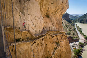 Lolo hiking on the new route, with the old deteriorated one belowWhen rebuilding the new path, they just built it above the old pathway, which allowed us to see how lucky we were that they had replaced it.
It wasn’t until the final stretch when we crossed a long suspension bridge over the gorge that we realized just how bad the wind was. It really whipped pretty fiercely through the gorge, causing the bridge to swing quite a bit. Still, there was no danger of falling as there were steel cables to hold onto. Plus, the incredible views of the ravine and the valley beyond were a good distraction.
It was a pretty awesome day. We were so so glad we were able to get on it before it closed.
Description
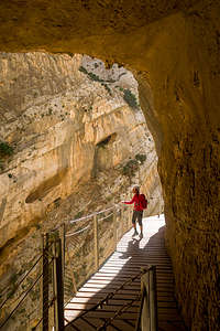 Lolo along the Caminito del ReyArdales is a town in the Andalusian region that lies on the beautiful Embalse del Conde del Guadalhorce, a huge reservoir that dominates the landscape and is a paradise for those looking for water recreation.
As if that isn’t a big enough draw to the region, Ardales is also home to the site of the legendary Caminito del Rey path that was once considered the most dangerous pathway in the world, as it goes along the sheer walls of the Garganta del Chorro, a 4-km long gorge that is 400 meters deep.
The original path, which was completed in 1905, was built to provide workers with a means to transport materials between two hydroelectric plants at either end of the gorge. The path, which was made of concrete resting on steel rails deteriorated over the years, resulting in large gaps bridged only by narrow steel beams that the workers had precariously walk across with the steep drop into the gorge below.
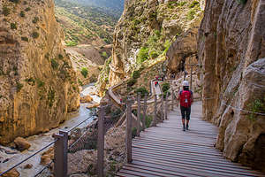 Lolo along the Caminito del ReyIn 1921 King Alfonso XIII crossed the walkway for the inauguration of the dam, giving the path its name with means “King’s path.”
Over the years, several people lost their lives falling off the walkway. After two more deaths in 1999 and 2000, the local government closed both entrances.
After a 9 million € refurbishment project in which 2.9 km of wide wooden boardwalks with handrails were installed, the newly safe El Caminito del Rey reopened in March of 2015. The new boardwalk that hangs 100m above the river, snakes around dramatic cliffs, providing breathtaking views all along the way.
Lonely Planet has listed it as one of its best attractions, so now it is so popular that you need to buy tickets in advance on their website.
- ‹ previous
- 7 of 20
- next ›
Ardales and the Caminito del Rey location map in "high definition"
Javascript is required to view this map.
