- Home
- About
- Map
- Trips
- Bringing Boat West
- Migration West
- Solo Motorcycle Ride
- Final Family XC Trip
- Colorado Rockies
- Graduates' XC Trip
- Yosemite & Nevada
- Colorado & Utah
- Best of Utah
- Southern Loop
- Pacific Northwest
- Northern Loop
- Los Angeles to NYC
- East Coast Trips
- Martha's Vineyard
- 1 Week in Quebec
- Southeast Coast
- NH Backpacking
- Martha's Vineyard
- Canadian Maritimes
- Ocracoke Island
- Edisto Island
- First Landing '02
- Hunting Island '02
- Stowe in Winter
- Hunting Island '01
- Lake Placid
- Chesapeake
- Provincetown
- Hunting Island '00
- Acadia in Winter
- Boston Suburbs
- Niagara Falls
- First Landing '99
- Cape Hatteras
- West Coast Trips
- Burning Man
- Utah Off-Roading
- Maui
- Mojave 4WD Course
- Colorado River Rafting
- Bishop & Death Valley
- Kauai
- Yosemite Fall
- Utah Off-Road
- Lost Coast
- Yosemite Valley
- Arizona and New Mexico
- Pescadero & Capitola
- Bishop & Death Valley
- San Diego, Anza Borrego, Joshua Tree
- Carmel
- Death Valley in Fall
- Yosemite in the Fall
- Pacific Northwest
- Utah Off-Roading
- Southern CA Deserts
- Yosemite & Covid
- Lake Powell Covid
- Eastern Sierra & Covid
- Bishop & Death Valley
- Central & SE Oregon
- Mojave Road
- Eastern Sierra
- Trinity Alps
- Tuolumne Meadows
- Lake Powell Boating
- Eastern Sierra
- Yosemite Winter
- Hawaii
- 4WD Eastern Sierra
- 4WD Death Valley +
- Southern CA Deserts
- Christmas in Tahoe
- Yosemite & Pinnacles
- Totality
- Yosemite & Sierra
- Yosemite Christmas
- Yosemite, San Diego
- Yosemite & North CA
- Seattle to Sierra
- Southwest Deserts
- Yosemite & Sierra
- Pacific Northwest
- Yosemite & South CA
- Pacific Northwest
- Northern California
- Southern Alaska
- Vancouver Island
- International Trips
- Index
- Tips
- Books
- Photos/Videos
- Search
- Contact
Queenstown
Thursday, February 20, 2025 - 8:15pm by Lolo117 miles and 2.5 hours from our last stop - 1 night stay
Travelogue
 Our lovely campsite in QueenstownOur itinerary was evolving as we went along. Originally we thought we would do an out-and-back to Queenstown to make the driving easier on Herb, but then we realized that we didn’t want to just repeat places we had already been to, when there was a whole western coast to explore.
So rather than spending 3 nights in Queenstown as we originally planned, doing hikes, a gondola ride, and a scenic flight / helicopter landing in Mount Cook, we decided to cut our Queenstown stop down to 1 day and then head over to and up the western coast to see new places. Plus we could still do a helicopter ride to a glacier in Fox Glacier.
 Onsen Hot PoolsPlus, Queenstown is a big city, which is really not our thing, especially with a campervan our size.
So, all we salvaged from our original Queenstown plans was a reservation at the Onsen Hot Pools Retreat and Day Spa, where we would soak in a lovely hot tub overlooking the Shotover River Canyon. We had tried to get a combination soak and massage, but the massages were all booked up
Fortunately, I had the foresight to reserve the Top 10 Holiday Park Campground, which was within walking distance to the Onsen Hot Pools for our 4:00 appointment.
 Onsen Hot PoolsThe photos of people soaking in one of their idyllic cedar-line hot tubs with beautiful panoramic views of the Shotover River is what lured me into this place.
Their website also stated that they offer a "Kiwi twist" on the traditional Japanese onsen experience. I had never had a Japanese onsen experience, or for that matter, any onsen experience at all, but it sounded great.
Basically a Japanese onsen places an emphasis on harmony with nature, which was accomplished here with the awesome views of the Shotover River canyon and surrounding mountains right from our pool.
 View from our Hot PoolThere were several pools to choose from, but I had reserved the Original Onsen Cedar Hot Pool, which was larger and round, rather than the newer oval tubs.
Each of the pools is filled with pure water from the surrounding mountains which is heated to approx. 38.3 degrees (101 Fahrenheit) - perfect.
We had 60 minutes to spend in our lovely private pool, gazing out at the lovely scenery.
We even saw a few of Queenstown's adrenaline-pumping jet boats go by in the Shotover River below us.
 View from our Hot PoolQueenstown is known as the adventure capital of New Zealand, and speeding along at 90 kph, making 360 degree spins on the river was one of them.
We much preferred sitting in our private hot pool sipping our complimentary Chardonnay and raspberry ice cream. We got enough adrenaline pumping just driving on the left side of the road on the narrow, winding, steep roads of New Zealand.
10 minutes before our time was up, a little bell rang warning us that our time was almost up.
It was just the right amount of time. We left feeling much more relaxed than when we had entered.
Te Anau (the second time)
Wednesday, February 19, 2025 - 1:30pm by Lolo72 miles and 4 hours from our last stop - 1 night stay
Travelogue
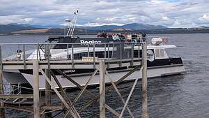 Our Te Anau Glowworm Tour BoatWe decided to get the challenging drive up to and through the Homer Tunnel today and spend the night in Te Anau at the same Top 10 Holiday Park we stayed in on our way into Milford Sound.
Along our drive to Te Anau, Herb and I discussed what we could do with our unexpected afternoon in Te Anau and both came up with the same answer - A Glowworm Tour.
I did a Google search on Te Anau Glowworm Tours and found that the best one was offered by RealNZ, so we booked a 2:00 pm one, which would give us time to check into our campground and walk down to the wharf where their boat would take us to the cave where they lived.
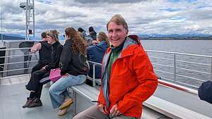 Herb on Lake Te AnauThe tour included a scenic cruise across Lake Te Anau to the western shores of the lake, where we were dropped off at the dock where the Te Anau Glowworm Caves are located.
The Te Anau Glowworm Caves, which we would be exploring today, are only a small, more recently formed section of the expansive 6.7-km Aurora Cave system, a network of limestone passages carved by underground streams and chemical reactions over 30 million years ago. In contrast the lower Te Anau Glowworm Caves were formed a mere 12,000 years ago and are only 250 meters long.
.thumbnail.jpg) Welcome to Te Anau Glowworm CavesAfter disembarking, we line up in groups of 8 to enter the caves. Unfortunately, no photographing was allowed in the caves because it disturbed the glowworms.
Welcome to Te Anau Glowworm CavesAfter disembarking, we line up in groups of 8 to enter the caves. Unfortunately, no photographing was allowed in the caves because it disturbed the glowworms.
Too bad because the caves were beautiful, with underground rock formations and even small waterfalls. It was totally dark except for a few well positioned spotlights on the more fascinating features.
.thumbnail.jpg) Into the CavesAfter walking for a short distance, our group of 8 climbed into a small boat which brought us into a dark grotto, where we were treated to a mesmerizing display of hundreds of glowworms hanging from the cave walls and ceiling, emitting their blue-green light, which they emit through a process called bioluminescence.
Into the CavesAfter walking for a short distance, our group of 8 climbed into a small boat which brought us into a dark grotto, where we were treated to a mesmerizing display of hundreds of glowworms hanging from the cave walls and ceiling, emitting their blue-green light, which they emit through a process called bioluminescence.
These "glowworms" are actually the larvae of a species of fly, Arachnocampa luminosa, which are unique to New Zealand.
The most interesting thing about them is the way they catch their prey. It’s quite creative:
Once they establish themselves on a cave surface, they create silk threads that they suspend below them. These threads are covered in sticky music and act as “fishing lines,” creating a trap for insects
They then use their bioluminescence to attract unsuspecting customers that are drawn to the light. When an insect flies towards the light and gets caught in the sticky threads, the glowworm senses the disturbance and reels in the thread.
Then it’s dinner time
Okay, that was an interesting and fun way to spend the day.
Milford Sound
Monday, February 17, 2025 - 9:15pm by Lolo72 miles and 4 hours from our last stop - 2 night stay
Travelogue
.thumbnail.jpg) Milford SoundMilford Sound was one of the few stops on our trip that we planned well in advance. You have to, because it's probably the most popular destination on the South Island. It is, afterall, the 8th Wonder of the World - at least according to Rudyard Kipling when he visited here in the 1890s.
Milford SoundMilford Sound was one of the few stops on our trip that we planned well in advance. You have to, because it's probably the most popular destination on the South Island. It is, afterall, the 8th Wonder of the World - at least according to Rudyard Kipling when he visited here in the 1890s.
There is only one campground in Milford Sound at the Milford Sound Lodge and it books up quickly, so I booked it 4 months in advance. It cost $120 a night NZ dollars, which is about $70 U.S., so a bargain to be able to stay in the 8th Wonder of the World.
The most popular thing to do in Milford Sound is to take a cruise on the Sound (which is really a fjord, but I’ll explain later).
.thumbnail.jpg) Our cruise shipThere are so many choices of cruise lines, but we chose the Small Boutique Cruise with Cruise Milford, because they have smaller boats with much fewer passengers than most of the other cruise lines. They advised that we book the first boat, which goes out at 8:30, because that is before the busloads of people arrive from Queenstown and Te Anau.
Our cruise shipThere are so many choices of cruise lines, but we chose the Small Boutique Cruise with Cruise Milford, because they have smaller boats with much fewer passengers than most of the other cruise lines. They advised that we book the first boat, which goes out at 8:30, because that is before the busloads of people arrive from Queenstown and Te Anau.
Another advantage of a small boat is that it can navigate closer to waterfalls, wildlife, and other points of interest, providing better opportunities for photography.
.thumbnail.jpg) Eglinton ValleyBut, I’m getting ahead of myself. First we had to get there. Although the drive from Te Anau to Milford Sound is only about 2 hours, it took us at least 4 hours with all the stops we made along the way.
Eglinton ValleyBut, I’m getting ahead of myself. First we had to get there. Although the drive from Te Anau to Milford Sound is only about 2 hours, it took us at least 4 hours with all the stops we made along the way.
The Milford Road is a major attraction in itself, winding through Fiordland National Park with stunning views of mountains, forests, valleys, and waterfalls along the way.
 Ancient Red Beech ForestOur first stop was Eglinton Valley, or better known to Lord of the Ring trilogy fans as Middle Earth, as some of the scenes in "The Fellowship of the Ring" were filmed in the mountains surrounding the valley to represent the Misty Mountains.
Eglinton is a classic, U-shaped glacial valley, carved out by glaciers over thousands of years. It is covered golden tussock and grasslands, providing a striking contrast with the dark mountains surrounding it.
Some Middle-Earthlings from a tour bus had beat us out into the Valley, so I just included them in my photo.
.thumbnail.jpg) Christie FallsA little further on, we stopped at Mirror Lake, known for its reflections of the surrounding Earl Mountains in the lake when conditions are calm and the lake is still.
Christie FallsA little further on, we stopped at Mirror Lake, known for its reflections of the surrounding Earl Mountains in the lake when conditions are calm and the lake is still.
Our next stop was a short walk along the Lake Gunn Nature trail, which passed through an ancient beech forest of moss-covered trees. A short side path led to a stony beach on Lake Dunn.
The next and last stop we made before getting to Milford Sound was Christie Falls, also known as Falls Creek Falls. From the parking right over the bridge, it’s just a short walk back to the falls, which can be seen right from the Milford Sound Road - no effort required.
.thumbnail.jpg) The rooty trail to the hidden fallsHowever, a tour bus driver in the parking lot told us that if we went up the trail to the left side of the falls and hiked for about a quarter mile, we would come to a hidden falls that few people knew about.
The rooty trail to the hidden fallsHowever, a tour bus driver in the parking lot told us that if we went up the trail to the left side of the falls and hiked for about a quarter mile, we would come to a hidden falls that few people knew about.
Okay, a quarter mile didn’t sound too bad, but what a quarter mile it was. We were basically hiking through a jungle up a very steep, barely marked trail, covered in roots from the surrounding trees. Those roots became my best friend because they served as handholds to get up, and later down, this ridiculous trail. Unlike Christie Falls there was much effort required, but it was worth it.
.thumbnail.jpg) The hidden fallsContinuing on, we came to the most challenging part of the road to Milford Sound - the Homer Tunnel. It’s single lane, so there is a traffic light to control which side can enter.
The hidden fallsContinuing on, we came to the most challenging part of the road to Milford Sound - the Homer Tunnel. It’s single lane, so there is a traffic light to control which side can enter.
The tunnel is three quarter miles long with a 1-in-10 gradient, meaning for every 10 meters of horizontal distance, the tunnel rises or falls 1 meter. On the way to Milford Sound we were descending in the tunnel and on the way back we were ascending.
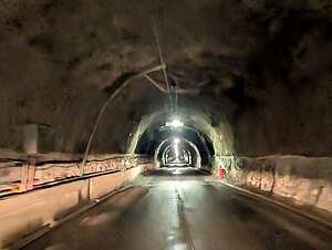 Homer TunnelThis combined with its single-lane width, narrowness, limited lighting, and hairpin bends immediately after exiting, makes it extremely stressful.
Herb was pretty much ready to just get to Milford Sound and park the car. Thank God, we decided to stay in Te Anau last night, rather than drive all the way here from Wanaka.
When we got to Milford Sound, it was too early to check into our campground, so we parked in the pay parking lot for cruise customers and walked the short distance to the cruise ships, so that we would know where we had to be by 8:00 tomorrow morning for our cruise.
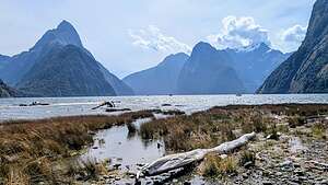 Milford Sound from Foreshore TrailThen we took a walk on what turned out to be a very rewarding trail called the "Milford Foreshore Walk." This is where we got our first glimpse of Milford Sound’s iconic Mitre Peak, rising 5,522 feet steeply from the water.
The name “Mitre Peak” was given by Captain John Lort Stokes of HMS Acheron, when he was surveying this area for the British Crown in the 1840s, when New Zealand first became a colony of Great Britain.
.thumbnail.jpg) Milford Sound from Foreshore TrailHe named it so because its shape reminded him of the mitre headwear worn by Christian bishops.
Milford Sound from Foreshore TrailHe named it so because its shape reminded him of the mitre headwear worn by Christian bishops.
There was a lot of bang for our buck on this short walk. Besides Mitre Peak, there was Bowen Falls, where the Bowens River plunges from a 162-meter cliff directly into Milford Sound.
In 1990, Milford Sound was designated as a World Heritage site due to its exceptional natural beauty and significant geological and ecological features.
.thumbnail.jpg) Calm morning for our cruiseWe walked back to the Campervan and drove to Milford Sound Lodge where we checked into our campsite, which was very lush, like in jungle lush.
Calm morning for our cruiseWe walked back to the Campervan and drove to Milford Sound Lodge where we checked into our campsite, which was very lush, like in jungle lush.
After a quick dinner, we walked back to the Foreshore Trail from our campground by going along a rocky trail to Deepwater Basin, past the Milford Sound Airport, and onto the Foreshore Trail.
.thumbnail.jpg) The smiles say it allThe Sound with the sun setting over Mitre Peak and Bowens Falls was even more lovely than this afternoon.
The smiles say it allThe Sound with the sun setting over Mitre Peak and Bowens Falls was even more lovely than this afternoon.
The next day we awoke to sunny skies - a good omen for our cruise on Milford Sound this morning. I had been tracking the weather in Milford Sound for the last 3 days, and the hourly forecast consistently showed a narrow window of sunny skies rom 8:00 am until noon today. All around it was rain.
.thumbnail.jpg) Good morning Mitre PeakWe were very, very lucky because Milford Sound is a very wet place, renowned for its very high rainfall, which averages over 22 feet per year, making it one of the wettest inhabited places in New Zealand and even the world.
Good morning Mitre PeakWe were very, very lucky because Milford Sound is a very wet place, renowned for its very high rainfall, which averages over 22 feet per year, making it one of the wettest inhabited places in New Zealand and even the world.
The Sound is surrounded by a temperate rainforest, meaning it experiences moderate temperatures in addition to high rainfall. That’s what makes the waterfalls so spectacular.
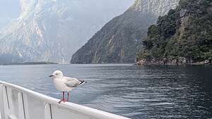 A little visitor to our shipWe drove back to the cruise ship passenger parking lot and walked over to the wharf where the cruise ships left from. Ours was the cute tiny one all the way on the left - well at least small compared to the larger ones docked nearby.
As I mentioned above, we had chosen the Cruise Milford “Boutique” Small Boat Cruise, because, although the ship can hold 150 passengers, they limit it to a maximum of 75, and usually that’s even smaller, especially if you go on the early morning cruise before the busloads of tourists arrive from Queenstown and Te Anau.
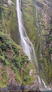 Stirling FallsI would estimate that our ship had about 40 passengers that morning, allowing for room along the railiings to take unobstructed photos.
One of the first things we learned aboard the ship was that Milford Sound was incorrectly named in that it is not a “sound” at all, but rather a “fjord.” Sounds are formed when a river valley is flooded by the sea, which was not what created Milford Sound.
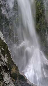 Stirling Falls up closeIn contrast, a fjord is a narrow inlet created by glacial erosion and surrounded by steep cliffs and rock walls carved by those glaciers. So, we were more correctly on a cruise on "Milford Fjord."
Maybe it would be best to just call it by its Maori name Piopiotahi, which in Maori means “a single piopio.” A piopio is a now extinct New Zealand bird. According to Māori legend, when the demigod Māui died while attempting to gain immortality for humankind, a piopio flew to Milford Sound to mourn his passing. Thus, the name reflects this act of mourning and connects this stunning landscape to a story of loss and remembrance.
The cruise, which lasted about an hour and 45 minutes took us up along the western (left) shoreline first, providing us close-up views of the very impressive Mitre Peak.
It then proceeded up the entire length of the Sound to the mouth, where it opens into the Tasman Sea. From there, we turned around and went along the eastern shoreline.
.thumbnail.jpg) Getting a glacial facial at Stirling FallsA true highlight of the cruise was our closeup encounter with Stirling Falls, which plunges 495 feet down a steep cliff face. The falls cascade from a "hanging valley," which is a valley carved by glaciers that ends abruptly high on a mountainside, creating a dramatic effect.
Getting a glacial facial at Stirling FallsA true highlight of the cruise was our closeup encounter with Stirling Falls, which plunges 495 feet down a steep cliff face. The falls cascade from a "hanging valley," which is a valley carved by glaciers that ends abruptly high on a mountainside, creating a dramatic effect.
Our captain brought us right up close to the falls where we could feel its spray and receive what is known as a “glacial facial.” Some of my favorite photos of our entire trip are long exposure close-ups of the water crashing into the Sound.
We then continued back to the wharf passing a few fur seals along the way.
The cruise had been well worth it and I was so thankful we took the early one, because as we walked back to our campervan, it began to rain and hard. That little window of sunshine that I had been tracking for days was right on..
.thumbnail.jpg) Dinner at Pio PioLater that evening we had dinner at PioPio, the restaurant at the Milford Sound Lodge. They promised world-class dining in World Heritage location. They certainly delivered. The setting was lovely, the service was perfect, and the food was delicious.
Dinner at Pio PioLater that evening we had dinner at PioPio, the restaurant at the Milford Sound Lodge. They promised world-class dining in World Heritage location. They certainly delivered. The setting was lovely, the service was perfect, and the food was delicious.
I had the Duo of Central Otago Lamb (low cooked and charred lamb rump, lamb shank rillette, parsnip foam, bordelaise sauce, wild mushroom, pureed swede, potato fondant). I am a bit embarrassed to say, but it was my first lamb, and definitely my first parsnip foam (whatever that was).
Herb had the Canterbury Duck Breast (red cabbage & apple puree, fig & port Jus, duck fat potato fondant, charred baby carrots, beetroot disks, black pudding, broccolini).
Herb and I agreed that this was one of the best meals we had had in a long time.
That night we slept to the pitter patter of rain hitting the roof of our campervan. Very cozy.
The next morning it was still pitter pattering, but even harder, and forecast to do so for much of the day. We had hoped to take the water taxi to the Milford Track to do a hike to a waterfall today, but that didn’t sound like much fun in the rain. Plus, I was very satisfied with the incredible waterfalls we had seen here already.
So, we decided to get the challenging drive up to and through the Homer Tunnel today and spend the night in Te Anau at the same Top 10 Holiday Park we stayed in on our way into Milford Sound..
Te Anau
Sunday, February 16, 2025 - 9:45am by Lolo150 miles and 3 hours from our last stop - 1 night stay
Travelogue
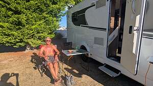 Camping in Te AnauGlendhu Bay was a good decision. Otherwise, we would have had an extremely stressful 5 hour challenging drive to Milford Sound the following day.
Even our 3 hour drive to Te Anau was very stressful in that Google Maps directed us over the Crown Range to get to Queenstown, a highly scenic, but highly steep and stressful road. In fact, we later found out that campervans were not even supposed to be on this road.
It had been a long day, starting in Glendhu Bay, then e-biking from Lake Hawea to Lake Wanaka, and now here we were in the lovely town of Te Anau, the gateway to Fiordland National Park.
Set on the shores of lovely Lake Te Anau, it is a destination in itself, but for us it was just a convenient stopover on our way to Milford Sound.
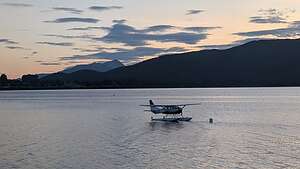 Sea plane on Lake Te AnauWe stayed in a Top 10 Holiday Park, kind of like the KOAs of New Zealand - clean, great facilities, etc.
We didn’t have much time here, so all we did was take a walk down to and along the lake, which is the largest in the South Island.
There were sea planes in the lake and helicopters on docks along the shoreline. Every town on the South Island has its share of aerial tours. It’s a great way to see the Southern Alps. We would have our chance of a helicopter ride to a glacier when we got to Fox Glacier.
The next morning it was on to Milford Sound, where the drive alone was supposed to be one of the most beautiful in New Zealand.
Wanaka
Friday, February 14, 2025 - 8:30pm by Lolo137 miles and 2.75 hours from our last stop - 2 night stay
Travelogue
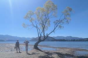 #ThatWanakaTreeSo far, we had pretty much been following our son’s itinerary from his trip here a few months back. We are very similar to him in what we like to see and do and where to eat, so it had been extremely helpful.
Wanaka was a particular favorite of theirs, so they had lots of suggestions for us.
We were not going to be camping in town, but rather about 15 minutes past at the Hampshire Holiday Park directly on Glendhu Bay. That location had the advantage of being right on Lake Wanaka, as well as in close proximity to two of the hikes we were considering - Roy’s Peak and Diamond Lake / Rocky Mountain track.
 Federal DinerWhen we got to Wanaka, we found that the road to Glendhu Bay was closed for the next few hours while they prepared the race course for the half triathlon that was happening tomorrow.
We had things we wanted to do in town anyway, so it was no real hardship - except for finding a parking space for a van our size. The town was really bustling, I guess because of the triathlon.
One of the first orders of business, as per our son’s recommendation, was to stop in at the Isite Visitor Information Center in town to reserve e-bikes for the day after tomorrow with Wanaka Bike Tours. They have a shuttle that drives you and the bikes up to Lake Hawea and then you bicycle the 18 miles back to Lake Wanaka.
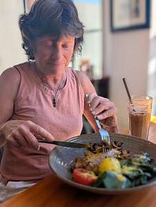 The Buddha Eggs BenedictThe road to Glendhu Bay still wasn’t open, so we took another one of his recommendations and went to the Federal Diner for lunch.
That boy knows his food. The Buddha Eggs Benedict was to die for - organic eggs, spinach, mushrooms, and roasted tomatoes. Herb had the French Toast.
After lunch, we walked along the lakeshore to visit the Wanaka Tree, the most photographed trees in New Zealand, largely due to its solitary position in the lake, with the backdrop of the Southern Alps, creating a stunning visual.
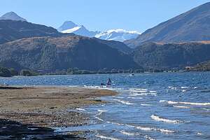 Our campground at Glendhu BayIts rise to fame is relatively recent, with increased attention following a 2014 award-winning photograph. Then came social media, and thousands of posts with the hashtag “ThatWanakaTree.”
While this lovely willow tree is usually about 50 yards offshore, today it was actually about 10 yards onshore. Not sure if that is typical of late summer or a result of climate change or a drought.
The crowds didn’t seem to care, as people lined up to take their photo beneath it. We, of course, did so as well.
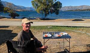 Dinner at our campsiteBy now the road to Glendhu Bay had reopened, so we headed towards the Hampshire Holiday Park campground, right on Lake Wanaka. It was a lovely setting.
This was definitely a campground frequented by New Zealanders, specifically those with watercraft of any kind. There were power boats, jet skis, kayaks, and SUPs, and even a beach for swimming.
That evening we set out our camp table and chairs, which faced the lake, and enjoyed our Mount Cook sashimi, cheese and crackers, and wine.
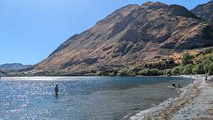 Quick swim in Glendhu BayOne of the reasons we had chosen this campground was because it was located close to the trailhead for one of New Zealand's most famous, as well as most challenging hikes - Roy’s Peak, a 10-mile hike with over 4,200 feet of elevation gain. It takes about 7 hours to complete, and with the heat of the summer, they recommend starting at 4:30 am.
I admit to feeling intimidated by this hike, but fortunately I got a great excuse to not do it while still saving face. The road outside our campground would be closed until 1:00 pm because the bicycle portion of the half marathon they were setting up yesterday was going right by. Oh well, too late to do the hike. Plus, it was like 85 degrees out.
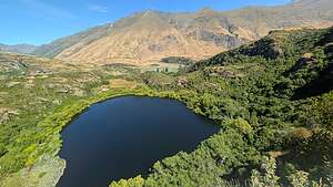 Diamond LakeInstead, once the road opened we decided that we would do a different hike that our wonderful son recommended - the hike to Diamond Lake and Rocky Mountain, the trailhead for which was also close by.
This one was a more realistic (for me) 5-mile hike with 1,644 feet of elevation gain. However, because of its rocky terrain, it is still considered a challenging hike.
In the meantime we had some time to kill before the campground gates opened, so I took a brief swim in the lake and then we walked out to the road to watch the bicycle portion of the half marathon go by.
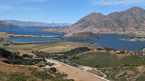 Lake Wanaka ViewpointOnce that was over, we headed over to the trailhead for the Diamond Lake and Rocky Mountain hike which was just 10 minutes away at the Diamond Lake Conservation Area.
From the parking lot, we headed up a moderately steep gravel road until we came to a fork in the trail. We could have gone either left or right as this was the loop trail around Diamond Lake. We took the left but the right would have worked as well.
From there, the trail began to ascend up a series of wooden steps, and after about another 10 minutes we came to Diamond Lake Bird View where we enjoyed a view overlooking the lake with some lovely mountains behind.
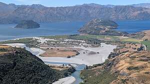 From the summitA short distance afterwards, we reached another split in the trail. Every trail guide we read recommended going right and taking the steeper route up. Plus, that was the side that had all the great views over Lake Wanaka. To make it a loop, we would come down the left side.
After taking the right trail, we came to our first views of Lake Wanaka. At about 1.25 miles we followed a spur trail to the right to the Lake Wanaka viewpoint where there was a beautiful panoramic view of the lake and surrounding mountains.
Once back on the main trail, we continued up towards the summit of Rocky Mountain, where the trail got steep and more rocky.
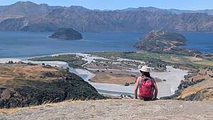 From the summitAt the 2-mile point we came to another trail junction. We took the right for more views over Lake Wanaka.
The last half mile up to the summit was the toughest. The trail narrowed and climbed a series of switchbacks, often requiring some rock scrambling.
Once atop the summit, there was of course another breathtaking panoramic view. It was so windy that we didn’t linger long.
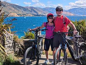 Ready to e-bikeWe descended via the other track as we wanted to make it a look, even though we didn’t have any views of Lake Wanaka this way. No worry, as I already had about a hundred photos from the way up.
I am so glad we chose to do this hike. Although Roy’s Peak has a spectacular finish, the Diamond Lake and Rocky Mountain hike has great views of Lake Wanaka and the surrounding Southern Alps the whole way. Plus, it is a lot less grueling.
Tired and happy, we returned to our campsite on Glendhu Bay for a well-earned glass of wine.
 Hawea WaveThe next morning, we drove into Wanaka where we would meet at the iSite Visitor Center to meet our e-bike shuttle to Lake Hawea.
We had some time to kill, so we went for breakfast at the Federal Diner again. This time we both had the Buddha Eggs Benedict.
At 10:30, we met Stu from Wanaka Bike Tours who drove us and another couple up to Lake Hawea where we would start our e-bike ride back to Lake Wanaka.
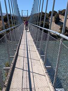 Bridge over Clutha RiverAlong the way, he rattled off directions for us to follow that completely went over our heads. Fortunately, Herb had the Gaia app with the aid of which we would be able to find our way.
He dropped us off at the southern end of Lake Hawea, another beautiful, bright blue lake with mountain scenery surrounding it.
The start of the ride pretty much followed the Hawea River Track for the first 9 miles, along a riverside trail with beautiful landscapes along the way.
Using the power of the e-bike made any hills just melt away. It was so much fun. I had ridden an e-bike before in San Francisco, but this was Herb’s first time.
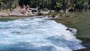
About 5 miles into our ride along the river, to our surprise we came upon a surfer riding a wave in the Hawea River. Unbeknownst to us at the time, we had stumbled across the Hawea Wave," also known as the Hawea Flat Whitewater Park.
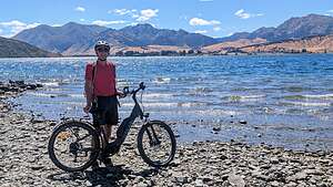 Along the Hawea to Wanaka rideThis park features two man-made river waves for kayakers, surfers, rafters, and boogie boarders.
At around 9 miles (the halfway point) we came to the Clutha River, where there was a short side trip into the highly recommended Pembroke Patisserie, a French Bakery in the small village of Albert Town.
Defying Tommy’s recommendations for the first time, we decided to skip because we were in a bit of a hurry because we still needed to drive 3 hours to Te Anau when we got back to Wanaka.
This required riding over a narrow bridge over the Clutha River. There was about 2 inches to spare on either end of my handlebars, so I freaked out a little but made it over okay. I kept telling myself that if my son could do this while trailering his little 9-month old daughter behind it, I should be fine.
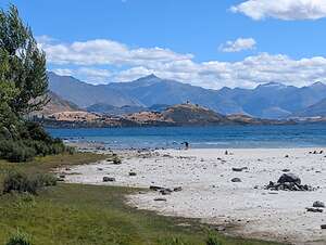 Almost backAfter that, we were on the Outlet Track, a beautiful dirt trail through a forest, which traced the shores of the Clutha River. As the trail narrowed in sections to single track (only one bike wide), I once again questioned how (and why?) my son was able to get my granddaughter through here in her little trailer behind him.
I think it was called the Outlet Track, because we eventually reached its source at Lake Wanaka.
From there we continued along a very picturesque lakeside trail leading us back along the lovely shores of Lake Wanaka into the town. Then we locked up our bikes where Stu from Wanaka Bike Tours told us and texted him that we were done.
I then immediately texted my son to thank him for telling us about this amazing ride and gave him big kudos for maneuvering his 9-month old daughter through it.
Before this, Herb and I were seriously considering buying e-bikes, but this ride clinched it.
Mount Cook National Park (Aoraki)
Wednesday, February 12, 2025 - 6:45am by Lolo67 miles and 1.5 hours from our last stop - 2 night stay
Travelogue
 Lake PukakiHerb and I had decided before we left that to gain the most flexibility in our itinerary I would double-book some nights in two different campgrounds. That way we could decide on the fly whether we wanted to stay or move on.
In this case, we had both Lakes Edge Holiday Park Camping Ground in Lake Tekapo and White Horse HIll Campground in Mount Cook booked for Van Night 2.
Since we had completed Mount John Loop hike, which was the main thing we wanted to do in Lake Tekapo, pretty early in the day, we decided to move on to Mount Cook, where we had 3 nights reserved. There our main event would be hiking the extremely popular and beautiful Hooker Valley Track, hopefully tomorrow if the weather cooperated.
 The TahrThe hour and a half drive from Lake Tekapo to Mount Cook is an event in itself. Renowned for its breathtaking scenery, it is considered one of New Zealand's most spectacular routes.
Most of the drive traces the shores of stunningly beautiful, turquoise blue Lake Pukaki, a glacial lake formed during past ice ages from the glaciers flowing down from the Southern Alps, carving out the valley that now holds the lake.
As these glaciers retreated, they left behind deposits of rock and sediment known as terminal moraines, which act like natural dams, blocking the valley. Then over the years, meltwater from the glaciers gradually filled the valley, creating Lake Pukaki.
 Lavender Ice Cream - Yum!The lake's stunning, bright turquoise color comes from finely ground rock particles carried into the lake by meltwater from the Tasman Glacier. These particles, known as “glacial flour,” are suspended in the water, and they reflect sunlight, giving the lake its unique hue.
Fortunately, today there was plenty of sunshine to reflect off the lake. I wish we had stopped to take more photos at one of the many viewpoints along the way, because on the way back, it was cloudy, and it pretty much looked like just an ordinary alpine lake.
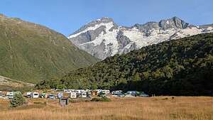 White Horse Hill CampgroundWe did make two important stops though, the first of which was the Mount Cook Alpine Salmon Shop, highly recommended by our son, daughter-in-law, and 9-month old salmon-loving granddaughter, who had traveled here a few months back.
The salmon shop farms their King Salmon in the pure, cold, glacial waters that flow from the Southern Alps, near Aoraki/Mount Cook. Roughly 2 million gallons of pure glacier-fed water passes through the farms every minute, creating a refreshed environment for the fish. No hormones, vaccines, pesticides, or antibiotics are used.
 Our campsite viewPlus, they have to constantly swim against the flowing ice-cold water (kind of like being on a fish treadmill), which keeps them healthy and fit with minimal solid stored fats. As a result, they have a more subtle taste and delicate texture than any other salmon.
We bought two packages of sashimi for dinner tonight and some smoked salmon to put on our bagels in the morning.
 First swing bridgeThere was a statue of an animal that I did not recognize, but the lake looked so stunningly blue behind him that I just had to take his photo. Then I read the plaque.
The tahr is a native of the Himalayan mountains that was introduced to New Zealand in 1904 as a way to attract tourists for recreational hunting, which seemed like a good idea at the time. With no natural predators, the tahr thrived in New Zealand and its population exploded, wreaking havoc on the native ecosystems. Now the Department of Conservation (DOC) tries to manage their numbers.
Continuing on,we stopped at the NZ Alpine Lavender Farm, another recommendation from our son. Fortunately for them, the lavenders were in full bloom in December, but pretty much faded by the time of our visit in late February.
 Crossing the first swing bridgeStill, the main reason for their stop, and ours, was the lavender ice cream that they sold. I admit to being a skeptic at first, because we couldn’t picture lavender tasting very good, but for my granddaughter, we would give it a shot.
There were a surprising number of flavors to choose from: Lavender Vanilla, Lavender Blueberry, Lavender Mango, Lavender honey, chocolate and lavender, and mixed berry and lavender.
 Hooker River from the bridge admit to being tempted by my usual go-to chocolate, but the woman serving ice cream encouraged me to try one of their more popular flavors, so I had the Mixed Berry and Lavender and Herb had the Lavender Vanilla. Good choice.
From there we continued up along the lake, stopping first at Mount Cook Village, which was a bit of a zoo - Mount Cook is an extremely popular destination.
So, we didn’t stay long before continuing on to the White Horse Hill Campground at the end of Hooker Valley Road,where we had a reservation for three nights.
There are no assigned sites in this campground, so it was a bit of a free-for-all to get a spot where we could squeeze in our camper van. It was already after 5:00 pm, so most of the spots had already been taken.
 3rd swing bridgeThis was not a commercial campground, but rather one run by the Department of Conservation, so the facilities were pretty spartan. However, the real attraction was the phenomenal scenery right from our campsite and the easy access to the very popular Hooker Valley Track.
We immediately took out our camp chairs and faced them towards the snow-covered mountain towering over the campground. At first I thought we were looking at Mount Cook, but later found out that it was 10,338-foot high Mount Sefton (200 feet Mount Cook’s junior).
 Mount Cook at lastFrom there we had a glass of wine, cheese and crackers, and our delicious sashimi salmon from Lake Pukaki.
The Hooker Valley Track, as I mentioned, is one of the most popular hikes in New Zealand, but since we were camping near the trailhead for the hike, we were able to get an early start and get ahead of the crowds.
The track follows the Hooker Valley floor for 3.5 miles (each way) to Hooker Lake.
The trail is mostly flat, with a few gentle inclines, and goes along gravel paths and boardwalks.
 Hooker LakeAfter about a mile we looked down at the first of three swinging bridges over the Hooker River that we would cross. I’m glad we took a picture of it from above, because trying to a picture while on the bridge was pretty challengings because it was bouncing up and down from the foot traffic.
To the left of the bridge was the glacial Mueller Lake. Both the River and the Lake were colored by the same “glacial flour” as Lake Pukaki.
About ½ mile later we came to the second swinging bridge over the Hooker River. One more swinging bridge o go.
 Brave bathersAfter about an hour of walking, we reached a wooden boardwalk and were treated to our first views of 12,218-foot Mount Cook.
The Maori name for the mountain is Aoraki, which means "cloud piercer," an appropriate name since the summit of Mount Cook is often hidden in the clouds. Fortunately for us, the mountain was No Aoraki today with clear blue skies.
 Hooker LakeAfter 3.5 miles, we arrived at the beach on turquoise blue Hooker Lake. I watched as 4 people clad in bathing suits marched into what had to be some pretty cold water. On a count of 3, they all submerged their whole bodies and then quickly ran to shore to fetch their towels. Ahh..to be 30 again.
On the 3.5 mile walk back to the campground, we passed a constant stream of hikers. I was so glad that we started early enough to pretty much have the trail to ourselves.
 The way backIt was only about 1:00, so we decided to drive over to the trailhead for the Tasman Glacier View and Blue Lakes hike, a short 40-minute walk for views of the Glacier and a terminal lake with icebergs.
Unfortunately, when we got there, the trail was closed, so we took the only trail that wasn’t blocked. It did eventually bring us out to Tasman Lake where there was one small lonely iceberg.
I hope this wasn’t a sign of climate change but rather the way things are in late summer.
 Iceberg on Tasman LakeWhen we drove back to the campground, it was less crowded, so we picked a little more spacious campsite than we had last night.
The next morning, although we had another night booked at White Horse Hill Campground, we decided to move on to Wanaka, our next planned stop.
Our main goal here had been to hike the Hooker Valley Track, and we had done it in the absolute perfect conditions. Lucky for us, because today was starting off very cloudy, which means the lakes and Hooker River might not be turquoise blue and Mount Cook might truly be Aoraki today, as its summit most likely would be in the clouds.
 Peter's LookoutWe had to retrace our drive along Lake Pukaki to get to Wanaka, and felt fortunate that we had seen it yesterday because the cloud cover was blocking the “glacial flour” in the lake from reflecting its turquoise blue.
There are many lookouts along Lake Pukaki, but Peter’s Lookout is supposed to be the best, so we stopped and took the short walk down to the shores of the lake. Wow! It was a beautiful spot with an interesting shoreline.
I can only imagine how beautiful this very spot would have been yesterday when the sun was shining brightly, reflecting off that “glacial flour,” painting the lake a vibrant turquoise.
We made just one more stop to pick up more sashimi at the Mount Cook Alpine Salmon Shop.
Lake Tekapo
Tuesday, February 11, 2025 - 6:15pm by Lolo140 miles and 3 hours from our last stop - 1 night stay
Travelogue
 Church of the Good ShepherdWe had chosen Lake Tekapo as the first destination on our South Island adventure, because we thought 3 hours would be a good amount of time for our first day on the road. Unfortunately, those 3 hours turned into 6 when our van broke down and required replacing the battery.
Undaunted - well maybe a little daunted - we forged on and got to the famous Church of the Good Shepherd, by 7:00 pm.
We were not alone as this is one of the most photographed buildings in New Zealand, and it’s easy to see why.
 View of Lake Tekapo from the ChurchThe church is a simple one, constructed of local stone, which blends seamlessly with the surrounding mountains.
Its setting is stunning - set on the shores of the turquoise waters of Lake Tekapo with a backdrop of the Southern Alps.
Unfortunately, we could not go inside where there is a large window behind the altar with stunning views of the lake and mountains.
 The Sheep Dog MemorialIt was impossible to get a photo of the church without hordes of people in front of it, so we gave up and embraced the current situation, which included pretty girls in white dresses posing in front of it. I believe they are called “influencers” that try to get likes and followers on social media.
Right next to the church there is a bronze statue of a sheep dog, a tribute to the working sheep dogs that played a vital role in the development of the Mackenzie Country’s farming industry.
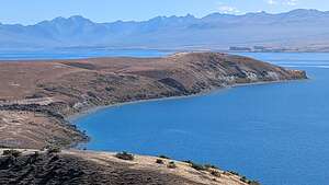 Along the Mount John Loop TrailBack in 1855, a Scot named James Mckenzie brought 1,000 sheep (most likely stolen) to the secluded pastures in this area. He was a bit of a colorful character and spent several months in jail before, escaping a few times, before he was eventually pardoned.
He was, however, a master herdsman of sheep and he and his loyal sheep dogs played an important role in establishing sheep farming in the region, which has been a crucial part of the area’s economy.
 Along the Mount John Loop TrailI assume the name Church of the Good Shepherd came from James McKenzie, probably because it sounds better than Church of the Scofflaw Shepherd.
It had been a very long day (van pickup, van breakdown, driving for the first time on the left side of narrow, windy roads, etc.), so we drove directly to the Lakes Edge Holiday Park Camping Ground, where we had a reservation for 2 nights.
 Along the Mount John Loop TrailWe were packed in pretty tightly next to our neighbors, but we did have a view of the lake, which we were able to easily walk down to.
The next morning, we set off right from our campground to hike the 6.5-mile (with 1,254-foot elevation gain) Mount John loop trail.
We decided to do the loop in a counter-clockwise direction, which meant that the first half of our hike traversed the hilly grasslands overlooking beautiful turquoise-blue Lake Tekapo, with the Southern Alps of Mount Aspiring National Park in the background. It was absolutely breathtaking.
 Along the Mount John Loop TrailFrom the top of the loop, where the trail U-turned back south, there was a beautiful peninsula jutting out into the lake with trails going to its end. It was so tempting to follow those trails, but it meant a lot of extra miles going down a steep grade and then back up again, so we stuck to the original plan.
There were also two lovely turquoise blue small lakes to the north of us.
Although we were at the top of the loop, we still had another mile and 800 more feet of elevation gain to conquer before reaching the summit.
I didn’t see how the view at the summit could be any better than this one.
From here the trail really did start to climb up a pretty steep grassy hill, where we got our first sight of the silver domes, which house the telescopes of the Mount John University Tower.
 Along the Mount John LoopThe summit of Mount John is part of the Aoraki Mackenzie International Dark Sky Reserve, renowned for its exceptional stargazing conditions because of the lack of light pollution.
It's a working astronomical research observatory and it’s very popular for the Dark Sky Project’s stargazing tours, where visitors see the night sky through the powerful telescopes within those domes.
Unfortunately, we planned to move on to Mount Cook today after we finished the hike, so we would not be able to stay for a tour. Besides, I think they require a reservation and fill up quickly on a clear night.
 Along the Mount John Loop TrailWe did have time, however, to partake in the Astro Cafe atop the summit, near the Observatory. The 360-degree panoramic views from the cafe of Lake Tekapo, the Southern Alps, and the Mackenzie Basin were pretty spectacular.
We bought coffee and the last two meat pies in the cafe and soaked in the views from a picnic table outside the cafe.
From there it was all downhill back to the campground.
Since it was only about 1:00 and we had done everything we wanted to do at Lake Tekapo, we decided to take a shower at our Lake Tekapo campground, since we were already paying for this night, and then move on to the White Horse Hill Campground in Mount Cook National Park.
I confess to being a bit paranoid about arriving at a full campground, so I had double booked both the Lake Tekapo and Mount Cook campgrounds, so we could be flexible.
It was a pattern that I would repeat several times during the trip..
Wilderness Motorhome Rentals
Tuesday, February 11, 2025 - 8:00am by Lolo0 miles and 0 hours from our last stop
Travelogue
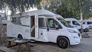 Our CampervanThis was it. The big day where we'd pick up our camper van and begin our 15-day road trip around the South Island of New Zealand.
This was not our first time traveling abroad via camper van. We had traveled around the Alps (Germany, Austria, Northern Italy, and Switzerland), Spain, and Iceland’s Ring Road.
However, each of those trips had been in a 6-meter van. This time the only van we could get was a 7.4-meter one that slept 4 people - much more space than we needed. That extra 5-feet was definitely going to make parking and driving a lot more stressful on the narrow, steep, windy roads of New Zealand. Plus, we had to get used to driving on the left side of the road.
It was pretty spacious though and had a king-size bed and a separate toilet and shower. Still we would have gladly taken a smaller one.
One might think a camper is an inexpensive way to travel, but it’s really not. Our van cost $4,650 dollars for 15 days, which is $310 per day. Then there is the campground fees, which probably averaged about $30 per day. You can get a pretty nice Airbnb in New Zealand for that price.
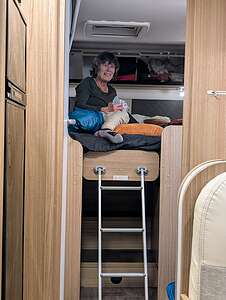 Up in my bedroomStill, we like that mode of travel. We don’t have to pack and unpack every time we move to a new location, and we always have a refrigerator full of cold beer and wine. Also, the campgrounds in New Zealand are usually in very scenic locations.
The first destination of every campervan trip is a grocery store to stock up for a few days. Sometimes grocery stores in different countries are a bit challenging, but the Woolworth’s near the rental place felt pretty much like a U.S. grocery store.
So, excited and a bit nervous, we set out for our first destination, which was Lake Tekapo, 3 hours away.
After about an hour on our way, the camper decided to die at a stoplight along a busy 2-lane highway in Ashburton. It was not a particularly safe place to be stuck as cars were coming pretty fast and we were afraid we might be rear-ended.
The manager from the Toyota dealership nearby came running out, told us to get out of the vehicle and started waving traffic around us. He said the same thing had happened two days ago and the people had gotten rear-ended. He then got one of his guys to come tow us off the road. The hospitality in New Zealand is pretty amazing.
We had already put in a call in Wilderness Motorhomes Road Side Assistance to let them know what happened. When the mechanic showed up, he said that our battery was totally dead and would not hold a charge. We would have to get a new one, which was not an easy thing.
We spoke to a woman at Wilderness Motorhomes, and she suggested we drive back the hour to Christchurch or drive 1.5 hours south to Timaru to try to get a battery there. When I mentioned that we were afraid to do that as the battery could just die again, she suggested that we just don’t stop.
We told her there was no way we were going to do this, as it was not safe, and that it was their responsibility to bring a battery to us. I must have raised my voice a bit, because she said, “If you are going to raise your voice, I’m going to hang up.”
New Zealanders are extremely friendly and polite, and I guess they expect to be treated the same. I apologized and she said she would call us back with a solution.
Our road-side mechanic was a hero. He very persistently called around for a battery and found one in a shop 5 minutes away.
He charged our battery so we could get to the battery shop, and an hour later we were on the road again with a brand new battery.
I was so relieved. We had lost a few hours, but our trip was saved!
Christchurch
Sunday, February 9, 2025 - 12:30pm by Lolo0 miles and 0 hours from our last stop - 2 night stay
Travelogue
 Observatory Tower HotelNot wanting to immediately dive into our campervan adventure, we booked our first two nights in New Zealand at the Observatory Hotel in Christchurch, which had a great location, in proximity to museums, the botanical garden, and lots of restaurants.
The Observatory Tower, which we stayed in, was originally part of the University of Canterbury campus and once housed the Townsend Telescope.
 Our room at the Observatory TowerBesides the tower, the old campus contained several Gothic Revival buildings, constructed in 1896. It reminded me so much of Ivy League campuses in the U.S., such as Princeton and Yale.
When the University of Canterbury campus moved to the Christchurch suburb of Ilam in 1975, the current buildings were gifted to the people of Christchurch and became the Arts Center of Christchurch, a vibrant hub for arts and culture. Today there are art galleries, a cinema, a great hall where concerts are held, and much more.
Unfortunately, the 2011 6.3-magnitude earthquake in Christchurch resulted in massive destruction to much of Christchurch, including the Observatory Tower, which collapsed, as well as most of the other buildings on the old campus.
 Observatory Tower ParlorA major restoration project was undertaken, and in 2022, the restored buildings were transformed into the Observatory Hotel. Although the transformation to a hotel required some modernization, they did a great job of respecting the history of the building, making us feel like we could have been students back in 1896.
Upon arrival at the Observatory Tower, we took a quick nap before heading out to explore the city. I felt like a little munchkin in the bed looking up at the 18-foot-high ceilings.
 Art Gallery Te Puna o WaiwhetūOur first order of business was visiting Christchurch’s famous Art Gallery Te Puna o Waiwhetū, which in Maori means "the wellspring of star-reflecting waters." This name holds deep cultural significance for the Maori people, connecting the gallery to the land and its history.
The museum, which is now one of my favorites, is free and contains a broad range of art mostly focusing on art from the Canterbury region of New Zealand and New Zealand as a whole, including Maori art and contemporary works that reflect the country's diverse cultural landscape.
 Art Gallery Te Puna o WaiwhetūThe building itself was a work of art, featuring a striking, flowing glass and metal facade, which is intended to evoke the koru and flow of Christchurch’s Avon River. Koru is the Maori word for a spiral shape that symbolizes new beginnings, growth, and harmony. It's a key symbol in Māori art, carving, and tattooing.
Once inside, I was totally blown away by two hyperrealistic sculptural pieces, where the people were so unbelievably realistic that I wanted to strike up a conversation with them - although they both looked quite absorbed in what they were doing.
 "Woman and Child"Both of them were made from silicone, and meticulously inserted human hair. The wrinkles and sagging skin of an elderly person, the protruding veins, and facial expressions were so unbelievably lifelike - I could relate to.
The first one was called "Woman and Child" by Sam Jinks.
It depicts an elderly woman holding a baby with such tenderness that I would have loved to know their story. Being a recent grandma myself, I assumed the woman was the child’s grandmother.
 “Chicken / Man”The second one was called “Chicken / Man.”
It depicts a naked, paunchy elderly man, clad only in tidy whities, sitting at a table with his feet braced heavily against the floor, seemingly having a staring contest with a younger sprightly chicken glaring back at him.
They looked like two combatants waiting for the other to back down. I wasn’t sure who I was rooting for.
I could go on and on about the interesting works in this museum, but there was so much more to see in Christchurch.
 AmazonitaWe hadn’t eaten anything since we got off the plane, so we wandered over to the Riverside Market, along the River Avon, which has lots of restaurants, cafes, and bars. Unfortunately, most of the restaurants close around 5:00 pm, so we went back out and walked north on Oxford Terrace along the Avon River looking for the liveliest restaurant we could find.
The Amazonita had live music outside and a bustling crowd inside. We managed to get one of the last tables. We started with a glass of wine and admired the brightly colored murals of birds and vegetation on the wall, which I assume were typical scenes that you would find along the Amazon. Dinner was excellent.
 Peacock FountainRecharged, we headed over to the Christchurch Botanical Gardens, located right across the street from our hotel.
At the entrance to the Gardens is the beautiful and iconic Peacock Fountain. Made of bronze and marble. Standing 25-feet tall, this large circular fountain with a central column that sprays water in all directions, surrounded by a ring of smaller fountains. It is adorned with herons, playful dolphins, and large lily leaves.
Where were the peacocks? I wondered, only to find out later that Peacock was the surname of the man who funded the fountain and gave it as a gift to the city in 1911.
The fountain is recognized as a fine and somewhat rare example of ornate Edwardian ornamental cast ironwork, reflecting the British influence on New Zealand architecture. After all, New Zealand had become a colony of Great Britain in 1840.
 Christchurch Botanical GardensTearing myself away from taking far too many pictures of this very photogenic fountain from every possible angle, we entered the 52-acre gardens.
The garden is known for its Historic Tree Walk where there are a wide variety of trees that were planted in the 19th century, including English oak, giant sequoia, monkey puzzle trees, royal purple beech trees, Lawson and Monterey cypresses, silver peppermint, lime trees, eucalyptus, maritime pines, cedar, cypress, fir, larch, juniper, pine, and spruce.
 Christchurch Botanical GardensThere were also lovely, colorful gardens of rhododendrons, calla lilies, roses (Hybrid Tea, Heritage), tulips, primula, Iceland poppies, petunia, begonia, aster, geranium, daffodils, azaleas, and magnolias.
The gardens also have specific areas dedicated to different types of plants, such as the Central Rose Garden, the New Zealand Garden, the Rock Garden, and the Herb Garden.
Botanical gardens always make me wish I knew more about botany.
 Christchurch Botanical GardensIt had been a pretty full first day in New Zealand, so we headed back to the Observatory Hotel. However, I just couldn’t get past the lovely parlor without sitting for a bit with a cup of decaf cappuccino in hand, admiring the many books they had the history, culture, and beauty of New Zealand.
Then it was off to sleep. We had seen so much today that it was hard to believe that we had just arrived this morning.
 Brunch at the Unknown ChapterWe had another full day to explore Christchurch, so we decided to start off with a hearty breakfast at the Unknown Chapter, a popular bustling cafe along our way to explore some of the city’s famous street art.
One thing we were learning about New Zealand was that it has excellent food and at a reasonable price, especially after taking into consideration the favorable exchange rate and the fact that there is no tipping. So with that, you could pretty much cut the cost in half.
I had the first of what would be many eggs benedict breakfasts in New Zealand. This one had spinach and I added salmon to it. It was absolutely delicious.
Herb went for the artery clogging “Classic” - Free range bacon, pork & apple sausage, poached eggs, field mushrooms, roast tomatoes, potato rosti, toasted sourdough. I think he thinks that “free range” pigs make them healthier to eat.
 The resilience of ChristchurchAfter breakfast, we headed out towards Cathedral Square to see how progress was going on rebuilding the Cathedral since it was so badly damaged in the 2011 earthquake.
In fact, most of Christchurch was pretty much destroyed during the earthquake, so almost all the buildings in the central part of town are new construction.
The Christchurch Cathedral was built between 1864 and 1894 in the center of the city, surrounded by what is now Cathedral Square. In 2011 the earthquake destroyed the spire and the upper portion of the tower, and severely damaged the rest of the building.
 Damaged Christ Church CathedralAfter several years of progress on reinstating the church, the project was halted due to lack of funding. Although some progress has been made, the project’s completion is currently uncertain.
We couldn’t really get a good photo of the progress, or the lack thereof, because it was blocked off, with only a bit of the top visible. It was sad to think that it might never be reinstated if new funding is not raised.
 The ChaliceIn the meantime, the “Cardboard Cathedral” was built as a transitional church to serve the Anglican congregation. It is named the Cardboard Cathedral because the Japanese architect Shigeru Ban used cardboard tubes in its construction, along with timber and steel.
It has become an iconic symbol of Christchurch's resilience and recovery after the earthquakes.
We walked to the Cardboard Cathedral hoping to photograph it, but it was currently being used for choir practice and no photos were allowed.
One of the few things in Christchurch that did survive the 2011 earthquake unscathed is the iconic “Chalice,” a giant steel vessel created by internationally acclaimed Christchurch sculptor Neil Dawson in 2001 to celebrate the 150th anniversary of the founding of Christchurch.
 Christchurch Street ArtIt's constructed from steel and features intricate cut-out patterns of native New Zealand plants.
Near the square, there is also some very interesting street art. Christchurch is known for its impressive street art, with murals and installations throughout the city.
We wandered back towards our hotel planning to cross over the Avon River on the Bridge of Remembrance, a stone bridge with a sculpted triumphal memorial arch to those who died in World War I.
 Christchurch Street ArtAs we were crossing the bridge, a man asked us if we had seen the eels. Seeing the confused looks on our faces, he explained that below the bridge at the bottom of a series of stairs, giant eels gathered looking for a handout of bread, but he warned us to not let them take a finger off.
It sounded like fun, so we went to a nearby convenience store to buy some eel food. I’m not sure what kind of convenience store doesn’t sell bread, but when we asked the guy behind the cash register, we apparently met the only person so far who didn’t speak English. He didn’t even understand the word bread. So we looked around and found a box of what looked like Ritz crackers and headed back to the river.
 New Zealand giant longfin eelsHe wasn’t kidding. As soon as we approached the river, they started congregating and circling and practically climbing all over each other to get at our Ritz crackers.
The gentleman on the bridge had told us that they are giant longfin eels and that they live in many of New Zealand’s rivers. However, they just don’t hang in the rivers their entire lives, because the adult eels need to spawn in the ocean, specifically in the South Pacific Ocean near Tonga - a 3,000 mile journey
 Feeding the eelsI think the adults die (or retire) there, but after their offspring hatch (they are larval eels at this point), they drift on ocean currents back to New Zealand. This journey across the Pacific can take over 15 months.
Once they reach New Zealand's shores, they transform into glass eels and then elvers, and begin their journey upstream. I’m not sure if they return to the same river their parents were from (like salmon) or just go up any river.
Okay, these eels had earned our respect and deserved a Ritz cracker or two. So, we spent a good half hour or so trying to tempt them with crackers. Herb was brave enough to hold the cracker in his hand while one took it, but I dropped mine immediately upon seeing one coming my way.
 “Diminish and Ascend”Since it was still early, we decided to take another walk through the botanical gardens.
In addition to the lovely trees and flowers we had seen yesterday, we stumbled upon a small pond with what I called a “stairway to nowhere” rising from the middle of the pond and abruptly ending high up in the air.
Each of the steps got narrower and narrower producing the optical illusion of being an endless stairway, or more poetically, an infinite stair to heaven. It was created by David McCracken, a New Zealand sculptor.
 Punting on the AvonThe real name of the stairway is “Diminish and Ascend” - a pretty good name but I like my “Stairway to Nowhere” better. Or, perhaps “Stairway to Heaven,” but Led Zeppelin already claimed that.
This time we walked back through the park along the Avon River, and saw our first “punter” “punting” a “punt” in the Avon River. In Christchurch, punting is sort of the equivalent of a gondola ride in Venice. Perhaps a bit of explanation is needed.
When “punting,” up to about 8 people (puntees??) sit in a flat-bottomed boat while the “punter” (dressed in traditional Edwardian attire) stands at the back of the boat and uses a long pole to push against the shallow riverbed to propel the boat along the river.
 Dinner at the Little FiddleIt is a very popular activity for tourists visiting Christchurch and its most popular route is through the Botanical Gardens.
That evening we strolled back over to the Riverside Market area to find a place to eat. There really are so many choices.
We settled on an Irish pub called the Little Fiddle, because it seemed quite lively as an Irish pub should. It was quite cozy and Herb’s lamb shank and my roasted pork were delicious.
 Our lovely Observatory HotelAfter dinner we went back to the Observatory Tower and wandered around the Art Center, which also serves as a campus. Although the main campus has been moved to Ilum, there are still some classes held on this campus, especially related to music and the arts.
As we strolled around, we were treated to the magical experience of acapela voices filling the air. We looked around to see where they were coming from, Then we looked up and saw lights on in a classroom above us where music students were practicing.
It was dark now, so Herb and I walked across the street to the Peacock Fountain, because we had seen a poster earlier in the day showing the Fountain totally lit up with colorful lights.
 Peacock Fountain at nightSo we stood there and stared at it for a while, but nothing happened. I guess it is only done on special occasions. Still, the fountain, even with its ordinary everyday lights, was quite beautiful, especially with the Gothic Revival buildings of the campus as a backdrop.
As I mentioned, Christchurch is a city where art is everywhere, even in the sky. While waiting for the fountain to light up, Herb pointed out what looked like a pencil drawing of a building hovering in the air above the Christchurch Art Center buildings by our hotel.
 The "Echo"At first I thought it was a hologram, but we later found out that it is an aerial wire sculpture called “Echo.” This “sky drawing” was created by Neil Dawson, the same artist that created the Chalice in Cathedral Square. It creates an optical illusion, appearing to change form depending on where we stood.
On the way back to our room, we had to stop for one last time in the beautiful parlor for our pre-bed decaf cappuccino. This was getting to be a bad habit.
 Brunch at the Westend Stories CafeThe next morning, before heading over to Wilderness Motorhome Rentals, we went to the Westend Stories Cafe, another one of Christchurch’s wonderful cafes for breakfast.
The food in Christchurch has really been over-the-top delicious. This morning I went healthy with the Granola bowl - Greek Yogurt with apple compote and seasonal fruit. I forget what Herb had, but I am pretty sure it involved bacon.
I am so glad we had decided to spend two nights in Christchurch. I knew it would be nice, but it exceeded expectations in every way - great art, beautiful gardens, delicious food, and friendly people.
Now, it was on to Wilderness Motorhomes to pick up our home for the next 15 days.
Wailea
Sunday, December 8, 2024 - 1:45pm by Lolo64 miles and 2.5 hours from our last stop - 5 night stay
Travelogue
Day 8 - Enjoying the Wailea Beach Resort
 Our buffet breakfastAs I mentioned in my previous stop, we checked into the Wailea Beach Resort last night and watched a beautiful sunset from our balcony.
We are not usually the “resort” type, but we decided to dive in and enjoy all the amenities, the first of which was an unlimited breakfast buffet at the Humble Market Kitchin by Roy Yamaguchi, a short walk away.
We had no idea who Roy Yamaguchi was, but apparently he is a big deal in the culinary world. He’s a Japanese-American celebrity chef and restaurateur and one of the founding members of the Hawaii Regional Cuisine movement.
 Scouting out the pool situationThe buffet had everything you could dream of: several types of scrambled eggs, Hawaiian French toast, applewood smoked bacon, various kinds of sausages, salmon gravlax (which I had never heard of before but instantly became a big fan), and of course the usual fruit, cereal, oatmeal, yogurt etc.
It was overwhelming and of course we overindulged on the first day. We would try to control ourselves better on the remaining 4 mornings. Plus, the setting was phenomenal as we sat at a table overlooking the ocean.
 Our infinity poolWhen we got back to our room, I looked down at the infinity pool from our balcony and saw that most of the lounge chairs already had towels on them.
I told Herb that we better get down there and claim two or we would be out of luck. He thought that it was rude to save chairs until you were already to use them, but he soon learned the ways of “resort life.” It’s a dog eat dog world out there, so we scurried down and claimed two of the few remaining chairs.
 Me feeling pretty pompousThe pool was a 50-meter long infinity pool, also known as a zero-edge or rimless pool.
They are so cool because they give you the feeling that they go on and one forever - you know, infinity. They give the illusion of a missing edge where the water just keeps flowing on and on, in this case into the ocean.
It was a very hot day, so it was a welcome treat to dip in the pool, cool off while the water evaporated on my skin, dip again, and repeat.
.thumbnail.jpg) Herb humoring me on a runIt was quite lovely. Still, I’m not known for my ability to just sit still for long periods of time, so I suggested to Herb that we go for a run on the Wailea Beach Path that goes for about 2 miles weaving its way between fancy hotels on one side and the ocean on the other.
Herb humoring me on a runIt was quite lovely. Still, I’m not known for my ability to just sit still for long periods of time, so I suggested to Herb that we go for a run on the Wailea Beach Path that goes for about 2 miles weaving its way between fancy hotels on one side and the ocean on the other.
We were located at about the halfway point, so we headed north first. After about a half mile or so, the pavement ended and we were spit out onto Ulea Beach, which is supposed to be the end of the trail. However, I was feeling feisty, so we continued running on the sand to Keawakapu Beach.
 Another perfect sunsetFrom there we turned around and started heading south, once again regaining the asphalt surface. As we passed our hotel, Herb waved bye bye to me, but I continued on to Polo Beach, at the other end of the Wailea Beach Path.
Since I could go no further, I turned around and ran back to the hotel, where I found Herb eating a Mango popsicle. He said they were giving them out for free and he didn't want to ask for two. I think we both thought we made the right choice - me running the full 4.5 miles and him cutting it short for a Mango pop.
 Lolo of the AlohaThat night we had dinner on the resort property at the Kapa Bar and Grill, located just one pool over from ours.
We both were in the mood for a Poke Bowl, so we ordered the local Ahi Bowl. I was a little disappointed because I didn’t notice that one of its ingredients was cilantro, and I am not a huge cilantro fan. User-error. The setting, however, was lovely.
After dinner we strolled around the resort grounds, this time on the side away from the ocean.
I felt compelled to pose for a photo inside the “O” of a huge lit up ALOHA display. I also took note of the Cornhole game, which I would definitely make Herb play with me another night.
Day 9 - Exploring the West Maui peninsula (Waihee Ridge Trail, Olivine Pools, Nakalele Blowhole, and Dragon’s Teeth)
 Almost backWhen we vacation, we like to alternate relaxing days with days with more physical activity, which is usually hiking.
Before leaving for this trip, I had researched the best hikes in Maui, and one of them that consistently came up was the Waihee Ridge Trail, located on the eastern side of the nugget-like peninsula that sticks out to the northwest of the rest of Maui.
 Makamakaole FallsOn a map it looks like you could just snap it off from the main part of Maui.
It’s considered a challenging hike, climbing 1,700 feet over 5 miles (RT).
It was about a 50 minute drive from Wailea, with about 3 miles of really twisty roads at the end. It’s a very popular hike, so as we approached, we got concerned when we saw a couple walking up the steep road to the trailhead parking. Uh oh! Parking lot must be full.
 Waihee CanyonSure enough it was, but we had come a long way to do this hike, so we decided to wait at the entrance to the parking lot for someone to return to their car. Sure enough, we only had to wait about 10 minutes.
This trail didn’t mess around. Right from the parking lot, it climbed 200 feet up a steep cement road.
.thumbnail.jpg) Waihee ValleyFrom there we followed a lovely dirt path through a dense rainforest of guava, kukui, swamp mahogany and Cook Island palms.
Waihee ValleyFrom there we followed a lovely dirt path through a dense rainforest of guava, kukui, swamp mahogany and Cook Island palms.
One really weird group of trees had a series of raised circles on its bark every foot or so right up to the top. One was even doing the Samba. For the life of me, I couldn’t find out what kind of tree it was.
.thumbnail.jpg) Waihee Ridge TrailBy a half mile into the hike, we had already gained 400 feet. Only 1,300 feet left to climb.
Waihee Ridge TrailBy a half mile into the hike, we had already gained 400 feet. Only 1,300 feet left to climb.
Shortly after that, at about the one mile point, we rounded a sharp switchback with a bench from which there is a panoramic view of Waihee Canyon, Makamakaole Gulch, and Makamakaole Falls, dropping 270 feet in several tiers.
.thumbnail.jpg) Almost thereContinuing up the ridge, we got our first view of Waihee Valley. The valley is mostly wilderness interspersed with taro fields (a traditional Hawaiian staple food) and a couple of dozens of inhabitants.
Almost thereContinuing up the ridge, we got our first view of Waihee Valley. The valley is mostly wilderness interspersed with taro fields (a traditional Hawaiian staple food) and a couple of dozens of inhabitants.
From here the trail continues to climb by means of switchbacks and stairs until finally reaching Lanalili peak (2,563 feet) at the end of the hike.
Lanalili means “small heaven” and we could see why as we were rewarded with magnificent views in every direction.
 Lanalili SummitThere were about a dozen people on top, three of which were speaking German. Herb, who spoke German as a child, loves to practice it, and he is surprisingly good.
Thankfully, the conversation switched back to English so I could get into the conversation.
Big coincidence, when we told them we live in Sonoma County in California, they said they are currently working at the Sonoma Racetrack, which is about a half hour from our home.
.thumbnail.jpg) The way downThey work for Hyundai and travel around the world teaching amateurs enough about racing to let them loose on the racetrack in a Hyundai Ionic 5.
The way downThey work for Hyundai and travel around the world teaching amateurs enough about racing to let them loose on the racetrack in a Hyundai Ionic 5.
The hike down was great and the views looked totally different from this perspective. Thankfully, it didn’t rain during our hike, because the trails can get extremely muddy and slippery.
 Almost backWe were lucky, because there was a downpour about an hour later.
Maui has some really narrow, twisty roads. We had already driven two of them - the road up to Haleakala Crater and the Road to Hana. We had one more to go - the one around the edges of the West Peninsula, which I have affectionately been calling the “Nugget.”
Little did we know that this would be the worst of the three in that it had many more single lane situations where we had to back up fairly significant distances.
 Olivine Pools warning signThere would be 23 miles of challenging roads before getting to Kapulua on the west side of the Nugget where the roads finally began to straighten out and widen.
Driving this section of road (officially Highway 340) is called going “Over the Top,” meaning the top of the West Maui peninsula. It was pretty wild and we often had to back up as much as a quarter of a mile to let an oncoming car squeeze by.
There are some interesting stops though along “the Top.”
 The dangerous Olivine PoolsOur first one was the Olivine Pools, a dramatic set of tidepools, which used to be a popular spot for swimming, but has since been closed due to several drownings.
We pulled into the small parking lot at the side of the road and walked the short distance, past the warning sign about not swimming in the pools, and came to the top of a lava cliff from which we could look down on the waves crashing over the pools.
Maybe this was a pretty rough day in terms of waves, but we couldn’t imagine anyone trying to get into these pools. There were signs in memory of two people that had drowned here.
 Nakalele BlowholeIt was a pretty amazingly beautiful spot though, and I can understand the draw to this place.
From there, we continued on to the Nakalele Blowhole, another example of the dangerous power of the sea.
Like the Olivine Pools, this one too had warning signs to stay back to avoid being sucked in or washed out to sea by an unexpectedly large wave. So, in other words, stay back and enjoy the show from a distance.
 Dragon's TeethLike the Blowhole we saw at Waianapanapa State Park the other day, this one too was formed by a partially submerged sea cave. When waves move into the cave with enough force, the seawater gets compressed and releases through a port at the top of the blowhole, gushing out like a geyser. How high the spray goes depends on the geometry of the sea cave and the strength of the wave entering it. This one was shooting jets of water as high as 50 feet in the air.
Our last stop on the “Over the Top” West Maui drive was the Dragon’s Teeth on Makaluapuna Point, an excellent example of what happens when two different forces of nature collide (lava, wind, and waves).
 Dragon's TeethAbout half a million years ago, the dying West Maui Volcano erupted for one more time, pouring lava into the ocean, while fierce wind and waves drove it back onshore.
Meanwhile, the strong winds sweeping over the point caused the lava to cool and harden in an upward fashion. The jagged points of this formation look like dragon’s teeth.
This lava, known as trachyte lava, looks much different that the stark black lava we had seen so far, in that it is lighter in color, denser, and more finely grained.
.thumbnail.jpg) Herb being reshaped by the windOn our visit here, we got to experience one of those forces of nature. As we got about 100 yards from the car, the skies opened up, the winds began to howl, and the rain came down in buckets.
Herb being reshaped by the windOn our visit here, we got to experience one of those forces of nature. As we got about 100 yards from the car, the skies opened up, the winds began to howl, and the rain came down in buckets.
I just had short sleeves on, so I ran back to the car to get my rain jacket. Herb already had his - boy scout that he is. I was drenched, but still determined to see the Dragon’s Teeth.
As the wind practically knocked me over, I felt like I was reliving the conditions under which these unique rock formation were created.
I’m glad I decided to go back to see them, because they were very cool.
 Herb adjusting to resort lifePlus, I think it was more dramatic visiting them while experiencing the powerful force of the wind, which was, after all, what created their unique upward thrust.
Fortunately the Dragon’s Teeth was our last planned stop, because we were soaked.
Back at the hotel we didn’t feel like going out for dinner, so we ordered a vegetarian pizza from the Andiamo Pizza Truck on the resort grounds. It is run by Roy Yamaguchi, the same famous chef that runs the Humble Market Kitchin where we have our buffet breakfast every morning. It was really good.
Then we got in our fancy resort bathrobes and ate it out on the balcony.
Day 10 - Makena Beach, moonlight swim in Infinity Pool, exploring the Shops at Wailea, and Maloni’s Pizza)
 Another day, another buffetWe hiked a lot yesterday, which meant today was our day off, so off we went to Makena Beach where we had been last week.
We especially like the northern section called Little Beach, which is tucked between two rocky lava outcrops, making it more protected and calmer.
This time as we climbed up and over the rocky trail at the end of Big Beach onto Little Beach, we were greeted by a monk seal lounging in the sun. We respectfully gave him a wide berth.
 Our Monk Seal friendIt was a pretty hot day, so we quickly grabbed the last shady spot, tucked under a tree, which would at least give us a few hours before the sun got too high.
The water was much calmer than the last time we were here, so I spent more time in the water doing my version of body surfing - not exactly graceful, but lots of fun anyway.
All was going well, until all of a sudden the wind picked up with a vengeance. forcing people to quickly bring down their umbrellas and chase their belongings down the beach. The wind was blowing so hard that the sand actually hurt as it pelted us.
.thumbnail.jpg) Another beautiful Maui sunsetFortunately, we were thinking about leaving soon anyway, so we quickly grabbed our stuff and headed back to the car. The monk seal didn’t seem too bothered by the commotion.
Another beautiful Maui sunsetFortunately, we were thinking about leaving soon anyway, so we quickly grabbed our stuff and headed back to the car. The monk seal didn’t seem too bothered by the commotion.
When we got back to the hotel, we were surprised that the umbrellas around the pool were still up. Must not have been too windy here.
It looked like a good time to take advantage of our welcome coupon for two free Mai Tais at the pool, so we headed down to the pool and grabbed two of the few remaining lounge chairs upon which to sip our cocktails.
 Sunset swimHerb loves to swim laps, so we waited until dark when the pool cleared out to put on our swim snorkels and and get in. The pool is 50 meters long, so I lasted about 2 laps before getting out and just enjoying the post-sunset reflections on the infinity pool with Herb’s little snorkel going back and forth. It made for some interesting photo opportunities.
There was still dinner to take care of so we looked on TripAdvisor for a nearby restaurant for some casual fare.
 Is this really Christmas?There seemed to be more choices near us than we realized. Manoli’s Pizza Company appealed to us, mostly because one of their pizzas was called the Personal Trainer’s Choice.
It sounded so healthy - Free range chicken, spinach, tomatoes, artichoke hearts, kale, mozzarella, pomodoro sauce, topped with avocado, goat cheese & finished with a balsamic drizzle.
 The Personal Trainer's ChoiceWhen we followed the google walking directions to get there, we were amazed that it brought us through a beautiful, very upscale outdoor mall, with tons of restaurants. Why hadn’t we known about this before?
There was even live music with Hula Dancers dancing to Christmas music - still a bit odd for me spending most of my life on the East Coast where we really did have white Christmases.
Dinner was great. Nice setting, great service, and the Personal Trainer had made a very good choice.
As we strolled back through the mall, I found myself actually getting caught up in the Christmas spirit.
Day 11 - Hoapili Trail and dinner at Tommy Bahamas
 La Perouse Bay - Hoapili TrailIt was our last full day on Maui, and I had one last hike on our to-do list - the Hoapili Trail to Hanamanioa Point Lighthouse.
So after another delicious, artery-clogging buffet breakfast at the hotel, we headed out for our last Maui adventure.
Herb was relieved to find that the 7.5 miles to the trailhead, located at the very end of Makena Road (the beach we had been to yesterday), had no crazy twisty, single lanes.
 Along the Hoapili TrailWe were now at La Perouse Bay at “the end of the road” in South Maui, a very popular spot for surfing and snorkeling, as well as hiking through its rugged lava landscape along its dramatic coastline.
The Hoapili Trail is also known as the “King’s Highway,” because it was once an ancient Hawaiian walking path reserved for royalty.
 Along the Hoapili TrailWe had walked a bit on the King’s Highway when we were hiking in Waianapanapa State Park in Hana a few days back.
The King’s Highway was built over 500 years ago during the reign of King Piʻilani as a means of connecting Maui’s 12 regions. It served as a vital artery for trade and defense, as well as a cultural and communication link between communities.
 Along the Hoapili TrailErosion and development has taken its toll, and only fragments of the King’s Highway, like those on the Hoapili trail and in Waianapanapa State Park, have survived. However, it probably has held up better than many of our current roads.
Feeling a bit like royalty, we set off from the parking lot along a lovely trail that traced the coastline. We would pretty much parallel the coastline the entire way, sometimes climbing up onto rocky lava outcrops to watch the pounding surf below us, and other times walking across small sandy beaches covered in lava and coral.
 Along the Hoapili TrailThe contrasting landscape of black lava rock, white coral, and turquoise waters was stunning.
The day was clear so we were also able to see Molokini Crater and Kaho’olawe Island across La Perouse Bay. Kaho’olawe looked like the hump of a huge humpback whale.
We even came across a small group of feral goats in the wooded section of the trail. They didn’t appear to be bothered by us at all.
 Feral goat along the Hoapili TrailThese goats, and many other once domestic animals such as pigs and chickens, are not native to the Hawaiian islands, but were brought here by Europeans in the early 18th century as a source of food for sailors on long voyages.
However, they quickly became a self-sufficient feral population that now wreaks havoc on the islands' ecosystems.
They were cute though.
.thumbnail.jpg) Along the Hoapili TrailAt about three-quarters of a mile, we came to a junction. To the left was the continuation along the King’s Highway, and to the right it was one mile to the lighthouse at Cape Hanamanioa. We went to the right.
Along the Hoapili TrailAt about three-quarters of a mile, we came to a junction. To the left was the continuation along the King’s Highway, and to the right it was one mile to the lighthouse at Cape Hanamanioa. We went to the right.
The path to the lighthouse took us a bit deeper into the lava fields, where we felt like we were surrounded on all sides by big brown chunks of rock. There really was no trail at points. We just had to pick the best path to clamber over the sharp, uneven rocks.
By the time we got to the lighthouse, the wind had really begun to pick up with a vengeance - just like yesterday.
 Lighthouse at Cape HanamanioaHaving spent my childhood vacations in New England, I had an image of what a lighthouse is supposed to look like, and, sorry to say, this wasn’t it.
It was really more just a beacon - practical but not particularly photogenic. Still, we had to get the obligatory photo of the end point of our hike.
From there we retraced our steps the 1.7 miles back to the car. Great hike! Fit for a king!
 Another beautiful sunsetI suggested picking up take-out for dinner to eat on our balcony tonight, but my romantic husband said we definitely had to go out somewhere nice for our last night.
We tried to make a reservation at a popular, trendy place called Monkeypod, but that was booked, so we made a reservation at the Tommy Bahama restaurant over in the mall.
We had no idea that Tommy Bahama was more than an apparel store, but it was really good. There was live music and the food was delicious. I hadn’t had scallops in a long time so I very much enjoyed the Thai Shrimp & Scallops and Herb had his new Hawaiian go to - Macadamia Nut Crusted Mahi Mahi.
Tomorrow it was time to head home and get ready for Christmas!!
