- Home
- About
- Map
- Trips
- Bringing Boat West
- Migration West
- Solo Motorcycle Ride
- Final Family XC Trip
- Colorado Rockies
- Graduates' XC Trip
- Yosemite & Nevada
- Colorado & Utah
- Best of Utah
- Southern Loop
- Pacific Northwest
- Northern Loop
- Los Angeles to NYC
- East Coast Trips
- 1 Week in Quebec
- Southeast Coast
- NH Backpacking
- Martha's Vineyard
- Canadian Maritimes
- Ocracoke Island
- Edisto Island
- First Landing '02
- Hunting Island '02
- Stowe in Winter
- Hunting Island '01
- Lake Placid
- Chesapeake
- Provincetown
- Hunting Island '00
- Acadia in Winter
- Boston Suburbs
- Niagara Falls
- First Landing '99
- Cape Hatteras
- West Coast Trips
- Mojave 4WD Course
- Colorado River Rafting
- Bishop & Death Valley
- Kauai
- Yosemite Fall
- Utah Off-Road
- Lost Coast
- Yosemite Valley
- Arizona and New Mexico
- Pescadero & Capitola
- Bishop & Death Valley
- San Diego, Anza Borrego, Joshua Tree
- Carmel
- Death Valley in Fall
- Yosemite in the Fall
- Pacific Northwest
- Utah Off-Roading
- Southern CA Deserts
- Yosemite & Covid
- Lake Powell Covid
- Eastern Sierra & Covid
- Bishop & Death Valley
- Central & SE Oregon
- Mojave Road
- Eastern Sierra
- Trinity Alps
- Tuolumne Meadows
- Lake Powell Boating
- Eastern Sierra
- Yosemite Winter
- Hawaii
- 4WD Eastern Sierra
- 4WD Death Valley +
- Southern CA Deserts
- Christmas in Tahoe
- Yosemite & Pinnacles
- Totality
- Yosemite & Sierra
- Yosemite Christmas
- Yosemite, San Diego
- Yosemite & North CA
- Seattle to Sierra
- Southwest Deserts
- Yosemite & Sierra
- Pacific Northwest
- Yosemite & South CA
- Pacific Northwest
- Northern California
- Southern Alaska
- Vancouver Island
- International Trips
- Index
- Tips
- Books
- Photos/Videos
- Search
- Contact
Shenandoah National Park, VA
Monday, April 6, 1998 - 3:30am by Lolo
10 miles and 0.25 hours from our last stop
Travelogue
This time we were not thwarted at the gates of Shenandoah, but were allowed entry onto its beautiful Skyline Drive, a scenic road that traced the crest of the Blue Ridge Mountains for the entire 105 miles of the park.
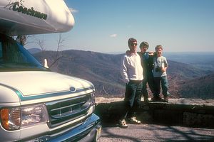
 Herb and Boys with Rental RVOur first stop was the Dickey Ridge Visitor Center, where we gathered maps and spoke to a ranger about possible hikes. I also purchased the audio tape of Skyline Drive, which gave Milepost by Milepost descriptions of everything along the way. Unfortunately, after about 3 miles into our drive, I realized that no one was listening to it--not even me. It was too much work; everyone wanted to just sit back and enjoy the views, which were quite lovely--even though we were not seeing them at their best. It was early April and the trees were still bare. I can just imagine how beautiful this drive must be in Autumn with the fall foliage. I also understand that at that time of the year Skyline Drive is practically bumper to bumper with people imagining the same thing.
At Thornton Gap (Mile 31.5), we temporarily left Skyline Drive for a side trip to Luray Caverns (see next stop). After our visit there, we came back to Thornton Gap and picked up where we left off.
 Boy's sporting coonskin hatsThe drive was lovely, but we're not ones to just sit and watch the scenery go by, so we selected two hikes to give us a flavor for the park. The first hike we did was the easy and rewarding one to the base of Dark Hollow Falls. The trail began in the parking lot at Mile 50.7 and followed a lovely stream down a hill to the base of a 70 foot waterfall. Thomas Jefferson once took this same hike--it was kind of special to think that he stood in this very same place gazing up at and admiring the falls, just as we did. The way back was all uphill, but it wasn't too bad. The kids were getting so many compliments from fellow hikers on their coonskin hats that they didn't even have time to complain.
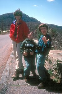
 Lolo and boys on Skyline DriveOur second hike to the summit of Bearfence Mountain (Mile 56.4) was a bit more adventurous. Although it was quite short--only about .8 mile roundtrip--it required a considerable amount of rock scrambling with some pretty steep dropoffs to the side. I was really worried that the boys, who were only 6 and 8, would fall and go tumbling down the rocks. They, however, scampered across the rocks like mountain goats, while I used far more body parts than were necessary to navigate the more difficult sections. The 360 degree views from the summit were worth all the palm sweating and humiliation.
Back in the motorhome, we continued along Skyline Drive, stopping at the numerous scenic overlooks along the way. At the end of the drive at Rockfish Gap, we hopped on Route 64 East towards Charlottesville to find a place to camp for the night.
Description
Shenandoah National Park, which contains the Virginia portion of the Blue Ridge Mountains, encompasses more than 300 square miles of mountains, forests, waterfalls, and rock formations. Most visitors explore the park by driving the beautiful 105-mile Skyline Drive, which runs along the crest of the Blue Ridge Mountains, the entire length of the park from Front Royal to Rockfish Gap. From along the drive, there are more than 75 designated overlooks with views of the Shenandoah Valley to the west and rolling foothills to the east. The entire drive takes about 3 hours without stopping, but few visitors do that. There are numerous picnic areas, scenic overlooks, and more than 500 miles of hiking trails along the way to enjoy.
Hiking is the most popular activity in the park. There are 112 hiking trails, varying in length from short walks to a 101-mile section of the Appalachian Trail that runs the entire length of the park. The trailheads to these hikes are located along the Skyline Drive. Hiking maps are available at either of the two visitor centers in the park: the Dickey Ridge Visitor Center at Mile 4.6 and the Byrd Visitor Center at Mile 51.
There are 4 campgrounds in the park: Matthews Arm (Mile 22.2), Big Meadow (Mile 51.2), Lewis Mountain (Mile 57.5), and Loft Mountain (79.5).
- ‹ previous
- 4 of 13
- next ›
Shenandoah National Park location map
Javascript is required to view this map.
