- Home
- About
- Map
- Trips
- Bringing Boat West
- Migration West
- Solo Motorcycle Ride
- Final Family XC Trip
- Colorado Rockies
- Graduates' XC Trip
- Yosemite & Nevada
- Colorado & Utah
- Best of Utah
- Southern Loop
- Pacific Northwest
- Northern Loop
- Los Angeles to NYC
- East Coast Trips
- 1 Week in Quebec
- Southeast Coast
- NH Backpacking
- Martha's Vineyard
- Canadian Maritimes
- Ocracoke Island
- Edisto Island
- First Landing '02
- Hunting Island '02
- Stowe in Winter
- Hunting Island '01
- Lake Placid
- Chesapeake
- Provincetown
- Hunting Island '00
- Acadia in Winter
- Boston Suburbs
- Niagara Falls
- First Landing '99
- Cape Hatteras
- West Coast Trips
- Mojave 4WD Course
- Colorado River Rafting
- Bishop & Death Valley
- Kauai
- Yosemite Fall
- Utah Off-Road
- Lost Coast
- Yosemite Valley
- Arizona and New Mexico
- Pescadero & Capitola
- Bishop & Death Valley
- San Diego, Anza Borrego, Joshua Tree
- Carmel
- Death Valley in Fall
- Yosemite in the Fall
- Pacific Northwest
- Utah Off-Roading
- Southern CA Deserts
- Yosemite & Covid
- Lake Powell Covid
- Eastern Sierra & Covid
- Bishop & Death Valley
- Central & SE Oregon
- Mojave Road
- Eastern Sierra
- Trinity Alps
- Tuolumne Meadows
- Lake Powell Boating
- Eastern Sierra
- Yosemite Winter
- Hawaii
- 4WD Eastern Sierra
- 4WD Death Valley +
- Southern CA Deserts
- Christmas in Tahoe
- Yosemite & Pinnacles
- Totality
- Yosemite & Sierra
- Yosemite Christmas
- Yosemite, San Diego
- Yosemite & North CA
- Seattle to Sierra
- Southwest Deserts
- Yosemite & Sierra
- Pacific Northwest
- Yosemite & South CA
- Pacific Northwest
- Northern California
- Southern Alaska
- Vancouver Island
- International Trips
- Index
- Tips
- Books
- Photos/Videos
- Search
- Contact
Cape Hatteras National Seashore, NC
Tuesday, April 7, 1998 - 12:00pm by Lolo
30 miles and 0.75 hours from our last stop - 3 night stay
Travelogue
The sun was setting over Pamlico Sound as we drove along the narrow barrier islands of Cape Hatteras on route to our home for the night--the Camp Hattaras Campground. In places, the islands are so narrow that you can see both the Atlantic Ocean and the Sound at the same time. Not the kind of place you wanted to be in a storm. Unfortunately, that's what was predicted to head our way in a day or so. For now though, the sky was a beautiful peaceful display of pinks and blues.
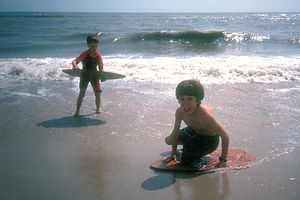
 SkimboardersSince it was already quite late and everyone was getting hungry, we stopped at a pizzeria (Lisa's Pizza) to get a pie to go before pulling into our campground. We sat in the RV while our pizza was cooking and watched the sun set over the Sound. Unfortunately, there was a huge dumpster blocking our view. Not quite the best aesthetics, but it would have to do for now. When I picked up the pizza, I grabbed a menu and happened to notice that they delivered. Hmmm! Maybe I could get out of cooking tomorrow as well.
By the time we checked into Camp Hattaras, it was already getting dark. I had reserved quite a bit in advance so we were lucky enough to get one of the beachfront sites. There was a large dune separating the campground from the beach, so we couldn't actually see the ocean from our campsite, but we could hear it, which was nice. Later on when the storm hit, I would be grateful that we had this dune between us and the stormy seas.
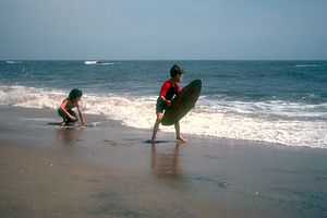
The next morning, the weather was still good, so we took the short hike over the dune to the beach. Since it was early April, the water was still a bit cool and not very conducive to lolling about in it. Instead the boys spent the day skimboarding along the shore in the receding waves. They had a blast. Herb tried it to and almost got whiplash. It's more a sport for the young and nimble. Afterwards, the kids worked on developing a gymnastic routine to entertain Herb and me. Neither of them is very graceful so it was quite entertaining. They climbed on each other's shoulders, did somersaults and cartwheels, stood on their heads, did intricate handshakes, etc., all in synchronization (kind of). It was very cute and entertaining.
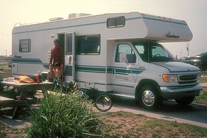
 Herb and boys by rental RVAfter the beach, the kids played some mini golf in the campground, while I listened to the weather radio. I tend to be a bit weatherphobic and the clouds were beginning to darken and build into that anvil shape that I have come to dread. My worst fears were realized--the robotic voice on the weather radio unemotionally announced that Hattaras was under a Tornado watch for the next 24 hours. Images of funnel clouds tossing motorhomes about like Matchbox cars flashed before my eyes. Much to Herb's amusement, I marched over to the campground office, weather radio in hand, to see what their plan was. Not only did they not know anything about the "watch," but they didn't seem to care. The woman behind the desk hardly reacted at all to my hysterical announcement. She made me feel like some crazy weatherphobic tourist--which, come to think of it, I was. Unsatisfied, I returned to the RV and told Herb to get the kids so we could get the heck out of here. "Where do you plan to go?" he asked. "Anywhere, but here," I replied. "How about Virginia Beach?" Fortunately, cooler heads prevailed and we stayed where we were. Luckily we did. The next day, Herb looked smugly at me as the news channels showed a Denny's with a roof blown off by the storm. Guess where it was. That's right, Virginia Beach. I would have had Herb drive us right into the eye of the storm. Oops!
It was beginning to drizzle a bit, so our plans for barbecuing that evening were squashed. However, every cloud has a silver lining, and this one's was the Lisa's Pizza phone number I had saved. About a half hour later, a cute VW bug pulled up to our motorhome with eggplant parmigiana for me and Herb and chicken fingers for the kids. This was much better than cooking.
 Determined SkimboardersAlthough we didn't get a tornado, we did get torrential rains that evening and the entire next day. The rains came down so hard that we couldn't even get from the RV to the indoor pool across the campground. That meant that we had a whole day to entertain 6 and 8 year old boys in a very confined space. I thought I was doing great. I had brought along some cookie dough and we were making funny shaped cookies. Everyone was having a good time and thinking that this wasn't so bad after all. Then I made the mistake of asking Herb the time. "11:00," he told me. Oh God! We had another 10 hours to kill. I had brought along some VCR tapes, so we had a "Rocko's Modern Life" marathon. Then the rain began leaking through the kitchen windows, so we spent some time mopping that up. The kids didn't seem to mind the confinement at all. They were having a great time. Herb and I, however, were going crazy.
Finally, around 4:00 in the afternoon, there was a lull in the storm. We immediately herded the boys out of the RV. We climbed over the dune to see how the storm had impacted the beach. Everything seemed okay, although the water was extremely rough--so different from the day before. Trying to squeeze as much activity in as we could with what was left of the day, the boys played some mini golf on a very squishy course and then we all took a quick dip in the indoor pool. Then to celebrate surviving the storm, we ordered from Lisa's Pizza again.
We've had some great views here in Hattaras, but none beats seeing that cute little VW bug pulling up with boxes of steaming hot food.
Description
The Cape Hatteras National Seashore stretches 70 miles down the Outer Banks barrier islands, with the Atlantic Ocean to the east and Pamlico Sound to the west. For thousands of years, these barrier islands have faced the onslaught of stormy winds and sea. Today the long stretches of beach, dunes, marshes, and woodlands have been set aside as a National Seashore. Cape Hatteras stretches across three islands - Bodie, Hatteras, and Ocracoke - which are linked by State Highway 12, a narrow, paved road, and the Hatteras Inlet ferry. The highway also passes through eight villages that reflect the nearly 300-year-old history and culture of the Outer Banks
The National Seashore begins about 3 miles south of the town of Nags Head. After crossing the grassy marshlands of Bodie Island for about 6 miles, you reach Coquina Beach, where the ruins of the 1921 shipwrecked Laura A. Barnes lie. Right beyond that is the Bodie Visitor Center and the 1872 Bodie Lighthouse.
A bridge across the Oregon Inlet connects Bodie and Hatteras islands. The northern end of Hatteras Island contains the Pea Island National Wildlife Refuge. Its location along the Atlantic flyway makes it a wonderful place to see migratory birds. It is also one of the northernmost nesting grounds for loggerhead turtles.
The drive continues along the narrow island with sweeping views of the Atlantic Ocean on one side and Pamlico Sound on the other. Pamlico Sound is the largest sound on the East Coast, and its steady winds make it a very popular place to windsurf. During the next 20 miles, you pass through the charming beach villages of Rodanthe, Waves, Salvo, and Avon.
At the town of Buxton, turn off Highway 12 to see the famed Cape Hatteras Lighthouse. This 208-foot lighthouse is the nation's tallest brick lighthouse and it has served as a beacon for ships passing through these dangerous waters since 1870. The treacherous currents and shoals off this coastline have cause so many ships to run aground that it has been dubbed the "Graveyard of the Atlantic."
The tiny fishing village of Hatteras lies at the end of the road. From here the choices are to turn back or to take the free Hatteras Inlet Ferry across the inlet to Ocracoke Island. The ferry ride is 40 minutes.
Once off the ferry, Highway 12 continues 14 miles along Ocracoke Island to the village of Ocracoke. This lovely little fishing village was first settled by ship pilots and served as the infamous Blackbeard's headquarters. In fact, it is rumored that this is where he the legendary pirate was captured and beheaded in 1718. The village is also home to the state's oldest operating lighthouse.
- ‹ previous
- 10 of 13
- next ›
Cape Hatteras National Seashore location map
Javascript is required to view this map.
