- Home
- About
- Map
- Trips
- Bringing Boat West
- Migration West
- Solo Motorcycle Ride
- Final Family XC Trip
- Colorado Rockies
- Graduates' XC Trip
- Yosemite & Nevada
- Colorado & Utah
- Best of Utah
- Southern Loop
- Pacific Northwest
- Northern Loop
- Los Angeles to NYC
- East Coast Trips
- 1 Week in Quebec
- Southeast Coast
- NH Backpacking
- Martha's Vineyard
- Canadian Maritimes
- Ocracoke Island
- Edisto Island
- First Landing '02
- Hunting Island '02
- Stowe in Winter
- Hunting Island '01
- Lake Placid
- Chesapeake
- Provincetown
- Hunting Island '00
- Acadia in Winter
- Boston Suburbs
- Niagara Falls
- First Landing '99
- Cape Hatteras
- West Coast Trips
- Maui
- Mojave 4WD Course
- Colorado River Rafting
- Bishop & Death Valley
- Kauai
- Yosemite Fall
- Utah Off-Road
- Lost Coast
- Yosemite Valley
- Arizona and New Mexico
- Pescadero & Capitola
- Bishop & Death Valley
- San Diego, Anza Borrego, Joshua Tree
- Carmel
- Death Valley in Fall
- Yosemite in the Fall
- Pacific Northwest
- Utah Off-Roading
- Southern CA Deserts
- Yosemite & Covid
- Lake Powell Covid
- Eastern Sierra & Covid
- Bishop & Death Valley
- Central & SE Oregon
- Mojave Road
- Eastern Sierra
- Trinity Alps
- Tuolumne Meadows
- Lake Powell Boating
- Eastern Sierra
- Yosemite Winter
- Hawaii
- 4WD Eastern Sierra
- 4WD Death Valley +
- Southern CA Deserts
- Christmas in Tahoe
- Yosemite & Pinnacles
- Totality
- Yosemite & Sierra
- Yosemite Christmas
- Yosemite, San Diego
- Yosemite & North CA
- Seattle to Sierra
- Southwest Deserts
- Yosemite & Sierra
- Pacific Northwest
- Yosemite & South CA
- Pacific Northwest
- Northern California
- Southern Alaska
- Vancouver Island
- International Trips
- Index
- Tips
- Books
- Photos/Videos
- Search
- Contact
Lake Powell - Halls Crossing, UT
Wednesday, July 20, 2005 - 4:00am by Lolo
57 miles and 1.25 hours from our last stop - 2 night stay
Travelogue
Our drive from Natural Bridges to Halls Crossing took us along Route 276, one of the few smaller highways in Utah not marked with those little dots on the map that signify a scenic road. Well, they must have just run out of dots because this road was incredible, and we were literally the only ones on it. At one point, Herb wanted to take a picture of the canyons we were driving through, so he just stopped the RV in the middle of the road, got out, and took a picture.
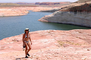 Lolo hiking up Lost Eden CanyonThe approach road was a sure giveaway that the Halls Crossing section of Lake Powell was going to be a lot different from the hustle and bustle of Page. We had our choice of two campgrounds right across from each other. The one on the left side of the road sat on a bluff with views of the lake below. It had no water or hookups. The one on the right side of the road had hookups but no view of the lake. We chose to forsake the comforts of air conditioning and go for the view. Besides, this was the desert and it cooled down at night--didn't it?
We couldn't wait to get out on the lake. The temperature was over 100 and the water looked extremely inviting. We drove down to the boat launch, quickly inflated our 12-foot Avon raft, and filled it with everything we would need for a day of fun out on the lake. While our 6 hp motor was not exactly going to zip us around the lake, it would enable us to do some slow-speed, close-up exploration of the many coves and canyons in Halls Creek Bay.
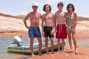 Family with trusty 21 year old Avon Redshank raftThe lake levels were really low. Way up on the wall of the canyon you could see the change in coloration line from where the water line normally was. It must have been about 70 feet down from its high point. The marinas at this end of the lake are really having a hard time. Halls Crossing Marina is no longer renting boats and Hite Marina, a bit further up the lake, is totally closed as there is no longer any water there. Their houseboats have been brought down to Halls Crossing and are sitting up on the land like beached whales. It made me kind of sad to look at them.
We had not been out on the lake more than 30 minutes before we noticed an official looking boat headed our way. Although we knew we weren't doing anything wrong--our boat registration was properly displayed, there were 4 life preservers in the boat, and there was no possible way we were speeding--we still broke out in a sweat.
As the rangers pulled up along our boat, one of them asked, "Where did you come from in that vessel?"
"New Jersey," I stupidly replied.
"No, I mean where did you come from right now?"
"Oh," Herb said pointing toward the boat launch, which was still in sight after 30 minutes of our not so swift travel.
"I've never seen a boat quite like that one out on this lake."
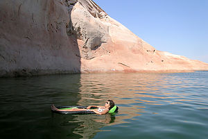 Lolo demonstrating use of the floatWe weren't sure whether we should be embarrassed or proud. Also, I wasn't quite sure just where this conversation was going. Then things lightened up. Actually I think they were always light, but we just had the typical reaction to being pulled over by a cop. I think they were just bored and we were a bit of a curiosity. They gave us some good advice on nearby destinations that a boat of our speed could reach on a day trip. We said goodbye and sped away (kind of).
We spent that day exploring Lost Eden Canyon. We followed one particular canyon that eventually narrowed to the width of our boat. At the end, we tried to climb up the walls that rose about 6 feet above our heads so that we could explore further into the canyon by foot. Andrew made the first attempt by putting one leg on each wall and trying to straddle his way up. After almost doing an unintentional split, he gave up and practically fell back into the boat. Herb had a bit more luck and actually made it to the top, but by that time none of us wanted to follow. He looked a bit like a cat caught up a tree in his attempts to get back down into the boat.
Meanwhile, we heard a banging noise coming from the entrance to the canyon. There was some idiot in a rental boat trying to come in despite the fact that his boat was wider than the entry. He left quite a bit of fiberglass on the rock before he finally gave up.
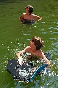 Boy's demonstrating the use of the scrotum squeezerThere weren't that many beaches to pull up on in this part of the lake, so we found a good spot in a wider part of the canyon to just hang out for the afternoon and swim from the boat. We couldn't even see the entrance to the canyon, so it felt like we were in an amphitheater with 100-foot walls rising out of the water all around us. The echoes were great--if only I could yodel. Since there was no beach to swim from, our two collapsible floats really came in handy. The kids solved their floatation issue by wearing two life preservers each--one the normal way and the other one through their legs, kind of like a diaper. I hesitate to mention their name for this new invention, but here it goes--the "scrotum squeezer." They are teenagers after all. I thought they looked like buoys bobbing about in the water. I had brought a "pinky" ball along, which managed to entertain us for hours. We had discovered the joys of chucking a "pinky" ball against the canyon walls on our last visit to the lake two years ago. With their new method of flotation, the game got even more entertaining.
After an absolutely wonderful day out on the lake, we cruised our way back over to the boat ramp where we had left our motorhome. Rather than go through the entire process of disassembling and reassembly the raft for the next day, Herb--always the handy one--rigged up a method of attaching it fully inflated to the bike rack in back of the RV. We just had to drive slow and remove it before backing into the cottonwood tree on our campsite. It worked perfectly.
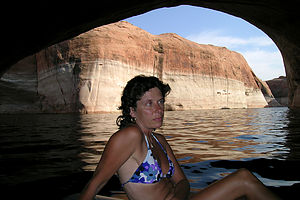 Lolo inside Lost Eden CanyonThe view from our site was so pretty that it hardly looked real. There was a hot breeze blowing off the lake and the sun was getting low. Herb and I relaxed in our beach chairs enjoying the view while the boys stalked lizards. They used a Tupperware container as a sort of lizard photography studio. They filled it with grass and twigs to create a natural backdrop and then practiced some close-up photography.
I kept expecting that hot breeze coming off the lake to turn into a cool one as the evening progressed, but it never did. We spent a pretty uncomfortable night sleeping in the RV without air conditioning. The first thing we did the next morning was drive across the street to the other campground and book a site with electric. There wasn't a view, but I didn't care. We would see enough of the lake all day long, and I wanted a good night's sleep that night.
We relaunched our trusty blow-up boat and spent another great day out on the lake. This time we explored Halls Creek Bay, which was much larger and more open than the canyon we had been in the day before. Although we didn't find any beaches, we were able to pull the raft up onto a flat rock and then hike up the slickrock to a great viewpoint. It was another wonderful day out on the lake.
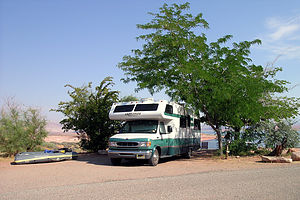 Halls Crossing Primitive CampgroundThat night back at our campsite, we got to experience a more frightening part of desert life. The kids had just come back from a run and I was happily making dinner in the comfort of my now air-conditioned motorhome when I heard what sounded like rain hitting the roof of the RV. Tommy and I quickly ran out to take in the towels only to find ourselves in the middle of a really bad sand storm. The wind was blowing so hard that the sand was pelting us and we couldn't see more than 6 inches in front of us. Somehow we managed to grab the towels and get back inside. Herb and Andrew, who had no idea of what was going on outside, looked at us in amazement. We were totally covered in sand. It was actually a quite painful and scary experience.
The next morning we rose early to catch the ferry to Bull Frog. This ferry, which is run by the state, makes the half-hour journey across Halls Creek every 2 hours, so we wanted to make sure we didn't miss it. Its price was pretty reasonable -- $32 for the RV and passengers are free. Afterwards I heard a rumor that because of the lake levels, the state might stop running this ferry in the future, so make sure you check on its status before depending on it. After departing the ferry, we headed north through some very pretty yet desolate scenery on our way to Capitol Reef.
Lake Powell still keeps its position as our family's all-time favorite place on earth. It will take a lot more than a little sand storm to knock it from that position.
Description
Lake Powell is the centerpiece of the Glen Canyon National Recreation Area's 1.25 million acres of beautiful desert and canyon country. It is considered by many to be one of the most scenic lakes in the country, with its clear turquoise water surrounded by red sandstone rock formations and steep remote side canyons.
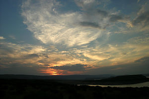 Sunset view from Halls Crossing CampgroundLake Powell is the second largest man-made lake in the country (Lake Meade is the largest), stretching 186 miles from Page, Arizona to Hite, Utah. Its 1,960 miles of shoreline with its hundreds of bays, coves, and canyons provides seemingly limitless opportunities for exploration by boat, truly the best way to access the beauty of this area.
For those that don't have their own boat, there are boat tours to various destinations on the lake, such as Rainbow Bridge, the world's largest natural bridge, and numerous marinas from which to rent boats for fishing, skiing, or houseboating. Houseboating has become an extremely popular activity on the lake.
The main base for people visiting Lake Powell is the Wahweap Resort and Marina in Page, Arizona. Facilities here include a marina, lodging, restaurants and shops, boat tours, and a campground. Also near Page are the Glen Canyon Dam and the Carl Hayden Visitor Center.
Other less accessible points to the lake include Hite, Bullfrog Bay, and Halls Crossing, all of which are in Utah.
- Halls Crossing, which is reached from Blanding, Utah, via state highways, has a ranger station, launch ramp, marina, store, housekeeping units, and two campgrounds.
- Bullfrog Bay is reached from Hanksville, Utah, via paved state highways. Facilities include a visitor center, launch ramp, marina, store, lodging, and two campgrounds. A ferry runs between Halls Crossing and Bullfrog Bay.
- Hite, at the extreme north of the lake, is reached via the Bicentennial Highway. Facilities include a ranger station, launch ramp, marina, lodging, store, and primitive camping. Many people find the area around Hite to be the most scenic in the recreation area.
The creation of the Glen Canyon Dam across the Colorado River, and the subsequent creation of Lake Powell, was one of the most controversial engineering projects in history, contributing to the birth of the modern day environmental movement. When the dam was completed in 1963, it flooded what was considered by many to be one of the most beautiful canyons in the southwest, the Glen Canyon. Today there is a movement to dismantle the dam and return the area to what it once was.
- ‹ previous
- 9 of 23
- next ›
Lake Powell - Halls Crossing location map in "high definition"
Javascript is required to view this map.
