- Home
- About
- Map
- Trips
- Bringing Boat West
- Migration West
- Solo Motorcycle Ride
- Final Family XC Trip
- Colorado Rockies
- Graduates' XC Trip
- Yosemite & Nevada
- Colorado & Utah
- Best of Utah
- Southern Loop
- Pacific Northwest
- Northern Loop
- Los Angeles to NYC
- East Coast Trips
- 1 Week in Quebec
- Southeast Coast
- NH Backpacking
- Martha's Vineyard
- Canadian Maritimes
- Ocracoke Island
- Edisto Island
- First Landing '02
- Hunting Island '02
- Stowe in Winter
- Hunting Island '01
- Lake Placid
- Chesapeake
- Provincetown
- Hunting Island '00
- Acadia in Winter
- Boston Suburbs
- Niagara Falls
- First Landing '99
- Cape Hatteras
- West Coast Trips
- Maui
- Mojave 4WD Course
- Colorado River Rafting
- Bishop & Death Valley
- Kauai
- Yosemite Fall
- Utah Off-Road
- Lost Coast
- Yosemite Valley
- Arizona and New Mexico
- Pescadero & Capitola
- Bishop & Death Valley
- San Diego, Anza Borrego, Joshua Tree
- Carmel
- Death Valley in Fall
- Yosemite in the Fall
- Pacific Northwest
- Utah Off-Roading
- Southern CA Deserts
- Yosemite & Covid
- Lake Powell Covid
- Eastern Sierra & Covid
- Bishop & Death Valley
- Central & SE Oregon
- Mojave Road
- Eastern Sierra
- Trinity Alps
- Tuolumne Meadows
- Lake Powell Boating
- Eastern Sierra
- Yosemite Winter
- Hawaii
- 4WD Eastern Sierra
- 4WD Death Valley +
- Southern CA Deserts
- Christmas in Tahoe
- Yosemite & Pinnacles
- Totality
- Yosemite & Sierra
- Yosemite Christmas
- Yosemite, San Diego
- Yosemite & North CA
- Seattle to Sierra
- Southwest Deserts
- Yosemite & Sierra
- Pacific Northwest
- Yosemite & South CA
- Pacific Northwest
- Northern California
- Southern Alaska
- Vancouver Island
- International Trips
- Index
- Tips
- Books
- Photos/Videos
- Search
- Contact
Sebastopol and Sonoma County, CA
Friday, November 21, 2014 - 12:15pm by Lolo
180 miles and 3.5 hours from our last stop - 3 night stay
Travelogue
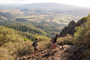 Hiking Hood Mountain Regional ParkWell, we were back in the Berg’s driveway for our second annual pre-Thanksgiving celebration. Once again we managed to back into the driveway without taking out their bushes – just a little minor pruning.
The Bergs are amazing hosts and unbelievable cooks, so the eating portion of the weekend was, as always, beyond compare. While we do not share their expertise in the kitchen, we do share a love of the outdoors, so whenever we get together, we go on a few long hikes.
There are so many wonderful hiking trails in Sonoma County, and Hilda and Paul have probably done most of them, so we always leave it in their capable hands to select one. Also, since we are planning to move out this direction sometime over the next year, they picked two that would help give us an idea of how much there was to do in close proximity to our potential new home.
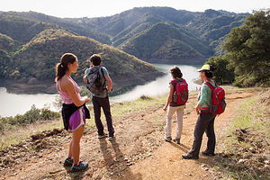 Hikers on Lake Sonoma Canoe TrailOn Saturday, we drove over to Hood Mountain Regional Park, right in neighboring Santa Rosa. To get there, we drove along Highway 12 through the Valley of the Moon, made famous by Jack London’s novel of the same name, and the heart of Sonoma Valley wine country. I never realized that the vineyards change their colors from to gold and red in the fall. I thought only the East Coast had beautiful fall foliage, but this was absolutely stunning.
Along the way we passed a 55+ adult community, and Hilda asked if we would ever consider living there. My immediate response was “No Way!!!” Ironically, later in the trip we would actually look at rental properties there and our “No Way” has changed to “Well, maybe we could try it for a year.” It definitely had location going for it – right smack in the middle of the Valley of the Moon, surrounded by vineyards and two major parks, Hood Mountain Regional Park and Annadel State Park.
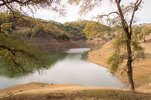 Low Water Levels at Lake SonomaToday, we would hike to the top of Mount Hood, which at 2,730 feet is the highest point in the Mayacama Mountain range which divides Sonoma and Napa Valley. It was a pretty strenuous hike – 3 ½ miles (one way) and over a 2,000 foot elevation gain to reach the Gunsight Rock Overlook. Fortunately, Paul had brought along a pair of binoculars, because we could see San Francisco from the tope, and Andrew and Celeste were having fun identifying different landmarks. The views of wine country below weren’t too shabby either.
Continuing our orientation of Sonoma County, the next day we drove north to the town of Cloverdale – to see if that grabbed us as a place to live – and then onto Lake Sonoma for a hike. Cloverdale was a little too far out there for me. I think I prefer living closer to a bigger city like Santa Rosa.
Lake Sonoma was of interest to us, because we have a boat that we are wondering what to do with when we move West. It was a lovely lake, a little down in depth because of the drought, but still quite boatable. The lake has a marina and boat-in campsites and about 50 miles of shoreline along its two arms to explore. It was good to know that we could still have a place to waterski.
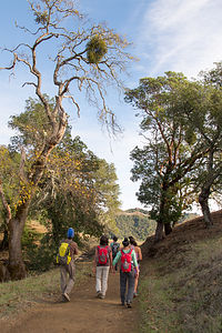 Mistletoe on Lake Sonoma Canoe Trail HikeHowever, today hiking was the plan, so we parked the car and took the 5.1-mile Half a Canoe trail up and down along the lake. Two things about this hike stand out in my mind.
First, the lovely Spanish moss hanging from the tree branches. I thought this was strictly a Georgia coast phenomenon. Geez, first beautiful vineyard fall foliage and now this. I was starting to lose some of my East Coast bragging points.
The second, and far less appealing discovery, was the reason for the churned up dirt alongside the trail. Although we didn’t see the culprits doing the digging, Paul informed us that there are lots of wild pigs in Sonoma County, in this area in particular, and they love to dig up the ground looking for grubs and acorns and such. I knew it. There had to be something wrong with this paradise they call Sonoma County. Just kidding. Actually we thought it was pretty cool and hoped we would come across one, but no luck. We did come across a couple of guys hunting for them, however, which is not only allowed, but encouraged.
Spanish moss and wild pigs aside, we had another lovely hike with the Berg’s and got to experience another Sonoma County gem.
Description
Sebastopol
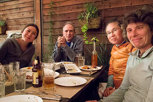 Dining at Diavola PizzeriaSebastopol is a charming town in Sonoma County, 52 miles north of San Francisco and about a 20-minute drive to the coast. Sebastopol is known for its apples and hosts an annual Apple Blossom Festival in April and the Gravenstein Apple Fair in August. Today, however, the apple orchards are becoming vineyards as wine-making moves more and more into the region.
Every Sunday, from April to mid-December, there is a Farmers market in the downtown plaza,
where people congregate to enjoy delicious fresh regional food, live music, and dancing.
Sebastopol is home to the artist, Patrick Amiot, known for his whimsical, cartoon-like, junk-art sculptures. There are over 200 of his wacky, found-object works scattered throughout Sebastopol, especially on Florence Street.
Hood Mountain Regional Park
Located on Pythian Road in Santa Rosa, the Mount Hood Regional Park encompasses 1,750 acres of wilderness with outstanding hiking and mountain biking. It is named for Mount Hood (not the one in Oregon), which at 2,730 feet, is the highest point in the Mayacama Mountain range which divides Sonoma and Napa Valleys.
One of the most popular hikes in Sonoma County is the 3.5 mile (one way) steep trail to Gunsight Rock Overlook. With a 2,000 foot elevation gain, the hike is not for the faint of heart, but for those that make the climb, the views of wine country and the Golden Gate Bridge in the distance are well worth it.
Lake Sonoma
Lake Sonoma is located 13 miles northwest of Healdsburg in the beautiful coastal foothills of northern Sonoma County. It was created in 1983 by the U.S. Army Corps of Engineers construction of the Warm Springs Dam. The lake extends 9 miles on Dry Creek and 4 miles on Warm Springs Creek. It full capacity is has 50 miles of shoreline.
At the park entrance there is a Visitor Center with exhibits telling the story of the Dam as well as the natural and early cultural history of Dry Creek Valley. Behind the Visitor Center is a Fish Hatchery where visitors can learn about the life cycle of the coho salmon, steelhead, and Chinook.
Activities at the lake include boating; swimming; 40 miles of trails for hiking, mountain biking, and horseback riding; hunting; and camping.
There are 9 primitive camping sites accessible by boat or hiking. A backcountry camping permit must be obtained at the Visitor Center. The Liberty Glen Campground has 113 campsites for RVs and tents. Campsites are available on a first-come, first-served basis.
- ‹ previous
- 10 of 13
- next ›
Sebastopol and Sonoma County location map in "high definition"
Javascript is required to view this map.
