- Home
- About
- Map
- Trips
- Bringing Boat West
- Migration West
- Solo Motorcycle Ride
- Final Family XC Trip
- Colorado Rockies
- Graduates' XC Trip
- Yosemite & Nevada
- Colorado & Utah
- Best of Utah
- Southern Loop
- Pacific Northwest
- Northern Loop
- Los Angeles to NYC
- East Coast Trips
- 1 Week in Quebec
- Southeast Coast
- NH Backpacking
- Martha's Vineyard
- Canadian Maritimes
- Ocracoke Island
- Edisto Island
- First Landing '02
- Hunting Island '02
- Stowe in Winter
- Hunting Island '01
- Lake Placid
- Chesapeake
- Provincetown
- Hunting Island '00
- Acadia in Winter
- Boston Suburbs
- Niagara Falls
- First Landing '99
- Cape Hatteras
- West Coast Trips
- Maui
- Mojave 4WD Course
- Colorado River Rafting
- Bishop & Death Valley
- Kauai
- Yosemite Fall
- Utah Off-Road
- Lost Coast
- Yosemite Valley
- Arizona and New Mexico
- Pescadero & Capitola
- Bishop & Death Valley
- San Diego, Anza Borrego, Joshua Tree
- Carmel
- Death Valley in Fall
- Yosemite in the Fall
- Pacific Northwest
- Utah Off-Roading
- Southern CA Deserts
- Yosemite & Covid
- Lake Powell Covid
- Eastern Sierra & Covid
- Bishop & Death Valley
- Central & SE Oregon
- Mojave Road
- Eastern Sierra
- Trinity Alps
- Tuolumne Meadows
- Lake Powell Boating
- Eastern Sierra
- Yosemite Winter
- Hawaii
- 4WD Eastern Sierra
- 4WD Death Valley +
- Southern CA Deserts
- Christmas in Tahoe
- Yosemite & Pinnacles
- Totality
- Yosemite & Sierra
- Yosemite Christmas
- Yosemite, San Diego
- Yosemite & North CA
- Seattle to Sierra
- Southwest Deserts
- Yosemite & Sierra
- Pacific Northwest
- Yosemite & South CA
- Pacific Northwest
- Northern California
- Southern Alaska
- Vancouver Island
- International Trips
- Index
- Tips
- Books
- Photos/Videos
- Search
- Contact
Lake Powell - Halls Creek Bay, UT
Friday, September 4, 2020 - 3:00pm by Lolo
48 miles and 3.5 hours from our last stop - 1 night stay
Travelogue
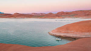
 Our campsite in Halls Creek BayAfter leaving Register Rock, without ever getting to sign the register, we cruised on up the main channel, bypassing the left turn which would have taken us up the Escalante Arm. We cruised into Iceberg Canyon to look for an inviting campsite, but found nothing great.
We figured we would try Halls Creek Bay, where we had a terrific campsite last visit along the west side of the Bay that was set against the Waterpocket Fold. Camping along here would allow us to take a pretty decent hike.
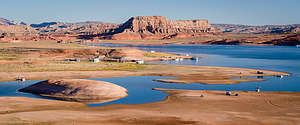
But first, time to gas up at Halls Creek Marina and pick up some ice. While Herb handled the fuel, I went into the store to get ice. I was pretty appalled. We have been so careful wearing masks and social distancing during Covid - after all, we are in the vulnerable age group now and Herb has asthma.
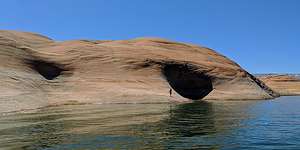
 Swimming to the caves (?) from our Halls Creek campsiteApparently here, Covid was a hoax. The girl checking people at the door had a mask haphazardly below her nose (I hate that) and she just kept waving people in. There were probably well over 30 maskless, 20-somethings in that store acting like life was totally normal. Their attire definitely gave away their political affiliation and covid denial. I grabbed a bag of ice and got out of there as fast as I could.
From there we crossed back over to Halls Creek (Buoy 93), a large bay barely noticeable from the main channel because of its narrow opening. Along its 12 miles, there are innumerable coves that cut into the southernmost toe of 100-mile long Waterpocket Fold, many of which have sandy beaches for camping.
 View from the ridge above our campsite in Halls Creek BayWe managed to find a nice quiet home for the night in a shallow cove, hopefully too small for houseboats to join us. The scenery was incredible and there was much more opportunity to hike for longer distances than we had been able to so far at our previous camping spots - good, because I was beginning to feel a little confined on the boat, and then I get cranky.
We were getting in a groove now - cruise in the morning, find camping early afternoon, swim / float, and then hike when the sun got low.
This particular cove had a rocky promontory jutting out into the lake with what looked like a series of caves in them. I swam out to them, smeared my way up the rock, and tried to enter. No cave, just a deep cutout. Still, very cool.
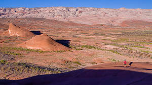
 Gazing out at the Waterpocket Fold from the ridge above our campsiteWhen I got back, Herb went for a swim. He’s a much stronger swimmer than me, so he continued on and around the promontory where I couldn’t see him any more. He was gone pretty long, but as I was just starting to get nervous, I spotted his head coming around the bend.
That evening, we took a lovely hike up to the ridge that looked out over the bay on one side, and the Waterpocket Fold on the other. Another evening of breathtaking views. For us, the best campsites were those with expansive views and the opportunity to hike at least a mile.
In the morning, before setting out, we took another, longer 2.5-mile hike up to the ridge towards the Waterpocket Fold. So, so beautiful.
- ‹ previous
- 6 of 9
- next ›
Lake Powell - Halls Creek Bay location map in "high definition"
Javascript is required to view this map.
