Drive Activities
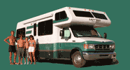
Showing 111 drive activities logged during our motorhome cross-country adventures.
16-mile Dunes Drive
Scenic drive that loops through the National Momument. Much of the 16 miles of road is made of hard-packed gypsum. There are many established parking areas along the road to allow you to get out and experience the dunes closeup.
Natchez Trace Parkway
429-mile scenic parkway that runs from Franklin, Tennessee to Natchez, Mississippi. It parallels the original Trace, which was the trail used by Indian tribes thousands of years ago. More recently, the trail was used by traders and farmers walking back home after sailing their goods down the Mississippi River.
Oak Creek Canyon Drive
This 27-mile scenic drive runs from the ponderosa pine forests of Flagstaff to the red rock of Sedona.
Turquoise Trail
48 mile scenic drive, connecting Alburguerque and Santa Fe.
Desert View Drive
26-mile long scenic drive from the East Entrance, which has numerous pull-offs to stop and enjoy the vistas.
High Road to Taos
54-mile scenic drive connecting Santa Fe and Taos
Going to the Sun Road
50-mile-long very scenic drive, which crosses the park from West Glacier to St. Mary
Chief Mountain International Highway
75-mile scenic highway from the town of Babb across the border to Waterton Village
Circuit drive through refuge
A circuit drive through the refuge provides ample opportunity to observe the various wildlife. Allow 2 hours.
Hayden Valley
Beautiful green meadows with herds of buffalo, some even blocking the road
Scenic Cape Royal Road
23-mile scenic drive through meadows and forests of ponderosa pines, aspens, and spruce to Cape Royal Overlook. A 3-mile side road takes you to Point Imperial Overlook.
Bryce Canyon Scenic Drive
17-mile scenic drive which takes you from the Visitor Center to Rainbow Point with numerous viewpoints into the amphitheater along the way
Ruins Road
6-mile loop along Chapin Mesa with numerous views of cliff dwellings along the way
Trail Ridge Road
50-mile scenic drive from Estes Park to Grand Lake. Along the way there are spectacular views of snow-covered peaks, alpine meadows full of wildflowers, deep forests, and much wildlife.
Sea to Sky Highway
Canada's most scenic highway. It begins at sea level in Vancouver, hugs the coastal mountains along the shores of Howe Sound (North America's southernmost fjord), and then ascends into the spectacular lake and mountain country of Whistler.
Scenic drive
5-mile scenic drive through the park. Four spectactular view points along the way, each giving a different persepective of the amphitheater.
Colorado Riverway
35-mile scenic drive on Utah 128 from Moab to Dewey Bridge. The drive winds along the eastern shore of the Colorado River through spectacular sandstone canyons.
Zion-Mount Carmel Parkway
24-mile long drive, which passes through the mile-long Zion-Mount Carmel Tunnel and winds down six steep switchbacks on its way to the canyons and high plateaus east of Zion Canyon. Vehicles over 7 feet 10 inches wide or 11 feet 4 inches tall must pay a $10 fee for using the tunnel since traffic must be stopped in order for the vehicle to drive down the center of the tunnel.
Cherry Orchards Drive
100-mile scenic drive from Sleeping Bear to Mackinaw City, through lakeside resort towns and cherry orchards along the eastern shore of Lake Michigan.
Scenic Drive - South Unit
36-mile scenic drive through the South Unit onto a high plateau with excellent views of the badlands and places to hike along the way.
Icefields Parkway
One of the most spectacular mountain roads in the world. This 178-mile road, which connects Lake Louise and Jasper, climbs through three river valleys past deep-green lakes, waterfalls, glacier-covered mountains, and dozens of permanent snowfields.
Utah 12 Scenic Byway
122-mile scenic drive, from Capitol Reef to Bryce Canyon, through some of Utah's most outstanding high desert country.
Acadia Park Loop
27-mile scenic loop drive through the park with spectacular mountain and ocean scenery. Some of the many scenic stops along the way include Sand Beach, Thunder Hole, and Eagle Lake.
Fundy Trail Parkway
12.6-mile (out and back) road which runs along the shores of the Bay of Fundy from St. Martins to the Big Salmon River. The trail hugs the coastline providing spectacular views from its many scenic lookouts along the way.
Cabot Trail
The 184-mile Cabot Trail is considered by many to be one of the most spectacular drives in North America. Its most scenic section is the 66 miles through Cape Breton Highlands National Park, where the views of the magnificent highland plateaus and the colorful cliffs that plunge down to the sea are breathtaking.
Confederation Bridge
7 3/4 mile bridge that connects PEI to the southeastern tip of New Brunswick. The fare for an RV is $45.25. Fares are only collected when leaving PEI.
South Rim Scenic Drive
7.5 mile scenic drive along the south rim of the canyon. There are 10 scenic overlooks along the way, the best of which are Gunnison Point, Pulpit Rock, Chasm View and Sunset View
Million Dollar Highway
Very scenic section of the San Juan Skyway between Ouray and Silverton. The original road was built in the 1880s as a way of more efficiently moving ore mined in Ouray over the Pass into Silverton. The current two-lane winding road pretty much follows the old path.
Rimrock Drive
23-mile scenic drive, which starts in the Colorado River valley and then climbs through the canyons to the top of the Uncompahgre Plateau. From there it winds along the rim of the plateau. Along the drive are the Visitor Center, numerous scenic overlooks, picnic areas, and trailheads to hikes.
Bridge View Drive
9-mile scenic drive, which leads to overlooks and trailheads for each of the three natural bridges
Scenic Drive
25-mile roundtrip and and back drive with great views of the dramatic canyons and rock formations of Capitol Reef
Colorado Riverway
35-mile scenic drive on Utah 128 from Moab to Dewey Bridge. The drive winds along the eastern shore of the Colorado River through spectacular sandstone canyons.
Arches Scenic Drive
The drive through Arches National Park is 18 miles one way, plus 5 miles for a side trip to the Windows and 4.5 miles for a side trip to Delicate Arch. The views of the arches and rock formations along the way are spectacular.
Arches Scenic Drive
The drive through Arches National Park is 18 miles one way, plus 5 miles for a side trip to the Windows and 4.5 miles for a side trip to Delicate Arch. The views of the arches and rock formations along the way are spectacular.
Arches Scenic Drive
The drive through Arches National Park is 18 miles one way, plus 5 miles for a side trip to the Windows and 4.5 miles for a side trip to Delicate Arch. The views of the arches and rock formations along the way are spectacular.
Skyline Drive
105-mile scenic drive along the crest of the Blue Ridge Mountains through Shenandoah National Park
Scenic Route 12
80 mile drive across the barrier islands that make up the Cape Hattaras National Seashore. The 4 1/2 hour drive takes you thorugh a wildlife refuge and pleasant villagees, past sandy beaches and lighthouses. For most of the drive there are views of the Atlantic Ocean to the east and Pamlico Sound to the west.
Road through the Park
Short drive along Assateague Island with the bay to the west and the ocean to the east. There are plenty of wild ponies along the way.
East End Road
20-mile scenic drive along Kachemak Bay with great views of the Spit and the Bay.
Acadia Park Loop
27-mile scenic loop drive through the park with spectacular mountain and ocean scenery. Some of the many scenic stops along the way include Sand Beach, Thunder Hole, and Eagle Lake. Only two small sections of the road are open in the winter: a one-mile section along the ocean and access to Jordan Pond.
Kancamangus Highway
34-mile scenic road through the White Mountains from Conway to Lincoln.
Tilghman Island
Pretty drive through farmland along one of the many fingerlike pieces of land that project out into the Bay. There are some great views of the Bay along the way.
"The Loneliest Road in America"
400-mile drive on US-50 from Lake Tahoe to Great Basin National Park through an endless landscape of desert, sagebrush, and mountains.
Trail Ridge Road
50-mile scenic drive from Estes Park to Grand Lake. Along the way there are spectacular views of snow-covered peaks, alpine meadows full of wildflowers, deep forests, and much wildlife.
12-mile loop through Valley
Fairly strenuous 12-mile loop on the sandy roads through the Tribal Park, with cars kicking up sand all along the way. With that said, it is still worth every single mile. The views are absolutely incredible.
Desert View Drive
26-mile long scenic drive from the East Entrance, which has numerous pull-offs to stop and enjoy the vistas.
Arches Scenic Drive
The drive through Arches National Park is 18 miles one way, plus 5 miles for a side trip to the Windows and 4.5 miles for a side trip to Delicate Arch. The views of the arches and rock formations along the way are spectacular
Route du Fleuve (River Route)
58 km scenic drive (also known as Route 362) from Baie-St-Paul to La Malbaie along the bluffs on the northern shore of the St. Lawrence River
Peak to Peak Highway
55-mile scenic drive from Central City through Blackhawk, Nederland, and Allenspark to Estes Park near the eastern gateway to Rocky Mountain National Park with spectacular snow-capped mountain vistas of the Continental Divide.
Trail Ridge Road
50-mile scenic drive from Estes Park to Grand Lake. Along the way there are spectacular views of snow-covered peaks, alpine meadows full of wildflowers, deep forests, and much wildlife.
Kings Canyon Scenic Byway
Kings Canyon Scenic Byway, a 31-mile rollercoaster road connecting Grant Grove and Cedar Grove, which descends 2,000 feet deep into the canyon, It takes about an hour to drive and ranks among the most magnificent in any national park.
Panoramic Highway
Scenic and winding section of Highway 1 that runs from Mill Valley over the mountains through Mt. Tamalpais State Park and then down to Stinson Beach.
Pacific Coast Highway
Technically, the Pacific Coast Highways goes 220 miles from San Francisco to Leggett, but we just did the 100 mile section from Jenner to Fort Bragg. The drive along the majestic cliffs above the sea is spectacular.
Trail Ridge Road
50-mile scenic drive from Estes Park to Grand Lake. Along the way there are spectacular views of snow-covered peaks, alpine meadows full of wildflowers, deep forests, and much wildlife.
Rim Drive
Highly scenic 33-mile drive around the perimeter of Crater Lake. Best to do clockwise, so that the viewpoints are easy to pull in and out of.
Redwood Highway
A 231-mile scenic drive through the Redwood National Forests.This drive starts at the Oregon border on US-199 and travels south until it joins the US-101 for a coastal scenic drive. From Crescent City it heads south on US-101 to the town of Leggett.
Samuel H. Boardman State Scenic Corridor
12-mile long urban linear park that encompasses one of the most beautiful stretches of the Oregon coastline, with tremendous views of rugged cliffs, secluded cove beaches, and forested sea stacks.
Columbia River Gorge
Scenic byway from Troutdale, Oregon, past Bonneville Lock and Dam, across the Bridge of Gods into Washington, and onto Columbia Hills State Park
Summit of Pilot Butte
Scenic views from the top of an old cinder cone that looks out over the Three Sisters, Mt. Jefferson, Black Butte, Mount Hood, and the town of Bend. There are several hiking trails that lead to the top, but unfortunately we didn't have the time.
Red Rock Canyon Scenic Drive
13-mile scenic loop through the spectacular scenery of Red Rock Canyon
Artists Drive
9-mile scenic loop through multi-hued volcanic and sedimentary hills. Artist’s Palette is especially photogenic in late afternoon light. The drive starts from Badwater Road and is only accessible in vehicles less than 25 feet in length.
Twenty Mule Team Canyon Road
2.7-mile unpaved loop through the unworldly badlands of Death Valley. The road is located off 190, east of Furnace Creek and is not accessible by RV or trailers. The road is named for the teams of eighteen mules and two horses that pulled wagons loaded with borax out of this canyon from 1883 to 1889.
Geology Tour Road
18-mile dirt road through some of the park’s most distinctive geological formations. There are 16 stops along the way, so allow approximately 2 hours for the round trip. RVs are not allowed, but two-wheel vehicles may go as far as Squaw Tank, stop #9. After that point, only 4-wheel drive vehicles are advised.
Queens Valley Road
Side trip through a network of 13.4 miles of dirt roads through the park’s most impressive groves of Joshua trees
Movie Flat Road
5.7-mile unpaved road through the Alabama Hills that passes the filming locations for such greats as “How the West was Won,” “Rawhide,” and “Gunga Din.” A “Movie Road Touring Brochure,” is available online or at the museum.
Lake Berryessa and Napa Valley
Long, twisty drive to Lake Berryessa, the largest lake in Napa County followed be a scenic drive past numerous vineyards from the town of Napa to Calistoga on Route 29 and the Silverado Trail
Happy Jack Road
40-mile scenic alternative to I80 past prairies, ranches, and rocky plateaus that connects the towns of Cheyenne and Laramie, Wyoming.
Valley Floor Loop
21 mile loop along Northside and Southside Drives past the Valley highlights.
To the various pools in the Long Valley Area
Explored Crowley Hot Spring (Wild Willy’s), Hilltop Hot Spring (Pulky’s Pool), Alkali Lake Hot Spring, The Crab Cooker, Shepherd Hot Spring, and the Hot Creek Geothermal Area
Chain of Craters Road
19-miles windy road down to the sea where the road ends abruptly where the current lava flow cut it off. From there there is nothing but miles and miles of desolate, barren, black lava rock as far as the eye can see.
Tuk Tuk Ride
Wild ride from Khao San Road to our hotel, weaving in and out between buses, motorbikes, and pedestrians. Frightening, yet exhilarating! Recommend doing it once.
La Ruta del Vino (Wine Route)
Road through the Valle de Guadalupe, a rapidly growing wine region in northern Baja, just an hour south of the Tecate border crossing. La Ruta del Vino is the name given to the roads that connect the many wineries in the valley. There are only three paved road in the Valle de Guadalupe, the rest being a network of unnamed dirt roads. Blue signs designate the turn-offs from the paved roads for various wineries and restaurants.
Artists Drive
9-mile scenic loop through multi-hued volcanic and sedimentary hills. Artist’s Palette is especially photogenic in late afternoon light. The drive starts from Badwater Road and is only accessible in vehicles less than 25 feet in length.
Cascades Scenic Byway
Unfortunately, we didn't get too far on this beautiful scenic byway, as the weather turned cold and rainy
Alvord Desert Playa
Cruising along the dry, alkali lake bed of the playa
Steens Mountain Scenic Byway
Rugged 66-mile gravel road that takes you from Malheur National Wildlife Refuge to the top of Steens Mountain and then back down to the Carlow Valley
Fish Slough Road
6.7 miles in the Volcanic Table to a petroglyph site
Onion Valley Road
13-mile winding road from the town of Independence up 5,200 feet to the lovely Onion Valley with breathtaking scenery along the way. The road was originally intended to go all the way to Kearsarge Pass, but that idea was thwarted by the expansion of Kings Canyon National Park.
Horseshoe Meadow Road
20 miles of zigzagging road, blasted out of granite rock, from Lone Pine (elevation 3,727 feet) to Horseshoe Meadow (elevation 10,072 feet). It is the second highest paved road in California.
Jawbone to Lake Isabella
50 mile 4WD road from the Mojave Desert up and over the Piute Mountains in the Sequoia National Forest, and down steep switchbacks to Lake Isabella
Rainbow Basin Scenic Loop Road
4.6-mile dirt loop road through the colorful and interestingly shaped sedimentary rock formations of the Calico Range
Bonneville Speedway
12 mile long and 5 mile wide amazing moonscape, comprised of approximately 90% common table salt. Bonneville is on the National Register of Historic Landmarks because of its contribution to land speed racing, which has been going on since 1914. It was on the Bonneville Speedway that the 300, 400, 500, and 600 mile-per-hour land speed barriers were broken.
Arches Scenic Drive
The drive through Arches National Park is 18 miles one way, plus 5 miles for a side trip to the Windows and 4.5 miles for a side trip to Delicate Arch. The views of the arches and rock formations along the way are spectacular.
Valley Floor Loop
21 mile loop along Northside and Southside Drives past the Valley highlights.
Twenty Mule Team Canyon Road
2.7-mile unpaved loop through the unworldly badlands of Death Valley. The road is located off 190, east of Furnace Creek and is not accessible by RV or trailers. The road is named for the teams of eighteen mules and two horses that pulled wagons loaded with borax out of this canyon from 1883 to 1889.
Movie Flat Road
5.7-mile unpaved road through the Alabama Hills that passes the filming locations for such greats as “How the West was Won,” “Rawhide,” and “Gunga Din.” A “Movie Road Touring Brochure,” is available online or at the museum.
17-Mile Drive
Private toll road through a ritzy neighborhood that includes the famous Pebble Beach golf course and some of the most incredible scenery on the California coast. Entry is $10.75 per vehicle. The most iconic stop along the drive is the Lone Cypress, a Monterey Cypress tree standing atop a granite headland overlooking Carmel Bay - one of the most photographed trees in North America.
Big Sur
38 miles along the highly scenic Pacific Coast Highway (Route 1) from Carmel to McWay Falls along the rugged stretch of California’s central coast, bordered by the Santa Lucia Mountains and the Pacific Ocean.
Eastern Sierra Scenic Byway
The drive on Highway 395, also known as the Eastern Sierra Scenic Byway, is probably one of the most beautiful drives in the U.S. The 133-mile stretch from the Nevada border to Bishop is loaded with scenic vistas, each more beautiful than the next.
Movie Flat Road
5.7-mile unpaved road through the Alabama Hills that passes the filming locations for such greats as “How the West was Won,” “Rawhide,” and “Gunga Din.” A “Movie Road Touring Brochure,” is available online or at the museum.
Pacific Coast Highway
90 miles of the legendary Pacific Coast Highway from San Francisco to Capitola along California’s rugged and beautiful coastline
Rainbow Basin Scenic Loop Road
4.6-mile dirt loop road through the colorful and interestingly shaped sedimentary rock formations of the Calico Range
Moki Dugway to Muley Point
8-mile (each way) scenic drive up through a series of switchbacks and along a dirt road with spectacular views of Valley of the Gods, Monument Valley, the goosenecks of the San Juan, the Henry Mountains, and Navajo Mountain
Valley of the Gods Scenic Loop
17-mile scenic drive along a dirt road through a valley of red rock buttes and pinnacles, similar to Monument Valley, but less dramatic and crowded
17-mile Scenic Drive
This highly scenic drive along a dirt road starts at the Visitor Center and heads southeast amongst the towering buttes, mittens, and mesas. Along the drive there are 11 numbered stops at the most scenic places. The drive takes at least 2 hours and is doable in a 2WD vehicle. Tourists are not allowed to hike away from the road towards the formations.
North Rim Drive
14-mile scenic drive on Highway 64 tracing the rim of Canyon de Muerte with stops at Antelope House Overlook, Mummy Cave Overlook, and Massacre Cave Overlook
South Rim Drive
16-mile scenic drive tracing the rim of Canyon de Chelly with stops at Tunnel Overlook, Tsegi Overlook, Junction Overlook, White House Overlook, Sliding House Overlook, Face Rock Overlook, and Spider Rock Overlook
Chaco Canyon Loop
9-mile loop road through Chaco Canyon with stops along the way to visit the various ruins: Una Vida, Hungo Pavi, Pueblo Bonito, Chetro Ketl, Pueblo del Arroyo, and Casa Rinconada
East Fjords
The Ring Road along the East Fjords follows an incredibly beautiful rocky coastline, with steep cliffs and mountains dropping dramatically down to the ocean, sea stacks off the coast, and the occasional quaint fishing village along the way.
Burr Trail
Beautiful 40-mile, highly scenic drive from the Notom Bullfrog Road, up the Burr Trail Switchbacks, and on to Boulder, passing through lovely Long Canyon. The first part of the road, which is in Capitol Reef National Park is unpaved, but the rest is a smooth asphalt.
Waimea Canyon
Highly scenic 20-mile (each way) drive, with a 4,000-foot elevation gain, from the town of Waimea through a spectacular gorge with many spectacular lookouts along the way with stunning views of emerald green valleys, sharp mountain spires, jagged colorful cliffs layered in time, and cascading waterfalls everywhere you look.
Twenty Mule Team Canyon Road
2.7-mile unpaved loop through the unworldly badlands of Death Valley. The road is located off 190, east of Furnace Creek and is not accessible by RV or trailers. The road is named for the teams of eighteen mules and two horses that pulled wagons loaded with borax out of this canyon from 1883 to 1889.
Road to Hana
64-mile scenic drive along a narrow, twisting road connecting the towns of Kahului and Hana. Along the way there are over 600 curves and 46 single-lane bridges. So why do people put themselves through this? Because it’s incredibly beautiful and I think people actually like the challenge of completing it without damaging their rental cars. If you drive straight through, it probably takes about 3 hours, but there are so many beautiful stops along the way that it is more of an all-day thing.
Milford Sound Road
blah
Great Alpine Highway
This beautiful highway is one of three that cross the Southern Alps taking us from the West Coast to Christchuch, along 150 miles of mountains, stunning rivers, weird rock formations, and quirky towns.
Hole-in-the-Rock Road
Hstorical trail that retraces the route taken in 1879 by a party of 230 Mormons, 83 wagons, and 1,000 cattle, who were sent out to build a settlement on the San Juan River. They went through quite an ordeal when after 53 miles they reached the top of a cliff, with a narrow and steep crevice lending at a 45 degree angle down to what is now the Escalante Arm of Lake Powell 2,000 feet below. The pioneers spent the entire winter working on the crack, slowly enlarging the opening with only pick axes, shovels, and small supplies of blasting powder. Finally, on January 26, 1880, the expedition slowly made its way down the precarious “road” where a ferry had been built to get them across to the eastern side of the Colorado River where there was a route for them to continue on.
Cathedral Valley Loop
60-miles (out-and-back) from Caineville to Temple of the Sun and Temple of the Moon, the Upper Cathedral Valley lookouts, and the Upper Cathedral Valley Campground with awesome scenery along the entire way.
Mohawk Trail
60-mile scenic drive across northern Massachusetts) from Greenfield on the Connecticut River to Williamstown near the New York border. More than just a road, it's a historic and cultural corridor that offers some of the most stunning vistas in New England.
Route 100
A scenic byway that stretches for over 200 miles, winding through picturesque villages, past rolling hills, and alongside crystal-clear lakes and rivers.
Big Sur
38 miles along the highly scenic Pacific Coast Highway (Route 1) from Carmel to McWay Falls along the rugged stretch of California’s central coast, bordered by the Santa Lucia Mountains and the Pacific Ocean.
17-Mile Drive
Private toll road through a ritzy neighborhood that includes the famous Pebble Beach golf course and some of the most incredible scenery on the California coast. Entry is $10.75 per vehicle. The most iconic stop along the drive is the Lone Cypress, a Monterey Cypress tree standing atop a granite headland overlooking Carmel Bay - one of the most photographed trees in North America