Kayak Activities
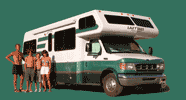
Showing 22 kayak activities logged during our motorhome cross-country adventures.
Lake Tashmoo
Around the 1.4 mile long and 0.6 mile wide sheltered waters of Lake Tashmoo
Sengekontacket Pond
The pond is 2.5 miles long and 0.5 miles wide. It takes about three to four hours to paddle around the entire pond. There is a boat ramp on the south side of Beach Road about 1.8 miles from Oak Bluffs.
Menemsha, Nashaquitsa, and Stonewall Ponds
About a 3 to 4 hour paddle from Vineyard Sound in the north to a beach on the Atlantic Ocean in the South.
Menemsha, Nashaquitsa, and Stonewall Ponds
About a 3 to 4 hour paddle from Vineyard Sound in the north to a beach on the Atlantic Ocean in the South. There is a boat launch at the end of West Basin Road
Poucha Pond
Lovely sheltered pond and salt marsh on the south side of Dike Bridge.
State Beach to "The Gut"
10-mile out and back from State Beach in Edgartown, along the shores of Eel Pond, past the Edgartown Lighthouse and on to "The Gut" and Cape Poge Bay (and back again of course)
Norton Point
5 or 6 miles paddle from Town Launch across Katama Bay to Norton Point to explore the breach that a 2007 storm made in the barrier beach that used to connect Edgartown to Chappy.
South Slough National Estuary
9-mile paddle from the Port of Coos Bay Industrial Annex Landing south into the slough and up into freshwater Elliot Creek. It is very important to time a trip into the slough with the tides, paddling the incoming tide south and the outgoing tide back north.
Russian River
From Jenner, out to the mouth of the Russian River and then back upriver to just past the bridge
Lake Union
7-mile kayak from Moss Bay Kayak Rentals past the houseboats on Lake Union, through Portage Bay, to the Arboretum on Union Bay
Mono Lake
6.6 miles past South Tufa State Reserve and out to Paoha Island
Tenaya Lake
2.3 miles around a beautiful alpine lake in Tuolumne Meadows
Mono Lake
6.6 miles past South Tufa State Reserve and out to Paoha Island
Fallen Leaf Lake
7.4-mile paddle around the perimeter of this lovely lake one mile south of Lake Tahoe
Manzanita Lake
1.5-mile paddle around the perimeter of Manzanita Lake with spectacular views of Lassen Peak and Chaos Crags along the way
Lake Siskiyou
5.9-mile paddle around the perimeter of the lake with awesome views of Mount Shasta along the way
Castle Lake
2.1-mile paddle around the perimeter of a beautiful, glacier-carved lake in the Shasta-Trinity National Forest, about 7 miles south of Lake Siskiyou
Mono Lake
12.7 mile (RT) paddle from Navy Beach to a remote tufa area on the southeastern end of the lake
Mono Lake
7.9 miles (RT) from Navy Beach to Paoha Island and back
Tenaya Lake
2.3 miles around a beautiful alpine lake in Tuolumne Meadows
Tenaya Lake
2.3 miles around a beautiful alpine lake in Tuolumne Meadows
Tagus Cove
Along the rocky cliffs with We pelicans, herons, blue-footed boobies, and penguins all hanging out and doing their thing